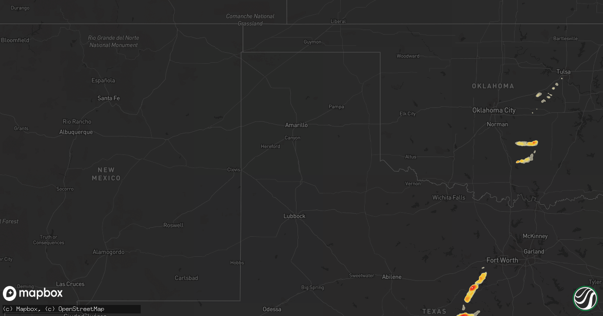
Hail Map on May 21, 2011
Get this storm
May 21 map
$229
one time, instant access
Download today. No call, no setup
Keep the $229
Bought the map and want the full workflow? Apply the entire $229 to a subscription within 7 days. None of it is wasted.
Every map, not just this one
This buys you this map. Subscription and you get every map we run, in the markets you choose from a few cities to whole states to nationwide. Plus real-time alerts the moment a storm fires.
Contact data
Name, contact info, occupancy, even credit band for addresses in the footprint. You go from where it hit to who to call.
Become the source they trust
Unlimited branding weather history reports on demand. You already have the documented answer ready for the property owner, and you are the one who showed up with it.
Property data and RoofTrace estimates
Pull up any address you have got, its value and the exact code rules for that jurisdiction, straight from One Click Code. Then RoofTrace estimates the squares, pitch, and roof value, priced the way you price.
States Impacted by Hail Map on May 21, 2011
Storm reports
Arkansas
| Date | Description |
|---|---|
| 05/21/20115:14 PM CDT | A local report indicates 1.00 inch wind near 1 N BRINKLEY |
| 05/21/20116:01 AM CDT | Quarter to nickel size hail was falling near the intersection of albert pike road and airport road on the west side of hot springs. |
| 05/21/20115:55 AM CDT | Quarter size hail fell. The location is four miles west of the hot springs airport. |
| 05/20/20118:45 PM CDT | Law enforcement reported quarter size hail on hwy 278 west. |
South Dakota
| Date | Description |
|---|---|
| 05/21/20115:55 PM CDT | A local report indicates 1.00 inch wind near 3 WSW CONDE |
| 05/21/20115:25 PM CDT | Hail covered the ground. Most stones pea size with some stones 1 inch and slightly larger. |
| 05/20/20118:19 PM CDT | Metal porch awning reported ripped off in town |
| 05/20/20118:17 PM CDT | Tree pushed down across roadway by strong wind gusts |
| 05/20/20117:58 PM CDT | Hail up to quarter size and 0.71 inches rain. |
| 05/20/20117:50 PM CDT | Wind moved several full heavy flower pots. Small branches blown from trees. Also pea size hail. |
Iowa
| Date | Description |
|---|---|
| 05/21/20116:55 PM CDT | Hail up to quarter size |
| 05/21/20116:03 PM CDT | Quarter size hail covering the ground... |
| 05/20/201110:19 PM CDT | Correction to report for same location at 836 pm. There were no reports for that location at 836 pm. |
| 05/20/201110:15 PM CDT | Estimated 60 mph wind with minor tree damage. Skirting off base of mobile home. |
| 05/20/20119:48 PM CDT | Pea sized hail as well. |
| 05/20/20119:41 PM CDT | United community school. Kcci schoolnet. |
| 05/20/20119:41 PM CDT | Public report of damage to an outbuilding. Windows blown out. Relayed by polk co sheriffs dept. |
| 05/20/20119:05 PM CDT | Power poles down. |
| 05/20/20118:53 PM CDT | A local report indicates 60 MPH wind near LAMONI AIRPORT |
| 05/20/20118:40 PM CDT | Near target in east council bluffs. |
| 05/20/20118:36 PM CDT | A local report indicates 60 MPH wind near SW OSKALOOSA |
| 05/20/20118:36 PM CDT | A local report indicates 1.00 inch wind near S GUTHRIE CENTER |
| 05/20/20118:27 PM CDT | A local report indicates 1.00 inch wind near 3 S DEFIANCE |
| 05/20/20118:18 PM CDT | A local report indicates 1.75 inch wind near LOGAN |
| 05/20/20118:05 PM CDT | Non rotating wall cloud moving overhead at 810 pm. |
| 05/20/20117:52 PM CDT | A local report indicates 1.50 inch wind near ESTHERVILLE AIRPORT |
| 05/20/20117:42 PM CDT | A local report indicates 2.00 inch wind near 5 E WALLINGFORD |
| 05/20/20117:38 PM CDT | A local report indicates 1.75 inch wind near WALLINGFORD |
| 05/20/20117:16 PM CDT | This was from saturday may 21 |
Minnesota
| Date | Description |
|---|---|
| 05/21/20116:25 PM CDT | Dime to quarter |
| 05/21/20116:10 PM CDT | Mostly pea size with a few larger stones. |
| 05/21/20116:08 PM CDT | Varied pea to one inch |
| 05/21/20116:00 PM CDT | A local report indicates 2.00 inch wind near 1 N MOUND |
| 05/21/20114:44 PM CDT | A local report indicates 1.50 inch wind near 5 SSE COKATO |
| 05/21/20114:17 PM CDT | A local report indicates 1.00 inch wind near COKATO |
| 05/21/201112:40 AM CDT | Metar kacq |
| 05/21/201112:20 AM CDT | Small limbs down. |
| 05/21/201112:19 AM CDT | A local report indicates 1.00 inch wind near LAKEVILLE |
| 05/20/20119:25 PM CDT | A local report indicates 1.00 inch wind near 5 W LONG PRAIRIE |
| 05/20/20119:20 PM CDT | A local report indicates 1.00 inch wind near WINDOM |
| 05/20/20119:20 PM CDT | A local report indicates 1.00 inch wind near 8 W LONG PRAIRIE |
| 05/20/20119:17 PM CDT | A local report indicates 1.50 inch wind near W WINDOM |
| 05/20/20118:48 PM CDT | A local report indicates 1.00 inch wind near 1 E JACKSON |
| 05/20/20118:47 PM CDT | A local report indicates 1.00 inch wind near 3 W JACKSON |
| 05/20/20118:45 PM CDT | Also estimated 60 mph wind gusts |
| 05/20/20118:45 PM CDT | Power out. Also quarter size hail. |
| 05/20/20118:40 PM CDT | A local report indicates 1.00 inch wind near 1 W SHERBURN |
| 05/20/20118:23 PM CDT | A local report indicates 1.00 inch wind near DUNNELL |
| 05/20/20117:29 PM CDT | A local report indicates 1.00 inch wind near DELANO |
| 05/20/20117:17 PM CDT | Also rotating wall cloud |
Tennessee
| Date | Description |
|---|---|
| 05/21/20115:40 PM CDT | Sheriffs office reported trees down over the eastern parts of macon county. |
| 05/21/20115:05 PM CDT | Sheriffs office reported trees down over the western part of macon county. |
| 05/21/20114:56 PM CDT | Tree reported down 1 mile southeast of lebanon. |
| 05/21/20114:45 PM CDT | Sheriffs office reported trees down along cairo rd. |
| 05/21/20114:25 PM CDT | Tree down at the national weather service office |
| 05/21/20115:00 AM CDT | Trees down. |
Kentucky
| Date | Description |
|---|---|
| 05/21/20116:45 PM CDT | Trees down. |
| 05/21/20115:53 PM CDT | Two trees down on hwy 100. |
| 05/21/20115:40 PM CDT | Sheriffs office reported trees down over the eastern parts of macon county. |
| 05/21/20115:30 PM CDT | Emergency manager reports one mobile home and barn destroyed along a small wind damage path that crossed lonoke road. Six trees were also reported down. |
Nebraska
| Date | Description |
|---|---|
| 05/21/20116:54 PM CDT | A local report indicates 1.75 inch wind near MURDOCK |
| 05/21/20116:39 PM CDT | Hail up to the size of quarters was reported. |
| 05/21/20116:10 PM CDT | Hail up to the size of quarters |
| 05/21/20116:01 PM CDT | Golf ball size hail covered the ground. |
| 05/21/20115:52 PM CDT | A local report indicates 1.00 inch wind near COLUMBUS |
| 05/21/20115:50 PM CDT | Hail up to ping pong ball size |
| 05/21/20115:50 PM CDT | Quarter sie to ping pong size hail 1 mile east of york |
| 05/21/20115:49 PM CDT | A local report indicates 1.00 inch wind near DAVID CITY |
| 05/21/20115:25 PM CDT | A local report indicates 1.00 inch wind near RISING CITY |
| 05/21/20115:24 PM CDT | A local report indicates 1.00 inch wind near 3 W RISING CITY |
| 05/21/20115:23 PM CDT | A local report indicates 1.00 inch wind near 10 SE BARTLETT |
| 05/21/20115:20 PM CDT | Corrected time of earlier report. Quarter size to ping pong size hail 1 mile east of york |
| 05/21/20115:20 PM CDT | A local report indicates 1.75 inch wind near 2 W SURPRISE |
| 05/21/20115:10 PM CDT | Hailed for appx. 5 min. Quarter sized for appx. 1 min. 0.47 inches of total rainfall. |
| 05/21/20115:10 PM CDT | A local report indicates 1.75 inch wind near YORK |
| 05/21/20114:55 PM CDT | Dimes mixed quarter sized hail. |
| 05/21/20114:30 PM CDT | Late report of hail from earlier thunderstorms. |
| 05/20/20119:06 PM CDT | Was orginally sent as a report from omaha. |
| 05/20/20119:06 PM CDT | A local report indicates 1.75 inch wind near OMAHA |
| 05/20/20119:05 PM CDT | Some car damage...near 205 and industrial road. |
| 05/20/20118:15 PM CDT | A local report indicates 1.00 inch wind near 3 N OFFUTT AFB |
| 05/20/20118:11 PM CDT | 108th and blondo street. |
| 05/20/20118:10 PM CDT | 90th and burt street. |
| 05/20/20117:51 PM CDT | Quarter size hail reported at 156th and state street in omaha |
| 05/20/20117:48 PM CDT | A local report indicates 1.25 inch wind near BELLEVUE |
| 05/20/20117:45 PM CDT | A local report indicates 1.25 inch wind near BELLEVUE |
| 05/20/20117:45 PM CDT | A local report indicates 1.00 inch wind near OMAHA |
| 05/20/20117:44 PM CDT | A local report indicates 1.00 inch wind near 3 N OFFUTT AFB |
| 05/20/20117:44 PM CDT | 144th and fort street |
| 05/20/20117:42 PM CDT | A local report indicates 1.00 inch wind near 3 E GRETNA |
| 05/20/20117:40 PM CDT | Few quarter size hail stones near 145th and blondo. |
| 05/20/20117:38 PM CDT | A local report indicates 1.75 inch wind near 1 NW NEWCASTLE |
| 05/20/20117:35 PM CDT | 146th and chandler road. |
| 05/20/20117:35 PM CDT | 163rd and harrison st. |
| 05/20/20117:33 PM CDT | Hail of various sizes from pea to golf ball. |
| 05/20/20117:30 PM CDT | A local report indicates 1.00 inch wind near OMAHA |
| 05/20/20117:25 PM CDT | A local report indicates 1.25 inch wind near BRUNO |
| 05/20/20117:25 PM CDT | A local report indicates 1.00 inch wind near 3 ENE GRETNA |
| 05/20/20117:21 PM CDT | Hail up to 1.5 inch diameter. |
| 05/20/20117:15 PM CDT | A local report indicates 1.50 inch wind near WAYNE |
| 05/20/20117:10 PM CDT | A local report indicates 1.75 inch wind near 3 SW WAYNE |
Kansas
| Date | Description |
|---|---|
| 05/21/20116:58 PM CDT | A local report indicates 1.75 inch wind near ALMA |
| 05/21/20116:57 PM CDT | A local report indicates a tornado near 4 N HIGHLAND |
| 05/21/20116:57 PM CDT | A local report indicates 1.75 inch wind near 3 NNE GRANTVILLE |
| 05/21/20116:54 PM CDT | At us 40 and k4. |
| 05/21/20116:49 PM CDT | A local report indicates 1.00 inch wind near ST. MARYS |
| 05/21/20116:48 PM CDT | A local report indicates 1.75 inch wind near ST. MARYS |
| 05/21/20116:46 PM CDT | A local report indicates 1.75 inch wind near ST. MARYS |
| 05/21/20116:46 PM CDT | At 29th and meradin rd. |
| 05/21/20116:45 PM CDT | A local report indicates 2.75 inch wind near HIGHLAND |
| 05/21/20116:45 PM CDT | A local report indicates 1.75 inch wind near 6 N ROBINSON |
| 05/21/20116:42 PM CDT | A local report indicates 1.75 inch wind near 3 NE TOPEKA |
| 05/21/20116:41 PM CDT | At 33rd sw and stone st. |
| 05/21/20116:39 PM CDT | Damage at ballfields at 29th and croco and a 5th wheel over turned possible tornado |
| 05/21/20116:38 PM CDT | A local report indicates 1.50 inch wind near 2 SE EVEREST |
| 05/21/20116:35 PM CDT | A local report indicates 1.50 inch wind near 3 NE TOPEKA |
| 05/21/20116:34 PM CDT | A local report indicates 2.00 inch wind near 1 NW TOPEKA |
| 05/21/20116:33 PM CDT | A local report indicates 2.00 inch wind near 2 SW TOPEKA |
| 05/21/20116:29 PM CDT | A local report indicates 1.25 inch wind near 3 SW TOPEKA |
| 05/21/20116:27 PM CDT | A local report indicates 1.25 inch wind near SW TOPEKA |
| 05/21/20116:27 PM CDT | A local report indicates 1.25 inch wind near MUSCOTAH |
| 05/21/20116:27 PM CDT | Large tree limbs down 61st and wanamaker. |
| 05/21/20116:27 PM CDT | A local report indicates 1.75 inch wind near 3 SW TOPEKA |
| 05/21/20116:25 PM CDT | A local report indicates 1.00 inch wind near 3 SW TOPEKA |
| 05/21/20116:18 PM CDT | A local report indicates 1.00 inch wind near 1 E DENISON |
| 05/21/20116:18 PM CDT | Also observing a wall cloud in same location. |
| 05/21/20116:17 PM CDT | Drifts of quarter size hail and larger along side the road 1 mile southeast of harlan |
| 05/21/20116:16 PM CDT | Weak ef0 tornado damaged an outbuilding and snapped some trees near the washburn rural highschool. |
| 05/21/20116:06 PM CDT | A local report indicates 1.25 inch wind near HOYT |
| 05/21/20116:05 PM CDT | Frequent golf ball and occasionally larger hail. |
| 05/21/20116:00 PM CDT | Near sw 27th street and sw washburn ave. Time estimated. |
| 05/21/20116:00 PM CDT | A local report indicates 1.75 inch wind near 2 E DOVER |
| 05/21/20115:57 PM CDT | A local report indicates 1.50 inch wind near CEDAR |
| 05/21/20115:57 PM CDT | Measured 5 1/4 in hail |
| 05/21/20115:57 PM CDT | A local report indicates 1.50 inch wind near 5 ENE FAIRVIEW |
| 05/21/20115:53 PM CDT | A local report indicates 1.00 inch wind near 2 E DOVER |
| 05/21/20115:53 PM CDT | A local report indicates 1.75 inch wind near DOVER |
| 05/21/20115:50 PM CDT | A local report indicates 1.00 inch wind near 6 WNW TOPEKA |
| 05/21/20115:43 PM CDT | A local report indicates 1.75 inch wind near 2 S FAIRVIEW |
| 05/21/20115:40 PM CDT | A local report indicates 1.50 inch wind near 4 S WILLARD |
| 05/21/20115:37 PM CDT | A local report indicates 1.00 inch wind near 4 S WILLARD |
| 05/21/20115:35 PM CDT | A local report indicates 1.00 inch wind near SSW SABETHA |
| 05/21/20115:35 PM CDT | A local report indicates 1.25 inch wind near KIRWIN |
| 05/21/20115:35 PM CDT | Spotter reports quarter sized hail at i-70 and sw carlson rd. |
| 05/21/20115:34 PM CDT | A local report indicates 1.00 inch wind near 1 S ESKRIDGE |
| 05/21/20115:33 PM CDT | A local report indicates 1.75 inch wind near 4 SE ESKRIDGE |
| 05/21/20115:30 PM CDT | A local report indicates 2.50 inch wind near SE ESKRIDGE |
| 05/21/20115:29 PM CDT | A local report indicates 1.00 inch wind near 5 S KIRWIN |
| 05/21/20115:13 PM CDT | Hail covering the ground |
| 05/21/20115:13 PM CDT | Relayed by wibw tv |
| 05/21/201112:12 AM CDT | A local report indicates 1.00 inch wind near 7 ESE OTTAWA |
| 05/21/201112:05 AM CDT | A local report indicates 1.25 inch wind near 5 SE OTTAWA |
| 05/20/201111:36 PM CDT | Pea size to quarter size hail. |
| 05/20/201110:52 PM CDT | Relayed by emergency manager |
| 05/20/201110:43 PM CDT | Minor damage to several homes in quenemo. No injuries. One barn or garage destroyed. |
| 05/20/201110:41 PM CDT | Relayed by county em near the 59 and 56 junction |
| 05/20/201110:40 PM CDT | 60 mph wind gust from storm chaser relayed by em. |
| 05/20/201110:38 PM CDT | Relayed by em at the corner of hwy 56 and hwy 59 |
| 05/20/201110:36 PM CDT | Relayed by osage county em |
| 05/20/201110:26 PM CDT | A local report indicates 1.25 inch wind near CENTROPOLIS |
| 05/20/201110:15 PM CDT | A local report indicates 2.75 inch wind near OSAGE CITY |
| 05/20/201110:15 PM CDT | Relayed by osage county em |
| 05/20/201110:13 PM CDT | A local report indicates 1.00 inch wind near 5 NW LEAVENWORTH |
| 05/20/201110:10 PM CDT | A local report indicates 1.00 inch wind near 2 S OSAGE CITY |
| 05/20/201110:00 PM CDT | A local report indicates 1.75 inch wind near 2 W EASTON KS |
| 05/20/20119:48 PM CDT | A local report indicates 1.00 inch wind near LYNDON |
| 05/20/20119:43 PM CDT | 4 foot tree uprooted and damaged propane tank |
| 05/20/20119:38 PM CDT | A local report indicates 1.00 inch wind near 2 ESE OZAWKIE |
| 05/20/20119:33 PM CDT | 70 mph winds |
| 05/20/20119:15 PM CDT | A local report indicates 1.75 inch wind near NORTONVILLE |
| 05/20/20119:15 PM CDT | Reported by emergeny management |
| 05/20/20119:07 PM CDT | A local report indicates 1.00 inch wind near 8 NNE EMPORIA |
| 05/20/20119:00 PM CDT | A local report indicates 1.75 inch wind near 10 N EMPORIA |
| 05/20/20118:59 PM CDT | A local report indicates a tornado near 9 ENE EMPORIA |
| 05/20/20118:56 PM CDT | A local report indicates a tornado near 4 NE EMPORIA |
| 05/20/20118:51 PM CDT | A local report indicates a tornado near 1 NE EMPORIA |
| 05/20/20118:48 PM CDT | A local report indicates 1.75 inch wind near 1 NNE NORTONVILLE |
| 05/20/20118:46 PM CDT | A local report indicates 1.00 inch wind near 5 SSE BUSHONG |
| 05/20/20118:44 PM CDT | A local report indicates 1.25 inch wind near 1 N SILVER LAKE |
| 05/20/20118:42 PM CDT | A local report indicates 1.75 inch wind near 1 N NORTONVILLE |
| 05/20/20118:38 PM CDT | A local report indicates 1.75 inch wind near 1 NW EMPORIA |
| 05/20/20118:34 PM CDT | A local report indicates 1.00 inch wind near 4 ESE DUNLAP |
| 05/20/20118:34 PM CDT | A local report indicates 1.75 inch wind near 2 ESE MAYETTA |
| 05/20/20118:33 PM CDT | A local report indicates 1.00 inch wind near 5 NW LEAVENWORTH |
| 05/20/20118:30 PM CDT | At 134th and 75 hwy |
| 05/20/20118:30 PM CDT | At 118th and s-road. |
| 05/20/20118:29 PM CDT | Some stones were larger but size was unknown |
| 05/20/20118:28 PM CDT | A local report indicates 1.00 inch wind near 5 W AMERICUS |
| 05/20/20118:17 PM CDT | A local report indicates 1.00 inch wind near 2 W EASTON KS |
| 05/20/20118:10 PM CDT | A local report indicates 2.00 inch wind near 2 ESE OSKALOOSA |
| 05/20/20118:08 PM CDT | A local report indicates 2.75 inch wind near 4 NE OSKALOOSA |
| 05/20/20118:07 PM CDT | A local report indicates 1.75 inch wind near 4 N EASTON KS |
| 05/20/20118:05 PM CDT | A local report indicates 1.25 inch wind near 5 N MCLOUTH |
| 05/20/20118:04 PM CDT | A local report indicates 2.50 inch wind near 4 NE OSKALOOSA |
| 05/20/20118:01 PM CDT | A local report indicates 2.00 inch wind near 4 NE OSKALOOSA |
| 05/20/20118:00 PM CDT | A local report indicates 1.25 inch wind near E MAYETTA |
| 05/20/20117:57 PM CDT | A local report indicates 1.75 inch wind near 2 W EASTON KS |
| 05/20/20117:51 PM CDT | A local report indicates 2.00 inch wind near 6 WSW MAYETTA |
| 05/20/20117:50 PM CDT | A local report indicates 1.00 inch wind near COTTONWOOD FALLS |
| 05/20/20117:33 PM CDT | Lots of debris along roads. Large trees down. |
| 05/20/20117:33 PM CDT | Lots of debris along roads. Large trees down. |
| 05/20/20117:29 PM CDT | Tornado reported near lake perry. Lasted for about 3 minutes. |
| 05/20/20117:22 PM CDT | A local report indicates 1.25 inch wind near 1 NNE ST. MARYS |
| 05/20/20117:20 PM CDT | Water spout over lake perry |
| 05/20/20117:20 PM CDT | Damage at ballfields at 29th and croco and a 5th wheel over turned possible tornado |
| 05/20/20117:15 PM CDT | A local report indicates 1.00 inch wind near 2 SW OSKALOOSA |
| 05/20/20117:12 PM CDT | A local report indicates 1.00 inch wind near 1 W CAWKER CITY |
| 05/20/20117:10 PM CDT | A local report indicates 1.75 inch wind near 4 S OZAWKIE |
| 05/20/20117:08 PM CDT | A local report indicates 2.00 inch wind near 4 NNW PERRY |
| 05/20/20117:00 PM CDT | 21st and corco rd. |
| 05/20/20117:00 PM CDT | A local report indicates 1.75 inch wind near 3 S MERIDEN |
| 05/20/20117:00 PM CDT | A local report indicates 1.75 inch wind near TECUMSEH |
| 05/20/20117:00 PM CDT | *** 1 inj *** hail broke car windows at 6th and croco rd. One injury reported from the hail. |
Virginia
| Date | Description |
|---|---|
| 05/21/20113:15 AM CDT | Trees down near rondo on rt.57 |
| 05/21/20112:00 AM CDT | Trees down near red valley on rt. 116 |
North Dakota
| Date | Description |
|---|---|
| 05/20/20118:45 PM CDT | Several quarters embedded within a greater volume of pea size hail. |
Missouri
| Date | Description |
|---|---|
| 05/20/20119:58 PM CDT | A local report indicates 1.00 inch wind near EASTON |
| 05/20/20119:45 PM CDT | Estimated wind gusts 50 to 60 mph. |
| 05/20/20119:14 PM CDT | At milemarker 31 on interstate 29 |
| 05/20/20119:07 PM CDT | Tree limbs on the ground. 50mph straight line winds. Penny size hail. |
| 05/20/20119:07 PM CDT | A local report indicates 60 MPH wind near 4 E JAMESPORT |
| 05/20/20118:47 PM CDT | Small tree limbs broken. |
| 05/20/20118:36 PM CDT | 50 mph winds reported as well |
| 05/20/20118:30 PM CDT | Pea size to quarter size hail falling |
| 05/20/20118:17 PM CDT | A local report indicates 1.00 inch wind near 2 W EASTON |
| 05/20/20118:07 PM CDT | A local report indicates 1.75 inch wind near 4 N EASTON |
| 05/20/20117:47 PM CDT | Power pole blown over road at us hwy 71 and route y. Possible tornado |
| 05/20/20117:30 PM CDT | A local report indicates a tornado near 1 S FILLMORE |
| 05/20/20117:27 PM CDT | A local report indicates 1.00 inch wind near 5 SE BURLINGTON JCT |
| 05/20/20117:15 PM CDT | A local report indicates 1.75 inch wind near ROSENDALE |
| 05/20/20117:12 PM CDT | A local report indicates 1.00 inch wind near AGENCY |
Oklahoma
| Date | Description |
|---|---|
| 05/20/20119:00 PM CDT | A local report indicates 2.00 inch wind near 1 S BYNG |
| 05/20/20118:41 PM CDT | A local report indicates a tornado near 4 WNW ADA |
| 05/20/20118:38 PM CDT | A local report indicates 1.00 inch wind near 2 N SLICK |
| 05/20/20118:34 PM CDT | A local report indicates a tornado near 5 W ADA |
| 05/20/20118:30 PM CDT | A local report indicates a tornado near 8 W ADA |
| 05/20/20118:19 PM CDT | A local report indicates a tornado near 2 NW VANOSS |
| 05/20/20117:40 PM CDT | Multiple reports |
| 05/20/20117:00 PM CDT | A local report indicates 1.75 inch wind near 2 N SULPHUR |
Texas
| Date | Description |
|---|---|
| 05/21/20116:55 PM CDT | A local report indicates 2.50 inch wind near 9 NE COPPERAS COVE |
| 05/21/20116:49 PM CDT | A local report indicates 1.50 inch wind near 4 NNE BURNET |
| 05/21/20116:48 PM CDT | A local report indicates 2.75 inch wind near 2 WNW BRIGGS |
| 05/21/20116:23 PM CDT | A local report indicates 1.50 inch wind near COPPERAS COVE |
| 05/21/20116:18 PM CDT | A local report indicates 1.00 inch wind near 5 N COPPERAS COVE |
| 05/21/20116:12 PM CDT | A local report indicates 1.00 inch wind near 2 E TOW |
| 05/21/20116:11 PM CDT | A local report indicates 1.75 inch wind near 3 N COPPERAS COVE |
| 05/21/20116:06 PM CDT | A local report indicates 3.00 inch wind near TOPSEY |
| 05/21/20116:06 PM CDT | Antelope crossing |
| 05/21/20116:05 PM CDT | A local report indicates 2.00 inch wind near TOPSEY |
| 05/21/20116:02 PM CDT | A local report indicates 1.75 inch wind near 2 NW COPPERAS COVE |
| 05/21/20115:59 PM CDT | On highway 36 |
| 05/21/20115:50 PM CDT | Fell near fm 1113 and cr 3295 inside the lampasas county line |
| 05/21/20114:10 PM CDT | Damage to roofs in evant...possible tornado time estimated |
| 05/21/20114:08 PM CDT | Quarter to golf ball hail in granbury |
| 05/21/20113:50 PM CDT | A local report indicates 1.75 inch wind near CARADAN |
| 05/21/20113:45 PM CDT | A local report indicates 1.75 inch wind near CLAIRETTE |
| 05/21/20113:45 PM CDT | A local report indicates 1.50 inch wind near 9 S BLUFF DALE |
| 05/21/20113:42 PM CDT | A local report indicates 1.00 inch wind near SHIVE |
| 05/21/20113:38 PM CDT | A local report indicates 2.75 inch wind near 9 S BLUFF DALE |
| 05/21/20113:08 PM CDT | Us 281 and 2905 on the north side of hamilton |
| 05/21/201112:17 AM CDT | A local report indicates 1.75 inch wind near 5 WNW KEMPNER |
| 05/20/201110:55 PM CDT | 5 miles north of radio junction |
| 05/20/20119:24 PM CDT | A local report indicates 1.00 inch wind near 1 N BERTRAM |
| 05/20/20119:00 PM CDT | Nws damage survey confirms a tornado touched down about 1 mile southeast of andice. The tornado tracked approximately 1.5 miles to the northeast. Damage consisted of ma |
| 05/20/20118:59 PM CDT | A local report indicates 1.75 inch wind near BURNET |
| 05/20/20118:57 PM CDT | Minor mobile home damage in and around andice as well as some fences blown down. |
| 05/20/20118:53 PM CDT | Measured hail with 2.38 inches across. |
| 05/20/20118:48 PM CDT | A local report indicates 2.75 inch wind near BURNET |
| 05/20/20118:42 PM CDT | Golfball to baseball size hail near burnet. |
| 05/20/20118:40 PM CDT | 5 inch hail measured. |
| 05/20/20118:36 PM CDT | Grapefruit size hail falling in north central burnet. |
| 05/20/20118:30 PM CDT | A local report indicates 1.50 inch wind near 5 NW BURNET |
| 05/20/20117:51 PM CDT | A local report indicates 1.75 inch wind near GATESVILLE |
| 05/20/20117:11 PM CDT | A local report indicates 1.00 inch wind near BERTRAM |
New York
| Date | Description |
|---|---|
| 05/21/20113:38 PM CDT | Tree limbs down. Nickel size hail covered the ground. Hail lasted about 10 minutes. Hail is still on the ground as of 7 pm. Lots of leaves down on the ground. |
| 05/21/20113:38 PM CDT | Limbs down. Also nickel size hail. House located on walker road. |
Cities Impacted by Hail Map on May 21, 2011
- Neola, IA
- Ada, OK
- Sasakwa, OK
- Stratford, OK
- Konawa, OK
- Byars, OK
- Revere, MN
- Lamberton, MN
- Hancock, MN
- Hartley, IA
- Primghar, IA
- Sanborn, IA
- Garvin, MN
- Cogswell, ND
- Forman, ND
- Schleswig, IA
- Ida Grove, IA
- Hopkins, MO
- Goldthwaite, TX
- Carson, IA
- Macedonia, IA
- Oakland, IA
- Hancock, IA
- Griswold, IA
- Henderson, IA
- Logan, IA
- Woodbine, IA
- Dunlap, IA
- Scotia, NE
- Greeley, NE
- Lidgerwood, ND
- Cayuga, ND
- Wakefield, NE
- Wayne, NE
- Pender, NE
- Thurston, NE
- Laurel, NE
- Emerson, NE
- Allen, NE
- Dixon, NE
- Concord, NE
- Maple Plain, MN
- Mound, MN
- Center, KY
- Horse Cave, KY
- Offutt Afb, NE
- Plattsmouth, NE
- Council Bluffs, IA
- Bellevue, NE
- McClelland, IA
- Zwolle, LA
- Many, LA
- Cameron, MO
- Osborn, MO
- Gallatin, TN
- Shreveport, LA
- Britt, IA
- Okolona, AR
- Modale, IA
- Mondamin, IA
- Missouri Valley, IA
- Winside, NE
- Evant, TX
- Buffalo, MN
- Loretto, MN
- Rockford, MN
- Royal, AR
- Bonnerdale, AR
- Bertram, TX
- Briggs, TX
- Lampasas, TX
- Madison, NE
- Humphrey, NE
- Louisville, NE
- Ashland, NE
- Murdock, NE
- Casey, IA
- Guthrie Center, IA
- Craig, MO
- Rulo, NE
- Hiawatha, KS
- Falls City, NE
- Purmela, TX
- Orange City, IA
- Stroud, OK
- Depew, OK
- Olaton, KY
- Knob Lick, KY
- Cave City, KY
- Glasgow, KY
- Oakland, NE
- Scribner, NE
- West Point, NE
- Gatesville, TX
- Sheldon, IA
- Papillion, NE
- Springfield, NE
- Hector, MN
- Fairfax, MN
- Panama, IA
- Earling, IA
- Dearborn, MO
- Easton, KS
- Walnut Grove, MN
- Alma, KS
- Downs, KS
- Riverton, IA
- Sidney, IA
- Hamburg, IA
- Kirwin, KS
- Cedar, KS
- Gaylord, KS
- Ashland, LA
- Castor, LA
- Omaha, NE
- La Vista, NE
- Sabetha, KS
- Alta Vista, KS
- Kidder, MO
- Gallatin, MO
- Winston, MO
- Altamont, MO
- Hamilton, MO
- Danvers, MN
- Appleton, MN
- Irwin, IA
- Kirkman, IA
- Lindsay, NE
- Percival, IA
- Amity, AR
- Emerson, AR
- Cherokee, TX
- Anoka, MN
- Andover, MN
- Wallingford, IA
- Graettinger, IA
- Mapleton, IA
- Sulphur, OK
- Jonesboro, TX
- Valley Mills, TX
- Morgan, MN
- Effingham, KS
- Horton, KS
- Everest, KS
- Lancaster, KS
- Muscotah, KS
- Bronson, TX
- Meadville, MO
- Roff, OK
- Malvern, AR
- Emporia, KS
- Strong City, KS
- Copperas Cove, TX
- Surprise, NE
- Ulysses, NE
- Rising City, NE
- Shelby, NE
- Osborne, KS
- Portis, KS
- Waverly, MN
- Montrose, MN
- Arkadelphia, AR
- Rock Port, MO
- Newcastle, NE
- Elk Point, SD
- Burbank, SD
- Vermillion, SD
- Montevideo, MN
- Benson, MN
- Troy, KS
- Jackson, MN
- Mount Holly, AR
- Stephens, AR
- White Cloud, KS
- Forest City, MO
- Highland, KS
- Powhattan, KS
- Fairview, KS
- Robinson, KS
- Morrill, KS
- Osage City, KS
- Greensburg, KY
- Edmonton, KY
- Higginsville, MO
- Hurley, SD
- Viborg, SD
- Reading, KS
- Lyndon, KS
- Waldo, AR
- Kimballton, IA
- Morris, MN
- Sherburn, MN
- Greenwood, LA
- Keithville, LA
- Bossier City, LA
- Hamel, MN
- Long Lake, MN
- Spring Park, MN
- Howard Lake, MN
- Cokato, MN
- Mountain Lake, MN
- Odin, MN
- Burnet, TX
- Florence, TX
- Brainerd, MN
- Magnolia, AR
- Taylor, AR
- Stratford, SD
- Davis, SD
- Centerville, SD
- Irene, SD
- Randolph, NE
- Bancroft, NE
- Rosalie, NE
- Walthill, NE
- Grant City, MO
- Mount Ayr, IA
- Kellerton, IA
- Lamoni, IA
- Martinsville, MO
- Hatfield, MO
- Sumner, IA
- Hartington, NE
- Park Falls, WI
- Phillips, WI
- Osceola, NE
- Platte City, MO
- Smithville, MO
- Mullin, TX
- Ringsted, IA
- Dunnell, MN
- Ceylon, MN
- Dolliver, IA
- Estherville, IA
- Underwood, IA
- Hope, AR
- Malvern, IA
- Brunswick, MO
- Skidmore, MO
- Cowgill, MO
- Polo, MO
- Braymer, MO
- Breckenridge, MO
- Kingston, MO
- McNeil, AR
- Rosston, AR
- Worthington, MN
- Lake Park, IA
- Round Lake, MN
- Harris, IA
- Oskaloosa, KS
- Hubbard, NE
- Kempner, TX
- Fort Hood, TX
- Beresford, SD
- Tolar, TX
- Granbury, TX
- Rison, AR
- Bethany, LA
- Volin, SD
- Melvern, KS
- Quenemo, KS
- Oregon, MO
- Rosendale, MO
- Bolckow, MO
- Fillmore, MO
- Groton, SD
- Ferney, SD
- Conde, SD
- El Dorado, AR
- North Branch, MN
- Stacy, MN
- Oneida, KS
- Boys Town, NE
- Tow, TX
- Bluffton, TX
- San Saba, TX
- Verdigre, NE
- Lometa, TX
- Hamilton, TX
- Crescent, IA
- Leawood, KS
- Overland Park, KS
- Richland Springs, TX
- Donaldson, AR
- Veblen, SD
- Osage, IA
- Sheldon, WI
- Chidester, AR
- Fenton, IA
- Lone Rock, IA
- Glade, KS
- Lester Prairie, MN
- Silver Lake, MN
- Winsted, MN
- Mayer, MN
- New Germany, MN
- Hutchinson, MN
- De Witt, MO
- Carrollton, MO
- Bancroft, IA
- Burt, IA
- Williamsburg, KS
- Pomona, KS
- Wakonda, SD
- Edgerton, MO
- Gower, MO
- Peru, NE
- Nebraska City, NE
- Hoyt, KS
- Meriden, KS
- Denison, KS
- Creston, NE
- Columbus, NE
- Leigh, NE
- Sparkman, AR
- Carthage, AR
- Leola, AR
- Maryville, MO
- Maitland, MO
- Mound City, MO
- Fairfax, MO
- Burlington Junction, MO
- Moorhead, IA
- Paxico, KS
- Maple Hill, KS
- Cosby, MO
- Easton, MO
- Stewartsville, MO
- Clarksdale, MO
- Saint Joseph, MO
- Ottawa, KS
- Lebo, KS
- Eskridge, KS
- Elmo, MO
- Westboro, MO
- Glenwood, IA
- Castle, OK
- Bristow, OK
- Glen Rose, TX
- Hico, TX
- Stephenville, TX
- Bluff Dale, TX
- Dublin, TX
- Portsmouth, IA
- Cottonwood Falls, KS
- Colton, SD
- Gresham, NE
- David City, NE
- Waco, NE
- York, NE
- Karnack, TX
- Belcher, LA
- Benton, LA
- Vivian, LA
- Hosston, LA
- Plain Dealing, LA
- Gilliam, LA
- Jefferson, TX
- Cotton Valley, LA
- Oil City, LA
- Mooringsport, LA
- Herman, MN
- Barrett, MN
- Hoffman, MN
- Delia, KS
- Holton, KS
- Mayetta, KS
- Tecumseh, KS
- Rossville, KS
- Rushville, MO
- Winchester, KS
- Harveyville, KS
- Grantville, KS
- Ozawkie, KS
- Leavenworth, KS
- Weston, MO
- Auburn, KS
- McLouth, KS
- Saint Marys, KS
- Silver Lake, KS
- Faucett, MO
- Cummings, KS
- Topeka, KS
- Nortonville, KS
- Atchison, KS
- De Kalb, MO
- Valley Falls, KS
- Shubert, NE
- Stella, NE
- Auburn, NE
- Nemaha, NE
- Brownville, NE
- Rush City, MN
- Harris, MN
- Little Falls, MN
- Salisbury, MO
- South Bend, NE
- Gretna, NE
- Maysville, MO
- Excello, MO
- Jacksonville, MO
- Lucan, MN
- Gwinner, ND
- Stuart, IA
- Butterfield, MN
- Trimont, MN
- Alpha, MN
- Jessieville, AR
- Allen, KS
- Glencoe, MN
- Lonsdale, AR
- Benton, AR
- Hot Springs Village, AR
- Hot Springs National Park, AR
- Chillicothe, MO
- Hale, MO
- Jefferson, AR
- Sherrill, AR
- White Hall, AR
- Bruno, NE
- Minneapolis, MN
- Cresson, TX
- Mountain Pine, AR
- Palmyra, MO
- Taylor, MO
- Wood River, NE
- Americus, KS
- Admire, KS
- Osakis, MN
- Scandia, MN
- Macomb, IL
- Doddridge, AR
- Forest City, IA
- Speer, IL
- Overbrook, KS
- Lawrence, KS
- Corning, KS
- Goff, KS
- Evansville, MN
- Battle Lake, MN
- Clitherall, MN
- Kingsland, AR
- Fordyce, AR
- Maple Grove, MN
- Wayzata, MN
- Lake Crystal, MN
- Colchester, IL
- Plymouth, IL
- Stanton, NE
- Windom, MN
- Glenwood, AR
- Norman, AR
- Heron Lake, MN
- Agency, MO
- Perry, KS
- Fort Leavenworth, KS
- Saint Paul, MN
- Utica, NE
- Bellwood, NE
- Stromsburg, NE
- Brainard, NE
- Benedict, NE
- Redding, IA
- Wells, MN
- Alden, MN
- Lakefield, MN
- Trenton, MO
- Penfield, IL
- Faulkton, SD
- Hardwick, MN
- Jasper, MN
- Springhill, LA
- Sarepta, LA
- Shongaloo, LA
- Elmwood, NE
- Turton, SD
- Dwight, KS
- Honey Creek, IA
- Smiths Grove, KY
- Centerville, IA
- Osseo, MN
- Worthing, SD
- Canton, SD
- South Haven, MN
- Kellyville, OK
- Lu Verne, IA
- Corwith, IA
- Prescott, AR
- Buckner, AR
- Stamps, AR
- Garland City, AR
- Emmet, AR
- Lewisville, AR
- Norfolk, NE
- Shenandoah, IA
- Coin, IA
- Northboro, IA
- Vassar, KS
- Oakland, KY
- Wetmore, KS
- Jamesport, MO
- Stirum, ND
- Minden, IA
- Truman, MN
- Murfreesboro, AR
- Bismarck, AR
- Pearcy, AR
- Delight, AR
- Kirby, AR
- Guilford, MO
- Savannah, MO
- Rea, MO
- Kathryn, ND
- Hoskins, NE
- Mammoth Cave, KY
- Llano, TX
- Becker, MN
- Pine Bluff, AR
- Craig, NE
- Caddo Gap, AR
- Broaddus, TX
- Pineland, TX
- Castana, IA
- Kansas City, MO
- Whiting, KS
- Netawaka, KS
- Shelby, IA
- Mendon, MO
- Lyons, NE
- Lennox, SD
- Lake View, IA
- Callao, MO
- Long Prairie, MN
- Dassel, MN
- Cedar, MN
- Imogene, IA
- Sheridan, AR
- Coleridge, NE
- Keytesville, MO
- Milroy, MN
- Prattsville, AR
- Randolph, IA
- Hastings, IA
- Silver City, IA
- Tabor, IA
- Burnsville, MN
- Ruthven, IA
- Emmetsburg, IA
- Ayrshire, IA
- Comfrey, MN
- Bingham Lake, MN
- Jeffers, MN
- Welcome, MN
- Armstrong, IA
- Springfield, MN
- Sanborn, MN
- Bartlett, NE
- Plattsburg, MO
- Langley, AR
- Corydon, IA
- Buffalo Lake, MN
- Stewart, MN
- Hartford, KY
- Dundee, KY
- Camden, AR
- Echo, MN
- Livermore, IA
- Jesup, IA
- Barnard, MO
- Farmington, MN
- Lakeville, MN
- Elbow Lake, MN
- Pilger, NE
- Amity, MO
- Coushatta, LA
- Delano, MN
- Watertown, MN
- Okabena, MN
- Emerson, IA
- Lees Summit, MO
- Glenwood, MN
- Avoca, IA
- Clarence, MO
- Saint Paul, NE
- Platte Center, NE
- Lathrop, MO
- Holt, MO
- Maynard, MN
- Wynot, NE
- Altheimer, AR
- Corning, IA
- Lenox, IA
- Buffalo Center, IA
- Paden, OK
- Browerville, MN
- Medford, WI
- Cedar Creek, NE
- San Augustine, TX
- Treynor, IA
- Decorah, IA
- Loup City, NE
- Hudson, SD
- Alcester, SD
- Moulton, IA
- Onawa, IA
- Elba, NE
- Lake Wilson, MN
- Laredo, MO
- Galt, MO
- Charleston, MS
- Cascilla, MS
- Wellsville, KS
- Princeton, KS
- Waverly, KS
- Burlingame, KS
- Council Grove, KS
- Rantoul, KS
- Neosho Rapids, KS
- Scranton, KS
- Baldwin City, KS
- Clarkson, NE
- Correll, MN
- Amazonia, MO
- Chula, MO
- Humphreys, MO
- Britton, SD
- Clifton, TX
- Horse Branch, KY
- Fordsville, KY
- Stilwell, KS
- Belton, MO
- Manilla, IA
- Vail, IA
- Orchard, NE
- Salem, NE
- Brownton, MN
- Fulda, MN
- Spirit Lake, IA
- Gurdon, AR
- England, AR
- Rochelle, TX
- Marceline, MO
- Carlton, TX
- Wesley, IA
- Granville, IA
- Alton, IA
- Fordyce, NE
- Trimble, MO
- Hemphill, TX
- Huntington, TX
- Concordia, MO
- Hospers, IA
- Harrisburg, SD
- Milam, TX
- Fouke, AR
- Beggs, OK
- Sapulpa, OK
- Weatherford, TX
- Barnum, IA
- Manson, IA
- Creston, IA
- Starbuck, MN
- Allerton, IA
- Parnell, MO
- Westboro, WI
- Grandview, MO
- Gayville, SD
- Osceola, IA
- Lisbon, ND
- Minden, LA
- Circleville, KS
- Maywood, MO
- La Grange, MO
- Seymour, IA
- Milnor, ND
- Grapevine, AR
- Winter, WI
- Ojibwa, WI
- Union Star, MO
- Sisseton, SD
- Tekamah, NE
- Henning, MN
- Ottertail, MN
- Etoile, TX
- Quincy, IL
- Ashton, NE
- North Loup, NE
- West Bend, IA
- Pottsville, TX
- Denton, KS
- Bendena, KS
- White Heath, IL
- Murdock, MN
- Shawnee, OK
- Prague, OK
- New Cambria, MO
- Napoleon, MO
- Bates City, MO
- Oak Grove, MO
- Buchanan Dam, TX
- Hawkins, WI
- Glen Flora, WI
- Bradley, AR
- Cawker City, KS
- Mayview, MO
- Georgetown, TX
- Winnebago, NE
- Reliance, SD
- Wyoming, IL
- Phillipsburg, KS
- Prairie View, KS
- Willisville, AR
- Orient, IA
- Mercer, MO
- Spring Hill, KS
- Bucyrus, KS
- Olathe, KS
- Blencoe, IA
- Roscoe, TX
- Fontanelle, IA
- Mitchell, SD
- Annandale, MN
- Mineola, IA
- Lower Brule, SD
- Cottonwood, MN
- Saint Michael, MN
- Dayton, MN
- Champlin, MN
- Dannebrog, NE
- Henry, IL
- Sparland, IL
- Grain Valley, MO
- Blue Springs, MO
- Lakota, IA
- Swea City, IA
- Bluff City, AR
- Gardner, KS
- Edgerton, KS
- Hardyville, KY
- Haughton, LA
- Beemer, NE
- Cedar Rapids, NE
- Wolbach, NE
- Fort Thompson, SD
- Rogers, MN
- Rothville, MO
- Havana, ND
- Doland, SD
- Hornbeck, LA
- Fonda, IA
- Bertha, MN
- Staples, MN
- Clarissa, MN
- Ericson, NE
- Humboldt, NE
- Wheaton, MN
- Thompson, IA
- Holly Grove, AR
- Elm Grove, LA
- Paola, KS
- Powersville, MO
- Pierpont, SD
- Magnolia, KY
- Cedar Point, KS
- Aldrich, MN
- Anabel, MO
- Fitzhugh, OK
- Fittstown, OK
- Stonewall, OK
- Green City, MO
- Garner, IA
- Sturgeon Lake, MN
- Oakes, ND
- Bradley, SD
- Tyler, MN
- Ruthton, MN
- Oto, IA
- Farwell, NE
- Elk Horn, IA
- Exeland, WI
- Madison, MO
- Loraine, TX
- Zephyr, TX
- Star, TX
- Melvin, IA
- Greenfield, IA
- Wyoming, MN
- Rutland, ND
- Ocheyedan, IA
- Homer, NE
- Shelton, NE
- Big Lake, MN
- Soldier, IA
- Pisgah, IA
- Harlan, IA
- Myakka City, FL
- Slayton, MN
- Pickering, MO
- Mabelvale, AR
- Bauxite, AR
- Carroll, IA
- Verdon, NE
- Carroll, NE
- Ravenwood, MO
- Tomahawk, WI
- Huntsville, MO
- Edgerton, MN
- Ivan, AR
- Redfield, AR
- Eagle Bend, MN
- Albany, MO
- Denver, MO
- New Century, KS
- Eudora, KS
- Early, IA
- Schaller, IA
- Stanberry, MO
- Chandler, MN
- Dickens, IA
- Jolley, IA
- Rockwell City, IA
- Carthage, TX
- Miller, SD
- Ute, IA
- Charter Oak, IA
- Denison, IA
- Ricketts, IA
- Dow City, IA
- Monroe, NE
- Liberty, IL
- Bend, TX
- Liberty Hill, TX
- Ludlow, MO
- Mooresville, MO
- Marthaville, LA
- Pipestone, MN
- Durham, MO
- Rice, MN
- Fort Calhoun, NE
- Walnut, IA
- Farragut, IA
- Shelbyville, MO
- Saint Charles, IA
- Spalding, NE
- Forest Lake, MN
- Belvue, KS
- King City, MO
- Seneca, KS
- Helena, MO
- Tarkio, MO
- Dewitt, IL
- Ord, NE
- Thurman, IA
- Arthur, IA
- Sheridan, MO
- Blockton, IA
- Tyndall, SD
- Scotland, SD
- Storden, MN
- Nicollet, MN
- Denver, IA
- Meridian, TX
- Cranfills Gap, TX
- Jarrell, TX
- Stonewall, LA
- Bethel, MO
- Emden, MO
- Philadelphia, MO
- Tucker, AR
- Cromwell, IA
- Florien, LA
- Odessa, MO
- Hanover, MN
- Randall, MN
- Schuyler, NE
- Waite Park, MN
- Lawson, MO
- Munfordville, KY
- Ewing, MO
- Jackson, NE
- Tulsa, OK
- Pacific Junction, IA
- Lineville, IA
- Davis City, IA
- Leon, IA
- Cainsville, MO
- Maple Lake, MN
- Bethel, MN
- Franklin, MN
- Sioux City, IA
- Bedford, IA