Hail Map in Nebraska on May 19, 2012
Get this storm
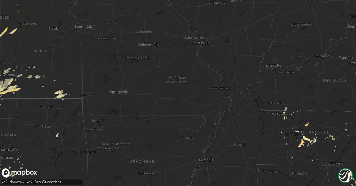
May 19 map
$229
one time, instant access
Download today. No call, no setup
Keep the $229
Bought the map and want the full workflow? Apply the entire $229 to a subscription within 7 days. None of it is wasted.
Every map, not just this one
This buys you this map. Subscription and you get every map we run, in the markets you choose from a few cities to whole states to nationwide. Plus real-time alerts the moment a storm fires.
Contact data
Name, contact info, occupancy, even credit band for addresses in the footprint. You go from where it hit to who to call.
Become the source they trust
Unlimited branding weather history reports on demand. You already have the documented answer ready for the property owner, and you are the one who showed up with it.
Property data and RoofTrace estimates
Pull up any address you have got, its value and the exact code rules for that jurisdiction, straight from One Click Code. Then RoofTrace estimates the squares, pitch, and roof value, priced the way you price.
Storm reports in Nebraska
Nebraska
| Date | Description |
|---|---|
| 05/19/20126:55 PM CDT | A local report indicates 1.00 inch wind near 3 SE BRAINARD |
| 05/19/20126:50 PM CDT | A local report indicates 1.00 inch wind near 2 SW GRAND ISLAND |
| 05/19/20126:47 PM CDT | Hail reported near highways 2 and 34. |
| 05/19/20126:44 PM CDT | A local report indicates 1.00 inch wind near GRAND ISLAND |
| 05/19/20126:35 PM CDT | A local report indicates 1.75 inch wind near 1 E SCHUYLER |
| 05/19/20126:28 PM CDT | A local report indicates 1.00 inch wind near 6 N MALCOLM |
| 05/19/20126:28 PM CDT | Quarter and golfball hail. |
| 05/19/20126:22 PM CDT | A local report indicates 1.00 inch wind near 1 S SCHUYLER |
| 05/19/20126:22 PM CDT | Just south of i-80 |
| 05/19/20126:20 PM CDT | A grain bin was reported in the southbound lanes of highway 81 near strang between roads s and t. Time estimated from radar. |
| 05/19/20126:20 PM CDT | A local report indicates 1.00 inch wind near 2 NE MALCOLM |
| 05/19/20126:15 PM CDT | Wind gust reported at the airport 36006g57kt |
| 05/19/20126:11 PM CDT | A local report indicates 1.00 inch wind near 6 ESE BENNINGTON |
| 05/19/20126:03 PM CDT | Quarter size hail at intersection of cr 309 and cr w |
| 05/19/20126:02 PM CDT | Power lines down south of ruskin. |
| 05/19/20126:01 PM CDT | Spotters reporting a tornado 1 mile west of shickley. |
| 05/19/20125:57 PM CDT | 8-10 power poles down from hardy to sw of ruskin. Pivots knocked over also. |
| 05/19/20125:50 PM CDT | A local report indicates 1.50 inch wind near SUPERIOR |
| 05/19/20125:48 PM CDT | Pivot overturned near highway 8 on the east side of hardy. Tree limbs 2 inches in diameter snapped in hardy. Time estimated from radar. |
| 05/19/20125:44 PM CDT | A local report indicates 1.00 inch wind near SUPERIOR |
| 05/19/20125:40 PM CDT | Delayed report from severe storms on the 19th. Hail up to quarter size. Time estimated from radar data. Report from nerain observer. |
| 05/19/20125:30 PM CDT | Hail sized from pea to slightly larger than a quarter. Covered most of the ground |
| 05/19/20125:24 PM CDT | At least 3 fields located approximately 1 mile west of the deweese spur off of highway 14 and 1 mile north of the county line were damaged. Time estimated from radar. |
| 05/19/20125:16 PM CDT | Quarter to golf ball hail almost covering ground |
| 05/19/20125:12 PM CDT | Wind gust measured at intersection of highways 14 and 4 in northern nuckolls county. |
| 05/19/20125:12 PM CDT | Dime to quarter size hail reported. |
| 05/19/20125:05 PM CDT | Hail up to the size of hen eggs reported. Trees damaged. |
| 05/19/20124:30 PM CDT | Delayed report from severe storms on the 19th. Golf ball size hail for nearly 20 minutes starting around 430 pm. Time estimated from radar. Severe damage to crops and b |
| 05/19/20124:20 PM CDT | A local report indicates 1.50 inch wind near BLUE HILL |
| 05/19/20124:18 PM CDT | A local report indicates 1.00 inch wind near 3 W BLUE HILL |
| 05/19/20124:15 PM CDT | Nickel to quarter size hail started around 405 pm. |
| 05/19/20124:14 PM CDT | A local report indicates 1.00 inch wind near 3 W MERNA |
| 05/19/20123:08 PM CDT | Most of the hail was pea to nickel with a few up to the size of ping pong balls. |
| 05/19/20122:36 PM CDT | Mostly pea to nickel size hail but a few stones were as large as a quarter. |
| 05/19/20122:13 PM CDT | Ground is covered white with hail. |
| 05/19/20122:07 PM CDT | A local report indicates 1.00 inch wind near 13 E HAYES CENTER |
| 05/19/20121:58 PM CDT | Ground covered white with hail. |
| 05/19/20121:28 PM CDT | Hail was ping pong ball in size. |
| 05/19/20121:15 PM CDT | A local report indicates 1.75 inch wind near 13 NW STRATTON NE |
| 05/19/20121:10 PM CDT | A local report indicates 1.75 inch wind near STRATTON NE |
| 05/19/20121:05 PM CDT | A local report indicates 1.00 inch wind near 4 N MAX |
| 05/19/201212:47 PM CDT | A local report indicates 1.00 inch wind near BENKELMAN |
| 05/19/20129:40 AM CDT | Nickel to quarter size hail covering the ground. |
| 05/19/20129:26 AM CDT | Ground covered with hail. The largest size of hail was a quarter. |
| 05/18/20129:36 PM CDT | A local report indicates 1.00 inch wind near 2 S CEDAR CREEK |
| 05/18/20128:11 PM CDT | A local report indicates 1.00 inch wind near 6 ESE BENNINGTON |
| 05/18/20128:00 PM CDT | Measured by public with wind equipment. Horse barn destroyed and siding damage to house. |
| 05/18/20127:55 PM CDT | Barn roof blown off |
| 05/18/20127:55 PM CDT | 6 inch diameter tree uprooted. Wind equipment measured 58 mph gust. |
| 05/18/20127:53 PM CDT | A local report indicates 60 MPH wind near ASHLAND |
| 05/18/20127:45 PM CDT | 3-5 inch diameter tree branches broken. |
| 05/18/20127:41 PM CDT | A local report indicates 70 MPH wind near WAHOO |
| 05/18/20127:38 PM CDT | Nickle size hail. |
| 05/18/20127:00 PM CDT | A local report indicates 1.00 inch wind near NORTH BEND |
All States Impacted by Hail Map on May 19, 2012
Cities Impacted by Hail Map on May 19, 2012
- Lyons, KS
- Altus, OK
- Elk City, OK
- Clearwater, NE
- Neligh, NE
- Kingman, KS
- Murdock, KS
- Omaha, NE
- Leedey, OK
- Arnett, OK
- Schuyler, NE
- Mooreland, OK
- Union, NE
- Nehawka, NE
- Bon Aqua, TN
- Chisago City, MN
- Lindstrom, MN
- Scandia, MN
- Forest Lake, MN
- Erick, OK
- Hinckley, MN
- Graettinger, IA
- Woodward, OK
- Loretto, MN
- Maple Plain, MN
- Buffalo, MN
- Rockford, MN
- Delano, MN
- Hamel, MN
- Minneapolis, MN
- Andover, MN
- Circle Pines, MN
- Callaway, NE
- Argonia, KS
- Freeport, KS
- Attica, KS
- Anthony, KS
- Danville, KS
- Harper, KS
- Rogers, NE
- Sutton, NE
- Glenvil, NE
- Edgar, NE
- Fairfield, NE
- Geneva, NE
- Deweese, NE
- Clay Center, NE
- Shickley, NE
- Lawrence, NE
- Blue Hill, NE
- Winfield, KS
- Fort Cobb, OK
- Valley, NE
- Mankato, KS
- Sharon, OK
- Mutual, OK
- Great Bend, KS
- Udall, KS
- Oxford, KS
- Binger, OK
- Tobias, NE
- Dorchester, NE
- Alexandria, NE
- Western, NE
- Milligan, NE
- Friend, NE
- Ohiowa, NE
- Daykin, NE
- Murfreesboro, TN
- Benkelman, NE
- Max, NE
- Wauneta, NE
- Stratton, NE
- Palisade, NE
- Chickasha, OK
- Ninnekah, OK
- Cedar Bluffs, NE
- Lyons, NE
- Oakland, NE
- Oneill, NE
- Superior, NE
- Nelson, NE
- Cheyenne, OK
- Mayfield, KS
- Caldwell, KS
- Wellington, KS
- Belle Plaine, KS
- Delavan, MN
- Whiting, IA
- Hornick, IA
- Rodney, IA
- Onawa, IA
- Castana, IA
- Smithland, IA
- Liberty, TN
- Lindsborg, KS
- Salina, KS
- Falun, KS
- Brookville, KS
- Randall, KS
- Jewell, KS
- Mason City, NE
- Solomon, KS
- New Cambria, KS
- Elk River, MN
- Sewanee, TN
- Christiana, TN
- Readyville, TN
- Saint Paul, MN
- Idalia, CO
- Bell Buckle, TN
- Jasper, GA
- Potwin, KS
- Benton, KS
- Whitewater, KS
- Colony, OK
- Valparaiso, NE
- Raymond, NE
- St John, KS
- Stafford, KS
- Elmore City, OK
- Springfield, NE
- Papillion, NE
- Bellevue, NE
- La Vista, NE
- Council Bluffs, IA
- Plattsmouth, NE
- Louisville, NE
- Giltner, NE
- Mangum, OK
- Isanti, MN
- Lebanon, TN
- Springfield, TN
- Tekamah, NE
- Decatur, NE
- Henderson, NE
- Hampton, NE
- Sylvan Grove, KS
- Tryon, NE
- Liberty, KS
- Mound Valley, KS
- Cherryvale, KS
- Coffeyville, KS
- Long Lake, MN
- Moville, IA
- Anthon, IA
- Oto, IA
- Branson, CO
- Hobart, OK
- Howard, KS
- Severy, KS
- Wilson, KS
- Burlington, CO
- Wayzata, MN
- Somerset, WI
- New Prague, MN
- Savage, MN
- Jordan, MN
- South Saint Paul, MN
- Burnsville, MN
- Hugo, MN
- Mendota, MN
- Webster, MN
- Prior Lake, MN
- Willernie, MN
- Osceola, WI
- Inver Grove Heights, MN
- Newport, MN
- Lakeville, MN
- Stillwater, MN
- Lake Elmo, MN
- Marine On Saint Croix, MN
- Elko New Market, MN
- Bruno, NE
- David City, NE
- Resaca, GA
- Chatsworth, GA
- York, NE
- Waco, NE
- Gresham, NE
- Utica, NE
- Bradshaw, NE
- Dodge, NE
- Linwood, NE
- Columbus, NE
- North Bend, NE
- Bellwood, NE
- Shelby, NE
- Adams, TN
- Saint Francis, KS
- Folsom, NM
- Pauls Valley, OK
- Wynnewood, OK
- Trenton, NE
- Rockvale, TN
- Shelbyville, TN
- Unionville, TN
- Chapel Hill, TN
- Alda, NE
- Morse Bluff, NE
- Brainard, NE
- Nash, OK
- Medford, OK
- Wakita, OK
- Farmington, MN
- El Dorado, KS
- Leon, KS
- Sandstone, MN
- Butler, OK
- Silver Lake, MN
- Gotebo, OK
- Olustee, OK
- Carnegie, OK
- Cordell, OK
- Foss, OK
- Headrick, OK
- Altus Afb, OK
- Hydro, OK
- Mountain View, OK
- Clinton, OK
- Carter, OK
- Vinson, OK
- Sweetwater, OK
- Sayre, OK
- Cement, OK
- Corn, OK
- Willow, OK
- Lookeba, OK
- Gracemont, OK
- Duke, OK
- Verden, OK
- Blair, OK
- Rocky, OK
- Granite, OK
- Arapaho, OK
- Sentinel, OK
- Anadarko, OK
- Weatherford, OK
- Canute, OK
- Dill City, OK
- Lone Wolf, OK
- Minco, OK
- Hammon, OK
- Cyril, OK
- Apache, OK
- Holyrood, KS
- Ellsworth, KS
- Lorraine, KS
- Peck, KS
- Derby, KS
- Mulvane, KS
- Braham, MN
- Spivey, KS
- Chapman, NE
- Moorefield, NE
- Brady, NE
- Maxwell, NE
- Logan, IA
- Ruskin, NE
- Hardy, NE
- Oak, NE
- Guide Rock, NE
- Pleasant View, TN
- Ashland City, TN
- Chapmansboro, TN
- Beverly, KS
- Tescott, KS
- Hayes Center, NE
- Maywood, NE
- Shafer, MN
- Everly, IA
- Spencer, IA
- Peterson, IA
- Royal, IA
- Estherville, IA
- Columbia, TN
- Mount Pleasant, TN
- Hopkins, MN
- Neola, IA
- Minden, IA
- Geneseo, KS
- Little River, KS
- Allensville, KY
- Woodbine, IA
- Arden, NC
- Fletcher, NC
- Mills River, NC
- Elsie, NE
- Weston, NE
- Custer City, OK
- Taloga, OK
- Hollis, OK
- Dodson, TX
- Wellington, TX
- Wagner, SD
- Red Cloud, NE
- Burr Oak, KS
- Clearwater, KS
- Darwin, MN
- Boys Town, NE
- Ellijay, GA
- Hershey, NE
- Alva, OK
- Gothenburg, NE
- Champlin, MN
- Arlington, KS
- Partridge, KS
- Abbyville, KS
- Sylvia, KS
- Pretty Prairie, KS
- Plevna, KS
- Turon, KS
- Paxton, NE
- Oakley, KS
- Monument, KS
- Winona, KS
- Bee, NE
- Ceresco, NE
- Prague, NE
- Wahoo, NE
- Garland, NE
- Dwight, NE
- Malmo, NE
- Malcolm, NE
- Weeping Water, NE
- Ames, NE
- Fremont, NE
- Hudson, WI
- New Richmond, WI
- Harvard, NE
- Vero Beach, FL
- Okeechobee, FL
- Woodbury, TN
- Loxahatchee, FL
- Scribner, NE
- Rising City, NE
- Osceola, NE
- Howells, NE
- Hooper, NE
- Clarkson, NE
- Stuart, NE
- Burwell, NE
- Atkinson, NE
- Amelia, NE
- Morganton, GA
- Sparta, TN
- Stromsburg, NE
- Augusta, KS
- Aurora, NE
- Lincoln, NE
- Walton, NE
- Immokalee, FL
- Wilber, NE
- Crete, NE
- Greeley, NE
- Litchfield, MN
- Hutchinson, MN
- Nickerson, NE
- Arlington, NE
- Blair, NE
- Bennington, NE
- Kennard, NE
- Washington, NE
- Craig, NE
- Herman, NE
- Randolph, NE
- Wood River, NE
- Palm City, FL
- Stuart, FL
- Indiantown, FL
- Schleswig, IA
- Russellville, KY
- Paoli, OK
- Wayne, OK
- Dorrance, KS
- Ayr, NE
- Brasstown, NC
- Benedict, NE
- Anoka, MN
- Bethel, MN
- Rogers, MN
- Dayton, MN
- Cedar, MN
- Saint Francis, MN
- Saint Michael, MN
- Howard Lake, MN
- Cokato, MN
- Glidden, IA
- Vail, IA
- Denison, IA
- Eads, CO
- Curtis, NE
- Wellfleet, NE
- McCook, NE
- Anselmo, NE
- Merna, NE
- Farnam, NE
- Norwich, KS
- Lawton, OK
- Brook Park, MN
- Pine City, MN
- Grasston, MN
- Gould, OK
- Welch, OK
- Beloit, KS
- Barnard, KS
- Culbertson, NE
- Petersburg, NE
- Antioch, TN
- Nolensville, TN
- Nashville, TN
- Brentwood, TN
- Edna, KS
- Grand Island, NE
- Doniphan, NE
- Phillips, NE
- Lakeland, MN
- Chapman, KS
- Abilene, KS
- Harlan, IA
- Stapleton, NE
- Seneca, NE
- Milaca, MN
- Albertville, AL
- Lexington, NE
- Eddyville, NE
- Briscoe, TX
- Wheeler, TX
- Redbird, OK
- Porter, OK
- Coweta, OK
- Sedgwick, KS
- Maize, KS
- Wichita, KS
- Goddard, KS
- Colwich, KS
- Valley Center, KS
- Seward, NE
- Macksville, KS
- Waldron, KS
- Milton, KS
- Hazelton, KS
- Cheney, KS
- Conway Springs, KS
- Milan, KS
- Correctionville, IA
- Taylor, NE
- Center City, MN
- Greenwood, NE
- Waverly, NE
- Eagle, NE
- Alvo, NE
- Mora, MN
- Clarksville, TN
- Guthrie, KY
- Olmstead, KY
- Danbury, IA
- Battle Creek, IA
- Mapleton, IA
- Morton, MN
- Franklin, MN
- Redwood Falls, MN
- Hector, MN
- Bird Island, MN
- Olivia, MN
- Rosemount, MN
- Gretna, NE
- Ashland, NE
- South Bend, NE
- Dow City, IA
- Charter Oak, IA
- Glencoe, MN
- Morrison, TN
- Mcminnville, TN
- Grenville, NM
- Ruthven, IA
- Crossville, TN
- West Point, NE
- Colon, NE
- Pleasant Dale, NE
- Doyle, TN
- Quebeck, TN
- Martell, NE
- Oswego, KS
- Bartlett, KS
- Sutherland, NE
- Milford, NE
- Winthrop, MN
- Winsted, MN
- Stewart, MN
- Brownton, MN
- Gibbon, MN
- Missouri Valley, IA
- Fairmont, NE
- Westside, IA
- Manning, IA
- Manilla, IA
- Cozad, NE
- Bradyville, TN
- Long Pine, NE
- Alpha, MN
- Staplehurst, NE
- Flagler, CO
- Rockwood, TN
- Avoca, NE
- Ardmore, OK
- Springer, OK
- Spencer, TN
- McCool Junction, NE
- Cedar Hill, TN
- Foreston, MN
- Roca, NE
- Altoona, KS
- Ong, NE
- Davenport, NE
- Grafton, NE
- Saint Paul, NE
- Kim, CO
- Pritchett, CO
- Willow River, MN
- Stacy, MN
- Firth, NE
- Adams, NE
- Latham, KS
- Piedmont, KS
- Beaumont, KS
- Cambridge, MN
- Grandy, MN
- Stanchfield, MN
- Haysville, KS
- Wolbach, NE
- Spalding, NE
- Ada, OK
- Stratford, OK
- Titonka, IA
- Bancroft, IA
- Burt, IA
- Claflin, KS
- Hoisington, KS
- Ord, NE
- Underwood, IA
- Isabella, OK
- Okeene, OK
- Model, CO
- Trinidad, CO
- Walsenburg, CO
- Blanchard, OK
- Swea City, IA
- Fort Calhoun, NE
- Manchester, TN
- Beechgrove, TN
- Persia, IA
- Manchester, OK
- Clewiston, FL
- Bessie, OK
- Mountain Park, OK
- Fletcher, OK
- Crawford, OK
- Rush Springs, OK
- Roosevelt, OK
- Snyder, OK
- Exeter, NE
- Beaver Crossing, NE
- Pocasset, OK
- Tecumseh, OK
- Trumbull, NE
- Elba, NE
- Amherst, NE
- Grand Junction, IA
- Rippey, IA
- De Witt, NE
- Comfrey, MN
- Fairfax, MN
- Thedford, NE
- Shakopee, MN
- Arcadia, IA
- Breda, IA
- Shelby, IA
- Blencoe, IA
- Deloit, IA
- Miller, NE
- Pond Creek, OK
- Crossville, AL
- Andale, KS
- Mount Hope, KS
- Hickman, NE
- Palisade, MN
- Esbon, KS
- Lebanon, KS
- Webber, KS
- Bladen, NE
- Dassel, MN
- Sumner, NE
- Ravenna, NE
- Rockville, NE
- North Branch, MN
- Harris, MN
- Winchester, TN
- Dunlap, TN
- Wallace, KS
- Sharon Springs, KS
- Bird City, KS
- Parks, NE
- Waterloo, NE
- Elkhorn, NE
- Ogden, IA
- Kingfisher, OK
- Lincoln, KS
- Kirkman, IA
- Geary, OK
- Lester Prairie, MN
- Mcgregor, MN
- Dolliver, IA
- Armstrong, IA
- Childress, TX
- Denton, NE
- Ogilvie, MN
- Labelle, FL
- Cleghorn, IA
- Mead, NE
- Washta, IA
- Pierson, IA
- Marcus, IA
- Snyder, NE
- Cushing, IA
- Cherokee, IA
- Kingsley, IA
- Little Sioux, IA
- Abie, NE
- Yutan, NE
- Uehling, NE
- Holstein, IA
- Quimby, IA
- Ogallala, NE
- Verdigre, NE
- Page, NE
- Lynch, NE
- Niobrara, NE
- Albion, NE
- Smyrna, TN
- Tecumseh, NE
- Ainsworth, NE
- Marlow, OK
- Duncan, OK
- Sargent, NE
- Strang, NE
- Cortland, NE
- Clatonia, NE
- Hallam, NE
- Minneapolis, KS
- Kanopolis, KS
- Mayer, MN
- Offutt Afb, NE
- Sturgeon Lake, MN
- Moose Lake, MN
- Tribune, KS
- Garden Plain, KS
- Moorhead, IA
- Lehigh Acres, FL
- Dunlap, IA
- Asbury, MO
- Eagleville, TN
- Calumet, OK
- Lindsay, OK
- Sterling, KS
- Westcliffe, CO
- Enders, NE
- Young Harris, GA
- Norfolk, NE
- Cook, MN
- McClelland, IA
- Star Prairie, WI
- Dresser, WI
- Hoxie, KS
- Grinnell, KS
- Aitkin, MN
- Princeton, MN
- Emmet, NE
- Chambers, NE
- Jackson, MN
- Spirit Lake, IA
- Lakefield, MN
- Kiowa, KS
- Scotia, NE
- Grantsburg, WI
- Chester, OK
- McCune, KS
- Dante, SD
- Butterfield, MN
- Young America, MN
- Cologne, MN
- Pickrell, NE
- Filley, NE
- Wyoming, MN
- Osseo, MN
- Blairsville, GA
- Suches, GA
- Wyandotte, OK
- Fairmount, GA
- Waleska, GA
- Pacific Junction, IA
- Glenwood, IA
- Hastings, NE
- Inland, NE
- Polk, NE
- Macomb, OK
- Asher, OK
- Elmwood, NE
- Murdock, NE
- Crescent, IA
- Cedar Creek, NE
- Avoca, IA
- Honey Creek, IA
- Carter Lake, IA
- Eden Prairie, MN
- Terril, IA
- Watertown, MN
- New Germany, MN
- Montrose, MN
- Inman, KS
- Hutchinson, KS
- Bluff City, KS
- Viola, KS
- Granada, MN
- Maple Grove, MN
- La Vergne, TN
- Smithville, TN
- Stratton, CO
- Chase, KS
- Windom, KS
- Shawnee, OK
- Blue Earth, MN
- Elmore, MN
- Mineral Bluff, GA
- Murphy, NC
- Orlinda, TN
- Cross Plains, TN
- Portland, TN
- Flandreau, SD
- Rock Island, TN
- Elgin, OK
- Vona, CO
- Bradley, OK
- Green, KS
- Broken Bow, NE
- Longdale, OK
- Ringsted, IA
- Wartrace, TN
- Konawa, OK
- Winnetoon, NE
- Oak Park, MN
- Foley, MN
- Elkton, KY
- Pleasanton, NE
- Petersburg, TN
- Pulaski, TN
- Frankewing, TN
- Sherburn, MN
- Fairbury, NE
- Fall River, KS
- Center, NE
- Franklin, KY
- Mound, MN
- Bassett, NE
- Santa Fe, TN
- Waynoka, OK
- Larrabee, IA
- Newcastle, OK
- Union City, OK
- Cherry Log, GA
- Blue Ridge, GA
- Kimball, MN
- Geuda Springs, KS
- Eureka, KS
- Johnstown, NE
- Haven, KS
- Dickens, IA
- Rose Hill, KS
- Douglass, KS
- Kenesaw, NE
- Sprague, NE
- Bennet, NE
- Swanton, NE
- Plymouth, NE
- Loup City, NE
- Litchfield, NE
- Sheridan Lake, CO
- Siren, WI
- Orr, MN
- Otoe, NE
- Dunbar, NE
- Pikeville, TN
- Deer Lodge, TN
- Ithaca, NE
- North Loup, NE
- Fredonia, KS
- Talking Rock, GA
- Ulysses, NE
- Surprise, NE
- Wanette, OK
- North Platte, NE
- Altamont, KS
- Arnolds Park, IA
- Milford, IA
- College Grove, TN
- Byars, OK
- Washington, KS
- Cunningham, KS
- Longton, KS
- Wann, OK
- S Coffeyville, OK
- Madisonville, KY
- Hanson, KY
- Burns, TN
- Waverly, MN
- Monticello, MN
- Albertville, MN
- Hanover, MN
- Waconia, MN


