Hail Map in Kansas on May 19, 2012
Get this storm
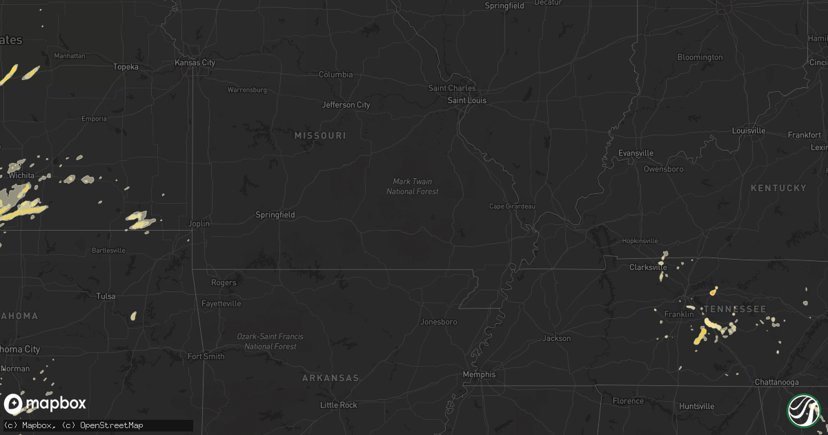
May 19 map
$229
one time, instant access
Download today. No call, no setup
Keep the $229
Bought the map and want the full workflow? Apply the entire $229 to a subscription within 7 days. None of it is wasted.
Every map, not just this one
This buys you this map. Subscription and you get every map we run, in the markets you choose from a few cities to whole states to nationwide. Plus real-time alerts the moment a storm fires.
Contact data
Name, contact info, occupancy, even credit band for addresses in the footprint. You go from where it hit to who to call.
Become the source they trust
Unlimited branding weather history reports on demand. You already have the documented answer ready for the property owner, and you are the one who showed up with it.
Property data and RoofTrace estimates
Pull up any address you have got, its value and the exact code rules for that jurisdiction, straight from One Click Code. Then RoofTrace estimates the squares, pitch, and roof value, priced the way you price.
Storm reports in Kansas
Kansas
| Date | Description |
|---|---|
| 05/19/20126:58 PM CDT | Tornado damage path is 300 yards wide. Some homes were damaged. Powerlines were down. |
| 05/19/20126:52 PM CDT | A local report indicates 1.50 inch wind near 13 WSW ANTHONY |
| 05/19/20126:52 PM CDT | A local report indicates 1.50 inch wind near 13 WNW ANTHONY |
| 05/19/20126:49 PM CDT | A local report indicates 1.25 inch wind near 13 WSW ANTHONY |
| 05/19/20126:49 PM CDT | Correction. Location is wnw not wsw. |
| 05/19/20126:46 PM CDT | A local report indicates a tornado near 5 SE SPIVEY |
| 05/19/20126:45 PM CDT | Two homes damaged with one having roof ripped off. Heavy tree damage with uprooted trees. |
| 05/19/20126:45 PM CDT | Farmstead was hit by tornado. Extent of damage is unknown at this time. |
| 05/19/20126:45 PM CDT | Moderate damage to a mobile home |
| 05/19/20126:41 PM CDT | A local report indicates a tornado near 3 SSW RAGO |
| 05/19/20126:40 PM CDT | Spotter reported oil tanks and wells damaged in the area with multiple tree damage near the kingman and harper county line |
| 05/19/20126:40 PM CDT | Spotter reported oil tanks and wells damaged in the area with multiple tree damage near the kingman and harper county line |
| 05/19/20126:38 PM CDT | A local report indicates a tornado near 3 ENE ATTICA |
| 05/19/20126:35 PM CDT | A local report indicates 1.25 inch wind near 3 WNW CULVER |
| 05/19/20126:33 PM CDT | A local report indicates a tornado near 6 W HARPER |
| 05/19/20126:33 PM CDT | A local report indicates a tornado near 3 NW HARPER |
| 05/19/20126:32 PM CDT | Rope tornado. |
| 05/19/20126:28 PM CDT | A local report indicates a tornado near 4 SSE SPIVEY |
| 05/19/20126:27 PM CDT | Pea to golfball size hail for 3 to 4 minutes. |
| 05/19/20126:23 PM CDT | A local report indicates 1.00 inch wind near 2 N STERLING |
| 05/19/20126:20 PM CDT | A local report indicates 1.75 inch wind near 4 N GLENDALE |
| 05/19/20126:19 PM CDT | Tornado is a bit bigger than a rope. |
| 05/19/20126:15 PM CDT | Rope tornado. |
| 05/19/20126:06 PM CDT | A local report indicates 3.00 inch wind near 5 ENE KINGMAN |
| 05/19/20126:04 PM CDT | Estimating 65 to 70 mph winds. |
| 05/19/20126:03 PM CDT | A local report indicates 3.00 inch wind near 4 ENE KINGMAN |
| 05/19/20126:01 PM CDT | A local report indicates a tornado near 5 SW KINGMAN |
| 05/19/20125:58 PM CDT | Rope tornado. |
| 05/19/20125:58 PM CDT | Rope tornado. |
| 05/19/20125:57 PM CDT | A local report indicates 1.75 inch wind near KINGMAN |
| 05/19/20125:53 PM CDT | Spotter reported landspout tornado |
| 05/19/20125:49 PM CDT | Spotter reported rope tornado |
| 05/19/20125:45 PM CDT | Rope tornado. |
| 05/19/20125:44 PM CDT | A local report indicates 1.75 inch wind near 7 SW KINGMAN |
| 05/19/20125:38 PM CDT | A local report indicates a tornado near 5 NW KINGMAN |
| 05/19/20125:35 PM CDT | A local report indicates 1.00 inch wind near 9 S HUTCHINSON |
| 05/19/20125:30 PM CDT | Hail up to the size of ping pong balls reported. |
| 05/19/20125:30 PM CDT | A local report indicates 2.00 inch wind near 1 WSW ARLINGTON |
| 05/19/20125:24 PM CDT | A local report indicates 2.00 inch wind near 2 SW ARLINGTON |
| 05/19/20125:21 PM CDT | A local report indicates 1.75 inch wind near ARLINGTON |
| 05/19/20125:18 PM CDT | A local report indicates 1.75 inch wind near 4 SW ARLINGTON |
| 05/19/20125:18 PM CDT | A local report indicates 1.50 inch wind near ELLSWORTH |
| 05/19/20125:17 PM CDT | A local report indicates 2.00 inch wind near 1 WSW ARLINGTON |
| 05/19/20125:15 PM CDT | A local report indicates 1.00 inch wind near ARLINGTON |
| 05/19/20125:15 PM CDT | A local report indicates 1.00 inch wind near ELLSWORTH |
| 05/19/20125:11 PM CDT | A local report indicates 1.75 inch wind near 5 W ARLINGTON |
| 05/19/20125:11 PM CDT | A local report indicates 2.00 inch wind near 4 W ARLINGTON |
| 05/19/20125:06 PM CDT | A local report indicates 1.25 inch wind near 4 S SYLVIA |
| 05/19/20125:00 PM CDT | Public reported ping pong ball size hail covering his yard. |
| 05/19/20124:45 PM CDT | A local report indicates 60 MPH wind near 3 E SYLVAN GROVE |
| 05/19/20124:45 PM CDT | A local report indicates 1.50 inch wind near 3 E SYLVAN GROVE |
| 05/19/20124:44 PM CDT | A local report indicates 1.75 inch wind near SYLVIA |
| 05/19/20124:31 PM CDT | A local report indicates 1.75 inch wind near 5 E STAFFORD |
| 05/19/20124:27 PM CDT | This time was estimated by radar data. |
| 05/19/20124:23 PM CDT | A local report indicates 1.75 inch wind near ZENITH |
| 05/19/20124:22 PM CDT | A local report indicates 1.00 inch wind near 4 E STAFFORD |
| 05/19/20124:22 PM CDT | A local report indicates 1.00 inch wind near N ZENITH |
| 05/19/20124:15 PM CDT | Half dollar sized hail...just hail no wind or rain |
| 05/19/20124:07 PM CDT | A local report indicates 1.50 inch wind near 3 N STAFFORD |
| 05/19/20124:05 PM CDT | A local report indicates 1.00 inch wind near 5 E ST. JOHN |
| 05/19/20123:59 PM CDT | A local report indicates 1.00 inch wind near 7 SSE ST. JOHN |
| 05/19/20123:50 PM CDT | A local report indicates 2.50 inch wind near 4 SE ST. JOHN |
| 05/19/20123:45 PM CDT | A local report indicates 2.00 inch wind near GREAT BEND |
| 05/19/20123:42 PM CDT | A local report indicates 1.00 inch wind near GREAT BEND |
| 05/19/20123:38 PM CDT | A local report indicates 1.00 inch wind near GREAT BEND |
| 05/19/20123:36 PM CDT | A local report indicates 1.00 inch wind near 2 NNE DILLWYN |
| 05/19/20123:35 PM CDT | A local report indicates 2.00 inch wind near 2 W GREAT BEND |
| 05/19/20121:46 PM CDT | Chaser reports large quantity of hail covering highway 25 at russell springs |
| 05/18/20129:57 PM CDT | A local report indicates 1.00 inch wind near SEVERY |
| 05/18/20129:48 PM CDT | Nickel to quarter size hail. |
| 05/18/20129:47 PM CDT | Spotters reported 70 to 80 mph winds near eureka city lake with numerous trees down. |
| 05/18/20128:30 PM CDT | A local report indicates 66 MPH wind near MCCONNELL AIR FORCE BAS |
| 05/18/20128:26 PM CDT | A local report indicates 1.25 inch wind near MULVANE |
| 05/18/20128:00 PM CDT | A local report indicates 1.00 inch wind near ESE ABILENE |
| 05/18/20127:35 PM CDT | A local report indicates 1.75 inch wind near 1 SE NILES |
| 05/18/20127:32 PM CDT | A local report indicates 1.50 inch wind near 5 WNW ARGONIA |
| 05/18/20127:02 PM CDT | Spotter reported tornado on the northwest side of harper. |
All States Impacted by Hail Map on May 19, 2012
Cities Impacted by Hail Map on May 19, 2012
- Lyons, KS
- Altus, OK
- Elk City, OK
- Clearwater, NE
- Neligh, NE
- Kingman, KS
- Murdock, KS
- Omaha, NE
- Leedey, OK
- Arnett, OK
- Schuyler, NE
- Mooreland, OK
- Union, NE
- Nehawka, NE
- Bon Aqua, TN
- Chisago City, MN
- Lindstrom, MN
- Scandia, MN
- Forest Lake, MN
- Erick, OK
- Hinckley, MN
- Graettinger, IA
- Woodward, OK
- Loretto, MN
- Maple Plain, MN
- Buffalo, MN
- Rockford, MN
- Delano, MN
- Hamel, MN
- Minneapolis, MN
- Andover, MN
- Circle Pines, MN
- Callaway, NE
- Argonia, KS
- Freeport, KS
- Attica, KS
- Anthony, KS
- Danville, KS
- Harper, KS
- Rogers, NE
- Sutton, NE
- Glenvil, NE
- Edgar, NE
- Fairfield, NE
- Geneva, NE
- Deweese, NE
- Clay Center, NE
- Shickley, NE
- Lawrence, NE
- Blue Hill, NE
- Winfield, KS
- Fort Cobb, OK
- Valley, NE
- Mankato, KS
- Sharon, OK
- Mutual, OK
- Great Bend, KS
- Udall, KS
- Oxford, KS
- Binger, OK
- Tobias, NE
- Dorchester, NE
- Alexandria, NE
- Western, NE
- Milligan, NE
- Friend, NE
- Ohiowa, NE
- Daykin, NE
- Murfreesboro, TN
- Benkelman, NE
- Max, NE
- Wauneta, NE
- Stratton, NE
- Palisade, NE
- Chickasha, OK
- Ninnekah, OK
- Cedar Bluffs, NE
- Lyons, NE
- Oakland, NE
- Oneill, NE
- Superior, NE
- Nelson, NE
- Cheyenne, OK
- Mayfield, KS
- Caldwell, KS
- Wellington, KS
- Belle Plaine, KS
- Delavan, MN
- Whiting, IA
- Hornick, IA
- Rodney, IA
- Onawa, IA
- Castana, IA
- Smithland, IA
- Liberty, TN
- Lindsborg, KS
- Salina, KS
- Falun, KS
- Brookville, KS
- Randall, KS
- Jewell, KS
- Mason City, NE
- Solomon, KS
- New Cambria, KS
- Elk River, MN
- Sewanee, TN
- Christiana, TN
- Readyville, TN
- Saint Paul, MN
- Idalia, CO
- Bell Buckle, TN
- Jasper, GA
- Potwin, KS
- Benton, KS
- Whitewater, KS
- Colony, OK
- Valparaiso, NE
- Raymond, NE
- St John, KS
- Stafford, KS
- Elmore City, OK
- Springfield, NE
- Papillion, NE
- Bellevue, NE
- La Vista, NE
- Council Bluffs, IA
- Plattsmouth, NE
- Louisville, NE
- Giltner, NE
- Mangum, OK
- Isanti, MN
- Lebanon, TN
- Springfield, TN
- Tekamah, NE
- Decatur, NE
- Henderson, NE
- Hampton, NE
- Sylvan Grove, KS
- Tryon, NE
- Liberty, KS
- Mound Valley, KS
- Cherryvale, KS
- Coffeyville, KS
- Long Lake, MN
- Moville, IA
- Anthon, IA
- Oto, IA
- Branson, CO
- Hobart, OK
- Howard, KS
- Severy, KS
- Wilson, KS
- Burlington, CO
- Wayzata, MN
- Somerset, WI
- New Prague, MN
- Savage, MN
- Jordan, MN
- South Saint Paul, MN
- Burnsville, MN
- Hugo, MN
- Mendota, MN
- Webster, MN
- Prior Lake, MN
- Willernie, MN
- Osceola, WI
- Inver Grove Heights, MN
- Newport, MN
- Lakeville, MN
- Stillwater, MN
- Lake Elmo, MN
- Marine On Saint Croix, MN
- Elko New Market, MN
- Bruno, NE
- David City, NE
- Resaca, GA
- Chatsworth, GA
- York, NE
- Waco, NE
- Gresham, NE
- Utica, NE
- Bradshaw, NE
- Dodge, NE
- Linwood, NE
- Columbus, NE
- North Bend, NE
- Bellwood, NE
- Shelby, NE
- Adams, TN
- Saint Francis, KS
- Folsom, NM
- Pauls Valley, OK
- Wynnewood, OK
- Trenton, NE
- Rockvale, TN
- Shelbyville, TN
- Unionville, TN
- Chapel Hill, TN
- Alda, NE
- Morse Bluff, NE
- Brainard, NE
- Nash, OK
- Medford, OK
- Wakita, OK
- Farmington, MN
- El Dorado, KS
- Leon, KS
- Sandstone, MN
- Butler, OK
- Silver Lake, MN
- Gotebo, OK
- Olustee, OK
- Carnegie, OK
- Cordell, OK
- Foss, OK
- Headrick, OK
- Altus Afb, OK
- Hydro, OK
- Mountain View, OK
- Clinton, OK
- Carter, OK
- Vinson, OK
- Sweetwater, OK
- Sayre, OK
- Cement, OK
- Corn, OK
- Willow, OK
- Lookeba, OK
- Gracemont, OK
- Duke, OK
- Verden, OK
- Blair, OK
- Rocky, OK
- Granite, OK
- Arapaho, OK
- Sentinel, OK
- Anadarko, OK
- Weatherford, OK
- Canute, OK
- Dill City, OK
- Lone Wolf, OK
- Minco, OK
- Hammon, OK
- Cyril, OK
- Apache, OK
- Holyrood, KS
- Ellsworth, KS
- Lorraine, KS
- Peck, KS
- Derby, KS
- Mulvane, KS
- Braham, MN
- Spivey, KS
- Chapman, NE
- Moorefield, NE
- Brady, NE
- Maxwell, NE
- Logan, IA
- Ruskin, NE
- Hardy, NE
- Oak, NE
- Guide Rock, NE
- Pleasant View, TN
- Ashland City, TN
- Chapmansboro, TN
- Beverly, KS
- Tescott, KS
- Hayes Center, NE
- Maywood, NE
- Shafer, MN
- Everly, IA
- Spencer, IA
- Peterson, IA
- Royal, IA
- Estherville, IA
- Columbia, TN
- Mount Pleasant, TN
- Hopkins, MN
- Neola, IA
- Minden, IA
- Geneseo, KS
- Little River, KS
- Allensville, KY
- Woodbine, IA
- Arden, NC
- Fletcher, NC
- Mills River, NC
- Elsie, NE
- Weston, NE
- Custer City, OK
- Taloga, OK
- Hollis, OK
- Dodson, TX
- Wellington, TX
- Wagner, SD
- Red Cloud, NE
- Burr Oak, KS
- Clearwater, KS
- Darwin, MN
- Boys Town, NE
- Ellijay, GA
- Hershey, NE
- Alva, OK
- Gothenburg, NE
- Champlin, MN
- Arlington, KS
- Partridge, KS
- Abbyville, KS
- Sylvia, KS
- Pretty Prairie, KS
- Plevna, KS
- Turon, KS
- Paxton, NE
- Oakley, KS
- Monument, KS
- Winona, KS
- Bee, NE
- Ceresco, NE
- Prague, NE
- Wahoo, NE
- Garland, NE
- Dwight, NE
- Malmo, NE
- Malcolm, NE
- Weeping Water, NE
- Ames, NE
- Fremont, NE
- Hudson, WI
- New Richmond, WI
- Harvard, NE
- Vero Beach, FL
- Okeechobee, FL
- Woodbury, TN
- Loxahatchee, FL
- Scribner, NE
- Rising City, NE
- Osceola, NE
- Howells, NE
- Hooper, NE
- Clarkson, NE
- Stuart, NE
- Burwell, NE
- Atkinson, NE
- Amelia, NE
- Morganton, GA
- Sparta, TN
- Stromsburg, NE
- Augusta, KS
- Aurora, NE
- Lincoln, NE
- Walton, NE
- Immokalee, FL
- Wilber, NE
- Crete, NE
- Greeley, NE
- Litchfield, MN
- Hutchinson, MN
- Nickerson, NE
- Arlington, NE
- Blair, NE
- Bennington, NE
- Kennard, NE
- Washington, NE
- Craig, NE
- Herman, NE
- Randolph, NE
- Wood River, NE
- Palm City, FL
- Stuart, FL
- Indiantown, FL
- Schleswig, IA
- Russellville, KY
- Paoli, OK
- Wayne, OK
- Dorrance, KS
- Ayr, NE
- Brasstown, NC
- Benedict, NE
- Anoka, MN
- Bethel, MN
- Rogers, MN
- Dayton, MN
- Cedar, MN
- Saint Francis, MN
- Saint Michael, MN
- Howard Lake, MN
- Cokato, MN
- Glidden, IA
- Vail, IA
- Denison, IA
- Eads, CO
- Curtis, NE
- Wellfleet, NE
- McCook, NE
- Anselmo, NE
- Merna, NE
- Farnam, NE
- Norwich, KS
- Lawton, OK
- Brook Park, MN
- Pine City, MN
- Grasston, MN
- Gould, OK
- Welch, OK
- Beloit, KS
- Barnard, KS
- Culbertson, NE
- Petersburg, NE
- Antioch, TN
- Nolensville, TN
- Nashville, TN
- Brentwood, TN
- Edna, KS
- Grand Island, NE
- Doniphan, NE
- Phillips, NE
- Lakeland, MN
- Chapman, KS
- Abilene, KS
- Harlan, IA
- Stapleton, NE
- Seneca, NE
- Milaca, MN
- Albertville, AL
- Lexington, NE
- Eddyville, NE
- Briscoe, TX
- Wheeler, TX
- Redbird, OK
- Porter, OK
- Coweta, OK
- Sedgwick, KS
- Maize, KS
- Wichita, KS
- Goddard, KS
- Colwich, KS
- Valley Center, KS
- Seward, NE
- Macksville, KS
- Waldron, KS
- Milton, KS
- Hazelton, KS
- Cheney, KS
- Conway Springs, KS
- Milan, KS
- Correctionville, IA
- Taylor, NE
- Center City, MN
- Greenwood, NE
- Waverly, NE
- Eagle, NE
- Alvo, NE
- Mora, MN
- Clarksville, TN
- Guthrie, KY
- Olmstead, KY
- Danbury, IA
- Battle Creek, IA
- Mapleton, IA
- Morton, MN
- Franklin, MN
- Redwood Falls, MN
- Hector, MN
- Bird Island, MN
- Olivia, MN
- Rosemount, MN
- Gretna, NE
- Ashland, NE
- South Bend, NE
- Dow City, IA
- Charter Oak, IA
- Glencoe, MN
- Morrison, TN
- Mcminnville, TN
- Grenville, NM
- Ruthven, IA
- Crossville, TN
- West Point, NE
- Colon, NE
- Pleasant Dale, NE
- Doyle, TN
- Quebeck, TN
- Martell, NE
- Oswego, KS
- Bartlett, KS
- Sutherland, NE
- Milford, NE
- Winthrop, MN
- Winsted, MN
- Stewart, MN
- Brownton, MN
- Gibbon, MN
- Missouri Valley, IA
- Fairmont, NE
- Westside, IA
- Manning, IA
- Manilla, IA
- Cozad, NE
- Bradyville, TN
- Long Pine, NE
- Alpha, MN
- Staplehurst, NE
- Flagler, CO
- Rockwood, TN
- Avoca, NE
- Ardmore, OK
- Springer, OK
- Spencer, TN
- McCool Junction, NE
- Cedar Hill, TN
- Foreston, MN
- Roca, NE
- Altoona, KS
- Ong, NE
- Davenport, NE
- Grafton, NE
- Saint Paul, NE
- Kim, CO
- Pritchett, CO
- Willow River, MN
- Stacy, MN
- Firth, NE
- Adams, NE
- Latham, KS
- Piedmont, KS
- Beaumont, KS
- Cambridge, MN
- Grandy, MN
- Stanchfield, MN
- Haysville, KS
- Wolbach, NE
- Spalding, NE
- Ada, OK
- Stratford, OK
- Titonka, IA
- Bancroft, IA
- Burt, IA
- Claflin, KS
- Hoisington, KS
- Ord, NE
- Underwood, IA
- Isabella, OK
- Okeene, OK
- Model, CO
- Trinidad, CO
- Walsenburg, CO
- Blanchard, OK
- Swea City, IA
- Fort Calhoun, NE
- Manchester, TN
- Beechgrove, TN
- Persia, IA
- Manchester, OK
- Clewiston, FL
- Bessie, OK
- Mountain Park, OK
- Fletcher, OK
- Crawford, OK
- Rush Springs, OK
- Roosevelt, OK
- Snyder, OK
- Exeter, NE
- Beaver Crossing, NE
- Pocasset, OK
- Tecumseh, OK
- Trumbull, NE
- Elba, NE
- Amherst, NE
- Grand Junction, IA
- Rippey, IA
- De Witt, NE
- Comfrey, MN
- Fairfax, MN
- Thedford, NE
- Shakopee, MN
- Arcadia, IA
- Breda, IA
- Shelby, IA
- Blencoe, IA
- Deloit, IA
- Miller, NE
- Pond Creek, OK
- Crossville, AL
- Andale, KS
- Mount Hope, KS
- Hickman, NE
- Palisade, MN
- Esbon, KS
- Lebanon, KS
- Webber, KS
- Bladen, NE
- Dassel, MN
- Sumner, NE
- Ravenna, NE
- Rockville, NE
- North Branch, MN
- Harris, MN
- Winchester, TN
- Dunlap, TN
- Wallace, KS
- Sharon Springs, KS
- Bird City, KS
- Parks, NE
- Waterloo, NE
- Elkhorn, NE
- Ogden, IA
- Kingfisher, OK
- Lincoln, KS
- Kirkman, IA
- Geary, OK
- Lester Prairie, MN
- Mcgregor, MN
- Dolliver, IA
- Armstrong, IA
- Childress, TX
- Denton, NE
- Ogilvie, MN
- Labelle, FL
- Cleghorn, IA
- Mead, NE
- Washta, IA
- Pierson, IA
- Marcus, IA
- Snyder, NE
- Cushing, IA
- Cherokee, IA
- Kingsley, IA
- Little Sioux, IA
- Abie, NE
- Yutan, NE
- Uehling, NE
- Holstein, IA
- Quimby, IA
- Ogallala, NE
- Verdigre, NE
- Page, NE
- Lynch, NE
- Niobrara, NE
- Albion, NE
- Smyrna, TN
- Tecumseh, NE
- Ainsworth, NE
- Marlow, OK
- Duncan, OK
- Sargent, NE
- Strang, NE
- Cortland, NE
- Clatonia, NE
- Hallam, NE
- Minneapolis, KS
- Kanopolis, KS
- Mayer, MN
- Offutt Afb, NE
- Sturgeon Lake, MN
- Moose Lake, MN
- Tribune, KS
- Garden Plain, KS
- Moorhead, IA
- Lehigh Acres, FL
- Dunlap, IA
- Asbury, MO
- Eagleville, TN
- Calumet, OK
- Lindsay, OK
- Sterling, KS
- Westcliffe, CO
- Enders, NE
- Young Harris, GA
- Norfolk, NE
- Cook, MN
- McClelland, IA
- Star Prairie, WI
- Dresser, WI
- Hoxie, KS
- Grinnell, KS
- Aitkin, MN
- Princeton, MN
- Emmet, NE
- Chambers, NE
- Jackson, MN
- Spirit Lake, IA
- Lakefield, MN
- Kiowa, KS
- Scotia, NE
- Grantsburg, WI
- Chester, OK
- McCune, KS
- Dante, SD
- Butterfield, MN
- Young America, MN
- Cologne, MN
- Pickrell, NE
- Filley, NE
- Wyoming, MN
- Osseo, MN
- Blairsville, GA
- Suches, GA
- Wyandotte, OK
- Fairmount, GA
- Waleska, GA
- Pacific Junction, IA
- Glenwood, IA
- Hastings, NE
- Inland, NE
- Polk, NE
- Macomb, OK
- Asher, OK
- Elmwood, NE
- Murdock, NE
- Crescent, IA
- Cedar Creek, NE
- Avoca, IA
- Honey Creek, IA
- Carter Lake, IA
- Eden Prairie, MN
- Terril, IA
- Watertown, MN
- New Germany, MN
- Montrose, MN
- Inman, KS
- Hutchinson, KS
- Bluff City, KS
- Viola, KS
- Granada, MN
- Maple Grove, MN
- La Vergne, TN
- Smithville, TN
- Stratton, CO
- Chase, KS
- Windom, KS
- Shawnee, OK
- Blue Earth, MN
- Elmore, MN
- Mineral Bluff, GA
- Murphy, NC
- Orlinda, TN
- Cross Plains, TN
- Portland, TN
- Flandreau, SD
- Rock Island, TN
- Elgin, OK
- Vona, CO
- Bradley, OK
- Green, KS
- Broken Bow, NE
- Longdale, OK
- Ringsted, IA
- Wartrace, TN
- Konawa, OK
- Winnetoon, NE
- Oak Park, MN
- Foley, MN
- Elkton, KY
- Pleasanton, NE
- Petersburg, TN
- Pulaski, TN
- Frankewing, TN
- Sherburn, MN
- Fairbury, NE
- Fall River, KS
- Center, NE
- Franklin, KY
- Mound, MN
- Bassett, NE
- Santa Fe, TN
- Waynoka, OK
- Larrabee, IA
- Newcastle, OK
- Union City, OK
- Cherry Log, GA
- Blue Ridge, GA
- Kimball, MN
- Geuda Springs, KS
- Eureka, KS
- Johnstown, NE
- Haven, KS
- Dickens, IA
- Rose Hill, KS
- Douglass, KS
- Kenesaw, NE
- Sprague, NE
- Bennet, NE
- Swanton, NE
- Plymouth, NE
- Loup City, NE
- Litchfield, NE
- Sheridan Lake, CO
- Siren, WI
- Orr, MN
- Otoe, NE
- Dunbar, NE
- Pikeville, TN
- Deer Lodge, TN
- Ithaca, NE
- North Loup, NE
- Fredonia, KS
- Talking Rock, GA
- Ulysses, NE
- Surprise, NE
- Wanette, OK
- North Platte, NE
- Altamont, KS
- Arnolds Park, IA
- Milford, IA
- College Grove, TN
- Byars, OK
- Washington, KS
- Cunningham, KS
- Longton, KS
- Wann, OK
- S Coffeyville, OK
- Madisonville, KY
- Hanson, KY
- Burns, TN
- Waverly, MN
- Monticello, MN
- Albertville, MN
- Hanover, MN
- Waconia, MN


