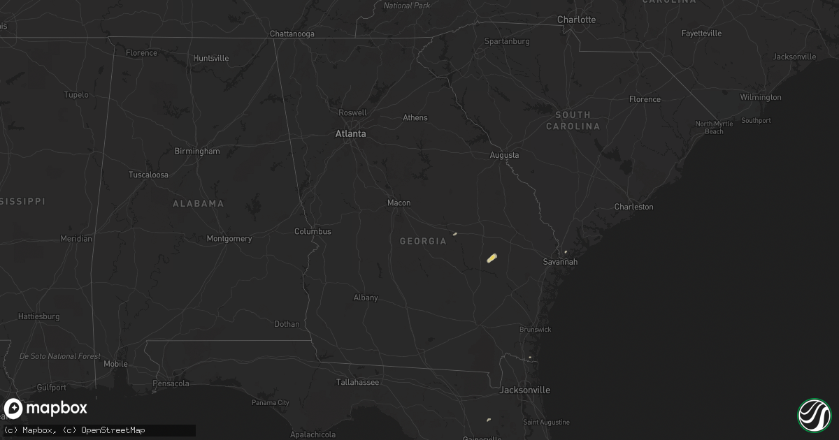
Hail Map in Georgia on May 17, 2016
Get this storm
May 17 map
$229
one time, instant access
Download today. No call, no setup
Keep the $229
Bought the map and want the full workflow? Apply the entire $229 to a subscription within 7 days. None of it is wasted.
Every map, not just this one
This buys you this map. Subscription and you get every map we run, in the markets you choose from a few cities to whole states to nationwide. Plus real-time alerts the moment a storm fires.
Contact data
Name, contact info, occupancy, even credit band for addresses in the footprint. You go from where it hit to who to call.
Become the source they trust
Unlimited branding weather history reports on demand. You already have the documented answer ready for the property owner, and you are the one who showed up with it.
Property data and RoofTrace estimates
Pull up any address you have got, its value and the exact code rules for that jurisdiction, straight from One Click Code. Then RoofTrace estimates the squares, pitch, and roof value, priced the way you price.
Storm reports in Georgia
Georgia
| Date | Description |
|---|---|
| 05/17/20166:30 PM CDT | Tree about 12 inches thick snapped at 15-20 feet above the ground on thornhill drive near cartwright circle. Time based on radar. |
| 05/17/20163:13 PM CDT | Chatham emergency management relayed a report from the bloomingdale fire chief of possible tornado damage along cheyenne road. There was partial damage to a mobile home |
| 05/17/20163:09 PM CDT | Nws storm survey team found damage consistent with an ef1 tornado northwest of bloomingdale ga. Maximum winds estimated 90-95 mph. Path length 1 mile with a maximum wid |
| 05/17/20161:50 PM CDT | Chatham county emergency management reported a few trees down in the landings area of skidaway island. The landings public works department cleared the trees away. |
| 05/17/20161:30 PM CDT | Newspaper relayed a report of a tree downed on taylor drive. |
| 05/17/20161:30 PM CDT | Public reported a tree down on a vehicle off of jekyll island causeway. |
| 05/17/20161:30 PM CDT | Emeregency manager reported power lines downed on blythe island. |
| 05/17/20161:15 PM CDT | Emergency manager reported a tree downed on a powerline off of scrubby bluff road. |
| 05/17/20169:15 AM CDT | Tree about 12 inches thick snapped at 15-20 feet above the ground on thornhill drive near cartwright circle. Time based on radar. |
All States Impacted by Hail Map on May 17, 2016
Cities Impacted by Hail Map on May 17, 2016
- Sebring, FL
- Ozona, TX
- Laredo, TX
- San Antonio, TX
- Gillett, TX
- Hebbronville, TX
- Saint Cloud, FL
- Comstock, TX
- Cotulla, TX
- Big Wells, TX
- Encinal, TX
- Midkiff, TX
- Utopia, TX
- Cibolo, TX
- Bulverde, TX
- Marion, TX
- New Braunfels, TX
- Roma, TX
- Bandera, TX
- Medina, TX
- Rocksprings, TX
- Sonora, TX
- Rio Grande City, TX
- Barnhart, TX
- Big Lake, TX
- Junction, TX
- Ingram, TX
- Mountain Home, TX
- Kerrville, TX
- Harper, TX
- Iraan, TX
- Victoria, TX
- Fort Pierce, FL
- Floresville, TX
- Santa Elena, TX
- Garciasville, TX
- Zapata, TX
- Spring Branch, TX
- Sedona, AZ
- Hondo, TX
- Pipe Creek, TX
- D Hanis, TX
- La Coste, TX
- Castroville, TX
- Seguin, TX
- Eldorado, TX
- Christoval, TX
- Rio Frio, TX
- Camp Wood, TX
- Leakey, TX
- Del Rio, TX
- Okeechobee, FL
- Indiantown, FL
- Mertzon, TX
- Apollo Beach, FL
- Sun City Center, FL
- Ruskin, FL
- Fredericksburg, TX
- Parrish, FL
- Palmetto, FL
- Wimauma, FL
- Brownfield, TX
- Westhoff, TX
- Brackettville, TX
- Denver City, TX
- Plains, TX
- Lovington, NM
- Tilden, TX
- Roosevelt, TX
- Doss, TX
- London, TX
- Menard, TX
- Comfort, TX
- Hunt, TX
- Center Point, TX
- Fort McKavett, TX
- Naples, FL
- Dryden, TX
- Ochopee, FL
- Old Glory, TX
- Rule, TX
- Aspermont, TX
- Realitos, TX
- Vero Beach, FL
- Concepcion, TX
- Smiley, TX
- Goliad, TX
- White Sands Missile Range, NM
- Brooksville, FL
- Tatum, NM
- Nordheim, TX
- Fellsmere, FL
- Quemado, TX
- McCamey, TX
- Mirando City, TX
- Bruni, TX
- Oilton, TX
- Elmendorf, TX
- Adkins, TX
- Guerra, TX
- Devine, TX
- Immokalee, FL
- Stockdale, TX
- Seagraves, TX
- Reidsville, GA
- Lyons, GA
- Collins, GA
- Mcdonald, NM
- Crane, TX
- Runge, TX
- Kenedy, TX
- Natalia, TX
- Von Ormy, TX
- Mico, TX
- Atascosa, TX
- Rio Medina, TX
- Lytle, TX
- Jbsa Lackland, TX
- La Vernia, TX
- Somerset, TX
- Wauchula, FL
- Willcox, AZ
- Pima, AZ
- Mascotte, FL
- Groveland, FL
- Pine, AZ
- Clewiston, FL
- Hardeeville, SC
- Schertz, TX
- McQueeney, TX
- Bartow, FL
- Sabinal, TX
- Moore Haven, FL
- Beverly Hills, FL
- Lecanto, FL
- Encino, TX
- Lehigh Acres, FL
- Fort Meade, FL
- Cuero, TX
- Cliff, NM
- Buckhorn, NM
- Gila, NM
- Fort Myers, FL
- Reddick, FL
- Redrock, NM
- Estero, FL
- Kings Bay, GA
- Saint Marys, GA
- Port Saint Lucie, FL
- San Angelo, TX
- Rockledge, GA
- Las Cruces, NM
- Avon Park, FL
- Gonzales, TX
- Starke, FL
- Yorktown, TX
- Alpine, TX
- Fort Stockton, TX
- Vancourt, TX
- Carrizo Springs, TX
- Eagle Pass, TX
- Grulla, TX


