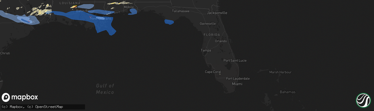
Hail Map in Florida on May 16, 2024
The weather event in Florida on May 16, 2024 includes Hail, Wind, and Tornado maps. 11 states and 602 cities were impacted and suffered possible damage. The total estimated number of properties impacted is 0.
Want more than just the map?
Turn this storm into a full workflow.
- Owner + property data so you know who to knock
- OnDemand branded weather history reports to win the "did we even have hail?" argument
- RoofTrace estimate so reps stop guessing numbers at the door
Bought this map? Upgrade within 7 days and we'll credit the $230. (10-15 min setup call)
Hail
Wind
Tornado
0
Estimated number of impacted properties by a 1.00" hail or larger0
Estimated number of impacted properties by a 1.75" hail or larger0
Estimated number of impacted properties by a 2.50" hail or largerStorm reports in Florida
Florida
| Date | Description |
|---|---|
| 05/16/202412:45 PM CDT | Several downed trees and powerlines across immokalee. Tree down at 59th and palmetto ave blocking entire roadway. |
| 05/16/202412:45 PM CDT | Pictures on social media of damage left behind after strong thunderstorm. Medium-large tree limbs broken... Power line poles down... Tents blown over. |
| 05/16/202412:45 PM CDT | Corrects previous tstm wnd dmg report from 1 ene immokalee. Several downed trees and powerlines across immokalee. Tree down at south 9th and palmetto ave blocking entir |
| 05/16/20245:25 AM CDT | Franklin eoc weatherstem gusted to 60 mph along the coast. |
| 05/16/20245:25 AM CDT | A local report indicates 70 MPH wind near Apalachicola Airport |
| 05/16/20245:15 AM CDT | Porch screens ripped apart... Doors mechanisms torn... Dead trees broken... Light debris scattered. |
| 05/16/20245:13 AM CDT | Ambient station gusted to 74 mph. |
| 05/16/20245:07 AM CDT | Ambient station gusted to 62 mph. |
| 05/16/20245:06 AM CDT | Downed cable lines in port st. Joe. |
| 05/16/20245:02 AM CDT | Ambient station gusted to 87 mph. |
| 05/16/20245:01 AM CDT | Ambient station gusted to 71 mph. |
All States Impacted by Hail Map on May 16, 2024
Cities Impacted by Hail Map on May 16, 2024
- Graford, TX
- Perrin, TX
- Mineral Wells, TX
- Palo Pinto, TX
- Santo, TX
- Millsap, TX
- Tolar, TX
- Granbury, TX
- Bluff Dale, TX
- Glen Rose, TX
- Rainbow, TX
- Nemo, TX
- Kopperl, TX
- Blackwell, TX
- Tatum, NM
- Ballinger, TX
- Ozona, TX
- Rowena, TX
- Paint Rock, TX
- Millersview, TX
- Tuscola, TX
- Voss, TX
- Merkel, TX
- Eldorado, TX
- Gouldbusk, TX
- Elida, NM
- Abilene, TX
- Rockwood, TX
- Santa Anna, TX
- Coleman, TX
- Alto, NM
- Nogal, NM
- Rochelle, TX
- Brookesmith, TX
- Pep, NM
- West, TX
- Fairfield, TX
- Brownwood, TX
- Elm Mott, TX
- Waco, TX
- Mullin, TX
- Richland Springs, TX
- Axtell, TX
- Mount Calm, TX
- Trent, TX
- Muleshoe, TX
- Christoval, TX
- Goldthwaite, TX
- Prairie Hill, TX
- Mart, TX
- Coahoma, TX
- Ira, TX
- San Saba, TX
- Lenorah, TX
- Knott, TX
- Snyder, TX
- Menard, TX
- Immokalee, FL
- Big Spring, TX
- Gail, TX
- Eden, TX
- Tinnie, NM
- Lometa, TX
- Star, TX
- Lampasas, TX
- Weed, NM
- Pinon, NM
- Hermleigh, TX
- Copperas Cove, TX
- Gatesville, TX
- Stamford, TX
- Evant, TX
- Rotan, TX
- Nacogdoches, TX
- Fluvanna, TX
- Sweetwater, TX
- Hext, TX
- Chireno, TX
- Justiceburg, TX
- Bent, NM
- Roswell, NM
- Fort Hood, TX
- San Augustine, TX
- Center, TX
- Grapeland, TX
- Kennard, TX
- Hamlin, TX
- Roby, TX
- Rusk, TX
- Fort Sumner, NM
- Crockett, TX
- Sudan, TX
- Mason, TX
- McCaulley, TX
- Temple, TX
- Lufkin, TX
- Brady, TX
- Moody, TX
- Theriot, LA
- Alto, TX
- Wells, TX
- Kempner, TX
- Pollok, TX
- Troy, TX
- Post, TX
- Fredonia, TX
- Huntington, TX
- Broaddus, TX
- Killeen, TX
- Zavalla, TX
- Lovelady, TX
- Hagerman, NM
- Seminole, TX
- Bronson, TX
- Pennington, TX
- Groveton, TX
- Tow, TX
- Maljamar, NM
- Pineland, TX
- Lovington, NM
- Hemphill, TX
- Harker Heights, TX
- Nolan, TX
- Denver City, TX
- Belton, TX
- Andrews, TX
- Burnet, TX
- Calico Rock, AR
- Salt Flat, TX
- Caldwell, TX
- Anderson, TX
- Jefferson, WI
- Helenville, WI
- Jal, NM
- Hobbs, NM
- Deridder, LA
- Pitkin, LA
- Sugartown, LA
- Eunice, NM
- College Station, TX
- Bedias, TX
- Plains, TX
- Goodrich, TX
- Shepherd, TX
- Livingston, TX
- Huntsville, TX
- Kirbyville, TX
- Jasper, TX
- Newton, TX
- Iola, TX
- Richards, TX
- Colmesneil, TX
- Kermit, TX
- Midkiff, TX
- Lincoln, TX
- Giddings, TX
- Barstow, TX
- Dry Creek, LA
- Coldspring, TX
- Woodville, TX
- Big Lake, TX
- Monahans, TX
- Cleveland, TX
- New Caney, TX
- Splendora, TX
- Brackettville, TX
- Ville Platte, LA
- Opelousas, LA
- Washington, LA
- Bon Wier, TX
- Conroe, TX
- Dime Box, TX
- Grandfalls, TX
- Warren, TX
- Bunkie, LA
- Uvalde, TX
- Ledbetter, TX
- Dayton, TX
- Palmetto, LA
- Plaucheville, LA
- Melville, LA
- Notrees, TX
- Goldsmith, TX
- Seagraves, TX
- Dimmitt, TX
- Whitewater, MT
- Morganza, LA
- Batchelor, LA
- Merryville, LA
- Burkeville, TX
- New Roads, LA
- Brenham, TX
- Chappell Hill, TX
- Odessa, TX
- Barnhart, TX
- Mertzon, TX
- Hempstead, TX
- Washington, TX
- Navasota, TX
- Nazareth, TX
- Saratoga, TX
- Gardendale, TX
- Bellville, TX
- Brookshire, TX
- Sealy, TX
- Prairie View, TX
- Waller, TX
- Katy, TX
- Hockley, TX
- Cypress, TX
- Tomball, TX
- Magnolia, TX
- Tokio, TX
- Brownfield, TX
- Morton, TX
- Sundown, TX
- Meadow, TX
- Whiteface, TX
- Levelland, TX
- Littlefield, TX
- Wolfforth, TX
- Smyer, TX
- Ropesville, TX
- Lubbock, TX
- Shallowater, TX
- Anton, TX
- Singer, LA
- Kountze, TX
- Saint Martinville, LA
- Grosse Tete, LA
- Midland, TX
- Houston, TX
- Crane, TX
- Tulia, TX
- Longville, LA
- Sour Lake, TX
- Batson, TX
- Idalou, TX
- Abernathy, TX
- Petersburg, TX
- New Deal, TX
- Stanton, TX
- Spring, TX
- Mittie, LA
- Silsbee, TX
- Liberty, TX
- Port Allen, LA
- Brusly, LA
- Addis, LA
- Grant, LA
- McCamey, TX
- Lorenzo, TX
- Oberlin, LA
- Kinder, LA
- Hull, TX
- Buna, TX
- Fred, TX
- Baker, LA
- Baton Rouge, LA
- Reeves, LA
- Vida, MT
- Lumberton, TX
- Richmond, TX
- Rosenberg, TX
- Wallis, TX
- Oakdale, LA
- Humble, TX
- Elizabeth, LA
- South Houston, TX
- Bellaire, TX
- Pasadena, TX
- Galena Park, TX
- Deer Park, TX
- Channelview, TX
- Highlands, TX
- Hale Center, TX
- Plainview, TX
- Garden City, TX
- San Angelo, TX
- Mamou, LA
- Opheim, MT
- Seabrook, TX
- Baytown, TX
- La Porte, TX
- Webster, TX
- Crosby, TX
- Floydada, TX
- Lockney, TX
- Ralls, TX
- Kemah, TX
- League City, TX
- Anahuac, TX
- Wallisville, TX
- Wayside, TX
- Happy, TX
- Pearland, TX
- Fresno, TX
- Rankin, TX
- Claude, TX
- Jackson, LA
- Kaukauna, WI
- Kyle, SD
- Mchenry, ND
- Vidor, TX
- Seymour, WI
- De Pere, WI
- Call, TX
- Basile, LA
- Elton, LA
- Deweyville, TX
- Sterling City, TX
- Winnie, TX
- Vancourt, TX
- Starks, LA
- Richland, MT
- Eunice, LA
- Pearlington, MS
- Bay Saint Louis, MS
- Orange, TX
- Pinehurst, TX
- Kingwood, TX
- Porter, TX
- Huffman, TX
- Hankamer, TX
- Bleiblerville, TX
- Cat Spring, TX
- New Ulm, TX
- Vinton, LA
- Dequincy, LA
- Sulphur, LA
- Fulshear, TX
- Waveland, MS
- Burton, TX
- Industry, TX
- Fayetteville, TX
- Round Top, TX
- Paige, TX
- Carmine, TX
- Lexington, TX
- La Grange, TX
- Smithville, TX
- Bastrop, TX
- McDade, TX
- Manor, TX
- Elgin, TX
- Coupland, TX
- Taylor, TX
- Thrall, TX
- Binford, ND
- Porcupine, SD
- Allen, SD
- Wanblee, SD
- New Rockford, ND
- Glenfield, ND
- Cameron, LA
- Lake Charles, LA
- Ragley, LA
- Cooperstown, ND
- Port Arthur, TX
- Melvin, TX
- Pine Ridge, SD
- Carlsbad, TX
- Robert Lee, TX
- Hannaford, ND
- Bell City, LA
- Martin, SD
- Hackberry, LA
- Art, TX
- Castell, TX
- Iota, LA
- Jennings, LA
- Evangeline, LA
- Comstock, TX
- Voca, TX
- Fordoche, LA
- Port Barre, LA
- Krotz Springs, LA
- Saint Francisville, LA
- Roanoke, LA
- Childress, TX
- Luverne, ND
- Morse, LA
- Mermentau, LA
- Egan, LA
- Llano, TX
- Grand Chenier, LA
- Kaplan, LA
- Gueydan, LA
- Pontotoc, TX
- Valley Spring, TX
- Hope, ND
- Sonora, TX
- Dazey, ND
- Livonia, LA
- Lottie, LA
- Maringouin, LA
- Jarreau, LA
- Oscar, LA
- Lakeland, LA
- Rayne, LA
- Creole, LA
- Maurice, LA
- Duson, LA
- Rougon, LA
- Ventress, LA
- Glynn, LA
- Erwinville, LA
- Zachary, LA
- Slaughter, LA
- Ethel, LA
- Pillsbury, ND
- Bluffton, TX
- Abbeville, LA
- Rocksprings, TX
- Lafayette, LA
- Youngsville, LA
- Page, ND
- Lake Arthur, LA
- Welsh, LA
- Church Point, LA
- Branch, LA
- Crowley, LA
- Estherwood, LA
- Carencro, LA
- Sunset, LA
- Arnaudville, LA
- Scott, LA
- New Iberia, LA
- Delcambre, LA
- Broussard, LA
- Erath, LA
- Breaux Bridge, LA
- Loreauville, LA
- Jeanerette, LA
- Greensburg, LA
- Pride, LA
- Clinton, LA
- Greenwell Springs, LA
- Denham Springs, LA
- Buchanan Dam, TX
- Kentwood, LA
- Walker, LA
- Pine Grove, LA
- Amite, LA
- Holden, LA
- Plaquemine, LA
- Rosedale, LA
- Sunshine, LA
- Franklin, LA
- Baldwin, LA
- Pierre Part, LA
- Morgan City, LA
- White Castle, LA
- Gonzales, LA
- Darrow, LA
- Sorrento, LA
- Belle Rose, LA
- Corsicana, TX
- Weatherford, TX
- Purdon, TX
- Richland, TX
- Geismar, LA
- Donaldsonville, LA
- Salado, TX
- Napoleonville, LA
- Streetman, TX
- Roseland, LA
- Independence, LA
- Livingston, LA
- Plattenville, LA
- Saint Gabriel, LA
- Carville, LA
- Convent, LA
- Paulina, LA
- Leakey, TX
- Saint James, LA
- Tickfaw, LA
- Hammond, LA
- Ponchatoula, LA
- Hunt, TX
- Loranger, LA
- Vanderpool, TX
- Ama, LA
- Medina, TX
- New Orleans, LA
- Westwego, LA
- Marrero, LA
- Kenner, LA
- Metairie, LA
- Prairieville, LA
- French Settlement, LA
- Albany, LA
- Springfield, LA
- Abita Springs, LA
- Robert, LA
- Madisonville, LA
- Covington, LA
- Mandeville, LA
- Lacombe, LA
- Bandera, TX
- Pipe Creek, TX
- Barataria, LA
- Lafitte, LA
- Cut Off, LA
- Lockport, LA
- Edgard, LA
- Raceland, LA
- Lutcher, LA
- Des Allemands, LA
- Hahnville, LA
- Thibodaux, LA
- Vacherie, LA
- Gray, LA
- Labadieville, LA
- Houma, LA
- Schriever, LA
- Mathews, LA
- Gheens, LA
- Boutte, LA
- Luling, LA
- Reserve, LA
- Destrehan, LA
- Saint Amant, LA
- La Place, LA
- Saint Rose, LA
- Garyville, LA
- Gramercy, LA
- Mount Airy, LA
- Paradis, LA
- Norco, LA
- Maurepas, LA
- Helotes, TX
- Arabi, LA
- Port Sulphur, LA
- Belle Chasse, LA
- Violet, LA
- Gretna, LA
- Meraux, LA
- Chalmette, LA
- Saint Bernard, LA
- Braithwaite, LA
- Harvey, LA
- Berwick, LA
- Patterson, LA
- Pearl River, LA
- Slidell, LA
- Gulfport, MS
- Long Beach, MS
- Stennis Space Center, MS
- Pass Christian, MS
- Picayune, MS
- Kiln, MS
- Diamondhead, MS
- Lumberton, MS
- Wiggins, MS
- Poplarville, MS
- Brooklyn, MS
- Eagle Pass, TX
- Laredo, TX
- Lucedale, MS
- Cotulla, TX
- Chunchula, AL
- Axis, AL
- Encinal, TX
- Wilmer, AL
- Citronelle, AL
- Calliham, TX
- Creola, AL
- Saraland, AL
- Tilden, TX
- Saucier, MS
- Three Rivers, TX
- Bay Minette, AL
- McLain, MS
- George West, TX
- Lacassine, LA
- Westlake, LA
- Iowa, LA
- Golden Meadow, LA
- Galliano, LA
- Larose, LA
- Grand Isle, LA
- Buras, LA
- Venice, LA
- Port Saint Joe, FL
- Eastpoint, FL
- Apalachicola, FL
- Wewahitchka, FL
- Summerdale, AL
- Pensacola, FL
- Silverhill, AL
- Robertsdale, AL
- Bon Secour, AL
- Loxley, AL
- Magnolia Springs, AL
- Orange Beach, AL
- Gulf Shores, AL
- Lillian, AL
- Fairhope, AL
- Daphne, AL
- Foley, AL
- Elberta, AL


