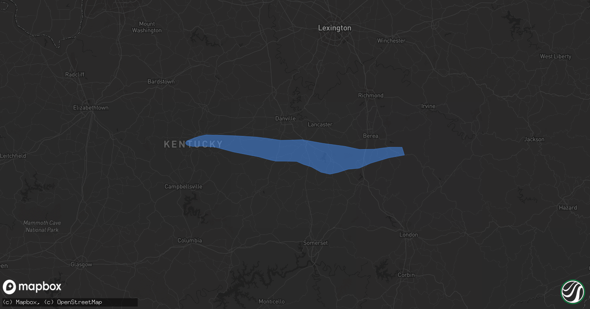
Hail Map in Brodhead, KY on May 16, 2023
Get this storm
May 16 map
$229
one time, instant access
Download today. No call, no setup
Keep the $229
Bought the map and want the full workflow? Apply the entire $229 to a subscription within 7 days. None of it is wasted.
Every map, not just this one
This buys you this map. Subscription and you get every map we run, in the markets you choose from a few cities to whole states to nationwide. Plus real-time alerts the moment a storm fires.
Contact data
Name, contact info, occupancy, even credit band for addresses in the footprint. You go from where it hit to who to call.
Become the source they trust
Unlimited branding weather history reports on demand. You already have the documented answer ready for the property owner, and you are the one who showed up with it.
Property data and RoofTrace estimates
Pull up any address you have got, its value and the exact code rules for that jurisdiction, straight from One Click Code. Then RoofTrace estimates the squares, pitch, and roof value, priced the way you price.
Storm reports in Brodhead, KY
Brodhead, KY
| Date | Description |
|---|---|
| 05/16/20232:13 PM CDT | Tree down on red bird road near lake linville road. Time estimated from radar. |
| 05/16/20232:12 PM CDT | Multiple trees down at 1490 barnett road. Time estimated from radar. |
| 05/16/20232:11 PM CDT | Tree down along highway 1505 near the intersection of highway 1326. Time estimated from radar. |
| 05/16/20232:10 PM CDT | Tree down in broadhead along highway 1505. Time estimated from radar. |
| 05/16/20232:10 PM CDT | Tree down on a vehicle at 142 proffitt street. Time estimated from radar. |
| 05/16/20232:09 PM CDT | Tree down along highway 3245 about a half mile west of the u.s. 150 intersection. Time estimated from radar. |
All States Impacted by Hail Map on May 16, 2023
All Cities Impacted by Hail Map on May 16, 2023
- Lebanon, KY
- Bradfordsville, KY
- Gravel Switch, KY
- Parksville, KY
- Hustonville, KY
- Junction City, KY
- Stanford, KY
- Richmond, KY
- Waco, KY
- Irvine, KY
- Clay City, KY
- Winchester, KY
- Waynesburg, KY
- Crab Orchard, KY
- Lancaster, KY
- Mount Vernon, KY
- Brodhead, KY
- Berea, KY
- McKee, KY
- Orlando, KY
- Manchester, KY
- Sextons Creek, KY
- Booneville, KY
- Sandgap, KY
- Oneida, KY
- Mistletoe, KY
- Buckhorn, KY
- Knoxville, TN
- Corryton, TN
- Bonnyman, KY
- Hazard, KY
- Bulan, KY
- Dwarf, KY
- Oak Ridge, TN
- Carrie, KY
- Jackhorn, KY
- Virgie, KY
- Jenkins, KY
- Neon, KY
- McRoberts, KY
- Deane, KY
- Shelby Gap, KY
- Clintwood, VA
- Pound, VA
- Clinchco, VA
- Haysi, VA
- Birchleaf, VA
- Bee, VA
- Dante, VA
- Vansant, VA
- Grundy, VA
- Davenport, VA
- Oakwood, VA
- Rowe, VA
- Morganton, NC
- Bostic, NC
- Raven, VA
- Jewell Ridge, VA
- Whitewood, VA
- Casar, NC
- Richlands, VA
- Bandy, VA
- Pennington Gap, VA
- Tazewell, VA
- North Tazewell, VA
- Cedar Bluff, VA
- Squire, WV
- Berwind, WV
- Roxboro, NC
- Cherryville, NC
- Lawndale, NC
- Vale, NC
- Bluefield, VA
- Bastian, VA
- Ceres, VA
- Rocky Gap, VA
- Martinsville, VA
- Callands, VA
- Millers Creek, NC
- McGrady, NC
- North Wilkesboro, NC
- Hays, NC
- Danville, VA
- Dry Fork, VA
- Blairs, VA
- Ringgold, VA
- Sutherlin, VA
- Keeling, VA
- Alton, VA
- South Boston, VA
- Semora, NC
- Virgilina, VA
- Oxford, NC
- Charlotte, NC
- Crouse, NC
- Axton, VA
- Chesterfield, VA
- Richmond, VA
- Dryden, VA
- Brogan, OR
- Vale, OR
- Harper, OR
- Baker City, OR
- Parks, NE
- Champion, NE
- Haigler, NE
- Saint Francis, KS
- Krypton, KY
- Busy, KY
- Hyden, KY
- Hindman, KY
- Pikeville, KY
- Raccoon, KY
- Kimper, KY
- Mount Airy, NC
- Ararat, NC
- Pilot Mountain, NC
- Westfield, NC
- Claudville, VA
- Stuart, VA
- Lawsonville, NC
- Radford, VA
- Dublin, VA
- Starkville, MS
- Sevierville, TN
- Poplarville, MS
- Ozark, AL
- Kalispell, MT
- Kila, MT
- Corbin, KY
- Parkers Lake, KY
- Akron, CO
- Clinton, TN
- Oliver Springs, TN
- Spring Branch, TX
- Bergheim, TX
- Kendalia, TX
- Union Springs, AL
- Midway, AL
- Batchelor, LA
- Adrian, TX
- Andalusia, AL
- Gantt, AL
- Opp, AL
- Forkland, AL
- Boligee, AL
- Titus, AL
- Watson, AR
- Baskerville, VA
- Bracey, VA
- Matagorda, TX
- Bay City, TX
- Imperial, NE
- Clayhole, KY
- Bay Minette, AL
- Union Mills, NC
- Bessemer City, NC
- Nebo, NC
- Ellenboro, NC
- Shelby, NC
- Troy, AL
- Banks, AL
- Jackson, KY
- Lewellen, NE
- York, AL
- Penhook, VA
- Chatham, VA
- Rocky Mount, VA
- Quitman, MS
- Jackson, AL
- Moundville, AL
- Marion, NC
- Pine Top, KY
- Germantown, TN
- Collierville, TN
- Bullock, NC
- Milton, NC
- Snellville, GA
- Grayson, GA
- Loganville, GA
- Cumberland, KY
- Leeds, AL
- Washburn, TN
- Sidney, NE
- Leoti, KS
- Rudyard, MT
- Talladega, AL
- Phyllis, KY
- Mississippi State, MS
- Geyser, MT
- Mantee, MS
- Shepherd, MT
- Pounding Mill, VA
- Adel, GA
- Rutledge, TN
- Meadows Of Dan, VA
- Florence, AL
- Killen, AL
- Livingston, AL
- Salyersville, KY
- Ivel, KY
- Gunlock, KY
- Grethel, KY
- McDowell, KY
- Printer, KY
- Pinsonfork, KY
- Tram, KY
- Banner, KY
- David, KY
- Teaberry, KY
- Martin, KY
- McAndrews, KY
- Harold, KY
- Langley, KY
- Dana, KY
- Betsy Layne, KY
- Prestonsburg, KY
- Stanville, KY
- Shelbiana, KY
- Newnan, GA
- Louin, MS
- Rose Hill, MS
- McIntosh, AL
- Palacios, TX
- Monroeville, AL
- Repton, AL
- Frisco City, AL
- Birmingham, AL
- Pelham, AL
- Helena, AL
- Oxford, AL
- Eastaboga, AL
- Anniston, AL
- West Blocton, AL
- Woodstock, AL
- Midland City, AL
- Batesville, MS
- Bessemer, AL
- Alabaster, AL
- Oakland, MS
- Coffeeville, MS
- Chavies, KY
- Vicco, KY
- Sassafras, KY
- Slidell, LA
- New Orleans, LA
- Henry, VA
- Collinsville, VA
- Bassett, VA
- Conyers, GA
- South Hill, VA
- Chase City, VA
- Boydton, VA
- Skipwith, VA
- Julesburg, CO
- Buchanan, GA
- Bremen, GA
- Macon, MS
- Weaver, AL
- Geneva, AL
- Lumpkin, GA
- Franklin, LA
- Bailey, MS
- Meridian, MS
- Maynardville, TN
- Powhatan, VA
- Midlothian, VA
- Villa Rica, GA
- Henrico, VA
- New Market, TN
- Luttrell, TN
- Blaine, TN
- Falkner, MS
- Ripley, MS
- Elba, AL
- Corpus Christi, TX
- Cottondale, FL
- Chipley, FL
- Graceville, FL
- Harlingen, TX
- Broadwater, NE
- Cascade, MT
- Brantley, AL
- Cantonment, FL
- Douglasville, GA
- Glade Hill, VA
- Lost Creek, KY
- Santa Fe, TX
- Dickinson, TX
- Union Hall, VA
- Enterprise, MS
- Stonewall, MS
- Swords Creek, VA
- Molino, FL
- Jefferson City, TN
- Dandridge, TN
- Tylertown, MS
- Wagarville, AL
- Sunflower, AL
- Mount Holly, NC
- Cedarbluff, MS
- Pheba, MS
- Cascade, VA
- Blanch, NC
- Providence, NC
- Ravenna, KY
- Stanton, KY
- Riner, VA
- Mobile, AL
- Pilot, VA
- Floyd, VA
- Campbellton, FL
- Burlington, CO
- Bethune, CO
- Colbert, GA
- Adkins, TX
- La Vernia, TX
- Santa Rosa, NM
- Stratton, CO
- Kirk, CO
- Seymour, TN
- Malta, MT
- Elkin, NC
- Patterson, LA
- Leavenworth, WA
- Dobson, NC
- Jamieson, OR
- Pineland, SC
- Fayetteville, TN
- State Road, NC
- Thurmond, NC
- Christiansburg, VA
- Florence, MS
- Sidney, KY
- Demopolis, AL
- Greensboro, AL
- Lexington, AL
- Greenwood, MS
- Cotulla, TX
- Hazlehurst, MS
- Dozier, AL
- Venango, NE
- Palmetto, GA
- Anderson, AL
- Cleveland, VA
- Honaker, VA
- Vance, AL
- Clanton, AL
- Cawood, KY
- Cranks, KY
- Ronda, NC
- Smilax, KY
- Viper, KY
- Ferrum, VA
- Vossburg, MS
- La Marque, TX
- League City, TX
- Texas City, TX
- Brooklyn, MS
- Hattiesburg, MS
- Traphill, NC
- Roaring River, NC
- Mascot, TN
- Ganado, TX
- Littcarr, KY
- Hornsby, TN
- Comer, GA
- Meigs, GA
- Ochlocknee, GA
- Big Rock, VA
- Hurley, VA
- Phelps, KY
- Sulphur, LA
- Vest, KY
- Holt, FL
- Jeremiah, KY
- Happy, KY
- Blackey, KY
- Redfox, KY
- Scuddy, KY
- Robertsdale, AL
- Wooton, KY
- Powell, TN
- Potter, NE
- Guntown, MS
- Denver, CO
- Detroit, AL
- Lisman, AL
- Jachin, AL
- Courtland, MS
- Wauconda, WA
- Lincolnton, NC
- Trussville, AL
- Connelly Springs, NC
- Hickory, NC
- Charles City, VA
- Akron, AL
- Samson, AL
- Seadrift, TX
- Newton, MS
- Pachuta, MS
- Huntley, MT
- Duncan, MS
- Hereford, TX
- Yuma, CO
- Slade, KY
- Heiskell, TN
- Strawberry Plains, TN
- Corinth, MS
- Glen, MS
- Nora, VA
- Steele, KY
- Fedscreek, KY
- Heflin, AL
- Newbern, AL
- Wilsonville, AL
- De Kalb, MS
- Lauderdale, MS
- Leburn, KY
- Mousie, KY


