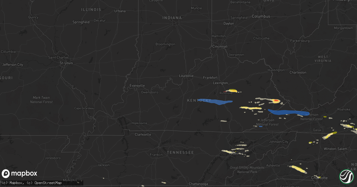
Hail Map in Kentucky on May 16, 2023
Get this storm
May 16 map
$229
one time, instant access
Download today. No call, no setup
Keep the $229
Bought the map and want the full workflow? Apply the entire $229 to a subscription within 7 days. None of it is wasted.
Every map, not just this one
This buys you this map. Subscription and you get every map we run, in the markets you choose from a few cities to whole states to nationwide. Plus real-time alerts the moment a storm fires.
Contact data
Name, contact info, occupancy, even credit band for addresses in the footprint. You go from where it hit to who to call.
Become the source they trust
Unlimited branding weather history reports on demand. You already have the documented answer ready for the property owner, and you are the one who showed up with it.
Property data and RoofTrace estimates
Pull up any address you have got, its value and the exact code rules for that jurisdiction, straight from One Click Code. Then RoofTrace estimates the squares, pitch, and roof value, priced the way you price.
Storm reports in Kentucky
Kentucky
| Date | Description |
|---|---|
| 05/16/20234:18 PM CDT | Dept of highways reported tree down in the town of majestic. Time estimated from radar. |
| 05/16/20234:15 PM CDT | Dept of highways reported a tree down in the town of freeburn. Time estimated from radar. |
| 05/16/20234:15 PM CDT | A tree was blown down onto old us 119 at partridge. The time of the event is radar estimated. |
| 05/16/20234:13 PM CDT | Pike county em referred to dispatch for reports of trees down in southern pike county. Time estimated from radar. |
| 05/16/20234:10 PM CDT | Video provided to pike county em showed golf ball size hail. Time estimated from radar. |
| 05/16/20234:09 PM CDT | A tree was reported down near 1106 ky highway 568 near cranks. The event time is radar estimated. |
| 05/16/20234:09 PM CDT | Report forwarded via twitter off of lawsons branch near highway 194. |
| 05/16/20234:08 PM CDT | A tree was reported to have been blown down on ky hwy 302 between on half mile and one mile before dewey dam. |
| 05/16/20234:05 PM CDT | Report from mping: large limbs were blown down. |
| 05/16/20234:05 PM CDT | A tree was reported to have been blown down onto ky hwy 805 near big shelby creek road. |
| 05/16/20234:05 PM CDT | A tree was blown down onto ky highway 805 about 1 to 2 miles from the pike county line. The time of the event is radar estimated. |
| 05/16/20234:02 PM CDT | A tree was reported to have been blown down onto ky hwy 987 near martins fork lake. The time of the event is radar estimated. |
| 05/16/20234:02 PM CDT | A tree was reported to have been blown down onto ky 3001 near mountain oaks drive. The time of the event is radar estimated. |
| 05/16/20234:01 PM CDT | Report of video provided to pike county em. At least tennis ball size hail. Time estimated from radar. |
| 05/16/20234:00 PM CDT | Several trees were reported to have bene blown down onto ky 3409 between jenkins and mcroberts. The time of the event is radar estimated. |
| 05/16/20234:00 PM CDT | A tree was blown down onto ky hwy 1556. The time of the event is radar estimated. |
| 05/16/20234:00 PM CDT | A tree was downed onto ky hwy 3001 near the harlan country club. The time of the event is radar estimated. |
| 05/16/20233:58 PM CDT | A tree was reported to have been blown down in mcroberts. The time of the event is radar estimated. |
| 05/16/20233:55 PM CDT | A tree was reported to have been blown down on ky 1469 near the pike county line. The time of the event is radar estimated. |
| 05/16/20233:53 PM CDT | Owsley county state garage reported a tree down on ky-1768 about a half of a mile down from the intersection of ky-28 and ky-1768. |
| 05/16/20233:52 PM CDT | A tree was reported to have been downed along ky 522 near russell road. The time of the event is radar estimated. |
| 05/16/20233:42 PM CDT | Trees were reported to have been blown down on ky 1087. |
| 05/16/20233:42 PM CDT | Highway department reported a tree down on us 460 between mm 0 and 9. Time estimated from radar. |
| 05/16/20233:35 PM CDT | A local report indicates 1.00 inch wind near 1 SSW AMBURGEY |
| 05/16/20233:34 PM CDT | Tree down on kentucky highway 1809. Time estimated from radar. |
| 05/16/20233:25 PM CDT | Picture on social media show approximately golf-ball size hail south of fisty... Ky. Time estimated from radar. |
| 05/16/20233:23 PM CDT | A tree was reported down on ky hwy 777 near the kentucky hydrocarbon company plant. |
| 05/16/20233:20 PM CDT | Picture posted to social media shows approximately half dollar-sized hail at hazard animal shelter. Time estimated from radar. |
| 05/16/20233:10 PM CDT | Trees and large limbs were reported to have been blown down on marydell road near bush. |
| 05/16/20233:03 PM CDT | Tree down in gray along kentucky highway 233. Time estimated from radar. |
| 05/16/20233:00 PM CDT | Army corp. Of engineer employee relayed a picture of large hail that fell at buckhorn lake dam. |
| 05/16/20232:55 PM CDT | A couple of trees reported down on ky 746 near mile marker 5. Time estimated from radar. |
| 05/16/20232:52 PM CDT | A tree was reported to have been blown down in east bernstadt. The time of the event is radar estimated. |
| 05/16/20232:51 PM CDT | A tree was blown down on north laurel road just north of the london city limits. |
| 05/16/20232:49 PM CDT | 2 trees down along highway 30. Time estimated from radar. |
| 05/16/20232:45 PM CDT | Tree down near the 2000 block of old whitney road. Time estimated from radar. |
| 05/16/20232:45 PM CDT | Tree down along highway 30. Time estimated from radar. |
| 05/16/20232:32 PM CDT | Corrects previous tstm wnd dmg report from lewis creek. A tree was reported down on ky 3403 near the harlan county line in the vicinity of partridge. The time of the ev |
| 05/16/20232:29 PM CDT | A tree was reported down on ky 3403 near the harlan county line in the vicinity of partridge. The time of the event is radar estimated. |
| 05/16/20232:28 PM CDT | Powerline down on bourne avenue close to the intersection of murphy avenue. Time estimated from radar. |
| 05/16/20232:25 PM CDT | Tree down off of nelson valley road near the intersection of jeffries drive. Time estimated from radar. |
| 05/16/20232:24 PM CDT | Corrects previous tstm wnd dmg report from 2 s science hill. Report of a tree down on a powerline off of highway 1247 near the intersection of raleigh road. Time estima |
| 05/16/20232:24 PM CDT | Report of a tree down off of highway 1247 near the intersection of raleigh road. |
| 05/16/20232:15 PM CDT | Nickel to quarter-sized hail covering the ground. |
| 05/16/20232:13 PM CDT | Tree down on red bird road near lake linville road. Time estimated from radar. |
| 05/16/20232:13 PM CDT | Tree down on a powerline off of koa campground road. Time estimated from radar. |
| 05/16/20232:12 PM CDT | Multiple trees down at 1490 barnett road. Time estimated from radar. |
| 05/16/20232:12 PM CDT | Picture on social media shows hail up golf-ball size near vaughn mill. |
| 05/16/20232:11 PM CDT | Tree down along highway 1505 near the intersection of highway 1326. Time estimated from radar. |
| 05/16/20232:10 PM CDT | Tree down on a vehicle at 142 proffitt street. Time estimated from radar. |
| 05/16/20232:10 PM CDT | Tree down in broadhead along highway 1505. Time estimated from radar. |
| 05/16/20232:09 PM CDT | Tree down along highway 3245 about a half mile west of the u.s. 150 intersection. Time estimated from radar. |
| 05/16/20232:09 PM CDT | Large limb was blocking the intersection at liberty road and bull run road. The road department was dispatched to remove the limb. |
| 05/16/20232:07 PM CDT | Tree down on the 9000 block of kentucky 1247. |
| 05/16/20232:03 PM CDT | Tree down on river drive. |
| 05/16/20232:03 PM CDT | Rowan county dept. Of highway reported 5 trees down along ky-377 between mm 5 and mm 6. Time estimated from radar. |
| 05/16/20232:00 PM CDT | Tree down on the 9000 block of us 127. |
| 05/16/20231:59 PM CDT | Tree down on horton cutoff road. |
| 05/16/20231:57 PM CDT | Delayed report. Spotter said there was a tree down in college hill that shut his electricity off until roughly 12 hours later. Also... He had dime sized plus hail at hi |
| 05/16/20231:55 PM CDT | Tree and power line down on danville avenue between portman avenue and maxwell street. |
| 05/16/20231:53 PM CDT | Tree down on highway 698. |
| 05/16/20231:44 PM CDT | Tree down on southridge rd. |
| 05/16/20231:44 PM CDT | Tree down on the 10000 block of highway 78 west. |
| 05/16/20231:41 PM CDT | Received two reports of a tree down on red house road. |
| 05/16/20231:33 PM CDT | Trees down in the forkland area. |
| 05/16/20231:32 PM CDT | Dead tree came down on his driveway. Time estimated from radar. |
| 05/16/20231:22 PM CDT | A tree fell across 31 east near uno. |
| 05/16/20231:18 PM CDT | Tree down on a power line on tatum lane. |
| 05/16/20231:10 PM CDT | Bath county highway garage reported numerous trees down along ky-11 between sharpsburg and bethel. |
| 05/16/20231:10 PM CDT | Trees down across from marion county public library. |
| 05/16/202312:25 PM CDT | Delayed report: dispatch reported tree down on raider hallow rd. |
All States Impacted by Hail Map on May 16, 2023
Cities Impacted by Hail Map on May 16, 2023
- Lebanon, KY
- Bradfordsville, KY
- Gravel Switch, KY
- Parksville, KY
- Hustonville, KY
- Junction City, KY
- Stanford, KY
- Richmond, KY
- Waco, KY
- Irvine, KY
- Clay City, KY
- Winchester, KY
- Waynesburg, KY
- Crab Orchard, KY
- Lancaster, KY
- Mount Vernon, KY
- Brodhead, KY
- Berea, KY
- McKee, KY
- Orlando, KY
- Manchester, KY
- Sextons Creek, KY
- Booneville, KY
- Sandgap, KY
- Oneida, KY
- Mistletoe, KY
- Buckhorn, KY
- Knoxville, TN
- Corryton, TN
- Bonnyman, KY
- Hazard, KY
- Bulan, KY
- Dwarf, KY
- Oak Ridge, TN
- Carrie, KY
- Jackhorn, KY
- Virgie, KY
- Jenkins, KY
- Neon, KY
- McRoberts, KY
- Deane, KY
- Shelby Gap, KY
- Clintwood, VA
- Pound, VA
- Clinchco, VA
- Haysi, VA
- Birchleaf, VA
- Bee, VA
- Dante, VA
- Vansant, VA
- Grundy, VA
- Davenport, VA
- Oakwood, VA
- Rowe, VA
- Morganton, NC
- Bostic, NC
- Raven, VA
- Jewell Ridge, VA
- Whitewood, VA
- Casar, NC
- Richlands, VA
- Bandy, VA
- Pennington Gap, VA
- Tazewell, VA
- North Tazewell, VA
- Cedar Bluff, VA
- Squire, WV
- Berwind, WV
- Roxboro, NC
- Cherryville, NC
- Lawndale, NC
- Vale, NC
- Bluefield, VA
- Bastian, VA
- Ceres, VA
- Rocky Gap, VA
- Martinsville, VA
- Callands, VA
- Millers Creek, NC
- McGrady, NC
- North Wilkesboro, NC
- Hays, NC
- Danville, VA
- Dry Fork, VA
- Blairs, VA
- Ringgold, VA
- Sutherlin, VA
- Keeling, VA
- Alton, VA
- South Boston, VA
- Semora, NC
- Virgilina, VA
- Oxford, NC
- Charlotte, NC
- Crouse, NC
- Axton, VA
- Chesterfield, VA
- Richmond, VA
- Dryden, VA
- Brogan, OR
- Vale, OR
- Harper, OR
- Baker City, OR
- Parks, NE
- Champion, NE
- Haigler, NE
- Saint Francis, KS
- Krypton, KY
- Busy, KY
- Hyden, KY
- Hindman, KY
- Pikeville, KY
- Raccoon, KY
- Kimper, KY
- Mount Airy, NC
- Ararat, NC
- Pilot Mountain, NC
- Westfield, NC
- Claudville, VA
- Stuart, VA
- Lawsonville, NC
- Radford, VA
- Dublin, VA
- Starkville, MS
- Sevierville, TN
- Poplarville, MS
- Ozark, AL
- Kalispell, MT
- Kila, MT
- Corbin, KY
- Parkers Lake, KY
- Akron, CO
- Clinton, TN
- Oliver Springs, TN
- Spring Branch, TX
- Bergheim, TX
- Kendalia, TX
- Union Springs, AL
- Midway, AL
- Batchelor, LA
- Adrian, TX
- Andalusia, AL
- Gantt, AL
- Opp, AL
- Forkland, AL
- Boligee, AL
- Titus, AL
- Watson, AR
- Baskerville, VA
- Bracey, VA
- Matagorda, TX
- Bay City, TX
- Imperial, NE
- Clayhole, KY
- Bay Minette, AL
- Union Mills, NC
- Bessemer City, NC
- Nebo, NC
- Ellenboro, NC
- Shelby, NC
- Troy, AL
- Banks, AL
- Jackson, KY
- Lewellen, NE
- York, AL
- Penhook, VA
- Chatham, VA
- Rocky Mount, VA
- Quitman, MS
- Jackson, AL
- Moundville, AL
- Marion, NC
- Pine Top, KY
- Germantown, TN
- Collierville, TN
- Bullock, NC
- Milton, NC
- Snellville, GA
- Grayson, GA
- Loganville, GA
- Cumberland, KY
- Leeds, AL
- Washburn, TN
- Sidney, NE
- Leoti, KS
- Rudyard, MT
- Talladega, AL
- Phyllis, KY
- Mississippi State, MS
- Geyser, MT
- Mantee, MS
- Shepherd, MT
- Pounding Mill, VA
- Adel, GA
- Rutledge, TN
- Meadows Of Dan, VA
- Florence, AL
- Killen, AL
- Livingston, AL
- Salyersville, KY
- Ivel, KY
- Gunlock, KY
- Grethel, KY
- McDowell, KY
- Printer, KY
- Pinsonfork, KY
- Tram, KY
- Banner, KY
- David, KY
- Teaberry, KY
- Martin, KY
- McAndrews, KY
- Harold, KY
- Langley, KY
- Dana, KY
- Betsy Layne, KY
- Prestonsburg, KY
- Stanville, KY
- Shelbiana, KY
- Newnan, GA
- Louin, MS
- Rose Hill, MS
- McIntosh, AL
- Palacios, TX
- Monroeville, AL
- Repton, AL
- Frisco City, AL
- Birmingham, AL
- Pelham, AL
- Helena, AL
- Oxford, AL
- Eastaboga, AL
- Anniston, AL
- West Blocton, AL
- Woodstock, AL
- Midland City, AL
- Batesville, MS
- Bessemer, AL
- Alabaster, AL
- Oakland, MS
- Coffeeville, MS
- Chavies, KY
- Vicco, KY
- Sassafras, KY
- Slidell, LA
- New Orleans, LA
- Henry, VA
- Collinsville, VA
- Bassett, VA
- Conyers, GA
- South Hill, VA
- Chase City, VA
- Boydton, VA
- Skipwith, VA
- Julesburg, CO
- Buchanan, GA
- Bremen, GA
- Macon, MS
- Weaver, AL
- Geneva, AL
- Lumpkin, GA
- Franklin, LA
- Bailey, MS
- Meridian, MS
- Maynardville, TN
- Powhatan, VA
- Midlothian, VA
- Villa Rica, GA
- Henrico, VA
- New Market, TN
- Luttrell, TN
- Blaine, TN
- Falkner, MS
- Ripley, MS
- Elba, AL
- Corpus Christi, TX
- Cottondale, FL
- Chipley, FL
- Graceville, FL
- Harlingen, TX
- Broadwater, NE
- Cascade, MT
- Brantley, AL
- Cantonment, FL
- Douglasville, GA
- Glade Hill, VA
- Lost Creek, KY
- Santa Fe, TX
- Dickinson, TX
- Union Hall, VA
- Enterprise, MS
- Stonewall, MS
- Swords Creek, VA
- Molino, FL
- Jefferson City, TN
- Dandridge, TN
- Tylertown, MS
- Wagarville, AL
- Sunflower, AL
- Mount Holly, NC
- Cedarbluff, MS
- Pheba, MS
- Cascade, VA
- Blanch, NC
- Providence, NC
- Ravenna, KY
- Stanton, KY
- Riner, VA
- Mobile, AL
- Pilot, VA
- Floyd, VA
- Campbellton, FL
- Burlington, CO
- Bethune, CO
- Colbert, GA
- Adkins, TX
- La Vernia, TX
- Santa Rosa, NM
- Stratton, CO
- Kirk, CO
- Seymour, TN
- Malta, MT
- Elkin, NC
- Patterson, LA
- Leavenworth, WA
- Dobson, NC
- Jamieson, OR
- Pineland, SC
- Fayetteville, TN
- State Road, NC
- Thurmond, NC
- Christiansburg, VA
- Florence, MS
- Sidney, KY
- Demopolis, AL
- Greensboro, AL
- Lexington, AL
- Greenwood, MS
- Cotulla, TX
- Hazlehurst, MS
- Dozier, AL
- Venango, NE
- Palmetto, GA
- Anderson, AL
- Cleveland, VA
- Honaker, VA
- Vance, AL
- Clanton, AL
- Cawood, KY
- Cranks, KY
- Ronda, NC
- Smilax, KY
- Viper, KY
- Ferrum, VA
- Vossburg, MS
- La Marque, TX
- League City, TX
- Texas City, TX
- Brooklyn, MS
- Hattiesburg, MS
- Traphill, NC
- Roaring River, NC
- Mascot, TN
- Ganado, TX
- Littcarr, KY
- Hornsby, TN
- Comer, GA
- Meigs, GA
- Ochlocknee, GA
- Big Rock, VA
- Hurley, VA
- Phelps, KY
- Sulphur, LA
- Vest, KY
- Holt, FL
- Jeremiah, KY
- Happy, KY
- Blackey, KY
- Redfox, KY
- Scuddy, KY
- Robertsdale, AL
- Wooton, KY
- Powell, TN
- Potter, NE
- Guntown, MS
- Denver, CO
- Detroit, AL
- Lisman, AL
- Jachin, AL
- Courtland, MS
- Wauconda, WA
- Lincolnton, NC
- Trussville, AL
- Connelly Springs, NC
- Hickory, NC
- Charles City, VA
- Akron, AL
- Samson, AL
- Seadrift, TX
- Newton, MS
- Pachuta, MS
- Huntley, MT
- Duncan, MS
- Hereford, TX
- Yuma, CO
- Slade, KY
- Heiskell, TN
- Strawberry Plains, TN
- Corinth, MS
- Glen, MS
- Nora, VA
- Steele, KY
- Fedscreek, KY
- Heflin, AL
- Newbern, AL
- Wilsonville, AL
- De Kalb, MS
- Lauderdale, MS
- Leburn, KY
- Mousie, KY


