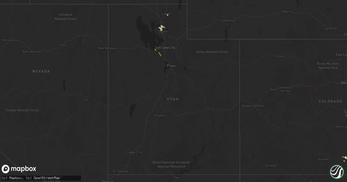
Hail Map in Utah on May 16, 2021
Get this storm
May 16 map
$229
one time, instant access
Download today. No call, no setup
Keep the $229
Bought the map and want the full workflow? Apply the entire $229 to a subscription within 7 days. None of it is wasted.
Every map, not just this one
This buys you this map. Subscription and you get every map we run, in the markets you choose from a few cities to whole states to nationwide. Plus real-time alerts the moment a storm fires.
Contact data
Name, contact info, occupancy, even credit band for addresses in the footprint. You go from where it hit to who to call.
Become the source they trust
Unlimited branding weather history reports on demand. You already have the documented answer ready for the property owner, and you are the one who showed up with it.
Property data and RoofTrace estimates
Pull up any address you have got, its value and the exact code rules for that jurisdiction, straight from One Click Code. Then RoofTrace estimates the squares, pitch, and roof value, priced the way you price.
Storm reports in Utah
Utah
| Date | Description |
|---|---|
| 05/16/20214:50 PM CDT | A local report indicates 76 MPH wind near GUNNISON ISLAND |
| 05/16/20214:30 PM CDT | A local report indicates 1.00 inch wind near 1 S LOGAN |
| 05/16/20214:27 PM CDT | A local report indicates 1.00 inch wind near PLAIN CITY |
| 05/16/20212:20 PM CDT | A local report indicates 1.00 inch wind near HERRIMAN |
| 05/15/202110:24 PM CDT | At 324 PM MDT, a severe thunderstorm was located 9 miles north of Skull Valley, or 15 miles west of Grantsville, moving northwest at 15 mph. HAZARD...60 mph wind gusts and quarter size hail. SOURCE...Radar indicated. IMPACT...Hail damage to vehicles is expected. Expect wind damage to roofs, siding, and trees. Locations impacted include... Delle and Skull Valley. This includes Interstate 80 in Utah between mile markers 51 and 59,and between mile markers 63 and 74. |
| 05/15/202110:00 PM CDT | At 259 PM MDT, a severe thunderstorm was located over South Willard, or 9 miles south of Brigham City, moving northwest at 20 mph. HAZARD...60 mph wind gusts and quarter size hail. SOURCE...Radar indicated. IMPACT...Hail damage to vehicles is expected. Expect wind damage to roofs, siding, and trees. Locations impacted include... Ogden, Brigham City, North Ogden, Hooper, Perry, Willard, Marriott-Slaterville, Bear River City, Corinne, South Willard, West Haven, Pleasant View, Farr West, Harrisville, Plain City, West Warren, Wilson, Warren, West Weber and Slaterville.This includes Interstate 15 between mile markers 345 and 365. |
| 05/15/20219:29 PM CDT | At 229 PM MDT, a severe thunderstorm was located 7 miles east of Ogden, moving northwest at 25 mph. HAZARD...60 mph wind gusts and half dollar size hail. SOURCE...Radar indicated. IMPACT...Hail damage to vehicles is expected. Expect wind damage to roofs, siding, and trees. Locations impacted include... Ogden, Brigham City, North Ogden, Perry, Willard, Marriott-Slaterville, South Willard, Pleasant View, Farr West, Harrisville, Plain City, Huntsville, Eden, Liberty, Warren, Snowbasin and Slaterville.This includes Interstate 15 between mile markers 345 and 362. |
| 05/15/20219:03 PM CDT | At 202 PM MDT, a severe thunderstorm was located near Morgan, moving northwest at 20 mph. HAZARD...60 mph wind gusts and quarter size hail. SOURCE...Radar indicated. IMPACT...Hail damage to vehicles is expected. Expect wind damage to roofs, siding, and trees. Locations impacted include... Ogden, South Ogden, Weber State University, Mountain Green, Peterson, Snowbasin and Eden.This includes Interstate 84 between mile markers 91 and 98. |
| 05/15/20218:22 PM CDT | At 122 PM MDT, a severe thunderstorm was located near Bingham Canyon Mine, or 7 miles southwest of West Valley City, moving northwest at 35 mph. HAZARD...60 mph wind gusts and quarter size hail. SOURCE...Public reported hail up to quarter sized. IMPACT...Hail damage to vehicles is expected. Expect wind damage to roofs, siding, and trees. Locations impacted include... West Valley City, West Jordan, Magna, Bingham Canyon Mine, Oquirrh, Copperton and Lake Point.This includes Interstate 80 in Utah between mile markers 98 and 109. |
All States Impacted by Hail Map on May 16, 2021
Cities Impacted by Hail Map on May 16, 2021
- Garden City, KS
- Earth, TX
- Nocona, TX
- Ryan, OK
- Wilson, OK
- Ringling, OK
- Saint Jo, TX
- Westbrook, TX
- Crowell, TX
- Quanah, TX
- Vernon, TX
- Seymour, TX
- Dalhart, TX
- Ballwin, MO
- Maywood, NE
- Clarendon, TX
- Rotan, TX
- McCaulley, TX
- Roby, TX
- Hamlin, TX
- Canyon, TX
- Claude, TX
- Poolville, TX
- Weatherford, TX
- O'Brien, TX
- Crosbyton, TX
- Walsenburg, CO
- Girard, TX
- Colorado City, TX
- Bridgeport, TX
- Lakeview, TX
- Snyder, TX
- Pueblo, CO
- Sudan, TX
- Petersburg, TX
- Floydada, TX
- Loomis, NE
- Deerfield, KS
- Hugo, CO
- Bellevue, TX
- Henrietta, TX
- Childress, TX
- Karval, CO
- Vega, TX
- Hereford, TX
- Morland, KS
- Texline, TX
- Edson, KS
- Haswell, CO
- La Veta, CO
- Marietta, OK
- Whitesboro, TX
- Loraine, TX
- Knox City, TX
- Atwood, KS
- Otterville, MO
- Tipton, MO
- Clarksburg, MO
- Florence, MO
- Syracuse, MO
- Wayside, TX
- Chillicothe, TX
- Paducah, TX
- Plainview, TX
- Roscoe, TX
- Sweetwater, TX
- Great Bend, KS
- Hoisington, KS
- Orland, ME
- Lorenzo, TX
- Smithton, MO
- McClave, CO
- Amarillo, TX
- Chico, TX
- Perrin, TX
- Jacksboro, TX
- Bowie, TX
- Alvord, TX
- Goree, TX
- Weinert, TX
- Munday, TX
- Rochester, TX
- Garden City, TX
- Big Lake, TX
- Ordway, CO
- Ogden, UT
- Eads, CO
- Rawlins, WY
- Ballinger, TX
- Lockney, TX
- Penokee, KS
- Hermleigh, TX
- Ulysses, KS
- Claflin, KS
- Sheridan Lake, CO
- Silverton, TX
- Meade, KS
- Wray, CO
- Willard, UT
- Ness City, KS
- Bazine, KS
- La Crosse, KS
- Alexander, KS
- Sugar City, CO
- Bison, KS
- Boone, CO
- Terral, OK
- Cee Vee, TX
- Springtown, TX
- Jayton, TX
- Otis, KS
- Sunset, TX
- Arlington, CO
- Aspermont, TX
- Abernathy, TX
- Hale Center, TX
- Surry, ME
- Matador, TX
- Ashland, MO
- Fieldton, TX
- Springlake, TX
- Kit Carson, CO
- Logan, UT
- Stratton, CO
- Colorado Springs, CO
- Yoder, CO
- Wildorado, TX
- Eureka, MO
- Flagler, CO
- Pacific, MO
- House Springs, MO
- Syracuse, KS
- Mcadoo, TX
- Happy, TX
- New Bloomfield, MO
- Avondale, CO
- Ira, TX
- Burlington, CO
- Branson, CO
- Idalou, TX
- Ralls, TX
- Dickens, TX
- Spur, TX
- Flomot, TX
- Roaring Springs, TX
- Quitaque, TX
- Hartsburg, MO
- Curtis, NE
- Bethune, CO
- Sabine Pass, TX
- Port Arthur, TX
- Overton, NE
- Elm Creek, NE
- Bertrand, NE
- Starks, LA
- Eden, UT
- Ingalls, KS
- Ringgold, TX
- Chesterfield, IL
- Fulton, MO
- Seibert, CO
- Hoxie, KS
- Tebbetts, MO
- Wilson, KS
- Rule, TX
- Old Glory, TX
- Azle, TX
- Memphis, TX
- McCracken, KS
- Skellytown, TX
- Chamois, MO
- Carlinville, IL
- Strawn, TX
- Mingus, TX
- Grenville, NM
- Monument, KS
- Paradise, TX
- Holts Summit, MO
- Hanston, KS
- Tell, TX
- Big Spring, TX
- Sterling City, TX
- Jamestown, MO
- Centertown, MO
- Overbrook, OK
- Plainville, KS
- Hayes Center, NE
- Mokane, MO
- Coahoma, TX
- Afton, TX
- Cimarron, KS
- Model, CO
- Fowler, CO
- Gorham, KS
- Pierceville, KS
- Wheeler, IL
- Montrose, IL
- Wichita Falls, TX
- Rio Hondo, TX
- Bunceton, MO
- Ellsworth, KS
- Colby, KS
- Brownell, KS
- Burdett, KS
- Beeler, KS
- Jetmore, KS
- Olney Springs, CO
- West Jordan, UT
- Herriman, UT
- Bingham Canyon, UT
- Magna, UT
- South Jordan, UT
- Tooele, UT
- Leon, OK
- Burneyville, OK
- Ardmore, OK
- Masterson, TX
- Panhandle, TX
- McCamey, TX
- Olton, TX
- White Deer, TX
- Tulia, TX
- Stamford, TX
- Fort Worth, TX
- Healdton, OK
- Gordonville, TX
- Sadler, TX
- Gainesville, TX
- Pottsboro, TX
- Muenster, TX
- Thackerville, OK
- Kress, TX
- Turkey, TX
- Dallas, TX


