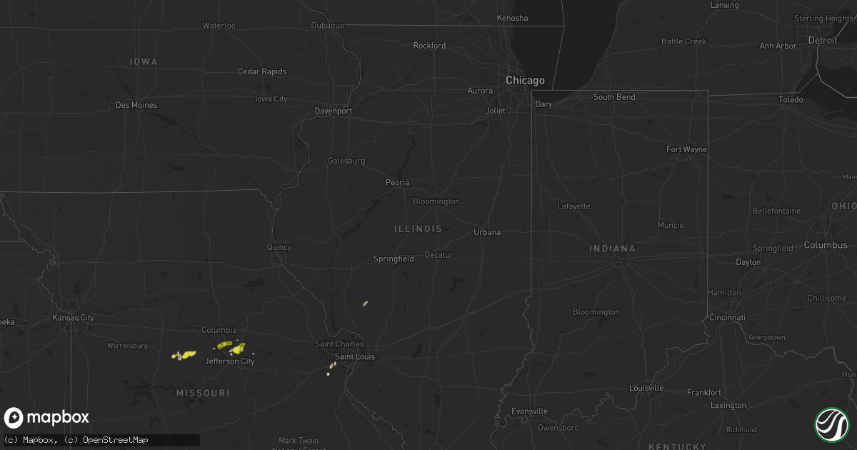
Hail Map in Illinois on May 16, 2021
Get this storm
May 16 map
$229
one time, instant access
Download today. No call, no setup
Keep the $229
Bought the map and want the full workflow? Apply the entire $229 to a subscription within 7 days. None of it is wasted.
Every map, not just this one
This buys you this map. Subscription and you get every map we run, in the markets you choose from a few cities to whole states to nationwide. Plus real-time alerts the moment a storm fires.
Contact data
Name, contact info, occupancy, even credit band for addresses in the footprint. You go from where it hit to who to call.
Become the source they trust
Unlimited branding weather history reports on demand. You already have the documented answer ready for the property owner, and you are the one who showed up with it.
Property data and RoofTrace estimates
Pull up any address you have got, its value and the exact code rules for that jurisdiction, straight from One Click Code. Then RoofTrace estimates the squares, pitch, and roof value, priced the way you price.
Storm reports in Illinois
Illinois
| Date | Description |
|---|---|
| 05/16/20215:58 AM CDT | At 1057 PM CDT, severe thunderstorms were located along a line extending from Schram City to near Pocahontas, moving east at 30 mph. HAZARD...60 mph wind gusts and nickel size hail. SOURCE...Radar indicated. IMPACT...Expect damage to roofs, siding, and trees. Severe thunderstorms will be near... Coffeen around 1105 PM CDT. Woburn around 1115 PM CDT.Other locations in the path of these severe thunderstorms includeMulberry Grove and Van Burensburg.This includes Interstate 70 in Illinois between exits 45 and 52. |
| 05/16/20215:40 AM CDT | At 1040 PM CDT, a severe thunderstorm was located near Nokomis, moving east at 30 mph. HAZARD...60 mph wind gusts and nickel size hail. SOURCE...Radar indicated. IMPACT...Expect damage to roofs, siding, and trees. Locations impacted include... Shelbyville, Pana, Findlay, Cowden, Tower Hill, Beecher City, Shumway, Westervelt, Moccasin, Herrick, Rosamond, Clarksburg, Oconee, Mode and Lake Sara. |
| 05/16/20215:36 AM CDT | At 1034 PM CDT, severe thunderstorms were located along a line extending from near Pana to near Van Burensburg, moving east at 20 mph. HAZARD...60 mph wind gusts and quarter size hail. SOURCE...Public. At 3:25 pm tree damage due to thunderstorm winds was reported in Nokomis, IL. IMPACT...Hail damage to vehicles is expected. Expect wind damage to roofs, siding, and trees. Locations impacted include... Ramsey.This also includes Ramsey Lake State Park. |
| 05/15/202110:40 PM CDT | Tree damage. Social media report. |
| 05/15/202110:25 PM CDT | Wind knocked over a partially dead tree in nokomis... Il. |
All States Impacted by Hail Map on May 16, 2021
Cities Impacted by Hail Map on May 16, 2021
- Garden City, KS
- Earth, TX
- Nocona, TX
- Ryan, OK
- Wilson, OK
- Ringling, OK
- Saint Jo, TX
- Westbrook, TX
- Crowell, TX
- Quanah, TX
- Vernon, TX
- Seymour, TX
- Dalhart, TX
- Ballwin, MO
- Maywood, NE
- Clarendon, TX
- Rotan, TX
- McCaulley, TX
- Roby, TX
- Hamlin, TX
- Canyon, TX
- Claude, TX
- Poolville, TX
- Weatherford, TX
- O'Brien, TX
- Crosbyton, TX
- Walsenburg, CO
- Girard, TX
- Colorado City, TX
- Bridgeport, TX
- Lakeview, TX
- Snyder, TX
- Pueblo, CO
- Sudan, TX
- Petersburg, TX
- Floydada, TX
- Loomis, NE
- Deerfield, KS
- Hugo, CO
- Bellevue, TX
- Henrietta, TX
- Childress, TX
- Karval, CO
- Vega, TX
- Hereford, TX
- Morland, KS
- Texline, TX
- Edson, KS
- Haswell, CO
- La Veta, CO
- Marietta, OK
- Whitesboro, TX
- Loraine, TX
- Knox City, TX
- Atwood, KS
- Otterville, MO
- Tipton, MO
- Clarksburg, MO
- Florence, MO
- Syracuse, MO
- Wayside, TX
- Chillicothe, TX
- Paducah, TX
- Plainview, TX
- Roscoe, TX
- Sweetwater, TX
- Great Bend, KS
- Hoisington, KS
- Orland, ME
- Lorenzo, TX
- Smithton, MO
- McClave, CO
- Amarillo, TX
- Chico, TX
- Perrin, TX
- Jacksboro, TX
- Bowie, TX
- Alvord, TX
- Goree, TX
- Weinert, TX
- Munday, TX
- Rochester, TX
- Garden City, TX
- Big Lake, TX
- Ordway, CO
- Ogden, UT
- Eads, CO
- Rawlins, WY
- Ballinger, TX
- Lockney, TX
- Penokee, KS
- Hermleigh, TX
- Ulysses, KS
- Claflin, KS
- Sheridan Lake, CO
- Silverton, TX
- Meade, KS
- Wray, CO
- Willard, UT
- Ness City, KS
- Bazine, KS
- La Crosse, KS
- Alexander, KS
- Sugar City, CO
- Bison, KS
- Boone, CO
- Terral, OK
- Cee Vee, TX
- Springtown, TX
- Jayton, TX
- Otis, KS
- Sunset, TX
- Arlington, CO
- Aspermont, TX
- Abernathy, TX
- Hale Center, TX
- Surry, ME
- Matador, TX
- Ashland, MO
- Fieldton, TX
- Springlake, TX
- Kit Carson, CO
- Logan, UT
- Stratton, CO
- Colorado Springs, CO
- Yoder, CO
- Wildorado, TX
- Eureka, MO
- Flagler, CO
- Pacific, MO
- House Springs, MO
- Syracuse, KS
- Mcadoo, TX
- Happy, TX
- New Bloomfield, MO
- Avondale, CO
- Ira, TX
- Burlington, CO
- Branson, CO
- Idalou, TX
- Ralls, TX
- Dickens, TX
- Spur, TX
- Flomot, TX
- Roaring Springs, TX
- Quitaque, TX
- Hartsburg, MO
- Curtis, NE
- Bethune, CO
- Sabine Pass, TX
- Port Arthur, TX
- Overton, NE
- Elm Creek, NE
- Bertrand, NE
- Starks, LA
- Eden, UT
- Ingalls, KS
- Ringgold, TX
- Chesterfield, IL
- Fulton, MO
- Seibert, CO
- Hoxie, KS
- Tebbetts, MO
- Wilson, KS
- Rule, TX
- Old Glory, TX
- Azle, TX
- Memphis, TX
- McCracken, KS
- Skellytown, TX
- Chamois, MO
- Carlinville, IL
- Strawn, TX
- Mingus, TX
- Grenville, NM
- Monument, KS
- Paradise, TX
- Holts Summit, MO
- Hanston, KS
- Tell, TX
- Big Spring, TX
- Sterling City, TX
- Jamestown, MO
- Centertown, MO
- Overbrook, OK
- Plainville, KS
- Hayes Center, NE
- Mokane, MO
- Coahoma, TX
- Afton, TX
- Cimarron, KS
- Model, CO
- Fowler, CO
- Gorham, KS
- Pierceville, KS
- Wheeler, IL
- Montrose, IL
- Wichita Falls, TX
- Rio Hondo, TX
- Bunceton, MO
- Ellsworth, KS
- Colby, KS
- Brownell, KS
- Burdett, KS
- Beeler, KS
- Jetmore, KS
- Olney Springs, CO
- West Jordan, UT
- Herriman, UT
- Bingham Canyon, UT
- Magna, UT
- South Jordan, UT
- Tooele, UT
- Leon, OK
- Burneyville, OK
- Ardmore, OK
- Masterson, TX
- Panhandle, TX
- McCamey, TX
- Olton, TX
- White Deer, TX
- Tulia, TX
- Stamford, TX
- Fort Worth, TX
- Healdton, OK
- Gordonville, TX
- Sadler, TX
- Gainesville, TX
- Pottsboro, TX
- Muenster, TX
- Thackerville, OK
- Kress, TX
- Turkey, TX
- Dallas, TX


