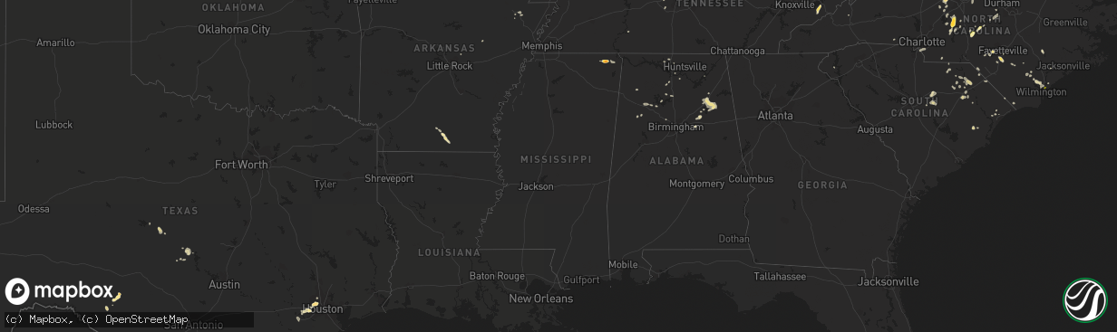
Hail Map in Mississippi on May 12, 2016
The weather event in Mississippi on May 12, 2016 includes Hail map. 12 states and 204 cities were impacted and suffered possible damage. The total estimated number of properties impacted is 233.
Want more than just the map?
Turn this storm into a full workflow.
- Owner + property data so you know who to knock
- OnDemand branded weather history reports to win the "did we even have hail?" argument
- RoofTrace estimate so reps stop guessing numbers at the door
Bought this map? Upgrade within 7 days and we'll credit the $230. (10-15 min setup call)
Hail
233
Estimated number of impacted properties by a 1.00" hail or larger59
Estimated number of impacted properties by a 1.75" hail or larger0
Estimated number of impacted properties by a 2.50" hail or largerStorm reports in Mississippi
Mississippi
| Date | Description |
|---|---|
| 05/12/20164:25 PM CDT | A couple of trees knocked down and a light pole snapped in two on county road 261 in bissel. |
| 05/12/20163:11 PM CDT | Utility lines down on county road 300 near town of glen. |
| 05/12/20163:11 PM CDT | Brief golfball size hail. Caused damage to a vehicle. Time is radar estimated. |
| 05/12/20163:08 PM CDT | Two trees downed on county road 185 right by greenwood-leflore airport. One tree downed northwest of the airport on highway 82 near the carroll and leflore county line. |
All States Impacted by Hail Map on May 12, 2016
Cities Impacted by Hail Map on May 12, 2016
- Sevierville, TN
- Cosby, TN
- Dandridge, TN
- Rocksprings, TX
- Del Rio, TX
- Walnut Cove, NC
- Glen, MS
- Corinth, MS
- Rienzi, MS
- El Dorado, AR
- Houston, TX
- Salem, VA
- Roanoke, VA
- Maple Hill, NC
- Ashville, AL
- Society Hill, SC
- Winston Salem, NC
- Richmond, TX
- Katy, TX
- Conway, SC
- Catawba, VA
- Fayetteville, NC
- Pineville, NC
- Matthews, NC
- Fort Mill, SC
- Charlotte, NC
- Hartsville, SC
- Darlington, SC
- Laurinburg, NC
- Maxton, NC
- Cropwell, AL
- Andrews, SC
- Logan, AL
- Cullman, AL
- Upton, KY
- Magnolia, KY
- Munfordville, KY
- Bonnieville, KY
- Parkton, NC
- Saint Pauls, NC
- Hope Mills, NC
- Shaw Afb, SC
- Rembert, SC
- Sumter, SC
- Dalzell, SC
- Pell City, AL
- Raeford, NC
- Denton, NC
- Lexington, NC
- Kingston Springs, TN
- Nashville, TN
- Pegram, TN
- Rainbow City, AL
- Gadsden, AL
- Attalla, AL
- Jacksonville, AL
- Wellington, AL
- Tow, TX
- Kenansville, NC
- Belews Creek, NC
- Stokesdale, NC
- Oak Ridge, NC
- Kernersville, NC
- Mount Sherman, KY
- Summersville, KY
- Troy, NC
- New London, NC
- Robbins, NC
- Carthage, NC
- Gouldbusk, TX
- Burnsville, MS
- Iuka, MS
- Hartselle, AL
- Ash, NC
- Hampton, AR
- Llano, TX
- Cherokee, TX
- San Saba, TX
- Summerfield, NC
- Myrtle Beach, SC
- Trinity, NC
- Cartersville, GA
- White, GA
- Athens, AL
- Ivanhoe, NC
- Asheboro, NC
- Star, NC
- Gibsonville, NC
- Whitsett, NC
- Eastover, SC
- Goldston, NC
- Madison, AL
- Currie, NC
- Atkinson, NC
- Langston, AL
- Strong, AR
- Timmonsville, SC
- Effingham, SC
- Eagle Springs, NC
- Carbon Hill, AL
- Berry, AL
- Palms, MI
- Marshville, NC
- Reese, MI
- Saginaw, MI
- Munger, MI
- North Wilkesboro, NC
- Roaring River, NC
- Walkertown, NC
- Apex, NC
- Pittsboro, NC
- Chapel Hill, NC
- Weiner, AR
- Shelby, NC
- Longwood, NC
- Arley, AL
- Crane Hill, AL
- Elon, NC
- Fairview, TN
- Nauvoo, AL
- Camden, SC
- Bald Knob, AR
- Bay City, MI
- Fairgrove, MI
- Carrollton, MI
- Hurdle Mills, NC
- Rougemont, NC
- Jasper, AL
- Cub Run, KY
- Pamplico, SC
- Hamer, SC
- Dillon, SC
- Florence, SC
- Franklin, TN
- Lancing, TN
- Advance, NC
- Port Austin, MI
- Campbellsville, KY
- Buffalo, KY
- Moncure, NC
- Rocky Point, NC
- Sidon, MS
- Vinton, VA
- Bear Creek, AL
- Garland, NC
- Gatlinburg, TN
- Fulshear, TX
- Rockwood, TX
- Rochelle, TX
- Lohn, TX
- Castle Hayne, NC
- Clifton, TN
- Little Rock, SC
- Rosenberg, TX
- Beasley, TX
- Bay, AR
- Fayette, AL
- Bankston, AL
- Cabot, AR
- Kingston, GA
- Harvest, AL
- Weaverville, NC
- Alexander, NC
- Elkmont, AL
- McKenzie, TN
- Elizabethtown, NC
- Tabor City, NC
- Loris, SC
- Falkville, AL
- Danville, AL
- Somerville, AL
- Laceys Spring, AL
- Hillsborough, NC
- Boaz, AL
- Ruby, SC
- Richfield, NC
- Seneca, SC
- Ragland, AL
- Julian, NC
- Albemarle, NC
- Jersey, AR
- Greensburg, KY
- Patrick, SC
- Blenheim, SC
- White Oak, NC
- Bennett, NC
- Hampstead, NC
- Jonesboro, AR
- Efland, NC
- McLeansville, NC
- Buchanan, GA
- Chesterfield, SC
- McBee, SC
- Lincoln, AL
- Altoona, AL
- Ohatchee, AL
- Shannon, NC
- Dora, AL
- Wilmington, NC
- Ronda, NC
- Mountain Rest, SC
- Tamassee, SC
- Walhalla, SC
- Salem, SC


