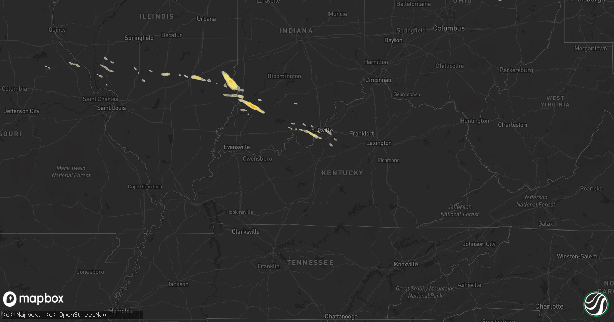
Hail Map in Kentucky on May 7, 2016
Get this storm
May 7 map
$229
one time, instant access
Download today. No call, no setup
Keep the $229
Bought the map and want the full workflow? Apply the entire $229 to a subscription within 7 days. None of it is wasted.
Every map, not just this one
This buys you this map. Subscription and you get every map we run, in the markets you choose from a few cities to whole states to nationwide. Plus real-time alerts the moment a storm fires.
Contact data
Name, contact info, occupancy, even credit band for addresses in the footprint. You go from where it hit to who to call.
Become the source they trust
Unlimited branding weather history reports on demand. You already have the documented answer ready for the property owner, and you are the one who showed up with it.
Property data and RoofTrace estimates
Pull up any address you have got, its value and the exact code rules for that jurisdiction, straight from One Click Code. Then RoofTrace estimates the squares, pitch, and roof value, priced the way you price.
Storm reports in Kentucky
Kentucky
| Date | Description |
|---|---|
| 05/07/20166:58 PM CDT | Pine tree down on highway 2011 blocking more than half the road. |
| 05/07/20166:56 PM CDT | Trees were reported to have been blown down. |
| 05/07/20166:54 PM CDT | A tree was blown down onto a powerline. |
| 05/07/20166:51 PM CDT | A tree was blown down onto a road. This was reported via social media to a media outlet. |
| 05/07/20166:49 PM CDT | A tree was blown down onto a powerline. |
| 05/07/20166:46 PM CDT | A tree was blown down onto a road. |
| 05/07/20166:46 PM CDT | A tree was blown down onto a road. This was reported via social media to a media outlet. |
| 05/07/20166:43 PM CDT | A tree was blown down onto a road. |
| 05/07/20166:40 PM CDT | A large tree was blown down. |
| 05/07/20166:38 PM CDT | Trees were reported to have been blown down. |
| 05/07/20166:30 PM CDT | Trees were down in and near manchester. |
| 05/07/20166:26 PM CDT | A tree was blown down along hammock road. |
| 05/07/20166:24 PM CDT | A tree was blown down along hammock road. |
| 05/07/20166:20 PM CDT | Report from ky state police post. A couple of trees and limbs were blown down along with damage to business signs near the london state police post. |
| 05/07/20166:20 PM CDT | A tree limb the size of a persons wrist was blown down near london. |
| 05/07/20166:16 PM CDT | A couple of trees were reported to have been blown down. This report is from social media. |
| 05/07/20165:53 PM CDT | A couple of trees were reported to have been blown down. |
| 05/07/20165:48 PM CDT | Large limbs blown down reported via social media. |
| 05/07/20165:35 PM CDT | Large limbs blown down reported via social media. |
| 05/07/20164:25 PM CDT | Large tree split in half. Time estimated based on radar. |
| 05/07/20164:15 PM CDT | Tree down on car. |
| 05/07/20164:09 PM CDT | Facebook picture of large tree down on new la grange road. Relayed via media. |
| 05/07/20164:08 PM CDT | Large tree down. |
| 05/07/20164:05 PM CDT | Picture from facebook of large tree leaning on apartments of mallgate st. Matthews. |
| 05/06/20168:55 PM CDT | Facebook picture of large tree down near ky 434. Relayed by media. Time estimated based on radar. |
| 05/06/20168:51 PM CDT | Trees reported down |
| 05/06/20167:57 PM CDT | A local report indicates 62 MPH wind near 1 S SHIVELY |
| 05/06/20167:36 PM CDT | Late report of tree down. |
| 05/06/20167:19 PM CDT | Tree and power poles down along center street. |
| 05/06/20167:19 PM CDT | A tree was blown down along ky highway 987. |
| 05/06/20167:16 PM CDT | A tree was blown down along ky highway 987. |
| 05/06/20167:14 PM CDT | A tree was blown down along ky highway 72. |
| 05/06/20167:12 PM CDT | Trees... Large limbs... And power lines were blown down on highway 72. |
| 05/06/20167:12 PM CDT | Trees... Large limbs... And power lines were blown down at the junction of highways 221 and 510. |
| 05/06/20167:07 PM CDT | Trees... Large limbs... And power lines were blown down at the junction of highways 421 and 221. |
All States Impacted by Hail Map on May 7, 2016
Cities Impacted by Hail Map on May 7, 2016
- Taylorsville, KY
- Fisherville, KY
- Louisville, KY
- Weldona, CO
- Palco, KS
- Ellis, KS
- Farnam, NE
- Floyds Knobs, IN
- Georgetown, IN
- Coshocton, OH
- Beecher City, IL
- Woodrow, CO
- Akron, CO
- Wray, CO
- Vernon, CO
- Eckley, CO
- Agate, CO
- Deer Trail, CO
- Gove, KS
- Grainfield, KS
- Scott City, KS
- Ramah, CO
- Bennett, CO
- Holyoke, CO
- Amherst, CO
- Strasburg, CO
- Cowden, IL
- Ramsey, IL
- Robinson, IL
- Martinsville, IL
- Annapolis, IL
- Palestine, IL
- Hutsonville, IL
- Carlisle, IN
- Merom, IN
- West York, IL
- Flat Rock, IL
- Alton, KS
- Kersey, CO
- Roggen, CO
- Wiggins, CO
- Orchard, CO
- Park, KS
- Norton, KS
- Clayton, KS
- Fort Morgan, CO
- Byers, CO
- Flagler, CO
- Greenfield, IL
- Palmyra, IN
- Greenville, IN
- New Salisbury, IN
- Champion, NE
- Kit Carson, CO
- Bicknell, IN
- Wheatland, IN
- Bruceville, IN
- Washington, IN
- Loogootee, IN
- Cannelburg, IN
- Montgomery, IN
- Vincennes, IN
- Healy, KS
- Dighton, KS
- Gill, CO
- La Salle, CO
- Greeley, CO
- Eaton, CO
- Cope, CO
- Roodhouse, IL
- White Hall, IL
- Hoxie, KS
- Plymouth, OH
- Shelby, OH
- Republic, OH
- Mansfield, OH
- Tiro, OH
- Willard, OH
- Attica, OH
- New Washington, OH
- Yuma, CO
- Seibert, CO
- Vona, CO
- Anton, CO
- Joes, CO
- Carpenter, WY
- Lenora, KS
- Elbert, CO
- Maywood, NE
- Wellfleet, NE
- North Platte, NE
- Hereford, CO
- Grover, CO
- Briggsdale, CO
- Elizabeth, IN
- Lanesville, IN
- Carrollton, IL
- Rockbridge, IL
- Portis, KS
- Woodston, KS
- Osborne, KS
- Downs, KS
- Gaylord, KS
- Bingham, IL
- Elizabeth, CO
- Oakley, KS
- Rexford, KS
- New Raymer, CO
- Effingham, IL
- Montrose, IL
- Wheeler, IL
- Newton, IL
- Teutopolis, IL
- Perrysville, OH
- Arnett, OK
- Mcadoo, TX
- Crete, IL
- Beecher, IL
- Tahoka, TX
- Oblong, IL
- Stratton, CO
- Irving, IL
- Witt, IL
- Brush, CO
- Loudonville, OH
- Grinnell, KS
- Selden, KS
- Morland, KS
- Moorefield, NE
- Milltown, IN
- Marengo, IN
- Norcatur, KS
- Ogallah, KS
- Plainville, KS
- Coxs Creek, KY
- Jennings, KS
- Depauw, IN
- Larkspur, CO
- Colorado Springs, CO
- Millersburg, OH
- Killbuck, OH
- Maxwell, NE
- Ransom, KS
- Shiloh, OH
- Wakeeney, KS
- Hidalgo, IL
- Litchfield, IL
- English, IN
- Louisiana, MO
- Clarksville, MO
- Bowling Green, MO
- Wilson, TX
- Farber, MO
- Kiowa, CO
- Campbellsburg, IN
- Jewett, IL
- Haxtun, CO
- Kane, IL
- Fieldon, IL
- Jerseyville, IL
- Arriba, CO
- Venango, NE
- Oaktown, IN
- Kirk, CO
- Tryon, NE
- Sumner, IL
- Lawrenceville, IL
- Bridgeport, IL
- Shumway, IL
- Stockton, KS
- Plainville, IN
- Odon, IN
- Bushnell, NE
- Joliet, IL
- Pine Bluffs, WY
- Brownell, KS
- Fairdale, KY
- Corydon, IN
- Westminster, CO
- Broomfield, CO
- Stockville, NE
- Glenmont, OH
- Mankato, KS
- Mount Washington, KY
- Monroe City, IN
- Cameron, WV
- Esbon, KS
- Collyer, KS
- Ashland, OH
- Lucas, OH
- Dow, IL
- Lindon, CO
- Laddonia, MO
- Julesburg, CO
- Minneapolis, KS
- Nilwood, IL
- Raymond, IL
- Ramsey, IN
- Hillsboro, IL
- Woodland Park, CO
- Quinter, KS


