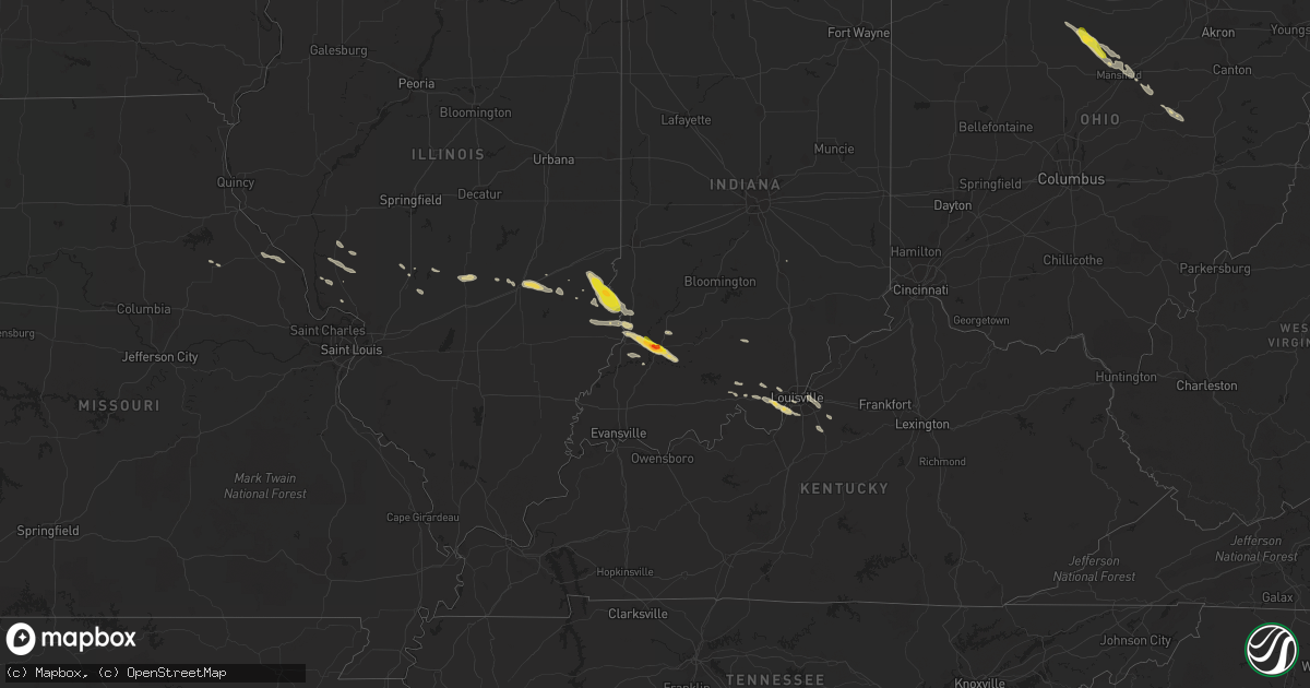
Hail Map on May 7, 2016
Get this storm
May 7 map
$229
one time, instant access
Download today. No call, no setup
Keep the $229
Bought the map and want the full workflow? Apply the entire $229 to a subscription within 7 days. None of it is wasted.
Every map, not just this one
This buys you this map. Subscription and you get every map we run, in the markets you choose from a few cities to whole states to nationwide. Plus real-time alerts the moment a storm fires.
Contact data
Name, contact info, occupancy, even credit band for addresses in the footprint. You go from where it hit to who to call.
Become the source they trust
Unlimited branding weather history reports on demand. You already have the documented answer ready for the property owner, and you are the one who showed up with it.
Property data and RoofTrace estimates
Pull up any address you have got, its value and the exact code rules for that jurisdiction, straight from One Click Code. Then RoofTrace estimates the squares, pitch, and roof value, priced the way you price.
States Impacted by Hail Map on May 7, 2016
Storm reports
Colorado
| Date | Description |
|---|---|
| 05/07/20166:54 PM CDT | On north side of town. |
| 05/07/20166:41 PM CDT | Lasted 2 minutes then dissipated. Crossed cr 32 a quarter mile west of highway 385. |
| 05/07/20166:36 PM CDT | Lifted after two minutes. |
| 05/07/20166:32 PM CDT | A local report indicates 1.00 inch wind near 4 WNW VERNON |
| 05/07/20166:01 PM CDT | A local report indicates a tornado near 7 NNE ECKLEY |
| 05/07/20166:01 PM CDT | Last 4 minutes. Corrected distance. Tornado at county road w and county road 48. |
| 05/07/20165:32 PM CDT | A local report indicates 1.00 inch wind near 2 E ECKLEY |
| 05/07/20165:19 PM CDT | A local report indicates 1.00 inch wind near 3 ESE YUMA |
| 05/07/20165:15 PM CDT | Lasted 5 minutes. |
| 05/07/20165:14 PM CDT | Brief tornado. |
| 05/07/20165:00 PM CDT | Lasted about 5 minutes. |
| 05/07/20164:54 PM CDT | A local report indicates 1.00 inch wind near ABARR |
| 05/07/20164:50 PM CDT | Hail lasted 20 minutes. Was soft. |
| 05/07/20164:28 PM CDT | A local report indicates 1.00 inch wind near 8 N JOES |
| 05/07/20164:27 PM CDT | A local report indicates 1.25 inch wind near 4 WNW JOES |
| 05/07/20164:26 PM CDT | Rain wrapped tornado south of highway 14 |
| 05/07/20164:13 PM CDT | Tornado on the ground on state road 2 near jackson lake |
| 05/07/20164:00 PM CDT | Confirmed multi-vortex tornado over interstate 76 |
| 05/07/20163:45 PM CDT | Wind was strong enough to blow a person over. Occurred same time as quarter size hail and lasted for 15 minutes. |
| 05/07/20163:45 PM CDT | Lasted 15 minutes. Hail started out as pea size. |
| 05/07/20163:10 PM CDT | A local report indicates 2.50 inch wind near 1 NW STRASBURG |
| 05/07/20163:02 PM CDT | A local report indicates 1.50 inch wind near 1 WNW STRASBURG |
| 05/07/20163:00 PM CDT | A local report indicates 1.75 inch wind near 2 S STRASBURG |
| 05/07/20163:00 PM CDT | Wind gusts to 55 mph |
| 05/07/20162:50 PM CDT | A local report indicates 1.75 inch wind near 3 WSW COUNTRY GARDENS |
| 05/07/20162:44 PM CDT | A local report indicates 1.00 inch wind near 1 WNW WOODLAND PARK |
| 05/07/20162:09 PM CDT | A local report indicates 1.00 inch wind near 3 W KIOWA |
| 05/07/20161:46 PM CDT | A local report indicates 1.00 inch wind near 2 E BLACK FOREST |
| 05/07/20161:29 PM CDT | A local report indicates 1.50 inch wind near 3 N BLACK FOREST |
| 05/06/20168:15 PM CDT | A local report indicates 1.75 inch wind near 6 SE HOLYOKE |
| 05/06/20168:00 PM CDT | Us 385 closed in both direction... Between holyoke and wray in yuma county due to downed power lines. |
| 05/06/20167:49 PM CDT | A local report indicates 1.00 inch wind near 3 N ALVIN |
| 05/06/20167:34 PM CDT | Mobile home destroyed an unknown distance north of wray. |
| 05/06/20167:30 PM CDT | A local report indicates 2.50 inch wind near 4 NW ALVIN |
| 05/06/20167:30 PM CDT | A local report indicates 1.25 inch wind near SSE WAUNETA |
| 05/06/20167:16 PM CDT | Two tornadoes roughly 7 miles north of wray. Second tornado lasted 2 minutes then both tornadoes lifted at same time. |
| 05/06/20167:16 PM CDT | Delayed report. Tornado produced path of damage from north of wray to 10 nne of wray before lifting. This may replace the location of the earlier report of 7 n of wray |
| 05/06/20167:10 PM CDT | Tornado flipped tractors and destroyed outbuildings. |
| 05/06/20167:08 PM CDT | Tornado damage observed 2 miles north of wray including roof damage to house and power lines down. |
| 05/06/20167:05 PM CDT | Continuing on northeast from town. |
| 05/06/20167:00 PM CDT | Hail between 1800 and 1830 local time. |
Kansas
| Date | Description |
|---|---|
| 05/06/201611:45 PM CDT | A local report indicates 1.75 inch wind near 2 SW ALTON |
| 05/06/20169:31 PM CDT | A local report indicates 1.75 inch wind near 3 S PARK |
| 05/06/20169:25 PM CDT | A local report indicates 1.50 inch wind near NORCATUR |
| 05/06/20169:25 PM CDT | A local report indicates 1.75 inch wind near 3 S PARK |
| 05/06/20168:50 PM CDT | A local report indicates 1.00 inch wind near 7 N TASCO |
| 05/06/20168:39 PM CDT | A local report indicates 1.75 inch wind near 7 SSE HOXIE |
| 05/06/20168:24 PM CDT | A local report indicates 2.00 inch wind near GRAINFIELD |
| 05/06/20168:22 PM CDT | A local report indicates 1.25 inch wind near GRAINFIELD |
| 05/06/20168:20 PM CDT | A local report indicates 1.25 inch wind near GRINNELL |
| 05/06/20168:16 PM CDT | A local report indicates 2.75 inch wind near 3 W GOVE |
Nebraska
| Date | Description |
|---|---|
| 05/06/20169:45 PM CDT | A swath of wind damage on the south side of grant including a healthy cottonwood tree snapped in half and several garage doors on machine sheds blown in. One small shed |
Indiana
| Date | Description |
|---|---|
| 05/07/20166:58 PM CDT | Wind gust estimated 55 to 60 mph. |
| 05/07/20166:48 PM CDT | A local report indicates 1.75 inch wind near WASHINGTON |
| 05/07/20166:48 PM CDT | A local report indicates 60 MPH wind near WASHINGTON |
| 05/07/20166:45 PM CDT | A local report indicates 1.00 inch wind near WASHINGTON |
| 05/06/20168:23 PM CDT | End of front porch taken off. Snapped 8 inch pine tree in half. |
| 05/06/20168:23 PM CDT | Trees down. |
| 05/06/20168:00 PM CDT | Tree down. |
| 05/06/20167:59 PM CDT | Multiple trees down throughout the county. |
| 05/06/20167:55 PM CDT | Trees down across highway 64. |
| 05/06/20167:54 PM CDT | Report from cwop weather observation site. |
| 05/06/20167:48 PM CDT | Trees down in the city. |
| 05/06/20167:47 PM CDT | Trees down. |
| 05/06/20167:47 PM CDT | Trees reported down. |
| 05/06/20167:41 PM CDT | Utility pole damaged on e 13th street |
| 05/06/20167:39 PM CDT | Measured wind. Numerous trees down along roadways. |
| 05/06/20167:35 PM CDT | A local report indicates 60 MPH wind near 3 S IRELAND |
| 05/06/20167:33 PM CDT | Power outages in ireland. |
| 05/06/20167:28 PM CDT | Rv type carport blown over. |
| 05/06/20167:25 PM CDT | Measured wind. Trees and branches down and laying across roadway and nearby rainroad track. |
| 05/06/20167:21 PM CDT | Winds estimated 65 to 70 mph reported. |
| 05/06/20167:12 PM CDT | Winds estimated. Report from the oak hill subdivision. |
| 05/06/20167:10 PM CDT | Many trees uprooted and large limbs down 1 and 1/2 miles west of us41. Just to the north and west of the city. |
| 05/06/20167:05 PM CDT | Utility lines down on state road 61 between vincennes and monroe city |
| 05/06/20167:02 PM CDT | Trees down on or near us 41 |
| 05/06/20167:00 PM CDT | Tree fell onto a house on roher road causing damage to the corner of the second floor. The house is believed to be vacant. |
| 05/06/20167:00 PM CDT | Tree and utility lines down near 8631 south decker road |
Ohio
| Date | Description |
|---|---|
| 05/06/20168:01 PM CDT | Hail from dimes to quarters reported on ohio route 83 |
Illinois
| Date | Description |
|---|---|
| 05/07/20166:57 PM CDT | A local report indicates 66 MPH wind near MOUNT CARMEL |
| 05/07/20166:57 PM CDT | Measured at mount carmel airport |
| 05/07/20166:54 PM CDT | Roof blown off of the middle school. Portions of the coummunity without power. Numerous trees and power lines down throughout the community. |
| 05/07/20166:54 PM CDT | Trees and power lines blown down. |
| 05/07/20166:45 PM CDT | Pea to half-inch hail also covering ground |
| 05/07/20166:45 PM CDT | Late report. Large tree limbs and branches down. Heavy rainfall reported with this storm. |
| 05/07/20166:40 PM CDT | Time estimated. Snapped trees and power poles reported in the community. |
| 05/07/20166:40 PM CDT | Winds estimated 60 to 65 mph. |
| 05/07/20166:36 PM CDT | Winds estimated greater than 60 mph... Relayed through em scanner. |
| 05/07/20166:32 PM CDT | 6-inch diamater tree limb blown down |
| 05/07/20166:31 PM CDT | Trees and power poles blown down |
| 05/07/20166:30 PM CDT | Trees and power lines blown down...tree blown down across road |
| 05/07/20166:23 PM CDT | Powerlines blown down |
| 05/07/20166:23 PM CDT | Trees blown down in wynoose |
| 05/07/20166:23 PM CDT | Trees and powerlines blown down |
| 05/07/20166:17 PM CDT | A local report indicates 61 MPH wind near 2 NE BELLE PRAIRIE CITY |
| 05/07/20166:15 PM CDT | Barn damaged...trees and power lines blown down. |
| 05/07/20166:08 PM CDT | Powerlines and large tree branches blown down...shingles blown off roof on austin ave. |
| 05/07/20166:05 PM CDT | Large tree limbs blown down. |
| 05/07/20166:01 PM CDT | Personal weather station |
| 05/07/20165:50 PM CDT | Large tree limb down across a power line |
| 05/07/20165:45 PM CDT | Downed trees and power lines |
| 05/07/20165:43 PM CDT | Reported by trained spotter. Winds estimated. |
| 05/07/20165:42 PM CDT | A local report indicates 60 MPH wind near EFFINGHAM |
| 05/07/20165:35 PM CDT | Report of tree blown onto house in odin. Additional tree damage observed south of us 50. |
| 05/07/20165:34 PM CDT | Trees downed |
| 05/07/20165:33 PM CDT | A local report indicates 60 MPH wind near NASHVILLE |
| 05/07/20165:33 PM CDT | Trees blown into houses |
| 05/07/20165:25 PM CDT | Damage to a tin shed near the fairgrounds. Time estimated. |
| 05/07/20165:20 PM CDT | Trees downed and camper overturned at campground |
| 05/07/20165:20 PM CDT | Power lines and trees downed |
| 05/07/20165:15 PM CDT | Three large trees down. Time estimated. |
| 05/07/20165:12 PM CDT | Trees downed and snapped |
| 05/07/20165:10 PM CDT | Trees snapped and downed |
| 05/07/20165:10 PM CDT | Two inch diameter tree limbs down. |
| 05/07/20165:09 PM CDT | Tree down. Approx one foot diameter. Approx 30 ft tall. |
| 05/07/20165:06 PM CDT | A local report indicates 64 MPH wind near SCOTT AFB |
| 05/07/20165:05 PM CDT | Shingles torn off roofs |
| 05/07/20165:05 PM CDT | A local report indicates 60 MPH wind near GREENVILLE |
| 05/07/20165:03 PM CDT | Tree blown into the garage at garden blvd and prairie ave |
| 05/07/20165:01 PM CDT | Tree limbs downed and large trampoline blown around 100 yards away from original location |
| 05/07/20165:00 PM CDT | 10 to 15 percent of roof blown off. |
| 05/07/20165:00 PM CDT | Branches of a 6 ft diameter maple snapped about 30 ft above the ground. Time estimated. |
| 05/07/20164:59 PM CDT | Trees and large tree limbs down |
| 05/07/20164:57 PM CDT | Large tree limbs and branches greater than two inches diameter downed. Snapped off six inch diameter maple tree. |
| 05/07/20164:55 PM CDT | A local report indicates 70 MPH wind near O'FALLON |
| 05/07/20164:50 PM CDT | Multiple trees downed...power outages. |
| 05/07/20164:50 PM CDT | Large tree limbs and trees down |
| 05/07/20164:45 PM CDT | Three and four foot diameter trees downed |
| 05/07/20164:43 PM CDT | Trees down |
| 05/07/20164:42 PM CDT | Large tree limbs and trees down |
| 05/07/20164:41 PM CDT | Shingles blown off roof and measured 60 mph winds |
| 05/07/20164:38 PM CDT | Large tree limbs and trees down |
| 05/07/20164:37 PM CDT | Two and four foot diameter trees downed |
| 05/07/20164:35 PM CDT | Shingles blown off roof and tree limbs down in town . |
| 05/07/20164:35 PM CDT | Roof and shingle damage to the city hall structure with multiple trees and power lines downed |
| 05/07/20164:30 PM CDT | Trees and tree limbs down |
| 05/07/20164:30 PM CDT | Three and four foot diameter trees downed |
| 05/07/20164:30 PM CDT | A local report indicates 60 MPH wind near SHIPMAN |
| 05/07/20164:25 PM CDT | Multiple large tree limbs downed... Exact size unknown |
| 05/07/20164:15 PM CDT | Trees and tree limbs down |
| 05/07/20164:00 PM CDT | Small tree branches downed |
| 05/07/20163:40 PM CDT | Trees and power lines downed |
| 05/06/20167:15 PM CDT | Barn damaged...trees and power lines blown down. |
Kentucky
| Date | Description |
|---|---|
| 05/07/20166:58 PM CDT | Pine tree down on highway 2011 blocking more than half the road. |
| 05/07/20166:56 PM CDT | Trees were reported to have been blown down. |
| 05/07/20166:54 PM CDT | A tree was blown down onto a powerline. |
| 05/07/20166:51 PM CDT | A tree was blown down onto a road. This was reported via social media to a media outlet. |
| 05/07/20166:49 PM CDT | A tree was blown down onto a powerline. |
| 05/07/20166:46 PM CDT | A tree was blown down onto a road. This was reported via social media to a media outlet. |
| 05/07/20166:46 PM CDT | A tree was blown down onto a road. |
| 05/07/20166:43 PM CDT | A tree was blown down onto a road. |
| 05/07/20166:40 PM CDT | A large tree was blown down. |
| 05/07/20166:38 PM CDT | Trees were reported to have been blown down. |
| 05/07/20166:30 PM CDT | Trees were down in and near manchester. |
| 05/07/20166:26 PM CDT | A tree was blown down along hammock road. |
| 05/07/20166:24 PM CDT | A tree was blown down along hammock road. |
| 05/07/20166:20 PM CDT | A tree limb the size of a persons wrist was blown down near london. |
| 05/07/20166:20 PM CDT | Report from ky state police post. A couple of trees and limbs were blown down along with damage to business signs near the london state police post. |
| 05/07/20166:16 PM CDT | A couple of trees were reported to have been blown down. This report is from social media. |
| 05/07/20165:53 PM CDT | A couple of trees were reported to have been blown down. |
| 05/07/20165:48 PM CDT | Large limbs blown down reported via social media. |
| 05/07/20165:35 PM CDT | Large limbs blown down reported via social media. |
| 05/07/20164:25 PM CDT | Large tree split in half. Time estimated based on radar. |
| 05/07/20164:15 PM CDT | Tree down on car. |
| 05/07/20164:09 PM CDT | Facebook picture of large tree down on new la grange road. Relayed via media. |
| 05/07/20164:08 PM CDT | Large tree down. |
| 05/07/20164:05 PM CDT | Picture from facebook of large tree leaning on apartments of mallgate st. Matthews. |
| 05/06/20168:55 PM CDT | Facebook picture of large tree down near ky 434. Relayed by media. Time estimated based on radar. |
| 05/06/20168:51 PM CDT | Trees reported down |
| 05/06/20167:57 PM CDT | A local report indicates 62 MPH wind near 1 S SHIVELY |
| 05/06/20167:36 PM CDT | Late report of tree down. |
| 05/06/20167:19 PM CDT | Tree and power poles down along center street. |
| 05/06/20167:19 PM CDT | A tree was blown down along ky highway 987. |
| 05/06/20167:16 PM CDT | A tree was blown down along ky highway 987. |
| 05/06/20167:14 PM CDT | A tree was blown down along ky highway 72. |
| 05/06/20167:12 PM CDT | Trees... Large limbs... And power lines were blown down at the junction of highways 221 and 510. |
| 05/06/20167:12 PM CDT | Trees... Large limbs... And power lines were blown down on highway 72. |
| 05/06/20167:07 PM CDT | Trees... Large limbs... And power lines were blown down at the junction of highways 421 and 221. |
Tennessee
| Date | Description |
|---|---|
| 05/06/20168:00 PM CDT | A couple of trees down in the bulls gap and mosheim areas. Winds estimated at 40-50 mph. |
| 05/06/20167:30 PM CDT | Multiple reports of trees down throughout the county. |
Texas
| Date | Description |
|---|---|
| 05/07/201612:01 AM CDT | A microburst occurred over midland international airport from a dissipating thunderstorm. |
Missouri
| Date | Description |
|---|---|
| 05/07/20164:45 PM CDT | One to two inch diameter tree limbs downed at arsenal and watson |
| 05/07/20164:40 PM CDT | Shingles torn on a townhouse on willott road. Time estimated. |
| 05/07/20164:31 PM CDT | Multiple trees of unknown size downed from winds |
| 05/07/20164:30 PM CDT | Major damage to barn under construction at payne road |
| 05/07/20164:16 PM CDT | A local report indicates 64 MPH wind near 4 NNE ORCHARD FARMS |
| 05/07/20163:55 PM CDT | Power lines downed |
| 05/07/20162:52 PM CDT | Tree branches of unknown size and power lines downed |
Virginia
| Date | Description |
|---|---|
| 05/06/20167:30 PM CDT | Multiple reports of trees down throughout the county. |
Cities Impacted by Hail Map on May 7, 2016
- Taylorsville, KY
- Fisherville, KY
- Louisville, KY
- Weldona, CO
- Palco, KS
- Ellis, KS
- Farnam, NE
- Floyds Knobs, IN
- Georgetown, IN
- Coshocton, OH
- Beecher City, IL
- Woodrow, CO
- Akron, CO
- Wray, CO
- Vernon, CO
- Eckley, CO
- Agate, CO
- Deer Trail, CO
- Gove, KS
- Grainfield, KS
- Scott City, KS
- Ramah, CO
- Bennett, CO
- Holyoke, CO
- Amherst, CO
- Strasburg, CO
- Cowden, IL
- Ramsey, IL
- Robinson, IL
- Martinsville, IL
- Annapolis, IL
- Palestine, IL
- Hutsonville, IL
- Carlisle, IN
- Merom, IN
- West York, IL
- Flat Rock, IL
- Alton, KS
- Kersey, CO
- Roggen, CO
- Wiggins, CO
- Orchard, CO
- Park, KS
- Norton, KS
- Clayton, KS
- Fort Morgan, CO
- Byers, CO
- Flagler, CO
- Greenfield, IL
- Palmyra, IN
- Greenville, IN
- New Salisbury, IN
- Champion, NE
- Kit Carson, CO
- Bicknell, IN
- Wheatland, IN
- Bruceville, IN
- Washington, IN
- Loogootee, IN
- Cannelburg, IN
- Montgomery, IN
- Vincennes, IN
- Healy, KS
- Dighton, KS
- Gill, CO
- La Salle, CO
- Greeley, CO
- Eaton, CO
- Cope, CO
- Roodhouse, IL
- White Hall, IL
- Hoxie, KS
- Plymouth, OH
- Shelby, OH
- Republic, OH
- Mansfield, OH
- Tiro, OH
- Willard, OH
- Attica, OH
- New Washington, OH
- Yuma, CO
- Seibert, CO
- Vona, CO
- Anton, CO
- Joes, CO
- Carpenter, WY
- Lenora, KS
- Elbert, CO
- Maywood, NE
- Wellfleet, NE
- North Platte, NE
- Hereford, CO
- Grover, CO
- Briggsdale, CO
- Elizabeth, IN
- Lanesville, IN
- Carrollton, IL
- Rockbridge, IL
- Portis, KS
- Woodston, KS
- Osborne, KS
- Downs, KS
- Gaylord, KS
- Bingham, IL
- Elizabeth, CO
- Oakley, KS
- Rexford, KS
- New Raymer, CO
- Effingham, IL
- Montrose, IL
- Wheeler, IL
- Newton, IL
- Teutopolis, IL
- Perrysville, OH
- Arnett, OK
- Mcadoo, TX
- Crete, IL
- Beecher, IL
- Tahoka, TX
- Oblong, IL
- Stratton, CO
- Irving, IL
- Witt, IL
- Brush, CO
- Loudonville, OH
- Grinnell, KS
- Selden, KS
- Morland, KS
- Moorefield, NE
- Milltown, IN
- Marengo, IN
- Norcatur, KS
- Ogallah, KS
- Plainville, KS
- Coxs Creek, KY
- Jennings, KS
- Depauw, IN
- Larkspur, CO
- Colorado Springs, CO
- Millersburg, OH
- Killbuck, OH
- Maxwell, NE
- Ransom, KS
- Shiloh, OH
- Wakeeney, KS
- Hidalgo, IL
- Litchfield, IL
- English, IN
- Louisiana, MO
- Clarksville, MO
- Bowling Green, MO
- Wilson, TX
- Farber, MO
- Kiowa, CO
- Campbellsburg, IN
- Jewett, IL
- Haxtun, CO
- Kane, IL
- Fieldon, IL
- Jerseyville, IL
- Arriba, CO
- Venango, NE
- Oaktown, IN
- Kirk, CO
- Tryon, NE
- Sumner, IL
- Lawrenceville, IL
- Bridgeport, IL
- Shumway, IL
- Stockton, KS
- Plainville, IN
- Odon, IN
- Bushnell, NE
- Joliet, IL
- Pine Bluffs, WY
- Brownell, KS
- Fairdale, KY
- Corydon, IN
- Westminster, CO
- Broomfield, CO
- Stockville, NE
- Glenmont, OH
- Mankato, KS
- Mount Washington, KY
- Monroe City, IN
- Cameron, WV
- Esbon, KS
- Collyer, KS
- Ashland, OH
- Lucas, OH
- Dow, IL
- Lindon, CO
- Laddonia, MO
- Julesburg, CO
- Minneapolis, KS
- Nilwood, IL
- Raymond, IL
- Ramsey, IN
- Hillsboro, IL
- Woodland Park, CO
- Quinter, KS