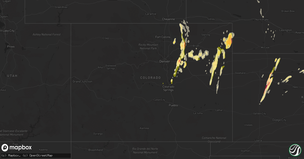
Hail Map in Colorado on May 7, 2016
Get this storm
May 7 map
$229
one time, instant access
Download today. No call, no setup
Keep the $229
Bought the map and want the full workflow? Apply the entire $229 to a subscription within 7 days. None of it is wasted.
Every map, not just this one
This buys you this map. Subscription and you get every map we run, in the markets you choose from a few cities to whole states to nationwide. Plus real-time alerts the moment a storm fires.
Contact data
Name, contact info, occupancy, even credit band for addresses in the footprint. You go from where it hit to who to call.
Become the source they trust
Unlimited branding weather history reports on demand. You already have the documented answer ready for the property owner, and you are the one who showed up with it.
Property data and RoofTrace estimates
Pull up any address you have got, its value and the exact code rules for that jurisdiction, straight from One Click Code. Then RoofTrace estimates the squares, pitch, and roof value, priced the way you price.
Storm reports in Colorado
Colorado
| Date | Description |
|---|---|
| 05/07/20166:54 PM CDT | On north side of town. |
| 05/07/20166:41 PM CDT | Lasted 2 minutes then dissipated. Crossed cr 32 a quarter mile west of highway 385. |
| 05/07/20166:36 PM CDT | Lifted after two minutes. |
| 05/07/20166:32 PM CDT | A local report indicates 1.00 inch wind near 4 WNW VERNON |
| 05/07/20166:01 PM CDT | A local report indicates a tornado near 7 NNE ECKLEY |
| 05/07/20166:01 PM CDT | Last 4 minutes. Corrected distance. Tornado at county road w and county road 48. |
| 05/07/20165:32 PM CDT | A local report indicates 1.00 inch wind near 2 E ECKLEY |
| 05/07/20165:19 PM CDT | A local report indicates 1.00 inch wind near 3 ESE YUMA |
| 05/07/20165:15 PM CDT | Lasted 5 minutes. |
| 05/07/20165:14 PM CDT | Brief tornado. |
| 05/07/20165:00 PM CDT | Lasted about 5 minutes. |
| 05/07/20164:54 PM CDT | A local report indicates 1.00 inch wind near ABARR |
| 05/07/20164:50 PM CDT | Hail lasted 20 minutes. Was soft. |
| 05/07/20164:28 PM CDT | A local report indicates 1.00 inch wind near 8 N JOES |
| 05/07/20164:27 PM CDT | A local report indicates 1.25 inch wind near 4 WNW JOES |
| 05/07/20164:26 PM CDT | Rain wrapped tornado south of highway 14 |
| 05/07/20164:13 PM CDT | Tornado on the ground on state road 2 near jackson lake |
| 05/07/20164:00 PM CDT | Confirmed multi-vortex tornado over interstate 76 |
| 05/07/20163:45 PM CDT | Lasted 15 minutes. Hail started out as pea size. |
| 05/07/20163:45 PM CDT | Wind was strong enough to blow a person over. Occurred same time as quarter size hail and lasted for 15 minutes. |
| 05/07/20163:10 PM CDT | A local report indicates 2.50 inch wind near 1 NW STRASBURG |
| 05/07/20163:02 PM CDT | A local report indicates 1.50 inch wind near 1 WNW STRASBURG |
| 05/07/20163:00 PM CDT | Wind gusts to 55 mph |
| 05/07/20163:00 PM CDT | A local report indicates 1.75 inch wind near 2 S STRASBURG |
| 05/07/20162:50 PM CDT | A local report indicates 1.75 inch wind near 3 WSW COUNTRY GARDENS |
| 05/07/20162:44 PM CDT | A local report indicates 1.00 inch wind near 1 WNW WOODLAND PARK |
| 05/07/20162:09 PM CDT | A local report indicates 1.00 inch wind near 3 W KIOWA |
| 05/07/20161:46 PM CDT | A local report indicates 1.00 inch wind near 2 E BLACK FOREST |
| 05/07/20161:29 PM CDT | A local report indicates 1.50 inch wind near 3 N BLACK FOREST |
| 05/06/20168:15 PM CDT | A local report indicates 1.75 inch wind near 6 SE HOLYOKE |
| 05/06/20168:00 PM CDT | Us 385 closed in both direction... Between holyoke and wray in yuma county due to downed power lines. |
| 05/06/20167:49 PM CDT | A local report indicates 1.00 inch wind near 3 N ALVIN |
| 05/06/20167:34 PM CDT | Mobile home destroyed an unknown distance north of wray. |
| 05/06/20167:30 PM CDT | A local report indicates 1.25 inch wind near SSE WAUNETA |
| 05/06/20167:30 PM CDT | A local report indicates 2.50 inch wind near 4 NW ALVIN |
| 05/06/20167:16 PM CDT | Two tornadoes roughly 7 miles north of wray. Second tornado lasted 2 minutes then both tornadoes lifted at same time. |
| 05/06/20167:16 PM CDT | Delayed report. Tornado produced path of damage from north of wray to 10 nne of wray before lifting. This may replace the location of the earlier report of 7 n of wray |
| 05/06/20167:10 PM CDT | Tornado flipped tractors and destroyed outbuildings. |
| 05/06/20167:08 PM CDT | Tornado damage observed 2 miles north of wray including roof damage to house and power lines down. |
| 05/06/20167:05 PM CDT | Continuing on northeast from town. |
| 05/06/20167:00 PM CDT | Hail between 1800 and 1830 local time. |
All States Impacted by Hail Map on May 7, 2016
Cities Impacted by Hail Map on May 7, 2016
- Taylorsville, KY
- Fisherville, KY
- Louisville, KY
- Weldona, CO
- Palco, KS
- Ellis, KS
- Farnam, NE
- Floyds Knobs, IN
- Georgetown, IN
- Coshocton, OH
- Beecher City, IL
- Woodrow, CO
- Akron, CO
- Wray, CO
- Vernon, CO
- Eckley, CO
- Agate, CO
- Deer Trail, CO
- Gove, KS
- Grainfield, KS
- Scott City, KS
- Ramah, CO
- Bennett, CO
- Holyoke, CO
- Amherst, CO
- Strasburg, CO
- Cowden, IL
- Ramsey, IL
- Robinson, IL
- Martinsville, IL
- Annapolis, IL
- Palestine, IL
- Hutsonville, IL
- Carlisle, IN
- Merom, IN
- West York, IL
- Flat Rock, IL
- Alton, KS
- Kersey, CO
- Roggen, CO
- Wiggins, CO
- Orchard, CO
- Park, KS
- Norton, KS
- Clayton, KS
- Fort Morgan, CO
- Byers, CO
- Flagler, CO
- Greenfield, IL
- Palmyra, IN
- Greenville, IN
- New Salisbury, IN
- Champion, NE
- Kit Carson, CO
- Bicknell, IN
- Wheatland, IN
- Bruceville, IN
- Washington, IN
- Loogootee, IN
- Cannelburg, IN
- Montgomery, IN
- Vincennes, IN
- Healy, KS
- Dighton, KS
- Gill, CO
- La Salle, CO
- Greeley, CO
- Eaton, CO
- Cope, CO
- Roodhouse, IL
- White Hall, IL
- Hoxie, KS
- Plymouth, OH
- Shelby, OH
- Republic, OH
- Mansfield, OH
- Tiro, OH
- Willard, OH
- Attica, OH
- New Washington, OH
- Yuma, CO
- Seibert, CO
- Vona, CO
- Anton, CO
- Joes, CO
- Carpenter, WY
- Lenora, KS
- Elbert, CO
- Maywood, NE
- Wellfleet, NE
- North Platte, NE
- Hereford, CO
- Grover, CO
- Briggsdale, CO
- Elizabeth, IN
- Lanesville, IN
- Carrollton, IL
- Rockbridge, IL
- Portis, KS
- Woodston, KS
- Osborne, KS
- Downs, KS
- Gaylord, KS
- Bingham, IL
- Elizabeth, CO
- Oakley, KS
- Rexford, KS
- New Raymer, CO
- Effingham, IL
- Montrose, IL
- Wheeler, IL
- Newton, IL
- Teutopolis, IL
- Perrysville, OH
- Arnett, OK
- Mcadoo, TX
- Crete, IL
- Beecher, IL
- Tahoka, TX
- Oblong, IL
- Stratton, CO
- Irving, IL
- Witt, IL
- Brush, CO
- Loudonville, OH
- Grinnell, KS
- Selden, KS
- Morland, KS
- Moorefield, NE
- Milltown, IN
- Marengo, IN
- Norcatur, KS
- Ogallah, KS
- Plainville, KS
- Coxs Creek, KY
- Jennings, KS
- Depauw, IN
- Larkspur, CO
- Colorado Springs, CO
- Millersburg, OH
- Killbuck, OH
- Maxwell, NE
- Ransom, KS
- Shiloh, OH
- Wakeeney, KS
- Hidalgo, IL
- Litchfield, IL
- English, IN
- Louisiana, MO
- Clarksville, MO
- Bowling Green, MO
- Wilson, TX
- Farber, MO
- Kiowa, CO
- Campbellsburg, IN
- Jewett, IL
- Haxtun, CO
- Kane, IL
- Fieldon, IL
- Jerseyville, IL
- Arriba, CO
- Venango, NE
- Oaktown, IN
- Kirk, CO
- Tryon, NE
- Sumner, IL
- Lawrenceville, IL
- Bridgeport, IL
- Shumway, IL
- Stockton, KS
- Plainville, IN
- Odon, IN
- Bushnell, NE
- Joliet, IL
- Pine Bluffs, WY
- Brownell, KS
- Fairdale, KY
- Corydon, IN
- Westminster, CO
- Broomfield, CO
- Stockville, NE
- Glenmont, OH
- Mankato, KS
- Mount Washington, KY
- Monroe City, IN
- Cameron, WV
- Esbon, KS
- Collyer, KS
- Ashland, OH
- Lucas, OH
- Dow, IL
- Lindon, CO
- Laddonia, MO
- Julesburg, CO
- Minneapolis, KS
- Nilwood, IL
- Raymond, IL
- Ramsey, IN
- Hillsboro, IL
- Woodland Park, CO
- Quinter, KS


