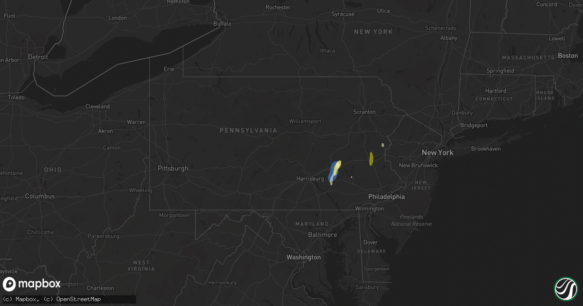
Hail Map in Pennsylvania on May 6, 2025
Get this storm
May 6 map
$229
one time, instant access
Download today. No call, no setup
Keep the $229
Bought the map and want the full workflow? Apply the entire $229 to a subscription within 7 days. None of it is wasted.
Every map, not just this one
This buys you this map. Subscription and you get every map we run, in the markets you choose from a few cities to whole states to nationwide. Plus real-time alerts the moment a storm fires.
Contact data
Name, contact info, occupancy, even credit band for addresses in the footprint. You go from where it hit to who to call.
Become the source they trust
Unlimited branding weather history reports on demand. You already have the documented answer ready for the property owner, and you are the one who showed up with it.
Property data and RoofTrace estimates
Pull up any address you have got, its value and the exact code rules for that jurisdiction, straight from One Click Code. Then RoofTrace estimates the squares, pitch, and roof value, priced the way you price.
Storm reports in Pennsylvania
Pennsylvania
| Date | Description |
|---|---|
| 05/06/20254:05 PM CDT | Trained spotter relays report of mostly small sized hail mixed in with some to quarters. Time estimated from radar. |
| 05/06/20253:45 PM CDT | Photo via social media of a large tree down blocking both lanes of pa route 512 between east bangor and mount bethel. Time estimated from radar. |
| 05/06/20253:28 PM CDT | Large tree down over half of the road. Radar-estimated time. |
| 05/06/20253:20 PM CDT | Also noted tree limbs down. |
| 05/06/20253:15 PM CDT | Tree down over wires. Radar-estimated time. |
| 05/06/20253:01 PM CDT | Tree down on a car along route 501 near the intersection with route 322. |
| 05/06/20252:51 PM CDT | Reports of minor trees and lines down along route 191 near bangor. Time estimated. |
| 05/06/20252:51 PM CDT | Several videos received via social media confirm a tornado occurred near route 191 south of bangor. Time estimated. |
| 05/06/20252:49 PM CDT | Em relays report of trees down in the area with damage near flicksville rd. Time estimated from radar. |
| 05/06/20252:47 PM CDT | An ef1 tornado with estimated maximum wind speeds of 80 to 90 mph occurred near bangor. The first damage was noted at a public works barn. Damage in this area was consi |
| 05/06/20251:51 PM CDT | Trees down on power lines along mill road in mahoning twp. Time estimated from radar. |
| 05/06/20251:30 PM CDT | Tree down blocking a lane of highway 6. Radar-estimated time. |
| 05/06/20251:25 PM CDT | Multiple trees and wires down along orchard rd. Time estimated from radar. |
| 05/06/20251:18 PM CDT | Alsace township: snyder rd and antietam rd. Tree down. Time estimated from radar. |
| 05/06/202512:43 PM CDT | Report of a large tree down blocking the roadway near the intersection of upland road and byrd road in marlborough twp. Time estimated from radar. |
| 05/06/202512:42 PM CDT | Microburst produced localized damage consisting of several snapped/downed pine trees. Peak estimated winds of 70-80 mph. |
| 05/06/202512:31 PM CDT | Tree blocking pa-183 south of summit station. |
| 05/06/202512:18 PM CDT | Broadcast media relays report of tree down on route 183. Time estimated from radar. |
| 05/06/202512:13 PM CDT | Quarter size hail falling at time of report. |
| 05/06/202512:03 PM CDT | Tree on wires in myerstown in the 300 block of south cherry street. |
All States Impacted by Hail Map on May 6, 2025
Cities Impacted by Hail Map on May 6, 2025
- Cisco, TX
- Cross Plains, TX
- Brownwood, TX
- Fredericksburg, TX
- Rising Star, TX
- Rocksprings, TX
- Stonewall, TX
- Carbon, TX
- Johnson City, TX
- Round Mountain, TX
- Clifton, TX
- Sonora, TX
- Cleburne, TX
- Rio Vista, TX
- Horseshoe Bay, TX
- Marble Falls, TX
- Llano, TX
- Meridian, TX
- Joshua, TX
- Burleson, TX
- Keene, TX
- Spicewood, TX
- Fort Worth, TX
- Bertram, TX
- Liberty Hill, TX
- Brackettville, TX
- Leander, TX
- Fredonia, TX
- Voca, TX
- Richland Springs, TX
- San Saba, TX
- Haltom City, TX
- Junction, TX
- Colleyville, TX
- Keller, TX
- Roanoke, TX
- Argyle, TX
- Justin, TX
- Flower Mound, TX
- Denton, TX
- Brownsboro, TX
- Boerne, TX
- Comfort, TX
- Crowley, TX
- Italy, TX
- Waxahachie, TX
- Milford, TX
- North Richland Hills, TX
- Southlake, TX
- Hurst, TX
- Jarrell, TX
- Georgetown, TX
- Florence, TX
- Leakey, TX
- Camp Wood, TX
- Lancaster, TX
- Salado, TX
- Hye, TX
- Mount Calm, TX
- Coolidge, TX
- Hunt, TX
- Blooming Grove, TX
- Frost, TX
- Holland, TX
- Cresson, TX
- Granbury, TX
- Dawson, TX
- Hubbard, TX
- Dallas, TX
- Bartlett, TX
- Belton, TX
- Mesquite, TX
- Dublin, TX
- Balch Springs, TX
- Rogers, TX
- Temple, TX
- Garland, TX
- Vanderpool, TX
- Ennis, TX
- Little River Academy, TX
- Purdon, TX
- Sunnyvale, TX
- Wortham, TX
- Rowlett, TX
- Barry, TX
- Corsicana, TX
- Lindale, TX
- Winnsboro, TX
- Chandler, TX
- Richland, TX
- Crowley, LA
- Estherwood, LA
- Gueydan, LA
- Morse, LA
- Sachse, TX
- Wylie, TX
- Richardson, TX
- Plano, TX
- Leesburg, TX
- Pittsburg, TX
- Gilmer, TX
- Scroggins, TX
- Rayne, LA
- Branch, LA
- Church Point, LA
- Burlington, TX
- Grand Chenier, LA
- Creole, LA
- Dripping Springs, TX
- Rockwall, TX
- Allen, TX
- Knippa, TX
- Uvalde, TX
- Rosebud, TX
- Lott, TX
- Egan, LA
- Hawkins, TX
- Princeton, TX
- Kaplan, LA
- Powell, TX
- Crystal City, TX
- Nevada, TX
- Mount Vernon, TX
- Mount Pleasant, TX
- Winfield, TX
- Duson, LA
- Cedar Park, TX
- Mckinney, TX
- Forreston, TX
- Round Rock, TX
- Austin, TX
- New Iberia, LA
- Granger, TX
- Farmersville, TX
- La Pryor, TX
- Batesville, TX
- Saint Martinville, LA
- Lafayette, LA
- Blanco, TX
- Reagan, TX
- Manheim, PA
- Washington, LA
- Plaucheville, LA
- Palmetto, LA
- Bunkie, LA
- Maurice, LA
- Taylor, TX
- Marlin, TX
- Loreauville, LA
- Bremond, TX
- Thorndale, TX
- Buckholts, TX
- Kosse, TX
- Lebanon, PA
- Thrall, TX
- Coupland, TX
- Talco, TX
- Simmesport, LA
- Myerstown, PA
- Marshall, TX
- Rockdale, TX
- Cameron, TX
- Davilla, TX
- Waskom, TX
- Avery, TX
- Annona, TX
- Lettsworth, LA
- Bethel, PA
- Rehrersburg, PA
- Richland, PA
- Bernville, PA
- Womelsdorf, PA
- Monterey, LA
- D Hanis, TX
- Batchelor, LA
- Woodville, MS
- Jeanerette, LA
- Yancey, TX
- Hondo, TX
- Devine, TX
- Karnack, TX
- Vivian, LA
- Mooringsport, LA
- Jacksonville, TX
- Schuylkill Haven, PA
- Rusk, TX
- Auburn, PA
- Pine Grove, PA
- Tyler, TX
- Flint, TX
- Elgin, TX
- Oil City, LA
- Bullard, TX
- Crosby, MS
- Gloster, MS
- Natchez, MS
- Linden, TX
- Jefferson, TX
- Atlanta, TX
- Lexington, TX
- Marquez, TX
- Rodessa, LA
- Bivins, TX
- Ida, LA
- Franklin, TX
- Plaquemine, LA
- Whitehouse, TX
- Milano, TX
- Caldwell, TX
- Grosse Tete, LA
- Hosston, LA
- Castroville, TX
- La Coste, TX
- Doddridge, AR
- Reading, PA
- Larue, TX
- De Berry, TX
- Buffalo, TX
- Jewett, TX
- Roxie, MS
- Oakwood, TX
- Centerville, TX
- Bradley, AR
- Fouke, AR
- Gause, TX
- White Castle, LA
- Shreveport, LA
- Elkhart, TX
- Bryan, TX
- Hearne, TX
- Gilliam, LA
- Normangee, TX
- Leona, TX
- Plain Dealing, LA
- Benton, LA
- Grapeland, TX
- Elm Grove, LA
- Taylor, AR
- Haughton, LA
- Coushatta, LA
- Grand Cane, LA
- Barton, NY
- Nichols, NY
- Owego, NY
- Roswell, NM
- Doyline, LA
- Bossier City, LA
- Saint Gabriel, LA
- Gloster, LA
- Frierson, LA
- Madisonville, TX
- Midway, TX
- Carville, LA
- Heflin, LA
- Sibley, LA
- Crockett, TX
- Alto, TX
- Newark Valley, NY
- Berkshire, NY
- Hall Summit, LA
- Ringgold, LA
- Cushing, TX
- Minden, LA
- Candor, NY
- Sunshine, LA
- Baton Rouge, LA
- Athens, LA
- Somerville, TX
- El Dorado, AR
- Lovelady, TX
- Denham Springs, LA
- Prairieville, LA
- College Station, TX
- Snook, TX
- Pollock, LA
- Homer, LA
- Gibsland, LA
- Ashland, LA
- Saline, LA
- Jonesboro, LA
- Gonzales, TX
- Waelder, TX
- Pen Argyl, PA
- Bangor, PA
- Nazareth, PA
- Keithville, LA
- Harwood, TX
- Iola, TX
- Immokalee, FL
- Castor, LA
- Smithville, TX
- Flatonia, TX
- Jena, LA
- Bienville, LA
- Kennard, TX
- Walker, LA
- Livingston, LA
- Newmanstown, PA
- Lititz, PA
- Schaefferstown, PA
- Fredericksburg, PA
- Jonesville, LA
- West Monroe, LA
- Chatham, LA
- Sikes, LA
- Anderson, TX
- Orange, TX
- West Point, TX
- La Grange, TX
- Muldoon, TX
- Olla, LA
- Bernice, LA
- Summerfield, LA
- Eros, LA
- Giddings, TX
- Rayville, LA
- Cost, TX
- Columbia, LA
- Navasota, TX
- Henderson, NV
- Bedias, TX
- Ferriday, LA
- Friona, TX
- Hereford, TX
- Starks, LA
- Vinton, LA
- Vidalia, LA
- Mangham, LA
- Oak Ridge, LA
- Holden, LA
- Albany, LA
- Springfield, LA
- Dequincy, LA
- Shiner, TX
- Labelle, FL
- Sulphur, LA
- Schulenburg, TX
- Fayetteville, TX
- Round Top, TX
- Moulton, TX
- Red Oak, TX
- Dodson, LA
- Alva, FL
- Maypearl, TX
- Palmer, TX
- Dimmitt, TX
- Centreville, MS
- Liberty, MS
- Clewiston, FL
- Kenansville, FL
- Richards, TX
- Westlake, LA
- Lake Charles, LA
- Moore Haven, FL
- Florien, LA
- Smithdale, MS
- Okeechobee, FL
- Iowa, LA
- Washington, TX
- Kinder, LA
- Glen Spey, NY
- Matamoras, PA
- Millrift, PA
- Milford, PA
- Sparrow Bush, NY
- Weimar, TX
- Ragley, LA
- Columbus, TX
- Laughlin, NV
- Cal Nev Ari, NV
- Elton, LA
- Singer, LA
- Vero Beach, FL
- Jamestown, LA
- Dubberly, LA
- Arcadia, LA
- Quitman, LA
- Simsboro, LA
- Ruston, LA
- Grambling, LA
- Choudrant, LA
- Downsville, LA
- Monroe, LA
- Calhoun, LA
- Collinston, LA
- Farmerville, LA
- Sterlington, LA
- Summit, MS
- Nipton, CA
- Welsh, LA
- Roanoke, LA
- Lake Wales, FL
- Jennings, LA
- Hallettsville, TX
- Searchlight, NV
- Jean, NV
- Merryville, LA
- Woodridge, NY
- Fallsburg, NY
- Hart, TX
- Epps, LA
- Delhi, LA
- Baskin, LA
- Sondheimer, LA
- Tallulah, LA
- Bell City, LA
- Idalou, TX
- Lorida, FL
- Oakland, TX
- Basile, LA
- Iota, LA
- Lorenzo, TX
- Ralls, TX
- Fort Mohave, AZ
- Bullhead City, AZ
- Kress, TX
- Lake Placid, FL
- Venus, FL
- Eunice, LA
- Mohave Valley, AZ
- Plainview, TX
- Abernathy, TX
- Hale Center, TX
- Cuero, TX
- Olton, TX
- Lacassine, LA
- Lake Arthur, LA
- Cameron, LA
- Fort Meade, FL
- Scott, LA
- Crosbyton, TX
- Sunset, LA
- Carencro, LA
- Arnaudville, LA
- Beeville, TX
- Kenedy, TX
- Brookshire, TX
- Sealy, TX
- Bowling Green, FL
- Dickens, TX
- Opelousas, LA
- Breaux Bridge, LA
- Mcadoo, TX
- Yorktown, TX
- Freer, TX
- George West, TX
- Mermentau, LA
- Katy, TX
- Goliad, TX
- Garwood, TX
- Roma, TX
- Cypress, TX
- Houston, TX
- Laredo, TX
- Mirando City, TX
- Spur, TX
- Maringouin, LA
- Bruni, TX
- Rosedale, LA
- Port Allen, LA
- Orange Grove, TX
- Richmond, TX
- Geismar, LA
- Sandia, TX
- Addis, LA
- Brusly, LA
- Gonzales, LA
- San Ygnacio, TX
- Zapata, TX
- Hebbronville, TX
- Victoria, TX
- Mathis, TX
- Abbeville, LA
- Bloomington, TX
- Inez, TX
- Edna, TX
- Sinton, TX
- Odem, TX
- Donaldsonville, LA
- Youngsville, LA
- Lolita, TX
- Needles, CA
- Delcambre, LA
- Erath, LA
- Franklin, LA
- Allentown, PA
- Emmaus, PA
- Center Valley, PA
- Coopersburg, PA
- Macungie, PA
- Zionsville, PA
- Whitehall, PA
- Bethlehem, PA
- Bath, PA
- Coplay, PA
- Northampton, PA
- Catasauqua, PA
- Eagle Pass, TX
- Carrizo Springs, TX
- Encino, TX
- Falfurrias, TX
- Sarita, TX
- Riviera, TX
- San Diego, TX
- Kingsville, TX
- Guerra, TX
- Asherton, TX
- Concepcion, TX
- Realitos, TX
- Cotulla, TX
- Las Vegas, NV
- Premont, TX
- Port Arthur, TX
- Seadrift, TX
- Port O'Connor, TX
- Bay City, TX
- Palacios, TX
- Port Lavaca, TX
- Danbury, TX
- Freeport, TX
- Liverpool, TX
- Galveston, TX
- Hitchcock, TX
- Baldwin, LA


