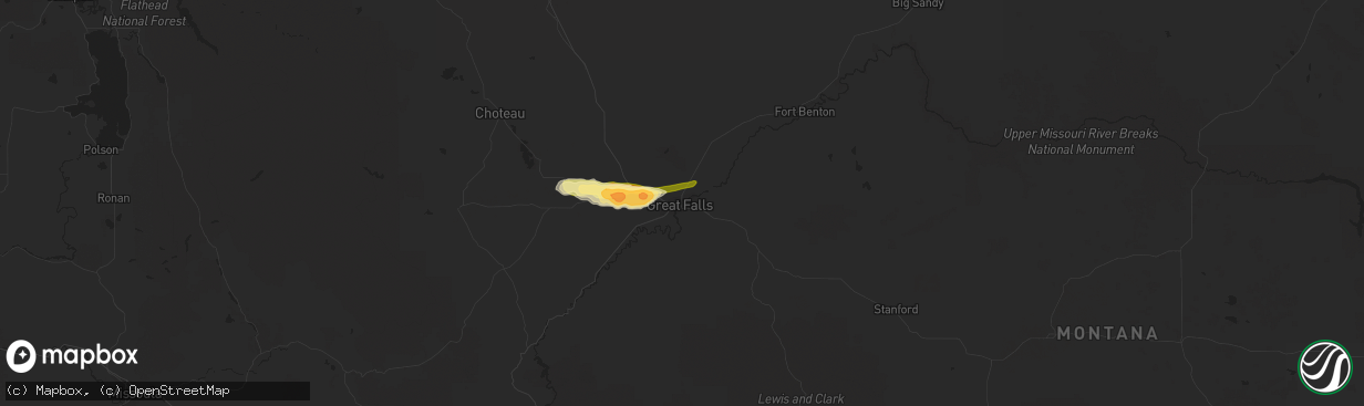
Hail Map in Great Falls, MT on May 4, 2014
The weather event in Great Falls, MT on May 4, 2014 includes Hail map. 1 state and 6 cities were impacted and suffered possible damage. The total estimated number of properties impacted is 891.
Hail
891
Estimated number of impacted properties by a 1.00" hail or larger716
Estimated number of impacted properties by a 1.75" hail or larger0
Estimated number of impacted properties by a 2.50" hail or largerStorm reports in Great Falls, MT
Great Falls, MT
| Date | Description |
|---|---|
| 05/04/20145:00 PM CDT | Quarter sized hail reported on u.s. Highway 87 6 miles northeast of great falls. |
| 05/04/20144:40 PM CDT | A local report indicates 1.00 inch wind near GREAT FALLS |
| 05/04/20144:38 PM CDT | A local report indicates 1.00 inch wind near 2 NW GREAT FALLS |
| 05/04/20144:37 PM CDT | A local report indicates 1.00 inch wind near 2 ENE GREAT FALLS |
| 05/04/20144:20 PM CDT | A local report indicates 1.75 inch wind near SUN PRAIRIE |


