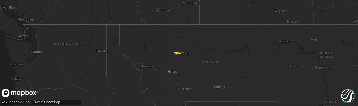
Hail Map on May 4, 2014
The weather event on May 4, 2014 includes Hail map. 1 state and 6 cities were impacted and suffered possible damage. The total estimated number of properties impacted is 1,977.
Want more than just the map?
Turn this storm into a full workflow.
- Owner + property data so you know who to knock
- OnDemand branded weather history reports to win the "did we even have hail?" argument
- RoofTrace estimate so reps stop guessing numbers at the door
Bought this map? Upgrade within 7 days and we'll credit the $230. (10-15 min setup call)
Hail
1,977
Estimated number of impacted properties by a 1.00" hail or larger1,350
Estimated number of impacted properties by a 1.75" hail or larger0
Estimated number of impacted properties by a 2.50" hail or largerStates Impacted by Hail Map on May 4, 2014
Storm reports
Montana
| Date | Description |
|---|---|
| 05/04/20145:00 PM CDT | Quarter sized hail reported on u.s. Highway 87 6 miles northeast of great falls. |
| 05/04/20144:40 PM CDT | A local report indicates 1.00 inch wind near GREAT FALLS |
| 05/04/20144:38 PM CDT | A local report indicates 1.00 inch wind near 2 NW GREAT FALLS |
| 05/04/20144:37 PM CDT | A local report indicates 1.00 inch wind near 2 ENE GREAT FALLS |
| 05/04/20144:21 PM CDT | A local report indicates 1.75 inch wind near VAUGHN |
| 05/04/20144:20 PM CDT | A local report indicates 1.75 inch wind near SUN PRAIRIE |
| 05/04/20144:04 PM CDT | A local report indicates 1.00 inch wind near FORT SHAW |