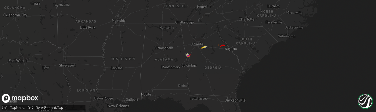
Hail Map on April 28, 2013
The weather event on April 28, 2013 includes Hail map. 3 states and 18 cities were impacted and suffered possible damage. The total estimated number of properties impacted is 12,424.
Want more than just the map?
Turn this storm into a full workflow.
- Owner + property data so you know who to knock
- OnDemand branded weather history reports to win the "did we even have hail?" argument
- RoofTrace estimate so reps stop guessing numbers at the door
Bought this map? Upgrade within 7 days and we'll credit the $230. (10-15 min setup call)
Hail
12,424
Estimated number of impacted properties by a 1.00" hail or larger19,128
Estimated number of impacted properties by a 1.75" hail or larger10,030
Estimated number of impacted properties by a 2.50" hail or largerStorm reports
Texas
| Date | Description |
|---|---|
| 04/28/20131:25 PM CDT | Two poorly constructed mobile homes had roofs ripped off and are now unihabitable. 9 residents have been displaced. Location of mobile homes a quarter mile east from th |
| 04/28/20131:25 PM CDT | Two poorly constructed mobile homes had roofs ripped off and are now unihabitable. 9 residents have been displaced. Location of mobile homes is 1 4 mile east from the i |
| 04/28/20131:19 PM CDT | Employee reports tree limb blown down. Wind gusts estimated at 50 to 60 mph. |
| 04/28/201312:50 PM CDT | Communication tower knocked down by strong winds near la paloma. |
| 04/28/201312:20 PM CDT | Tree blown down causing damage to carport. 800 block of 8th street near the intersection of 8th street and s. Col. Rowe blvd. Nearby kmfe asos reported 42 kt wind gust. |
| 04/27/20137:30 PM CDT | A local report indicates 1.50 inch wind near 1 SE SANDERSON |
| 04/27/20137:30 PM CDT | Sporadic 3/4 to 1 1/4 inch hailstones falling. |
Iowa
| Date | Description |
|---|---|
| 04/28/20135:24 AM CDT | Spotter in fort dodge reports hail a little larger than quarters. |
Georgia
| Date | Description |
|---|---|
| 04/28/20135:10 PM CDT | Numerous limbs along with several large limbs down at winfield corps campground. Dime size hail was also reported. Tstm wnd dmg duration 2 minutes |
| 04/28/20134:51 PM CDT | Media relayed a report of a tree down in warner robins. |
| 04/28/20134:42 PM CDT | Em relayed a report of 4 trees down across southern crawford county. |
| 04/28/20134:05 PM CDT | One tree and several powerlines down with 15 homes without power. This was near the center of town on troke drive off hwy 47. |
| 04/28/20133:55 PM CDT | Quarter size hail reported southwest of washington. |
| 04/28/20133:55 PM CDT | Media relayed a report of four trees down in oglethorpe. One tree fell on a car. |
| 04/28/20133:47 PM CDT | Emergency manager reported one tree down near union point. |
| 04/28/20132:56 PM CDT | The public relayed a report of quarter sized hail in covington. |
| 04/28/20132:43 PM CDT | A series of reports were received from the public from locations extending from sw covington through covington. |
| 04/28/20132:30 PM CDT | One large oak tree down along ga hwy 20 about 5 miles east of mcdonough. |
| 04/28/20132:20 PM CDT | A weak ef-0 tornado touched down at turner church road and north ola road. A tree was downed at that location. The tornado then lifted and touched down in the sleepy ho |
| 04/28/20131:56 PM CDT | Public relayed a report of baseball sized hail and damage to windows...cars and roofs. |
| 04/28/20131:55 PM CDT | Several public sources reported quarter to golf ball size hail covering the ground in lagrange. |
| 04/28/201312:32 PM CDT | Emergency manager relayed a report of trees down in the martin mill road area. A garage was also reported as significantly damaged. |
| 04/28/201312:30 PM CDT | A nws damage survey team determined than an ef0 tornado with maximum winds of 85 mph touched down just east of moreland near martin mill rd and windom dr. The majority |
South Carolina
| Date | Description |
|---|---|
| 04/28/20136:47 PM CDT | Nws storm survey revealed a weak tornado occurred...producing damage on mood harrison rd. About 6 trees were toppled...and several large limbs were downed. The antenna |
| 04/28/20135:40 PM CDT | Trees down on us 378 and callison highway reported by highway patrol. |