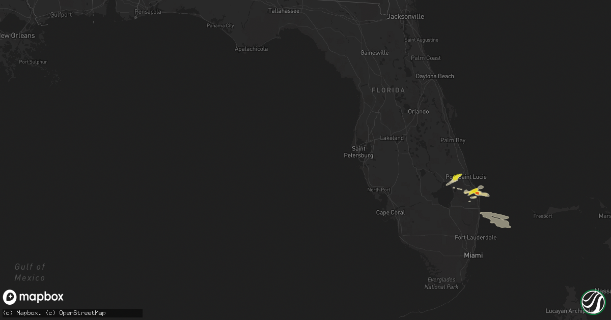
Hail Map in Florida on April 24, 2018
Get this storm
April 24 map
$229
one time, instant access
Download today. No call, no setup
Keep the $229
Bought the map and want the full workflow? Apply the entire $229 to a subscription within 7 days. None of it is wasted.
Every map, not just this one
This buys you this map. Subscription and you get every map we run, in the markets you choose from a few cities to whole states to nationwide. Plus real-time alerts the moment a storm fires.
Contact data
Name, contact info, occupancy, even credit band for addresses in the footprint. You go from where it hit to who to call.
Become the source they trust
Unlimited branding weather history reports on demand. You already have the documented answer ready for the property owner, and you are the one who showed up with it.
Property data and RoofTrace estimates
Pull up any address you have got, its value and the exact code rules for that jurisdiction, straight from One Click Code. Then RoofTrace estimates the squares, pitch, and roof value, priced the way you price.
Storm reports in Florida
Florida
| Date | Description |
|---|---|
| 04/24/20182:10 PM CDT | Public reported golf ball sized hail at the river ridge community in tequesta off county line road. |
| 04/24/20181:25 PM CDT | Trained spotter reported quarter size and larger hail in hobe sound. |
| 04/24/20187:36 AM CDT | At 1236 PM EDT, a severe thunderstorm was located over Fort Pierce South, or near White City, moving northeast at 20 mph. HAZARD...60 mph wind gusts and penny size hail. SOURCE...Radar indicated. IMPACT...Expect damage to roofs, siding, and trees. Locations impacted include... Fort Pierce, White City, Indrio, Saint Lucie Nuclear Power Plant and Fort Pierce Inlet. |
| 04/23/20189:40 PM CDT | At 240 PM EDT, a severe thunderstorm was located 7 miles west of Jonathan Dickinson State Park, or 7 miles southwest of Hobe Sound, moving east to northeast at 15 mph. HAZARD...60 mph wind gusts and quarter size hail. SOURCE...Radar indicated. IMPACT...Hail damage to vehicles is expected. Expect wind damage to roofs, siding, and trees. Locations impacted include... Stuart, Tequesta, Jupiter Island, Palm City and Hobe Sound. |
| 04/23/20189:12 PM CDT | At 212 PM EDT, a severe thunderstorm was located near Indiantown, moving east at 20 mph. HAZARD...70 mph wind gusts and quarter size hail. SOURCE...Radar indicated. IMPACT...Hail damage to vehicles is expected. Expect considerable tree damage. Wind damage is also likely to mobile homes, roofs, and outbuildings. Locations impacted include... Port Saint Lucie, Indiantown and Palm City. |
| 04/23/20189:08 PM CDT | At 208 PM EDT, a severe thunderstorm was located over Tradition, or 7 miles west of Port Saint Lucie, moving northeast at 30 mph. HAZARD...60 mph wind gusts and quarter size hail. SOURCE...Radar indicated. IMPACT...Hail damage to vehicles is expected. Expect wind damage to roofs, siding, and trees. Locations impacted include... Port Saint Lucie, Fort Pierce, White City, Saint Lucie Nuclear Power Plant and Fort Pierce Inlet. |
| 04/23/20188:55 PM CDT | At 154 PM EDT, a severe thunderstorm was located 8 miles north of North County Airport, or 10 miles southwest of Hobe Sound, moving northeast at 20 mph. HAZARD...60 mph wind gusts and nickel size hail. SOURCE...Radar indicated. IMPACT...Expect damage to roofs, siding, and trees. Locations impacted include... Tequesta, Jupiter Island, Hobe Sound, Port Salerno and Hobe Sound Beach. |
| 04/23/20188:31 PM CDT | At 130 PM EDT, a severe thunderstorm was located near J And S Fish Camp, moving east at 20 mph. HAZARD...60 mph wind gusts and nickel size hail. SOURCE...Radar indicated. IMPACT...Expect damage to roofs, siding, and trees. Locations impacted include... J And S Fish Camp and Tradition. |
All States Impacted by Hail Map on April 24, 2018
Cities Impacted by Hail Map on April 24, 2018
- Hobe Sound, FL
- Jupiter, FL
- Westbrook, TX
- Coahoma, TX
- Bronte, TX
- Palm Beach Gardens, FL
- Idalou, TX
- Lubbock, TX
- Miles, TX
- Roscoe, TX
- Mount Pleasant, NC
- Albemarle, NC
- Port Saint Lucie, FL
- Okeechobee, FL
- Ovalo, TX
- Stuart, FL
- Indiantown, FL
- Slaton, TX
- Lorenzo, TX
- Loxahatchee, FL
- West Palm Beach, FL
- Post, TX
- Palm Beach, FL
- Lake Worth, FL
- Colorado City, TX
- Coleman, TX
- Talpa, TX
- Nolan, TX
- Loraine, TX
- Gold Hill, NC
- Roby, TX
- Rotan, TX
- Maxton, NC
- Red Springs, NC
- Shannon, NC
- Richfield, NC


