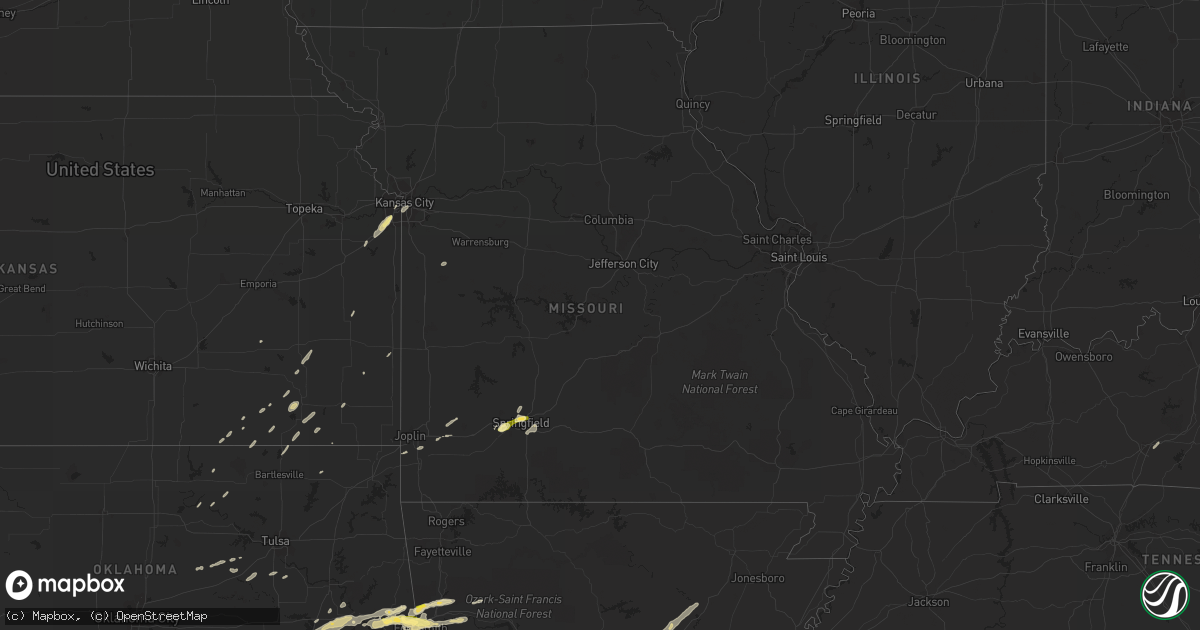
Hail Map in Missouri on April 24, 2014
Get this storm
April 24 map
$229
one time, instant access
Download today. No call, no setup
Keep the $229
Bought the map and want the full workflow? Apply the entire $229 to a subscription within 7 days. None of it is wasted.
Every map, not just this one
This buys you this map. Subscription and you get every map we run, in the markets you choose from a few cities to whole states to nationwide. Plus real-time alerts the moment a storm fires.
Contact data
Name, contact info, occupancy, even credit band for addresses in the footprint. You go from where it hit to who to call.
Become the source they trust
Unlimited branding weather history reports on demand. You already have the documented answer ready for the property owner, and you are the one who showed up with it.
Property data and RoofTrace estimates
Pull up any address you have got, its value and the exact code rules for that jurisdiction, straight from One Click Code. Then RoofTrace estimates the squares, pitch, and roof value, priced the way you price.
Storm reports in Missouri
Missouri
| Date | Description |
|---|---|
| 04/24/20145:35 PM CDT | Few shingles off of a home. |
| 04/24/20145:35 PM CDT | Picture from twitter of hail slightly larger than quarters. |
| 04/24/20145:31 PM CDT | Quarter to half dollar size hail at kearney and national. |
| 04/24/20145:27 PM CDT | Quarter size hail was reported to be covering the ground at the intersection of kearney and kansas expy in springfield. |
| 04/24/20145:25 PM CDT | Power lines down on highway u south of troy. |
| 04/24/20145:23 PM CDT | *** 1 inj *** garage roof blown completely off a home. Garage door was evidently open at the time the burst of strong winds hit. |
| 04/24/20145:12 PM CDT | Trees fallen down ontu power lines. Power outages. |
| 04/24/20144:54 PM CDT | Tree down. |
| 04/24/20144:14 PM CDT | Large spruce tree blown down. Shingles blown off of roofs. |
| 04/24/20144:03 PM CDT | Ten inch diameter tree limb blown down. |
| 04/24/20143:58 PM CDT | A local report indicates 63 MPH wind near 4 NNE ASHLAND |
| 04/24/20143:55 PM CDT | A local report indicates 63 MPH wind near 4 NNE ASHLAND |
| 04/24/20141:35 PM CDT | Update to previous report... Straight line winds confirmed as cause of damage in holden. Wind speeds based on the damage estimated at 70 to 80 mph...width of around 50 |
All States Impacted by Hail Map on April 24, 2014
Cities Impacted by Hail Map on April 24, 2014
- Wilburton, OK
- Jersey, AR
- Smackover, AR
- El Dorado, AR
- Hampton, AR
- Calion, AR
- Hot Springs National Park, AR
- Mansfield, AR
- Huntington, AR
- Benedict, KS
- Buffalo, KS
- Tchula, MS
- Belzoni, MS
- Indianola, MS
- Leland, MS
- Atoka, OK
- West, MS
- Rison, AR
- Star City, AR
- Dumas, AR
- Gould, AR
- Antlers, OK
- Daisy, OK
- French Camp, MS
- Vaiden, MS
- Winona, MS
- Kilmichael, MS
- Coila, MS
- Stigler, OK
- Greenville, MS
- Wister, OK
- Red Oak, OK
- Louisville, MS
- Cameron, OK
- Sidon, MS
- Greenwood, MS
- Carrollton, MS
- Aliceville, AL
- Eutaw, AL
- New Century, KS
- Lenexa, KS
- Overland Park, KS
- Gardner, KS
- Olathe, KS
- Seneca, MO
- Lonsdale, AR
- Glenwood, AR
- Duck Hill, MS
- Boswell, OK
- Bennington, OK
- Copan, OK
- Brookline, MO
- Republic, MO
- Springfield, MO
- Bonnerdale, AR
- Pearcy, AR
- Grapevine, AR
- Cecil, AR
- Charleston, AR
- Ringgold, LA
- Jamestown, LA
- Castor, LA
- Doddsville, MS
- Sunflower, MS
- Schlater, MS
- Boligee, AL
- Carthage, AR
- Yates Center, KS
- Shuqualak, MS
- Stephens, AR
- Mount Holly, AR
- Louann, AR
- Hermitage, AR
- Sarcoxie, MO
- Miller, MO
- La Russell, MO
- Reeds, MO
- Durant, MS
- Eufaula, OK
- Heavener, OK
- Howe, OK
- Wilmar, AR
- Muldrow, OK
- Roland, OK
- Van Buren, AR
- Ethel, MS
- Norman, AR
- Lake Village, AR
- Weir, MS
- Sallisaw, OK
- Fort Scott, KS
- Booneville, AR
- Lavaca, AR
- Ozark, AR
- Parsons, KS
- Fairfax, OK
- Midway, TX
- Garden City, MO
- Fort Smith, AR
- Gans, OK
- Arkoma, OK
- Keota, OK
- Plainview, AR
- Center Ridge, AR
- Porum, OK
- Webbers Falls, OK
- Royal, AR
- Malvern, AR
- Dubberly, LA
- Hamilton, KS
- Virgil, KS
- El Paso, AR
- Kansas City, MO
- Burbank, OK
- Shidler, OK
- Dermott, AR
- Quinton, OK
- Mountainburg, AR
- Rogersville, MO
- Mccurtain, OK
- Kosciusko, MS
- Lexington, MS
- Sallis, MS
- McGehee, AR
- Monticello, AR
- Watson, OK
- Judsonia, AR
- Bald Knob, AR
- Fouke, AR
- Arkadelphia, AR
- Okolona, AR
- Joplin, MO
- Preston, MS
- Philadelphia, MS
- Finley, OK
- Ralston, OK
- Talihina, OK
- Gainesville, AL
- Epes, AL
- Macon, MS
- Leola, AR
- Hot Springs Village, AR
- Neosho, MO
- Diamond, MO
- Noxapater, MS
- McCool, MS
- Moline, KS
- Cedar Vale, KS
- Stringtown, OK
- Clayton, OK
- Stewart, MS
- McCarley, MS
- Eupora, MS
- Itta Bena, MS
- Magnolia, AR
- Traskwood, AR
- Walnut, KS
- Pheba, MS
- Starkville, MS
- Cruger, MS
- Mounds, OK
- Kincaid, KS
- Cushing, OK
- Drumright, OK
- Arkansas City, AR
- Benoit, MS
- Hollandale, MS
- Mena, AR
- Independence, KS
- Cherryvale, KS
- Warren, AR
- Sheridan, AR
- Donaldson, AR
- Checotah, OK
- Vian, OK
- Cedarville, AR
- Alma, AR
- Mulberry, AR
- Rudy, AR
- Longton, KS
- Elk City, KS
- Waldron, AR
- Gravelly, AR
- Parks, AR
- Harvey, AR
- Kansas City, KS
- Eudora, AR
- Uniontown, AR
- Dubach, LA
- Ruston, LA
- England, AR
- Whitesboro, OK
- Ackerman, MS
- De Kalb, MS
- Scooba, MS
- Carthage, MS
- Sibley, LA
- Isola, MS
- Sedan, KS
- Havana, KS
- Hartford, AR
- Hugo, OK
- Edna, KS
- Bismarck, AR
- Spiro, OK
- Bokoshe, OK
- Boyle, MS
- Emelle, AL
- Cleveland, MS
- Russellville, AR
- Edgerton, KS
- Moorhead, MS
- Warner, OK
- Kinta, OK
- Hartshorne, OK
- Krebs, OK
- Mcalester, OK
- Thida, AR
- Searcy, AR
- Bradford, AR
- Oil Trough, AR
- Telephone, TX
- Ozark, MO
- Poteau, OK
- Beebe, AR
- Neodesha, KS
- Hackett, AR
- Marion, LA
- Fountain Hill, AR
- Caddo Gap, AR
- Bowling Green, KY
- Oakland, KY
- Pocola, OK
- Hamburg, AR
- Portland, AR
- Montrose, AR
- Dierks, AR
- Bauxite, AR
- Benton, AR
- Pittsburg, OK
- Heflin, LA
- Smithville, OK
- Agra, OK
- Atkins, AR
- Gibsland, LA
- Hatfield, AR
- Simsboro, LA
- Mount Ida, AR
- Mannford, OK
- Bristow, OK
- Farmerville, LA
- Kellyville, OK
- Lane, OK
- Muskogee, OK
- Poyen, AR
- Okmulgee, OK
- Delaware, OK
- Coushatta, LA
- Lewisville, AR
- Howe, TX
- Sherman, TX
- Liberty, KS
- Hodgen, OK
- Coffeyville, KS
- Caney, KS
- Hall Summit, LA
- Fredonia, KS
- Billings, MO
- Pawhuska, OK
- Solgohachia, AR
- Broken Bow, OK


