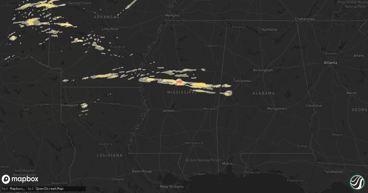
Hail Map in Mississippi on April 24, 2014
Get this storm
April 24 map
$229
one time, instant access
Download today. No call, no setup
Keep the $229
Bought the map and want the full workflow? Apply the entire $229 to a subscription within 7 days. None of it is wasted.
Every map, not just this one
This buys you this map. Subscription and you get every map we run, in the markets you choose from a few cities to whole states to nationwide. Plus real-time alerts the moment a storm fires.
Contact data
Name, contact info, occupancy, even credit band for addresses in the footprint. You go from where it hit to who to call.
Become the source they trust
Unlimited branding weather history reports on demand. You already have the documented answer ready for the property owner, and you are the one who showed up with it.
Property data and RoofTrace estimates
Pull up any address you have got, its value and the exact code rules for that jurisdiction, straight from One Click Code. Then RoofTrace estimates the squares, pitch, and roof value, priced the way you price.
Storm reports in Mississippi
Mississippi
| Date | Description |
|---|---|
| 04/24/20146:55 PM CDT | Quarter sized hail reported in hollandale |
| 04/24/20146:25 PM CDT | Tree down on highway 12 near belzoni. Reported by police department |
| 04/23/201411:40 PM CDT | Quarter size hail reported at the preston pit stop. |
| 04/23/20149:30 PM CDT | Numerous penny to quarter size hail reports relayed from members of the public across central and southern portions of the county |
| 04/23/20149:30 PM CDT | Report of trees down inside the city limits relayed through social media |
| 04/23/20149:28 PM CDT | Public reports of hail up to golf ball size on the west side of town relayed through social media. Time estimated by radar. |
| 04/23/20149:25 PM CDT | 5 businesses and 15 homes damaged by strong wind gusts and downed trees. Damage occurred throughout the county mainly along hwy 14 corridor. |
| 04/23/20149:25 PM CDT | A few trees snapped...truck sign damaged along hwy 14 |
| 04/23/20149:08 PM CDT | A couple trees down...each on a house and pickup truck. A hothouse was damaged along hwy 411 as well. |
| 04/23/20149:05 PM CDT | A couple trees down on the e side of the county. |
| 04/23/20148:33 PM CDT | A couple trees down on the w side of the county. |
| 04/23/20148:20 PM CDT | Softball sized hail reported near west by sheriffs office. |
| 04/23/20148:05 PM CDT | Numerous trees down and power outages. Reported by sheriffs office |
| 04/23/20147:30 PM CDT | Large tree blocking part of highway 12 near humpreys and holmes county line. Reported by sheriffs office. |
| 04/23/20147:25 PM CDT | Tree down on highway 12 near belzoni. Reported by police department |
| 04/23/20147:00 PM CDT | Numerous trees and powerlines down. Reported by sheriffs office |
All States Impacted by Hail Map on April 24, 2014
Cities Impacted by Hail Map on April 24, 2014
- Wilburton, OK
- Jersey, AR
- Smackover, AR
- El Dorado, AR
- Hampton, AR
- Calion, AR
- Hot Springs National Park, AR
- Mansfield, AR
- Huntington, AR
- Benedict, KS
- Buffalo, KS
- Tchula, MS
- Belzoni, MS
- Indianola, MS
- Leland, MS
- Atoka, OK
- West, MS
- Rison, AR
- Star City, AR
- Dumas, AR
- Gould, AR
- Antlers, OK
- Daisy, OK
- French Camp, MS
- Vaiden, MS
- Winona, MS
- Kilmichael, MS
- Coila, MS
- Stigler, OK
- Greenville, MS
- Wister, OK
- Red Oak, OK
- Louisville, MS
- Cameron, OK
- Sidon, MS
- Greenwood, MS
- Carrollton, MS
- Aliceville, AL
- Eutaw, AL
- New Century, KS
- Lenexa, KS
- Overland Park, KS
- Gardner, KS
- Olathe, KS
- Seneca, MO
- Lonsdale, AR
- Glenwood, AR
- Duck Hill, MS
- Boswell, OK
- Bennington, OK
- Copan, OK
- Brookline, MO
- Republic, MO
- Springfield, MO
- Bonnerdale, AR
- Pearcy, AR
- Grapevine, AR
- Cecil, AR
- Charleston, AR
- Ringgold, LA
- Jamestown, LA
- Castor, LA
- Doddsville, MS
- Sunflower, MS
- Schlater, MS
- Boligee, AL
- Carthage, AR
- Yates Center, KS
- Shuqualak, MS
- Stephens, AR
- Mount Holly, AR
- Louann, AR
- Hermitage, AR
- Sarcoxie, MO
- Miller, MO
- La Russell, MO
- Reeds, MO
- Durant, MS
- Eufaula, OK
- Heavener, OK
- Howe, OK
- Wilmar, AR
- Muldrow, OK
- Roland, OK
- Van Buren, AR
- Ethel, MS
- Norman, AR
- Lake Village, AR
- Weir, MS
- Sallisaw, OK
- Fort Scott, KS
- Booneville, AR
- Lavaca, AR
- Ozark, AR
- Parsons, KS
- Fairfax, OK
- Midway, TX
- Garden City, MO
- Fort Smith, AR
- Gans, OK
- Arkoma, OK
- Keota, OK
- Plainview, AR
- Center Ridge, AR
- Porum, OK
- Webbers Falls, OK
- Royal, AR
- Malvern, AR
- Dubberly, LA
- Hamilton, KS
- Virgil, KS
- El Paso, AR
- Kansas City, MO
- Burbank, OK
- Shidler, OK
- Dermott, AR
- Quinton, OK
- Mountainburg, AR
- Rogersville, MO
- Mccurtain, OK
- Kosciusko, MS
- Lexington, MS
- Sallis, MS
- McGehee, AR
- Monticello, AR
- Watson, OK
- Judsonia, AR
- Bald Knob, AR
- Fouke, AR
- Arkadelphia, AR
- Okolona, AR
- Joplin, MO
- Preston, MS
- Philadelphia, MS
- Finley, OK
- Ralston, OK
- Talihina, OK
- Gainesville, AL
- Epes, AL
- Macon, MS
- Leola, AR
- Hot Springs Village, AR
- Neosho, MO
- Diamond, MO
- Noxapater, MS
- McCool, MS
- Moline, KS
- Cedar Vale, KS
- Stringtown, OK
- Clayton, OK
- Stewart, MS
- McCarley, MS
- Eupora, MS
- Itta Bena, MS
- Magnolia, AR
- Traskwood, AR
- Walnut, KS
- Pheba, MS
- Starkville, MS
- Cruger, MS
- Mounds, OK
- Kincaid, KS
- Cushing, OK
- Drumright, OK
- Arkansas City, AR
- Benoit, MS
- Hollandale, MS
- Mena, AR
- Independence, KS
- Cherryvale, KS
- Warren, AR
- Sheridan, AR
- Donaldson, AR
- Checotah, OK
- Vian, OK
- Cedarville, AR
- Alma, AR
- Mulberry, AR
- Rudy, AR
- Longton, KS
- Elk City, KS
- Waldron, AR
- Gravelly, AR
- Parks, AR
- Harvey, AR
- Kansas City, KS
- Eudora, AR
- Uniontown, AR
- Dubach, LA
- Ruston, LA
- England, AR
- Whitesboro, OK
- Ackerman, MS
- De Kalb, MS
- Scooba, MS
- Carthage, MS
- Sibley, LA
- Isola, MS
- Sedan, KS
- Havana, KS
- Hartford, AR
- Hugo, OK
- Edna, KS
- Bismarck, AR
- Spiro, OK
- Bokoshe, OK
- Boyle, MS
- Emelle, AL
- Cleveland, MS
- Russellville, AR
- Edgerton, KS
- Moorhead, MS
- Warner, OK
- Kinta, OK
- Hartshorne, OK
- Krebs, OK
- Mcalester, OK
- Thida, AR
- Searcy, AR
- Bradford, AR
- Oil Trough, AR
- Telephone, TX
- Ozark, MO
- Poteau, OK
- Beebe, AR
- Neodesha, KS
- Hackett, AR
- Marion, LA
- Fountain Hill, AR
- Caddo Gap, AR
- Bowling Green, KY
- Oakland, KY
- Pocola, OK
- Hamburg, AR
- Portland, AR
- Montrose, AR
- Dierks, AR
- Bauxite, AR
- Benton, AR
- Pittsburg, OK
- Heflin, LA
- Smithville, OK
- Agra, OK
- Atkins, AR
- Gibsland, LA
- Hatfield, AR
- Simsboro, LA
- Mount Ida, AR
- Mannford, OK
- Bristow, OK
- Farmerville, LA
- Kellyville, OK
- Lane, OK
- Muskogee, OK
- Poyen, AR
- Okmulgee, OK
- Delaware, OK
- Coushatta, LA
- Lewisville, AR
- Howe, TX
- Sherman, TX
- Liberty, KS
- Hodgen, OK
- Coffeyville, KS
- Caney, KS
- Hall Summit, LA
- Fredonia, KS
- Billings, MO
- Pawhuska, OK
- Solgohachia, AR
- Broken Bow, OK


