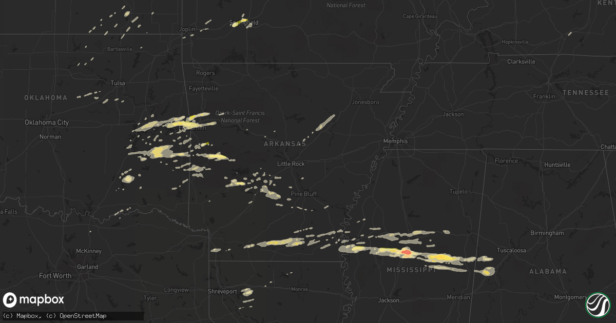
Hail Map in Arkansas on April 24, 2014
Get this storm
April 24 map
$229
one time, instant access
Download today. No call, no setup
Keep the $229
Bought the map and want the full workflow? Apply the entire $229 to a subscription within 7 days. None of it is wasted.
Every map, not just this one
This buys you this map. Subscription and you get every map we run, in the markets you choose from a few cities to whole states to nationwide. Plus real-time alerts the moment a storm fires.
Contact data
Name, contact info, occupancy, even credit band for addresses in the footprint. You go from where it hit to who to call.
Become the source they trust
Unlimited branding weather history reports on demand. You already have the documented answer ready for the property owner, and you are the one who showed up with it.
Property data and RoofTrace estimates
Pull up any address you have got, its value and the exact code rules for that jurisdiction, straight from One Click Code. Then RoofTrace estimates the squares, pitch, and roof value, priced the way you price.
Storm reports in Arkansas
Arkansas
| Date | Description |
|---|---|
| 04/24/20146:55 PM CDT | A local report indicates 1.00 inch wind near LEOLA |
| 04/24/20145:58 PM CDT | Trees and power lines were down...blocking the road...on arkansas 7 between fox pass and the junction of highways 5 and 7. |
| 04/24/20145:58 PM CDT | Many trees and power lines were blown down at park ave. And belvedere dr. The road was blocked and detours were set up. |
| 04/24/20145:56 PM CDT | A local report indicates 1.00 inch wind near 3 S PEARCY |
| 04/24/20145:53 PM CDT | A local report indicates 1.00 inch wind near 5 S CRYSTAL SPRINGS |
| 04/24/20145:48 PM CDT | A local report indicates 1.25 inch wind near 4 WNW BONNERDALE |
| 04/24/20144:55 PM CDT | A local report indicates 1.00 inch wind near 1 S MENA |
| 04/24/20144:33 PM CDT | A few quarter sized stones south of town |
| 04/24/20144:15 PM CDT | A local report indicates 1.00 inch wind near 1 N LACEY |
| 04/24/20143:55 PM CDT | A local report indicates 1.00 inch wind near FERN |
| 04/24/20143:45 PM CDT | Several golf carts blown around |
| 04/24/20143:42 PM CDT | Quarter size hail in town |
| 04/24/20143:42 PM CDT | Outbuilding destroyed |
| 04/24/20143:34 PM CDT | A local report indicates 1.00 inch wind near NORPHLET |
| 04/24/20143:30 PM CDT | Half inch to whole inch hail. Time estimated by radar. |
| 04/24/20143:30 PM CDT | A local report indicates 1.00 inch wind near SMACKOVER |
| 04/24/20143:18 PM CDT | Time estimated by radar. |
| 04/24/20142:22 PM CDT | A local report indicates 1.00 inch wind near DEGRAY LAKE |
| 04/24/20142:20 PM CDT | A local report indicates 1.00 inch wind near BISMARCK |
| 04/23/20147:50 PM CDT | A tree was blown down onto u.s. 425. |
| 04/23/20147:25 PM CDT | Tree reported down across highway 79 south. |
All States Impacted by Hail Map on April 24, 2014
Cities Impacted by Hail Map on April 24, 2014
- Wilburton, OK
- Jersey, AR
- Smackover, AR
- El Dorado, AR
- Hampton, AR
- Calion, AR
- Hot Springs National Park, AR
- Mansfield, AR
- Huntington, AR
- Benedict, KS
- Buffalo, KS
- Tchula, MS
- Belzoni, MS
- Indianola, MS
- Leland, MS
- Atoka, OK
- West, MS
- Rison, AR
- Star City, AR
- Dumas, AR
- Gould, AR
- Antlers, OK
- Daisy, OK
- French Camp, MS
- Vaiden, MS
- Winona, MS
- Kilmichael, MS
- Coila, MS
- Stigler, OK
- Greenville, MS
- Wister, OK
- Red Oak, OK
- Louisville, MS
- Cameron, OK
- Sidon, MS
- Greenwood, MS
- Carrollton, MS
- Aliceville, AL
- Eutaw, AL
- New Century, KS
- Lenexa, KS
- Overland Park, KS
- Gardner, KS
- Olathe, KS
- Seneca, MO
- Lonsdale, AR
- Glenwood, AR
- Duck Hill, MS
- Boswell, OK
- Bennington, OK
- Copan, OK
- Brookline, MO
- Republic, MO
- Springfield, MO
- Bonnerdale, AR
- Pearcy, AR
- Grapevine, AR
- Cecil, AR
- Charleston, AR
- Ringgold, LA
- Jamestown, LA
- Castor, LA
- Doddsville, MS
- Sunflower, MS
- Schlater, MS
- Boligee, AL
- Carthage, AR
- Yates Center, KS
- Shuqualak, MS
- Stephens, AR
- Mount Holly, AR
- Louann, AR
- Hermitage, AR
- Sarcoxie, MO
- Miller, MO
- La Russell, MO
- Reeds, MO
- Durant, MS
- Eufaula, OK
- Heavener, OK
- Howe, OK
- Wilmar, AR
- Muldrow, OK
- Roland, OK
- Van Buren, AR
- Ethel, MS
- Norman, AR
- Lake Village, AR
- Weir, MS
- Sallisaw, OK
- Fort Scott, KS
- Booneville, AR
- Lavaca, AR
- Ozark, AR
- Parsons, KS
- Fairfax, OK
- Midway, TX
- Garden City, MO
- Fort Smith, AR
- Gans, OK
- Arkoma, OK
- Keota, OK
- Plainview, AR
- Center Ridge, AR
- Porum, OK
- Webbers Falls, OK
- Royal, AR
- Malvern, AR
- Dubberly, LA
- Hamilton, KS
- Virgil, KS
- El Paso, AR
- Kansas City, MO
- Burbank, OK
- Shidler, OK
- Dermott, AR
- Quinton, OK
- Mountainburg, AR
- Rogersville, MO
- Mccurtain, OK
- Kosciusko, MS
- Lexington, MS
- Sallis, MS
- McGehee, AR
- Monticello, AR
- Watson, OK
- Judsonia, AR
- Bald Knob, AR
- Fouke, AR
- Arkadelphia, AR
- Okolona, AR
- Joplin, MO
- Preston, MS
- Philadelphia, MS
- Finley, OK
- Ralston, OK
- Talihina, OK
- Gainesville, AL
- Epes, AL
- Macon, MS
- Leola, AR
- Hot Springs Village, AR
- Neosho, MO
- Diamond, MO
- Noxapater, MS
- McCool, MS
- Moline, KS
- Cedar Vale, KS
- Stringtown, OK
- Clayton, OK
- Stewart, MS
- McCarley, MS
- Eupora, MS
- Itta Bena, MS
- Magnolia, AR
- Traskwood, AR
- Walnut, KS
- Pheba, MS
- Starkville, MS
- Cruger, MS
- Mounds, OK
- Kincaid, KS
- Cushing, OK
- Drumright, OK
- Arkansas City, AR
- Benoit, MS
- Hollandale, MS
- Mena, AR
- Independence, KS
- Cherryvale, KS
- Warren, AR
- Sheridan, AR
- Donaldson, AR
- Checotah, OK
- Vian, OK
- Cedarville, AR
- Alma, AR
- Mulberry, AR
- Rudy, AR
- Longton, KS
- Elk City, KS
- Waldron, AR
- Gravelly, AR
- Parks, AR
- Harvey, AR
- Kansas City, KS
- Eudora, AR
- Uniontown, AR
- Dubach, LA
- Ruston, LA
- England, AR
- Whitesboro, OK
- Ackerman, MS
- De Kalb, MS
- Scooba, MS
- Carthage, MS
- Sibley, LA
- Isola, MS
- Sedan, KS
- Havana, KS
- Hartford, AR
- Hugo, OK
- Edna, KS
- Bismarck, AR
- Spiro, OK
- Bokoshe, OK
- Boyle, MS
- Emelle, AL
- Cleveland, MS
- Russellville, AR
- Edgerton, KS
- Moorhead, MS
- Warner, OK
- Kinta, OK
- Hartshorne, OK
- Krebs, OK
- Mcalester, OK
- Thida, AR
- Searcy, AR
- Bradford, AR
- Oil Trough, AR
- Telephone, TX
- Ozark, MO
- Poteau, OK
- Beebe, AR
- Neodesha, KS
- Hackett, AR
- Marion, LA
- Fountain Hill, AR
- Caddo Gap, AR
- Bowling Green, KY
- Oakland, KY
- Pocola, OK
- Hamburg, AR
- Portland, AR
- Montrose, AR
- Dierks, AR
- Bauxite, AR
- Benton, AR
- Pittsburg, OK
- Heflin, LA
- Smithville, OK
- Agra, OK
- Atkins, AR
- Gibsland, LA
- Hatfield, AR
- Simsboro, LA
- Mount Ida, AR
- Mannford, OK
- Bristow, OK
- Farmerville, LA
- Kellyville, OK
- Lane, OK
- Muskogee, OK
- Poyen, AR
- Okmulgee, OK
- Delaware, OK
- Coushatta, LA
- Lewisville, AR
- Howe, TX
- Sherman, TX
- Liberty, KS
- Hodgen, OK
- Coffeyville, KS
- Caney, KS
- Hall Summit, LA
- Fredonia, KS
- Billings, MO
- Pawhuska, OK
- Solgohachia, AR
- Broken Bow, OK


