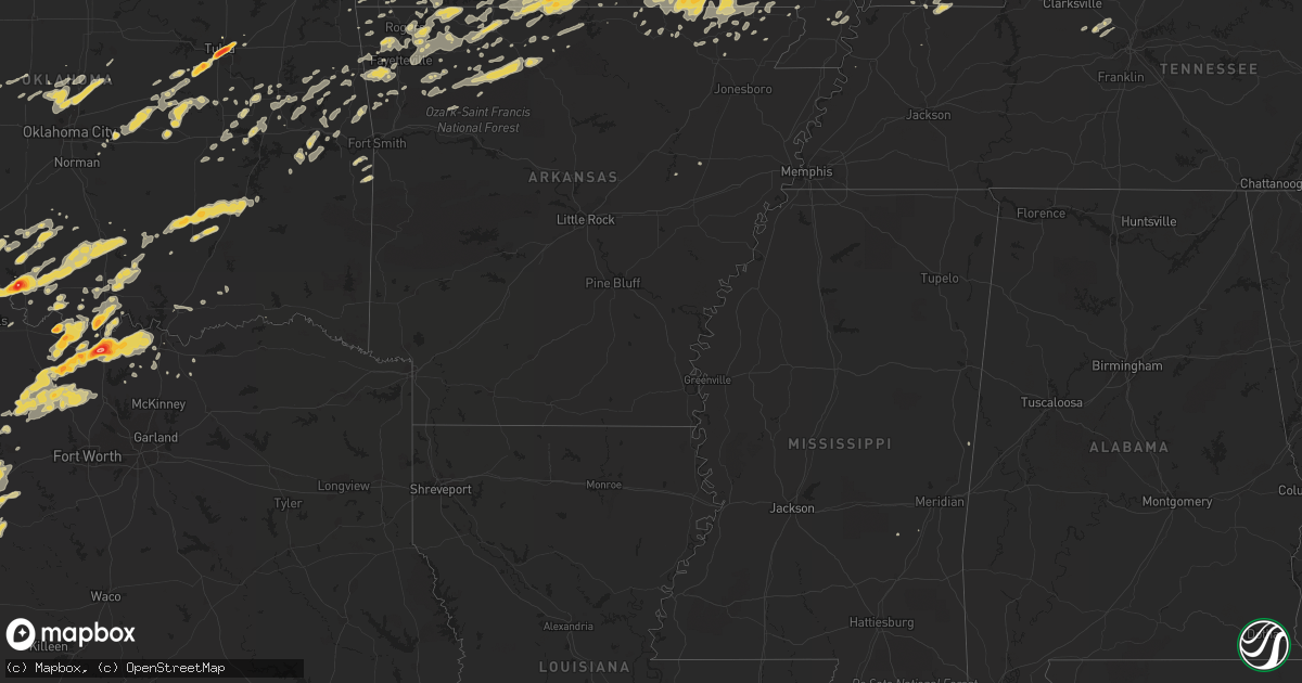
Hail Map on April 23, 2011
Get this storm
April 23 map
$229
one time, instant access
Download today. No call, no setup
Keep the $229
Bought the map and want the full workflow? Apply the entire $229 to a subscription within 7 days. None of it is wasted.
Every map, not just this one
This buys you this map. Subscription and you get every map we run, in the markets you choose from a few cities to whole states to nationwide. Plus real-time alerts the moment a storm fires.
Contact data
Name, contact info, occupancy, even credit band for addresses in the footprint. You go from where it hit to who to call.
Become the source they trust
Unlimited branding weather history reports on demand. You already have the documented answer ready for the property owner, and you are the one who showed up with it.
Property data and RoofTrace estimates
Pull up any address you have got, its value and the exact code rules for that jurisdiction, straight from One Click Code. Then RoofTrace estimates the squares, pitch, and roof value, priced the way you price.
States Impacted by Hail Map on April 23, 2011
Storm reports
Texas
| Date | Description |
|---|---|
| 04/23/20116:49 PM CDT | Quarter size hail 2 southwest of st. Jo |
| 04/23/20116:45 PM CDT | Ping pong ball size hail in callisburg |
| 04/23/20116:35 PM CDT | Orange size hail 2 north of gainesville |
| 04/23/20116:18 PM CDT | Half dollar size hail in sunset |
| 04/23/20116:06 PM CDT | Golfball size hail in gainesville |
| 04/23/20116:05 PM CDT | Tennis ball hail reported 4 miles nne of lindsay |
| 04/23/20116:03 PM CDT | Baseball hail in lindsay |
| 04/23/20116:02 PM CDT | Golfball hail 2 miles nw of gainesville |
| 04/23/20115:58 PM CDT | Quarter size hail in gainesville |
| 04/23/20115:57 PM CDT | Quarter hail reported on the west side of palo pinto |
| 04/23/20115:54 PM CDT | Baseball hail in lindsay |
| 04/23/20115:41 PM CDT | A local report indicates 1.00 inch wind near 4 S HASKELL |
| 04/23/20115:31 PM CDT | Quarter size hail reported in lueders. |
| 04/23/20115:31 PM CDT | Half dollar hail 4 se of myra |
| 04/23/20115:24 PM CDT | A local report indicates 1.50 inch wind near 2 W BROWNWOOD |
| 04/23/20115:16 PM CDT | Quarter size hail 3 miles south of muenster |
| 04/23/20115:06 PM CDT | Golfball hail 4 ssw of muenster |
| 04/23/20114:50 PM CDT | Baseball size hail in truby |
| 04/23/20114:45 PM CDT | Half dollar hail in prairie point |
| 04/23/20114:43 PM CDT | Forestburg vfd reported golfball hail 2 miles ne of forestburg |
| 04/22/201111:48 PM CDT | Addison asos reports 58 mph wind gust |
| 04/22/201111:37 PM CDT | 60 mph wind gust in plano at the intersection of coit rd. And parker rd. |
| 04/22/201111:27 PM CDT | 58 mph wind gust at dfw airport |
| 04/22/201111:25 PM CDT | Delayed report of golfball sized hail near burkburnett. |
| 04/22/201111:15 PM CDT | Quarter sized hail reported southeast of burkburnett near the intersection of 240 and bailey road. |
| 04/22/201111:14 PM CDT | Numerous power lines and 3 inch tree limbs down in grapevine....colleyville and bedford |
| 04/22/201110:47 PM CDT | 68 mph wind gust reported at alliance airport asos |
| 04/22/201110:45 PM CDT | A local report indicates 1.00 inch wind near CASHION COMMUNITY |
| 04/22/201110:40 PM CDT | A local report indicates 1.00 inch wind near ELECTRA |
| 04/22/201110:20 PM CDT | Golfball size hail in comanche |
| 04/22/201110:10 PM CDT | Golfball to baseball size hail 1 mile west of sidney |
| 04/22/201110:06 PM CDT | Baseball size hail just west of beattie |
| 04/22/20119:55 PM CDT | Sherman asos |
| 04/22/20119:50 PM CDT | Quarter hail in mineral wells |
| 04/22/20119:25 PM CDT | Quarter size hail in dublin |
| 04/22/20119:24 PM CDT | A local report indicates 1.25 inch wind near DUBLIN |
| 04/22/20119:03 PM CDT | A local report indicates 1.75 inch wind near MAY |
| 04/22/20119:00 PM CDT | Golfball size hail in duster |
| 04/22/20118:26 PM CDT | 67 mph wind gust reported by denton asos site kdto |
| 04/22/20118:13 PM CDT | Brief tornado 2 miles north northwest of sidney |
| 04/22/20118:11 PM CDT | Chimney blown off a house on fm 1202...just west of outlet mall |
| 04/22/20117:43 PM CDT | Golfball size hail in nocona |
| 04/22/20117:43 PM CDT | Golfball size hail in nocona hills |
| 04/22/20117:40 PM CDT | Ping pong ball size hail in nocona |
| 04/22/20117:40 PM CDT | A local report indicates 1.75 inch wind near SIDNEY |
| 04/22/20117:39 PM CDT | Half dollar nocona hills |
| 04/22/20117:33 PM CDT | Golfball size hail in gordon |
| 04/22/20117:25 PM CDT | Quarter hail at ranger hill |
| 04/22/20117:24 PM CDT | 17w comanche |
| 04/22/20117:22 PM CDT | Golball size hail 4 miles west of st. Jo |
| 04/22/20117:00 PM CDT | Ping pong ball size hail 8 nw of decatur |
Arkansas
| Date | Description |
|---|---|
| 04/22/20119:11 PM CDT | A tornado was reported on the ground northwest of point peter. |
| 04/22/20118:55 PM CDT | A tornado was reported near bass. |
| 04/22/20118:49 PM CDT | Large trees were snapped. Trees were down across county road 41 between mount judea and vendor. |
| 04/22/20118:33 PM CDT | A tornado was reported to have touched down near smith mountain. The road at smith mountain is blocked by fallen trees. |
| 04/22/20117:56 PM CDT | 16 inch diameter trees down... Reported by knwa storm chaser. |
| 04/22/20117:35 PM CDT | A local report indicates 1.00 inch wind near AURORA |
Indiana
| Date | Description |
|---|---|
| 04/23/201110:14 AM CDT | A local report indicates 1.00 inch wind near CHARLESTOWN |
Oklahoma
| Date | Description |
|---|---|
| 04/23/20115:36 PM CDT | A local report indicates 1.00 inch wind near MARIETTA |
| 04/23/20111:45 AM CDT | Quarter to half dollar sized hail reported by law enforcement in the city of davis. |
| 04/23/20111:15 AM CDT | Public report of baseball sized hail northwest of waurika. At least one home has taken minor damage from this hail. |
| 04/23/20111:08 AM CDT | Public report of half dollar sized hail in north waurika. |
| 04/23/20111:04 AM CDT | Quarter to golf ball sized hail reported in waurika. |
| 04/22/201110:52 PM CDT | A local report indicates 2.50 inch wind near TULSA |
| 04/22/201110:45 PM CDT | Location 4th and harvard and 21st and utica |
| 04/22/201110:41 PM CDT | A local report indicates 1.00 inch wind near 12 W MUSKOGEE |
| 04/22/201110:41 PM CDT | At kjrh studio. |
| 04/22/201110:40 PM CDT | A local report indicates 1.00 inch wind near TULSA |
| 04/22/201110:37 PM CDT | A local report indicates 1.75 inch wind near 3 SE SAND SPRINGS |
| 04/22/201110:30 PM CDT | A local report indicates 1.75 inch wind near SAPULPA |
| 04/22/201110:03 PM CDT | Time estimated from radar |
| 04/22/201110:02 PM CDT | Quarter sized hail reported near dickson. |
| 04/22/20119:42 PM CDT | A local report indicates 1.00 inch wind near MUSKOGEE |
| 04/22/20118:20 PM CDT | Quarter sized hail reported at mill creek fire department. |
| 04/22/20118:00 PM CDT | A local report indicates 1.00 inch wind near GENE AUTRY |
| 04/22/20117:56 PM CDT | Delayed report of quarter sized hail in leon relayed by marietta police department. |
| 04/22/20117:25 PM CDT | Public report of quarter to golf ball sized hail in burneyville. |
Ohio
| Date | Description |
|---|---|
| 04/23/20114:38 PM CDT | Metal roof rolled up allowing water damage to house. |
| 04/23/20114:20 PM CDT | Trees down along 141 near kitts |
| 04/23/20114:15 PM CDT | Roofs reported off houses...and multiple trees down along ellisonville ridge road in upper township |
| 04/23/20114:12 PM CDT | Spotter witnessed 4 trees uprooted |
| 04/23/20114:10 PM CDT | Numerous trees and power lines down |
| 04/23/20114:05 PM CDT | 10 foot by 40 foot porch flipped on roof of house. 18 inch diameter trees uprooted and broke off. |
| 04/23/20113:54 PM CDT | A half dozen trees were blown down with the saturated ground. Time and location were estimated. |
Missouri
| Date | Description |
|---|---|
| 04/23/20115:45 PM CDT | Spotter located in leesburg missouri |
| 04/23/20115:45 PM CDT | A local report indicates 1.50 inch wind near BOURBON |
| 04/23/20115:45 PM CDT | A local report indicates 1.50 inch wind near LEASBURG |
| 04/23/20115:38 PM CDT | A local report indicates 1.00 inch wind near CUBA |
| 04/23/20114:40 PM CDT | Relayed report. |
| 04/23/20114:40 PM CDT | A local report indicates 1.00 inch wind near FORDLAND |
| 04/23/20114:40 PM CDT | A local report indicates 1.00 inch wind near SEYMOUR |
| 04/23/20114:40 PM CDT | A local report indicates 1.00 inch wind near DORA |
| 04/23/20114:30 PM CDT | A local report indicates 2.50 inch wind near MOUNTAIN GROVE |
| 04/23/20114:28 PM CDT | A local report indicates 1.00 inch wind near 4 NE FORDLAND |
| 04/23/20114:25 PM CDT | A local report indicates 1.50 inch wind near 1 N MOUNTAIN GROVE |
| 04/23/20114:18 PM CDT | A local report indicates 1.00 inch wind near 2 N PLEASANT HOPE |
| 04/23/20114:08 PM CDT | Reported at battlefield and u.s. 65 in springfield. |
| 04/23/20113:55 PM CDT | A local report indicates 1.50 inch wind near 1 S RAYMONDVILLE |
| 04/23/20113:51 PM CDT | A local report indicates 1.00 inch wind near THEODOSIA |
| 04/23/20113:47 PM CDT | Hail covered the ground. |
| 04/23/20113:45 PM CDT | A local report indicates 1.00 inch wind near 1 S REPUBLIC |
| 04/23/20113:28 PM CDT | Volunteer observer. |
| 04/23/20113:10 PM CDT | Ping pong ball sized hail reported north of mansfield. Reports of cars dented by hail. |
| 04/23/20113:08 PM CDT | Reorted quarter sized hail covering the gound. |
| 04/23/20113:00 PM CDT | Delayed report cocorahs. |
| 04/23/20112:56 PM CDT | A local report indicates 1.00 inch wind near 1 E SEYMOUR |
| 04/23/20112:54 PM CDT | A local report indicates 1.00 inch wind near 4 S FORDLAND |
| 04/23/20112:30 PM CDT | Time estimated. Late report. Storage trailer had roof peeled off. 40 foot tree snapped. Shingle damage. |
| 04/23/20112:15 PM CDT | Brief touchdown of ef0 tornado on west side of community. Event along 3 mile road near railroad tracks and just north of west grant street. Large storage building destr |
| 04/23/20112:02 PM CDT | Late report. Couple of sheds blown over. |
| 04/23/20112:01 PM CDT | Late report. Older brick building under demolation had collapsed. |
| 04/23/201112:20 AM CDT | ...late report...ef-1 tornado occurred along u.s. Highway 67. Path length 0.6 miles. Two mobile homes destroyed. |
| 04/23/201112:20 AM CDT | Power lines down and electricity out in the town. |
| 04/22/201111:31 PM CDT | Hail fell on the southside in the town of portageville |
| 04/22/20117:29 PM CDT | A local report indicates 1.00 inch wind near MANSFIELD |
| 04/22/20117:28 PM CDT | A local report indicates 1.25 inch wind near MANSFIELD |
Kentucky
| Date | Description |
|---|---|
| 04/23/20115:35 PM CDT | Quarter sized hail reported |
| 04/23/20115:21 PM CDT | Pea to quarter sized hail reported |
| 04/23/20114:58 PM CDT | Ham relayed two reports of quarter sized hail |
| 04/23/20114:57 PM CDT | Weht relayed spotter report of estimated wind gusts between 60-70 mph |
| 04/23/20114:55 PM CDT | Nickel and quarter size hail reported. |
| 04/23/20114:50 PM CDT | A local report indicates 1.00 inch wind near 3 NW CENTERTOWN |
| 04/23/20114:49 PM CDT | Quarter size hail. |
| 04/23/20114:34 PM CDT | Quarter sized hail covered roadways |
| 04/23/20114:16 PM CDT | Tree down on car at city park. |
| 04/23/20114:07 PM CDT | Trees and power lines down |
| 04/23/20113:38 PM CDT | Golf ball size hail reported at the prison. |
| 04/23/20113:30 PM CDT | Large tree limbs were reported down. |
| 04/23/20113:00 PM CDT | Downed and uprooted trees along with some power poles damaged near intersection of bruce and pecan drive. |
| 04/23/20112:50 PM CDT | Measured gust at barkley regional airport. |
| 04/23/20112:50 PM CDT | Late report. Tree damage reported throughout the area. Underpinning on several mobile homes damaged. |
| 04/23/20112:48 PM CDT | In the town of dover. Three houses have trees downed on them. |
| 04/23/20112:40 PM CDT | Large branches down in town with unknown size hail. Barn downed outside of town. |
| 04/23/20112:40 PM CDT | Barn blown down on augusta chatham rd east. One foot diameter trees blown down in dutch ridge road area. |
| 04/23/20112:30 PM CDT | *** 2 inj *** one steel building destroyed. Entire walls demolished on older 2 story brick business bldgs. Approximately 30 large trees uprooted and around a hundred sm |
| 04/23/20112:29 PM CDT | Ef1 tornado...peak wind 99 mph. Average path width 65 yards...path length was 1.6 miles. Large tree on one home and two mobile homes. Minor roof damage on two homes and |
| 04/23/20112:22 PM CDT | Barn blown over. Time estimated from radar. |
| 04/23/20112:20 PM CDT | Home damaged/trees downed/power lines downed |
| 04/23/20112:20 PM CDT | 2 large cedar trees down. Time estimated from radar. |
| 04/23/20112:20 PM CDT | Numerous trees down in the central part of the county. Time estimated. |
| 04/23/20112:17 PM CDT | Trees across highway 1316. Reports of roofs off of outbuildings. |
| 04/23/20112:15 PM CDT | In visalia...2 homes with roofs blown off. Visalia elementary school building damaged. Trees downed/power lines with trees on them. |
| 04/23/20112:14 PM CDT | A survey confirmed an ef1 tornado with maximum winds of 95 mph. The path length was 1000 feet and the maximum path width was 50 yards. The tornado blew down numerous tr |
| 04/23/20112:10 PM CDT | Preliminary estimate of an ef1 tornado that touched down 1 mile east of dry ridge on greenville road. Damage continued from grant county into pendleton county approxima |
| 04/23/20112:05 PM CDT | Barn roof blown off. Trees and telephone poles downed on warsaw road/ky 467 |
| 04/23/20112:04 PM CDT | Roof damaged on a home on folsom-jonesville road. Trees across the road and telephone poles blown over. |
| 04/23/20111:59 PM CDT | A survey confirmed an ef0 tornado with maximum winds of 75 mph. The path length was 1.2 miles and the maximum path width was 25 yards. The tornado destroyed a garage on |
| 04/22/20117:45 PM CDT | Firefighter reports quarter sized hail between 845 and 900 pm edt. |
Illinois
| Date | Description |
|---|---|
| 04/23/20113:05 PM CDT | Downed and uprooted trees reported along north street. Downed power poles. One tree is laying across a house. |
| 04/23/20112:57 PM CDT | Widespread trees and power pole damage on the north side of town near the honeywell plant. |
| 04/23/20112:56 PM CDT | Widespread power outages in town. |
| 04/23/20112:47 PM CDT | Ef1 tornado/downburst...peak wind 110 mph. Average path width 225 yds...path length 6.5 miles. Several wooden utility poles snapped/broken along path. Roof off trailer |
| 04/23/20112:15 PM CDT | Ef2 tornado...peak wind 120 mph. Path width 120 yds and path length 2.9 miles. One mobile home destroyed...with minor/moderate roof damage to two homes in the klondike |
West Virginia
| Date | Description |
|---|---|
| 04/23/20116:47 PM CDT | A tree fell on a garage and snapped a power pole in half on brushy fork road off of rt 33 in buckhannon |
| 04/23/20116:45 PM CDT | Trees are down on hoovertown road... Abbott road and waterloo road in french creek |
| 04/23/20116:40 PM CDT | Trees down on gaines road in rock cave |
| 04/23/20116:33 PM CDT | Trees are down on glady creek road in weston |
| 04/23/20116:33 PM CDT | Trees are down on rock cave road and route 19 south near walkersville |
| 04/23/20116:32 PM CDT | Power lines are down...power line poles and telephone poles were snapped on bennett ave in webster springs |
| 04/23/20116:20 PM CDT | Signs were blown down along 1-79 between the flatwoods and burnsville exits |
| 04/23/20116:06 PM CDT | Trees are down on state route 33 west near stumptown |
| 04/23/20115:22 PM CDT | 2 trees down...one clipped house doing roof damage. |
| 04/23/20115:18 PM CDT | Tree down on martins branch road |
| 04/23/20115:15 PM CDT | Tree down on coal river road |
| 04/23/20115:15 PM CDT | Several trees down in downtown charleston |
| 04/23/20115:15 PM CDT | Tree down on ballard road |
| 04/23/20115:09 PM CDT | Tree down blake road and 21st street. |
| 04/23/20117:35 AM CDT | Metal roof peeled on a shed |
| 04/22/20117:33 PM CDT | A local report indicates 65 MPH wind near 2 NE KLINE GAP |
| 04/22/20117:04 PM CDT | Numerous trees are down in the crystal springs area |
| 04/22/20117:04 PM CDT | A metal pole fell on a car in the mcdonalds parking lot in downtown elkins |
Cities Impacted by Hail Map on April 23, 2011
- Gainesville, TX
- Marietta, OK
- Barlow, KY
- Boley, OK
- Myrtle, MO
- Couch, MO
- Lindsay, TX
- Muenster, TX
- Hulbert, OK
- Tahlequah, OK
- Edgar Springs, MO
- Hartville, MO
- Mountain Grove, MO
- Salem, MO
- Ava, MO
- Eunice, MO
- Raymondville, MO
- Jadwin, MO
- Hartshorn, MO
- Yukon, MO
- Elk Creek, MO
- Macomb, MO
- Drury, MO
- Licking, MO
- Bucyrus, MO
- Seymour, MO
- Fordland, MO
- Houston, MO
- Huggins, MO
- Plato, MO
- Mansfield, MO
- Bunker, MO
- Norwood, MO
- Solo, MO
- Cabool, MO
- Graff, MO
- Squires, MO
- Wasola, MO
- Noble, MO
- Irvington, KY
- Garfield, KY
- Shawnee, OK
- Mcloud, OK
- Floyds Knobs, IN
- Clarksville, IN
- Sellersburg, IN
- Louisville, KY
- Glenview, KY
- Jeffersonville, IN
- Charlestown, IN
- Borden, IN
- New Albany, IN
- Prospect, KY
- Rogersville, MO
- Clermont, KY
- Coxs Creek, KY
- Ashland City, TN
- Charlotte, TN
- Kirksey, KY
- Murray, KY
- Farmington, KY
- Winchester, KY
- Poteau, OK
- Cameron, OK
- Coalgate, OK
- Shepherdsville, KY
- Lebanon Junction, KY
- Muskogee, OK
- Oktaha, OK
- Fort Gibson, OK
- Howe, TX
- Paducah, KY
- Morris, OK
- Boynton, OK
- Belleview, MO
- Duncan, OK
- Marlow, OK
- Davis, OK
- Hennepin, OK
- Chapmansboro, TN
- Springfield, TN
- Pleasant View, TN
- Joelton, TN
- Gentry, AR
- Morgantown, KY
- Duke, MO
- Bradley, OK
- Birch Tree, MO
- Protem, MO
- Peel, AR
- Theodosia, MO
- Lead Hill, AR
- Yellville, AR
- Saint Joe, AR
- Pindall, AR
- Palo Pinto, TX
- Gordon, TX
- Santo, TX
- Ector, TX
- Bonham, TX
- Ledbetter, KY
- Calvert City, KY
- Sidney, TX
- Rising Star, TX
- May, TX
- Blanket, TX
- Gorman, TX
- Dublin, TX
- Gustine, TX
- De Leon, TX
- Stephenville, TX
- Comanche, TX
- Stamford, TX
- Sheppard Afb, TX
- Burkburnett, TX
- Wichita Falls, TX
- Bardwell, KY
- Ravenden Springs, AR
- Gatewood, MO
- Moody, MO
- Pocahontas, AR
- Alton, MO
- Caulfield, MO
- Warm Springs, AR
- West Plains, MO
- Koshkonong, MO
- Peace Valley, MO
- Pottersville, MO
- Mammoth Spring, AR
- Ravenden, AR
- Thayer, MO
- Brandsville, MO
- Foss, OK
- Albany, TX
- Lueders, TX
- Waurika, OK
- Ardmore, OK
- Cuba, MO
- Steelville, MO
- Perrin, TX
- Graford, TX
- Healdton, OK
- Stuart, OK
- Willow Springs, MO
- Dora, MO
- Mountain View, MO
- Bunch, OK
- Bluff Dale, TX
- Maynard, AR
- Doniphan, MO
- Okemah, OK
- Paden, OK
- Castle, OK
- Bristow, OK
- Temple, OK
- Byers, TX
- Cadiz, KY
- Hardinsburg, KY
- Cloverport, KY
- Falls Of Rough, KY
- Harned, KY
- Reynolds Station, KY
- Anson, TX
- Merkel, TX
- Hawley, TX
- Abilene, TX
- Sapulpa, OK
- Tulsa, OK
- Kellyville, OK
- Marquand, MO
- Elmore City, OK
- Van Buren, MO
- Ellington, MO
- Piedmont, MO
- Burneyville, OK
- Wilson, OK
- Overbrook, OK
- Ranger, TX
- Gainesville, MO
- Brixey, MO
- Zanoni, MO
- Sallisaw, OK
- Paoli, IN
- Cook Sta, MO
- Mill Creek, OK
- Thackerville, OK
- Success, MO
- Westville, OK
- Devol, OK
- Pottsboro, TX
- Forestburg, TX
- Whitesboro, TX
- Sherman, TX
- Saint Jo, TX
- Sadler, TX
- Haskell, TX
- Rule, TX
- Elkview, WV
- Augusta, AR
- Randlett, OK
- West Point, KY
- Frederick, OK
- Tipton, OK
- Isabella, MO
- Mcalester, OK
- Early, TX
- Brownwood, TX
- Fulton, KY
- Park Hill, OK
- Cookson, OK
- Lewisport, KY
- Rogers, AR
- Ringling, OK
- Spiro, OK
- Van Alstyne, TX
- Tupelo, OK
- Allen, OK
- Centrahoma, OK
- Kuttawa, KY
- Brookport, IL
- Leon, OK
- Montague, TX
- Nocona, TX
- Carbon, TX
- Prairie Grove, AR
- Lincoln, AR
- Thornfield, MO
- Advance, MO
- Stillwater, OK
- Deer, AR
- Fayetteville, AR
- Siloam Springs, AR
- Springdale, AR
- Lowell, AR
- Cave Springs, AR
- Bentonville, AR
- Kiowa, OK
- Calvin, OK
- Blanco, OK
- Savanna, OK
- Bourbon, MO
- Sunset, TX
- Alvord, TX
- Willard, MO
- Berryville, AR
- Huntsville, AR
- Eastland, TX
- Mingus, TX
- Desdemona, TX
- Strawn, TX
- Vian, OK
- Lawton, OK
- Walters, OK
- Saint James, MO
- Moran, TX
- Paradise, TX
- Krum, TX
- Chico, TX
- Bowie, TX
- Jacksboro, TX
- Bridgeport, TX
- Valley View, TX
- Rhome, TX
- Decatur, TX
- Ponder, TX
- Rosston, TX
- Meridian, OK
- Edmond, OK
- Guthrie, OK
- Coyle, OK
- Henrietta, TX
- Exeter, MO
- Cassville, MO
- Purdy, MO
- Success, AR
- Naylor, MO
- Shell Knob, MO
- Bernie, MO
- Campbell, MO
- Proctor, OK
- Elkins, AR
- Combs, AR
- Wardville, OK
- Vine Grove, KY
- Elizabethtown, KY
- Radcliff, KY
- Custer, KY
- Rineyville, KY
- Nixa, MO
- Ozark, MO
- Ash Grove, MO
- Keota, OK
- Stigler, OK
- Wagoner, OK
- Porter, OK
- Princeton, KY
- Dawson Springs, KY
- Providence, KY
- Ironton, MO
- Arcadia, MO
- Cashion, OK
- Okarche, OK
- Watonga, OK
- Ponca, AR
- Tolar, TX
- Hico, TX
- Lipan, TX
- Mineral Wells, TX
- Millsap, TX
- Arapaho, OK
- Stonewall, OK
- Roff, OK
- Springfield, MO
- Powell, MO
- Washburn, MO
- Lowndes, MO
- Wappapello, MO
- Zalma, MO
- McGee, MO
- Gipsy, MO
- Graham, KY
- Greenville, KY
- White Plains, KY
- Ratliff City, OK
- Wynnewood, OK
- Graham, OK
- Hastings, OK
- Loco, OK
- Sulphur, OK
- Springer, OK
- West Fork, AR
- Canehill, AR
- Summers, AR
- Breckenridge, TX
- Sullivan, MO
- Durant, OK
- Alpena, AR
- Omaha, AR
- Green Forest, AR
- Harrison, AR
- Golconda, IL
- Leedey, OK
- Centertown, KY
- Rush Springs, OK
- Everton, AR
- Marion, KY
- Chandler, OK
- Poolville, TX
- Denison, TX
- Monett, MO
- Adairville, KY
- Geronimo, OK
- Williamsville, MO
- Republic, MO
- Ekron, KY
- Fordsville, KY
- Cecilia, KY
- Guston, KY
- Fort Knox, KY
- Council Hill, OK
- Checotah, OK
- Hindsville, AR
- Cherokee Village, AR
- Hardy, AR
- Perryville, MO
- Braggs, OK
- Electra, TX
- Bokchito, OK
- Corning, AR
- Neelyville, MO
- Nortonville, KY
- Weatherford, OK
- Vanzant, MO
- Flippin, AR
- Gassville, AR
- Cotter, AR
- Mountain Home, AR
- Haskell, OK
- Mortons Gap, KY
- Powderly, KY
- Island, KY
- Drakesboro, KY
- Bremen, KY
- Central City, KY
- Beech Creek, KY
- Earlington, KY
- Beechmont, KY
- Sacramento, KY
- Madisonville, KY
- Anderson, MO
- Depew, OK
- Farmington, MO
- Portageville, MO
- Eddyville, KY
- Owasso, OK
- Catoosa, OK
- Hawesville, KY
- Petrolia, TX
- Water Valley, KY
- Wingo, KY
- Dexter, MO
- Meeker, OK
- Sparks, OK
- Vendor, AR
- Jasper, AR
- Parthenon, AR
- Hasty, AR
- Western Grove, AR
- Noel, MO
- Kevil, KY
- Ryan, OK
- Comanche, OK
- Leasburg, MO
- Lesterville, MO
- Silva, MO
- Clinton, OK
- Pilot Point, TX
- Eufaula, OK
- Summersville, MO
- Oakland, AR
- Pontiac, MO
- Niangua, MO
- Newalla, OK
- Norman, OK
- Knobel, AR
- Paragould, AR
- Golden, MO
- Fredonia, KY
- Crestwood, KY
- Bloomfield, MO
- Essex, MO
- Lenox, MO
- Buffalo, WV
- Charleston, WV
- Poca, WV
- Oark, AR
- Omega, OK
- Hartford, KY
- Dudley, MO
- Garfield, AR
- Aurora, MO
- Marionville, MO
- Billings, MO
- South West City, MO
- Lindsay, OK
- Williford, AR
- Mount Eden, KY
- Bloomfield, KY
- Lawrenceburg, KY
- Beggs, OK
- Okmulgee, OK
- Mayfield, KY
- Martin, TN
- Sedalia, KY
- Dukedom, TN
- Palmersville, TN
- Stilwell, OK
- Muldrow, OK
- Charleston, MO
- Puxico, MO
- Camp, AR
- Eureka Springs, AR
- Avoca, TX
- Crane, MO
- Iowa Park, TX
- Summit, AR
- Stroud, OK
- Prague, OK
- Corydon, IN
- Kingston, AR
- Annapolis, MO
- Eagle Rock, MO
- Butler, OK
- Canute, OK
- Grandin, MO
- Tioga, TX
- Collinsville, TX
- Pettigrew, AR
- Elk City, OK
- La Center, KY
- Wickliffe, KY
- Ellsinore, MO
- Indiahoma, OK
- Grand Rivers, KY
- Gandeeville, WV
- Advent, WV
- Kenna, WV
- Kinta, OK
- Fisk, MO
- Poplar Bluff, MO
- Cheyenne, OK
- Sweetwater, OK
- Eminence, MO
- Fredericktown, MO
- Reeds Spring, MO
- Fremont, MO
- Brookline, MO
- Bennington, OK
- Greenfield, TN
- Marshfield, MO
- Pineville, MO
- Lone Grove, OK
- Grandfield, OK
- Mount Sterling, KY
- Sperry, OK
- Whitesville, KY
- Winslow, AR
- Philpot, KY
- Brandenburg, KY
- Smithland, KY
- Tiline, KY
- Salem, KY
- Greenfield, OK
- Bell City, MO
- Oran, MO
- Crofton, KY
- Highlandville, MO
- Cache, OK
- Ash Flat, AR
- Bardstown, KY
- Boston, KY
- Almo, KY
- South Fulton, TN
- Farmington, AR
- Marmaduke, AR
- Lafe, AR
- Scooba, MS
- Winona, MO
- Sikeston, MO
- Hackett, AR
- Grovespring, MO
- Peach Orchard, AR
- Delaplaine, AR
- Jay, OK
- Sayre, OK
- Winfield, WV
- Nitro, WV
- Hurricane, WV
- Scott Depot, WV
- Red House, WV
- Saint Albans, WV
- Hanna, OK
- Dustin, OK
- Perkins, OK
- Clever, MO
- Taloga, OK
- Whitewright, TX
- Horse Branch, KY
- Beaver Dam, KY
- Pollard, AR
- Custer City, OK
- Liberty, WV
- Leon, WV
- Fraziers Bottom, WV
- Saint Paul, AR
- Henryetta, OK
- Calhoun, KY
- Drumright, OK
- Cushing, OK
- Kingfisher, OK
- Trenton, TX
- Bella Vista, AR
- Rueter, MO
- Galena, MO
- Biggers, AR
- Sparta, MO
- Cherryville, MO
- Davisville, MO
- Pocola, OK
- Georgetown, IN
- Oak Grove, AR
- Ridgedale, MO
- Hollister, MO
- Blue Eye, MO
- Marble Falls, AR
- Foster, OK
- Crescent, OK
- Bradleyville, MO
- Arlington, KY
- Greenville, MO
- Sturdivant, MO
- Mannsville, OK
- Tishomingo, OK
- Madill, OK
- Chadwick, MO
- Kirbyville, MO
- Powersite, MO
- Forsyth, MO
- Hoyleton, IL
- Cunningham, KY
- Gunter, TX
- Lexington, KY
- Belton, KY
- Verona, MO
- Broseley, MO
- Bakersfield, MO
- Cannelton, IN
- Burna, KY
- Witter, AR
- Wesco, MO
- Welling, OK
- Hardenville, MO
- Weleetka, OK
- Gilbertsville, KY
- Benton, KY
- Walnut Ridge, AR
- Tecumseh, MO
- Pomona, MO
- Cedarcreek, MO
- Clay, KY
- Clinton, KY
- Seligman, MO
- Falcon, MO
- Brownwood, MO
- Lane, OK
- Atoka, OK
- Olaton, KY
- Mounds, OK
- Weatherford, TX
- Mill Spring, MO
- Piggott, AR
- Windthorst, TX
- Livermore, KY
- Oklahoma City, OK
- Piedmont, OK
- Centerville, MO
- Compton, AR
- Wetumka, OK
- Oldfield, MO
- Natural Dam, AR
- Chester, AR
- Campbellsville, KY
- Owensboro, KY
- Imboden, AR
- Dover, OK
- Porum, OK
- Whitefield, OK
- Taneyville, MO
- Wheeler, TX
- Shamrock, TX
- Wesley, AR
- Taft, OK
- Salem, AR
- Fitzhugh, OK
- Hampton, KY
- Wardell, MO
- Gravette, AR
- Hiwasse, AR
- Mount Judea, AR
- Cairo, IL
- Ramsey, IN
- New Salisbury, IN
- Bois D Arc, MO
- Cromwell, KY
- Caneyville, KY
- Depauw, IN
- Vulcan, MO
- Lampe, MO
- Kimberling City, MO
- Watts, OK
- Mount Vernon, MO
- Decatur, AR
- Dunmor, KY
- Browder, KY
- Garrison, MO
- Fort Sill, OK
- Geary, OK
- Taylorsville, KY
- Melber, KY
- Briscoe, TX
- Krebs, OK
- Patterson, MO
- Branson, MO
- Brighton, MO
- Pleasant Hope, MO