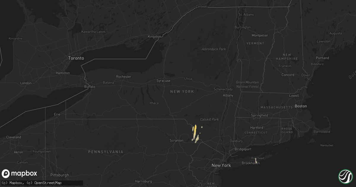
Hail Map in New York on April 22, 2023
Get this storm
April 22 map
$229
one time, instant access
Download today. No call, no setup
Keep the $229
Bought the map and want the full workflow? Apply the entire $229 to a subscription within 7 days. None of it is wasted.
Every map, not just this one
This buys you this map. Subscription and you get every map we run, in the markets you choose from a few cities to whole states to nationwide. Plus real-time alerts the moment a storm fires.
Contact data
Name, contact info, occupancy, even credit band for addresses in the footprint. You go from where it hit to who to call.
Become the source they trust
Unlimited branding weather history reports on demand. You already have the documented answer ready for the property owner, and you are the one who showed up with it.
Property data and RoofTrace estimates
Pull up any address you have got, its value and the exact code rules for that jurisdiction, straight from One Click Code. Then RoofTrace estimates the squares, pitch, and roof value, priced the way you price.
Storm reports in New York
New York
| Date | Description |
|---|---|
| 04/22/20236:30 PM CDT | Tree down with photo sent to broadcast media. |
| 04/22/20236:01 PM CDT | Via social media. Public reported to nws of trees down on state police barracks. Radar-estimated time. |
| 04/22/20236:00 PM CDT | Downed trees and wires. Possible other damage but still being assessed. Radar-estimated time. |
| 04/22/20236:00 PM CDT | Trees and wires down in watson. |
| 04/22/20235:58 PM CDT | Trees and wires down. |
| 04/22/20235:57 PM CDT | Trees and wires down. |
| 04/22/20235:50 PM CDT | Trees and wires down on road. |
| 04/22/20235:50 PM CDT | 2 barns heavily damaged. |
| 04/22/20235:50 PM CDT | Trees and wires down on road. |
| 04/22/20235:47 PM CDT | Trees and wires down in the road. |
| 04/22/20235:47 PM CDT | Damage to house caused occupants to be trapped. Occupant said it was a tornado. |
| 04/22/20235:40 PM CDT | Tree and wires down. |
| 04/22/20235:40 PM CDT | Multiple trees and wires down... As well as broken power poles... In vicinity of main street and maple. Radar-estimated time. |
| 04/22/20235:39 PM CDT | Golf ball sized hail. Along miller road. Radar-estimated time. |
| 04/22/20235:30 PM CDT | Corrects previous tstm wnd dmg report from 1 e bethel. Multiple trees down on house. |
| 04/22/20235:30 PM CDT | Multiple trees down on house. |
| 04/22/20233:40 PM CDT | Tree down on road. Transformer and wires also knocked down. |
All States Impacted by Hail Map on April 22, 2023
Cities Impacted by Hail Map on April 22, 2023
- Fayette, AL
- Bankston, AL
- New Market, AL
- Huntsville, AL
- Ararat, NC
- Siloam, NC
- Pilot Mountain, NC
- Pinnacle, NC
- Westfield, NC
- Mount Airy, NC
- Stuart, VA
- Claudville, VA
- Meadows Of Dan, VA
- Radiant, VA
- Orange, VA
- Oakpark, VA
- Locust Dale, VA
- Rapidan, VA
- Culpeper, VA
- Lumberton, NC
- Bladenboro, NC
- Norton, TX
- Ballinger, TX
- Rowena, TX
- Talpa, TX
- Voss, TX
- Paint Rock, TX
- Millersview, TX
- Gouldbusk, TX
- Doole, TX
- Lohn, TX
- Rockwood, TX
- Eden, TX
- Rochelle, TX
- Santa Anna, TX
- Brady, TX
- Richland Springs, TX
- Mullins, SC
- Pinebluff, NC
- Aberdeen, NC
- Lake Butler, FL
- Dillon, SC
- Marion, SC
- Latta, SC
- Sellers, SC
- Orrum, NC
- Fairmont, NC
- Fayetteville, NC
- Wade, NC
- Bronte, TX
- Evergreen, NC
- Lake City, FL
- Lulu, FL
- Whiteville, NC
- Wallace, SC
- Bennettsville, SC
- Hamer, SC
- Rowland, NC
- San Saba, TX
- Cherry Hill, NJ
- Marlton, NJ
- Mount Laurel, NJ
- Moorestown, NJ
- Maple Shade, NJ
- Riverside, NJ
- Cherokee, TX
- Llano, TX
- Tow, TX
- Burnet, TX
- Mason, TX
- Art, TX
- Pontotoc, TX
- Valley Spring, TX
- Fredericksburg, TX
- Doss, TX
- Callicoon, NY
- Damascus, PA
- Cochecton, NY
- Liberty, NY
- Ferndale, NY
- Conway, SC
- Milanville, PA
- Pond Eddy, NY
- Barryville, NY
- Eldred, NY
- Shohola, PA
- Melvin, TX
- Milford, PA
- Nichols, SC
- Monticello, NY
- Hext, TX
- Galivants Ferry, SC
- Aynor, SC
- Glen Spey, NY
- Highland Lake, NY
- Longs, SC
- Bunnell, FL
- Lackawaxen, PA
- Narrowsburg, NY
- Kenoza Lake, NY
- North Branch, NY
- Hawley, PA
- Jeffersonville, NY
- Roscoe, NY
- Greeley, PA
- Lake Huntington, NY
- Loris, SC
- Jacksonville, FL
- Ormond Beach, FL
- Daytona Beach, FL
- Hortonville, NY
- Bluffton, TX
- Calverton, NY
- Junction, TX
- Voca, TX
- Rocksprings, TX
- Speonk, NY
- Eastport, NY
- Remsenburg, NY
- Westhampton, NY
- East Moriches, NY
- Westhampton Beach, NY
- London, TX
- Kendalia, TX
- Boerne, TX
- Blanco, TX
- Cocoa Beach, FL
- Manorville, NY
- Stonewall, TX
- Brookesmith, TX
- Bangs, TX
- Brownwood, TX
- Del Rio, TX
- Laughlin Afb, TX
- Bandera, TX
- Brackettville, TX
- Comstock, TX
- Camp Wood, TX
- Pipe Creek, TX
- Menard, TX
- Rio Medina, TX
- Hondo, TX
- San Antonio, TX
- Mico, TX
- Harper, TX
- Riverhead, NY
- Quemado, TX
- Sonora, TX
- Eagle Pass, TX
- Winters, TX
- Cuero, TX
- Yorktown, TX
- Westhoff, TX


