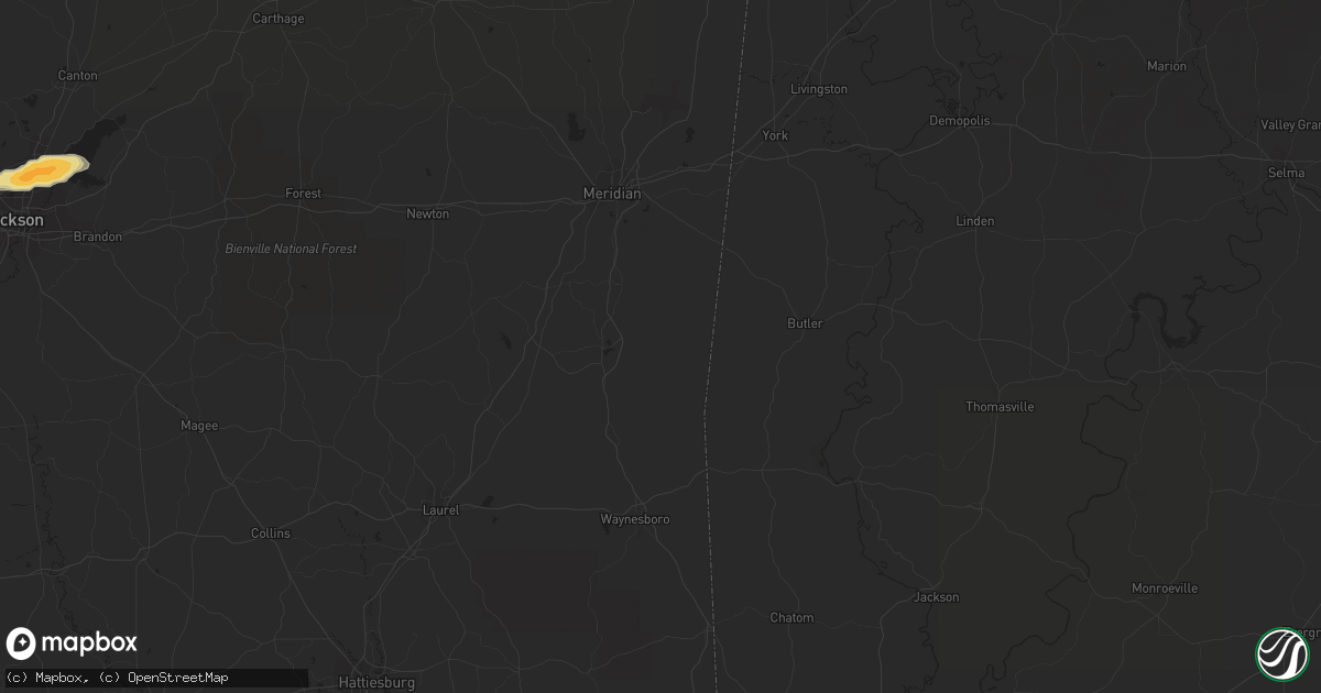
Hail Map in Starkville, MS on April 20, 2011
Get this storm
April 20 map
$229
one time, instant access
Download today. No call, no setup
Keep the $229
Bought the map and want the full workflow? Apply the entire $229 to a subscription within 7 days. None of it is wasted.
Every map, not just this one
This buys you this map. Subscription and you get every map we run, in the markets you choose from a few cities to whole states to nationwide. Plus real-time alerts the moment a storm fires.
Contact data
Name, contact info, occupancy, even credit band for addresses in the footprint. You go from where it hit to who to call.
Become the source they trust
Unlimited branding weather history reports on demand. You already have the documented answer ready for the property owner, and you are the one who showed up with it.
Property data and RoofTrace estimates
Pull up any address you have got, its value and the exact code rules for that jurisdiction, straight from One Click Code. Then RoofTrace estimates the squares, pitch, and roof value, priced the way you price.
Storm reports in Starkville, MS
Starkville, MS
| Date | Description |
|---|---|
| 04/20/20115:35 PM CDT | Reported in the highland plantation area |
| 04/20/20115:20 PM CDT | Quarter to golf ball size hail |
| 04/20/20114:58 PM CDT | Sizes ranging from half inch to golf ball |
| 04/20/20114:40 PM CDT | A local report indicates 1.75 inch wind near 6 W STARKVILLE |
| 04/20/20114:30 PM CDT | Sizes ranging from golfball to baseball |
| 04/20/20117:04 AM CDT | A local report indicates 1.00 inch wind near 2 SW STARKVILLE |
| 04/19/20119:06 PM CDT | Tree down on a house on old crawford road |
| 04/19/20118:50 PM CDT | Trees down on southeast side of starkville |
| 04/19/20118:45 PM CDT | Trees down in the northwest and west-central part of the county. Location approximate. |
All States Impacted by Hail Map on April 20, 2011
All Cities Impacted by Hail Map on April 20, 2011
- Oxford, MS
- Abbeville, MS
- Porterville, MS
- Iraan, TX
- Banks, AR
- Warren, AR
- Summertown, TN
- Lawrenceburg, TN
- Hohenwald, TN
- Bogata, TX
- Savannah, TN
- Junction, TX
- Guin, AL
- Beaverton, AL
- Sulligent, AL
- Piedmont, AL
- Bearden, AR
- Sparkman, AR
- Camden, AR
- Clarksdale, MS
- Greenwood, AR
- Huntington, AR
- Lane, OK
- Caddo, OK
- Atoka, OK
- Caney, OK
- Stringtown, OK
- Conehatta, MS
- Eldorado, TX
- Jacksboro, TX
- New Albany, MS
- Guntown, MS
- Blue Springs, MS
- Jessieville, AR
- Marks, MS
- Tunica, MS
- Coahoma, MS
- Sledge, MS
- Marianna, AR
- Dundee, MS
- French Camp, MS
- Vaiden, MS
- Winona, MS
- Eupora, MS
- Kilmichael, MS
- Stewart, MS
- Clyde, TX
- Muenster, TX
- Norman, AR
- Chunky, MS
- Little Rock, MS
- Collinsville, MS
- Counce, TN
- Chico, TX
- Cedarbluff, MS
- Ballinger, TX
- Waynesboro, TN
- Christoval, TX
- Cascilla, MS
- Holcomb, MS
- Harvey, AR
- Ola, AR
- Perryville, AR
- Bluffton, AR
- Rover, AR
- Briggsville, AR
- Plainview, AR
- Danville, AR
- Gravelly, AR
- Lexa, AR
- Eden, TX
- Vancourt, TX
- Menard, TX
- Hazen, AR
- Nocona, TX
- Broken Bow, OK
- Quemado, TX
- Brackettville, TX
- Wright City, OK
- De Queen, AR
- Gillham, AR
- Lockesburg, AR
- Belzoni, MS
- Silver City, MS
- Keystone Heights, FL
- Starke, FL
- Aubrey, AR
- Marvell, AR
- Holly Grove, AR
- Brinkley, AR
- Idabel, OK
- Old Town, FL
- Branford, FL
- Eagle Pass, TX
- Waldron, AR
- Boles, AR
- Parks, AR
- Okolona, MS
- Bowie, TX
- Roosevelt, TX
- Sonora, TX
- Breckenridge, TX
- Graham, TX
- South Bend, TX
- North Little Rock, AR
- Trenton, FL
- Bell, FL
- Columbus, MS
- Morton, MS
- Coleman, TX
- Novice, TX
- Talpa, TX
- McCaskill, AR
- Saratoga, AR
- Blevins, AR
- Hope, AR
- Columbus, AR
- Mineral Springs, AR
- Ozan, AR
- Fulton, AR
- Prescott, AR
- Washington, AR
- Ashdown, AR
- Nashville, AR
- Emmet, AR
- Clarendon, AR
- Mena, AR
- Hampton, AR
- Carlisle, AR
- Lonoke, AR
- Mathiston, MS
- Ozona, TX
- Chiefland, FL
- McCarley, MS
- Walthall, MS
- Starkville, MS
- North Carrollton, MS
- Pheba, MS
- Mississippi State, MS
- Steens, MS
- Carrollton, MS
- Maben, MS
- Duck Hill, MS
- Brooksville, MS
- Crawford, MS
- Artesia, MS
- Sturgis, MS
- Macon, MS
- Louisville, MS
- De Valls Bluff, AR
- Rienzi, MS
- Glen, MS
- Burnsville, MS
- Booneville, MS
- Talladega, AL
- Munford, AL
- Baird, TX
- Cross Plains, TX
- Moran, TX
- Burkett, TX
- Cisco, TX
- Wilson, OK
- Monticello, AR
- Mill Creek, OK
- Madill, OK
- Mannsville, OK
- Ardmore, OK
- West Point, MS
- Gouldbusk, TX
- Lohn, TX
- Doole, TX
- Casa, AR
- Morrilton, AR
- Transylvania, LA
- Mer Rouge, LA
- Malvern, AR
- Newberry, FL
- Montague, TX
- Rayville, LA
- Oak Ridge, LA
- Monroe, LA
- Mayo, FL
- Haworth, OK
- Clarksville, TX
- Bagwell, TX
- Garvin, OK
- Sheridan, AR
- Grapevine, AR
- Carthage, AR
- Leola, AR
- White Hall, AR
- Pine Bluff, AR
- Weir, MS
- Ackerman, MS
- Bryson, TX
- Cleveland, MS
- Ruleville, MS
- Drew, MS
- Atkins, AR
- Lawtey, FL
- London, TX
- England, AR
- Scott, AR
- Walnut, MS
- Ashland, MS
- Michigan City, MS
- Ethel, MS
- West, MS
- Taylor, MS
- Interlachen, FL
- Hawthorne, FL
- Valera, TX
- Miles, TX
- Winters, TX
- Rowena, TX
- Woodson, TX
- New Boston, TX
- Itta Bena, MS
- Sidon, MS
- Gurdon, AR
- Orange Park, FL
- Jacksonville, FL
- Thornton, AR
- Fordyce, AR
- Melrose, FL
- Florahome, FL
- Royal, AR
- Paint Rock, TX
- Pottsville, AR
- Dardanelle, AR
- De Witt, AR
- Grenada, MS
- Greenwood, MS
- Houston, MS
- Jackson, MS
- Ridgeland, MS
- Madison, MS
- Tougaloo, MS
- Noxapater, MS
- Pontotoc, MS
- Randolph, MS
- Saint Jo, TX
- Sylacauga, AL
- Doddridge, AR
- Sallis, MS
- Winfield, AL
- Roland, AR
- Paron, AR
- Little Rock, AR
- Smithville, OK
- Pierson, FL
- Astor, FL
- Altoona, FL
- Goodman, MS
- Prairie, MS
- Crescent City, FL
- Welaka, FL
- Fort McCoy, FL
- Albany, TX
- Perrin, TX
- Anniston, AL
- Tutwiler, MS
- Charleston, MS
- Grand Junction, TN
- Saulsbury, TN
- Batesville, MS
- Hackett, AR
- Morriston, FL
- Bronson, FL
- McCool, MS
- Powder Springs, GA
- Marietta, GA
- Mereta, TX
- Eola, TX
- Micanopy, FL
- Anthony, FL
- Ocala, FL
- Citra, FL
- Detroit, TX
- Melvin, TX
- Preston, MS
- Elrod, AL
- Gordo, AL
- Loving, TX
- Marietta, OK
- Belden, MS
- Friendship, AR
- Donaldson, AR
- Amity, AR
- Arkadelphia, AR
- Brandon, MS
- Clinton, MS
- Big Lake, TX
- Cruger, MS
- Kirby, AR
- Glenwood, AR
- Caddo Gap, AR
- Langley, AR
- Horatio, AR
- Alleene, AR
- Okolona, AR
- Bluff City, AR
- Delight, AR
- Chidester, AR
- Shannon, MS
- Tupelo, MS
- Banner, MS
- Paris, MS
- Water Valley, MS
- Houlka, MS
- Bolivar, TN
- Middleton, TN
- Baldwyn, MS
- Dumas, MS
- Elaine, AR
- Merigold, MS
- Minter City, MS
- Boyle, MS
- Doddsville, MS
- Grady, AR
- Jasper, AL
- Millington, TN
- Schlater, MS
- San Angelo, TX
- Nashoba, OK
- Clayton, OK
- Mertzon, TX
- Eagletown, OK
- Ohatchee, AL
- Ragland, AL
- Aberdeen, MS
- Camden, MS
- Corinth, MS
- Bismarck, AR
- Williston, FL
- Story, AR
- Dumas, AR
- Green Cove Springs, FL
- Hot Springs National Park, AR
- Woodland, MS
- Vardaman, MS
- Mantee, MS
- Calhoun City, MS
- Lone Grove, OK
- Springer, OK
- Caledonia, MS
- Gattman, MS
- Hamilton, MS
- Umpire, AR
- Dierks, AR
- Mount Ida, AR
- Sims, AR
- Coldwater, MS
- Pickens, MS
- Vaughan, MS
- Saltillo, MS
- McCalla, AL
- Bellevue, TX
- Ringling, OK
- Epps, LA
- Cove, AR
- Hatfield, AR
- Watson, OK
- Vandervoort, AR
- Ethelsville, AL
- Carrollton, AL
- Thaxton, MS
- Etta, MS
- Scooba, MS
- De Kalb, MS
- Shuqualak, MS
- Kennedy, AL
- Fayette, AL
- Rolling Fork, MS
- Archer, FL
- Gainesville, FL
- Bruce, MS
- Aliceville, AL
- Abilene, TX
- Coila, MS
- Avery, TX
- Middleburg, FL
- Bridgeport, TX
- Tuscola, TX
- Buffalo Gap, TX
- Bradley, AR
- Ida, LA
- Atlanta, TX
- Bivins, TX
- Fouke, AR
- Rodessa, LA
- Northport, AL
- Coker, AL
- Star City, AR
- Yorktown, AR
- Texarkana, AR
- Lexington, MS
- Sarah, MS
- Lewisville, AR
- Garland City, AR
- Memphis, TN
- Nettleton, MS
- Alpine, AL
- Childersburg, AL
- Como, MS
- Sardis, MS
- Crenshaw, MS
- Lyon, MS
- Pioneer, LA
- Bauxite, AR
- Murfreesboro, AR
- Heavener, OK
- Gore Springs, MS
- Philadelphia, MS
- Pomona Park, FL
- Senatobia, MS
- Fort Smith, AR
- Rison, AR
- Sherwood, AR
- Jacksonville, AR
- Poplar Grove, AR
- Lake Providence, LA
- Mantachie, MS
- Canton, MS
- Paisley, FL
- Linden, TX
- Finger, TN
- Bethel Springs, TN
- Henderson, TN
- Pelahatchie, MS
- University, MS
- Waterford, MS
- Coffeeville, MS
- Arlington, TN
- Decatur, MS
- Casscoe, AR
- West Helena, AR
- Helena, AR
- Henrietta, TX
- Wilsonville, AL
- Columbiana, AL
- Buhl, AL
- Tishomingo, OK
- New Edinburg, AR
- Harrell, AR
- Wilmar, AR
- Ogden, AR
- Bonnerdale, AR
- Cross City, FL
- Hot Springs Village, AR
- Lonsdale, AR
- Forest, MS
- Hornsby, TN
- Saint Charles, AR
- Ethel, AR
- Grannis, AR
- Newhope, AR
- Altheimer, AR
- Wilton, AR
- Poyen, AR
- Valliant, OK
- Foreman, AR
- Kingsland, AR
- Pearcy, AR
- Stuttgart, AR
- Hickory Valley, TN
- Hayden, AL
- Warrior, AL
- Alvord, TX
- Cedartown, GA
- Marietta, TX
- Reform, AL
- Ashville, AL
- Odenville, AL
- Springville, AL
- Tucker, AR
- Vincent, AL
- Lauderdale, MS
- Howe, OK
- Poteau, OK
- Ecru, MS
- Coalgate, OK
- Nauvoo, AL
- Cleveland, AL
- Lincoln, AL
- Big Creek, MS
- Blue Mountain, MS
- Honobia, OK
- Mayersville, MS
- Fulton, MS
- Rockwood, TX
- Arley, AL
- Crane Hill, AL
- Humphrey, AR
- Carbon Hill, AL
- Roe, AR
- Hodgen, OK
- Bryceville, FL
- Forestburg, TX
- Greenwood Springs, MS
- Hamilton, AL
- De Kalb, TX
- Simms, TX
- Gainesville, TX
- Ringgold, TX
- Leon, OK
- Sunset, TX
- Belleview, FL
- O'Brien, FL
- Brookwood, AL
- Cottondale, AL
- Bryant, AR
- Palatka, FL
- Verona, MS
- Plantersville, MS
- Mooreville, MS
- Pittsboro, MS
- Reddick, FL
- Benton, AR
- Traskwood, AR
- Duncanville, AL
- Tillar, AR
- Michie, TN
- Stantonville, TN
- Olivehill, TN
- Lutts, TN
- Shiloh, TN
- Russellville, AR
- Oneonta, AL
- Haleyville, AL
- Columbia, TN
- Sterrett, AL
- Millport, AL
- Almyra, AR
- Bloomburg, TX
- Redfield, AR
- Hensley, AR
- Lynn, AL
- Little Rock Air Force Base, AR
- Tremont, MS
- Collinston, LA
- Snow Lake, AR
- Iuka, MS
- Carthage, MS
- Lake, MS
- Adamsville, TN
- Crump, TN
- Hampshire, TN
- Inglis, FL
- High Springs, FL
- Double Springs, AL
- Riverside, AL
- Pulaski, MS
- Wall, TX
- Uvalde, TX
- Mansfield, AR
- Eldridge, AL
- Blountsville, AL
- Eustis, FL
- Seville, FL
- Cave Spring, GA
- Hanceville, AL
- Overbrook, OK
- Hiram, GA
- Dallas, GA
- Satsuma, FL
- Midland, AR
- Ripley, MS
- Biscoe, AR
- Maumelle, AR
- Oden, AR
- Alexander, AR
- Wickes, AR
- Mabelvale, AR
- Bellefontaine, MS
- Vance, AL
- Townley, AL
- Oakman, AL
- Pell City, AL
- Remlap, AL


