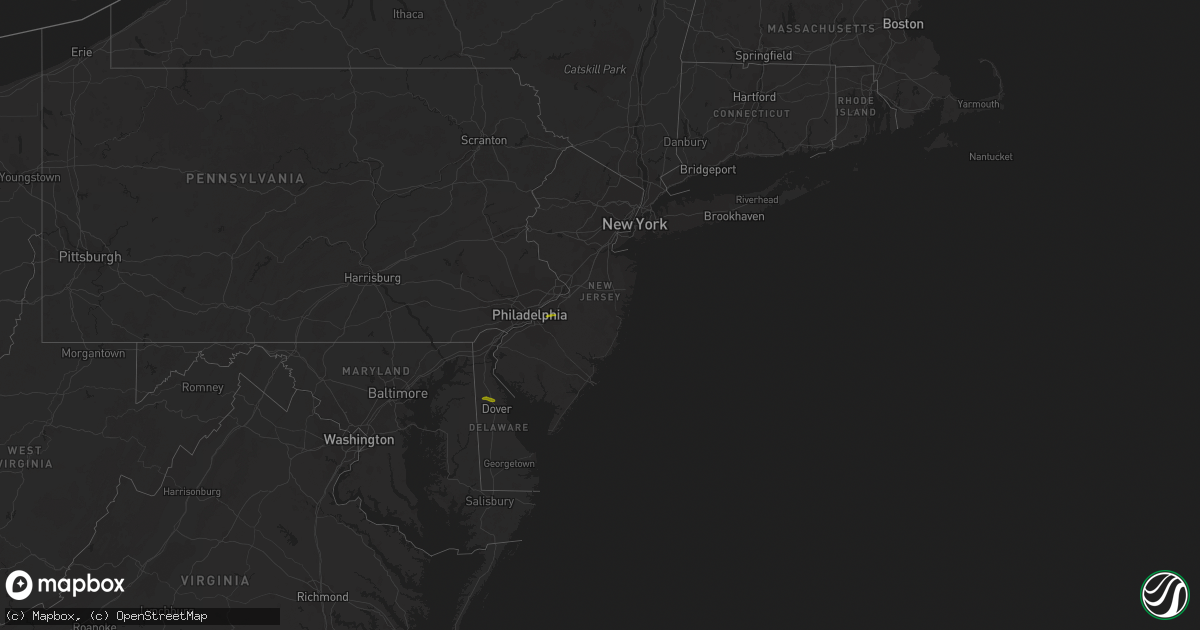
Hail Map in New Jersey on April 16, 2022
Get this storm
April 16 map
$229
one time, instant access
Download today. No call, no setup
Keep the $229
Bought the map and want the full workflow? Apply the entire $229 to a subscription within 7 days. None of it is wasted.
Every map, not just this one
This buys you this map. Subscription and you get every map we run, in the markets you choose from a few cities to whole states to nationwide. Plus real-time alerts the moment a storm fires.
Contact data
Name, contact info, occupancy, even credit band for addresses in the footprint. You go from where it hit to who to call.
Become the source they trust
Unlimited branding weather history reports on demand. You already have the documented answer ready for the property owner, and you are the one who showed up with it.
Property data and RoofTrace estimates
Pull up any address you have got, its value and the exact code rules for that jurisdiction, straight from One Click Code. Then RoofTrace estimates the squares, pitch, and roof value, priced the way you price.
Storm reports in New Jersey
New Jersey
| Date | Description |
|---|---|
| 04/16/20224:20 AM CDT | At 920 PM EDT, a severe thunderstorm was located near Dorothy, or 11 miles east of Vineland, moving east at 55 mph. HAZARD...Quarter size hail. SOURCE...Radar indicated. IMPACT...Minor damage to vehicles is possible. Locations impacted include... Vineland, Atlantic City, Cumberland, Pleasantville, Ventnor City, Brigantine, Northfield, Absecon, Egg Harbor City, Tuckerton, Weymouth, Estell Manor, Surf City, Port Republic, Pomona, Mays Landing, Dorothy, Mizpah, New Gretna and Beach Haven West.This includes the following highways... Garden State Parkway between mile markers 33 and 56. Atlantic City Expressway between mile markers 0 and 20. |
| 04/16/20223:28 AM CDT | At 827 PM EDT, a severe thunderstorm was located over Lumberton, or 16 miles east of Camden, moving east at 55 mph. HAZARD...Quarter size hail. SOURCE...Radar indicated. IMPACT...Minor damage to vehicles is possible. This severe thunderstorm will be near... Presidential Lakes Estates, Wrightstown, Browns Mills and Presidential Lakes around 840 PM EDT. Cedar Glen Lakes, Whiting and Woodruff around 850 PM EDT. Jackson, Lakehurst, Pine Ridge At Crestwood and Cassville around 855 PM EDT. Leisure Village West-Pine Lake Park, Pleasant Plains, Holiday City-Berkeley, Cedar Glen West and Holiday City South around 900 PM EDT. Toms River, Lakewood, Beachwood, Leisure Village and Leisure Village East around 905 PM EDT. Seaside Heights, Mantoloking, Brick Township, Dover Beaches North, Dover Beaches South and Ramtown around 910 PM EDT. Manasquan and Point Pleasant Beach around 915 PM EDT.Other locations impacted by this severe thunderstorm include CountryLake Estates, Silver Ridge, Brielle, Point Pleasant, Leisure Knoll,Nws Office, Crestwood Village, Gilford Park, South Toms River and BayHead.This includes the following highways... New Jersey Turnpike near exit 5. Interstate 295 in New Jersey between mile markers 40 and 47. Garden State Parkway between mile markers 79 and 97. |
| 04/15/20227:28 PM CDT | Report from mping: quarter |
All States Impacted by Hail Map on April 16, 2022
Cities Impacted by Hail Map on April 16, 2022
- Pine Hill, AL
- Waynesboro, MS
- Hampton, AR
- Bearden, AR
- Richton, MS
- Mayersville, MS
- Lake Providence, LA
- Gurdon, AR
- Banks, AR
- Jersey, AR
- Hermitage, AR
- Harrell, AR
- Tchula, MS
- Lexington, MS
- Yazoo City, MS
- Thomasville, AL
- Mansfield, AR
- Huntington, AR
- Greenwood, AR
- Shubuta, MS
- Oak Grove, LA
- Vanderpool, TX
- Camden, AR
- Kingsland, AR
- Rison, AR
- Eudora, AR
- Leola, AR
- Booneville, AR
- Leakesville, MS
- State Line, MS
- Uriah, AL
- Waldron, AR
- Hamburg, AR
- Millry, AL
- Chatom, AL
- Frankville, AL
- Wagarville, AL
- Saint Stephens, AL
- Jackson, AL
- Leroy, AL
- Cleveland, MS
- Laurel, MS
- Story, AR
- Mount Ida, AR
- Royal, AR
- Hot Springs National Park, AR
- Pearcy, AR
- Ovett, MS
- Gainestown, AL
- Sims, AR
- Wiggins, MS
- Toxey, AL
- Gilbertown, AL
- Needham, AL
- Arkadelphia, AR
- Wilmot, AR
- Annapolis, MD
- Harvey, AR
- Heidelberg, MS
- Greenville, MS
- Glen Allan, MS
- Cherry Hill, NJ
- Franklin, AL
- Chidester, AR
- Grand Ridge, FL
- Altha, FL
- Blountstown, FL
- Bristol, FL
- Vinegar Bend, AL
- Deer Park, AL
- Citronelle, AL
- Belzoni, MS
- Vaughan, MS
- Pickens, MS
- Ellisville, MS
- Doddsville, MS
- Minter City, MS
- Ruleville, MS
- Melvin, AL
- Sparkman, AR
- Carthage, AR
- Malvern, AR
- Neely, MS
- Silver City, MS
- Mount Laurel, NJ
- Smyrna, DE
- Cheswold, DE
- Dover, DE
- Clayton, DE


