Hail Map on April 16, 2022
Get this storm
April 16 map
$229
one time, instant access
Download today. No call, no setup
Keep the $229
Bought the map and want the full workflow? Apply the entire $229 to a subscription within 7 days. None of it is wasted.
Every map, not just this one
This buys you this map. Subscription and you get every map we run, in the markets you choose from a few cities to whole states to nationwide. Plus real-time alerts the moment a storm fires.
Contact data
Name, contact info, occupancy, even credit band for addresses in the footprint. You go from where it hit to who to call.
Become the source they trust
Unlimited branding weather history reports on demand. You already have the documented answer ready for the property owner, and you are the one who showed up with it.
Property data and RoofTrace estimates
Pull up any address you have got, its value and the exact code rules for that jurisdiction, straight from One Click Code. Then RoofTrace estimates the squares, pitch, and roof value, priced the way you price.
States Impacted by Hail Map on April 16, 2022
Storm reports
Oklahoma
| Date | Description |
|---|---|
| 04/16/20227:55 AM CDT | At 1254 AM CDT, a severe thunderstorm was located over Schulter, moving east at 40 mph. HAZARD...Half dollar size hail. SOURCE...Radar indicated. IMPACT...Damage to vehicles is expected. Locations in or near the path include... Henryetta... Checotah... Dewar... Schulter... Grayson... Council Hill... Hoffman... Hitchita... Pierce... This includes Interstate 40 in Oklahoma between mile markers 249 and265. |
| 04/16/20227:42 AM CDT | At 1242 AM CDT, a severe thunderstorm was located 7 miles southeast of Checotah, moving east at 25 mph. HAZARD...60 mph wind gusts and half dollar size hail. SOURCE...Radar indicated. IMPACT...Hail damage to vehicles is expected. Expect wind damage to roofs, siding, and trees. Locations in or near the path include... Checotah... Warner... Gore... Porum... Webbers Falls... Oktaha... Braggs... Tamaha... Rentiesville... Briartown... Greenleaf State Park... Keefeton... Onapa... This includes Interstate 40 in Oklahoma between mile markers 255 and294. |
| 04/16/20227:23 AM CDT | At 1223 AM CDT, a severe thunderstorm was located 3 miles east of Lake Eufaula State Park, moving east at 20 mph. HAZARD...60 mph wind gusts and half dollar size hail. SOURCE...Radar indicated. IMPACT...Hail damage to vehicles is expected. Expect wind damage to roofs, siding, and trees. Locations in or near the path include... Warner... Porum... Whitefield... Lake Eufaula State Park... Briartown... Onapa...This includes Interstate 40 in Oklahoma between mile markers 264 and282. |
| 04/16/20227:07 AM CDT | At 1206 AM CDT, a severe thunderstorm was located 4 miles northeast of Porum, moving east southeast at 30 mph. HAZARD...60 mph wind gusts and half dollar size hail. SOURCE...Radar indicated. IMPACT...Hail damage to vehicles is expected. Expect wind damage to roofs, siding, and trees. Locations in or near the path include... Webbers Falls... Keota... Bokoshe... Tamaha... Cowlington... Kanima... Milton... This includes Interstate 40 in Oklahoma between mile markers 282 and286. |
| 04/16/20222:18 AM CDT | At 718 AM CDT, a severe thunderstorm was located over Okay, moving east at 35 mph. HAZARD...60 mph wind gusts and quarter size hail. SOURCE...Radar indicated. IMPACT...Hail damage to vehicles is expected. Expect wind damage to roofs, siding, and trees. Locations in or near the path include... Muskogee... Tahlequah... Fort Gibson... Okay... Braggs... Cherokee Landing State Park... Sequoyah State Park... Pumpkin Center... Lake Tenkiller State Park... |
| 04/16/20221:41 AM CDT | At 640 AM CDT, a severe thunderstorm was located near Oneta, moving east at 35 mph. HAZARD...60 mph wind gusts and quarter size hail. SOURCE...Radar indicated. IMPACT...Hail damage to vehicles is expected. Expect wind damage to roofs, siding, and trees. Locations in or near the path include... Broken Arrow... Wagoner... Coweta... Sequoyah State Park... Oneta... Redbird... Mazie... |
| 04/16/202212:13 AM CDT | At 513 AM CDT, severe thunderstorms were located along a line extending from 5 miles northwest of Pryor to 2 miles west of Locust Grove, moving east at 45 mph. HAZARD...Quarter size hail. SOURCE...Radar indicated. IMPACT...Damage to vehicles is expected. Locations in or near the path include... Jay... Pryor... Pryor Creek... Chouteau... Locust Grove... Salina... Kansas... Adair... Spavinaw... Oaks... Hoot Owl... Rose... Spavinaw State Park... Leach... Chloeta... Twin Oaks... Sportsmen Acres Community... Strang... Snowdale State Park... Murphy...This includes Interstate 44 between mile markers 256 and 263. |
| 04/15/202211:28 PM CDT | At 428 AM CDT, a severe thunderstorm was located over Queen Wilhelmina State Park, or 12 miles northwest of Mena, moving southeast at 35 mph. HAZARD...60 mph wind gusts and quarter size hail. SOURCE...Radar indicated. IMPACT...Hail damage to vehicles is expected. Expect wind damage to roofs, siding, and trees. Locations impacted include... Mena... Hatfield... Vandervoort... Cossatot River State Park... Mountain Fork... Polk County Fairgrounds... Mena Intermountain Airport... Mccauley... Shady... Hartley... Bard Springs Recreation Area... Caney Creek Wilderness... Queen Wilhelmina State Park... Little Missouri Falls Recreatio... Cove... Acorn... Big Fork... Black Fork... Board Camp... Ink... |
| 04/15/202210:45 PM CDT | At 345 AM CDT, severe thunderstorms were located along a line extending from near Wister to Mansfield, moving southeast at 35 mph. HAZARD...Ping pong ball size hail and 60 mph wind gusts. SOURCE...Radar indicated. IMPACT...People and animals outdoors will be injured. Expect hail damage to roofs, siding, windows, and vehicles. Expect wind damage to roofs, siding, and trees. Locations in or near the path include... Poteau... Heavener... Wister... Howe... Hartford... Huntington... Midland... Heavener Runestone State Park... Washburn... Lake Wister State Park... Burnville... Patterson... Arkola... Crossroads... Witcherville... Dayton... Milltown... Hodgen... |
| 04/15/202210:32 PM CDT | At 332 AM CDT, a severe thunderstorm was located near Hartford, moving southeast at 35 mph. HAZARD...60 mph wind gusts and quarter size hail. SOURCE...Radar indicated. IMPACT...Hail damage to vehicles is expected. Expect wind damage to roofs, siding, and trees. Locations in or near the path include... Hartford... Patterson... Liberty... |
| 04/15/202210:24 PM CDT | At 324 AM CDT, a severe thunderstorm was located over Cincinnati, moving east at 35 mph. HAZARD...Golf ball size hail. SOURCE...Radar indicated. IMPACT...People and animals outdoors will be injured. Expect damage to roofs, siding, windows, and vehicles. Locations in or near the path include... Fayetteville... Springdale... Lowell... Farmington... Prairie Grove... Tontitown... Bethel Heights... Lincoln... Westville... Cincinnati... Johnson... Elm Springs... Goshen... Prairie Grove Battlefield State... Walnut Grove... Mayfield... Savoy... Ballard... Wedington... Rhea...This includes Interstate 49 between mile markers 59 and 78. |
| 04/15/202210:22 PM CDT | At 322 AM CDT, severe thunderstorms were located along a line extending from Midland to near Echo, moving east at 35 mph. HAZARD...60 mph wind gusts and quarter size hail. SOURCE...Radar indicated. IMPACT...Hail damage to vehicles is expected. Expect wind damage to roofs, siding, and trees. Locations impacted include... Booneville... Waldron... Mansfield... Magazine... Blue Mountain... Stonehouse Recreation Area... Cardiff... Mount Magazine... Echo... Oliver... Morgan Springs... Bates... Barber... Winfield... Olio... Liberty... Grayson... Glendale in Logan County... Ione... Elm Park... |
| 04/15/20229:46 PM CDT | At 246 AM CDT, a severe thunderstorm was located near Tahlequah, moving east at 35 mph. HAZARD...Ping pong ball size hail. SOURCE...Radar indicated. IMPACT...People and animals outdoors will be injured. Expect damage to roofs, siding, windows, and vehicles. Locations in or near the path include... Tahlequah... Siloam Springs... Westville... Watts... Eldon... Proctor... Christie... Cincinnati... Baron... Lake Francis... Ballard... Wedington... Rhea... Summers... |
| 04/15/20229:43 PM CDT | At 243 AM CDT, severe thunderstorms were located along a line extending from near Pumpkin Center to 2 miles northeast of Gore, moving east at 35 mph. HAZARD...60 mph wind gusts and quarter size hail. SOURCE...Radar indicated. IMPACT...Hail damage to vehicles is expected. Expect wind damage to roofs, siding, and trees. Locations in or near the path include... Stilwell... Westville... Vian... Gore... Webbers Falls... Marble City... Brushy... Adair State Park... Pumpkin Center... Maryetta... Cookson... Brushy Lake State Park... Cherokee Landing State Park... Bunch... Lake Tenkiller State Park... Baron... Box... This includes Interstate 40 in Oklahoma between mile markers 287 and292. |
| 04/15/20229:12 PM CDT | At 211 AM CDT, a severe thunderstorm was located 5 miles southeast of Rentiesville, moving east at 30 mph. HAZARD...Quarter size hail. SOURCE...Radar indicated. IMPACT...Damage to vehicles is expected. Locations in or near the path include... Stigler... Checotah... Warner... Porum... Webbers Falls... Keota... Tamaha... Rentiesville... Briartown... Kanima...This includes Interstate 40 in Oklahoma between mile markers 265 and290. |
| 04/15/20229:08 PM CDT | At 208 AM CDT, a severe thunderstorm was located 5 miles northeast of Brushy, moving east at 30 mph. HAZARD...Quarter size hail. SOURCE...Radar indicated. IMPACT...Damage to vehicles is expected. Locations in or near the path include... Cedarville... Mountainburg... Natural Dam... Chester... Brushy... Lee Creek... Devils Den State Park... Blackburn... Odell... This includes Interstate 49 between mile markers 31 and 41. |
| 04/15/20228:57 PM CDT | At 156 AM CDT, a severe thunderstorm was located near Muskogee, moving northeast at 35 mph. HAZARD...Two inch hail. SOURCE...Radar indicated. IMPACT...People and animals outdoors will be injured. Expect damage to roofs, siding, windows, and vehicles. Locations in or near the path include... Muskogee... Tahlequah... Fort Gibson... Okay... Hulbert... Tullahassee... Eldon... Scraper... Sequoyah State Park... Lost City... |
| 04/15/20228:21 PM CDT | At 120 AM CDT, severe thunderstorms were located along a line extending from 5 miles west of Boynton to 2 miles east of Oktaha to 2 miles east of Gore to Keota to 3 miles north of Spiro, moving northeast at 35 mph. HAZARD...Half dollar size hail. SOURCE...Radar indicated. IMPACT...Damage to vehicles is expected. Locations in or near the path include... Muskogee... Okmulgee... Sallisaw... Stigler... Fort Gibson... Muldrow... Checotah... Roland... Spiro... Haskell... Warner... Morris... Vian... Panama... Gore... Porum... Webbers Falls... Keota... Bokoshe... Oktaha...This includes Interstate 40 in Oklahoma between mile markers 252 and324. |
Arkansas
| Date | Description |
|---|---|
| 04/16/20228:52 AM CDT | Trees were blown down at denby point campground. |
| 04/16/20227:12 AM CDT | Trees were down along manchester road... Shandy road... And highway 128. |
| 04/16/20225:20 AM CDT | At 1020 AM CDT, a severe thunderstorm was located 9 miles southwest of Thiel, or 12 miles south of Malvern, moving east at 30 mph. HAZARD...60 mph wind gusts and quarter size hail. SOURCE...Radar indicated. IMPACT...Hail damage to vehicles is expected. Expect wind damage to roofs, siding, and trees. Locations impacted include... Sheridan... Leola... Carthage... Prattsville... Poyen... Thiel... Jenkins Ferry State Park... Dogwood... Donaldson... Lono... Cross Roads in Grant County... Tulip... Slabtown... Buie... Willow... Brush Creek... Millerville... |
| 04/16/20224:46 AM CDT | At 946 AM CDT, a severe thunderstorm was located near Cardiff, or 11 miles east of Waldron, moving southeast at 40 mph. HAZARD...60 mph wind gusts and quarter size hail. SOURCE...Radar indicated. IMPACT...Hail damage to vehicles is expected. Expect wind damage to roofs, siding, and trees. Locations impacted include... Cardiff... Gravelly... Fourche Valley... Muddy Creek WMA... Union Hill... Wing... Chula... Olio... Cedar Creek... Gibbs... Waltreak... Bluffton... Rover... Nola... Harvey... Sims... Parks... Briggsville... Blue Ball... |
| 04/16/20224:40 AM CDT | At 939 AM CDT, a severe thunderstorm was located near Hilo, or 10 miles southeast of Hampton, moving east at 30 mph. HAZARD...60 mph wind gusts and quarter size hail. SOURCE...Radar indicated. IMPACT...Hail damage to vehicles is expected. Expect wind damage to roofs, siding, and trees. Locations impacted include... Ladelle... Prairie Grove... New Hope in Drew County... Vick... Valley... Mt Olive in Bradley County... Johnsonville... Sumpter... Lacey... |
| 04/16/20224:11 AM CDT | At 911 AM CDT, a severe thunderstorm was located near Snyder, or 7 miles northeast of Hamburg, moving east at 25 mph. HAZARD...60 mph wind gusts and half dollar size hail. SOURCE...Radar indicated. IMPACT...Hail damage to vehicles is expected. Expect wind damage to roofs, siding, and trees. This severe thunderstorm will be near... Snyder around 925 AM CDT. Portland around 940 AM CDT. Montrose around 945 AM CDT. Mcmillan Corner around 1010 AM CDT. Lake Village and Chicot Junction around 1015 AM CDT. |
| 04/16/20224:01 AM CDT | At 901 AM CDT, a severe thunderstorm was located near Lanark, or 8 miles east of Hampton, moving east at 35 mph. HAZARD...60 mph wind gusts and quarter size hail. SOURCE...Radar indicated. IMPACT...Hail damage to vehicles is expected. Expect wind damage to roofs, siding, and trees. Locations impacted include... Warren... Hampton... Hermitage... Wilmar... Harrell... Ingalls... Weeks... Hilo... Hampton Municipal Airport... Lanark... Banks... Tinsman... Carmel... Farmville... Johnsonville... Vick... Valley... Gravelridge... Mt Olive in Bradley County... Marsden... |
| 04/16/20223:48 AM CDT | At 848 AM CDT, a severe thunderstorm was located 8 miles northeast of Mount Ida, moving east at 35 mph. HAZARD...60 mph wind gusts and quarter size hail. SOURCE...Radar indicated. IMPACT...Hail damage to vehicles is expected. Expect wind damage to roofs, siding, and trees. Locations impacted include... Mountain Pine... Lake Ouachita State Park... Rockwell... Avant... Crystal Springs Landing... Mt Tabor... Sunshine... Fannie... Royal... Lena Landing Rec Area... Silver... Hamilton... Hempwallace... Crystal Springs... Story... Washita... Hurricane Grove... |
| 04/16/20223:31 AM CDT | At 831 AM CDT, a severe thunderstorm was located 7 miles north of Hampton, moving east at 30 mph. HAZARD...60 mph wind gusts and quarter size hail. SOURCE...Radar indicated. IMPACT...Hail damage to vehicles is expected. Expect wind damage to roofs, siding, and trees. Locations impacted include... Hampton... Harrell... Hampton Municipal Airport... Weeks... Ellisville... Lanark... Highland Industrial Park... Banks... Tinsman... Farmville... Orlando... Woodberry... |
| 04/16/20223:23 AM CDT | At 822 AM CDT, a severe thunderstorm was located near Ingalls, or 14 miles north of West Crossett, moving east at 30 mph. HAZARD...60 mph wind gusts and half dollar size hail. SOURCE...Radar indicated. IMPACT...Hail damage to vehicles is expected. Expect wind damage to roofs, siding, and trees. Locations impacted include... Ingalls... Vick... Mt Olive in Bradley County... Marsden... Johnsonville... Blanchton... Lacey... |
| 04/16/20223:17 AM CDT | At 817 AM CDT, a severe thunderstorm was located over Muddy Creek WMA, or 18 miles north of Mount Ida, moving east at 45 mph. HAZARD...60 mph wind gusts and quarter size hail. SOURCE...Radar indicated. IMPACT...Hail damage to vehicles is expected. Expect wind damage to roofs, siding, and trees. Locations impacted include... Plainview in Yell County... Fourche Valley... Muddy Creek WMA... Carter Cove Park... Wing... Chula... Macedonia in Yell County... Cedar Creek... Gibbs... Mt Tabor... Fannie... Bluffton... Rover... Silver... Fourche Junction... Onyx... Sims... Fourche Mountain Recreation Are... Briggsville... Story... |
| 04/16/20222:59 AM CDT | At 759 AM CDT, a severe thunderstorm was located near Lanark, or 12 miles southeast of Hampton, moving east at 30 mph. HAZARD...60 mph wind gusts and quarter size hail. SOURCE...Radar indicated. IMPACT...Hail damage to vehicles is expected. Expect wind damage to roofs, siding, and trees. Locations impacted include... Warren... Hermitage... Ingalls... Hilo... Lanark... Carmel... Farmville... Johnsonville... Vick... Gravelridge... Mt Olive in Bradley County... Jersey... Sumpter... |
| 04/16/20222:57 AM CDT | At 756 AM CDT, a severe thunderstorm was located near Bearden, or 11 miles northeast of Camden, moving east at 30 mph. HAZARD...60 mph wind gusts and quarter size hail. SOURCE...Radar indicated. IMPACT...Hail damage to vehicles is expected. Expect wind damage to roofs, siding, and trees. Locations impacted include... Amy... Holly Springs... |
| 04/16/20222:55 AM CDT | At 755 AM CDT, a severe thunderstorm was located near Bearden, or 13 miles northeast of Camden, moving east at 40 mph. HAZARD...60 mph wind gusts and quarter size hail. SOURCE...Radar indicated. IMPACT...Hail damage to vehicles is expected. Expect wind damage to roofs, siding, and trees. Locations impacted include... Fordyce... Bearden... Thornton... Harlow... Highland Industrial Park... Amy... Chambersville... Hopeville... Eagle Mills... Woodberry... Holly Springs... Millville... |
| 04/16/20222:53 AM CDT | At 753 AM CDT, a severe thunderstorm was located near Cardiff, or 10 miles northeast of Waldron, moving east at 40 mph. HAZARD...60 mph wind gusts and half dollar size hail. SOURCE...Radar indicated. IMPACT...Hail damage to vehicles is expected. Expect wind damage to roofs, siding, and trees. Locations impacted include... Booneville... Waldron... Magazine... Blue Mountain... Stonehouse Recreation Area... Cardiff... Gravelly... Fourche Valley... Muddy Creek WMA... Havana... Union Hill... Waveland... Olio... Waltreak... Bluffton... Nola... Harvey... Sugar Grove... Carolan... Briggsville... |
| 04/16/20222:24 AM CDT | At 724 AM CDT, severe thunderstorms were located along a line extending from 3 miles south of Bloomer to near Huntington to near Hartford, moving southeast at 35 mph. HAZARD...60 mph wind gusts and half dollar size hail. SOURCE...Radar indicated. IMPACT...Hail damage to vehicles is expected. Expect wind damage to roofs, siding, and trees. Locations in or near the path include... Greenwood... Huntington... Midland... Washburn... Burnville... Fort Chaffee... Milltown... Arkola... Crossroads... Witcherville... Dayton... |
| 04/16/20222:24 AM CDT | At 723 AM CDT, a severe thunderstorm was located 7 miles east of Whelen Springs, or 19 miles northwest of Camden, moving east at 30 mph. HAZARD...60 mph wind gusts and quarter size hail. SOURCE...Radar indicated. IMPACT...Hail damage to vehicles is expected. Expect wind damage to roofs, siding, and trees. Locations impacted include... Sparkman... Whelen Springs... Amy... Tates Bluff... Pine Grove... Ouachita... Holly Springs... Vaden... |
| 04/16/20222:19 AM CDT | At 719 AM CDT, a severe thunderstorm was located near Huntington, or 16 miles southwest of Charleston, moving east at 35 mph. HAZARD...60 mph wind gusts and quarter size hail. SOURCE...Radar indicated. IMPACT...Hail damage to vehicles is expected. Expect wind damage to roofs, siding, and trees. Locations impacted include... Booneville... Mansfield... Magazine... Cardiff... Echo... Barber... Lucas... Chismville... Sugar Grove... Carolan... Grayson... Glendale in Logan County... Ione... Elm Park... Liberty... |
| 04/16/20222:17 AM CDT | At 717 AM CDT, severe thunderstorms were located along a line extending from near Highland Industrial Park to Hilo, moving northeast at 25 mph. HAZARD...60 mph wind gusts and quarter size hail. SOURCE...Radar indicated. IMPACT...Hail damage to vehicles is expected. Expect wind damage to roofs, siding, and trees. Locations impacted include... Hampton... Hermitage... Harrell... Ingalls... Hilo... Hampton Municipal Airport... Lanark... Highland Industrial Park... Banks... Tinsman... Artesian... Delhi... Farmville... Locust Bayou... Valley... Gravelridge... Woodberry... Mt Olive in Bradley County... Marsden... Jersey... |
| 04/16/20222:06 AM CDT | At 705 AM CDT, severe thunderstorms were located along a line extending from near Rockport to 12 miles north of Sparkman to near Richwoods, moving southeast at 30 mph. HAZARD...Golf ball size hail and 60 mph wind gusts. SOURCE...Radar indicated. IMPACT...People and animals outdoors will be injured. Expect hail damage to roofs, siding, windows, and vehicles. Expect wind damage to roofs, siding, and trees. Locations impacted include... Malvern... Rockport... Leola... Sparkman... Carthage... Prattsville... Poyen... Perla... Jenkins Ferry State Park... Thiel... Donaldson... Magnet Cove... Lono... Tulip... Ouachita... Gifford... Dalark... Fenter... Princeton... Social Hill...This includes Interstate 30 between mile markers 87 and 101. |
| 04/16/20221:52 AM CDT | At 652 AM CDT, a severe thunderstorm was located over Pocola, moving east at 40 mph. HAZARD...60 mph wind gusts and quarter size hail. SOURCE...Radar indicated. IMPACT...Hail damage to vehicles is expected. Expect wind damage to roofs, siding, and trees. Locations in or near the path include... Fort Smith... Greenwood... Pocola... Spiro... Arkoma... Hackett... Huntington... Bonanza... Midland... Cameron... Excelsior... Washburn... Burnville... Fort Chaffee... Jenny Lind... Rock Island... Arkola... Crossroads... Witcherville... Liberty...This includes Interstate 540 between mile markers 12 and 14. |
| 04/16/20221:25 AM CDT | At 624 AM CDT, a severe thunderstorm was located near DeGray Lake State Park, or 9 miles north of Arkadelphia, moving east at 40 mph. THIS IS A DESTRUCTIVE STORM! HAZARD...Three inch hail and 60 mph wind gusts. SOURCE...Radar indicated. IMPACT...People and animals outdoors will be severely injured. Expect shattered windows, extensive damage to roofs, siding, and vehicles. Locations impacted include... Arkadelphia... Malvern... Rockport... Amity... Caddo Valley... Perla... Gum Springs in Clark County... Richwoods... Meyers... Lofton... DeGray Lake State Park... Rockwell... Donaldson... Friendship... Bismarck... Alpine... Curtis... De Roche... Point Cedar... Dalark...This includes Interstate 30 between mile markers 64 and 98. |
| 04/16/20221:03 AM CDT | At 603 AM CDT, a severe thunderstorm was located near Lavaca, or near Charleston, moving east at 40 mph. HAZARD...60 mph wind gusts and half dollar size hail. SOURCE...Radar indicated. IMPACT...Hail damage to vehicles is expected. Expect wind damage to roofs, siding, and trees. Locations impacted include... Booneville... Paris... Magazine... Subiaco... Ratcliff... Caulksville... Wilkins... Roseville... Carbon City... Driggs... Chismville... |
| 04/16/202212:45 AM CDT | At 545 AM CDT, a severe thunderstorm was located near Van Buren, moving east at 40 mph. HAZARD...Half dollar size hail. SOURCE...Radar indicated. IMPACT...Damage to vehicles is expected. Locations in or near the path include... Fort Smith... Van Buren... Charleston... Alma... Barling... Lavaca... Mulberry... Dyer... Branch... Denning... Rudy... Fort Smith Regional Airport... Bloomer... Fort Chaffee... Kibler... Central City... Concord... Shibley... Vesta... Cecil...This includes the following highways, Interstate 40 in Arkansas between mile markers 2 and 21. Interstate 540 between mile markers 1 and 11. Interstate 49 between mile markers 22 and 26. |
| 04/16/202212:40 AM CDT | At 539 AM CDT, severe thunderstorms were located along a line extending from 13 miles northwest of Mountain Pine to near Lake Ouachita State Park to near Meyers to 9 miles west of Lofton to near Glenwood, moving southeast at 40 mph. HAZARD...60 mph wind gusts and half dollar size hail. SOURCE...Radar indicated. IMPACT...Hail damage to vehicles is expected. Expect wind damage to roofs, siding, and trees. Locations impacted include... Hot Springs... Hot Springs Village... Arkadelphia... Malvern... Mount Ida... Glenwood... Mountain Pine... Rockport... Amity... Caddo Valley... Norman... Perla... Lonsdale... Gum Springs in Clark County... Meyers... Jessieville... Lake Ouachita State Park... Lofton... Rockwell... DeGray Lake State Park...This includes Interstate 30 between mile markers 62 and 106. |
| 04/16/202212:08 AM CDT | At 508 AM CDT, a severe thunderstorm was located over Brushy, moving east at 35 mph. HAZARD...Quarter size hail. SOURCE...Radar indicated. IMPACT...Damage to vehicles is expected. Locations in or near the path include... Fort Smith... Van Buren... Sallisaw... Cedarville... Alma... Barling... Muldrow... Roland... Marble City... Moffett... Rudy... Brushy... Figure Five... Brushy Lake State Park... Short... Fort Smith Regional Airport... Kibler... Concord... Shibley... Uniontown...This includes the following highways, Interstate 40 in Arkansas between mile markers 0 and 13. Interstate 40 in Oklahoma between mile markers 322 and 328. Interstate 540 between mile markers 1 and 9. Interstate 49 between mile markers 22 and 23. |
| 04/15/202211:58 PM CDT | At 457 AM CDT, severe thunderstorms were located along a line extending from near Fourche Valley to near Muddy Creek WMA to 6 miles north of Mauldin to near Oden to near Opal, moving southeast at 30 mph. HAZARD...Golf ball size hail and 60 mph wind gusts. SOURCE...Radar indicated. IMPACT...People and animals outdoors will be injured. Expect hail damage to roofs, siding, windows, and vehicles. Expect wind damage to roofs, siding, and trees. Locations impacted include... Mount Ida... Mountain Pine... Norman... Oden... Little Missouri Falls Recreatio... Meyers... Lake Ouachita State Park... Mauldin... Albert Pike Recreation Area... Muddy Creek WMA... Stonehouse Recreation Area... Opal... Mimosa... Gravelly... Fourche Valley... Avant... Black Springs... Acorn... Big Fork... Wing... |
| 04/15/202211:14 PM CDT | At 414 AM CDT, severe thunderstorms were located along a line extending from near Cardiff to 7 miles southeast of Waldron to near Beauchamp, moving southeast at 35 mph. HAZARD...Ping pong ball size hail and 60 mph wind gusts. SOURCE...Radar indicated. IMPACT...People and animals outdoors will be injured. Expect hail damage to roofs, siding, windows, and vehicles. Expect wind damage to roofs, siding, and trees. Locations impacted include... Waldron... Mount Ida... Oden... Beauchamp... Cardiff... Opal... Mimosa... Gravelly... Fourche Valley... Mauldin... Muddy Creek WMA... Olio... Bluffton... Pine Ridge... Boles... Story... Union Hill... Chula... Cedar Creek... Gibbs... |
| 04/15/202211:04 PM CDT | At 404 AM CDT, a severe thunderstorm was located 4 miles east of Springdale, moving east at 40 mph. HAZARD...Half dollar size hail. SOURCE...Radar indicated. IMPACT...Damage to vehicles is expected. Locations in or near the path include... Fayetteville... Springdale... Berryville... Eureka Springs... Lowell... Green Forest... Bethel Heights... Hindsville... Rudd... Forum... Hobbs State Park... Clifty... Withrow Springs State Park... War Eagle... Urbanette... Rule... Goshen... Metalton... Connor... Best... |
| 04/15/202210:53 PM CDT | At 352 AM CDT, severe thunderstorms were located along a line extending from 7 miles east of Heavener Runestone State Park to Morgan Springs to near Oliver to 6 miles east of Echo, moving south at 20 mph. HAZARD...60 mph wind gusts and half dollar size hail. SOURCE...Radar indicated. IMPACT...Hail damage to vehicles is expected. Expect wind damage to roofs, siding, and trees. Locations impacted include... Booneville... Waldron... Mansfield... Magazine... Blue Mountain... Beauchamp... Stonehouse Recreation Area... Cardiff... Echo... Oliver... Morgan Springs... Mount Magazine... Bates... Barber... Black Fork... Winfield... Olio... Chismville... Liberty... Grayson... |
| 04/15/202210:42 PM CDT | At 341 AM CDT, severe thunderstorms were located along a line extending from 6 miles northeast of Heavener Runestone State Park to near Morgan Springs to near Oliver to near Washburn, moving south at 20 mph. HAZARD...60 mph wind gusts and quarter size hail. SOURCE...Radar indicated. IMPACT...Hail damage to vehicles is expected. Expect wind damage to roofs, siding, and trees. Locations impacted include... Booneville... Waldron... Mansfield... Magazine... Blue Mountain... Beauchamp... Stonehouse Recreation Area... Cardiff... Echo... Oliver... Morgan Springs... Mount Magazine... Bates... Barber... Black Fork... Winfield... Olio... Chismville... Liberty... Grayson... |
| 04/15/202210:09 PM CDT | At 309 AM CDT, a severe thunderstorm was located 3 miles north of Mc Curtain, moving southeast at 30 mph. HAZARD...60 mph wind gusts and quarter size hail. SOURCE...Radar indicated. IMPACT...Hail damage to vehicles is expected. Expect wind damage to roofs, siding, and trees. Locations in or near the path include... Poteau... Panama... Wister... Howe... Keota... Mccurtain... Bokoshe... Cameron... Mc Curtain... Lequire... Shady Point... Kanima... Milton... |
| 04/15/20229:49 PM CDT | At 249 AM CDT, a severe thunderstorm was located over Spiro, moving southeast at 30 mph. HAZARD...Ping pong ball size hail. SOURCE...Radar indicated. IMPACT...People and animals outdoors will be injured. Expect damage to roofs, siding, windows, and vehicles. Locations in or near the path include... Fort Smith... Greenwood... Pocola... Spiro... Panama... Hackett... Hartford... Huntington... Bonanza... Midland... Cameron... Excelsior... Washburn... Burnville... Jenny Lind... Rock Island... Arkola... Crossroads... Witcherville... Dayton...This includes Interstate 540 near mile marker 14. |
| 04/15/20229:20 PM CDT | At 220 AM CDT, a severe thunderstorm was located 6 miles southwest of Gans, moving east at 25 mph. HAZARD...Golf ball size hail. SOURCE...Radar indicated. IMPACT...People and animals outdoors will be injured. Expect damage to roofs, siding, windows, and vehicles. Locations in or near the path include... Fort Smith... Pocola... Spiro... Arkoma... Hackett... Bonanza... Gans... Rock Island... Cowlington... Scullyville... Braden... Rye Hill... Jenson... Cottonwood...This includes Interstate 540 between mile markers 12 and 14. |
| 04/15/20229:14 PM CDT | At 214 AM CDT, a severe thunderstorm was located over Midland, or 14 miles east of Poteau, moving east at 35 mph. HAZARD...Ping pong ball size hail. SOURCE...Radar indicated. IMPACT...People and animals outdoors will be injured. Expect damage to roofs, siding, windows, and vehicles. Locations impacted include... Booneville... Waldron... Mansfield... Cardiff... Echo... Barber... Lucas... Carolan... Grayson... Ione... Elm Park... Liberty... Hon... |
| 04/15/20228:44 PM CDT | At 144 AM CDT, a severe thunderstorm was located over Panama, moving east at 35 mph. HAZARD...Ping pong ball size hail. SOURCE...Radar indicated. IMPACT...People and animals outdoors will be injured. Expect damage to roofs, siding, windows, and vehicles. Locations in or near the path include... Poteau... Spiro... Panama... Hackett... Hartford... Huntington... Midland... Cameron... Shady Point... Rock Island... Patterson... Arkola... Crossroads... Witcherville... Dayton... Jenson... |
Texas
| Date | Description |
|---|---|
| 04/16/20222:53 AM CDT | At 753 PM CDT, a severe thunderstorm was located over Lost Maples State Natural Area, or 7 miles north of Vanderpool, moving southeast at 15 mph. HAZARD...60 mph wind gusts and quarter size hail. SOURCE...Radar indicated. IMPACT...Hail damage to vehicles is expected. Expect wind damage to roofs, siding, and trees. Locations impacted include... Vanderpool and Lost Maples State Natural Area. |
Alabama
| Date | Description |
|---|---|
| 04/16/20227:50 AM CDT | At 1250 AM CDT, a severe thunderstorm was located over Mertz, or 13 miles west of Brent, moving east at 45 mph. HAZARD...Ping pong ball size hail and 60 mph wind gusts. SOURCE...Radar indicated. IMPACT...People and animals outdoors will be injured. Expect hail damage to roofs, siding, windows, and vehicles. Expect wind damage to roofs, siding, and trees. Locations impacted include... Brent, Centreville, Lawley, Low Gap, West Centreville, Mertz, Talladega National Forest, Eoline, Randolph, Trio, Bibb County Airport, Oakmulgee, Ellards and Six Mile. |
| 04/16/20227:35 AM CDT | At 1234 AM CDT, a severe thunderstorm was located near Athens, moving northeast at 70 mph. HAZARD...Quarter size hail. SOURCE...Radar indicated. IMPACT...Damage to vehicles is expected. Locations impacted include... Northern Huntsville, Athens, Meridianville, Moores Mill, Hazel Green, Ardmore, Harvest, Tanner, Elkmont and Cartwright. |
| 04/16/20227:32 AM CDT | At 1232 AM CDT, a severe thunderstorm was located near Akron, or 11 miles north of Greensboro, moving east at 45 mph. HAZARD...Ping pong ball size hail and 60 mph wind gusts. SOURCE...Radar indicated. IMPACT...People and animals outdoors will be injured. Expect hail damage to roofs, siding, windows, and vehicles. Expect wind damage to roofs, siding, and trees. Locations impacted include... Marion, Akron, Heiberger, Evansville, Judson College, Radford, Morgan Springs, Folsom, Sprott, Harper Hill, Wateroak, Ellards and Havana. |
| 04/15/20229:21 PM CDT | At 220 PM CDT, a severe thunderstorm was located 8 miles southeast of Putnam, or 12 miles west of Thomasville, moving east at 35 mph. HAZARD...60 mph wind gusts and nickel size hail. SOURCE...Radar indicated. IMPACT...Expect damage to roofs, siding, and trees. Locations impacted include... Thomasville and Fulton. |
| 04/15/20228:23 PM CDT | At 122 PM CDT, a severe thunderstorm was located 12 miles northwest of Monroeville, moving east at 35 mph. HAZARD...60 mph wind gusts and penny size hail. SOURCE...Radar indicated. IMPACT...Expect damage to roofs, siding, and trees. Locations impacted include... Monroeville, Peterman and Beatrice. |
| 04/15/20228:13 PM CDT | At 112 AM CDT, a severe thunderstorm was located near Marion, moving east at 35 mph. HAZARD...Ping pong ball size hail and 60 mph wind gusts. SOURCE...Radar indicated. IMPACT...People and animals outdoors will be injured. Expect hail damage to roofs, siding, windows, and vehicles. Expect wind damage to roofs, siding, and trees. Locations impacted include... Selma, Valley Grande, Marion, Gardner Island, Paul M Grist State Park, Heiberger, Burnsville, Judson College, Radford, Folsom, Summerfield, Valley Creek Junction, Plantersville, Suttle, Sprott and Barrett Creek. |
Mississippi
| Date | Description |
|---|---|
| 04/16/20223:55 PM CDT | Photo of large hail received on office social media accounts. |
| 04/16/20223:45 PM CDT | Photo of large hail received on office social media accounts. |
| 04/16/20223:44 PM CDT | A local report indicates 1.75 inch wind near 18 SW WAYNESBORO |
| 04/16/20223:40 PM CDT | Ping pong sized hail reported by public. Via social media. Time estimated by radar. |
| 04/16/20223:04 PM CDT | Trees downed in the oak bowery community. Report via social media. |
| 04/16/20221:30 PM CDT | Corrects previous tstm wnd dmg report from 1 wnw ratliff ferry. A tree was blown down along the natchez trace and ratliff ferry road. Another tree was blown down along |
| 04/16/20221:30 PM CDT | A tree was blown down along the natchez trace and ratliff ferry road. |
| 04/16/202212:35 PM CDT | Trees down around durant. |
| 04/16/202212:30 PM CDT | Trees down across the county. |
| 04/16/202212:18 PM CDT | A couple of trees were blown down on highway 17 near lexington. |
| 04/16/20227:43 AM CDT | At 1242 AM CDT, a severe thunderstorm was located near J P Coleman State Park, moving east at 45 mph. HAZARD...60 mph wind gusts and penny size hail. SOURCE...Radar indicated. IMPACT...Expect damage to roofs, siding, and trees. Locations impacted include... Florence, Muscle Shoals, Sheffield, Tuscumbia, Killen, Cherokee, Lexington, St. Florian, Underwood-Petersville and Waterloo. |
| 04/16/20227:17 AM CDT | At 1217 PM CDT, severe thunderstorms were located along a line extending from near Coxburg to 7 miles south of Holly Bluff, moving southeast at 20 mph. HAZARD...60 mph wind gusts and quarter size hail. SOURCE...Radar indicated. IMPACT...Hail damage to vehicles is expected. Expect wind damage to roofs, siding, and trees. Severe thunderstorms will be near... Phoenix around 1255 PM CDT. Vaughan around 105 PM CDT.Other locations impacted by these severe thunderstorms includeSatartia and Bentonia. |
| 04/16/20227:13 AM CDT | At 1213 PM CDT, severe thunderstorms were located along a line extending from Bowling Green to Way, moving northeast at 30 mph. HAZARD...60 mph wind gusts and quarter size hail. SOURCE...Radar indicated. IMPACT...Hail damage to vehicles is expected. Expect wind damage to roofs, siding, and trees. Severe thunderstorms will be near... Durant and Bowling Green around 1220 PM CDT. Possumneck around 1230 PM CDT. Camden around 1235 PM CDT. Hesterville around 1240 PM CDT. Newport around 1250 PM CDT. Thomastown around 1255 PM CDT.Other locations impacted by these severe thunderstorms include Westand Sallis. |
| 04/16/20226:03 AM CDT | At 1102 AM CDT, a severe thunderstorm was located 7 miles northwest of Yazoo City, moving east at 30 mph. HAZARD...60 mph wind gusts and quarter size hail. SOURCE...Radar indicated. IMPACT...Hail damage to vehicles is expected. Expect wind damage to roofs, siding, and trees. This severe thunderstorm will be near... Yazoo City around 1115 AM CDT.Other locations impacted by this severe thunderstorm include Eden andLouise. |
| 04/15/202211:05 PM CDT | At 404 PM CDT, a severe thunderstorm was located 12 miles west of State Line, or 15 miles east of Richton, moving east at 25 mph. HAZARD...60 mph wind gusts and quarter size hail. SOURCE...Radar indicated. IMPACT...Hail damage to vehicles is expected. Expect wind damage to roofs, siding, and trees. Locations impacted include... Fruitdale. |
| 04/15/202210:35 PM CDT | At 335 PM CDT, a severe thunderstorm was located 7 miles southeast of Stafford Springs, or 16 miles northwest of Waynesboro, moving southeast at 35 mph. HAZARD...60 mph wind gusts and quarter size hail. SOURCE...Radar indicated. IMPACT...Hail damage to vehicles is expected. Expect wind damage to roofs, siding, and trees. Locations impacted include... Waynesboro, Clara and Buckatunna. |
| 04/15/202210:31 PM CDT | At 331 PM CDT, a severe thunderstorm was located 5 miles east of Ovett, or 7 miles north of Richton, moving east at 20 mph. HAZARD...60 mph wind gusts and quarter size hail. SOURCE...Radar indicated. IMPACT...Hail damage to vehicles is expected. Expect wind damage to roofs, siding, and trees. This severe thunderstorm will remain over mainly rural areas of northeastern Perry, southwestern Wayne and northwestern Greene Counties. |
| 04/15/202210:26 PM CDT | At 326 PM CDT, a severe thunderstorm was located near Ovett, or 9 miles north of Richton, moving east at 30 mph. HAZARD...60 mph wind gusts and quarter size hail. SOURCE...Radar indicated. IMPACT...Hail damage to vehicles is expected. Expect wind damage to roofs, siding, and trees. This severe thunderstorm will remain over mainly rural areas of southeastern Jones County. |
| 04/15/20229:28 PM CDT | At 227 AM CDT, a severe thunderstorm was located over Pinedale, or 12 miles southwest of New Albany, moving east at 30 mph. HAZARD...Quarter size hail. SOURCE...Radar indicated. IMPACT...Damage to vehicles is expected. Locations impacted include... New Albany, Pontotoc, Trace State Park, Ecru, New Harmony, Etta, Furrs, Pinedale, Sherman, Thaxton, Blue Springs, Hortontown, Poolville, Esperanza, Endville, Cherry Creek, Ellistown, Rough Edge, Nixon and Union Hill. |
| 04/15/20228:50 PM CDT | At 150 AM CDT, a severe thunderstorm was located near Harmontown, or 10 miles north of Holly Springs National Forest, moving southeast at 30 mph. HAZARD...Quarter size hail. SOURCE...Radar indicated. IMPACT...Damage to vehicles is expected. Locations impacted include... Oxford, Cambridge, Harmontown, Etta, Denmark, Pinedale, Laws Hill, Thaxton, Abbeville, Toccopola, Malone, Hortontown, Keel, Poolville, Esperanza, Delay, College Hill Station, College Hill, Altus and Blackwater. |
Delaware
| Date | Description |
|---|---|
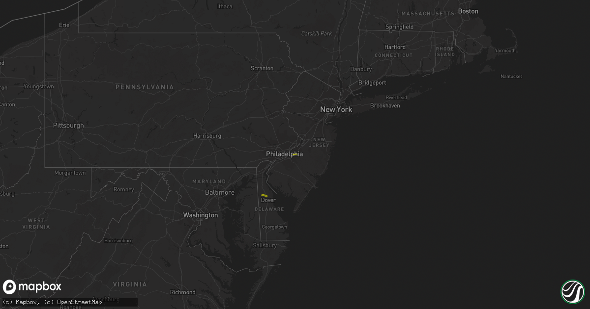
| 04/16/20223:34 AM CDT | At 834 PM EDT, a severe thunderstorm was located near Woodland Beach, or 8 miles north of Dover, moving east at 50 mph. HAZARD...Quarter size hail. SOURCE...Radar indicated. IMPACT...Minor damage to vehicles is possible. Locations impacted include... Vineland, Dover, Millville, Cumberland, Smyrna, North Wildwood, Laurel Lake, Woodbine, Estell Manor, Cheswold, Avalon, Stone Harbor, Greenwich, Corbin City, Newport, Cape May Court House, Leesburg, Scotch Bonnet, Woodland Beach and Dorothy.This includes Garden State Parkway between mile markers 5 and 15. |
| 04/15/20227:34 PM CDT | A local report indicates 1.00 inch wind near 1 NNW CHESWOLD |
New Jersey
| Date | Description |
|---|---|
| 04/16/20224:20 AM CDT | At 920 PM EDT, a severe thunderstorm was located near Dorothy, or 11 miles east of Vineland, moving east at 55 mph. HAZARD...Quarter size hail. SOURCE...Radar indicated. IMPACT...Minor damage to vehicles is possible. Locations impacted include... Vineland, Atlantic City, Cumberland, Pleasantville, Ventnor City, Brigantine, Northfield, Absecon, Egg Harbor City, Tuckerton, Weymouth, Estell Manor, Surf City, Port Republic, Pomona, Mays Landing, Dorothy, Mizpah, New Gretna and Beach Haven West.This includes the following highways... Garden State Parkway between mile markers 33 and 56. Atlantic City Expressway between mile markers 0 and 20. |
| 04/16/20223:28 AM CDT | At 827 PM EDT, a severe thunderstorm was located over Lumberton, or 16 miles east of Camden, moving east at 55 mph. HAZARD...Quarter size hail. SOURCE...Radar indicated. IMPACT...Minor damage to vehicles is possible. This severe thunderstorm will be near... Presidential Lakes Estates, Wrightstown, Browns Mills and Presidential Lakes around 840 PM EDT. Cedar Glen Lakes, Whiting and Woodruff around 850 PM EDT. Jackson, Lakehurst, Pine Ridge At Crestwood and Cassville around 855 PM EDT. Leisure Village West-Pine Lake Park, Pleasant Plains, Holiday City-Berkeley, Cedar Glen West and Holiday City South around 900 PM EDT. Toms River, Lakewood, Beachwood, Leisure Village and Leisure Village East around 905 PM EDT. Seaside Heights, Mantoloking, Brick Township, Dover Beaches North, Dover Beaches South and Ramtown around 910 PM EDT. Manasquan and Point Pleasant Beach around 915 PM EDT.Other locations impacted by this severe thunderstorm include CountryLake Estates, Silver Ridge, Brielle, Point Pleasant, Leisure Knoll,Nws Office, Crestwood Village, Gilford Park, South Toms River and BayHead.This includes the following highways... New Jersey Turnpike near exit 5. Interstate 295 in New Jersey between mile markers 40 and 47. Garden State Parkway between mile markers 79 and 97. |
| 04/15/20227:28 PM CDT | Report from mping: quarter |
Utah
| Date | Description |
|---|---|
| 04/16/20225:10 PM CDT | Pc098 sensor at gunnison reservoir |
| 04/16/20224:50 PM CDT | Utsci sensor |
| 04/16/20224:42 PM CDT | Milford asos |
| 04/15/202211:50 PM CDT | At 449 PM MDT, a severe thunderstorm was located near Scipio, moving east at 55 mph. HAZARD...60 mph wind gusts. SOURCE...Radar indicated. IMPACT...Expect damage to roofs, siding, and trees. Locations impacted include... Manti, Moroni, Scipio, Ephraim, Gunnison, Mount Pleasant, Wales, Fayette, Centerfield, Fountain Green, Spring City, Levan, Mayfield, Sterling and Yuba Lake State Park.This includes the following highways... Interstate 15 between mile markers 184 and 217, and between milemarkers 221 and 222. US Route 50 between mile markers 130 and 141. US Route 89 between mile markers 239 and 280. |
Cities Impacted by Hail Map on April 16, 2022
- Pine Hill, AL
- Waynesboro, MS
- Hampton, AR
- Bearden, AR
- Richton, MS
- Mayersville, MS
- Lake Providence, LA
- Gurdon, AR
- Banks, AR
- Jersey, AR
- Hermitage, AR
- Harrell, AR
- Tchula, MS
- Lexington, MS
- Yazoo City, MS
- Thomasville, AL
- Mansfield, AR
- Huntington, AR
- Greenwood, AR
- Shubuta, MS
- Oak Grove, LA
- Vanderpool, TX
- Camden, AR
- Kingsland, AR
- Rison, AR
- Eudora, AR
- Leola, AR
- Booneville, AR
- Leakesville, MS
- State Line, MS
- Uriah, AL
- Waldron, AR
- Hamburg, AR
- Millry, AL
- Chatom, AL
- Frankville, AL
- Wagarville, AL
- Saint Stephens, AL
- Jackson, AL
- Leroy, AL
- Cleveland, MS
- Laurel, MS
- Story, AR
- Mount Ida, AR
- Royal, AR
- Hot Springs National Park, AR
- Pearcy, AR
- Ovett, MS
- Gainestown, AL
- Sims, AR
- Wiggins, MS
- Toxey, AL
- Gilbertown, AL
- Needham, AL
- Arkadelphia, AR
- Wilmot, AR
- Annapolis, MD
- Harvey, AR
- Heidelberg, MS
- Greenville, MS
- Glen Allan, MS
- Cherry Hill, NJ
- Franklin, AL
- Chidester, AR
- Grand Ridge, FL
- Altha, FL
- Blountstown, FL
- Bristol, FL
- Vinegar Bend, AL
- Deer Park, AL
- Citronelle, AL
- Belzoni, MS
- Vaughan, MS
- Pickens, MS
- Ellisville, MS
- Doddsville, MS
- Minter City, MS
- Ruleville, MS
- Melvin, AL
- Sparkman, AR
- Carthage, AR
- Malvern, AR
- Neely, MS
- Silver City, MS
- Mount Laurel, NJ
- Smyrna, DE
- Cheswold, DE
- Dover, DE
- Clayton, DE