Hail Map in Virginia on April 16, 2011
Get this storm
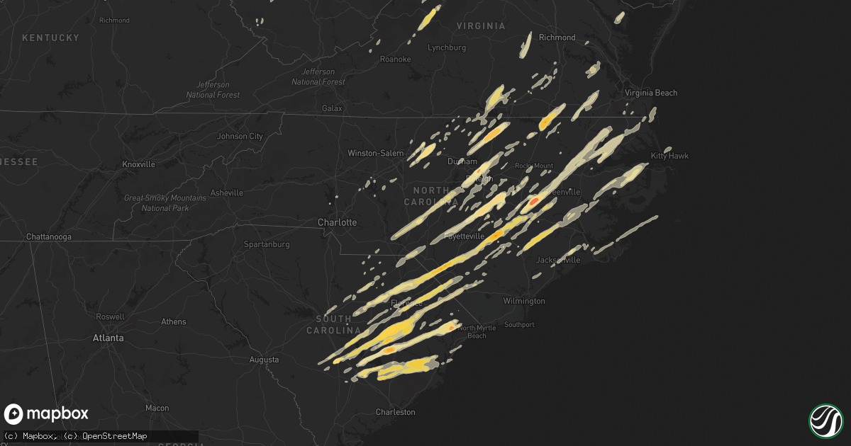
April 16 map
$229
one time, instant access
Download today. No call, no setup
Keep the $229
Bought the map and want the full workflow? Apply the entire $229 to a subscription within 7 days. None of it is wasted.
Every map, not just this one
This buys you this map. Subscription and you get every map we run, in the markets you choose from a few cities to whole states to nationwide. Plus real-time alerts the moment a storm fires.
Contact data
Name, contact info, occupancy, even credit band for addresses in the footprint. You go from where it hit to who to call.
Become the source they trust
Unlimited branding weather history reports on demand. You already have the documented answer ready for the property owner, and you are the one who showed up with it.
Property data and RoofTrace estimates
Pull up any address you have got, its value and the exact code rules for that jurisdiction, straight from One Click Code. Then RoofTrace estimates the squares, pitch, and roof value, priced the way you price.
Storm reports in Virginia
Virginia
| Date | Description |
|---|---|
| 04/16/20116:30 PM CDT | House damaged...trees knocked down partially defoliated. |
| 04/16/20116:27 PM CDT | Nws storm survey determined damage consistent with an ef-2 tornado in isle of wight county. The tornado damage was along a nearly continuous damage path from east of wa |
| 04/16/20116:25 PM CDT | Nws storm survey determined the damage was consistent with an ef-2 tornado. The tornado developed in southeastern middlesex county along the plankatank river moving nor |
| 04/16/20116:20 PM CDT | Large trees and powerlines knocked down on hull road. |
| 04/16/20116:16 PM CDT | Large sign torn down and a lot of trees blown down near south king street and davis avenue in leesburg |
| 04/16/20116:14 PM CDT | Ef0 tornado confirmed by storm survey. Damage consisted mainly of several snapped tree limbs and a few uprooted trees. A street sign post was pulled from the ground and |
| 04/16/20116:12 PM CDT | Large sign torn down and a lot of trees blown down near south king street and davis avenue in leesburg |
| 04/16/20116:10 PM CDT | Large tree and powerlines blocking road |
| 04/16/20116:05 PM CDT | 3 houses damaged on hummingbird ln. Unconfirmed fatalities. Storm survey will be conducted sunday morning. |
| 04/16/20116:05 PM CDT | Extensive damage to page middle school. |
| 04/16/20116:05 PM CDT | Nws storm survey determined damage consistent with an ef-2 tornado. The tornado damage was along a nearly continuous damage path from near coke to ware neck in gloucest |
| 04/16/20116:00 PM CDT | Large trees blocking road |
| 04/16/20115:45 PM CDT | Trees down on pocahontas trail |
| 04/16/20115:43 PM CDT | Power poles and transformer down on calmes neck lane. |
| 04/16/20115:40 PM CDT | Tree down over route 723 near route 50. |
| 04/16/20115:36 PM CDT | Tree down on millwood pike. |
| 04/16/20115:34 PM CDT | Hail up to quarters in size. |
| 04/16/20115:34 PM CDT | Tree blocking punch run road off strasburg road. |
| 04/16/20115:30 PM CDT | Nws storm survey determined the damage was consistent with an ef1 tornado. The tornado tracked from lagrange creek across corbin hall farm to family lane. The path widt |
| 04/16/20115:30 PM CDT | Tops of pine trees knocked off |
| 04/16/20115:10 PM CDT | Tree down at intersection of millwood drive and horner road. |
| 04/16/20115:00 PM CDT | Tree down on larchmont court and brawner drive. |
| 04/16/20114:57 PM CDT | Trees down 13299 cedar view rd one tree on house. |
| 04/16/20114:45 PM CDT | Trees down on crescent court. |
| 04/16/20114:35 PM CDT | A local report indicates 1.00 inch wind near POWHATAN |
| 04/16/20113:50 PM CDT | Numerous trees down along county drive. |
| 04/16/20113:47 PM CDT | Tree blown down on house on dinwiddie court. |
| 04/16/20113:47 PM CDT | Trees down on cox road. |
| 04/16/20113:46 PM CDT | Tree fell onto a vehicle at the intersection of stubbs bridge road and lawyers road. |
| 04/16/20113:37 PM CDT | *** 4 inj *** rated as a high-end ef1 tornado with approximate path length of 8 miles...path width variable...about 300-400 yards at its greatest extent. Tornado path s |
| 04/16/20113:33 PM CDT | Tree and powerlines down on foxcroft road. |
| 04/16/20113:33 PM CDT | Couple of trees down along colonial highway in hamilton. |
| 04/16/20113:11 PM CDT | Trees down along the 5000 block of docs road. |
| 04/16/20113:08 PM CDT | A local report indicates 1.00 inch wind near LANEXA |
| 04/16/20113:00 PM CDT | Trees down in fort pickett and forkland. |
| 04/16/20112:54 PM CDT | Large oak tree down on scuffletown rd |
| 04/16/20112:50 PM CDT | Tree down along shelby road. |
| 04/16/20112:45 PM CDT | Wind damage to trees. |
| 04/16/20112:45 PM CDT | Wind damage. Possible tornado. |
| 04/16/20112:45 PM CDT | Wind damage. Possible tornado. |
| 04/16/20112:45 PM CDT | Two trees down on farm along u.s. 29. |
| 04/16/20112:43 PM CDT | Trees and wires down at frays mill and mill house dr. |
| 04/16/20112:41 PM CDT | Tree down over road |
| 04/16/20112:41 PM CDT | Thirty trees were blown down at a golf course near the intersection of madison road and state route 619. |
| 04/16/20112:37 PM CDT | Tree down powell creek and shadybrook trail. |
| 04/16/20112:37 PM CDT | A tree fell onto a house along westminster road. |
| 04/16/20112:35 PM CDT | Wind damage. Golf ball size hail. |
| 04/16/20112:30 PM CDT | Nws storm survey determined the damamge was consistent with a long track ef1 tornado. The tornado initially touched down within the lunenburg county limits near kells c |
| 04/16/20112:30 PM CDT | Trees down |
| 04/16/20112:25 PM CDT | Power lines down in the community of arvonia. |
| 04/16/20112:25 PM CDT | Damage to siding and roof of apt building. Few trees cracked in half. |
| 04/16/20112:24 PM CDT | Tree down on powerlines. |
| 04/16/20112:20 PM CDT | Tree down |
| 04/16/20112:20 PM CDT | Tree down |
| 04/16/20112:17 PM CDT | Tree down blocking u.s. 29. |
| 04/16/20112:15 PM CDT | One tree blown down. |
| 04/16/20112:14 PM CDT | Tree down on power lines on lord fairfax highway. |
| 04/16/20112:12 PM CDT | Tree down at 8100 mcdonald rd |
| 04/16/20112:10 PM CDT | Tree down |
| 04/16/20112:10 PM CDT | Possible tornado. Trees down limiting access in or out of stauton river state park. This damage lines up and is consistent with the damage 4 miles nw of virgilina and c |
| 04/16/20112:10 PM CDT | Tree down on route 24 near the county line |
| 04/16/20112:05 PM CDT | 3 trees and power lines down at 10028 bill tuck highway |
| 04/16/20112:05 PM CDT | Tree down |
| 04/16/20112:05 PM CDT | Tree down |
| 04/16/20112:04 PM CDT | Tree down blocking road at garth road and lake albemarle road. |
| 04/16/20112:03 PM CDT | Numerous tres down. Route 58 eastbound was closed due to trees on the road. Possible tornado. |
| 04/16/20112:02 PM CDT | Tree down |
| 04/16/20112:00 PM CDT | 3 to 4 large trees down in area. Many smaller trees down. |
| 04/16/20111:59 PM CDT | Tree down blocking road. |
| 04/16/20111:55 PM CDT | Tree down at 1071 plywood trail |
| 04/16/20111:55 PM CDT | *** 4 inj *** possible tornado. 8 homes destroyed. 2 homes with significant damage. 4 minor injuries. Numerous trees down. Nws will conduct storm survey sunday 4/17/201 |
| 04/16/20111:53 PM CDT | Tree blocking road |
| 04/16/20111:53 PM CDT | Trees down onto wires on perry road. |
| 04/16/20111:50 PM CDT | *** 4 inj *** confirmed ef-2 tornado. Entered county from person county. Maximum wind speed 120 mph. Maximum path width 300 yards. Path length in va 16.6 miles. Ended 3 |
| 04/16/20111:49 PM CDT | A local report indicates 68 MPH wind near 4 NW WINTERGREEN |
| 04/16/20111:45 PM CDT | Numerous trees down and shingles off of houses. |
| 04/16/20111:43 PM CDT | Power poles down on whispering pine lane. |
| 04/16/20111:35 PM CDT | City of lynchburg law enforcement reported a tree down off of fort avenue. |
| 04/16/20111:35 PM CDT | City of lynchburg law enforcement reported a tree down off of forest brook road. |
| 04/16/20111:25 PM CDT | Tornado confirmed ef-1. Max winds 95 mph. Max path width 300 yrds. Path length 4 miles. Numerous trees snapped. Several barns demolished. |
| 04/16/20111:20 PM CDT | A couple of buildings collapsed near stuarts draft. |
| 04/16/20111:05 PM CDT | Measured in raphine. Also had pea sized hail. |
| 04/16/20111:03 PM CDT | Between mile marker 196 and 195 southbound on interstate 81 |
| 04/16/20111:03 PM CDT | A nws storm survey concluded that an ef0 tornado with intermittent damage along a 1.3 mile path...and maximum width of 100 yards...occured in the vesuvius community...t |
| 04/16/20111:00 PM CDT | A local report indicates 1.75 inch wind near FAIRFIELD |
| 04/16/20111:00 PM CDT | Trees down across the county. |
| 04/16/201112:50 PM CDT | Numerous trees down county wide. |
| 04/16/201112:42 PM CDT | 4-5 large trees down on moffett branch rd |
| 04/16/201112:38 PM CDT | A few reports of trees down in county |
| 04/16/201112:35 PM CDT | Estimated quarter size hail |
| 04/16/201112:34 PM CDT | Tree down at the intersection of pendleton road and quarles road. |
| 04/16/201112:15 PM CDT | Tree blown down at 1390 fairy stone park road. |
| 04/16/201111:30 AM CDT | Trees down county wide. |
| 04/16/201111:30 AM CDT | Couple trees down. |
| 04/16/201111:15 AM CDT | Trees and power lines down throughout the county. |
| 04/16/201111:00 AM CDT | 2 foot diameter fork of a tree broke through a rooftop |
| 04/16/201110:40 AM CDT | Tree blown down |
| 04/15/20117:48 PM CDT | Numerous trees reported knocked down |
| 04/15/20117:46 PM CDT | Numerous trees reported knocked down |
| 04/15/20117:46 PM CDT | Numerous trees reported knocked down |
| 04/15/20117:45 PM CDT | Parts of siding of house torn off. |
| 04/15/20117:40 PM CDT | Numerous trees reported knocked down |
| 04/15/20117:40 PM CDT | Numerous trees reported knocked down |
| 04/15/20117:20 PM CDT | Trees down on matoaka road. |
| 04/15/20117:00 PM CDT | A local report indicates 61 MPH wind near FRANKLIN |
All States Impacted by Hail Map on April 16, 2011
Cities Impacted by Hail Map on April 16, 2011
- Efland, NC
- Deep Run, NC
- Kenansville, NC
- Kinston, NC
- Beulaville, NC
- Rose Hill, NC
- Pink Hill, NC
- Dover, NC
- Magnolia, NC
- Trenton, NC
- Roanoke Rapids, NC
- Gaston, NC
- Emporia, VA
- Pleasant Hill, NC
- Garysburg, NC
- Skippers, VA
- Drewryville, VA
- Weldon, NC
- Boykins, VA
- Newsoms, VA
- Lillington, NC
- Reevesville, SC
- Branchville, SC
- Littleton, NC
- Enfield, NC
- New Zion, SC
- Gable, SC
- Andrews, SC
- Lane, SC
- Loris, SC
- Galivants Ferry, SC
- Maysville, NC
- Jacksonville, NC
- New Bern, NC
- Quantico, VA
- Stafford, VA
- Fair Bluff, NC
- Cerro Gordo, NC
- Orangeburg, SC
- Cordova, SC
- Columbia, NC
- Oxford, NC
- Stem, NC
- Burlington, NC
- Julian, NC
- Elon, NC
- Haw River, NC
- Whitsett, NC
- Henderson, NC
- Mebane, NC
- South Hill, VA
- Chase City, VA
- Lunenburg, VA
- Kenbridge, VA
- Boydton, VA
- Baskerville, VA
- Clarksville, VA
- Victoria, VA
- Skipwith, VA
- Conway, SC
- Aynor, SC
- Pawleys Island, SC
- Middleburg, NC
- Norlina, NC
- Creedmoor, NC
- Manson, NC
- Faison, NC
- Dudley, NC
- Mount Olive, NC
- Beaufort, NC
- Rowland, NC
- Summerton, SC
- Lake City, SC
- Olanta, SC
- Coward, SC
- Chadbourn, NC
- Pamplico, SC
- Alcolu, SC
- Elloree, SC
- Pinewood, SC
- Turbeville, SC
- Effingham, SC
- Nichols, SC
- Scranton, SC
- Santee, SC
- Manning, SC
- Greeleyville, SC
- Cades, SC
- Cameron, SC
- Mullins, SC
- Marion, SC
- Kingstree, SC
- Lancaster, VA
- Heathsville, VA
- Franklin, WV
- Merry Hill, NC
- Hertford, NC
- Edenton, NC
- Colerain, NC
- Belvidere, NC
- Windsor, NC
- Tyner, NC
- Steeles Tavern, VA
- Greenville, VA
- Staunton, VA
- Salters, SC
- Clinton, NC
- Vanceboro, NC
- Triangle, VA
- Fredericksburg, VA
- Fork, SC
- Sellers, SC
- Neeses, SC
- Timmonsville, SC
- Latta, SC
- Lynchburg, SC
- Sumter, SC
- Dillon, SC
- Cope, SC
- Lake View, SC
- Saint Matthews, SC
- Orrum, NC
- Lumberton, NC
- Fairmont, NC
- Norway, SC
- Florence, SC
- Mayesville, SC
- Hamer, SC
- Snow Hill, NC
- Pikeville, NC
- Goldsboro, NC
- Stantonsburg, NC
- Walstonburg, NC
- La Grange, NC
- Elkview, WV
- Charleston, WV
- Taneytown, MD
- Hanover, PA
- Littlestown, PA
- Jackson Springs, NC
- West End, NC
- Natural Bridge, VA
- Vesuvius, VA
- Buena Vista, VA
- Fairfield, VA
- Raphine, VA
- Glasgow, VA
- Lexington, VA
- Buchanan, VA
- Natural Bridge Station, VA
- Cary, NC
- Apex, NC
- Raleigh, NC
- Wake Forest, NC
- Autryville, NC
- Fayetteville, NC
- Salemburg, NC
- White Oak, NC
- Roseboro, NC
- Farmville, NC
- Fremont, NC
- Columbia, SC
- Millboro, VA
- New Castle, VA
- Prospect Hill, NC
- Hurdle Mills, NC
- Little Rock, SC
- Harleyville, SC
- Holly Hill, SC
- Elgin, SC
- Aulander, NC
- Robersonville, NC
- Hobbsville, NC
- Tarboro, NC
- Fountain, NC
- Williamston, NC
- Harrellsville, NC
- Oak City, NC
- Lewiston Woodville, NC
- Cofield, NC
- Bethel, NC
- Gatesville, NC
- Greenville, NC
- Ahoskie, NC
- Hamilton, NC
- Westminster, MD
- Bishopville, SC
- Elm City, NC
- Wilson, NC
- Gibsonville, NC
- Greensboro, NC
- Graham, NC
- McLeansville, NC
- Climax, NC
- Fort Bragg, NC
- Lucama, NC
- Saint Stephen, SC
- Bonneau, SC
- Cross, SC
- Pinopolis, SC
- Ernul, NC
- Chocowinity, NC
- Cove City, NC
- Grifton, NC
- Blounts Creek, NC
- Foster, WV
- Ridgeview, WV
- Ashford, WV
- Julian, WV
- Costa, WV
- Nellis, WV
- Peytona, WV
- Lexington, NC
- Salisbury, NC
- Seven Springs, NC
- Laurel Hill, NC
- Bennettsville, SC
- Hamlet, NC
- Bethune, SC
- Kershaw, SC
- Jefferson, SC
- Whiteville, NC
- Evergreen, NC
- Clarkton, NC
- Goshen, VA
- Craigsville, VA
- Haymarket, VA
- Broad Run, VA
- Reidsville, NC
- Browns Summit, NC
- Kenly, NC
- Roxboro, NC
- Chesterfield, SC
- Ruby, SC
- Powhatan, VA
- Amelia Court House, VA
- Carson, VA
- Crozier, VA
- Madison, WV
- Danville, WV
- Alum Creek, WV
- Belle, WV
- Racine, WV
- Hernshaw, WV
- Selma, NC
- Coats, NC
- Erwin, NC
- Clayton, NC
- Benson, NC
- Smithfield, NC
- Four Oaks, NC
- Dunn, NC
- Catawba, VA
- Havelock, NC
- Rowesville, SC
- Bowman, SC
- Jefferson, MD
- Richfield, NC
- Harrells, NC
- Garland, NC
- Eutawville, SC
- Vance, SC
- Delbarton, WV
- Alton, VA
- Lamar, SC
- Tar Heel, NC
- Maxton, NC
- Saint Pauls, NC
- Darlington, SC
- Dalzell, SC
- Shannon, NC
- Hartsville, SC
- Society Hill, SC
- Clio, SC
- Blenheim, SC
- Rembert, SC
- Pembroke, NC
- Red Springs, NC
- Omar, WV
- Summerville, SC
- Moncks Corner, SC
- Saint George, SC
- Georgetown, SC
- Jamestown, SC
- Pineville, SC
- Leesburg, VA
- Zuni, VA
- Carrsville, VA
- Franklin, VA
- Nesmith, SC
- Hemingway, SC
- Johnsonville, SC
- Gresham, SC
- Wallace, SC
- Petersburg, WV
- Monterey, VA
- Petersburg, VA
- Pine Level, NC
- Linden, NC
- Bluemont, VA
- West Point, VA
- Remington, VA
- Midland, VA
- Warrenton, VA
- Bealeton, VA
- Jeffersonton, VA
- Halifax, NC
- Capron, VA
- Branchville, VA
- Camden, SC
- Cassatt, SC
- Kittrell, NC
- Butner, NC
- Wendell, NC
- Williamsburg, VA
- Surry, VA
- Dendron, VA
- Elberon, VA
- Spring Grove, VA
- Waverly, VA
- Broadway, NC
- Sanford, NC
- Murrells Inlet, SC
- Myrtle Beach, SC
- Willow Spring, NC
- Fuquay Varina, NC
- Dickerson, MD
- Adamstown, MD
- Belhaven, NC
- Godwin, NC
- Catlett, VA
- Nokesville, VA
- Rougemont, NC
- Providence Forge, VA
- Lanexa, VA
- Lovettsville, VA
- Swoope, VA
- McBee, SC
- Marston, NC
- Cheraw, SC
- Kitty Hawk, NC
- Mount Croghan, SC
- Purcellville, VA
- Harpers Ferry, WV
- Como, NC
- Pendleton, NC
- Ashburn, VA
- Elkwood, VA
- Sumerduck, VA
- Richardsville, VA
- Louisburg, NC
- Carthage, NC
- Newport, NC
- Winterville, NC
- Hookerton, NC
- Ayden, NC
- Bullock, NC
- Durham, NC
- Ellerbe, NC
- New Hill, NC
- Moncure, NC
- Lilesville, NC
- Candor, NC
- Levels, WV
- Points, WV
- Snow Camp, NC
- Liberty, NC
- Prince Frederick, MD
- Port Republic, MD
- Mechanicsville, MD
- Hague, VA
- Montross, VA
- Dinwiddie, VA
- Patrick, SC
- New Oxford, PA
- Middlesex, NC
- Zebulon, NC
- Waterford, VA
- Hamilton, VA
- Round Hill, VA
- Asheboro, NC
- Sophia, NC
- Trinity, NC
- Pageland, SC
- Nelson, VA
- Buffalo Junction, VA
- Delaplane, VA
- Upperville, VA
- Blue Grass, VA
- Castalia, NC
- Upper Tract, WV
- Front Royal, VA
- Raeford, NC
- Spring Lake, NC
- Macclesfield, NC
- Bahama, NC
- Franklinton, NC
- Warrenton, NC
- Moorefield, WV
- Denton, NC
- Rolesville, NC
- Youngsville, NC
- Holly Springs, NC
- McKenney, VA
- Dewitt, VA
- Wilsons, VA
- Bunnlevel, NC
- Calypso, NC
- Warsaw, NC
- Angier, NC
- Windsor, VA
- Margarettsville, NC
- Courtland, VA
- Hanover, MD
- Newton Grove, NC
- Rockville, VA
- Aberdeen, NC
- Cornelius, NC
- Denver, NC
- Lugoff, SC
- Sterling, VA
- Herndon, VA
- Seaboard, NC
- Jackson, NC
- Manassas, VA
- Linwood, NC
- Hewett, WV
- Turtle Creek, WV
- Seth, WV
- Chapmanville, WV
- Bloomingrose, WV
- Jeffrey, WV
- Walton, WV
- Leasburg, NC
- Rocky Point, NC
- Chesapeake, VA
- Semora, NC
- Yanceyville, NC
- Bamberg, SC
- Knightdale, NC
- Garner, NC
- Brandywine, WV
- Huntingtown, MD
- Gainesville, VA
- Dolphin, VA
- Sugar Grove, WV
- Spotsylvania, VA
- Warfield, VA
- Stony Creek, VA
- Rawlings, VA
- Knotts Island, NC
- Moyock, NC
- Eastover, SC
- Sarah Ann, WV
- La Crosse, VA
- Peachland, NC
- Wadesboro, NC
- Elizabethtown, NC
- Milam, WV
- Bergton, VA
- Mathias, WV
- Bladenboro, NC
- Pope Army Airfield, NC
- Princeton, NC
- Creswell, NC
- Elizabeth City, NC
- Sunbury, NC
- South Mills, NC
- Camden, NC
- Centreville, VA
- Chantilly, VA
- Winchester, VA
- Bath, NC
- Washington, NC
- Hollister, NC
- Turkey, NC
- Pinetops, NC
- Pantego, NC
- Roper, NC
- Augusta, WV
- Slanesville, WV
- Romney, WV
- Scotland Neck, NC
- Wagram, NC
- Virginia Beach, VA
- Mooresville, NC
- Bunn, NC
- Jennings, FL
- Alberta, VA
- Rocky Mount, NC
- Camp Lejeune, NC
- Tarawa Terrace, NC
- Jessup, MD
- Annapolis Junction, MD
- Laurel, MD
- Pinetown, NC


