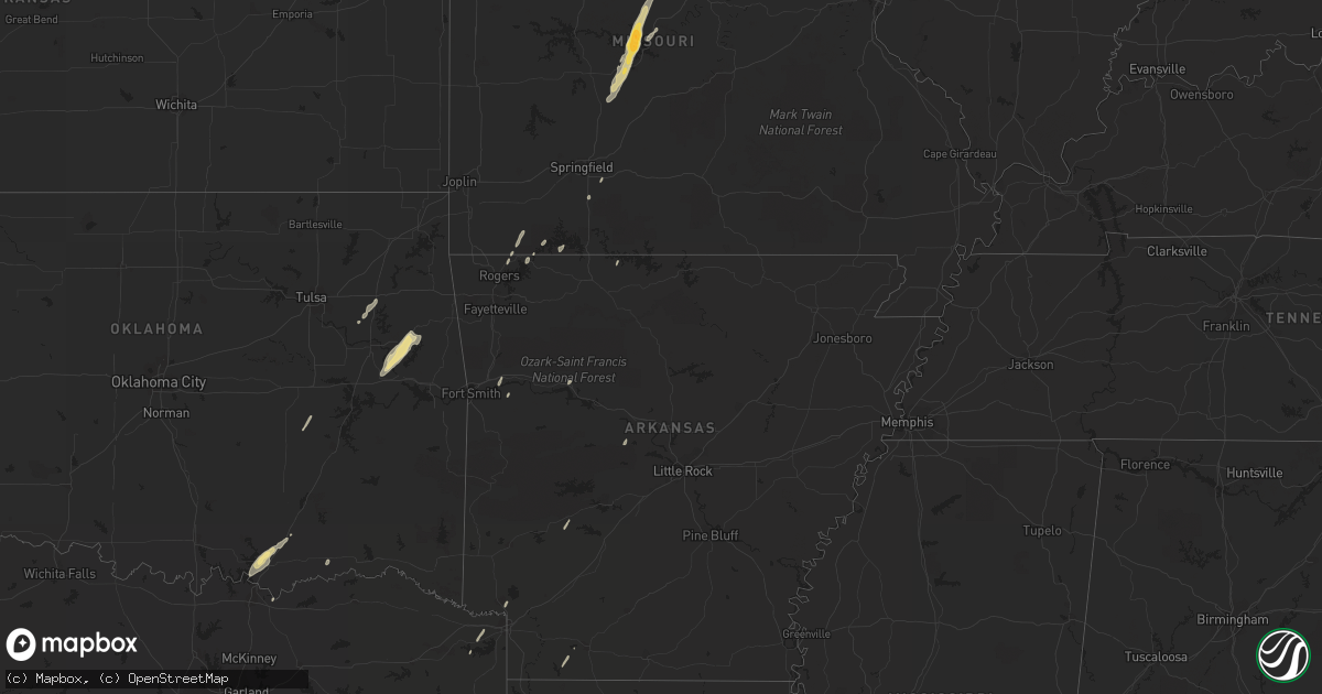
Hail Map in Texas on April 15, 2012
Get this storm
April 15 map
$229
one time, instant access
Download today. No call, no setup
Keep the $229
Bought the map and want the full workflow? Apply the entire $229 to a subscription within 7 days. None of it is wasted.
Every map, not just this one
This buys you this map. Subscription and you get every map we run, in the markets you choose from a few cities to whole states to nationwide. Plus real-time alerts the moment a storm fires.
Contact data
Name, contact info, occupancy, even credit band for addresses in the footprint. You go from where it hit to who to call.
Become the source they trust
Unlimited branding weather history reports on demand. You already have the documented answer ready for the property owner, and you are the one who showed up with it.
Property data and RoofTrace estimates
Pull up any address you have got, its value and the exact code rules for that jurisdiction, straight from One Click Code. Then RoofTrace estimates the squares, pitch, and roof value, priced the way you price.
Storm reports in Texas
Texas
| Date | Description |
|---|---|
| 04/15/20126:44 PM CDT | Spotter reported quarter sized hail in the town of fannin. |
| 04/15/20126:25 PM CDT | Spotter reported golf ball sized hail in goliad. |
| 04/15/20126:10 PM CDT | Ping pong ball sized hail reported off farm-to-market road 1726. |
| 04/15/20125:43 PM CDT | Golf ball sized hail reported off farm-to-market road 1726. |
| 04/15/20126:20 AM CDT | Nws storm survey concluded a tornado touched down in an open field south of highway 361 about two miles southeast of gregory. The tornado crossed highway 361 damaging a |
| 04/15/20125:50 AM CDT | Nws storm survey concluded a tornado touched down in a field south of highway 361 about a mile southeast of gregory. The tornado flipped over a fireworks stand and dama |
| 04/15/20125:44 AM CDT | Damage to cotton gin near gregory along with powerlines down. |
| 04/15/20125:44 AM CDT | Damage to cotton gin near gregory along with powerlines down. |
| 04/15/20125:39 AM CDT | Damage to homes on the north side of portland. Fences and tree limbs down. |
| 04/15/201212:54 AM CDT | Hail broke flood lights at the island italian restaurant on north padre island |
| 04/14/201210:04 PM CDT | Quarter size hail and 50 to 60 mph winds between falcon and lopeno. |
| 04/14/20129:10 PM CDT | Public report in morales-sanchez community of golf ball size hail. |
| 04/14/20128:41 PM CDT | Quarter sized hail reported by storm spotter. |
| 04/14/20128:29 PM CDT | Public near cruz calle reported quarter sized hail. |
| 04/14/20127:31 PM CDT | Stripes convenience store employee reported quarter sized hail at u.s. 59 and north laurent st. |
All States Impacted by Hail Map on April 15, 2012
Cities Impacted by Hail Map on April 15, 2012
- Minneota, MN
- Clarkfield, MN
- Portland, TX
- Gregory, TX
- Taft, TX
- Aransas Pass, TX
- Hector, MN
- Zapata, TX
- Refugio, TX
- Victoria, TX
- Goliad, TX
- Santa Elena, TX
- Rio Grande City, TX
- Roma, TX
- Buffalo, MN
- Montrose, MN
- Waverly, MN
- Hebbronville, TX
- Bayside, TX
- Inez, TX
- Tivoli, TX
- Woodsboro, TX
- Rockport, TX
- Ingleside, TX
- Kenedy, TX
- Corpus Christi, TX
- Edna, TX
- Dawson, MN
- Milwaukee, WI
- Guerra, TX
- Cassville, MO
- Golden, MO
- Shell Knob, MO
- Amity, AR
- Mitchell, SD
- Artesian, SD
- Letcher, SD
- Huntington, TX
- Porter, OK
- Coweta, OK
- Sunrise Beach, MO
- Camdenton, MO
- Gravois Mills, MO
- Lake Ozark, MO
- Groveton, TX
- Macks Creek, MO
- Osage Beach, MO
- Eldon, MO
- Buffalo, MO
- Roach, MO
- Barnett, MO
- Tunas, MO
- Russellville, MO
- Rocky Mount, MO
- Eldridge, MO
- Windyville, MO
- California, MO
- Mapleton, MN
- Lead Hill, AR
- Jamestown, MO
- Muskogee, OK
- Park Hill, OK
- Braggs, OK
- Gore, OK
- Tahlequah, OK
- Warner, OK
- Livingston, TX
- Hopkins, MN
- Premont, TX
- Concepcion, TX
- Tyler, MN
- Yoakum, TX
- Muskego, WI
- Hutchinson, MN
- Savoy, TX
- Bells, TX
- Calera, OK
- Durant, OK
- Caddo, OK
- Mead, OK
- Young America, MN
- New Germany, MN
- Lester Prairie, MN
- Plato, MN
- Minneapolis, MN
- Moscow, TX
- Corrigan, TX
- Brownton, MN
- Logansport, LA
- Joaquin, TX
- Glencoe, MN
- Pipestone, MN
- Tuscumbia, MO
- Kaiser, MO
- Jasper, TX
- Port O'Connor, TX
- Austwell, TX
- Winthrop, MN
- Gaylord, MN
- Good Thunder, MN
- Center, TX
- Brookings, SD
- Volga, SD
- Trinity, TX
- New Auburn, MN
- Colmesneil, TX
- Zavalla, TX
- Beeville, TX
- Winsted, MN
- Mayer, MN
- Howard Lake, MN
- Yorktown, TX
- Douglassville, TX
- Coushatta, LA
- Madisonville, TX
- San Augustine, TX
- Cartwright, OK
- Granite Falls, MN
- Maynard, MN
- Ruthton, MN
- Edgerton, MN
- Holland, MN
- Lake Benton, MN
- Jasper, MN
- Ashdown, AR
- Chouteau, OK
- Wagoner, OK
- Madison, SD
- Mulberry, AR
- Latham, MO
- Green Isle, MN
- Easton, MN
- Minnesota Lake, MN
- Shelbyville, TX
- Milam, TX
- Lynd, MN
- Ghent, MN
- Seligman, MO
- Garfield, AR
- Westhoff, TX
- Canova, SD
- Howard, SD
- Florien, LA
- Many, LA
- Lamar, AR
- Clarksville, AR
- Laredo, TX
- Charleston, AR
- Chester, TX
- Woodville, TX
- Russell, MN
- Lampe, MO
- Robeline, LA
- Natchitoches, LA
- Falfurrias, TX
- Baldwin, WI
- Woodville, WI
- Glenwood City, WI
- Brenham, TX
- Navasota, TX
- Somerville, TX
- Broaddus, TX
- Caney, OK
- Washburn, MO
- Lagrange, IN
- Lamar, OK
- Dustin, OK
- Ozark, MO
- Boswell, OK
- New Prague, MN
- Belle Plaine, MN
- Realitos, TX
- Winfred, SD
- Eureka Springs, AR
- Madison, MN
- Hemphill, TX
- Stamps, AR
- Taylor, AR
- Tilden, TX
- Marthaville, LA
- Waldo, AR
- Rogersville, MO
- Hooks, TX
- Maud, TX
- Newton, TX
- Chireno, TX
- Perryville, AR
- Zwolle, LA
- Noble, LA
- Belmont, LA
- Pleasant Hill, LA
- Cokato, MN
- Hales Corners, WI
- Welling, OK
- Fort Gibson, OK


