Hail Map in Missouri on April 15, 2012
Get this storm
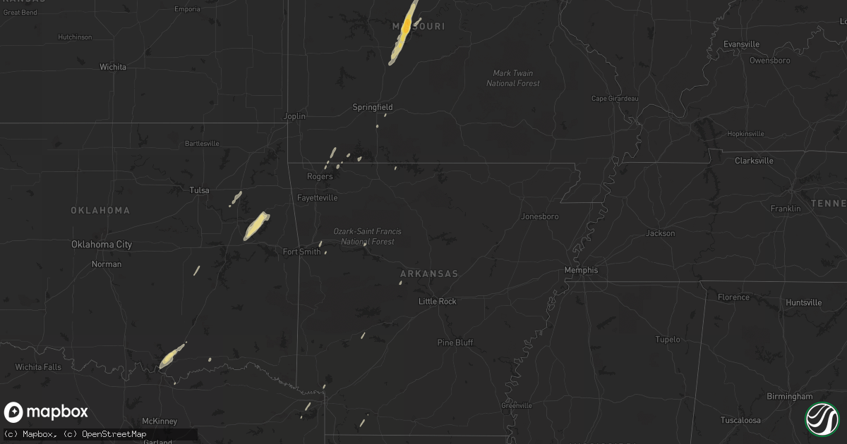
April 15 map
$229
one time, instant access
Download today. No call, no setup
Keep the $229
Bought the map and want the full workflow? Apply the entire $229 to a subscription within 7 days. None of it is wasted.
Every map, not just this one
This buys you this map. Subscription and you get every map we run, in the markets you choose from a few cities to whole states to nationwide. Plus real-time alerts the moment a storm fires.
Contact data
Name, contact info, occupancy, even credit band for addresses in the footprint. You go from where it hit to who to call.
Become the source they trust
Unlimited branding weather history reports on demand. You already have the documented answer ready for the property owner, and you are the one who showed up with it.
Property data and RoofTrace estimates
Pull up any address you have got, its value and the exact code rules for that jurisdiction, straight from One Click Code. Then RoofTrace estimates the squares, pitch, and roof value, priced the way you price.
Storm reports in Missouri
Missouri
| Date | Description |
|---|---|
| 04/15/20126:05 PM CDT | Shed blown around and tree down over road on county road 2240. |
| 04/15/20126:05 PM CDT | A couple of trees down over roadway. |
| 04/15/20124:31 PM CDT | Large cedar tree was blown over onto highway c near intersection with highway cc. |
| 04/15/20124:15 PM CDT | A local report indicates 1.75 inch wind near 1 E LAURIE |
| 04/15/20124:11 PM CDT | A local report indicates 1.00 inch wind near HURRICANE DECK |
| 04/15/20121:53 PM CDT | A local report indicates 1.00 inch wind near CASSVILLE |
| 04/15/20121:50 PM CDT | A local report indicates 1.00 inch wind near 1 WSW CASSVILLE |
| 04/14/20127:52 PM CDT | Fire dispatch reports that a power line was blown over with storms. Time estimated with radar. |
| 04/14/20127:45 PM CDT | 12 inch diameter tree snapped off at its trunk in st. Charles. |
| 04/14/20127:39 PM CDT | At cave springs and mexico road. |
| 04/14/20127:34 PM CDT | Large tree limb blown down onto power lines. |
| 04/14/20127:33 PM CDT | A local report indicates 58 MPH wind near 3 W CHESTERFIELD |
All States Impacted by Hail Map on April 15, 2012
Cities Impacted by Hail Map on April 15, 2012
- Minneota, MN
- Clarkfield, MN
- Portland, TX
- Gregory, TX
- Taft, TX
- Aransas Pass, TX
- Hector, MN
- Zapata, TX
- Refugio, TX
- Victoria, TX
- Goliad, TX
- Santa Elena, TX
- Rio Grande City, TX
- Roma, TX
- Buffalo, MN
- Montrose, MN
- Waverly, MN
- Hebbronville, TX
- Bayside, TX
- Inez, TX
- Tivoli, TX
- Woodsboro, TX
- Rockport, TX
- Ingleside, TX
- Kenedy, TX
- Corpus Christi, TX
- Edna, TX
- Dawson, MN
- Milwaukee, WI
- Guerra, TX
- Cassville, MO
- Golden, MO
- Shell Knob, MO
- Amity, AR
- Mitchell, SD
- Artesian, SD
- Letcher, SD
- Huntington, TX
- Porter, OK
- Coweta, OK
- Sunrise Beach, MO
- Camdenton, MO
- Gravois Mills, MO
- Lake Ozark, MO
- Groveton, TX
- Macks Creek, MO
- Osage Beach, MO
- Eldon, MO
- Buffalo, MO
- Roach, MO
- Barnett, MO
- Tunas, MO
- Russellville, MO
- Rocky Mount, MO
- Eldridge, MO
- Windyville, MO
- California, MO
- Mapleton, MN
- Lead Hill, AR
- Jamestown, MO
- Muskogee, OK
- Park Hill, OK
- Braggs, OK
- Gore, OK
- Tahlequah, OK
- Warner, OK
- Livingston, TX
- Hopkins, MN
- Premont, TX
- Concepcion, TX
- Tyler, MN
- Yoakum, TX
- Muskego, WI
- Hutchinson, MN
- Savoy, TX
- Bells, TX
- Calera, OK
- Durant, OK
- Caddo, OK
- Mead, OK
- Young America, MN
- New Germany, MN
- Lester Prairie, MN
- Plato, MN
- Minneapolis, MN
- Moscow, TX
- Corrigan, TX
- Brownton, MN
- Logansport, LA
- Joaquin, TX
- Glencoe, MN
- Pipestone, MN
- Tuscumbia, MO
- Kaiser, MO
- Jasper, TX
- Port O'Connor, TX
- Austwell, TX
- Winthrop, MN
- Gaylord, MN
- Good Thunder, MN
- Center, TX
- Brookings, SD
- Volga, SD
- Trinity, TX
- New Auburn, MN
- Colmesneil, TX
- Zavalla, TX
- Beeville, TX
- Winsted, MN
- Mayer, MN
- Howard Lake, MN
- Yorktown, TX
- Douglassville, TX
- Coushatta, LA
- Madisonville, TX
- San Augustine, TX
- Cartwright, OK
- Granite Falls, MN
- Maynard, MN
- Ruthton, MN
- Edgerton, MN
- Holland, MN
- Lake Benton, MN
- Jasper, MN
- Ashdown, AR
- Chouteau, OK
- Wagoner, OK
- Madison, SD
- Mulberry, AR
- Latham, MO
- Green Isle, MN
- Easton, MN
- Minnesota Lake, MN
- Shelbyville, TX
- Milam, TX
- Lynd, MN
- Ghent, MN
- Seligman, MO
- Garfield, AR
- Westhoff, TX
- Canova, SD
- Howard, SD
- Florien, LA
- Many, LA
- Lamar, AR
- Clarksville, AR
- Laredo, TX
- Charleston, AR
- Chester, TX
- Woodville, TX
- Russell, MN
- Lampe, MO
- Robeline, LA
- Natchitoches, LA
- Falfurrias, TX
- Baldwin, WI
- Woodville, WI
- Glenwood City, WI
- Brenham, TX
- Navasota, TX
- Somerville, TX
- Broaddus, TX
- Caney, OK
- Washburn, MO
- Lagrange, IN
- Lamar, OK
- Dustin, OK
- Ozark, MO
- Boswell, OK
- New Prague, MN
- Belle Plaine, MN
- Realitos, TX
- Winfred, SD
- Eureka Springs, AR
- Madison, MN
- Hemphill, TX
- Stamps, AR
- Taylor, AR
- Tilden, TX
- Marthaville, LA
- Waldo, AR
- Rogersville, MO
- Hooks, TX
- Maud, TX
- Newton, TX
- Chireno, TX
- Perryville, AR
- Zwolle, LA
- Noble, LA
- Belmont, LA
- Pleasant Hill, LA
- Cokato, MN
- Hales Corners, WI
- Welling, OK
- Fort Gibson, OK


