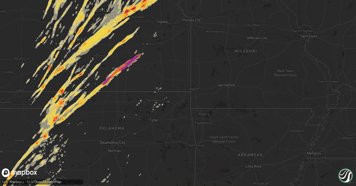
Hail Map on April 14, 2012
Get this storm
April 14 map
$229
one time, instant access
Download today. No call, no setup
Keep the $229
Bought the map and want the full workflow? Apply the entire $229 to a subscription within 7 days. None of it is wasted.
Every map, not just this one
This buys you this map. Subscription and you get every map we run, in the markets you choose from a few cities to whole states to nationwide. Plus real-time alerts the moment a storm fires.
Contact data
Name, contact info, occupancy, even credit band for addresses in the footprint. You go from where it hit to who to call.
Become the source they trust
Unlimited branding weather history reports on demand. You already have the documented answer ready for the property owner, and you are the one who showed up with it.
Property data and RoofTrace estimates
Pull up any address you have got, its value and the exact code rules for that jurisdiction, straight from One Click Code. Then RoofTrace estimates the squares, pitch, and roof value, priced the way you price.
States Impacted by Hail Map on April 14, 2012
Storm reports
Kansas
| Date | Description |
|---|---|
| 04/14/20126:55 PM CDT | Tornado touched down briefly west of varner. |
| 04/14/20126:55 PM CDT | Tornado on the ground at new cambria |
| 04/14/20126:44 PM CDT | A local report indicates 1.00 inch wind near 6 NE KINGMAN |
| 04/14/20126:38 PM CDT | Structure damage to farmhouse. |
| 04/14/20126:35 PM CDT | Hail lasted between 5 to 10 minutes long. |
| 04/14/20126:25 PM CDT | A tornado 1.5 miles northwest of falun and muir road. Large visible debri detected. |
| 04/14/20126:19 PM CDT | A local report indicates a tornado near 6 W ASSARIA |
| 04/14/20126:09 PM CDT | A tornado on the ground just southwest of the town of falun. Also seeing debri. |
| 04/14/20126:09 PM CDT | A large tornado about one quarter mile wide was near k4 and highway 141. Tornado was now entering into saline county. |
| 04/14/20126:01 PM CDT | Large wedge tornado on ground. |
| 04/14/20125:45 PM CDT | Wedge tornado still on ground. |
| 04/14/20125:37 PM CDT | Large wedge tornado. |
| 04/14/20125:35 PM CDT | Tornado on ground |
| 04/14/20125:03 PM CDT | Quarter size hail west of chase on highway 56. |
| 04/14/20125:02 PM CDT | Brief tornado touchdown |
| 04/14/20125:00 PM CDT | A local report indicates 1.75 inch wind near E ELLINWOOD |
| 04/14/20124:54 PM CDT | A local report indicates 1.25 inch wind near 3 E ELLINWOOD |
| 04/14/20124:51 PM CDT | Quarter to pea size hail. |
| 04/14/20124:50 PM CDT | A local report indicates a tornado near NW SAWYER |
| 04/14/20124:50 PM CDT | A local report indicates a tornado near 6 SSE ELLINWOOD |
| 04/14/20124:48 PM CDT | A local report indicates a tornado near 1 W SAWYER |
| 04/14/20124:40 PM CDT | A local report indicates 1.25 inch wind near WNW SAWYER |
| 04/14/20124:35 PM CDT | A local report indicates 2.50 inch wind near SAWYER |
| 04/14/20124:25 PM CDT | A local report indicates a tornado near 1 SE SEWARD |
| 04/14/20124:25 PM CDT | The hail smashed though the skylight of the spotters home. |
| 04/14/20124:25 PM CDT | A local report indicates a tornado near 5 W HUDSON |
| 04/14/20124:05 PM CDT | A local report indicates a tornado near 2 E TIMKEN |
| 04/14/20123:46 PM CDT | Brief tornado touchdown just south of the town of rush center. |
| 04/14/20123:43 PM CDT | A local report indicates a tornado near 5 W ASH VALLEY |
| 04/14/20123:43 PM CDT | A local report indicates 60 MPH wind near 3 N CUBA |
| 04/14/20123:35 PM CDT | A local report indicates 1.50 inch wind near SUMMERFIELD |
| 04/14/20123:34 PM CDT | A local report indicates a tornado near 10 N ROZEL |
| 04/14/20123:30 PM CDT | Tornado tore up storage bins on his neighbors farm. |
| 04/14/20123:30 PM CDT | A local report indicates 1.00 inch wind near 7 N BEATTIE |
| 04/14/20123:25 PM CDT | A tornado was observed. The tornado destroyed numerous farm implements including flipping 4 grain augers through a grain bin. Two complete pivot irrigation systems were |
| 04/14/20123:25 PM CDT | A local report indicates a tornado near 5 W ASH VALLEY |
| 04/14/20123:23 PM CDT | A local report indicates 1.00 inch wind near 1 ENE MARYSVILLE |
| 04/14/20123:21 PM CDT | A local report indicates 1.00 inch wind near 6 WSW BEATTIE |
| 04/14/20123:20 PM CDT | A local report indicates 2.00 inch wind near ENE MULLINVILLE |
| 04/14/20123:05 PM CDT | A local report indicates 1.00 inch wind near SSE BARNES |
| 04/14/20122:58 PM CDT | Sheriff reported tornado 2 to 3 miles west of burdette. |
| 04/14/20122:56 PM CDT | A local report indicates a tornado near 1 E BURDETT |
| 04/14/20122:55 PM CDT | A local report indicates a tornado near 1 SE BURDETT |
| 04/14/20122:54 PM CDT | A local report indicates a tornado near 2 W ROZEL |
| 04/14/20122:50 PM CDT | A local report indicates a tornado near 2 E GRAY |
| 04/14/20122:46 PM CDT | A local report indicates 1.00 inch wind near 3 WNW CLYDE |
| 04/14/20122:45 PM CDT | A local report indicates 60 MPH wind near BELOIT |
| 04/14/20122:30 PM CDT | Power lines reported down in the glen elder reservior area. |
| 04/14/20122:30 PM CDT | A local report indicates 1.75 inch wind near BUCKLIN |
| 04/14/20122:28 PM CDT | A wall cloud with a funnel appearing to reach to near the ground was observed from a distance of about 6 miles from the observation point northeast of the possible torn |
| 04/14/20122:23 PM CDT | The tornado was observed from a residence 3 miles southeast. |
| 04/14/20122:20 PM CDT | Power poles down and power lines down across highway 18 between lucas and luray. |
| 04/14/20122:14 PM CDT | Storm chaser reported a wrapped tornado 1.5 miles south of tipton. Emergency management had a report of some tin taken from a building in the same general area. A garag |
| 04/14/20122:09 PM CDT | Public reported a tornado crossing highway 283 on the hodgeman and ford county line. |
| 04/14/20121:54 PM CDT | Some outbuildings damaged or destroyed along with power pole lines down. |
| 04/14/20121:45 PM CDT | A local report indicates 2.00 inch wind near 9 NW ENGLEWOOD |
| 04/14/20121:45 PM CDT | A local report indicates 65 MPH wind near 4 N LUCAS |
| 04/14/20121:40 PM CDT | A local report indicates 1.00 inch wind near HOWELL |
| 04/14/20121:40 PM CDT | Public reported a tornado crossing highway 283 on the hodgeman and ford county line. |
| 04/14/20121:33 PM CDT | Damage to an old school house was reported at this location. Damage to outbuildings were also reported along 232 rd. |
| 04/14/20121:33 PM CDT | Out building damaged with debri scattered 3/4 of mile northeast of impact. |
| 04/14/20121:33 PM CDT | Electric lines down and power pole lines snapped. |
| 04/14/20121:32 PM CDT | A local report indicates 1.00 inch wind near 9 NW ENGLEWOOD |
| 04/14/20121:22 PM CDT | A local report indicates 74 MPH wind near RUSSELL AIRPORT |
| 04/14/20121:20 PM CDT | On highway 70 at mile marker 188 a few roads signs are blown over or snapped. Trash blown around at rest area east of russell. |
| 04/14/201212:30 PM CDT | This is post event verification from severe weather that occurred yesterday. |
| 04/14/201212:30 PM CDT | The observer noted a couple of brief touchdowns over a few minutes. |
| 04/14/201212:17 PM CDT | Tree limbs were blown across the road. A power pole was snapped off near the base. An entire irrigation pivot system was blown over. This could have been either straigh |
| 04/14/201212:17 PM CDT | Tree limbs were thrown across the road. A power pole was snapped off near the base. An entire irrigation system was blown over. This could have been straight line winds |
| 04/14/201212:16 PM CDT | Tree limbs were blown across the road. A pivot irrigation system was blown over and a power pole was snapped off near the base. This could have been a tornado or straig |
| 04/14/201212:08 PM CDT | A local report indicates 1.75 inch wind near 8 S ARNOLD |
| 04/14/201211:40 AM CDT | A local report indicates 1.00 inch wind near 3 N YOCEMENTO |
| 04/14/20124:58 AM CDT | Along highway 400. |
| 04/14/20123:46 AM CDT | A metal outbuilding had its roof ripped off. A hay barn made out of a pole shed was also destroyed. A narrow corridor of cottonwood trees were also heavily damaged. |
| 04/14/20123:20 AM CDT | 6 inch diameter tree limbs down. Delayed report. |
| 04/14/20122:30 AM CDT | Golf ball sized hail west of town. Nickel sized in olsburg. Time estimated by radar. |
| 04/14/20121:55 AM CDT | Time estimated by radar. Delayed report |
| 04/14/20121:53 AM CDT | A local report indicates 1.25 inch wind near VERMILLION |
| 04/14/20121:50 AM CDT | Minor crop damage also reported. Estimated 3 to 4 inches of rainfall also. |
| 04/14/20121:50 AM CDT | Delayed report |
| 04/14/20121:46 AM CDT | A local report indicates 1.00 inch wind near 5 S FRANKFORT |
| 04/14/20121:45 AM CDT | A local report indicates 2.50 inch wind near BLAINE |
| 04/14/20121:20 AM CDT | A local report indicates 1.75 inch wind near 1 W OLSBURG |
| 04/14/20121:17 AM CDT | A local report indicates 4.50 inch wind near RANDOLPH |
| 04/14/20121:15 AM CDT | A local report indicates 4.25 inch wind near RANDOLPH |
| 04/14/20121:05 AM CDT | Grapefruit size hail put holes in roofs of cars and broke all west facing house windows. Time estimated. |
| 04/14/201212:58 AM CDT | A local report indicates 2.00 inch wind near WAKEFIELD |
| 04/14/201212:06 AM CDT | Storm chasers reported a brief tornado in open field. |
| 04/13/201211:39 PM CDT | Large wedge tornado |
| 04/13/201211:38 PM CDT | 60 to 70 mph. |
| 04/13/201211:34 PM CDT | On the ground. |
| 04/13/201211:29 PM CDT | A local report indicates 1.50 inch wind near WSW MOONLIGHT |
| 04/13/201211:26 PM CDT | A local report indicates 1.75 inch wind near 4 S CASSODAY |
| 04/13/201211:25 PM CDT | Tornado illuminated by lightning. |
| 04/13/201211:22 PM CDT | A local report indicates a tornado near 1 ENE NEW CAMBRIA |
| 04/13/201211:22 PM CDT | Off duty ncar meteorologist. |
| 04/13/201211:18 PM CDT | Large wedge tornado roughly 9 miles nne of el dorado |
| 04/13/201211:18 PM CDT | Damage to a house near kanopolis...time estimated |
| 04/13/201211:14 PM CDT | Power flashes northeast of el dorado. |
| 04/13/201211:10 PM CDT | Spotter reported a cone to wedge tornado |
| 04/13/201211:06 PM CDT | Power outages on the west side of el dorado |
| 04/13/201211:06 PM CDT | Near the best western hotel |
| 04/13/201211:01 PM CDT | At the law enforcement center in salina. |
| 04/13/201211:01 PM CDT | Rope tornado. |
| 04/13/201210:59 PM CDT | Just west on highway 254 |
| 04/13/201210:59 PM CDT | Power flashes parsons road and i-135. |
| 04/13/201210:57 PM CDT | A local report indicates 1.75 inch wind near SALINA |
| 04/13/201210:57 PM CDT | A local report indicates 1.00 inch wind near EL DORADO |
| 04/13/201210:55 PM CDT | Illuminated by lightning. |
| 04/13/201210:49 PM CDT | Tornado crossed santa fe road. |
| 04/13/201210:44 PM CDT | Power flashes noted. |
| 04/13/201210:43 PM CDT | Damage reported near oliver and east 47th street as well as hangar damage to the west side of mcdonnell air force base. |
| 04/13/201210:39 PM CDT | Visible near mcconnell air force base. |
| 04/13/201210:37 PM CDT | On the ground. 71st street south and 134 east. |
| 04/13/201210:35 PM CDT | Damage at 63rd and hydralic. |
| 04/13/201210:32 PM CDT | A local report indicates 76 MPH wind near MCCONNELL AIR FORCE BAS |
| 04/13/201210:29 PM CDT | A local report indicates 84 MPH wind near WICHITA MID CONTINENT A |
| 04/13/201210:26 PM CDT | Damage to a mobile home park south of oaklawn near clifton. |
| 04/13/201210:26 PM CDT | Power lines down on cars. Damage to apartments. |
| 04/13/201210:21 PM CDT | Delayed report of power lines down near south brook and broadway |
| 04/13/201210:06 PM CDT | A local report indicates 70 MPH wind near CLEARWATER |
| 04/13/201210:02 PM CDT | A local report indicates a tornado near 3 W LYONS |
| 04/13/20129:55 PM CDT | A local report indicates 58 MPH wind near JABARA AIRPORT |
| 04/13/20129:55 PM CDT | A local report indicates 1.00 inch wind near LYONS |
| 04/13/20129:52 PM CDT | A local report indicates a tornado near 3 SE RAYMOND |
| 04/13/20129:48 PM CDT | 1/4 to 1/2 mile wide tornado. |
| 04/13/20129:47 PM CDT | A local report indicates 1.00 inch wind near RAYMOND |
| 04/13/20129:42 PM CDT | A local report indicates 1.00 inch wind near GREAT BEND |
| 04/13/20129:42 PM CDT | Stove pipe tornado. |
| 04/13/20129:39 PM CDT | Rain wrapped tornado. From mayfield fire. |
| 04/13/20129:38 PM CDT | Multi vortex tornado south of conway springs. |
| 04/13/20129:37 PM CDT | Unconfirmed report of a house destroyed at west 40th street. Emergency vehicles in route. |
| 04/13/20129:35 PM CDT | Storm chaser reported a large wedge tornado to the east of his position. |
| 04/13/20129:31 PM CDT | House destroyed west of conway springs. |
| 04/13/20129:30 PM CDT | A 1/2 mile wide wedge on the ground. |
| 04/13/20129:29 PM CDT | Trained spotters reported very large tornado |
| 04/13/20129:23 PM CDT | Wedge tornado on the ground with power flashes. |
| 04/13/20129:21 PM CDT | Spotter reported seeing power flashes |
| 04/13/20129:21 PM CDT | Sheriffs deputy reported a large tornado just north of st. John. |
| 04/13/20129:18 PM CDT | On the ground near highway 44 and argonia road. |
| 04/13/20129:17 PM CDT | A local report indicates 1.00 inch wind near 6 W PHILLIPSBURG |
| 04/13/20129:14 PM CDT | Stove pipe tornado on the ground. |
| 04/13/20129:13 PM CDT | Damage to a house and a barn destroyed. No injuries. |
| 04/13/20129:10 PM CDT | Wedge tornado. |
| 04/13/20129:00 PM CDT | Also 50 mph winds |
| 04/13/20129:00 PM CDT | Brief ef0 tornado touched down. Minor tree damage reported. |
| 04/13/20129:00 PM CDT | On the ground. Illuminated by lightning. |
| 04/13/20129:00 PM CDT | Large wedge tornado. Approximately a 1/2 mile wide. |
| 04/13/20129:00 PM CDT | Spotters were 3 miles south of antelope and viewed the tornado 5 to 8 miles to the north. |
| 04/13/20128:57 PM CDT | Nickels and quater sized hail reported |
| 04/13/20128:55 PM CDT | A local report indicates 1.00 inch wind near BURR OAK |
| 04/13/20128:52 PM CDT | Power lines down along highway 179 one mile north of the kansas oklahoma state line. |
| 04/13/20128:50 PM CDT | Damage along a tornado path was reported. The damage began at about 180th ave and persisted northeastward to near p and m roads leading to the stafford county line. Dam |
| 04/13/20128:49 PM CDT | A local report indicates 1.00 inch wind near 9 NE HUNTER |
| 04/13/20128:48 PM CDT | A local report indicates 1.00 inch wind near KENSINGTON |
| 04/13/20128:41 PM CDT | Large tornado on the ground. |
| 04/13/20128:41 PM CDT | A local report indicates 1.00 inch wind near 5 E PHILLIPSBURG |
| 04/13/20128:41 PM CDT | A local report indicates 1.00 inch wind near 5 NE ALMENA |
| 04/13/20128:40 PM CDT | A local report indicates 1.50 inch wind near ASH GROVE |
| 04/13/20128:35 PM CDT | Hail was golf ball to tennis ball sized. |
| 04/13/20128:35 PM CDT | A local report indicates a tornado near 2 WNW GREENSBURG |
| 04/13/20128:33 PM CDT | A local report indicates 1.00 inch wind near 7 S PHILLIPSBURG |
| 04/13/20128:33 PM CDT | A local report indicates 1.75 inch wind near ALMENA |
| 04/13/20128:26 PM CDT | A local report indicates 1.50 inch wind near 9 NNE MULLINVILLE |
| 04/13/20128:22 PM CDT | Large wedge tornado reported |
| 04/13/20128:21 PM CDT | Damage to a garage 1 north and 1/4 mile northwest of 27th and arrowhead. |
| 04/13/20128:21 PM CDT | A local report indicates 1.75 inch wind near BUNKER HILL |
| 04/13/20128:18 PM CDT | A local report indicates 1.00 inch wind near EDMOND |
| 04/13/20128:15 PM CDT | A local report indicates 1.50 inch wind near EDMOND |
| 04/13/20128:13 PM CDT | A local report indicates 1.75 inch wind near 6 N SUSANK |
| 04/13/20128:10 PM CDT | Half dollar to ping pong ball size hail. |
| 04/13/20128:08 PM CDT | A local report indicates 1.00 inch wind near 3 N LURAY |
| 04/13/20128:05 PM CDT | A local report indicates 1.75 inch wind near ALBERT |
| 04/13/20128:05 PM CDT | A local report indicates a tornado near 5 NNW HESSTON |
| 04/13/20128:04 PM CDT | Ground white with hail. |
| 04/13/20128:03 PM CDT | Off duty nws employee reported a cone shaped tornado. |
| 04/13/20127:58 PM CDT | Windows were knocked out by hail in kingsdown. |
| 04/13/20127:58 PM CDT | A local report indicates 1.50 inch wind near 8 SSE GRAY |
| 04/13/20127:47 PM CDT | A local report indicates 1.00 inch wind near 7 S SHAFFER |
| 04/13/20127:40 PM CDT | A local report indicates 2.00 inch wind near 6 SE DODGE CITY |
| 04/13/20127:36 PM CDT | Report relayed via wfo pleasant hill |
| 04/13/20127:35 PM CDT | A local report indicates 2.75 inch wind near 8 E DODGE CITY |
| 04/13/20127:31 PM CDT | Via ksn-tv salina |
| 04/13/20127:27 PM CDT | A local report indicates 1.00 inch wind near 9 NW ENGLEWOOD |
| 04/13/20127:19 PM CDT | Golfball-sized hail covered the ground. |
| 04/13/20127:15 PM CDT | Report relayed via wfo pleasant hill |
| 04/13/20127:15 PM CDT | A large metal outbuilding had its roof ripped off by straight line winds. |
| 04/13/20127:10 PM CDT | Brief tornado touchdown |
| 04/13/20127:10 PM CDT | A local report indicates 1.00 inch wind near 8 SSE FOWLER |
| 04/13/20127:08 PM CDT | Large bowl funnel with swirls on the ground reported by chaser. |
| 04/13/20127:07 PM CDT | Ef0 damage at this location. |
| 04/13/20127:05 PM CDT | Trained spotter reported road signs folded over and some blown 100 yards away and multiple trees down at i-70 and niles road. |
| 04/13/20127:05 PM CDT | Report of farm damaged at 280th and aspen roads |
| 04/13/20127:05 PM CDT | Tornado moving east and is to the north of i70 mile marker 263 and approaching the rest area at the saline and dickinson coutny line |
| 04/13/20127:05 PM CDT | Ef1 damage to outbuildings. |
| 04/13/20127:01 PM CDT | A local report indicates a tornado near 4 N NEW CAMBRIA |
Iowa
| Date | Description |
|---|---|
| 04/14/20126:57 PM CDT | A local report indicates 1.00 inch wind near 5 SW CRESTON |
| 04/14/20126:55 PM CDT | Large tree knocked down over the road near the intersection of highway 49 and highway 34. |
| 04/14/20126:55 PM CDT | Large tree knocked down over the road near the intersection of highway 49 and highway 34. |
| 04/14/20126:54 PM CDT | A local report indicates 1.25 inch wind near 1 W NEW VIRGINIA |
| 04/14/20126:50 PM CDT | A local report indicates 1.00 inch wind near 5 SW NEW VIRGINIA |
| 04/14/20126:47 PM CDT | Nickel to quarter size hail |
| 04/14/20126:47 PM CDT | A local report indicates 1.00 inch wind near 5 NW OSCEOLA |
| 04/14/20126:44 PM CDT | Shingles blown off home. Small branches broken off. |
| 04/14/20126:10 PM CDT | Gust measured by weather station at 4 ft height. Damage to trees and power poles and some structural damage. |
| 04/14/20125:58 PM CDT | 2 foot diameter trees blown down. |
| 04/14/20125:54 PM CDT | Measured on a home weather station. Tree snapped off just above grade and many limbs snapped and thrown. |
| 04/14/20125:40 PM CDT | 5 semi trucks blown off interstate 29 between mile marker 16 and 18. |
| 04/14/20125:35 PM CDT | 75 percent of the town of thurman was destroyed. The town has been evacuated with an emergency shelter in a nearby town. No power in the town. No major injuries. |
| 04/14/20125:27 PM CDT | Located at army post rd and se 5th st. |
| 04/14/20125:25 PM CDT | A local report indicates 1.00 inch wind near S DES MOINES |
| 04/14/20125:21 PM CDT | A local report indicates 1.00 inch wind near 3 SSW DES MOINES INT AI |
| 04/14/20125:19 PM CDT | Report from des moines international airport. Hail fell from 519 pm until 537 pm. Largest hail was 1 inch. |
| 04/14/20124:41 PM CDT | Wind blowing over road signs. |
| 04/14/20124:31 PM CDT | A local report indicates 1.00 inch wind near 3 W WINTERSET |
| 04/14/20124:30 PM CDT | A local report indicates 1.00 inch wind near 1 WSW WINTERSET |
| 04/14/20124:30 PM CDT | A local report indicates 1.00 inch wind near 5 E STUART |
| 04/14/20124:24 PM CDT | At highway 92 and pitzer road |
| 04/14/20124:15 PM CDT | Damaged to several large trees and roof damage to a building. Time estimated. |
| 04/14/20123:55 PM CDT | Large branches down |
| 04/14/20123:51 PM CDT | Rain-wrapped tornado. Retransmission of report from 352pm. |
| 04/14/20123:13 PM CDT | Storm chaser reports wind damage. Car damage...trees down...transformer blown. Funnel clouds also observed in the area. Delayed report. Time estimated from radar. |
| 04/14/20123:05 PM CDT | Trained spotter reports quarter sized hail has been falling for about five minutes. |
| 04/14/20123:00 PM CDT | Farm outbuilding destroyed by either wind or torando. The event was not observed. |
| 04/14/20122:59 PM CDT | An ef0 tornado briefly touched down about 6.25 miles northwest of castana. |
| 04/14/20122:50 PM CDT | A local report indicates 1.00 inch wind near 2 SW GRANT |
| 04/14/20122:32 PM CDT | A local report indicates 1.75 inch wind near COBURG |
| 04/14/20122:28 PM CDT | An ef0 tornado briefly touched down about 6.25 miles northwest of castana. |
| 04/14/20121:50 PM CDT | A local report indicates 1.00 inch wind near E RANDOLPH |
| 04/14/20121:05 AM CDT | Damage near the westfair amphitheatre...then east northeast for a mile or two. |
| 04/13/201210:20 PM CDT | Pea sized along with quarter sized hail. |
| 04/13/201210:04 PM CDT | Trees down. |
| 04/13/20129:56 PM CDT | Estimated 50 to 60 mph. Hail up to size of half dollars. |
| 04/13/20129:56 PM CDT | Also 50 to 60 mph winds estimated. |
| 04/13/20129:35 PM CDT | Approx 10 homes damaged in hedrick along with rural farmsteads. Deputy police car was turned around and fell into a ditch. Trees down. Delayed report. |
| 04/13/20129:30 PM CDT | From approximately 930 pm to 945 pm some power lines were blown down and some wind damage occurred from 4 miles west of hedrick eastward along highway 78 to ollie. The |
| 04/13/20129:23 PM CDT | The tornado was determined to be an ef1 tornado with a broad and intense rear flank downdraft south of the track. Thank you mahaska county emergency management for the |
| 04/13/20129:22 PM CDT | Measured by awos site at the airport. Time estimated from radar. |
| 04/13/20129:15 PM CDT | Est. Wind gust to 60 mph. Pea size hail also reported. |
| 04/13/20129:15 PM CDT | Delayed report from april 14. A tree fell on a house on 11th street near 2nd avenue in belle plaine. Relayed by a spotter. Time estimated. |
| 04/13/20129:07 PM CDT | Quarter size hail and est. 60 to 70 mph wind gusts. |
| 04/13/20129:07 PM CDT | Golfball size hail |
| 04/13/20129:05 PM CDT | A local report indicates 1.50 inch wind near EDDYVILLE |
| 04/13/20129:02 PM CDT | Quarter size hail |
| 04/13/20129:00 PM CDT | A local report indicates 2.50 inch wind near 4 SW EDDYVILLE |
| 04/13/20128:50 PM CDT | A local report indicates 60 MPH wind near 1 WSW SEARSBORO |
| 04/13/20128:49 PM CDT | Roof blown off house. Garage blown down. |
| 04/13/20128:45 PM CDT | Quarter size hail... Partially covering the ground |
| 04/13/20128:43 PM CDT | 3 to 8 inch tree limbs down at valley junction. |
| 04/13/20128:30 PM CDT | Garage attached to a house destroyed and partial roof loss to the house. Debris from the house strewn eastward downwind of the house for over 100 yards. Garage door...w |
| 04/13/20128:29 PM CDT | Trees down and dime size hail reported. |
| 04/13/20128:29 PM CDT | Quarter sized hail along with estimated 60 mph wind gusts. |
| 04/13/20128:28 PM CDT | Siding ripped off house. Small hail also reported |
| 04/13/20128:23 PM CDT | Steel shed blown away |
| 04/13/20128:21 PM CDT | A local report indicates 1.75 inch wind near 5 W CHARITON AIRPORT |
| 04/13/20128:02 PM CDT | A local report indicates 60 MPH wind near 2 ENE URBANDALE |
| 04/13/20128:02 PM CDT | Large trees down near 18th and woodlawn and near sherman hoyt area. Significant tree damage reported. Media report relayed by woi tv. |
| 04/13/20128:00 PM CDT | Most of roof torn away from a commercial building. Time estimated from radar. |
| 04/13/20127:59 PM CDT | Small branches broken off. Minor street flooding. |
| 04/13/20127:58 PM CDT | Tree limbs down. |
| 04/13/20127:55 PM CDT | Brief ef1 tornado confirmed by nws damage survey. The tornado touched down three miles east of new virginia and tracked one mile to the east before dissipating. The tor |
| 04/13/20127:55 PM CDT | Possible tornado damage east of new virgina. Campers and farm outbuildings damaged. Sheet metal lying around. Time estimated from radar. |
| 04/13/20127:55 PM CDT | 60 to 65 mph winds...no damage reports yet. Wind lasted about 10 mph. |
| 04/13/20127:53 PM CDT | 10 inch diameter limbs down along east 18th street. |
| 04/13/20127:51 PM CDT | A local report indicates 60 MPH wind near 1 W OSCEOLA |
| 04/13/20127:51 PM CDT | South wind at 65 mph at blank park zoo in south des moines. |
| 04/13/20127:50 PM CDT | Small tree blown over. Time estimated from radar. |
| 04/13/20127:50 PM CDT | Power lines down...power outages...4-5 inches running water in streets due to heavy rainfall. |
| 04/13/20127:46 PM CDT | And ... 50 to 60 mph from the southwest. |
| 04/13/20127:45 PM CDT | 12-13 tree snapped at base. |
| 04/13/20127:44 PM CDT | Reported north of the jordan creek mall. |
| 04/13/20127:39 PM CDT | A local report indicates 60 MPH wind near 4 NNW OSCEOLA |
| 04/13/20127:39 PM CDT | A local report indicates 70 MPH wind near 4 S DALLAS CENTER |
| 04/13/20127:37 PM CDT | Tornado on the ground. Looking northwest from lakeside casino near osceola. |
| 04/13/20127:30 PM CDT | Estimated 60 mph gust at intersection of highways 169 and 92 on west side of winterset. |
| 04/13/20127:30 PM CDT | Dime to quarter size hail. 1.67 inches of rain in an hour and twenty minutes also. |
| 04/13/20127:29 PM CDT | A local report indicates 2.75 inch wind near MURRAY |
| 04/13/20127:24 PM CDT | 20 inch trees down. Structural and roof damage to hospital. Large trees uprooted. |
| 04/13/20127:20 PM CDT | A local report indicates 1.75 inch wind near 5 SW LORIMOR |
| 04/13/20127:00 PM CDT | Nws storm survey confirmed strong ef2 tornado. The tornado began about one and a half miles east of cromwell and tracked northeastward through the far northwest portion |
| 04/13/20127:00 PM CDT | Measured 1.2 inches after melting for a few minutes. |
Oklahoma
| Date | Description |
|---|---|
| 04/14/20126:50 PM CDT | Relayed by woodward county em |
| 04/14/20126:50 PM CDT | Relayed by woodward county em |
| 04/14/20126:13 PM CDT | A local report indicates 1.75 inch wind near VICI |
| 04/14/20126:04 PM CDT | A local report indicates 1.75 inch wind near 5 W VICI |
| 04/14/20125:18 PM CDT | A local report indicates 1.75 inch wind near MOORELAND |
| 04/14/20125:16 PM CDT | Brief touchdown |
| 04/14/20125:15 PM CDT | A local report indicates 1.75 inch wind near 10 W SHARON |
| 04/14/20125:10 PM CDT | A local report indicates 2.75 inch wind near 4 NW REYDON |
| 04/14/20125:05 PM CDT | A local report indicates 3.00 inch wind near 6 E ARNETT |
| 04/14/20124:52 PM CDT | A local report indicates 1.75 inch wind near 10 S ARNETT |
| 04/14/20124:30 PM CDT | Brief touchdown reported by kwtv-9. |
| 04/14/20124:08 PM CDT | A local report indicates 3.00 inch wind near 15 N WOODWARD |
| 04/14/20123:59 PM CDT | Brief touchdown |
| 04/14/20123:59 PM CDT | A local report indicates 1.75 inch wind near 12 SSE SELMAN |
| 04/14/20123:59 PM CDT | Brief touchdown near woodward/harper county line |
| 04/14/20123:47 PM CDT | A local report indicates 1.75 inch wind near 1 E FORT SUPPLY |
| 04/14/20123:15 PM CDT | A local report indicates 2.75 inch wind near 11 NNE SELMAN |
| 04/14/20122:30 PM CDT | A local report indicates 1.00 inch wind near 6 S LAVERNE |
| 04/14/20126:43 AM CDT | 1 inch tree limbs down and unanchored outhouse blown over. Time is radar estimated. |
| 04/14/20126:02 AM CDT | A local report indicates 65 MPH wind near COLLINSVILLE |
| 04/14/20125:56 AM CDT | A local report indicates 1.00 inch wind near SAND SPRINGS |
| 04/14/20125:55 AM CDT | Unknown damage at the airport. Probable tornado. Relayed by kotv. Time estimated via radar. |
| 04/14/20125:54 AM CDT | Oklahoma mesonet |
| 04/14/20125:49 AM CDT | Nws storm survey found tornado damage that began 4.8 miles southwest of skiatook and ended just northeast of the skiatook municipal airport. Rating was ef-1 based on tr |
| 04/14/20125:25 AM CDT | A local report indicates 60 MPH wind near PAWHUSKA |
| 04/14/20125:18 AM CDT | Near the airport. |
| 04/14/20125:10 AM CDT | 1-2 inch tree limbs down. Time is radar estimated. |
| 04/14/20125:04 AM CDT | 3 inch tree limbs down. Time is radar estimated. |
| 04/14/20124:54 AM CDT | Oklahoma mesonet |
| 04/14/20121:45 AM CDT | A local report indicates 60 MPH wind near CHEYENNE |
| 04/14/20121:45 AM CDT | A local report indicates 60 MPH wind near CLINTON |
| 04/14/201212:30 AM CDT | A local report indicates 60 MPH wind near CHEYENNE |
| 04/13/201211:07 PM CDT | A local report indicates 1.00 inch wind near SHATTUCK |
| 04/13/201210:45 PM CDT | A local report indicates 1.75 inch wind near BUFFALO |
| 04/13/20128:24 PM CDT | This tornado continued northeast and crossed into kansas approximately 2 west of manchester in grant county at 2039 cdt. |
| 04/13/20128:11 PM CDT | A local report indicates a tornado near 7 S DRIFTWOOD |
| 04/13/20127:55 PM CDT | This tornado occurred simultaneously with a tornado that was located two miles west. The tornado continued northeast and lifted near byron and amorita. A cemetary was d |
| 04/13/20127:41 PM CDT | This tornado continued northeast and lifted approximately 3 miles west-northwest of cherokee. Toward the end of its life cycle... A second tornado developed 2 miles eas |
| 04/13/20127:39 PM CDT | The tornado lasted several minutes |
| 04/13/20127:12 PM CDT | Brief tornado occurred simultaneously with tornado located just south. |
| 04/13/20127:12 PM CDT | Relayed by wfo ama |
| 04/13/20127:08 PM CDT | A local report indicates a tornado near 8 S WAYNOKA |
| 04/13/20127:08 PM CDT | A local report indicates a tornado near 11 S WAYNOKA |
Nebraska
| Date | Description |
|---|---|
| 04/14/20126:55 PM CDT | Time is estimated based off radar. |
| 04/14/20126:53 PM CDT | Most of the hail was pea to quarter size but the largest measured was 1.5 inches. |
| 04/14/20126:50 PM CDT | Ping pong ball sized hail at the lbf weather office. |
| 04/14/20126:43 PM CDT | A local report indicates 1.00 inch wind near NORTH PLATTE |
| 04/14/20126:41 PM CDT | A local report indicates 1.00 inch wind near 7 W ARNOLD |
| 04/14/20126:40 PM CDT | A local report indicates 1.75 inch wind near 1 SW NORTH PLATTE |
| 04/14/20126:37 PM CDT | Law enforcement reported tornado near junction of hwy 23 and hwy 83 6 miles north of wellfleet. |
| 04/14/20126:21 PM CDT | A local report indicates 1.00 inch wind near 8 SW ANSELMO |
| 04/14/20126:16 PM CDT | Confirmed ef-0 tornado on ground from 616-618pm. Estimated winds 65 mph. Path length 3/4 mile. Width 40 yards. Grain bin destroyed near highway 6. |
| 04/14/20126:14 PM CDT | A local report indicates 2.50 inch wind near NORTH PLATTE |
| 04/14/20126:11 PM CDT | Large trees down in the beaver lake area |
| 04/14/20126:10 PM CDT | Brief touchdown. |
| 04/14/20125:50 PM CDT | A local report indicates 1.25 inch wind near 6 NNW OXFORD |
| 04/14/20125:47 PM CDT | Spotter reports tornado just south of flying j truck stop in north platte |
| 04/14/20125:46 PM CDT | A local report indicates 1.00 inch wind near 9 SSW NORTH PLATTE |
| 04/14/20125:39 PM CDT | At hwy 83 and dodge hill road. |
| 04/14/20125:32 PM CDT | Trooper watching tornado approximately 3 miles ssw of north platte. Tornado approaching state farm road. |
| 04/14/20125:32 PM CDT | Trooper watching tornado approximately 1 mile ssw of north platte. Tornado was approaching state farm road. |
| 04/14/20125:30 PM CDT | 6 homes damaged...2 of which may not be livable. 50 to 100 trees in an orchard layed flat a little bit south. Time estimated. |
| 04/14/20125:28 PM CDT | A local report indicates 61 MPH wind near NEBRASKA CITY |
| 04/14/20125:27 PM CDT | Golf ball sized hail in north platte on south chestnut st. |
| 04/14/20125:25 PM CDT | Thin rope tornado on the ground. |
| 04/14/20125:21 PM CDT | Nws storm survey confirmed a tornado touching down 3 miles nw of nebraska city...and continuing to 2.25 miles nnw of nebraska city...lifting at 525 pm. |
| 04/14/20125:13 PM CDT | A local report indicates a tornado near 3 SE COOK |
| 04/14/20125:10 PM CDT | Significant damage to a home. |
| 04/14/20125:10 PM CDT | Irrigation pivot destroyed. Trees twisted. Machine shed destroyed. Near intersection of 736 and 629 road. |
| 04/14/20125:09 PM CDT | A local report indicates 1.00 inch wind near 7 N NORTH PLATTE |
| 04/14/20125:07 PM CDT | Nws storm survey confirmed an ef0 tornado beginning 3.18 miles sw of talmage and continuing to 1.7 mi sse of talmage...lifting at 516 pm. |
| 04/14/20125:00 PM CDT | 6 to 10 inch tree limbs down in town everywhere |
| 04/14/20124:56 PM CDT | Nws storm survey confirmed an ef2 tornado beginning 5 miles wsw of cook and continuing to 1 mile ene of cook...lifting at 505 pm. |
| 04/14/20124:55 PM CDT | 2 to 3 inches of hail covering the ground. |
| 04/14/20124:52 PM CDT | 4 inch diameter tree limb blown down. 4 by 8 foot sheet of aluminum roofing torn off shed. |
| 04/14/20124:50 PM CDT | Nws storm survey confirmed an ef0 tornado starting on the east side of sterling...and lifting at 455 pm 2.75 miles east of sterling. |
| 04/14/20124:46 PM CDT | A local report indicates 1.00 inch wind near STAPLETON |
| 04/14/20124:45 PM CDT | A local report indicates 1.00 inch wind near STAPLETON |
| 04/14/20124:40 PM CDT | A local report indicates 1.75 inch wind near 7 W STAPLETON |
| 04/14/20124:30 PM CDT | A local report indicates 1.00 inch wind near 8 SW STAPLETON |
| 04/14/20124:30 PM CDT | A local report indicates 1.00 inch wind near 7 NW NORTH PLATTE |
| 04/14/20124:23 PM CDT | Hail covering the ground with the largestthe size of quarters. |
| 04/14/20124:17 PM CDT | A local report indicates 1.00 inch wind near 5 N NORTH PLATTE |
| 04/14/20124:15 PM CDT | A local report indicates 1.00 inch wind near 7 NE ELK CREEK |
| 04/14/20124:12 PM CDT | A local report indicates 1.00 inch wind near 8 SW RINGGOLD |
| 04/14/20124:00 PM CDT | Tree branches down. Barn damaged. Windows blown in. Time estimated. |
| 04/14/20123:35 PM CDT | Along highway 99 on the nebraska and kansas state line. |
| 04/14/20123:34 PM CDT | Damage reported at farmstead north of alexandria. Grain bin lost...tin from a shed blown off...some siding and window damage to the home at the farmstead. In the same a |
| 04/14/20123:21 PM CDT | 24 inch diameter trees blown down...some onto homes. |
| 04/14/20123:10 PM CDT | Several irrigation pivots overturned and one foot trees downed. |
| 04/14/20122:59 PM CDT | An ef1 tornado produced mainly shed and tree damage to a couple of farms northwest of pleasant dale. |
| 04/14/20122:15 PM CDT | Brief tornado reported on ground 5 miles west of byron. |
| 04/14/20122:14 PM CDT | Lasted about one minute. |
| 04/14/20121:25 PM CDT | A local report indicates 1.50 inch wind near 2 ESE NORFOLK |
| 04/14/20121:17 PM CDT | A local report indicates 1.75 inch wind near 7 SW NORFOLK |
| 04/14/20121:03 PM CDT | A local report indicates 1.00 inch wind near BATTLE CREEK |
| 04/14/201212:54 PM CDT | Hail covers the ground. |
| 04/14/201212:50 PM CDT | Quarter sized hail. Broke a windshield wiper. |
| 04/14/201212:36 PM CDT | A local report indicates 3.00 inch wind near 9 E PETERSBURG |
| 04/14/201212:23 PM CDT | A local report indicates 2.50 inch wind near 13 ENE PETERSBURG |
| 04/14/201212:16 PM CDT | 16 inch diameter tree blown down on nw edge of albion. |
| 04/14/201212:14 PM CDT | A local report indicates 2.50 inch wind near 3 E PETERSBURG |
| 04/14/201212:13 PM CDT | A local report indicates 2.75 inch wind near 3 W PETERSBURG |
| 04/14/201211:54 AM CDT | Delayed report of hen egg size hail. Damaged law enforcement vehicle. Corrected location from original lsr issuance. |
| 04/14/201211:54 AM CDT | Delayed report of hen egg size hail. Damaged law enforcement vehicle. |
| 04/14/201211:52 AM CDT | A local report indicates 2.75 inch wind near 9 ESE ERICSON |
| 04/14/201211:52 AM CDT | Hailed for 7 minutes with wind gusts estimated at 50mph. |
| 04/14/201211:51 AM CDT | A local report indicates 1.75 inch wind near 3 N SPALDING |
| 04/14/201211:30 AM CDT | Damage to outbuildings at 3 farmsteads. Relayed through local newspaper in seward. |
| 04/14/201210:38 AM CDT | Delayed report of golf ball size hail. Time of event estimated from radar data. |
| 04/14/201210:04 AM CDT | A local report indicates 1.00 inch wind near 4 ESE CALLAWAY |
| 04/14/201212:25 AM CDT | A local report indicates 70 MPH wind near S SOUTH BEND |
| 04/14/201212:18 AM CDT | Nws storm survey confirmed an ef1 tornado starting 1 mile northeast of south bend...and lifting at 1212 am 2 miles north-northeast of south bend in cass county across t |
| 04/14/201212:18 AM CDT | Nws storm survey confirmed an ef1 tornado starting 1 mile northeast of south bend...and lifting at 1212 am 2 miles north-northwest of south bend in cass county across t |
| 04/13/201211:30 PM CDT | Damage to outbuildings at 3 farmsteads. Relayed through local newspaper in seward. |
| 04/13/201211:26 PM CDT | An ef1 tornado produced mainly shed and tree damage to a couple of farms northwest of pleasant dale. |
| 04/13/201211:18 PM CDT | Nws storm survey confirmed an ef1 tornado starting 1 mile northeast of south bend...and lifting at 1121 pm 2 miles north-northwest of south bend in cass county across t |
| 04/13/201211:16 PM CDT | A local report indicates 1.00 inch wind near 3 W HOLDREGE |
| 04/13/201211:01 PM CDT | A local report indicates 1.75 inch wind near 5 E EDISON |
| 04/13/201210:54 PM CDT | A local report indicates 1.75 inch wind near 2 W MCCOOL JUNCTION |
| 04/13/201210:45 PM CDT | Quarter size hail in town with penny size hail covering the ground. |
| 04/13/201210:37 PM CDT | 40 mph winds also |
| 04/13/201210:24 PM CDT | Trees down in edgar. Also power outage in fairfield. |
| 04/13/201210:07 PM CDT | Em reported the hail |
| 04/13/201210:03 PM CDT | Nickel hail also |
| 04/13/201210:02 PM CDT | A local report indicates 1.00 inch wind near 5 E AYR |
| 04/13/20129:37 PM CDT | Pivot rolled over. |
| 04/13/20129:32 PM CDT | A local report indicates 1.00 inch wind near 6 SE OCONTO |
| 04/13/20129:23 PM CDT | A local report indicates 1.75 inch wind near 6 W KENESAW |
| 04/13/20129:10 PM CDT | A local report indicates 1.75 inch wind near 1 W HEARTWELL |
| 04/13/20129:07 PM CDT | A local report indicates 1.00 inch wind near HEARTWELL |
| 04/13/20128:48 PM CDT | A local report indicates 1.00 inch wind near 4 N PAXTON |
| 04/13/20128:32 PM CDT | A local report indicates 1.50 inch wind near 19 SW CHAMBERS |
| 04/13/20128:28 PM CDT | A local report indicates 1.00 inch wind near 4 S GATES |
| 04/13/20128:28 PM CDT | A local report indicates 1.00 inch wind near 3 NW CALLAWAY |
| 04/13/20128:15 PM CDT | A local report indicates 1.50 inch wind near 8 SW CALLAWAY |
| 04/13/20127:45 PM CDT | Baseball sized hail caused extensive damage to windows and siding. |
| 04/13/20127:41 PM CDT | A local report indicates 1.00 inch wind near 10 SW ARNOLD |
| 04/13/20127:38 PM CDT | A local report indicates a tornado near 3 NE ANSELMO |
| 04/13/20127:38 PM CDT | Hail almost covering the ground. |
| 04/13/20127:22 PM CDT | Hail was covering the ground. |
| 04/13/20127:22 PM CDT | Hail covered the ground. |
| 04/13/20127:15 PM CDT | A local report indicates 1.50 inch wind near 2 S MAXWELL |
Texas
| Date | Description |
|---|---|
| 04/14/20122:10 AM CDT | Nickel hail also occurred. |
| 04/14/20122:06 AM CDT | Lasted 5 minutes. |
| 04/14/20121:44 AM CDT | A local report indicates 1.00 inch wind near BIG SPRING |
| 04/14/20121:29 AM CDT | A local report indicates 1.75 inch wind near 6 NW ST. LAWRENCE |
| 04/13/201211:35 PM CDT | Local television station relayed report of quarter sized hail and power out in post |
| 04/13/201211:16 PM CDT | A local report indicates 1.00 inch wind near WHEELER |
| 04/13/201211:14 PM CDT | A local report indicates 2.00 inch wind near WHEELER |
| 04/13/201211:00 PM CDT | Small tree limbs down |
| 04/13/201210:51 PM CDT | A local report indicates 1.00 inch wind near CLARENDON |
| 04/13/201210:50 PM CDT | A local report indicates 1.00 inch wind near 5 E CLARENDON |
| 04/13/201210:50 PM CDT | Back porch roof taken off by wind |
| 04/13/201210:47 PM CDT | Trained spotter reports 2 inch hail |
| 04/13/201210:38 PM CDT | A local report indicates 1.75 inch wind near SILVERTON |
| 04/13/201210:36 PM CDT | Along highway 378 |
| 04/13/201210:30 PM CDT | A local report indicates 1.75 inch wind near SILVERTON |
| 04/13/201210:16 PM CDT | Klbb speci observation |
Illinois
| Date | Description |
|---|---|
| 04/14/201212:54 AM CDT | Time estimated. Dome of a former church blown off at 700 22nd street. Dome fell onto a house at 721 22nd street causing damage. Delayed report. |
| 04/14/201212:52 AM CDT | 2 aircraft damaged at the airport. Time estimated. No further details available at this time. |
| 04/14/201212:52 AM CDT | Delayed report. |
Cities Impacted by Hail Map on April 14, 2012
- Burwell, NE
- Bazine, KS
- Oskaloosa, IA
- University Park, IA
- Buffalo, OK
- Yarmouth, IA
- Milan, IL
- Joy, IL
- New London, IA
- Blue Grass, IA
- Davenport, IA
- Wapello, IA
- Andalusia, IL
- Morning Sun, IA
- Illinois City, IL
- Reynolds, IL
- Montpelier, IA
- Salem, IA
- Mount Union, IA
- Muscatine, IA
- Aledo, IL
- Mount Pleasant, IA
- Taylor Ridge, IL
- New Boston, IL
- Mediapolis, IA
- Buffalo, IA
- Mclean, TX
- Lelia Lake, TX
- Wellington, TX
- Hedley, TX
- Higgins, TX
- Shattuck, OK
- Arnett, OK
- Tipton, IA
- West Branch, IA
- Downs, KS
- Luray, KS
- Otis, KS
- Esbon, KS
- Victoria, KS
- Bunker Hill, KS
- Gaylord, KS
- Russell, KS
- Guide Rock, NE
- Superior, NE
- Mankato, KS
- Osborne, KS
- Nelson, NE
- Waldo, KS
- Burr Oak, KS
- Pfeifer, KS
- Lucas, KS
- Paradise, KS
- Gorham, KS
- Ohiowa, NE
- Lakeview, TX
- Quail, TX
- Shamrock, TX
- Memphis, TX
- Clay Center, KS
- Anselmo, NE
- Oakdale, NE
- Tilden, NE
- Newman Grove, NE
- Petersburg, NE
- Albion, NE
- Meadow Grove, NE
- Elgin, NE
- Durham, OK
- Gage, OK
- Protection, KS
- Hardtner, KS
- Mooreland, OK
- Coldwater, KS
- Plainview, TX
- Quitaque, TX
- Silverton, TX
- Medicine Lodge, KS
- Sharon, OK
- Fargo, OK
- Lake City, KS
- Woodward, OK
- Clarendon, TX
- Alva, OK
- Reydon, OK
- Canadian, TX
- Mobeetie, TX
- Wilmore, KS
- Laverne, OK
- Lockney, TX
- Briscoe, TX
- Fort Supply, OK
- May, OK
- Petersburg, TX
- Freedom, OK
- Crawford, OK
- Wheeler, TX
- Central City, NE
- Palmer, NE
- Archer, NE
- Oak, NE
- Seward, NE
- Pleasant Dale, NE
- Garland, NE
- Malcolm, NE
- Raymond, NE
- Ford, KS
- Dodge City, KS
- Spearville, KS
- Wright, KS
- Andover, KS
- Justiceburg, TX
- Idalou, TX
- Lubbock, TX
- Sun City, KS
- Wolfforth, TX
- Greensburg, KS
- Mason City, NE
- Burdett, KS
- Rush Center, KS
- Nekoma, KS
- Bison, KS
- La Crosse, KS
- Rozel, KS
- Hanston, KS
- Elk City, OK
- Brewster, NE
- Arnold, NE
- Taylor, NE
- Sargent, NE
- Dunning, NE
- Sergeant Bluff, IA
- Winnebago, NE
- Homer, NE
- Salix, IA
- Wakeeney, KS
- Ogallah, KS
- Ellis, KS
- Palco, KS
- Bogue, KS
- Damar, KS
- Hastings, IA
- Malvern, IA
- Imogene, IA
- Randolph, IA
- Cherokee, OK
- Stapleton, NE
- Bartlett, NE
- Chambers, NE
- Cedar, IA
- Bussey, IA
- Eddyville, IA
- Fremont, IA
- Ozona, TX
- Midkiff, TX
- Afton, IA
- New Virginia, IA
- Shannon City, IA
- Osceola, IA
- Grand River, IA
- Lorimor, IA
- Ellston, IA
- Creston, IA
- Truro, IA
- Tingley, IA
- Lenox, IA
- Diagonal, IA
- Murray, IA
- Thayer, IA
- Mullinville, KS
- Bucklin, KS
- Magnet, NE
- Osmond, NE
- Creighton, NE
- Randolph, NE
- Crofton, NE
- Bloomfield, NE
- Wausa, NE
- Hartington, NE
- Plainview, NE
- Mclean, NE
- Cunningham, KS
- Pratt, KS
- Nashville, KS
- Follett, TX
- Isabel, KS
- Coats, KS
- Haviland, KS
- Sawyer, KS
- Friend, NE
- Exeter, NE
- Fairmont, NE
- Ollie, IA
- Hedrick, IA
- Fairfield, NE
- Leonardville, KS
- Riley, KS
- Green, KS
- Maxwell, NE
- Gail, TX
- Crosbyton, TX
- Floydada, TX
- Richland, IA
- Silvis, IL
- East Moline, IL
- Sidney, IA
- Tabor, IA
- Percival, IA
- Thurman, IA
- Callaway, NE
- Broken Bow, NE
- Oconto, NE
- Wakefield, KS
- Glenvil, NE
- Juniata, NE
- Salina, KS
- Snyder, TX
- Vermillion, KS
- Frankfort, KS
- Brookville, KS
- Falun, KS
- Lindsborg, KS
- Carter, OK
- Great Bend, KS
- Albert, KS
- Dacoma, OK
- Burns, KS
- Derby, KS
- Wichita, KS
- Clearwater, KS
- Conway Springs, KS
- Milan, KS
- Amorita, OK
- Peck, KS
- Danville, KS
- Freeport, KS
- Benton, KS
- Rose Hill, KS
- Vici, OK
- Potwin, KS
- Burlington, OK
- Anthony, KS
- Bluff City, KS
- Viola, KS
- Caldwell, KS
- Waynoka, OK
- Waldron, KS
- Cassoday, KS
- Matfield Green, KS
- Aline, OK
- Augusta, KS
- Chester, OK
- Harper, KS
- Haysville, KS
- Mcconnell Afb, KS
- Mutual, OK
- Towanda, KS
- Carmen, OK
- Manchester, OK
- Argonia, KS
- El Dorado, KS
- Slaton, TX
- Hiawatha, KS
- White Cloud, KS
- Blackwell, TX
- Concordia, KS
- Beloit, KS
- Olmitz, KS
- Jamestown, KS
- Randall, KS
- Belleville, KS
- Hoisington, KS
- Dorrance, KS
- Jewell, KS
- Norway, KS
- Courtland, KS
- Barnard, KS
- Scandia, KS
- Larned, KS
- Sylvan Grove, KS
- Hunter, KS
- Pawnee Rock, KS
- Seagraves, TX
- Blair, NE
- Lewis, KS
- Kinsley, KS
- Ericson, NE
- Ayr, NE
- Hastings, NE
- Cedar Bluffs, NE
- Colon, NE
- Edison, NE
- McCool Junction, NE
- Cleveland, OK
- Beaver City, NE
- Bertrand, NE
- Hendley, NE
- Arapahoe, NE
- Oxford, NE
- Dixon, IL
- Lenora, KS
- Minneola, KS
- Fowler, KS
- Meade, KS
- Greenleaf, KS
- Corning, KS
- Wallace, NE
- Carroll, NE
- Norfolk, NE
- Hoskins, NE
- Ord, NE
- Winside, NE
- Pilger, NE
- Arcadia, NE
- Loup City, NE
- Stanton, NE
- Lindsay, NE
- Spalding, NE
- Madison, NE
- North Loup, NE
- Wisner, NE
- Belden, NE
- Battle Creek, NE
- Pierce, NE
- Greeley, NE
- Scotia, NE
- Pender, NE
- Paducah, TX
- Washington, IA
- Wayland, IA
- Crawfordsville, IA
- Ainsworth, IA
- Columbus Junction, IA
- Mound City, MO
- Paton, IA
- Dayton, IA
- Pilot Mound, IA
- Boxholm, IA
- Millbrook, IL
- Sheridan, IL
- Plano, IL
- Sandwich, IL
- Somonauk, IL
- Leland, IL
- Yorkville, IL
- Newark, IL
- Oxford, IA
- Watonga, OK
- Bedford, IA
- Big Lake, TX
- Matador, TX
- Marysville, KS
- Swan, IA
- Elk Creek, NE
- Humboldt, NE
- Burchard, NE
- Steinauer, NE
- Table Rock, NE
- Pawnee City, NE
- Johnson, NE
- Home, KS
- Summerfield, KS
- Liberty, NE
- Blue Rapids, KS
- Auburn, NE
- Brock, NE
- Beattie, KS
- Saronville, NE
- Wellfleet, NE
- North Platte, NE
- Pretty Prairie, KS
- Kingman, KS
- Fairbury, NE
- Alexandria, NE
- Olsburg, KS
- Randolph, KS
- Plainville, KS
- Winterset, IA
- Ensign, KS
- Cimarron, KS
- Centralia, KS
- Seneca, KS
- Kennard, NE
- Washington, NE
- Clarinda, IA
- New Market, IA
- Sharpsburg, IA
- Indianola, IA
- Gravity, IA
- Mount Ayr, IA
- Garden City, KS
- Sublette, KS
- Rule, TX
- Haskell, TX
- Crowell, TX
- Kearney, NE
- Gibbon, NE
- Milford, NE
- Alton, KS
- Agra, KS
- Kensington, KS
- Phillipsburg, KS
- Riverton, NE
- Franklin, NE
- Bloomington, NE
- Edgar, NE
- Crab Orchard, NE
- Newton, IA
- Lawton, IA
- Kingsley, IA
- Hinton, IA
- Naponee, NE
- Republican City, NE
- Marlow, OK
- Dickens, TX
- Osceola, NE
- Oakville, IA
- Smith Center, KS
- Packwood, IA
- Lovilia, IA
- Beacon, IA
- Hamilton, IA
- Ottumwa, IA
- Knoxville, IA
- Albia, IA
- Melrose, IA
- Melcher Dallas, IA
- Tracy, IA
- Chariton, IA
- Columbia, IA
- Kirkville, IA
- Lacona, IA
- Hardy, NE
- Republic, KS
- Deshler, NE
- Ackerly, TX
- Abilene, TX
- Lucas, IA
- Woodburn, IA
- Holdrege, NE
- Elwood, NE
- Atlanta, NE
- Loomis, NE
- Smithfield, NE
- Orleans, NE
- Norton, KS
- Wilsonville, NE
- Pleasantville, IA
- Milo, IA
- Butler, OK
- Hammon, OK
- Tahoka, TX
- Odonnell, TX
- Cedar Rapids, IA
- Robert Lee, TX
- Morrowville, KS
- Jansen, NE
- Endicott, NE
- Haddam, KS
- Mahaska, KS
- Diller, NE
- Oswego, IL
- Russell, IA
- Columbus, NE
- Lamesa, TX
- Hays, KS
- Lincoln, NE
- Lenorah, TX
- Knott, TX
- Williamson, IA
- Leighton, IA
- Minneapolis, KS
- Tescott, KS
- Utica, KS
- Beaver, OK
- Moundridge, KS
- Ralls, TX
- Wilcox, NE
- Erie, IL
- Prophetstown, IL
- Hopkins, MO
- Logan, KS
- Campbell, NE
- Goehner, NE
- Dorchester, NE
- Stockton, KS
- Prairie View, KS
- Inavale, NE
- Deweese, NE
- Roseland, NE
- Ashland, NE
- Henderson, NE
- Glade, KS
- Denton, NE
- Davey, NE
- Harvard, NE
- Beaver Crossing, NE
- Waco, NE
- Geneva, NE
- Holstein, NE
- Greenwood, NE
- York, NE
- Clay Center, NE
- Blue Hill, NE
- Grafton, NE
- Gretna, NE
- Ceresco, NE
- Sutton, NE
- Bladen, NE
- Lawrence, NE
- Waverly, NE
- Inland, NE
- Cordova, NE
- Shelton, NE
- Lincolnville, KS
- Tampa, KS
- Marion, KS
- Wood River, NE
- Caney, KS
- Havana, KS
- Independence, KS
- Almena, KS
- Miles, IA
- Preston, IA
- Mertzon, TX
- Lincoln, KS
- Beeler, KS
- Ness City, KS
- Colfax, IA
- Westmoreland, KS
- Elyria, NE
- Merna, NE
- Orchard, NE
- Gothenburg, NE
- Inman, NE
- Tryon, NE
- Maywood, NE
- Amelia, NE
- Page, NE
- Elsie, NE
- Ewing, NE
- Thedford, NE
- Hershey, NE
- Dickens, NE
- Royal, NE
- Comstock, NE
- Brady, NE
- Nodaway, IA
- Gibson, IA
- Grinnell, IA
- Searsboro, IA
- Otley, IA
- Deep River, IA
- Barnes City, IA
- Montezuma, IA
- Reasnor, IA
- Lynnville, IA
- Sully, IA
- New Sharon, IA
- Pella, IA
- Cawker City, KS
- Glen Elder, KS
- Hill City, KS
- Midland, TX
- Willow, OK
- Mangum, OK
- Vinson, OK
- Turon, KS
- Seiling, OK
- Shickley, NE
- Ruskin, NE
- Carleton, NE
- Davenport, NE
- Dighton, KS
- Bridgewater, IA
- Massena, IA
- Valentine, NE
- Westbrook, TX
- Colorado City, TX
- Seminole, TX
- Meadow, TX
- Wilson, TX
- Ransom Canyon, TX
- Post, TX
- Abernathy, TX
- Mcadoo, TX
- Spur, TX
- Lorenzo, TX
- Welch, TX
- Fluvanna, TX
- Brownfield, TX
- Girard, TX
- Humeston, IA
- Sheridan, MO
- Garden City, TX
- Phillips, NE
- Marquette, NE
- Chapman, NE
- Grand Island, NE
- Brighton, IA
- Batavia, IA
- Fremont, NE
- Arlington, NE
- Valley, NE
- Berwyn, IL
- Chicago, IL
- Summit Argo, IL
- Dannebrog, NE
- Lone Wolf, OK
- Sterling City, TX
- Trumbull, NE
- Alda, NE
- North English, IA
- Hamburg, IA
- Rock Port, MO
- Nebraska City, NE
- Peru, NE
- Seymour, TX
- Kenesaw, NE
- Heartwell, NE
- Eddyville, NE
- Nehawka, NE
- Murray, NE
- Grant, IA
- Pleasant Hill, IA
- Essex, IA
- Shenandoah, IA
- Des Moines, IA
- Villisca, IA
- Orient, IA
- Stanton, IA
- Farragut, IA
- Greenfield, IA
- West Des Moines, IA
- Cumming, IA
- Red Oak, IA
- Cumberland, IA
- Carbon, IA
- Norwalk, IA
- Earlham, IA
- Fontanelle, IA
- Elliott, IA
- Emerson, IA
- Corning, IA
- Prescott, IA
- Riverton, IA
- Prole, IA
- Dexter, IA
- Van Meter, IA
- Tecumseh, NE
- Cook, NE
- Long Island, KS
- Funk, NE
- Hinsdale, IL
- Western Springs, IL
- Narka, KS
- Morland, KS
- Cee Vee, TX
- Unadilla, NE
- Elmwood, NE
- Eagle, NE
- Palmyra, NE
- Ransom, KS
- Sheffield, TX
- Strang, NE
- Solomon, KS
- Litchfield, NE
- Sumner, NE
- Lexington, NE
- Ansley, NE
- Hillsboro, KS
- Lost Springs, KS
- Ramona, KS
- Manhattan, KS
- Blanchard, IA
- Martinsburg, IA
- Clearfield, IA
- Delta, IA
- Weldon, IA
- Derby, IA
- Coin, IA
- Fairfield, IA
- Chillicothe, IA
- Harvey, IA
- Braddyville, IA
- Sigourney, IA
- Northboro, IA
- Skiatook, OK
- Kiowa, KS
- Axtell, NE
- Clifton, KS
- Clyde, KS
- Agenda, KS
- Hildreth, NE
- Upland, NE
- Minden, NE
- Genoa, NE
- Saint Edward, NE
- Wahoo, NE
- Malmo, NE
- Clyde, TX
- Garfield, KS
- Oregon, MO
- Big Spring, TX
- Coahoma, TX
- Spivey, KS
- Menno, SD
- Freeman, SD
- Talmage, NE
- Assaria, KS
- Geneseo, KS
- Little River, KS
- Hudson, KS
- Raymond, KS
- Ellinwood, KS
- Lyons, KS
- Junction City, KS
- Chapman, KS
- Marquette, KS
- Abilene, KS
- Ellsworth, KS
- New Cambria, KS
- Chase, KS
- Stuart, NE
- Atkinson, NE
- Bassett, NE
- Belvidere, NE
- Hebron, NE
- Palmer, KS
- Linn, KS
- Morganville, KS
- Cheyenne, OK
- Burlingame, KS
- Reading, KS
- Osage City, KS
- Stanton, TX
- Balko, OK
- Ramona, OK
- Bartlesville, OK
- Louisville, NE
- Council Bluffs, IA
- Glenwood, IA
- Plainfield, IL
- Aurora, IL
- Millington, IL
- Earlville, IL
- Naperville, IL
- Montgomery, IL
- Saint Paul, NE
- Wolbach, NE
- Roaring Springs, TX
- Moline, IL
- Sayre, OK
- Sweetwater, OK
- Gilman, IA
- Quanah, TX
- Canton, KS
- Galva, KS
- Granite, OK
- Walthill, NE
- Burrton, KS
- Haven, KS
- Milledgeville, IL
- Onaga, KS
- Bevington, IA
- Saint Charles, IA
- Jetmore, KS
- Woodston, KS
- Reynolds, NE
- Englewood, KS
- Ochelata, OK
- Pawhuska, OK
- Burbank, OK
- Lorraine, KS
- Bushton, KS
- Macksville, KS
- Holliday, TX
- North Liberty, IA
- Solon, IA
- Swisher, IA
- Ely, IA
- Tarzan, TX
- Longford, KS
- Sabetha, KS
- Claflin, KS
- Lehigh, KS
- Buhler, KS
- Herington, KS
- Burdick, KS
- Fairfax, MO
- Havensville, KS
- Goff, KS
- San Angelo, TX
- Avoca, NE
- Syracuse, NE
- Otoe, NE
- Hubbell, NE
- Duncan, OK
- Clearwater, NE
- Coffeyville, KS
- Blue Springs, NE
- Craig, MO
- Forest City, MO
- Robinson, KS
- Ira, TX
- Bennington, NE
- Erick, OK
- Plains, KS
- Penokee, KS
- Fairfax, OK
- Hampton, IL
- Moville, IA
- Malcom, IA
- Loraine, TX
- Stratford, OK
- St John, KS
- Plattsmouth, NE
- Marseilles, IL
- Hennepin, IL
- Seneca, IL
- Ottawa, IL
- Mark, IL
- Oglesby, IL
- Peru, IL
- Cedar Point, IL
- Utica, IL
- Standard, IL
- Granville, IL
- Putnam, IL
- Norcatur, KS
- Bellevue, NE
- Pacific Junction, IA
- Ropesville, TX
- Pisgah, IA
- Glasco, KS
- Barnsdall, OK
- Minooka, IL
- Tipton, KS
- Barnes, KS
- Pleasant Valley, IA
- Port Byron, IL
- Hillsdale, IL
- Coal Valley, IL
- Rock Island, IL
- Colona, IL
- Bettendorf, IA
- Le Claire, IA
- Carbon Cliff, IL
- Rapids City, IL
- Wilson, KS
- Beverly, KS
- Decatur, IA
- Marengo, IA
- Ladora, IA
- Belle Plaine, IA
- Hanover, KS
- Bremen, KS
- Weston, NE
- Valparaiso, NE
- Kellogg, IA
- Omaha, NE
- Yutan, NE
- Waterloo, NE
- Elkhorn, NE
- Blairstown, IA
- Luzerne, IA
- Van Horne, IA
- Asher, OK
- Williamsburg, IA
- Stamford, TX
- Hamlin, TX
- Hesston, KS
- Hutchinson, KS
- Council Grove, KS
- Durham, KS
- Wilsey, KS
- Dwight, KS
- White City, KS
- Afton, TX
- Duke, OK
- Clearmont, MO
- Hayesville, IA
- Elmo, MO
- What Cheer, IA
- Columbus City, IA
- Keswick, IA
- Benton, IA
- Monroe, IA
- Rose Hill, IA
- Verdigre, NE
- Gypsum, KS
- Abbyville, KS
- Alta Vista, KS
- Plevna, KS
- Milton, KS
- Arlington, KS
- Wellington, KS
- Mayfield, KS
- Zenda, KS
- Byers, KS
- Mulvane, KS
- Canute, OK
- Wetmore, KS
- Milford, KS
- Oneida, KS
- Morrill, KS
- Fairview, KS
- Henderson, IA
- Natoma, KS
- Emporia, KS
- Montezuma, KS
- Delaware, OK
- Childress, TX
- Jayton, TX
- Westerville, NE
- Brownell, KS
- Nowata, OK
- Marion, SD
- Milligan, NE
- Tobias, NE
- Eldorado, OK
- Athol, KS
- Falls City, NE
- Kanopolis, KS
- Bennington, KS
- Dunbar, NE
- Hampton, NE
- Highland, KS
- Bradford, IL
- Silver Creek, NE
- Pickrell, NE
- Gould, OK
- Webber, KS
- Tupelo, OK
- Bruning, NE
- Waterville, KS
- Wymore, NE
- Macksburg, IA
- Tuscola, TX
- Iuka, KS
- Belpre, KS
- Hollenberg, KS
- Julian, NE
- Baileyville, KS
- Beatrice, NE
- Keota, IA
- Blockton, IA
- De Witt, NE
- Salem, NE
- Steele City, NE
- Winfield, IA
- Washington, KS
- College Springs, IA
- Offerle, KS
- Holyrood, KS
- Aurora, KS
- Soldier, KS
- Delphos, KS
- Sylvia, KS
- Axtell, KS
- Westboro, MO
- Plymouth, NE
- Sterling, NE
- Forgan, OK
- Burlington Junction, MO
- Miltonvale, KS
- Olds, IA
- Stuart, IA
- Gate, OK
- Oketo, KS
- Burr, NE
- Cuba, KS
- Blakesburg, IA
- Shambaugh, IA
- Rulo, NE
- Griswold, IA
- Prairie City, IA
- Runnells, IA
- Western, NE
- Altus, OK
- Talala, OK
- Hurdland, MO
- Sentinel, OK
- Paxton, NE
- Watson, MO
- Cedar, KS
- Cedar Rapids, NE
- McCracken, KS
- Roby, TX
- Portis, KS
- Elm Creek, NE
- Springfield, NE
- South Bend, NE
- Alexander, KS
- Aurora, NE
- Collyer, KS
- Murdock, NE
- Alvo, NE
- Walker, KS
- Clinton, OK
- Rutledge, MO
- Lewiston, NE
- Virginia, NE
- Comanche, OK
- Savanna, IL
- Giltner, NE
- Olustee, OK
- Stillwater, OK
- Morrison, OK
- Altoona, IA
- Webster, IA
- La Vista, NE
- Papillion, NE
- Tarkio, MO
- Skidmore, MO
- Waurika, OK
- Brooklyn, IA
- Clarks, NE
- Macomb, OK
- Fullerton, NE
- McCaulley, TX
- Sylvester, TX
- Stroud, OK
- Merkel, TX
- Downers Grove, IL
- Westmont, IL
- Elba, NE
- Firth, NE
- Hickman, NE
- Martell, NE
- Taloga, OK
- Dryden, TX
- Coleridge, NE
- Bee, NE
- Dwight, NE
- Sweetwater, TX
- Cairo, NE
- Iraan, TX
- Rankin, TX
- Galesburg, IL
- Monmouth, IL
- Cameron, IL
- Stromsburg, NE
- Chester, NE
- Toulon, IL
- La Fayette, IL
- Wataga, IL
- Galva, IL
- East Galesburg, IL
- Oneida, IL
- Victoria, IL
- Knoxville, IL
- Hazelton, KS
- Sharon, KS
- Hollis, OK
- Boys Town, NE
- Polk, NE
- Benedict, NE
- Bradshaw, NE
- Lisle, IL
- Sioux Center, IA
- Bennet, NE
- Cambridge, NE
- Doniphan, NE
- Danville, IA
- Loco, OK
- Adams, NE
- Shelby, NE
- Cedar Point, KS
- Harper, IA
- Dodson, TX
- Grant City, MO
- Redding, IA
- Parnell, MO
- Formoso, KS
- Alcester, SD
- Smithland, IA
- Corydon, IA
- Brunswick, NE
- Oneill, NE
- Mead, NE
- Rising City, NE
- Tiffin, IA
- Harcourt, IA
- Anson, TX
- Thurston, NE
- Wakefield, NE
- Emerson, NE
- Munden, KS
- Ackworth, IA
- Odell, NE
- Wilmington, IL