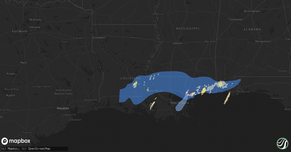
Hail Map in Louisiana on April 10, 2024
Get this storm
April 10 map
$229
one time, instant access
Download today. No call, no setup
Keep the $229
Bought the map and want the full workflow? Apply the entire $229 to a subscription within 7 days. None of it is wasted.
Every map, not just this one
This buys you this map. Subscription and you get every map we run, in the markets you choose from a few cities to whole states to nationwide. Plus real-time alerts the moment a storm fires.
Contact data
Name, contact info, occupancy, even credit band for addresses in the footprint. You go from where it hit to who to call.
Become the source they trust
Unlimited branding weather history reports on demand. You already have the documented answer ready for the property owner, and you are the one who showed up with it.
Property data and RoofTrace estimates
Pull up any address you have got, its value and the exact code rules for that jurisdiction, straight from One Click Code. Then RoofTrace estimates the squares, pitch, and roof value, priced the way you price.
Storm reports in Louisiana
Louisiana
| Date | Description |
|---|---|
| 04/10/202411:46 AM CDT | Several inches of standing water on senac dr. Measured 5.07 inches of rain. |
| 04/10/202411:29 AM CDT | Archbishop hannan blvd flooded in mereaux. |
| 04/10/202410:57 AM CDT | Report from mping: 1-inch tree limbs broken; shingles blown off. |
| 04/10/202410:37 AM CDT | Lg trees down in john slidell park. |
| 04/10/202410:13 AM CDT | Tree on a house on susan st. |
| 04/10/202410:08 AM CDT | Tree down on oak grove way in slidell. |
| 04/10/202410:08 AM CDT | Roof damage and trees down at lakeside christian school. |
| 04/10/202410:08 AM CDT | Large limbs down on dockside dr. |
| 04/10/202410:08 AM CDT | Significant structural damage along old spanish trail. |
| 04/10/202410:08 AM CDT | Widespread damage around old spanish trail in slidell. Possible tornado. |
| 04/10/202410:07 AM CDT | Trees down on pine st... Hwy 1090 and hwy 41 spur by s.o. Annex. |
| 04/10/202410:07 AM CDT | Multiple trees down including one tree on a mobile home. Siding ripped off of several mobile homes as well. |
| 04/10/202410:05 AM CDT | Multiple trees down... Powerlines down... Fence damage... And minor structural damage along spruce dr and cherry ln between i-59 and n military rd. |
| 04/10/202410:03 AM CDT | Tree snapped and numerous branches down behind nws office on airport rd. |
| 04/10/202410:03 AM CDT | Start point - a 9.3 mile long... 120 mph... Ef2 tornado touched down 1 mile north of eden isle and tracked east-northeast causing mainly tree damage through the first h |
| 04/10/20249:53 AM CDT | Asos station knew new orleans lakefront airport. |
| 04/10/20249:51 AM CDT | Mesonet station xptn pontchartrain causeway. |
| 04/10/20249:44 AM CDT | Report from mping: 1-inch tree limbs broken; shingles blown off. |
| 04/10/20249:39 AM CDT | Tree down on hwy 434 just south of i-12. |
| 04/10/20249:30 AM CDT | Louisiana dotd reports a tree down along the atchafalaya bridge blocking westbound traffic. |
| 04/10/20249:13 AM CDT | Nofd engine 36 weatherstem site reported wind gust of 71 mph. |
| 04/10/20249:08 AM CDT | Mesonet station xbyu bayou bienvenue |
| 04/10/20249:02 AM CDT | Report from mping: 1-inch tree limbs broken; shingles blown off. |
| 04/10/20248:50 AM CDT | Trees down. |
| 04/10/20248:50 AM CDT | Power poles down on la 449 just south of la 63. |
| 04/10/20248:45 AM CDT | Report from mping: 3-inch tree limbs broken; power poles broken. |
| 04/10/20248:41 AM CDT | Picture of tree down on parked truck in greenwell spring on social media. |
| 04/10/20248:41 AM CDT | Trees and power lines down on old perkins rd near santa maria subdivision. |
| 04/10/20248:32 AM CDT | Tree down at n 19th and main. |
| 04/10/20248:30 AM CDT | A local report indicates 60 MPH wind near 1 ENE St. Francisville |
| 04/10/20248:15 AM CDT | *** 1 inj *** delayed report: tree on a electricity company truck led to one minor injury during severe thunderstorm winds. Location near island and reech road. Time es |
| 04/10/20248:15 AM CDT | Awos station khzr new roads. |
| 04/10/20248:15 AM CDT | Report of a building damaged in st. Francisville. |
| 04/10/20248:10 AM CDT | Start point- nws survey team determined an ef1 tornado... Estimated peak with winds around 110 mph began crossing highway 61 north of st. Francisville and in the area o |
| 04/10/20248:09 AM CDT | Picture of estimated quarter size hail. Relayed via social media. |
| 04/10/20248:07 AM CDT | Numerous trees down throughout new roads. Power poles also broken and lines down. Widespread power outages. |
| 04/10/20248:07 AM CDT | Numerous trees and power lines/poles down on hwy 1 west of new roads. |
| 04/10/20248:03 AM CDT | Number of trees down outside the city hall at youngsville. Time estimated by radar. |
| 04/10/20247:58 AM CDT | Start point- nws survey team determined a ef1 tornado... Estimated with peak winds of around 100mph caused damage across southern portions of morganza. This tornado beg |
| 04/10/20247:52 AM CDT | Tree down fallen on the innis senior center. |
| 04/10/20247:52 AM CDT | Corrects previous tstm wnd dmg report from 1 s arnaudville. Public submitted a photo of quarter size hail near arnaudville. Time estimated by radar. |
| 04/10/20247:52 AM CDT | Public submitted a photo of quarter size hail near arnaudville. Time estimated by radar. |
| 04/10/20247:51 AM CDT | Photos received of trees down and shed destroyed in krotz springs. Time estimated by radar. |
| 04/10/20247:49 AM CDT | Mesonet station hakl1 sabine. |
| 04/10/20247:47 AM CDT | Report of widespread wind damage across st. Landry parish. Over 60 roads blocked with trees down. Time estimated by radar. |
| 04/10/20247:46 AM CDT | Report from mping: 1-inch tree limbs broken; shingles blown off. |
| 04/10/20247:44 AM CDT | Report from mping: 3-inch tree limbs broken; power poles broken. |
| 04/10/20247:43 AM CDT | Photo received of trees down in port barre. Time estimated by radar. |
| 04/10/20247:38 AM CDT | A brief tornado touched down along the leading edge of the squall line as it reached la-103... Twisting off large tree limbs and snapping tree trunks. Tornado rated ef1 |
| 04/10/20247:34 AM CDT | *** 4 inj *** st landry parish em reports four people were injured when a tree fell on a car. One injury is critical and the victim is being airlifted to baton rouge. |
| 04/10/20247:34 AM CDT | Photo of tree down on hypolite rd near cankton. Time estimated by radar. |
| 04/10/20247:30 AM CDT | Report of damage and heavy debris at diamond lane... Berab and vautrot rd. Possible tornado. Time estimated by radar. |
| 04/10/20247:30 AM CDT | Numerous reports of trees blown down or snapped off in the area of church point. Time estimated by radar. |
| 04/10/20247:30 AM CDT | Large tree blown down on vista st. Time estimated by radar. |
| 04/10/20247:27 AM CDT | Corrects previous tornado report from 2 ese church point. Brief tornado touched down at the leading edge of the squall line as it reached parish rd 3-97. Tornado caused |
| 04/10/20247:23 AM CDT | Video of damage on prairie hays rd in branch. Siding ripped from building. Trees down. Time estimated by radar. |
| 04/10/20247:21 AM CDT | Live powerlines and power poles down on la 13 and schultz rd near iota. Time estimated by radar. |
| 04/10/20247:17 AM CDT | The tornado touched down just northeast of bayou courtableau... Causing tree damage and minor roof damage to residential homes on vista drive. One carport was destroyed |
| 04/10/20247:14 AM CDT | Photos of multiple trees down... Metal flag pole down... And chicken coop was damaged. Time estimated by radar. |
| 04/10/20247:10 AM CDT | Photo received of tree down on a home in basile. |
| 04/10/20247:10 AM CDT | Awos station kopl opelousas. |
| 04/10/20247:05 AM CDT | Photo of heavy tree damage and debris on market st in elton. Time estimated by radar. |
| 04/10/20247:00 AM CDT | Several shops/sheds with damage ranging from total destruction to moderate damage in this location. Three homes with minor roof damage as well. |
| 04/10/20247:00 AM CDT | Several reports of twisted/uprooted/snapped trees in the lebleu settlement area received via facebook. In addition... Received reports of damaged sheds/carports as well |
All States Impacted by Hail Map on April 10, 2024
Cities Impacted by Hail Map on April 10, 2024
- Kinder, LA
- Elton, LA
- Welsh, LA
- Jennings, LA
- Roanoke, LA
- Lake Arthur, LA
- Maringouin, LA
- Rosedale, LA
- Gueydan, LA
- Iota, LA
- Basile, LA
- Lottie, LA
- Livonia, LA
- Oscar, LA
- Mermentau, LA
- Morse, LA
- Evangeline, LA
- Eunice, LA
- Egan, LA
- Opelousas, LA
- Washington, LA
- Bunkie, LA
- Morrow, LA
- Estherwood, LA
- Crowley, LA
- Mamou, LA
- Branch, LA
- Rayne, LA
- Church Point, LA
- Ville Platte, LA
- Scott, LA
- Duson, LA
- Sunset, LA
- Carencro, LA
- Lafayette, LA
- Kaplan, LA
- Maurice, LA
- Abbeville, LA
- Port Barre, LA
- Cottonport, LA
- Simmesport, LA
- Palmetto, LA
- Evergreen, LA
- Plaucheville, LA
- Moreauville, LA
- Breaux Bridge, LA
- Fordoche, LA
- Youngsville, LA
- Batchelor, LA
- Morganza, LA
- Krotz Springs, LA
- Arnaudville, LA
- Lettsworth, LA
- Melville, LA
- Broussard, LA
- New Iberia, LA
- Saint Martinville, LA
- Erath, LA
- Grosse Tete, LA
- Delcambre, LA
- Loreauville, LA
- Saint Francisville, LA
- Woodville, MS
- Angola, LA
- Monterey, LA
- New Roads, LA
- Jarreau, LA
- Ventress, LA
- Port Allen, LA
- Erwinville, LA
- Glynn, LA
- Lakeland, LA
- Rougon, LA
- Jackson, LA
- Brusly, LA
- Plaquemine, LA
- Baton Rouge, LA
- Addis, LA
- Baker, LA
- Slaughter, LA
- Centreville, MS
- Norwood, LA
- Zachary, LA
- Ethel, LA
- Pride, LA
- Wilson, LA
- Liberty, MS
- Gloster, MS
- Clinton, LA
- Greenwell Springs, LA
- Denham Springs, LA
- Bay Saint Louis, MS
- Walker, LA
- Greensburg, LA
- Holden, LA
- Amite, LA
- Pine Grove, LA
- Kentwood, LA
- Osyka, MS
- Livingston, LA
- Magnolia, MS
- Independence, LA
- Springfield, LA
- Albany, LA
- Hammond, LA
- Roseland, LA
- Tickfaw, LA
- Fluker, LA
- Summit, MS
- Mccomb, MS
- Smithdale, MS
- Loranger, LA
- Ponchatoula, LA
- Folsom, LA
- Mount Hermon, LA
- Franklinton, LA
- Robert, LA
- Husser, LA
- Tylertown, MS
- New Orleans, LA
- Slidell, LA
- Saint Bernard, LA
- Meraux, LA
- Chalmette, LA
- Violet, LA
- Braithwaite, LA
- Lafitte, LA
- Arabi, LA
- Harvey, LA
- Ama, LA
- Marrero, LA
- Belle Chasse, LA
- Westwego, LA
- Gretna, LA
- Cut Off, LA
- Barataria, LA
- Madisonville, LA
- Covington, LA
- Columbia, MS
- Kokomo, MS
- Foxworth, MS
- Jayess, MS
- Monticello, MS
- Ruth, MS
- Sandy Hook, MS
- Angie, LA
- Bush, LA
- Bogalusa, LA
- Mandeville, LA
- Pearl River, LA
- Lacombe, LA
- Abita Springs, LA
- Poplarville, MS
- Picayune, MS
- Carriere, MS
- Gautier, MS
- Lumberton, MS
- Stennis Space Center, MS
- Pearlington, MS
- Ocean Springs, MS
- Kiln, MS
- Perkinston, MS
- Diamondhead, MS
- Pass Christian, MS
- Waveland, MS
- Saucier, MS
- McHenry, MS
- Gulfport, MS
- Long Beach, MS
- Biloxi, MS
- Wiggins, MS
- Brooklyn, MS
- Diberville, MS
- Vancleave, MS
- McLain, MS
- Lucedale, MS
- Pascagoula, MS
- Moss Point, MS
- Gulf Shores, AL
- Grand Bay, AL
- Mobile, AL
- Wilmer, AL
- Franklin, LA
- Jeanerette, LA
- Morgan City, LA
- Semmes, AL
- Theodore, AL
- Irvington, AL
- Eight Mile, AL
- Pierre Part, LA
- Coden, AL
- Bayou La Batre, AL
- Saraland, AL
- Foley, AL
- White Castle, LA
- Magnolia Springs, AL
- Fairhope, AL
- Daphne, AL
- Bay Minette, AL
- Stapleton, AL
- Silverhill, AL
- Loxley, AL
- Robertsdale, AL
- McDavid, FL
- Molino, FL
- Century, FL
- Panama City Beach, FL
- Inlet Beach, FL
- Chunchula, AL
- Pensacola, FL


