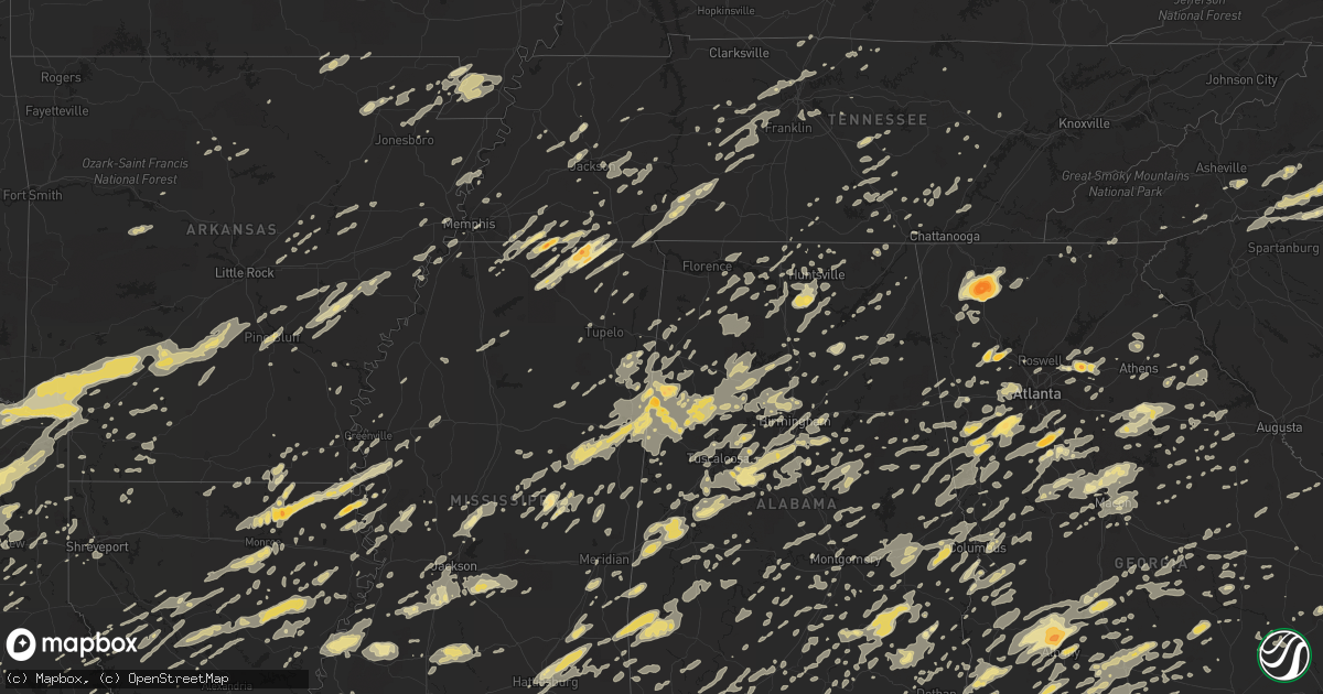
Hail Map in Louisiana on April 4, 2011
Get this storm
April 4 map
$229
one time, instant access
Download today. No call, no setup
Keep the $229
Bought the map and want the full workflow? Apply the entire $229 to a subscription within 7 days. None of it is wasted.
Every map, not just this one
This buys you this map. Subscription and you get every map we run, in the markets you choose from a few cities to whole states to nationwide. Plus real-time alerts the moment a storm fires.
Contact data
Name, contact info, occupancy, even credit band for addresses in the footprint. You go from where it hit to who to call.
Become the source they trust
Unlimited branding weather history reports on demand. You already have the documented answer ready for the property owner, and you are the one who showed up with it.
Property data and RoofTrace estimates
Pull up any address you have got, its value and the exact code rules for that jurisdiction, straight from One Click Code. Then RoofTrace estimates the squares, pitch, and roof value, priced the way you price.
Storm reports in Louisiana
Louisiana
| Date | Description |
|---|---|
| 04/04/20116:55 PM CDT | A few trees and powerline poles downed by thunderstorm winds. |
| 04/04/20116:53 PM CDT | Powerlines and trees down in gramercy |
| 04/04/20116:50 PM CDT | Touchdown occurred near intersection of north airline avenue andhighway 3125. The tornado moved to the south-southeast through a residential neighboorhood with the wors |
| 04/04/20116:50 PM CDT | Baton rouge media reports trees downed on to powerlines. |
| 04/04/20116:50 PM CDT | Roof damaged and possibly blown off of framed house near intersection of bogue chitto river and louisiana state highway 25. |
| 04/04/20116:50 PM CDT | Several trees and powerlines down in gramercy. Portion of roof removed on one home with damage to at least 5 other homes. Time estimated based on radar. |
| 04/04/20116:49 PM CDT | Baton rouge media reports trees and powerlines down across several locations in baton rouge. Over 20000 customers without power. |
| 04/04/20116:42 PM CDT | Trees down along i-12 near i-55 interchange. |
| 04/04/20116:42 PM CDT | Minor to moderate damage to a home and the roof. Numerous trees and powerlines down...possible tornado...survey team will investigate |
| 04/04/20116:42 PM CDT | Brief tornado touchdown occurred along lower rome rd just north of chapel rd. Tornado roughly traveled due east along lower rome rd causing significant damage to trees. |
| 04/04/20116:40 PM CDT | Roof damaged and possibly blown off of framed house near intersection of bogue chitto river and louisiana state highway 25. Time estimated/corrected based on radar. |
| 04/04/20116:40 PM CDT | Large portion of roof structure completely removed from one home. Several very large trees completely uprooted. Two single wide mobile homes also had roof damage. Damag |
| 04/04/20116:35 PM CDT | Several trees and a few powerlines downed. |
| 04/04/20116:35 PM CDT | Tree down along hwy 43 in hungarian settlement. |
| 04/04/20116:32 PM CDT | Trees down blocking sam martin road near st amant. |
| 04/04/20116:30 PM CDT | Several large limbs from numerous trees down. Fence damaged. Damage occurred along hwy 22 in st. Amant. |
| 04/04/20116:30 PM CDT | Large tree snapped on louisiana highway 441. Time estimated based on radar. |
| 04/04/20116:30 PM CDT | Tree down on pertuis road. |
| 04/04/20116:28 PM CDT | Trees down blocking stringer ridge road. |
| 04/04/20116:26 PM CDT | Trees down along gold place road in st amant. |
| 04/04/20116:25 PM CDT | Multiple trees and power lines blocking la highway 431 between churchpoint/stringer bridge and weber city road. |
| 04/04/20116:24 PM CDT | Trees and power lines down along and blocking preston landry. |
| 04/04/20116:23 PM CDT | Trees down on denham road. |
| 04/04/20116:23 PM CDT | Trees down blocking intersection of black bayou and hilbert young road. |
| 04/04/20116:23 PM CDT | Tree blocking intersection of black bayou and oneal road. |
| 04/04/20116:22 PM CDT | Tree down along toby road. |
| 04/04/20116:22 PM CDT | Large tree limbs snapped and a small tree uprooted along louisiana highway 42. |
| 04/04/20116:21 PM CDT | An ef-2 tornado track was discovered in tensas parish...more details will come later. |
| 04/04/20116:20 PM CDT | Power lines and large limbs down on walnut road at airline highway |
| 04/04/20116:10 PM CDT | Trees blown over and completely blocked intersection of coursey and stumberg ln. |
| 04/04/20116:05 PM CDT | Baton rouge media reports trees downed on to powerlines. Time estimated/corrected based on radar. |
| 04/04/20116:05 PM CDT | Trees and fences down on south foster drive in baton rouge. |
| 04/04/20115:59 PM CDT | Trees and fences down on south foster drive in baton rouge. |
| 04/04/20115:55 PM CDT | Baton rouge media reports trees and powerlines down across several locations in baton rouge. Over 20000 customers without power. Time estimated/corrected based on radar |
| 04/04/20115:40 PM CDT | Multiple trees down along highway 421 between la 10 and la 967. Road was blocked inm multiple areas. |
| 04/04/20115:35 PM CDT | 24 inch diameter tree down 1 mile sw of new roads. |
| 04/04/20115:29 PM CDT | Trees blown over and blocking bains road just west of stirling road. |
| 04/04/20115:21 PM CDT | Trees down blocking mahoney road at airport road. |
| 04/04/20115:08 PM CDT | Klfy-tv reported a large tree fell on a mobile home in krotz springs causing a large hole in the roof |
| 04/04/20115:08 PM CDT | Tree blown down blocking como road 1 mile west of highland road. |
| 04/04/20114:55 PM CDT | Nws storm survey team found gazebo destroyed and fence blown down at king truck stop. Wind estimated at 55 mph. |
| 04/04/20114:52 PM CDT | Katc-tv reported a gazebo was destroyed at the kings truck stop on hwy 190 west of port barre |
| 04/04/20114:45 PM CDT | Nws storm survey team found microburst wind damage in opelousas at abdalla blvd. Two large trees uprooted and 1 fell on house. Another home had hole punctured in roof. |
| 04/04/20114:41 PM CDT | St landry parish sheriff office reported trees down at hwy 182 and hwy 358 |
| 04/04/20114:39 PM CDT | St landry parish sheriff office reported trees blown down at hwy 10 and i-49 |
| 04/04/20114:29 PM CDT | Avoyelles parish sheriff office reported trees down in simmesport |
| 04/04/20114:25 PM CDT | Unconfirmed report from the public of a tornado viewed passing across a field north of grand prairie |
| 04/04/20114:20 PM CDT | Avoyelles parish sheriff office reported trees down in plaucheville |
| 04/04/20114:20 PM CDT | St landry parish sheriff office reported trees blown down at hwy 29 and i-49 |
| 04/04/20114:12 PM CDT | Avoyelles parish sheriff office reported trees down in marksville |
| 04/04/20114:05 PM CDT | Nws storm survey team found downburst wind damage south and e of vidrine. 1 out building was destroyed on mayeauxville road and another was damaged. Several tree limbs |
| 04/04/20114:00 PM CDT | An ef-2 tornado track was discovered...more details to come. |
| 04/04/20113:54 PM CDT | Structural damage...power poles and trees down near the intersection of highway 65 and 605 just west of lake bruin. |
| 04/04/20113:54 PM CDT | *** 1 inj *** several houses with roofs destroyed...parish wide water system building severely damaged...numerous trees down across highways. One confirmed injury. Poss |
| 04/04/20113:52 PM CDT | Dispatcher reports sending ambulances out to highway 892 to the west of st. Jospeh for possible injuries |
| 04/04/20113:48 PM CDT | Nws storm survey found evidence of a strong downburst along duplechain rd and albert rd. Several large trees were blown down and one outbuilding was damaged. Winds esti |
| 04/04/20113:43 PM CDT | *** 1 inj *** numerous homes...barns and outbuildings were damaged along the path. A water treatment plant was nearly destroyed and an 18 wheeler was overturned. Numero |
| 04/04/20113:40 PM CDT | Large tree downed in olive grove community off highway 562. |
| 04/04/20113:30 PM CDT | Trees and powerlines down. One large tree down on a house. |
| 04/04/20113:20 PM CDT | A local report indicates 1.50 inch wind near LAKE PROVIDENCE |
| 04/04/20113:20 PM CDT | Tree down across hwy 124 |
| 04/04/20113:20 PM CDT | Half the roof blown off a mobile home |
| 04/04/20113:15 PM CDT | Wheat crops damaged by high winds in the areas around archie and mangham |
| 04/04/20113:15 PM CDT | Power lines down in the oakhill area on durand road |
| 04/04/20113:15 PM CDT | Tree down across doctor rogers road |
| 04/04/20113:13 PM CDT | Tree down on labuse cutoff road. |
| 04/04/20113:09 PM CDT | Update...ef-2 found 4wsw enterprise with 115 mph max winds. Numerous trees uprooted and snapped. Four power poles were snapped. More information will be available after |
| 04/04/20113:09 PM CDT | Update...ef-2 found 4wsw enterprise with 115 mph max winds. Numerous trees uprooted and snapped. Four power poles were snapped. More information will be available after |
| 04/04/20113:07 PM CDT | Emergency manager reports numerous trees and powerlines down across the area...some houses are damaged...all across the northeast corner of la salle parish. |
| 04/04/20112:58 PM CDT | Quarter-sized hail reported by public at a convenience store. |
| 04/04/20112:58 PM CDT | The tornado snapped/uprooted numerous trees after it touched down just south of ip 13 west of brasher road. It continued northeast across highway 126 into an upopulated |
| 04/04/20112:55 PM CDT | Couple trees down near intersection of hwy 65 and hwy 585 near gassoway |
| 04/04/20112:52 PM CDT | Emergency manager reports numerous trees and powerlines down...with some houses damaged. |
| 04/04/20112:47 PM CDT | Nickel to quarter sized hail was reported around town. |
| 04/04/20112:42 PM CDT | An ef-1 tornado with estimated winds near 95 mph touched down just south of georgetown west of highway 165. This tornado continued northeast into the selma community an |
| 04/04/20112:41 PM CDT | Emergency manager reports numerous trees and powerlines down northwest of the community of little creek. |
| 04/04/20112:37 PM CDT | Georgetown sheriff department reports that there is a large amount of damage across the community of selma...numerous trees and powerlines down across the area. |
| 04/04/20112:17 PM CDT | A local report indicates 1.00 inch wind near MER ROUGE |
| 04/04/20112:15 PM CDT | Golf ball size hail along collinston road south of bastrop |
| 04/04/20112:09 PM CDT | A few trees were blown down...possible tornado. |
| 04/04/20111:59 PM CDT | Multiple trees down reported by grant parish sheriff office. |
| 04/04/20111:38 PM CDT | One inch hail reported by natchitoches co-op observer. |
| 04/04/201112:06 PM CDT | Several trees were blown down along highway 165 between jones and bonita. |
| 04/04/201111:47 AM CDT | Several trees were blown down on highway 425. |
| 04/04/201110:30 AM CDT | Tree down across cupps crossing rd. |
| 04/04/201110:00 AM CDT | Large tree down in bossier city |
| 04/03/20119:17 PM CDT | Two trees down on power lines near cut off. |
| 04/03/20118:45 PM CDT | Roof damage to business in dulac. |
| 04/03/20117:45 PM CDT | Roof damage to home. |
| 04/03/20117:44 PM CDT | A local report indicates 59 MPH wind near LAKEFRONT AIRPORT |
| 04/03/20117:42 PM CDT | Damage to commericial buidlings on pontchartrain drive...two metal roofs blown off building and carried down the road and numerous doors blown in on a couple buildings. |
| 04/03/20117:40 PM CDT | Shudder damage and large tree limbs downed in luling on kayle drive |
| 04/03/20117:40 PM CDT | Emergency manager reported a tree down and blocking road in the chamale cove subdivision. |
| 04/03/20117:40 PM CDT | Tree down across hwy 11 near st. Joe brick works between slidell and pearl river. Time estimated based on radar. |
| 04/03/20117:35 PM CDT | Roof damage to home. Time estimated/corrected based on radar. |
| 04/03/20117:35 PM CDT | Shutter damage and large tree limbs downed in luling on kayle drive. Time estimated/corrected based on radar. |
| 04/03/20117:35 PM CDT | Fence downed on forest brooke ave. |
| 04/03/20117:35 PM CDT | Nws employee reports power flashes in mandeville and estimates 60 mph winds. |
| 04/03/20117:35 PM CDT | Metal roof panels curled up on industrial garage on bobcat road. Time estimated by radar. |
| 04/03/20117:30 PM CDT | Several reports of trees and power lines down. Gas station awning down on eftef rd. |
| 04/03/20117:27 PM CDT | Trees and powerlines down in lacombe. |
| 04/03/20117:25 PM CDT | Powerlines downed on airline highway. |
| 04/03/20117:22 PM CDT | Larger tree about 3 to 4 feet thick in diameter blown down blocking highway 190 between colbert and soult street. Numerous power outages east of highway 59 to soult str |
| 04/03/20117:21 PM CDT | Kmsy asos measured 53 knots from west. |
| 04/03/20117:20 PM CDT | Trees and powerlines down in lacombe. |
| 04/03/20117:20 PM CDT | Broadcast media relayed equipment on causeway bridge measured 90 mph. Time estimated based on radar. |
| 04/03/20117:19 PM CDT | 61 mph wind gust at msy |
| 04/03/20117:18 PM CDT | Numerous trees down in old mandeville blocking...villere rd and monroe st. Power out across much of the area south of highway 190 and east causeway approach and west of |
| 04/03/20117:17 PM CDT | Branch fell through a trailer on choctaw rd. |
| 04/03/20117:15 PM CDT | Large oak tree uprooted and fell on house just off hwy. 41. Large portion of house was crushed. |
| 04/03/20117:05 PM CDT | Widespread power outage in laplace. Trees down and other debris near 2217 airline. Tree down across residential handicap ramp. |
| 04/03/20117:01 PM CDT | Trailer lifted of the ground and another camper and blown about 20 yards. Sheet metal and tin roofing and awning blown 50 to 75 yards away and wrapped around one tree t |
| 04/03/20117:01 PM CDT | Trailer lifted of the ground and a few camper trailers flipped over. |
All States Impacted by Hail Map on April 4, 2011
Cities Impacted by Hail Map on April 4, 2011
- Longview, TX
- Denmark, TN
- Medon, TN
- Crossville, TN
- Noble, LA
- Converse, LA
- Selmer, TN
- Boaz, AL
- Horton, AL
- Altoona, AL
- Jewell, GA
- Bloomington, IN
- Midland City, AL
- Ozark, AL
- Quitman, MS
- Meridian, MS
- Norman, IN
- Louisville, MS
- Weir, MS
- McCool, MS
- Clarendon, AR
- Casscoe, AR
- Almyra, AR
- Stuttgart, AR
- Crocketts Bluff, AR
- Delta, AL
- Woodville, TX
- Campti, LA
- Marietta, GA
- Eminence, MO
- Ethelsville, AL
- Ozan, AR
- Antoine, AR
- Okolona, AR
- Hooks, TX
- Blevins, AR
- Nashville, AR
- Alleene, AR
- Murfreesboro, AR
- De Kalb, TX
- Prescott, AR
- Delight, AR
- Ogden, AR
- Foreman, AR
- Saratoga, AR
- Texarkana, TX
- McCaskill, AR
- Ashdown, AR
- New Boston, TX
- Lockesburg, AR
- Avery, TX
- Columbus, AR
- Mineral Springs, AR
- Wilton, AR
- Evergreen, AL
- Fletcher, NC
- Buford, GA
- Hoschton, GA
- Flowery Branch, GA
- Auburn, GA
- Braselton, GA
- Mayo, FL
- Horseshoe Beach, FL
- Live Oak, FL
- Branford, FL
- Perry, FL
- Steinhatchee, FL
- Salem, FL
- Day, FL
- Old Town, FL
- Luverne, AL
- Goshen, AL
- Pine Bluff, AR
- Sherrill, AR
- Nashville, IN
- Ashland, AL
- Seneca, SC
- Ponce De Leon, FL
- Shreveport, LA
- Bradley, AR
- Taylor, AR
- Lafe, AR
- Rector, AR
- Marmaduke, AR
- Milam, TX
- Beallsville, OH
- Powhatan Point, OH
- Alledonia, OH
- Jacobsburg, OH
- Port Richey, FL
- New Port Richey, FL
- Hudson, FL
- Spring Hill, FL
- Lake Toxaway, NC
- Ponchatoula, LA
- Kane, PA
- Lewis Run, PA
- Warren, PA
- Tiona, PA
- Clarendon, PA
- Melville, LA
- Plaucheville, LA
- Palmetto, LA
- Milledgeville, TN
- Sardis, TN
- Bluffton, SC
- Lexington, GA
- Stephens, GA
- Bainbridge, GA
- Pontotoc, MS
- Centreville, AL
- Duncanville, AL
- Brent, AL
- West Blocton, AL
- Boligee, AL
- Livingston, AL
- Olivehill, TN
- Baileyton, AL
- Cullman, AL
- Huntsville, AL
- Union Grove, AL
- Somerville, AL
- Laceys Spring, AL
- Vinemont, AL
- New Hope, AL
- Eva, AL
- Canton, TX
- Leesburg, TX
- Mineola, TX
- Hughes Springs, TX
- Pittsburg, TX
- Quitman, TX
- Daingerfield, TX
- Hawkins, TX
- Naples, TX
- Como, TX
- Big Sandy, TX
- Gilmer, TX
- Omaha, TX
- Winnsboro, TX
- Atlanta, GA
- Shiloh, GA
- Hamilton, GA
- Cataula, GA
- Warm Springs, GA
- Jacksons Gap, AL
- Dadeville, AL
- Marion Junction, AL
- Uniontown, AL
- Wilsonville, AL
- Adger, AL
- Bessemer, AL
- Vance, AL
- Pelham, AL
- Knoxville, AL
- Alabaster, AL
- Brierfield, AL
- Fosters, AL
- Sterrett, AL
- Tuscaloosa, AL
- Birmingham, AL
- Harpersville, AL
- Moundville, AL
- Akron, AL
- Helena, AL
- Montevallo, AL
- Cottondale, AL
- Chelsea, AL
- Vincent, AL
- Columbiana, AL
- Brookwood, AL
- McCalla, AL
- Woodstock, AL
- Williams, IN
- Guntersville, AL
- Midland, GA
- Collierville, TN
- Williston, TN
- Somerville, TN
- Rossville, TN
- Moscow, TN
- Barlow, KY
- Greensboro, GA
- Madison, GA
- Dayton, OH
- Longs, SC
- Conway, SC
- Loris, SC
- Adamsville, AL
- Monroe, LA
- Ethel, MS
- Kosciusko, MS
- Trinity, AL
- Moulton, AL
- Hillsboro, AL
- Andalusia, AL
- Red Level, AL
- Gordo, AL
- Steens, MS
- Sulligent, AL
- Bankston, AL
- Oakman, AL
- Parrish, AL
- Crane Hill, AL
- Caledonia, MS
- Arley, AL
- Beaverton, AL
- Double Springs, AL
- Reform, AL
- Berry, AL
- Millport, AL
- Aberdeen, MS
- Hanceville, AL
- Nauvoo, AL
- Bremen, AL
- Jasper, AL
- Sturgis, MS
- Carbon Hill, AL
- Brooksville, MS
- Starkville, MS
- Houston, AL
- Kennedy, AL
- Greenwood Springs, MS
- Gattman, MS
- Carrollton, AL
- West Point, MS
- Detroit, AL
- Cordova, AL
- Hamilton, MS
- Fayette, AL
- Northport, AL
- Vernon, AL
- Columbus, MS
- Townley, AL
- Crawford, MS
- Robeline, LA
- Marthaville, LA
- Brickeys, AR
- Marianna, AR
- Tunica, MS
- Isola, MS
- Inverness, MS
- Leland, MS
- Greenville, MS
- Colfax, LA
- Dry Prong, LA
- Magnolia, AR
- McNeil, AR
- Petersburg, TN
- Bremen, GA
- Temple, GA
- Carrollton, GA
- Clay, KY
- Winfield, AL
- Eldridge, AL
- Shubuta, MS
- Marksville, LA
- Hessmer, LA
- Newnan, GA
- Palmetto, GA
- Fairburn, GA
- Sharpsburg, GA
- Chidester, AR
- Homerville, GA
- Thomaston, AL
- Bogata, TX
- De Kalb, MS
- Hawkinsville, GA
- Eastman, GA
- Coal Center, PA
- Daisytown, PA
- Clayton, AL
- Vale, NC
- Lincolnton, NC
- Florence, MS
- Bastrop, LA
- Hilliard, FL
- Humboldt, TN
- Trenton, TN
- De Berry, TX
- Bethany, LA
- Hackleburg, AL
- Hamilton, AL
- Union Springs, AL
- Troy, AL
- Grady, AL
- Wind Ridge, PA
- Cameron, WV
- Glen Easton, WV
- Hornbeck, LA
- Tutwiler, MS
- Thornton, TX
- Groesbeck, TX
- Fairfield, TX
- Teague, TX
- Donie, TX
- Franklin, GA
- Douglasville, GA
- Whitesburg, GA
- Roopville, GA
- San Augustine, TX
- Palmer, TN
- Milton, FL
- Holt, FL
- Millington, TN
- Childersburg, AL
- Alpine, AL
- Louisville, GA
- Stapleton, GA
- Ariton, AL
- Long Branch, TX
- Mount Enterprise, TX
- Tifton, GA
- Montville, OH
- Chardon, OH
- Faunsdale, AL
- Linden, AL
- Saint Albans, WV
- Tornado, WV
- Camilla, GA
- Ellisville, MS
- Ovett, MS
- Petal, MS
- Hattiesburg, MS
- Richton, MS
- Waynesboro, MS
- Moselle, MS
- Laurel, MS
- Hartford, AL
- Slocomb, AL
- Albany, GA
- Sylvester, GA
- Crofton, KY
- White Plains, KY
- Gadsden, AL
- Lawrenceville, GA
- Kennett, MO
- Mooresboro, NC
- Shelby, NC
- Gaffney, SC
- Lewisville, AR
- Hull, GA
- Nicholson, GA
- Commerce, GA
- Merom, IN
- Hutsonville, IL
- Sullivan, IN
- Fairbanks, IN
- Mayersville, MS
- Lake Providence, LA
- Lawndale, NC
- Cherryville, NC
- Acworth, GA
- Dallas, GA
- Graysville, AL
- Shelbyville, IN
- Fargo, GA
- Hogansville, GA
- Ash, NC
- Bolton, NC
- Mount Olive, AL
- Clarkson, KY
- Cub Run, KY
- Munfordville, KY
- Panama City, FL
- Lindale, TX
- Tyler, TX
- Winona, TX
- Morgantown, KY
- Belton, KY
- Dunmor, KY
- Lewisburg, KY
- Guthrie, KY
- Elkton, KY
- Branchland, WV
- Weogufka, AL
- Sylacauga, AL
- Hendersonville, TN
- Germantown, OH
- La Grange, TN
- Lamar, MS
- Michigan City, MS
- Byhalia, MS
- Red Banks, MS
- Holly Springs, MS
- Grand Junction, TN
- Blakely, GA
- Horse Cave, KY
- Cave City, KY
- Bowling Green, KY
- Cory, IN
- Clay City, IN
- Pimento, IN
- Lewis, IN
- Huntingdon, TN
- Hollow Rock, TN
- Bruceton, TN
- Griffin, GA
- Williamson, GA
- Opp, AL
- Kite, GA
- Adrian, GA
- Dover, AR
- Harrison, TN
- Soddy Daisy, TN
- Greer, SC
- Landrum, SC
- Taylors, SC
- Philadelphia, MS
- Gray, GA
- Haddock, GA
- Juliette, GA
- Hillsboro, GA
- Forsyth, GA
- Macon, GA
- Mocksville, NC
- Newellton, LA
- Tallulah, LA
- Leeds, AL
- Coal City, IN
- Freedom, IN
- Spencer, IN
- Gosport, IN
- Ellettsville, IN
- Worthington, IN
- Wadley, AL
- Natchez, MS
- Lecanto, FL
- Hernando, FL
- Inverness, FL
- Homosassa, FL
- Oneonta, AL
- Tiplersville, MS
- Transylvania, LA
- Cary, MS
- Sondheimer, LA
- Rolling Fork, MS
- Diana, TX
- Avinger, TX
- Ore City, TX
- Jefferson, TX
- Valhermoso Springs, AL
- Butler, AL
- Dacula, GA
- Austin, TX
- Leander, TX
- Cedar Park, TX
- Uvalda, GA
- Lyons, GA
- Thomasville, GA
- Hampton, GA
- Mcdonough, GA
- Locust Grove, GA
- Hazlehurst, GA
- West Green, GA
- Denton, GA
- Monticello, FL
- Dunlap, TN
- Natchitoches, LA
- Fayette, MS
- Ferriday, LA
- Fort Benning, GA
- Wing, AL
- Brantley, AL
- Rutledge, AL
- Nebo, NC
- Union Mills, NC
- Morganton, NC
- Valley Mills, TX
- Crawford, TX
- Vienna, GA
- Cordele, GA
- Miamisburg, OH
- Blountsville, AL
- Armuchee, GA
- Rome, GA
- Calhoun, GA
- McCrory, AR
- Augusta, AR
- Yazoo City, MS
- Yantis, TX
- Sulphur Springs, TX
- Opelika, AL
- Salem, AL
- Hatchechubbee, AL
- Seale, AL
- Hurtsboro, AL
- Phenix City, AL
- Honoraville, AL
- Terre Haute, IN
- Farmersburg, IN
- Bells, TN
- Jackson, TN
- Winnsboro, LA
- Fort Necessity, LA
- South Park, PA
- Clairton, PA
- Finleyville, PA
- Waverly Hall, GA
- Greenville, FL
- Makanda, IL
- Alto Pass, IL
- Carbondale, IL
- Cobden, IL
- Hayneville, AL
- Tyler, AL
- East Prairie, MO
- Matthews, MO
- Ellenboro, NC
- Rockdale, TX
- Thorndale, TX
- Town Creek, AL
- Sterlington, LA
- Farmerville, LA
- Waycross, GA
- Leesburg, GA
- Smithville, GA
- Bronwood, GA
- Dawson, GA
- Suwanee, GA
- Greensburg, IN
- Crossett, AR
- Hamburg, AR
- Gerton, NC
- Fairview, NC
- Hendersonville, NC
- Black Mountain, NC
- Sumner, GA
- Newport, AR
- Marietta, TX
- Palestine, TX
- Arp, TX
- Gladewater, TX
- Fruitvale, TX
- Grand Saline, TX
- Linden, TX
- Edgewood, TX
- Douglassville, TX
- Lone Star, TX
- Flint, TX
- Brownsboro, TX
- Alba, TX
- Athens, TX
- Whitehouse, TX
- Ben Wheeler, TX
- Chandler, TX
- Frankston, TX
- Wills Point, TX
- Larue, TX
- Tennessee Colony, TX
- Emory, TX
- Bullard, TX
- Van, TX
- Montalba, TX
- Scroggins, TX
- Carthage, MS
- Lumpkin, GA
- Cusseta, GA
- Richland, GA
- Talco, TX
- Mount Pleasant, TX
- Mount Vernon, TX
- Calera, AL
- Poulan, GA
- Indianapolis, IN
- Greenwood, IN
- Fairland, IN
- Needham, IN
- Boggstown, IN
- Georgetown, GA
- Athens, AL
- Elkmont, AL
- Middleton, TN
- Graceville, FL
- Waco, GA
- Deridder, LA
- New Castle, IN
- Whiteland, IN
- Eatonton, GA
- Buckhead, GA
- La Center, KY
- Kevil, KY
- Chatsworth, GA
- Dalton, GA
- Sugar Valley, GA
- Resaca, GA
- Ashland, MS
- Collinston, LA
- Mer Rouge, LA
- Crystal Springs, MS
- Hermanville, MS
- Utica, MS
- Hazlehurst, MS
- Scipio, IN
- Golconda, IL
- Fort Mitchell, AL
- Hickory Flat, MS
- Potts Camp, MS
- Granger, TX
- Taylor, TX
- Georgetown, TX
- Aquilla, TX
- China Spring, TX
- Whitney, TX
- Clifton, TX
- Ventress, LA
- Aliceville, AL
- Marion, KY
- Addison, AL
- Russellville, AL
- Danville, AL
- Haleyville, AL
- Belle Rose, LA
- Madison, FL
- Waldo, AR
- Forest, MS
- Raleigh, MS
- Silsbee, TX
- Marbury, AL
- Equality, AL
- Rockford, AL
- Titus, AL
- Deatsville, AL
- Kilgore, TX
- Sparkman, AR
- Clarksville, TX
- Annona, TX
- Eustace, TX
- Overton, TX
- Murchison, TX
- Haworth, OK
- White Oak, TX
- Maud, TX
- Dike, TX
- Prattsville, AR
- Jacksonville, TX
- Jewett, TX
- Saltillo, TX
- Queen City, TX
- Kaufman, TX
- Mexia, TX
- Horatio, AR
- Donaldson, AR
- Leola, AR
- Gurdon, AR
- Atlanta, TX
- Texarkana, AR
- Arkadelphia, AR
- Grapevine, AR
- Fulton, AR
- Pickton, TX
- Nash, TX
- Cookville, TX
- Sheridan, AR
- Hallsville, TX
- Carthage, AR
- Tallahassee, FL
- Phil Campbell, AL
- Gatewood, MO
- Woodbury, TN
- Many, LA
- Louisville, AL
- Letohatchee, AL
- Lowndesboro, AL
- Hope Hull, AL
- Coker, AL
- Buhl, AL
- Linesville, PA
- Vaughan, MS
- Lebanon, TN
- Goodlettsville, TN
- Fredonia, KY
- Tichnor, AR
- Jackson, GA
- Alberta, AL
- Catherine, AL
- Youngstown, FL
- Woodland, AL
- Muscadine, AL
- Tallapoosa, GA
- Buchanan, GA
- Madison, AL
- Nashville, TN
- Madison, TN
- Duck River, TN
- Centerville, TN
- Midway, FL
- Quincy, FL
- Havana, FL
- Dry Creek, LA
- Huron, TN
- Pinson, TN
- Henderson, TN
- Beech Bluff, TN
- Luray, TN
- Lexington, TN
- Ray City, GA
- Hilton Head Island, SC
- Pulaski, MS
- Tatum, TX
- Henderson, TX
- Dry Branch, GA
- Greensburg, LA
- Savannah, TN
- Lynn, AL
- Cartersville, GA
- Hemphill, TX
- Lake Park, GA
- Valdosta, GA
- Forest City, NC
- Bostic, NC
- Rutherfordton, NC
- Spindale, NC
- Belle Vernon, PA
- Waynesburg, PA
- Scenery Hill, PA
- Prosperity, PA
- Richeyville, PA
- Fredericktown, PA
- Dunlevy, PA
- Monessen, PA
- Beallsville, PA
- Amity, PA
- Marianna, PA
- Charleroi, PA
- Williamsville, MO
- Ludowici, GA
- Ashland City, TN
- Steele, AL
- Wedowee, AL
- Lineville, AL
- Cragford, AL
- Toxey, AL
- Gilbertown, AL
- Millry, AL
- Frankville, AL
- Sweet Water, AL
- Thomasville, AL
- Silas, AL
- Campbell, AL
- Coffeeville, AL
- Bogue Chitto, MS
- Doerun, GA
- Hartsfield, GA
- Omega, GA
- Ocilla, GA
- Norman Park, GA
- Chula, GA
- Fitzgerald, GA
- Funston, GA
- Moultrie, GA
- Meigs, GA
- Ty Ty, GA
- Grand Ridge, FL
- Marianna, FL
- Manchester, TN
- Tullahoma, TN
- Dora, AL
- Lake City, FL
- Ailey, GA
- Mount Vernon, GA
- Tarrytown, GA
- Vidalia, GA
- Eddyville, KY
- Shellman, GA
- Beebe, AR
- Brookhaven, MS
- Bronson, TX
- Bonifay, FL
- West Monroe, LA
- Estill Springs, TN
- Canonsburg, PA
- Washington, PA
- McEwen, TN
- Dickson, TN
- Hollandale, MS
- Rienzi, MS
- Corinth, MS
- Dixie, GA
- Earle, AR
- Sarepta, LA
- Oak Grove, LA
- Camden, MS
- Mendenhall, MS
- Pelahatchie, MS
- Brandon, MS
- Braxton, MS
- Rebecca, GA
- Sycamore, GA
- Odum, GA
- Kuttawa, KY
- Minter, AL
- Saulsbury, TN
- Walnut, MS
- Wiggins, MS
- Brooklyn, MS
- Lake Village, AR
- Lucedale, MS
- McLain, MS
- Peachtree City, GA
- Roanoke, AL
- Union City, GA
- Lanett, AL
- Lagrange, GA
- Cusseta, AL
- Lafayette, AL
- Tyrone, GA
- Five Points, AL
- Senoia, GA
- Grantville, GA
- Fayetteville, GA
- Moreland, GA
- Sandersville, GA
- Beatrice, AL
- Pine Apple, AL
- New Market, AL
- Graysville, TN
- Dayton, TN
- Pikeville, TN
- Sale Creek, TN
- Lake City, AR
- Buena Vista, GA
- Eudora, AR
- Liberty, SC
- Easley, SC
- Brookland, AR
- Paragould, AR
- Jonesboro, AR
- Chester, IL
- Ellis Grove, IL
- Saint Mary, MO
- Cuba, AL
- York, AL
- Naylor, GA
- Terry, MS
- Springfield, TN
- Orlinda, TN
- Bedford, IN
- Wetumpka, AL
- Eclectic, AL
- Mantee, MS
- Mathiston, MS
- Maben, MS
- Eupora, MS
- Annapolis, IL
- Palestine, IL
- Shelburn, IN
- Robinson, IL
- West York, IL
- Quitman, GA
- Chunchula, AL
- Citronelle, AL
- Stockbridge, GA
- Jonesboro, GA
- Rex, GA
- Laurel Hill, FL
- Florala, AL
- Scurry, TX
- Vidalia, LA
- Pollock, LA
- Trout, LA
- Counce, TN
- Andrews, SC
- Waynesboro, TN
- Clifton, TN
- Hohenwald, TN
- North Augusta, SC
- Jasper, TX
- Prattville, AL
- Jesup, GA
- Carthage, IN
- Knightstown, IN
- Morristown, IN
- Greenfield, IN
- Arlington, IN
- Dozier, AL
- Angie, LA
- Goodwater, AL
- Ararat, VA
- Meadows Of Dan, VA
- Laurel Fork, VA
- Hillsville, VA
- Reynolds, GA
- Doniphan, MO
- Watertown, TN
- Heth, AR
- Widener, AR
- Bunkie, LA
- Baconton, GA
- Newton, GA
- Booneville, MS
- Loranger, LA
- Folsom, LA
- Arlington, AL
- Pine Hill, AL
- Dixons Mills, AL
- Magnolia, AL
- Manor, TX
- Tabor City, NC
- Glenville, NC
- Cashiers, NC
- Milano, TX
- Cameron, TX
- Buckholts, TX
- Davilla, TX
- Clarington, OH
- Bragg City, MO
- Mitchell, GA
- Warrenton, GA
- Boston, GA
- Kings Mountain, NC
- Wisner, LA
- Glenwood, GA
- Alexandria, LA
- Woodworth, LA
- Lecompte, LA
- Westville, FL
- Clio, AL
- Jena, LA
- Grayson, LA
- Columbia, LA
- Pensacola, FL
- Robertsdale, AL
- Princeton, KY
- Freeport, FL
- Union, MS
- Dongola, IL
- Cuthbert, GA
- Coleman, GA
- Coolidge, GA
- Ochlocknee, GA
- Smithville, MS
- Fountain, FL
- Defuniak Springs, FL
- Amory, MS
- Nakina, NC
- Delco, NC
- Whiteville, NC
- Sweeden, KY
- Bee Spring, KY
- Mammoth Cave, KY
- Saint Stephen, SC
- Bonneau, SC
- Pocahontas, TN
- Ripley, MS
- Falkner, MS
- Tignall, GA
- Washington, GA
- Rayle, GA
- Campobello, SC
- Clarksville, FL
- Lisman, AL
- Columbia, MS
- Sandy Hook, MS
- Warner Robins, GA
- Altheimer, AR
- Wabbaseka, AR
- Hurricane, WV
- Hamlin, WV
- Dunbar, WV
- Griffithsville, WV
- Sod, WV
- Nitro, WV
- Alum Creek, WV
- Omaha, GA
- Griffithville, AR
- Covington, GA
- McDavid, FL
- Tanner, AL
- Donalsonville, GA
- Gordon, AL
- Jakin, GA
- Colquitt, GA
- Comer, GA
- Colbert, GA
- Danielsville, GA
- Monroe City, IN
- Hillsboro, TN
- Bartow, GA
- Highland Home, AL
- McClellandtown, PA
- Cotton Valley, LA
- Pitkin, LA
- Leesville, LA
- Elmer, LA
- Fort Polk, LA
- Glenmora, LA
- Hineston, LA
- Powder Springs, GA
- Lithia Springs, GA
- Mableton, GA
- Austell, GA
- Clarkdale, GA
- Mansfield, GA
- Bonnieville, KY
- Rockville, IN
- Montezuma, IN
- Crestview, FL
- Eglin Afb, FL
- Canton, MS
- Pine Mountain, GA
- Denham Springs, LA
- Walker, LA
- Vina, AL
- Hodges, AL
- Fordsville, KY
- Hartford, KY
- Washington, AR
- Sparta, TN
- Waverly, AL
- Auburn, AL
- Newton, NC
- Mooresville, NC
- Maiden, NC
- Crouse, NC
- Troutman, NC
- Columbus, NC
- Tryon, NC
- Statesville, NC
- Claremont, NC
- Mill Spring, NC
- Sherrills Ford, NC
- Terrell, NC
- Catawba, NC
- Westmoreland, TN
- Hartsville, TN
- Lafayette, TN
- Bethpage, TN
- Saluda, SC
- Edgefield, SC
- Shuqualak, MS
- Auburn, KY
- Jasper, FL
- Belton, SC
- Honea Path, SC
- Winston, GA
- Villa Rica, GA
- Epps, LA
- Pioneer, LA
- Plainville, GA
- Newville, AL
- Eros, LA
- Forkland, AL
- Bellamy, AL
- Epes, AL
- Butler, GA
- Roberta, GA
- Pittsview, AL
- Courtland, MS
- Oakland, MS
- Enid, MS
- Pope, MS
- Dardanelle, AR
- Danville, AR
- Belleville, AR
- Woodleaf, NC
- East Dublin, GA
- Dublin, GA
- Blairsville, GA
- Mason, IL
- Oblong, IL
- Jasonville, IN
- West Union, IL
- Willow Hill, IL
- Newton, IL
- Hymera, IN
- Yale, IL
- Coalmont, IN
- Wheeler, IL
- Dieterich, IL
- Lawrenceburg, TN
- Paris, IL
- Climax, GA
- Chatham, LA
- Jonesboro, LA
- Emelle, AL
- Bascom, FL
- Centerpoint, IN
- Poland, IN
- Eufaula, AL
- Banks, AL
- Memphis, TN
- Thomson, GA
- Pitts, GA
- Rochelle, GA
- Ashburn, GA
- Arabi, GA
- Central, SC
- Union Church, MS
- Roxie, MS
- Meadville, MS
- McCall Creek, MS
- Vienna, IL
- Washington, IN
- Portland, AR
- Montrose, AR
- Marlin, TX
- Doddridge, AR
- Cadiz, KY
- Sparta, GA
- Cobbtown, GA
- Pelham, TN
- Altamont, TN
- Inglis, FL
- Cedar Key, FL
- Chiefland, FL
- Rockfield, KY
- Tylertown, MS
- Mount Hermon, LA
- Franklinton, LA
- Weston, GA
- Coushatta, LA
- Pelican, LA
- Clinton, IN
- Clinton, MS
- Bolton, MS
- Jackson, MS
- Thorsby, AL
- Jemison, AL
- Clanton, AL
- Kimberly, AL
- Mulga, AL
- Fultondale, AL
- Gardendale, AL
- Quinton, AL
- Sumiton, AL
- Warrior, AL
- Empire, AL
- Trafford, AL
- Morris, AL
- Brookside, AL
- Hayden, AL
- Irvington, AL
- West Point, GA
- Hahira, GA
- Morven, GA
- Rushville, IN
- Cowan, TN
- Decherd, TN
- Bivins, TX
- Vivian, LA
- Mountain View, AR
- Fox, AR
- Clinton, AR
- Shirley, AR
- Nashville, GA
- Newton, AL
- Waskom, TX
- Mooringsport, LA
- Montgomery, IN
- Loogootee, IN
- Cannelburg, IN
- Petersburg, IN
- Mangham, LA
- Broxton, GA
- Cairo, GA
- Seminole, AL
- Elberta, AL
- Moody, AL
- Pell City, AL
- Damascus, GA
- Noxapater, MS
- Morgantown, IN
- Anderson, SC
- Wrightsville, GA
- Rayville, LA
- Whites Creek, TN
- Spruce Pine, AL
- Attapulgus, GA
- Troy, SC
- McCormick, SC
- Mount Carmel, IL
- Bone Gap, IL
- Toomsboro, GA
- Olla, LA
- Enterprise, LA
- Harrisonburg, LA
- Jerusalem, OH
- Graham, AL
- Jenkinsburg, GA
- Flovilla, GA
- Jasper, TN
- Bethlehem, GA
- Winder, GA
- Brewton, AL
- Bethesda, OH
- Belmont, OH
- Hickory Ridge, AR
- Wynne, AR
- Oran, MO
- Nacogdoches, TX
- Cottondale, FL
- Alford, FL
- Hope, AR
- Enville, TN
- Jacks Creek, TN
- Nineveh, IN
- Franklin, IN
- Trafalgar, IN
- Columbus, GA
- Sequatchie, TN
- Bentleyville, PA
- Eighty Four, PA
- Batesville, MS
- Oxford, MS
- Water Valley, MS
- Hornsby, TN
- Altha, FL
- Baxley, GA
- Stevenson, AL
- Livingston, TN
- Beech Grove, AR
- Delaplaine, AR
- Columbia, AL
- Holden, LA
- Sawyerville, AL
- Shorterville, AL
- Abbeville, AL
- Ider, AL
- Henagar, AL
- Morganfield, KY
- Thebes, IL
- McRae Helena, GA
- Singer, LA
- Hernando, MS
- Coldwater, MS
- Mount Carmel, SC
- Sylvania, GA
- Girard, GA
- Woolwine, VA
- Willis, VA
- Floyd, VA
- Fancy Gap, VA
- Evergreen, LA
- Washington, LA
- Morrow, LA
- Brockwell, AR
- Finger, TN
- Bethel Springs, TN
- Marion, AL
- Adel, GA
- Covington, LA
- Union Point, GA
- White Plains, GA
- Rutledge, GA
- Shady Dale, GA
- Monticello, GA
- Newborn, GA
- Bradley, SC
- Monroe, GA
- Hutto, TX
- Pflugerville, TX
- Roundhill, KY
- Port Saint Joe, FL
- Saint George, GA
- Dunnellon, FL
- Crystal River, FL
- Ocala, FL
- Toney, AL
- Buckner, AR
- Heflin, AL
- Fruithurst, AL
- Glenwood, IN
- Bristol, FL
- Couch, MO
- Greenville, AL
- Brevard, NC
- Surrency, GA
- La Fayette, GA
- Ranger, GA
- Summerville, GA
- Greenville, KY
- Rochester, KY
- Greensboro, AL
- Pearl, MS
- Cadwell, GA
- Searcy, AR
- Fountaintown, IN
- New Palestine, IN
- Marion, LA
- Lowgap, NC
- Mount Airy, NC
- Humnoke, AR
- Ulm, AR
- Carlisle, AR
- Cotton Plant, AR
- Walnut Ridge, AR
- Portia, AR
- Hoxie, AR
- Millerville, AL
- Arab, AL
- Merryville, LA
- Montgomery, AL
- Gibson, GA
- Pearson, GA
- Willacoochee, GA
- Henderson, KY
- Courtland, AL
- Centreville, MS
- Houston, MS
- Prairie, MS
- Brundidge, AL
- Marion, NC
- Lake Lure, NC
- Randolph, AL
- Brooks, GA
- Luthersville, GA
- Whitwell, TN
- Duluth, GA
- Guin, AL
- Delhi, LA
- Pavo, GA
- Farina, IL
- Twin City, GA
- Soperton, GA
- Swainsboro, GA
- Tuskegee, AL
- Jones, LA
- Glen Allan, MS
- Chatham, MS
- Bonita, LA
- Williamsport, TN
- Bon Aqua, TN
- Fairview, TN
- Primm Springs, TN
- Lyles, TN
- Santa Fe, TN
- Franklin, TN
- Kingston Springs, TN
- Nunnelly, TN
- Okolona, MS
- Sebree, KY
- Calhoun, KY
- Tickfaw, LA
- Hammond, LA
- Chauncey, GA
- White Springs, FL
- Qulin, MO
- Ashley, IL
- Woodlawn, IL
- Mount Vernon, IL
- Mount Hope, AL
- Rainbow City, AL
- Des Arc, AR
- Piedmont, AL
- Charleston, MO
- Carlton, GA
- Lamont, FL
- Ravenden Springs, AR
- Myrtle, MO
- Ravenden, AR
- Mammoth Spring, AR
- Pocahontas, AR
- Hardy, AR
- Valley Park, MS
- Cantonment, FL
- Eutaw, AL
- Blue Mountain, MS
- Ramer, TN
- Enterprise, MS
- Dearing, GA
- Charlottesville, IN
- Wilkinson, IN
- Shirley, IN
- De Valls Bluff, AR
- Roe, AR
- Liberty, IN
- Normandy, TN
- Wartrace, TN
- Raeford, NC
- Readyville, TN
- Liberty, TN
- Smithville, TN
- Duncan, SC
- Wellford, SC
- Fort Deposit, AL
- Loganville, GA
- Forest Home, AL
- Kingston, GA
- Taylorsville, GA
- Attalla, AL
- Gallant, AL
- Smithland, KY
- Burna, KY
- Musella, GA
- Knoxville, GA
- Glennville, GA
- Freetown, IN
- Shadyside, OH
- Wheeling, WV
- Valley Grove, WV
- Claysville, PA
- Glen Dale, WV
- Benwood, WV
- Triadelphia, WV
- Mcmechen, WV
- West Alexander, PA
- Safford, AL
- Longville, LA
- Hughes, AR
- Rogersville, AL
- Killen, AL
- Rocky Face, GA
- Leighton, AL
- Monticello, MS
- Sontag, MS
- Silver Creek, MS
- Prentiss, MS
- Jayess, MS
- Brownsville, IN
- Dixon, KY
- Claxton, GA
- Collins, GA
- Greenway, AR
- Piggott, AR
- Holcomb, MO
- Campbell, MO
- Gretna, FL
- Deer Park, AL
- McIntosh, AL
- Preston, MS
- Dundee, KY
- Fort Valley, GA
- Wrens, GA
- Rockmart, GA
- Barney, GA
- Emerson, AR
- Lakeland, GA
- Crawfordville, FL
- Box Springs, GA
- Ellerslie, GA
- Upatoi, GA
- Smiths Station, AL
- Tibbie, AL
- Paragon, IN
- Martinsville, IN
- Medina, TN
- Pisgah Forest, NC
- Rosman, NC
- Kelly, LA
- Montgomery, LA
- Georgetown, LA
- Natchez, LA
- Tullos, LA
- Atlanta, LA
- Cloutierville, LA
- Winnfield, LA
- Sicily Island, LA
- Gilbert, LA
- Fort Stewart, GA
- Pleasant Hill, LA
- Bargersville, IN
- Rusk, TX
- Pineview, GA
- Odenville, AL
- Elba, AL
- Falls Of Rough, KY
- Six Mile, SC
- Greenville, SC
- Pickens, SC
- Brownsville, KY
- Oakland, KY
- Park City, KY
- Smiths Grove, KY
- Fairborn, OH
- Indianola, MS
- Goldonna, LA
- Thayer, MO
- Hurricane Mills, TN
- Wellborn, FL
- Selma, AL
- Grandin, MO
- Satartia, MS
- Keithville, LA
- Byram, MS
- Centertown, KY
- Central City, KY
- Hollytree, AL
- Pattison, MS
- Greenwood, FL
- Hickory Valley, TN
- Caneyville, KY
- Leitchfield, KY
- Valley, AL
- Abita Springs, LA
- Bush, LA
- Pearl River, LA
- Paducah, KY
- Watson, AR
- Dumas, AR
- Stephens, AR
- Williston, FL
- Leslie, AR
- Marshall, TX
- Lloyd, FL
- Pinetta, FL
- Bonne Terre, MO
- Cushing, TX
- Mountain Rest, SC
- Fayetteville, TN
- Taft, TN
- Kirbyville, TX
- Edgewood, IL
- Louisville, IL
- Waldron, IN
- Saint Paul, IN
- Ohatchee, AL
- Ashville, AL
- Midville, GA
- Millen, GA
- Saint Clairsville, OH
- De Witt, AR
- Avera, GA
- Sneads, FL
- Dennard, AR
- Midway, AL
- Lonoke, AR
- Ramer, AL
- Lapine, AL
- Talladega, AL
- Reagan, TN
- Decaturville, TN
- Scotts Hill, TN
- Darden, TN
- Lizella, GA
- Morton, MS
- Pike Road, AL
- Hardaway, AL
- Fortson, GA
- Tuskegee Institute, AL
- Notasulga, AL
- Shorter, AL
- Tallassee, AL
- Oberlin, LA
- Oakdale, LA
- Bluffton, GA
- Arlington, GA
- Metropolis, IL
- Monroeville, AL
- Peterman, AL
- Jonesville, LA
- Pansey, AL
- Chattahoochee, FL
- Sparks, GA
- Hazel Green, AL
- Burnsville, MS
- Michie, TN
- Section, AL
- Dutton, AL
- Port Gibson, MS
- Adairville, KY
- Dexter, GA
- Rentz, GA
- Parsons, TN
- Crawfordville, GA
- Alapaha, GA
- Lock Haven, PA
- Cammal, PA
- Calvert, TX
- Lutts, TN
- Collinwood, TN
- Meridianville, AL
- Monterey, LA
- Karnack, TX
- Monteagle, TN
- Sewanee, TN
- Panama City Beach, FL
- Emerson, GA
- Harvest, AL
- Woodland, GA
- Beckville, TX
- Baker, FL
- Gadsden, TN
- Watkinsville, GA
- Athens, GA
- Pisgah, AL
- Sylvania, AL
- Rainsville, AL
- Lorman, MS
- Taylorsville, NC
- Lafitte, LA
- Marrero, LA
- Quincy, IN
- Cloverdale, IN
- Tracy City, TN
- Coalmont, TN
- Quaker City, OH
- Summerfield, OH
- Barnesville, OH
- Woodsfield, OH
- Ullin, IL
- Ardmore, TN
- Grand Rivers, KY
- Tiline, KY
- Call, TX
- Vernon, FL
- Russellville, KY
- Pollok, TX
- Collinsville, AL
- Gloster, MS
- Crosby, MS
- Buckatunna, MS
- Mart, TX
- Gantt, AL
- Atoka, TN
- McAlpin, FL
- Saline, LA
- Holly Grove, AR
- Langston, AL
- Albertville, AL
- Groveoak, AL
- Abbeville, GA
- Rhine, GA
- Milan, GA
- Ranburne, AL
- Bowdon, GA
- Fulton, MS
- Statenville, GA
- Jennings, FL
- Du Pont, GA
- Stockton, GA
- Moody Afb, GA
- Brilliant, AL
- Fitzpatrick, AL
- Mathews, AL
- Wardell, MO
- Steele, MO
- Hornersville, MO
- Hayti, MO
- Portageville, MO
- Senath, MO
- Glenwood, AL
- Edison, GA
- Startex, SC
- Spartanburg, SC
- Moore, SC
- Needham, AL
- Lauderdale, MS
- Daleville, MS
- Broaddus, TX
- Ridgeland, MS
- Frazeysburg, OH
- Collinsville, MS
- Antioch, TN
- Brentwood, TN
- Shoals, IN
- Dunnville, KY
- Castleberry, AL
- Grady, AR
- Centerville, GA
- Sardis, GA
- Stuart, VA
- Bentonia, MS
- Norcross, GA
- Alamo, GA
- Milroy, IN
- Tremont, MS
- Pegram, TN
- Jefferson, GA
- Ellijay, GA
- Zwolle, LA
- Saltillo, MS
- Marietta, MS
- New Site, MS
- Baldwyn, MS
- Niceville, FL
- Wewahitchka, FL
- Saint Joseph, LA
- Dunn Loring, VA
- Oakton, VA
- McLean, VA
- Vienna, VA
- Fairfax, VA
- Alexander City, AL
- Brownsville, PA
- Fayette City, PA
- Sycamore, PA
- Kinmundy, IL
- Barnesville, GA
- Yatesville, GA
- The Rock, GA
- Bloomfield, IN
- Adairsville, GA
- Greenville, GA
- Shelby, AL
- Cerulean, KY
- Chappells, SC
- Ninety Six, SC
- Chatom, AL
- State Line, MS
- Morganton, GA
- Hopkinsville, KY
- Warm Springs, AR
- Sulphur Bluff, TX
- Benton, MS
- Hampton, KY
- Elizabethtown, IL
- Rosiclare, IL
- West Paducah, KY
- Stonewall, MS
- Oxford, AL
- Munford, AL
- Schlater, MS
- Itta Bena, MS
- Decatur, AL
- Hartselle, AL
- Bay Minette, AL
- Fairhope, AL
- Loxley, AL
- Daphne, AL
- Abbott, TX
- Norwood, GA
- Du Bois, IL
- Red Bay, AL
- Golden, MS
- Poplarville, MS
- Lumberton, MS
- Grayson, GA
- Snellville, GA
- Lilburn, GA
- Trenton, KY
- Allensville, KY
- Olmstead, KY
- Lynchburg, TN
- Shelbyville, TN
- Whigham, GA
- Morrison, TN
- Mcminnville, TN
- Fruitdale, AL
- Baskin, LA
- Andover, OH
- Hayesville, NC
- Iron City, GA
- Vossburg, MS
- Heidelberg, MS
- Frisco City, AL
- Repton, AL
- Atmore, AL
- Provencal, LA
- Lena, LA
- Terrell, TX
- Rome, OH
- Dorset, OH
- Rock Creek, OH
- Jefferson, OH
- Crab Orchard, TN
- Enigma, GA
- Ellenton, GA
- Lenox, GA
- Byron, GA
- Crawfordsville, AR
- Marion, AR
- Nicholls, GA
- Black, AL
- Oxford, GA
- Thomaston, GA
- Ambrose, GA
- Douglas, GA
- Corning, AR
- Belden, MS
- Fort Bragg, NC
- Wagram, NC
- Lewisville, IN
- Cambridge City, IN
- Straughn, IN
- Bartlett, TX
- Sardis, AL
- Americus, GA
- Oakfield, GA
- Cobb, GA
- De Soto, GA
- Pinehurst, GA
- Morgan, GA
- Leslie, GA
- Unadilla, GA
- Parrott, GA
- Leary, GA
- Plains, GA
- Warwick, GA
- Toccoa, GA
- Martin, GA
- Hodgenville, KY
- Glendale, KY
- Elizabethtown, KY
- Sonora, KY
- Lee, FL
- Wesson, MS
- Martin, TN
- Docena, AL
- Woodville, MS
- Florien, LA
- Carson, MS
- Collins, MS
- Tillar, AR
- Belknap, IL
- Grantsburg, IL
- Remlap, AL
- Jay, FL
- Tucker, AR
- England, AR
- Elberton, GA
- Merigold, MS
- Mound Bayou, MS
- Friendship, TN
- Clinton, NC
- Turkey, NC
- Pelham, GA
- Eaton, OH
- Springville, AL
- Chatfield, TX
- Kemp, TX
- Rice, TX
- Warthen, GA
- Davisboro, GA
- Simpson, IL
- Sikes, LA
- Lufkin, TX
- Dripping Springs, TX
- Sunset, SC
- Salem, SC
- Gallion, AL
- Harleton, TX
- Martin, SC
- Wayne, WV
- Fort Gay, WV
- Genoa, WV
- East Lynn, WV
- Mauk, GA
- Junction City, GA
- Wilson, AR
- Joiner, AR
- Aubrey, AR
- Coosada, AL
- Elmore, AL
- Pendleton, SC
- Mooresville, IN
- Brooklyn, IN
- Statesboro, GA
- Pickens, MS
- Cana, VA
- McIntyre, GA
- Milledgeville, GA
- Saint Peter, IL
- Burns, TN
- White Bluff, TN
- Conesville, OH
- Dresden, OH
- Evensville, TN
- Spring City, TN
- Hagerstown, IN
- Dumas, MS
- Molino, FL
- Mount Vernon, AL
- Portland, TN
- Franklin, KY
- Raymond, MS
- Molena, GA
- Milner, GA
- Zebulon, GA
- Sanderson, FL
- Glen Saint Mary, FL
- Barnwell, SC
- Ulmer, SC
- Wagarville, AL
- Clinton, LA
- Belgrade, MO
- Georgiana, AL
- Jefferson, AR
- White Hall, AR
- Redfield, AR
- Demopolis, AL
- Ward, AR
- Centerville, IN
- Richmond, IN
- Camden, AL
- Alamo, TN
- Salem, KY
- Kinder, LA
- Mittie, LA
- Sharon Grove, KY
- Gurley, AL
- Irondale, MO
- Potosi, MO
- Gallatin, TN
- Baton Rouge, LA
- Centre, AL
- Brookport, IL
- Benton, MO
- Scott City, MO
- Forest Hill, LA
- Owens Cross Roads, AL
- Round Rock, TX
- O'Brien, FL
- Moundsville, WV
- New Eagle, PA
- Monongahela, PA
- Grayville, IL
- Robards, KY
- Windsor, KY
- Dodson, LA
- Bradyville, TN
- Beechgrove, TN
- Richland, MS
- Robinsonville, MS
- Sale City, GA
- Samson, AL
- Kinston, AL
- Hemingway, SC
- Georgetown, SC
- Lake Cormorant, MS
- Hazen, AR
- Chesnee, SC
- Grover, NC
- Inman, SC
- Nortonville, KY
- Fackler, AL
- Uriah, AL
- Little River, AL
- Franklin, TX
- Fouke, AR
- Ragley, LA
- Hosford, FL
- Cunningham, KY
- Madison, MS
- Oak Ridge, LA
- Lewisville, OH
- Crab Orchard, KY
- Eubank, KY
- Virgie, KY
- Olive Branch, MS
- Corydon, KY
- Fyffe, AL
- Alicia, AR
- Humphrey, AR
- Moro, AR
- Marvell, AR
- Guntown, MS
- Adah, PA
- Cardale, PA
- New Salem, PA
- Vanderbilt, PA
- Perryopolis, PA
- Grindstone, PA
- Republic, PA
- Merrittstown, PA
- Fairbank, PA
- Smock, PA
- La Vergne, TN
- Irwinton, GA
- Range, AL
- Ardmore, AL
- Coy, AL
- Spearsville, LA
- Lillie, LA
- Bellaire, OH
- Bridgeport, OH
- Clover, SC
- Blacksburg, SC
- Gastonia, NC
- Bloomburg, TX
- Westminster, SC
- Graysville, OH
- New Matamoras, OH
- Picayune, MS
- Big Creek, MS
- Theodore, AL
- Ebro, FL
- Carthage, TX
- Manilla, IN
- Homer, IN
- Macon, MS
- Scooba, MS
- Headland, AL
- Dothan, AL
- Fort Gaines, GA
- Marshall, AR
- Stockton, AL
- Mill Shoals, IL
- Burnt Prairie, IL
- Wilmar, AR
- Fountain Hill, AR
- Waterford, MS
- Eastaboga, AL
- Hampshire, TN
- Reeves, LA
- Vicksburg, MS
- Billingsley, AL
- Autaugaville, AL
- Jones, AL
- Purvis, MS
- Saint Francisville, LA
- Jackson, LA
- Mobile, AL
- Talbotton, GA
- O'Kean, AR
- Gainestown, AL
- Jackson, AL
- Drummonds, TN
- Wray, GA
- Osceola, AR
- Dyess, AR
- New Brockton, AL
- Falmouth, IN
- Connersville, IN
- Milton, IN
- Brownstown, IN
- Trussville, AL
- Joelton, TN
- Warsaw, NC
- Meansville, GA
- Jeffersonville, GA
- Culloden, GA
- Gordon, GA
- Timpson, TX
- Independence, LA
- Daleville, AL
- Peach Orchard, AR
- Westport, IN
- Myrtle Beach, SC
- Downsville, LA
- Scottsburg, VA
- Port Arthur, TX
- Jetson, KY
- Millbrook, AL
- Beechmont, KY
- Browder, KY
- Beech Creek, KY
- Skipperville, AL
- Clopton, AL
- Jack, AL
- Enterprise, AL
- Fort Rucker, AL
- Brinson, GA
- Charleston, WV
- Elkview, WV
- Island, KY
- Livermore, KY
- Higginson, AR
- Advance, MO
- Puxico, MO
- Brownwood, MO
- Sturdivant, MO
- Zalma, MO
- Lenox, AL
- Camp Hill, AL
- Rosston, AR
- Brookeland, TX
- Boaz, KY
- Bardwell, KY
- Melber, KY
- Ledbetter, KY
- Arlington, KY
- Hickory, KY
- Young Harris, GA
- Belvidere, TN
- Benoit, MS
- Shaw, MS
- Gideon, MO
- Fredericktown, OH
- Walhalla, SC
- Rison, AR
- Madisonville, KY
- Cochran, GA
- Carnesville, GA
- Halls, TN
- Woodland, MS
- Edinburgh, IN


