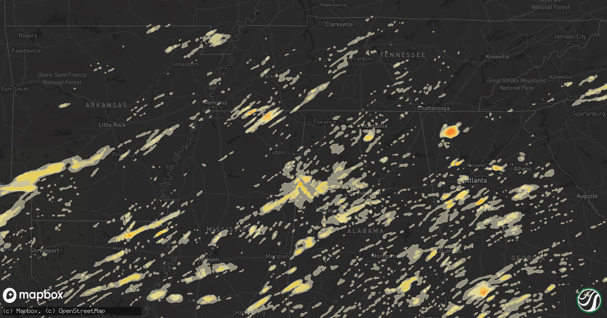
Hail Map in Florida on April 4, 2011
Get this storm
April 4 map
$229
one time, instant access
Download today. No call, no setup
Keep the $229
Bought the map and want the full workflow? Apply the entire $229 to a subscription within 7 days. None of it is wasted.
Every map, not just this one
This buys you this map. Subscription and you get every map we run, in the markets you choose from a few cities to whole states to nationwide. Plus real-time alerts the moment a storm fires.
Contact data
Name, contact info, occupancy, even credit band for addresses in the footprint. You go from where it hit to who to call.
Become the source they trust
Unlimited branding weather history reports on demand. You already have the documented answer ready for the property owner, and you are the one who showed up with it.
Property data and RoofTrace estimates
Pull up any address you have got, its value and the exact code rules for that jurisdiction, straight from One Click Code. Then RoofTrace estimates the squares, pitch, and roof value, priced the way you price.
Storm reports in Florida
Florida
| Date | Description |
|---|---|
| 04/04/20116:55 AM CDT | The asos at the hernando county airport measured a wind gust of 53 knots. |
| 04/04/20116:55 AM CDT | A large tree fell onto a home causing significant roof damage. |
| 04/04/20116:50 AM CDT | St johns county emergency management reported trees and power lines down in south st augustine. |
| 04/04/20116:49 AM CDT | Emergency management reported trees into homes and a roof off of a mobile home in high point mobile home park on club house road. |
| 04/04/20116:45 AM CDT | Putnam county emergency managment reported the roof is off the moose lodge in pomona park. The event time was based on radar imagery. |
| 04/04/20116:45 AM CDT | The public reported trees down...pool cage damage and holes in roof in hernando beach. Time estimated by radar. |
| 04/04/20116:45 AM CDT | St johns county emergency management reported trees and power lines down on wildwood drive near state road 207. Some trees were up in the power lines. |
| 04/04/20116:43 AM CDT | Public reported snapped trees and a gazebo blown across the street and onto a roof. |
| 04/04/20116:37 AM CDT | Trees and power lines down near the intersection of county road 44 and west woodward park street. |
| 04/04/20116:35 AM CDT | Putnam county emergency management reported one barn destroyed and other barns damaged along highway 207a.trees and power lines also reported down in the area including |
| 04/04/20116:30 AM CDT | A trained spotter reported widespread trees down near frances. The event time was estimated based on radar. |
| 04/04/20116:15 AM CDT | An off duty nws employee reported a large tree down near 12600 muirfield blvd east. |
| 04/04/20116:15 AM CDT | An off duty nws employee reported an estimated 60 mph wind gust and damage to a playset in his backyard. |
| 04/04/20116:15 AM CDT | An off duty nws employee reported an estimated 60 mph wind gust and damage to a playset in his backyard. A 20 foot tree was blown down. There was damage to a fence and |
| 04/04/20116:14 AM CDT | State division of emergency management relayed a report of wind damge at 309 anthony ave in interlachen. A possible tornado was reported but radar data indicatred wind |
| 04/04/20116:14 AM CDT | A mesonet site measured 62 mph or 54 knots from 269 degrees. Time of gust estimated based on report and radar imagery. |
| 04/04/20116:12 AM CDT | An off duty nws employee reported an estimated 60 mph wind gust and damage to a playset in his backyard. A 50-60 foot tree was blown down. There was damage to a fence a |
| 04/04/20116:00 AM CDT | Quarter size hail reported by a storm spotter at saint augustine road and philips highway. |
| 04/04/20116:00 AM CDT | A trained spotter reported widespread trees down. Time of damage estimated based on radar. |
| 04/04/20116:00 AM CDT | A trained spotter reported nine trees and power lines down along oak drive. |
| 04/04/20116:00 AM CDT | A downburst wind and elevated mesocyclone rotation caused significant tree damage in the ssw section of keystone heights...just northwest of lake geneva. Significant wi |
| 04/04/20115:50 AM CDT | Clay electric website indicated approximately 1000 customers remaining without power in the middleburg area at 0758 edt. The storm went through the middleburg area at 0 |
| 04/04/20115:45 AM CDT | Alachua county emergency management reported multiple trees and wires down across the county. The airport is also without power. Times based on radar and the event like |
| 04/04/20115:43 AM CDT | Alachua county fire recue reported trees and powerlines down along nw 93rd avenue from the 4300 block to the 5000 block. Report recieved at 0726 edt and event time was |
| 04/04/20115:40 AM CDT | Bradford county emergency management reported the squall line moved across the county between 0640 and 0800.several trees and power lines were down across the county wi |
| 04/04/20115:40 AM CDT | Nassau county emergency management reported trees and power lines down and a camper damaged along blackrock road near opel road. The event time was estimated based on r |
| 04/04/20115:35 AM CDT | At 0708 edt alachua county emergency management recieved a report of a tree down on a house at 8620m nw 13th street lot 414. The event time is estimated based on radar. |
| 04/04/20115:33 AM CDT | Alachua county emergency management reported a tree in the road at 9016 nw 143rd street. |
| 04/04/20115:32 AM CDT | Alachua county emergency management reported a tree down on a building at 5726 nw 91st blvd. Reported at 0739 edt and the event time was estimated based on radar. |
| 04/04/20115:26 AM CDT | Trees down blocking the roadways in the city of chiefland. |
| 04/04/20115:15 AM CDT | Roof of airport hanger was ripped off...reported at 37776 east wood road. Time was estimated based on radar. |
| 04/04/20115:10 AM CDT | 5 large trees down on hwy 349 north of willow hole. |
| 04/04/20115:05 AM CDT | Trees and powerlines down countywide. |
| 04/04/20115:00 AM CDT | A large oak tree fell across a lawn at 4700 se 70th ave. In trenton. |
| 04/04/20114:55 AM CDT | Numerous trees down. Numerous reports of roof damage. Many power poles down. Ace hardware in cross city missing part of roof. |
| 04/04/20114:45 AM CDT | Trees and powerlines down countywide. |
| 04/04/20114:00 AM CDT | Suwannee county emergency management reported widespread trees and power lines down across the county. Widepread power outages were also reported. Ema advised the event |
| 04/04/20113:59 AM CDT | Spotter estimated winds near 65 mph and reported power outages. |
| 04/04/20113:59 AM CDT | A local report indicates 75 MPH wind near PERRY-FOLEY AIRPORT |
| 04/04/20113:52 AM CDT | Multiple trees down highway 255 south of lee county |
| 04/04/20113:50 AM CDT | Forest service personnel reported widespread tree damage across the county beginning at 0450 and continuing until approximately 0535. A large tree was down across the h |
| 04/04/20113:45 AM CDT | Ema reported 4-5 homes and 2 businesses damaged in county...exact location not reported. 90 percent of area was reportedly without power. Time estimated based on radar |
| 04/04/20113:45 AM CDT | Ema reported 4-5 homes and 2 businesses damaged in county...exact location not reported. 90 percent of area was reportedly without power. Time estimated based on radar. |
| 04/04/20113:45 AM CDT | Tree damage ne persimmon drive in pinetta fl. |
| 04/04/20113:45 AM CDT | Unspecified damage ne persimmon drive in pinetta fl. |
| 04/04/20113:40 AM CDT | 3 trees down on homes..one each in pineta...greenville and madison. Multiple trees down across county |
| 04/04/20113:30 AM CDT | Home destroyed by falling tree 190 sw mlk. |
| 04/04/20113:24 AM CDT | Spotter relayed report of several trees down along interstate 10 between mile markers 232 and 233. |
| 04/04/20112:55 AM CDT | Over 10 transformer flashes witnessed by an nws employee on the east side of tallahassee. |
| 04/04/20112:52 AM CDT | Multiple trees down highway 255 south of lee county |
| 04/04/20112:52 AM CDT | Trees down across the county |
| 04/04/20112:50 AM CDT | A few trees and powerlines down near saint teresa and alligator point. |
| 04/04/20112:30 AM CDT | Large oak tree felled near the intersection of north meridian and bradford roads. |
| 04/04/20112:26 AM CDT | Trees and powerlines down countywide. Tree limb through a window in apalachicola. |
| 04/04/20112:25 AM CDT | 1 home with unknown damage vcnty of old bluff road. |
| 04/04/20112:20 AM CDT | Funnel cloud reported...not on ground. 2000 n meridian rd |
| 04/04/20112:15 AM CDT | 5-8 homes with minor major damage. Numerous roads were blocked by trees in gadsden county. Exact location in the county tbd by survey team. |
| 04/04/20112:09 AM CDT | Trees down across the county |
| 04/04/20112:06 AM CDT | Emergency manager reports trees down countywide. Time estimated by radar. |
| 04/04/20111:55 AM CDT | Widespread power outages with scattered debris from storms. |
| 04/04/20111:45 AM CDT | Widespread power outages across the county with 400 homes without power. Exact locations being surveyed. |
| 04/04/20111:40 AM CDT | Multiple large trees down along route 20 between clarksville and blountstown. |
| 04/04/20111:40 AM CDT | 63 mph winds. Roof damage to home. |
| 04/04/20111:35 AM CDT | Roof torn off trailer. |
| 04/04/20111:23 AM CDT | 3 trees down between altha and jackson county line. Hail reported of unknown size. |
| 04/04/20111:18 AM CDT | Part of a roof blown off and is suspended on powerlines. Trees down countwide. |
| 04/04/201112:55 AM CDT | Tree damage and powerlines down across county |
| 04/04/201112:32 AM CDT | Trees down countywide. |
| 04/04/201112:30 AM CDT | Hwy 79 closed due to debris. 4 power lines in roads blocking hwy 90 to the beach. |
| 04/04/201112:10 AM CDT | 60 mph winds.no power |
| 04/03/201111:45 PM CDT | Trees down countywide. |
| 04/03/201111:13 PM CDT | Skywarn spotter reports pine tree down across hwy 90...3 miles west of the okaloosa and walton county line. Time estimated from radar. |
| 04/03/201110:47 PM CDT | Tree down at hilburn road and creighton road. |
| 04/03/201110:26 PM CDT | Santa rosa fire dept reports a tree down on a mobile home on diamond street in pace. Eight people are being evacuated from the home. |
All States Impacted by Hail Map on April 4, 2011
Cities Impacted by Hail Map on April 4, 2011
- Longview, TX
- Denmark, TN
- Medon, TN
- Crossville, TN
- Noble, LA
- Converse, LA
- Selmer, TN
- Boaz, AL
- Horton, AL
- Altoona, AL
- Jewell, GA
- Bloomington, IN
- Midland City, AL
- Ozark, AL
- Quitman, MS
- Meridian, MS
- Norman, IN
- Louisville, MS
- Weir, MS
- McCool, MS
- Clarendon, AR
- Casscoe, AR
- Almyra, AR
- Stuttgart, AR
- Crocketts Bluff, AR
- Delta, AL
- Woodville, TX
- Campti, LA
- Marietta, GA
- Eminence, MO
- Ethelsville, AL
- Ozan, AR
- Antoine, AR
- Okolona, AR
- Hooks, TX
- Blevins, AR
- Nashville, AR
- Alleene, AR
- Murfreesboro, AR
- De Kalb, TX
- Prescott, AR
- Delight, AR
- Ogden, AR
- Foreman, AR
- Saratoga, AR
- Texarkana, TX
- McCaskill, AR
- Ashdown, AR
- New Boston, TX
- Lockesburg, AR
- Avery, TX
- Columbus, AR
- Mineral Springs, AR
- Wilton, AR
- Evergreen, AL
- Fletcher, NC
- Buford, GA
- Hoschton, GA
- Flowery Branch, GA
- Auburn, GA
- Braselton, GA
- Mayo, FL
- Horseshoe Beach, FL
- Live Oak, FL
- Branford, FL
- Perry, FL
- Steinhatchee, FL
- Salem, FL
- Day, FL
- Old Town, FL
- Luverne, AL
- Goshen, AL
- Pine Bluff, AR
- Sherrill, AR
- Nashville, IN
- Ashland, AL
- Seneca, SC
- Ponce De Leon, FL
- Shreveport, LA
- Bradley, AR
- Taylor, AR
- Lafe, AR
- Rector, AR
- Marmaduke, AR
- Milam, TX
- Beallsville, OH
- Powhatan Point, OH
- Alledonia, OH
- Jacobsburg, OH
- Port Richey, FL
- New Port Richey, FL
- Hudson, FL
- Spring Hill, FL
- Lake Toxaway, NC
- Ponchatoula, LA
- Kane, PA
- Lewis Run, PA
- Warren, PA
- Tiona, PA
- Clarendon, PA
- Melville, LA
- Plaucheville, LA
- Palmetto, LA
- Milledgeville, TN
- Sardis, TN
- Bluffton, SC
- Lexington, GA
- Stephens, GA
- Bainbridge, GA
- Pontotoc, MS
- Centreville, AL
- Duncanville, AL
- Brent, AL
- West Blocton, AL
- Boligee, AL
- Livingston, AL
- Olivehill, TN
- Baileyton, AL
- Cullman, AL
- Huntsville, AL
- Union Grove, AL
- Somerville, AL
- Laceys Spring, AL
- Vinemont, AL
- New Hope, AL
- Eva, AL
- Canton, TX
- Leesburg, TX
- Mineola, TX
- Hughes Springs, TX
- Pittsburg, TX
- Quitman, TX
- Daingerfield, TX
- Hawkins, TX
- Naples, TX
- Como, TX
- Big Sandy, TX
- Gilmer, TX
- Omaha, TX
- Winnsboro, TX
- Atlanta, GA
- Shiloh, GA
- Hamilton, GA
- Cataula, GA
- Warm Springs, GA
- Jacksons Gap, AL
- Dadeville, AL
- Marion Junction, AL
- Uniontown, AL
- Wilsonville, AL
- Adger, AL
- Bessemer, AL
- Vance, AL
- Pelham, AL
- Knoxville, AL
- Alabaster, AL
- Brierfield, AL
- Fosters, AL
- Sterrett, AL
- Tuscaloosa, AL
- Birmingham, AL
- Harpersville, AL
- Moundville, AL
- Akron, AL
- Helena, AL
- Montevallo, AL
- Cottondale, AL
- Chelsea, AL
- Vincent, AL
- Columbiana, AL
- Brookwood, AL
- McCalla, AL
- Woodstock, AL
- Williams, IN
- Guntersville, AL
- Midland, GA
- Collierville, TN
- Williston, TN
- Somerville, TN
- Rossville, TN
- Moscow, TN
- Barlow, KY
- Greensboro, GA
- Madison, GA
- Dayton, OH
- Longs, SC
- Conway, SC
- Loris, SC
- Adamsville, AL
- Monroe, LA
- Ethel, MS
- Kosciusko, MS
- Trinity, AL
- Moulton, AL
- Hillsboro, AL
- Andalusia, AL
- Red Level, AL
- Gordo, AL
- Steens, MS
- Sulligent, AL
- Bankston, AL
- Oakman, AL
- Parrish, AL
- Crane Hill, AL
- Caledonia, MS
- Arley, AL
- Beaverton, AL
- Double Springs, AL
- Reform, AL
- Berry, AL
- Millport, AL
- Aberdeen, MS
- Hanceville, AL
- Nauvoo, AL
- Bremen, AL
- Jasper, AL
- Sturgis, MS
- Carbon Hill, AL
- Brooksville, MS
- Starkville, MS
- Houston, AL
- Kennedy, AL
- Greenwood Springs, MS
- Gattman, MS
- Carrollton, AL
- West Point, MS
- Detroit, AL
- Cordova, AL
- Hamilton, MS
- Fayette, AL
- Northport, AL
- Vernon, AL
- Columbus, MS
- Townley, AL
- Crawford, MS
- Robeline, LA
- Marthaville, LA
- Brickeys, AR
- Marianna, AR
- Tunica, MS
- Isola, MS
- Inverness, MS
- Leland, MS
- Greenville, MS
- Colfax, LA
- Dry Prong, LA
- Magnolia, AR
- McNeil, AR
- Petersburg, TN
- Bremen, GA
- Temple, GA
- Carrollton, GA
- Clay, KY
- Winfield, AL
- Eldridge, AL
- Shubuta, MS
- Marksville, LA
- Hessmer, LA
- Newnan, GA
- Palmetto, GA
- Fairburn, GA
- Sharpsburg, GA
- Chidester, AR
- Homerville, GA
- Thomaston, AL
- Bogata, TX
- De Kalb, MS
- Hawkinsville, GA
- Eastman, GA
- Coal Center, PA
- Daisytown, PA
- Clayton, AL
- Vale, NC
- Lincolnton, NC
- Florence, MS
- Bastrop, LA
- Hilliard, FL
- Humboldt, TN
- Trenton, TN
- De Berry, TX
- Bethany, LA
- Hackleburg, AL
- Hamilton, AL
- Union Springs, AL
- Troy, AL
- Grady, AL
- Wind Ridge, PA
- Cameron, WV
- Glen Easton, WV
- Hornbeck, LA
- Tutwiler, MS
- Thornton, TX
- Groesbeck, TX
- Fairfield, TX
- Teague, TX
- Donie, TX
- Franklin, GA
- Douglasville, GA
- Whitesburg, GA
- Roopville, GA
- San Augustine, TX
- Palmer, TN
- Milton, FL
- Holt, FL
- Millington, TN
- Childersburg, AL
- Alpine, AL
- Louisville, GA
- Stapleton, GA
- Ariton, AL
- Long Branch, TX
- Mount Enterprise, TX
- Tifton, GA
- Montville, OH
- Chardon, OH
- Faunsdale, AL
- Linden, AL
- Saint Albans, WV
- Tornado, WV
- Camilla, GA
- Ellisville, MS
- Ovett, MS
- Petal, MS
- Hattiesburg, MS
- Richton, MS
- Waynesboro, MS
- Moselle, MS
- Laurel, MS
- Hartford, AL
- Slocomb, AL
- Albany, GA
- Sylvester, GA
- Crofton, KY
- White Plains, KY
- Gadsden, AL
- Lawrenceville, GA
- Kennett, MO
- Mooresboro, NC
- Shelby, NC
- Gaffney, SC
- Lewisville, AR
- Hull, GA
- Nicholson, GA
- Commerce, GA
- Merom, IN
- Hutsonville, IL
- Sullivan, IN
- Fairbanks, IN
- Mayersville, MS
- Lake Providence, LA
- Lawndale, NC
- Cherryville, NC
- Acworth, GA
- Dallas, GA
- Graysville, AL
- Shelbyville, IN
- Fargo, GA
- Hogansville, GA
- Ash, NC
- Bolton, NC
- Mount Olive, AL
- Clarkson, KY
- Cub Run, KY
- Munfordville, KY
- Panama City, FL
- Lindale, TX
- Tyler, TX
- Winona, TX
- Morgantown, KY
- Belton, KY
- Dunmor, KY
- Lewisburg, KY
- Guthrie, KY
- Elkton, KY
- Branchland, WV
- Weogufka, AL
- Sylacauga, AL
- Hendersonville, TN
- Germantown, OH
- La Grange, TN
- Lamar, MS
- Michigan City, MS
- Byhalia, MS
- Red Banks, MS
- Holly Springs, MS
- Grand Junction, TN
- Blakely, GA
- Horse Cave, KY
- Cave City, KY
- Bowling Green, KY
- Cory, IN
- Clay City, IN
- Pimento, IN
- Lewis, IN
- Huntingdon, TN
- Hollow Rock, TN
- Bruceton, TN
- Griffin, GA
- Williamson, GA
- Opp, AL
- Kite, GA
- Adrian, GA
- Dover, AR
- Harrison, TN
- Soddy Daisy, TN
- Greer, SC
- Landrum, SC
- Taylors, SC
- Philadelphia, MS
- Gray, GA
- Haddock, GA
- Juliette, GA
- Hillsboro, GA
- Forsyth, GA
- Macon, GA
- Mocksville, NC
- Newellton, LA
- Tallulah, LA
- Leeds, AL
- Coal City, IN
- Freedom, IN
- Spencer, IN
- Gosport, IN
- Ellettsville, IN
- Worthington, IN
- Wadley, AL
- Natchez, MS
- Lecanto, FL
- Hernando, FL
- Inverness, FL
- Homosassa, FL
- Oneonta, AL
- Tiplersville, MS
- Transylvania, LA
- Cary, MS
- Sondheimer, LA
- Rolling Fork, MS
- Diana, TX
- Avinger, TX
- Ore City, TX
- Jefferson, TX
- Valhermoso Springs, AL
- Butler, AL
- Dacula, GA
- Austin, TX
- Leander, TX
- Cedar Park, TX
- Uvalda, GA
- Lyons, GA
- Thomasville, GA
- Hampton, GA
- Mcdonough, GA
- Locust Grove, GA
- Hazlehurst, GA
- West Green, GA
- Denton, GA
- Monticello, FL
- Dunlap, TN
- Natchitoches, LA
- Fayette, MS
- Ferriday, LA
- Fort Benning, GA
- Wing, AL
- Brantley, AL
- Rutledge, AL
- Nebo, NC
- Union Mills, NC
- Morganton, NC
- Valley Mills, TX
- Crawford, TX
- Vienna, GA
- Cordele, GA
- Miamisburg, OH
- Blountsville, AL
- Armuchee, GA
- Rome, GA
- Calhoun, GA
- McCrory, AR
- Augusta, AR
- Yazoo City, MS
- Yantis, TX
- Sulphur Springs, TX
- Opelika, AL
- Salem, AL
- Hatchechubbee, AL
- Seale, AL
- Hurtsboro, AL
- Phenix City, AL
- Honoraville, AL
- Terre Haute, IN
- Farmersburg, IN
- Bells, TN
- Jackson, TN
- Winnsboro, LA
- Fort Necessity, LA
- South Park, PA
- Clairton, PA
- Finleyville, PA
- Waverly Hall, GA
- Greenville, FL
- Makanda, IL
- Alto Pass, IL
- Carbondale, IL
- Cobden, IL
- Hayneville, AL
- Tyler, AL
- East Prairie, MO
- Matthews, MO
- Ellenboro, NC
- Rockdale, TX
- Thorndale, TX
- Town Creek, AL
- Sterlington, LA
- Farmerville, LA
- Waycross, GA
- Leesburg, GA
- Smithville, GA
- Bronwood, GA
- Dawson, GA
- Suwanee, GA
- Greensburg, IN
- Crossett, AR
- Hamburg, AR
- Gerton, NC
- Fairview, NC
- Hendersonville, NC
- Black Mountain, NC
- Sumner, GA
- Newport, AR
- Marietta, TX
- Palestine, TX
- Arp, TX
- Gladewater, TX
- Fruitvale, TX
- Grand Saline, TX
- Linden, TX
- Edgewood, TX
- Douglassville, TX
- Lone Star, TX
- Flint, TX
- Brownsboro, TX
- Alba, TX
- Athens, TX
- Whitehouse, TX
- Ben Wheeler, TX
- Chandler, TX
- Frankston, TX
- Wills Point, TX
- Larue, TX
- Tennessee Colony, TX
- Emory, TX
- Bullard, TX
- Van, TX
- Montalba, TX
- Scroggins, TX
- Carthage, MS
- Lumpkin, GA
- Cusseta, GA
- Richland, GA
- Talco, TX
- Mount Pleasant, TX
- Mount Vernon, TX
- Calera, AL
- Poulan, GA
- Indianapolis, IN
- Greenwood, IN
- Fairland, IN
- Needham, IN
- Boggstown, IN
- Georgetown, GA
- Athens, AL
- Elkmont, AL
- Middleton, TN
- Graceville, FL
- Waco, GA
- Deridder, LA
- New Castle, IN
- Whiteland, IN
- Eatonton, GA
- Buckhead, GA
- La Center, KY
- Kevil, KY
- Chatsworth, GA
- Dalton, GA
- Sugar Valley, GA
- Resaca, GA
- Ashland, MS
- Collinston, LA
- Mer Rouge, LA
- Crystal Springs, MS
- Hermanville, MS
- Utica, MS
- Hazlehurst, MS
- Scipio, IN
- Golconda, IL
- Fort Mitchell, AL
- Hickory Flat, MS
- Potts Camp, MS
- Granger, TX
- Taylor, TX
- Georgetown, TX
- Aquilla, TX
- China Spring, TX
- Whitney, TX
- Clifton, TX
- Ventress, LA
- Aliceville, AL
- Marion, KY
- Addison, AL
- Russellville, AL
- Danville, AL
- Haleyville, AL
- Belle Rose, LA
- Madison, FL
- Waldo, AR
- Forest, MS
- Raleigh, MS
- Silsbee, TX
- Marbury, AL
- Equality, AL
- Rockford, AL
- Titus, AL
- Deatsville, AL
- Kilgore, TX
- Sparkman, AR
- Clarksville, TX
- Annona, TX
- Eustace, TX
- Overton, TX
- Murchison, TX
- Haworth, OK
- White Oak, TX
- Maud, TX
- Dike, TX
- Prattsville, AR
- Jacksonville, TX
- Jewett, TX
- Saltillo, TX
- Queen City, TX
- Kaufman, TX
- Mexia, TX
- Horatio, AR
- Donaldson, AR
- Leola, AR
- Gurdon, AR
- Atlanta, TX
- Texarkana, AR
- Arkadelphia, AR
- Grapevine, AR
- Fulton, AR
- Pickton, TX
- Nash, TX
- Cookville, TX
- Sheridan, AR
- Hallsville, TX
- Carthage, AR
- Tallahassee, FL
- Phil Campbell, AL
- Gatewood, MO
- Woodbury, TN
- Many, LA
- Louisville, AL
- Letohatchee, AL
- Lowndesboro, AL
- Hope Hull, AL
- Coker, AL
- Buhl, AL
- Linesville, PA
- Vaughan, MS
- Lebanon, TN
- Goodlettsville, TN
- Fredonia, KY
- Tichnor, AR
- Jackson, GA
- Alberta, AL
- Catherine, AL
- Youngstown, FL
- Woodland, AL
- Muscadine, AL
- Tallapoosa, GA
- Buchanan, GA
- Madison, AL
- Nashville, TN
- Madison, TN
- Duck River, TN
- Centerville, TN
- Midway, FL
- Quincy, FL
- Havana, FL
- Dry Creek, LA
- Huron, TN
- Pinson, TN
- Henderson, TN
- Beech Bluff, TN
- Luray, TN
- Lexington, TN
- Ray City, GA
- Hilton Head Island, SC
- Pulaski, MS
- Tatum, TX
- Henderson, TX
- Dry Branch, GA
- Greensburg, LA
- Savannah, TN
- Lynn, AL
- Cartersville, GA
- Hemphill, TX
- Lake Park, GA
- Valdosta, GA
- Forest City, NC
- Bostic, NC
- Rutherfordton, NC
- Spindale, NC
- Belle Vernon, PA
- Waynesburg, PA
- Scenery Hill, PA
- Prosperity, PA
- Richeyville, PA
- Fredericktown, PA
- Dunlevy, PA
- Monessen, PA
- Beallsville, PA
- Amity, PA
- Marianna, PA
- Charleroi, PA
- Williamsville, MO
- Ludowici, GA
- Ashland City, TN
- Steele, AL
- Wedowee, AL
- Lineville, AL
- Cragford, AL
- Toxey, AL
- Gilbertown, AL
- Millry, AL
- Frankville, AL
- Sweet Water, AL
- Thomasville, AL
- Silas, AL
- Campbell, AL
- Coffeeville, AL
- Bogue Chitto, MS
- Doerun, GA
- Hartsfield, GA
- Omega, GA
- Ocilla, GA
- Norman Park, GA
- Chula, GA
- Fitzgerald, GA
- Funston, GA
- Moultrie, GA
- Meigs, GA
- Ty Ty, GA
- Grand Ridge, FL
- Marianna, FL
- Manchester, TN
- Tullahoma, TN
- Dora, AL
- Lake City, FL
- Ailey, GA
- Mount Vernon, GA
- Tarrytown, GA
- Vidalia, GA
- Eddyville, KY
- Shellman, GA
- Beebe, AR
- Brookhaven, MS
- Bronson, TX
- Bonifay, FL
- West Monroe, LA
- Estill Springs, TN
- Canonsburg, PA
- Washington, PA
- McEwen, TN
- Dickson, TN
- Hollandale, MS
- Rienzi, MS
- Corinth, MS
- Dixie, GA
- Earle, AR
- Sarepta, LA
- Oak Grove, LA
- Camden, MS
- Mendenhall, MS
- Pelahatchie, MS
- Brandon, MS
- Braxton, MS
- Rebecca, GA
- Sycamore, GA
- Odum, GA
- Kuttawa, KY
- Minter, AL
- Saulsbury, TN
- Walnut, MS
- Wiggins, MS
- Brooklyn, MS
- Lake Village, AR
- Lucedale, MS
- McLain, MS
- Peachtree City, GA
- Roanoke, AL
- Union City, GA
- Lanett, AL
- Lagrange, GA
- Cusseta, AL
- Lafayette, AL
- Tyrone, GA
- Five Points, AL
- Senoia, GA
- Grantville, GA
- Fayetteville, GA
- Moreland, GA
- Sandersville, GA
- Beatrice, AL
- Pine Apple, AL
- New Market, AL
- Graysville, TN
- Dayton, TN
- Pikeville, TN
- Sale Creek, TN
- Lake City, AR
- Buena Vista, GA
- Eudora, AR
- Liberty, SC
- Easley, SC
- Brookland, AR
- Paragould, AR
- Jonesboro, AR
- Chester, IL
- Ellis Grove, IL
- Saint Mary, MO
- Cuba, AL
- York, AL
- Naylor, GA
- Terry, MS
- Springfield, TN
- Orlinda, TN
- Bedford, IN
- Wetumpka, AL
- Eclectic, AL
- Mantee, MS
- Mathiston, MS
- Maben, MS
- Eupora, MS
- Annapolis, IL
- Palestine, IL
- Shelburn, IN
- Robinson, IL
- West York, IL
- Quitman, GA
- Chunchula, AL
- Citronelle, AL
- Stockbridge, GA
- Jonesboro, GA
- Rex, GA
- Laurel Hill, FL
- Florala, AL
- Scurry, TX
- Vidalia, LA
- Pollock, LA
- Trout, LA
- Counce, TN
- Andrews, SC
- Waynesboro, TN
- Clifton, TN
- Hohenwald, TN
- North Augusta, SC
- Jasper, TX
- Prattville, AL
- Jesup, GA
- Carthage, IN
- Knightstown, IN
- Morristown, IN
- Greenfield, IN
- Arlington, IN
- Dozier, AL
- Angie, LA
- Goodwater, AL
- Ararat, VA
- Meadows Of Dan, VA
- Laurel Fork, VA
- Hillsville, VA
- Reynolds, GA
- Doniphan, MO
- Watertown, TN
- Heth, AR
- Widener, AR
- Bunkie, LA
- Baconton, GA
- Newton, GA
- Booneville, MS
- Loranger, LA
- Folsom, LA
- Arlington, AL
- Pine Hill, AL
- Dixons Mills, AL
- Magnolia, AL
- Manor, TX
- Tabor City, NC
- Glenville, NC
- Cashiers, NC
- Milano, TX
- Cameron, TX
- Buckholts, TX
- Davilla, TX
- Clarington, OH
- Bragg City, MO
- Mitchell, GA
- Warrenton, GA
- Boston, GA
- Kings Mountain, NC
- Wisner, LA
- Glenwood, GA
- Alexandria, LA
- Woodworth, LA
- Lecompte, LA
- Westville, FL
- Clio, AL
- Jena, LA
- Grayson, LA
- Columbia, LA
- Pensacola, FL
- Robertsdale, AL
- Princeton, KY
- Freeport, FL
- Union, MS
- Dongola, IL
- Cuthbert, GA
- Coleman, GA
- Coolidge, GA
- Ochlocknee, GA
- Smithville, MS
- Fountain, FL
- Defuniak Springs, FL
- Amory, MS
- Nakina, NC
- Delco, NC
- Whiteville, NC
- Sweeden, KY
- Bee Spring, KY
- Mammoth Cave, KY
- Saint Stephen, SC
- Bonneau, SC
- Pocahontas, TN
- Ripley, MS
- Falkner, MS
- Tignall, GA
- Washington, GA
- Rayle, GA
- Campobello, SC
- Clarksville, FL
- Lisman, AL
- Columbia, MS
- Sandy Hook, MS
- Warner Robins, GA
- Altheimer, AR
- Wabbaseka, AR
- Hurricane, WV
- Hamlin, WV
- Dunbar, WV
- Griffithsville, WV
- Sod, WV
- Nitro, WV
- Alum Creek, WV
- Omaha, GA
- Griffithville, AR
- Covington, GA
- McDavid, FL
- Tanner, AL
- Donalsonville, GA
- Gordon, AL
- Jakin, GA
- Colquitt, GA
- Comer, GA
- Colbert, GA
- Danielsville, GA
- Monroe City, IN
- Hillsboro, TN
- Bartow, GA
- Highland Home, AL
- McClellandtown, PA
- Cotton Valley, LA
- Pitkin, LA
- Leesville, LA
- Elmer, LA
- Fort Polk, LA
- Glenmora, LA
- Hineston, LA
- Powder Springs, GA
- Lithia Springs, GA
- Mableton, GA
- Austell, GA
- Clarkdale, GA
- Mansfield, GA
- Bonnieville, KY
- Rockville, IN
- Montezuma, IN
- Crestview, FL
- Eglin Afb, FL
- Canton, MS
- Pine Mountain, GA
- Denham Springs, LA
- Walker, LA
- Vina, AL
- Hodges, AL
- Fordsville, KY
- Hartford, KY
- Washington, AR
- Sparta, TN
- Waverly, AL
- Auburn, AL
- Newton, NC
- Mooresville, NC
- Maiden, NC
- Crouse, NC
- Troutman, NC
- Columbus, NC
- Tryon, NC
- Statesville, NC
- Claremont, NC
- Mill Spring, NC
- Sherrills Ford, NC
- Terrell, NC
- Catawba, NC
- Westmoreland, TN
- Hartsville, TN
- Lafayette, TN
- Bethpage, TN
- Saluda, SC
- Edgefield, SC
- Shuqualak, MS
- Auburn, KY
- Jasper, FL
- Belton, SC
- Honea Path, SC
- Winston, GA
- Villa Rica, GA
- Epps, LA
- Pioneer, LA
- Plainville, GA
- Newville, AL
- Eros, LA
- Forkland, AL
- Bellamy, AL
- Epes, AL
- Butler, GA
- Roberta, GA
- Pittsview, AL
- Courtland, MS
- Oakland, MS
- Enid, MS
- Pope, MS
- Dardanelle, AR
- Danville, AR
- Belleville, AR
- Woodleaf, NC
- East Dublin, GA
- Dublin, GA
- Blairsville, GA
- Mason, IL
- Oblong, IL
- Jasonville, IN
- West Union, IL
- Willow Hill, IL
- Newton, IL
- Hymera, IN
- Yale, IL
- Coalmont, IN
- Wheeler, IL
- Dieterich, IL
- Lawrenceburg, TN
- Paris, IL
- Climax, GA
- Chatham, LA
- Jonesboro, LA
- Emelle, AL
- Bascom, FL
- Centerpoint, IN
- Poland, IN
- Eufaula, AL
- Banks, AL
- Memphis, TN
- Thomson, GA
- Pitts, GA
- Rochelle, GA
- Ashburn, GA
- Arabi, GA
- Central, SC
- Union Church, MS
- Roxie, MS
- Meadville, MS
- McCall Creek, MS
- Vienna, IL
- Washington, IN
- Portland, AR
- Montrose, AR
- Marlin, TX
- Doddridge, AR
- Cadiz, KY
- Sparta, GA
- Cobbtown, GA
- Pelham, TN
- Altamont, TN
- Inglis, FL
- Cedar Key, FL
- Chiefland, FL
- Rockfield, KY
- Tylertown, MS
- Mount Hermon, LA
- Franklinton, LA
- Weston, GA
- Coushatta, LA
- Pelican, LA
- Clinton, IN
- Clinton, MS
- Bolton, MS
- Jackson, MS
- Thorsby, AL
- Jemison, AL
- Clanton, AL
- Kimberly, AL
- Mulga, AL
- Fultondale, AL
- Gardendale, AL
- Quinton, AL
- Sumiton, AL
- Warrior, AL
- Empire, AL
- Trafford, AL
- Morris, AL
- Brookside, AL
- Hayden, AL
- Irvington, AL
- West Point, GA
- Hahira, GA
- Morven, GA
- Rushville, IN
- Cowan, TN
- Decherd, TN
- Bivins, TX
- Vivian, LA
- Mountain View, AR
- Fox, AR
- Clinton, AR
- Shirley, AR
- Nashville, GA
- Newton, AL
- Waskom, TX
- Mooringsport, LA
- Montgomery, IN
- Loogootee, IN
- Cannelburg, IN
- Petersburg, IN
- Mangham, LA
- Broxton, GA
- Cairo, GA
- Seminole, AL
- Elberta, AL
- Moody, AL
- Pell City, AL
- Damascus, GA
- Noxapater, MS
- Morgantown, IN
- Anderson, SC
- Wrightsville, GA
- Rayville, LA
- Whites Creek, TN
- Spruce Pine, AL
- Attapulgus, GA
- Troy, SC
- McCormick, SC
- Mount Carmel, IL
- Bone Gap, IL
- Toomsboro, GA
- Olla, LA
- Enterprise, LA
- Harrisonburg, LA
- Jerusalem, OH
- Graham, AL
- Jenkinsburg, GA
- Flovilla, GA
- Jasper, TN
- Bethlehem, GA
- Winder, GA
- Brewton, AL
- Bethesda, OH
- Belmont, OH
- Hickory Ridge, AR
- Wynne, AR
- Oran, MO
- Nacogdoches, TX
- Cottondale, FL
- Alford, FL
- Hope, AR
- Enville, TN
- Jacks Creek, TN
- Nineveh, IN
- Franklin, IN
- Trafalgar, IN
- Columbus, GA
- Sequatchie, TN
- Bentleyville, PA
- Eighty Four, PA
- Batesville, MS
- Oxford, MS
- Water Valley, MS
- Hornsby, TN
- Altha, FL
- Baxley, GA
- Stevenson, AL
- Livingston, TN
- Beech Grove, AR
- Delaplaine, AR
- Columbia, AL
- Holden, LA
- Sawyerville, AL
- Shorterville, AL
- Abbeville, AL
- Ider, AL
- Henagar, AL
- Morganfield, KY
- Thebes, IL
- McRae Helena, GA
- Singer, LA
- Hernando, MS
- Coldwater, MS
- Mount Carmel, SC
- Sylvania, GA
- Girard, GA
- Woolwine, VA
- Willis, VA
- Floyd, VA
- Fancy Gap, VA
- Evergreen, LA
- Washington, LA
- Morrow, LA
- Brockwell, AR
- Finger, TN
- Bethel Springs, TN
- Marion, AL
- Adel, GA
- Covington, LA
- Union Point, GA
- White Plains, GA
- Rutledge, GA
- Shady Dale, GA
- Monticello, GA
- Newborn, GA
- Bradley, SC
- Monroe, GA
- Hutto, TX
- Pflugerville, TX
- Roundhill, KY
- Port Saint Joe, FL
- Saint George, GA
- Dunnellon, FL
- Crystal River, FL
- Ocala, FL
- Toney, AL
- Buckner, AR
- Heflin, AL
- Fruithurst, AL
- Glenwood, IN
- Bristol, FL
- Couch, MO
- Greenville, AL
- Brevard, NC
- Surrency, GA
- La Fayette, GA
- Ranger, GA
- Summerville, GA
- Greenville, KY
- Rochester, KY
- Greensboro, AL
- Pearl, MS
- Cadwell, GA
- Searcy, AR
- Fountaintown, IN
- New Palestine, IN
- Marion, LA
- Lowgap, NC
- Mount Airy, NC
- Humnoke, AR
- Ulm, AR
- Carlisle, AR
- Cotton Plant, AR
- Walnut Ridge, AR
- Portia, AR
- Hoxie, AR
- Millerville, AL
- Arab, AL
- Merryville, LA
- Montgomery, AL
- Gibson, GA
- Pearson, GA
- Willacoochee, GA
- Henderson, KY
- Courtland, AL
- Centreville, MS
- Houston, MS
- Prairie, MS
- Brundidge, AL
- Marion, NC
- Lake Lure, NC
- Randolph, AL
- Brooks, GA
- Luthersville, GA
- Whitwell, TN
- Duluth, GA
- Guin, AL
- Delhi, LA
- Pavo, GA
- Farina, IL
- Twin City, GA
- Soperton, GA
- Swainsboro, GA
- Tuskegee, AL
- Jones, LA
- Glen Allan, MS
- Chatham, MS
- Bonita, LA
- Williamsport, TN
- Bon Aqua, TN
- Fairview, TN
- Primm Springs, TN
- Lyles, TN
- Santa Fe, TN
- Franklin, TN
- Kingston Springs, TN
- Nunnelly, TN
- Okolona, MS
- Sebree, KY
- Calhoun, KY
- Tickfaw, LA
- Hammond, LA
- Chauncey, GA
- White Springs, FL
- Qulin, MO
- Ashley, IL
- Woodlawn, IL
- Mount Vernon, IL
- Mount Hope, AL
- Rainbow City, AL
- Des Arc, AR
- Piedmont, AL
- Charleston, MO
- Carlton, GA
- Lamont, FL
- Ravenden Springs, AR
- Myrtle, MO
- Ravenden, AR
- Mammoth Spring, AR
- Pocahontas, AR
- Hardy, AR
- Valley Park, MS
- Cantonment, FL
- Eutaw, AL
- Blue Mountain, MS
- Ramer, TN
- Enterprise, MS
- Dearing, GA
- Charlottesville, IN
- Wilkinson, IN
- Shirley, IN
- De Valls Bluff, AR
- Roe, AR
- Liberty, IN
- Normandy, TN
- Wartrace, TN
- Raeford, NC
- Readyville, TN
- Liberty, TN
- Smithville, TN
- Duncan, SC
- Wellford, SC
- Fort Deposit, AL
- Loganville, GA
- Forest Home, AL
- Kingston, GA
- Taylorsville, GA
- Attalla, AL
- Gallant, AL
- Smithland, KY
- Burna, KY
- Musella, GA
- Knoxville, GA
- Glennville, GA
- Freetown, IN
- Shadyside, OH
- Wheeling, WV
- Valley Grove, WV
- Claysville, PA
- Glen Dale, WV
- Benwood, WV
- Triadelphia, WV
- Mcmechen, WV
- West Alexander, PA
- Safford, AL
- Longville, LA
- Hughes, AR
- Rogersville, AL
- Killen, AL
- Rocky Face, GA
- Leighton, AL
- Monticello, MS
- Sontag, MS
- Silver Creek, MS
- Prentiss, MS
- Jayess, MS
- Brownsville, IN
- Dixon, KY
- Claxton, GA
- Collins, GA
- Greenway, AR
- Piggott, AR
- Holcomb, MO
- Campbell, MO
- Gretna, FL
- Deer Park, AL
- McIntosh, AL
- Preston, MS
- Dundee, KY
- Fort Valley, GA
- Wrens, GA
- Rockmart, GA
- Barney, GA
- Emerson, AR
- Lakeland, GA
- Crawfordville, FL
- Box Springs, GA
- Ellerslie, GA
- Upatoi, GA
- Smiths Station, AL
- Tibbie, AL
- Paragon, IN
- Martinsville, IN
- Medina, TN
- Pisgah Forest, NC
- Rosman, NC
- Kelly, LA
- Montgomery, LA
- Georgetown, LA
- Natchez, LA
- Tullos, LA
- Atlanta, LA
- Cloutierville, LA
- Winnfield, LA
- Sicily Island, LA
- Gilbert, LA
- Fort Stewart, GA
- Pleasant Hill, LA
- Bargersville, IN
- Rusk, TX
- Pineview, GA
- Odenville, AL
- Elba, AL
- Falls Of Rough, KY
- Six Mile, SC
- Greenville, SC
- Pickens, SC
- Brownsville, KY
- Oakland, KY
- Park City, KY
- Smiths Grove, KY
- Fairborn, OH
- Indianola, MS
- Goldonna, LA
- Thayer, MO
- Hurricane Mills, TN
- Wellborn, FL
- Selma, AL
- Grandin, MO
- Satartia, MS
- Keithville, LA
- Byram, MS
- Centertown, KY
- Central City, KY
- Hollytree, AL
- Pattison, MS
- Greenwood, FL
- Hickory Valley, TN
- Caneyville, KY
- Leitchfield, KY
- Valley, AL
- Abita Springs, LA
- Bush, LA
- Pearl River, LA
- Paducah, KY
- Watson, AR
- Dumas, AR
- Stephens, AR
- Williston, FL
- Leslie, AR
- Marshall, TX
- Lloyd, FL
- Pinetta, FL
- Bonne Terre, MO
- Cushing, TX
- Mountain Rest, SC
- Fayetteville, TN
- Taft, TN
- Kirbyville, TX
- Edgewood, IL
- Louisville, IL
- Waldron, IN
- Saint Paul, IN
- Ohatchee, AL
- Ashville, AL
- Midville, GA
- Millen, GA
- Saint Clairsville, OH
- De Witt, AR
- Avera, GA
- Sneads, FL
- Dennard, AR
- Midway, AL
- Lonoke, AR
- Ramer, AL
- Lapine, AL
- Talladega, AL
- Reagan, TN
- Decaturville, TN
- Scotts Hill, TN
- Darden, TN
- Lizella, GA
- Morton, MS
- Pike Road, AL
- Hardaway, AL
- Fortson, GA
- Tuskegee Institute, AL
- Notasulga, AL
- Shorter, AL
- Tallassee, AL
- Oberlin, LA
- Oakdale, LA
- Bluffton, GA
- Arlington, GA
- Metropolis, IL
- Monroeville, AL
- Peterman, AL
- Jonesville, LA
- Pansey, AL
- Chattahoochee, FL
- Sparks, GA
- Hazel Green, AL
- Burnsville, MS
- Michie, TN
- Section, AL
- Dutton, AL
- Port Gibson, MS
- Adairville, KY
- Dexter, GA
- Rentz, GA
- Parsons, TN
- Crawfordville, GA
- Alapaha, GA
- Lock Haven, PA
- Cammal, PA
- Calvert, TX
- Lutts, TN
- Collinwood, TN
- Meridianville, AL
- Monterey, LA
- Karnack, TX
- Monteagle, TN
- Sewanee, TN
- Panama City Beach, FL
- Emerson, GA
- Harvest, AL
- Woodland, GA
- Beckville, TX
- Baker, FL
- Gadsden, TN
- Watkinsville, GA
- Athens, GA
- Pisgah, AL
- Sylvania, AL
- Rainsville, AL
- Lorman, MS
- Taylorsville, NC
- Lafitte, LA
- Marrero, LA
- Quincy, IN
- Cloverdale, IN
- Tracy City, TN
- Coalmont, TN
- Quaker City, OH
- Summerfield, OH
- Barnesville, OH
- Woodsfield, OH
- Ullin, IL
- Ardmore, TN
- Grand Rivers, KY
- Tiline, KY
- Call, TX
- Vernon, FL
- Russellville, KY
- Pollok, TX
- Collinsville, AL
- Gloster, MS
- Crosby, MS
- Buckatunna, MS
- Mart, TX
- Gantt, AL
- Atoka, TN
- McAlpin, FL
- Saline, LA
- Holly Grove, AR
- Langston, AL
- Albertville, AL
- Groveoak, AL
- Abbeville, GA
- Rhine, GA
- Milan, GA
- Ranburne, AL
- Bowdon, GA
- Fulton, MS
- Statenville, GA
- Jennings, FL
- Du Pont, GA
- Stockton, GA
- Moody Afb, GA
- Brilliant, AL
- Fitzpatrick, AL
- Mathews, AL
- Wardell, MO
- Steele, MO
- Hornersville, MO
- Hayti, MO
- Portageville, MO
- Senath, MO
- Glenwood, AL
- Edison, GA
- Startex, SC
- Spartanburg, SC
- Moore, SC
- Needham, AL
- Lauderdale, MS
- Daleville, MS
- Broaddus, TX
- Ridgeland, MS
- Frazeysburg, OH
- Collinsville, MS
- Antioch, TN
- Brentwood, TN
- Shoals, IN
- Dunnville, KY
- Castleberry, AL
- Grady, AR
- Centerville, GA
- Sardis, GA
- Stuart, VA
- Bentonia, MS
- Norcross, GA
- Alamo, GA
- Milroy, IN
- Tremont, MS
- Pegram, TN
- Jefferson, GA
- Ellijay, GA
- Zwolle, LA
- Saltillo, MS
- Marietta, MS
- New Site, MS
- Baldwyn, MS
- Niceville, FL
- Wewahitchka, FL
- Saint Joseph, LA
- Dunn Loring, VA
- Oakton, VA
- McLean, VA
- Vienna, VA
- Fairfax, VA
- Alexander City, AL
- Brownsville, PA
- Fayette City, PA
- Sycamore, PA
- Kinmundy, IL
- Barnesville, GA
- Yatesville, GA
- The Rock, GA
- Bloomfield, IN
- Adairsville, GA
- Greenville, GA
- Shelby, AL
- Cerulean, KY
- Chappells, SC
- Ninety Six, SC
- Chatom, AL
- State Line, MS
- Morganton, GA
- Hopkinsville, KY
- Warm Springs, AR
- Sulphur Bluff, TX
- Benton, MS
- Hampton, KY
- Elizabethtown, IL
- Rosiclare, IL
- West Paducah, KY
- Stonewall, MS
- Oxford, AL
- Munford, AL
- Schlater, MS
- Itta Bena, MS
- Decatur, AL
- Hartselle, AL
- Bay Minette, AL
- Fairhope, AL
- Loxley, AL
- Daphne, AL
- Abbott, TX
- Norwood, GA
- Du Bois, IL
- Red Bay, AL
- Golden, MS
- Poplarville, MS
- Lumberton, MS
- Grayson, GA
- Snellville, GA
- Lilburn, GA
- Trenton, KY
- Allensville, KY
- Olmstead, KY
- Lynchburg, TN
- Shelbyville, TN
- Whigham, GA
- Morrison, TN
- Mcminnville, TN
- Fruitdale, AL
- Baskin, LA
- Andover, OH
- Hayesville, NC
- Iron City, GA
- Vossburg, MS
- Heidelberg, MS
- Frisco City, AL
- Repton, AL
- Atmore, AL
- Provencal, LA
- Lena, LA
- Terrell, TX
- Rome, OH
- Dorset, OH
- Rock Creek, OH
- Jefferson, OH
- Crab Orchard, TN
- Enigma, GA
- Ellenton, GA
- Lenox, GA
- Byron, GA
- Crawfordsville, AR
- Marion, AR
- Nicholls, GA
- Black, AL
- Oxford, GA
- Thomaston, GA
- Ambrose, GA
- Douglas, GA
- Corning, AR
- Belden, MS
- Fort Bragg, NC
- Wagram, NC
- Lewisville, IN
- Cambridge City, IN
- Straughn, IN
- Bartlett, TX
- Sardis, AL
- Americus, GA
- Oakfield, GA
- Cobb, GA
- De Soto, GA
- Pinehurst, GA
- Morgan, GA
- Leslie, GA
- Unadilla, GA
- Parrott, GA
- Leary, GA
- Plains, GA
- Warwick, GA
- Toccoa, GA
- Martin, GA
- Hodgenville, KY
- Glendale, KY
- Elizabethtown, KY
- Sonora, KY
- Lee, FL
- Wesson, MS
- Martin, TN
- Docena, AL
- Woodville, MS
- Florien, LA
- Carson, MS
- Collins, MS
- Tillar, AR
- Belknap, IL
- Grantsburg, IL
- Remlap, AL
- Jay, FL
- Tucker, AR
- England, AR
- Elberton, GA
- Merigold, MS
- Mound Bayou, MS
- Friendship, TN
- Clinton, NC
- Turkey, NC
- Pelham, GA
- Eaton, OH
- Springville, AL
- Chatfield, TX
- Kemp, TX
- Rice, TX
- Warthen, GA
- Davisboro, GA
- Simpson, IL
- Sikes, LA
- Lufkin, TX
- Dripping Springs, TX
- Sunset, SC
- Salem, SC
- Gallion, AL
- Harleton, TX
- Martin, SC
- Wayne, WV
- Fort Gay, WV
- Genoa, WV
- East Lynn, WV
- Mauk, GA
- Junction City, GA
- Wilson, AR
- Joiner, AR
- Aubrey, AR
- Coosada, AL
- Elmore, AL
- Pendleton, SC
- Mooresville, IN
- Brooklyn, IN
- Statesboro, GA
- Pickens, MS
- Cana, VA
- McIntyre, GA
- Milledgeville, GA
- Saint Peter, IL
- Burns, TN
- White Bluff, TN
- Conesville, OH
- Dresden, OH
- Evensville, TN
- Spring City, TN
- Hagerstown, IN
- Dumas, MS
- Molino, FL
- Mount Vernon, AL
- Portland, TN
- Franklin, KY
- Raymond, MS
- Molena, GA
- Milner, GA
- Zebulon, GA
- Sanderson, FL
- Glen Saint Mary, FL
- Barnwell, SC
- Ulmer, SC
- Wagarville, AL
- Clinton, LA
- Belgrade, MO
- Georgiana, AL
- Jefferson, AR
- White Hall, AR
- Redfield, AR
- Demopolis, AL
- Ward, AR
- Centerville, IN
- Richmond, IN
- Camden, AL
- Alamo, TN
- Salem, KY
- Kinder, LA
- Mittie, LA
- Sharon Grove, KY
- Gurley, AL
- Irondale, MO
- Potosi, MO
- Gallatin, TN
- Baton Rouge, LA
- Centre, AL
- Brookport, IL
- Benton, MO
- Scott City, MO
- Forest Hill, LA
- Owens Cross Roads, AL
- Round Rock, TX
- O'Brien, FL
- Moundsville, WV
- New Eagle, PA
- Monongahela, PA
- Grayville, IL
- Robards, KY
- Windsor, KY
- Dodson, LA
- Bradyville, TN
- Beechgrove, TN
- Richland, MS
- Robinsonville, MS
- Sale City, GA
- Samson, AL
- Kinston, AL
- Hemingway, SC
- Georgetown, SC
- Lake Cormorant, MS
- Hazen, AR
- Chesnee, SC
- Grover, NC
- Inman, SC
- Nortonville, KY
- Fackler, AL
- Uriah, AL
- Little River, AL
- Franklin, TX
- Fouke, AR
- Ragley, LA
- Hosford, FL
- Cunningham, KY
- Madison, MS
- Oak Ridge, LA
- Lewisville, OH
- Crab Orchard, KY
- Eubank, KY
- Virgie, KY
- Olive Branch, MS
- Corydon, KY
- Fyffe, AL
- Alicia, AR
- Humphrey, AR
- Moro, AR
- Marvell, AR
- Guntown, MS
- Adah, PA
- Cardale, PA
- New Salem, PA
- Vanderbilt, PA
- Perryopolis, PA
- Grindstone, PA
- Republic, PA
- Merrittstown, PA
- Fairbank, PA
- Smock, PA
- La Vergne, TN
- Irwinton, GA
- Range, AL
- Ardmore, AL
- Coy, AL
- Spearsville, LA
- Lillie, LA
- Bellaire, OH
- Bridgeport, OH
- Clover, SC
- Blacksburg, SC
- Gastonia, NC
- Bloomburg, TX
- Westminster, SC
- Graysville, OH
- New Matamoras, OH
- Picayune, MS
- Big Creek, MS
- Theodore, AL
- Ebro, FL
- Carthage, TX
- Manilla, IN
- Homer, IN
- Macon, MS
- Scooba, MS
- Headland, AL
- Dothan, AL
- Fort Gaines, GA
- Marshall, AR
- Stockton, AL
- Mill Shoals, IL
- Burnt Prairie, IL
- Wilmar, AR
- Fountain Hill, AR
- Waterford, MS
- Eastaboga, AL
- Hampshire, TN
- Reeves, LA
- Vicksburg, MS
- Billingsley, AL
- Autaugaville, AL
- Jones, AL
- Purvis, MS
- Saint Francisville, LA
- Jackson, LA
- Mobile, AL
- Talbotton, GA
- O'Kean, AR
- Gainestown, AL
- Jackson, AL
- Drummonds, TN
- Wray, GA
- Osceola, AR
- Dyess, AR
- New Brockton, AL
- Falmouth, IN
- Connersville, IN
- Milton, IN
- Brownstown, IN
- Trussville, AL
- Joelton, TN
- Warsaw, NC
- Meansville, GA
- Jeffersonville, GA
- Culloden, GA
- Gordon, GA
- Timpson, TX
- Independence, LA
- Daleville, AL
- Peach Orchard, AR
- Westport, IN
- Myrtle Beach, SC
- Downsville, LA
- Scottsburg, VA
- Port Arthur, TX
- Jetson, KY
- Millbrook, AL
- Beechmont, KY
- Browder, KY
- Beech Creek, KY
- Skipperville, AL
- Clopton, AL
- Jack, AL
- Enterprise, AL
- Fort Rucker, AL
- Brinson, GA
- Charleston, WV
- Elkview, WV
- Island, KY
- Livermore, KY
- Higginson, AR
- Advance, MO
- Puxico, MO
- Brownwood, MO
- Sturdivant, MO
- Zalma, MO
- Lenox, AL
- Camp Hill, AL
- Rosston, AR
- Brookeland, TX
- Boaz, KY
- Bardwell, KY
- Melber, KY
- Ledbetter, KY
- Arlington, KY
- Hickory, KY
- Young Harris, GA
- Belvidere, TN
- Benoit, MS
- Shaw, MS
- Gideon, MO
- Fredericktown, OH
- Walhalla, SC
- Rison, AR
- Madisonville, KY
- Cochran, GA
- Carnesville, GA
- Halls, TN
- Woodland, MS
- Edinburgh, IN


