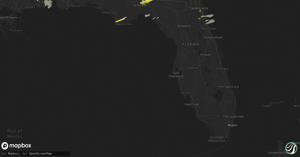
Hail Map in Florida on April 3, 2017
Get this storm
April 3 map
$229
one time, instant access
Download today. No call, no setup
Keep the $229
Bought the map and want the full workflow? Apply the entire $229 to a subscription within 7 days. None of it is wasted.
Every map, not just this one
This buys you this map. Subscription and you get every map we run, in the markets you choose from a few cities to whole states to nationwide. Plus real-time alerts the moment a storm fires.
Contact data
Name, contact info, occupancy, even credit band for addresses in the footprint. You go from where it hit to who to call.
Become the source they trust
Unlimited branding weather history reports on demand. You already have the documented answer ready for the property owner, and you are the one who showed up with it.
Property data and RoofTrace estimates
Pull up any address you have got, its value and the exact code rules for that jurisdiction, straight from One Click Code. Then RoofTrace estimates the squares, pitch, and roof value, priced the way you price.
Storm reports in Florida
Florida
| Date | Description |
|---|---|
| 04/03/20176:00 PM CDT | Tree blown down in ponte vedra. The time given was based on radar. |
| 04/03/20174:50 PM CDT | Quarter inch sized hail was reported at the san jose country club near mandarin. |
| 04/03/20173:24 PM CDT | Trees and power lines down in jefferson county |
| 04/03/20173:15 PM CDT | Spotter reports quarter sized hail on the east side of tallahassee |
| 04/03/20173:10 PM CDT | Tree down at 1925 benjamin chaires |
| 04/03/20173:10 PM CDT | Two large trees down along cap tram road near apalachee pkwy |
| 04/03/20173:09 PM CDT | Tree down at 6775 natchez ct |
| 04/03/20173:09 PM CDT | Multiple large trees down near apalachee regional park. The west-bound portion of apalachee parkway is partially blocked. Trees also down on chaires cross road and ww k |
| 04/03/20173:09 PM CDT | Tree down on williams road near apalachee pkwy |
| 04/03/20173:09 PM CDT | Tree down at 3448 louvenia road |
| 04/03/20173:03 PM CDT | Tree down at meridian road and ox bottom |
| 04/03/20173:03 PM CDT | Tree down at 3511 meridian |
| 04/03/20173:03 PM CDT | Tree down at ox bottom and thomasville road |
| 04/03/20172:55 PM CDT | Tree down on the csx railroad tracks at capital circle nw. |
| 04/03/20171:45 PM CDT | Tree down near mossy pond |
| 04/03/201712:12 PM CDT | Reports of trees down in the greenwood area |
| 04/03/201711:50 AM CDT | Reports of 3 power lines down in chipley |
| 04/03/201711:36 AM CDT | Report of tree down over road in freeport |
| 04/03/201711:06 AM CDT | Trees and power lines down at several locations across the county including bonifay. Roof blown was off a storage shed at fire station in bonifay. |
| 04/03/201712:05 AM CDT | Suwannee county law enforcement reported two trees down at county road 252 and 135th road. |
| 04/02/201711:55 PM CDT | Tree down near highway 27 and southwest oak street in mayo |
All States Impacted by Hail Map on April 3, 2017
Cities Impacted by Hail Map on April 3, 2017
- Buena Vista, GA
- Ellaville, GA
- Rupert, GA
- Mauk, GA
- Lucedale, MS
- Boston, GA
- Quitman, GA
- Dixie, GA
- Monticello, FL
- Valdosta, GA
- Perry, FL
- Arnett, OK
- Vici, OK
- Leedey, OK
- Camargo, OK
- Scott City, MO
- Thebes, IL
- Chaffee, MO
- McClure, IL
- Reydon, OK
- Midway, GA
- Fleming, GA
- Tamms, IL
- Ponte Vedra Beach, FL
- Sparta, GA
- Stratford, TX
- Mobile, AL
- Adrian, GA
- Kite, GA
- Canadian, TX
- Briscoe, TX
- Riceboro, GA
- Vidalia, GA
- Statesboro, GA
- Claxton, GA
- Register, GA
- Arapaho, OK
- Port Saint Joe, FL
- Wewahitchka, FL
- Eastpoint, FL
- Collins, GA
- Reidsville, GA
- Wilmer, AL
- Warthen, GA
- Semmes, AL
- Plum Branch, SC
- Lincolnton, GA
- Brooklet, GA
- Pembroke, GA
- Ellabell, GA
- Saint Augustine, FL
- Theodore, AL
- Grand Bay, AL
- Irvington, AL
- Moss Point, MS
- Bayou La Batre, AL
- Coden, AL
- Summerville, SC
- Jeffersonville, GA
- Ludowici, GA
- Mount Pleasant, SC
- Avera, GA
- Gibson, GA
- Davisboro, GA
- Louisville, GA
- Durham, OK
- Cheyenne, OK
- Girard, GA
- Tallahassee, FL
- Greenville, FL
- Thomasville, GA
- New Athens, IL
- Allenhurst, GA
- Hammon, OK
- Swainsboro, GA
- Wrightsville, GA
- East Dublin, GA
- Danville, GA
- Modoc, SC
- Stapleton, GA
- Sandersville, GA
- Mitchell, GA
- Midville, GA
- Yemassee, SC
- Early Branch, SC
- Hardin, KY
- Richmond Hill, GA
- Leesburg, GA
- Benton, KY
- Bamberg, SC
- Denmark, SC
- Preston, GA
- Oglethorpe, GA
- Ideal, GA
- Hazlehurst, GA
- Fort Stewart, GA
- Butler, OK
- Hinesville, GA
- Gruver, TX
- Springfield, GA
- Toomsboro, GA
- McIntyre, GA
- Braithwaite, LA
- Buras, LA
- Milledgeville, GA
- Ridgeville, SC
- Adams Run, SC
- Ladson, SC
- North Charleston, SC
- Goose Creek, SC
- Charleston, SC
- Hanahan, SC
- Vancleave, MS
- Martin, SC
- Haddock, GA
- Gordon, GA
- Pineland, SC
- Guyton, GA
- Garnett, SC
- Clyo, GA
- Tillman, SC
- Jesup, GA
- Johns Island, SC
- Cochran, GA
- Lamont, FL
- Perryton, TX
- Spearman, TX
- Crawfordville, GA
- Biloxi, MS
- Eight Mile, AL
- Rockledge, GA
- Wadley, GA
- Waynesboro, GA
- Keysville, GA
- Metter, GA
- Gilbertsville, KY
- Jacksonville, FL
- Green Cove Springs, FL


