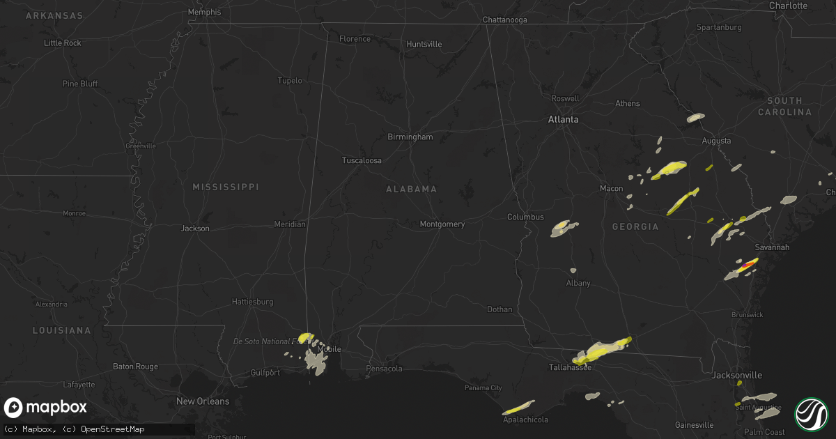
Hail Map in Alabama on April 3, 2017
Get this storm
April 3 map
$229
one time, instant access
Download today. No call, no setup
Keep the $229
Bought the map and want the full workflow? Apply the entire $229 to a subscription within 7 days. None of it is wasted.
Every map, not just this one
This buys you this map. Subscription and you get every map we run, in the markets you choose from a few cities to whole states to nationwide. Plus real-time alerts the moment a storm fires.
Contact data
Name, contact info, occupancy, even credit band for addresses in the footprint. You go from where it hit to who to call.
Become the source they trust
Unlimited branding weather history reports on demand. You already have the documented answer ready for the property owner, and you are the one who showed up with it.
Property data and RoofTrace estimates
Pull up any address you have got, its value and the exact code rules for that jurisdiction, straight from One Click Code. Then RoofTrace estimates the squares, pitch, and roof value, priced the way you price.
Storm reports in Alabama
Alabama
| Date | Description |
|---|---|
| 04/03/201711:42 AM CDT | Large tree fell on a house along broad street in eufaula. Time estimated by radar. |
| 04/03/201711:12 AM CDT | Power lines down at choctaw and cherokee in dothan |
| 04/03/201710:48 AM CDT | Trees and power lines down at several locations across the county... Including abbeeville. |
| 04/03/201710:45 AM CDT | Trees down in echo |
| 04/03/201710:42 AM CDT | Reports of trees snapped and uprooted... Some trees on homes. Some power poles snapped. Damage to sheet tin awnings. Time estimated by radar. |
| 04/03/201710:42 AM CDT | Tree down across fort toulouse road. |
| 04/03/201710:42 AM CDT | Trees down on state docks road . Power outage reported at eufaula pd. |
| 04/03/201710:32 AM CDT | Several reports of power outages. Traffic lights out in downtown phenix city. Fence blown down in orchard hills subdivision. Time estimated by radar. |
| 04/03/201710:31 AM CDT | Roof blown off a building... Several trees snapped and power lines down. Time estimated by radar. |
| 04/03/201710:30 AM CDT | Trees down in mabson |
| 04/03/201710:24 AM CDT | Tree down east co rd 36 |
| 04/03/201710:17 AM CDT | Tree down co road 2087 n co rd 21.tree down co road 20 |
| 04/03/20179:56 AM CDT | Tree down along old sides cemetery road. Estimated 40-50 mph winds. |
| 04/03/20179:51 AM CDT | Trees and power lines down. |
| 04/03/20179:32 AM CDT | Portion of barn tin roof pulled off by winds. Time estimated by radar. |
| 04/03/20179:31 AM CDT | Trees down on power lines near the intersection of george wallace drive and elm street in troy. |
| 04/03/20179:31 AM CDT | Multiple trees reported down along county roads 3316... 2290... 1101 and 2272. Time estimated by radar. |
| 04/03/20179:28 AM CDT | Trees down near the intersection of north three notch road and needmore road. Time estimated by radar. |
| 04/03/20179:24 AM CDT | Tree down along county road 12. Estimated 40-50 mph winds. |
| 04/03/20179:23 AM CDT | Tree and power lines down in roadway near intersection of ann street and main street. |
| 04/03/20179:21 AM CDT | Large tree down across highway 431 near county road 61. Estimated 45-55 mph winds. Time estimated by radar. |
| 04/03/20179:20 AM CDT | George wallace drive closed from ray avenue to dendron drive. City health dept building dealing with roof leaks. Trees down near intersections of highway 29 and cr 2293 |
| 04/03/20179:17 AM CDT | Large tree snapped in troy. Time estimated by radar. Report relayed via social media. |
| 04/03/20179:15 AM CDT | Tree down on power lines in troy. Time estimated by radar. |
| 04/03/20179:10 AM CDT | Tree and power lines down along county road 82. Estimated 45-55 mph winds. Time estimated by radar. |
| 04/03/20179:05 AM CDT | Trees down on power lines along highway 29 near county road 2293. Time estimated by radar. |
| 04/03/20178:56 AM CDT | Several structures with roof damage in luverne along with numerous trees and power lines down. Possible tornado. |
| 04/03/20178:40 AM CDT | Trees and power lines down on county road 82 near buck creek baptist church |
| 04/03/20178:33 AM CDT | Roof of a covered porch collapsed on spence mcgraw road. Numerous trees either blown over or snapped in this area. |
| 04/03/20178:32 AM CDT | One tree down across roadway. |
| 04/03/20178:30 AM CDT | 2 trees down across roadway. Estimated 45-55 mph winds. Time estimated. |
| 04/03/20178:27 AM CDT | Mulitple trees down on county road 6 near johnsonville in conecuh county. |
| 04/03/20178:10 AM CDT | Trees down on county road 18 near brewton |
| 04/03/20178:07 AM CDT | Multiple trees down along county road 6 near county road 28 and appleton road |
| 04/03/20178:06 AM CDT | Tree and power lines down on house along pecan grove road. |
| 04/03/20178:00 AM CDT | A barn damaged and trees on a home |
| 04/03/20177:55 AM CDT | Several trees and power lines down in and around flomaton |
| 04/03/20177:42 AM CDT | Tree and power lines down next to residence in coosada. Time estimated by radar. Estimated 40-50 mph winds. |
| 04/03/20177:32 AM CDT | Large tree fell onto home off of cooper avenue in prattville. Time estimated by radar. Estimated 45-55 mph winds. |
| 04/03/20177:31 AM CDT | Trampoline blown into power lines along mcqueen smith road in prattville. Time estimated by radar. Estimated 35-45 mph winds. |
| 04/03/20177:26 AM CDT | Quarter size hail reported via social media. |
| 04/03/20177:15 AM CDT | Porch blown off a house on walker springs road |
| 04/03/20177:11 AM CDT | Large tree down blocking lake mitchell road between studdard drive and thrash road in clanton. Time estimated by radar. Estimated 40-50 mph winds. |
| 04/03/20177:00 AM CDT | Roof damage to a home on play lane in manilla |
All States Impacted by Hail Map on April 3, 2017
Cities Impacted by Hail Map on April 3, 2017
- Buena Vista, GA
- Ellaville, GA
- Rupert, GA
- Mauk, GA
- Lucedale, MS
- Boston, GA
- Quitman, GA
- Dixie, GA
- Monticello, FL
- Valdosta, GA
- Perry, FL
- Arnett, OK
- Vici, OK
- Leedey, OK
- Camargo, OK
- Scott City, MO
- Thebes, IL
- Chaffee, MO
- McClure, IL
- Reydon, OK
- Midway, GA
- Fleming, GA
- Tamms, IL
- Ponte Vedra Beach, FL
- Sparta, GA
- Stratford, TX
- Mobile, AL
- Adrian, GA
- Kite, GA
- Canadian, TX
- Briscoe, TX
- Riceboro, GA
- Vidalia, GA
- Statesboro, GA
- Claxton, GA
- Register, GA
- Arapaho, OK
- Port Saint Joe, FL
- Wewahitchka, FL
- Eastpoint, FL
- Collins, GA
- Reidsville, GA
- Wilmer, AL
- Warthen, GA
- Semmes, AL
- Plum Branch, SC
- Lincolnton, GA
- Brooklet, GA
- Pembroke, GA
- Ellabell, GA
- Saint Augustine, FL
- Theodore, AL
- Grand Bay, AL
- Irvington, AL
- Moss Point, MS
- Bayou La Batre, AL
- Coden, AL
- Summerville, SC
- Jeffersonville, GA
- Ludowici, GA
- Mount Pleasant, SC
- Avera, GA
- Gibson, GA
- Davisboro, GA
- Louisville, GA
- Durham, OK
- Cheyenne, OK
- Girard, GA
- Tallahassee, FL
- Greenville, FL
- Thomasville, GA
- New Athens, IL
- Allenhurst, GA
- Hammon, OK
- Swainsboro, GA
- Wrightsville, GA
- East Dublin, GA
- Danville, GA
- Modoc, SC
- Stapleton, GA
- Sandersville, GA
- Mitchell, GA
- Midville, GA
- Yemassee, SC
- Early Branch, SC
- Hardin, KY
- Richmond Hill, GA
- Leesburg, GA
- Benton, KY
- Bamberg, SC
- Denmark, SC
- Preston, GA
- Oglethorpe, GA
- Ideal, GA
- Hazlehurst, GA
- Fort Stewart, GA
- Butler, OK
- Hinesville, GA
- Gruver, TX
- Springfield, GA
- Toomsboro, GA
- McIntyre, GA
- Braithwaite, LA
- Buras, LA
- Milledgeville, GA
- Ridgeville, SC
- Adams Run, SC
- Ladson, SC
- North Charleston, SC
- Goose Creek, SC
- Charleston, SC
- Hanahan, SC
- Vancleave, MS
- Martin, SC
- Haddock, GA
- Gordon, GA
- Pineland, SC
- Guyton, GA
- Garnett, SC
- Clyo, GA
- Tillman, SC
- Jesup, GA
- Johns Island, SC
- Cochran, GA
- Lamont, FL
- Perryton, TX
- Spearman, TX
- Crawfordville, GA
- Biloxi, MS
- Eight Mile, AL
- Rockledge, GA
- Wadley, GA
- Waynesboro, GA
- Keysville, GA
- Metter, GA
- Gilbertsville, KY
- Jacksonville, FL
- Green Cove Springs, FL


