Hail Map on April 3, 2017
Get this storm
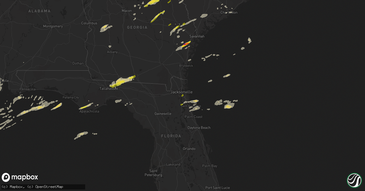
April 3 map
$229
one time, instant access
Download today. No call, no setup
Keep the $229
Bought the map and want the full workflow? Apply the entire $229 to a subscription within 7 days. None of it is wasted.
Every map, not just this one
This buys you this map. Subscription and you get every map we run, in the markets you choose from a few cities to whole states to nationwide. Plus real-time alerts the moment a storm fires.
Contact data
Name, contact info, occupancy, even credit band for addresses in the footprint. You go from where it hit to who to call.
Become the source they trust
Unlimited branding weather history reports on demand. You already have the documented answer ready for the property owner, and you are the one who showed up with it.
Property data and RoofTrace estimates
Pull up any address you have got, its value and the exact code rules for that jurisdiction, straight from One Click Code. Then RoofTrace estimates the squares, pitch, and roof value, priced the way you price.
States Impacted by Hail Map on April 3, 2017
Storm reports
North Carolina
| Date | Description |
|---|---|
| 04/03/20174:45 PM CDT | Thunderstorm winds overturned a mobile home and downed a large tree. No one was home at the time of the incident. Public nearby reported a possible tornado. |
| 04/03/20174:30 PM CDT | Tree down at nc hwy 49 s and union church rd. |
| 04/03/20174:24 PM CDT | Tree and power lines down at 109 south and horton road. |
| 04/03/20174:15 PM CDT | Power line down at liberty church drive and meadowbrook drive in trinity. Time estimated from radar. |
| 04/03/20174:00 PM CDT | Shingles blown off outbuilding on gulledge rd. Carport blown across the street and a couple of trees down. Resident reported seeing possible tornado. |
| 04/03/20173:40 PM CDT | Trees down on cool springs road. |
| 04/03/20172:56 PM CDT | Tree down in road in gastonia. Time estimated from radar. |
| 04/03/20172:54 PM CDT | 2 trees down. |
| 04/03/20172:25 PM CDT | Tree down at 1835 highway 70. |
| 04/03/20171:11 PM CDT | Roof damage along 2189 smoky park highway with adjacent building damaged. Possible tornado spotted. |
Georgia
| Date | Description |
|---|---|
| 04/03/20174:24 PM CDT | Reports of trees and power lines down |
| 04/03/20174:18 PM CDT | Reports of trees and power lines down |
| 04/03/20174:12 PM CDT | Reports of trees and power lines down |
| 04/03/20173:52 PM CDT | Social media picture showed a handful of quarter-sized hail stones. |
| 04/03/20173:42 PM CDT | Quarter size hail reported at rahns greenhouse off old dixie highway south |
| 04/03/20173:23 PM CDT | Screven county 911 reported a tree down near the intersection of oglethorpe trail and highway 301. |
| 04/03/20173:19 PM CDT | Screven county 911 reported a tree down near the intersection of plantation road and highway 301. |
| 04/03/20173:16 PM CDT | Screven county 911 reported a tree down near the intersection of buttermilk road and parker road. |
| 04/03/20173:09 PM CDT | Candler county dispatch reported a tree down in metter on washington street near bay street. |
| 04/03/20173:03 PM CDT | A spotter reported 60 mph wind gusts with a passing thunderstorm. |
| 04/03/20173:03 PM CDT | A spotter reported quarter size hail near richmond hill georgia. |
| 04/03/20173:01 PM CDT | The jenkins county warning point reported 4 trees down near perkins georgia. |
| 04/03/20172:52 PM CDT | Social media picture showed a handful of quarter-sized hail stones. |
| 04/03/20172:47 PM CDT | A trained spotter reports quarter sized hail currently falling on freedman grove road. |
| 04/03/20172:45 PM CDT | Roof damage reported at harvertys and a chinese restaurant along wrightsboro road. Also... Numerous reports of trees... Power lines and lights down in the area. . |
| 04/03/20172:43 PM CDT | Bulloch county 911 reported quarter sized hail near the intersection of highway 46 and sinkhole road. |
| 04/03/20172:43 PM CDT | Extensive damage to trees with a couple of homes damaged in the vicinity of belair road and powell road. . |
| 04/03/20172:38 PM CDT | Local media relayed a viewer report of hail the size of quartes or slightly larger near register. |
| 04/03/20172:35 PM CDT | Multiple trees down along advantage lane. |
| 04/03/20172:35 PM CDT | Tree and powerlines down. |
| 04/03/20172:32 PM CDT | Tree down at west church st. |
| 04/03/20172:31 PM CDT | A trained spotter relayed a picture of 2 hail stones ranging from 1 to 2 inches in diameter. The picture was from everson lane in midway. |
| 04/03/20172:30 PM CDT | Multiple trees down across county. |
| 04/03/20172:30 PM CDT | Multiple trees down across county. |
| 04/03/20172:30 PM CDT | *** 2 inj *** dock overturned and several boats damaged at points west marina. 2 injured were on the dock as it overturned. Injuries were minor. . |
| 04/03/20172:28 PM CDT | Several trees down along mckenzie drive. Time estimated from radar. |
| 04/03/20172:27 PM CDT | Several trees and powerlines down along west mooring road... Near swainsboro. Time estimated from radar. |
| 04/03/20172:25 PM CDT | Tree and powerlines down. |
| 04/03/20172:17 PM CDT | Multiple trees snapped off clarks mill road. Time estimated from radar. Possible tornado. |
| 04/03/20172:15 PM CDT | Reported more than 20 trees down along thomson highwy near the amity community and lake thurmond. Reported 6 to 8 trees snapped at 15 top 20 feet above the ground. Tree |
| 04/03/20172:09 PM CDT | A tree was reported on a car with one person trapped inside. Injuries unknown. Time estimated by radar. |
| 04/03/20172:04 PM CDT | Quarter size hail along meeks road southwest of kite. |
| 04/03/20172:00 PM CDT | This was an ef1 tornado with a path length of 7.84 miles and a maximum path width of approximately 1 mile. The estimated peak wind was 100 mph. The tornado caused minor |
| 04/03/20172:00 PM CDT | Large tree limbs down over roads in fitzgerald |
| 04/03/20172:00 PM CDT | Several trees down at oconee church road and old toomsboro road. The oconee baptist church had damage to its roof as well as siding torn off. |
| 04/03/20171:59 PM CDT | Trees down on ga-15 near dollar general and on the way motors |
| 04/03/20171:56 PM CDT | This was an ef1 tornado with a path length of .42 miles and a maxium path width of 179 yards. The estimated peak wind was 95 mph. This tornado uprooted and snapped nume |
| 04/03/20171:37 PM CDT | Multiple trees were reported down on highway 272 off of highway 24 west. |
| 04/03/20171:37 PM CDT | Power lines were reported down in the area of 117-140 j m walker road. |
| 04/03/20171:36 PM CDT | This was an ef1 tornado with a path length of 6.1 miles and a maximum path width of 688 yards. The estimated peak wind was 95 mph. This tornado caused roof damage to a |
| 04/03/20171:33 PM CDT | About a dozen trees down at residence off rocker road. Time estimated from radar. |
| 04/03/20171:30 PM CDT | Several trees down near the intersection of hwy 22 and 44. Time estimated by radar. |
| 04/03/20171:28 PM CDT | This was an ef1 tornado with a path length of .2 miles and a maximum path width of 250 yards. The estimated peak wind was 87 mph. This tornado caused damage to a single |
| 04/03/20171:25 PM CDT | Webeoc report of trees down blocking sr16 at green spring rd. Time estimated from radar. |
| 04/03/20171:21 PM CDT | This was an ef0 tornado with a path length of 3.2 miles and a maximum path width of 524 yards. The estimated peak wind was 80 mph. This tornado destroyed a small shed a |
| 04/03/20171:16 PM CDT | This was an ef0 tornado with a path length of 4.5 miles and a maximum path width of around .5 miles. The estimated peak wind was 84 mph. This tornado caused roof damage |
| 04/03/20171:15 PM CDT | Trees down in the gordy area |
| 04/03/20171:15 PM CDT | Trees down on highway 33n |
| 04/03/20171:15 PM CDT | Reports of numerous trees and powerlines down in turner county |
| 04/03/20171:14 PM CDT | Numerous trees were reported down near the intersections of bullard road and highway 80 and highway 96. |
| 04/03/20171:11 PM CDT | Severe structural damage was reported to the old chevrolet building in downtown gordon. |
| 04/03/20171:10 PM CDT | Trees down in the silver lake circle area |
| 04/03/20171:10 PM CDT | Video relayed by walb shows weak tornado over farmland near doles. No damage reported. |
| 04/03/20171:09 PM CDT | Trees were reported down at highway 300 and the 300 connector. |
| 04/03/20171:09 PM CDT | Numerous trees were reported down near the intersections of bullard rd and highway 96 and us 80. |
| 04/03/20171:08 PM CDT | Trees down along old sr50 |
| 04/03/20171:08 PM CDT | Trees down along findley road |
| 04/03/20171:06 PM CDT | Trees reported down near the highway 300/30 connector |
| 04/03/20171:06 PM CDT | Reports of power lines and trees down across worth county. Reports of trees down on homes. |
| 04/03/20171:05 PM CDT | Trees down along mossy oaks road |
| 04/03/20171:05 PM CDT | Trees down in the woodcrest area |
| 04/03/20171:03 PM CDT | This tornado was an ef2 with a path length of 3.3 miles and a maximum path width of 193 yards. The estimated peak wind was 115 mph. Several small business structures we |
| 04/03/20171:00 PM CDT | Tree down on frazier road |
| 04/03/20171:00 PM CDT | Tree down on highway 19 north of lewis collins road |
| 04/03/20171:00 PM CDT | Trees down on i16 eb on ramp at exit 18. Radar confirms tornado passed directly over the location. |
| 04/03/201712:57 PM CDT | A wind gust of 80 mph was reported near the turner park neighborhood on robbins afb. Also... Greater than 2 inch in diameter tree limbs/branches were reported down. |
| 04/03/201712:56 PM CDT | This tornado was an ef1 with a path length of 6. 3 miles and a maximum path width of 440 yards. The estimated peak wind was 93 mph. This tornado snapped and uprooted nu |
| 04/03/201712:55 PM CDT | Multiple trees were reported down near the intersection of highway 129 and mathis road. |
| 04/03/201712:52 PM CDT | Trees down in putney |
| 04/03/201712:51 PM CDT | A tree was reported down near the intersection of fawn court and buck road. |
| 04/03/201712:50 PM CDT | A large tree limb was reported on a houes near 13 green street. |
| 04/03/201712:48 PM CDT | Boat flipped at marine dealer on radium springs road. |
| 04/03/201712:47 PM CDT | Lite structure damage was reported near the intersection of highway 41 and dunbar road... Near the houston and peach county line. |
| 04/03/201712:45 PM CDT | Social media report of a home with really bad damage near the middle ga regional airport |
| 04/03/201712:44 PM CDT | A tree was reported down on macy ave near highway 127. |
| 04/03/201712:42 PM CDT | Power pole down on car on north harding st. |
| 04/03/201712:42 PM CDT | Tree down on 12th avenue |
| 04/03/201712:42 PM CDT | Wind damage to roof of building off of temple avenue |
| 04/03/201712:42 PM CDT | A tree was reported down near the intersection of highway 11 and round oak juliette road. |
| 04/03/201712:42 PM CDT | Tree down on house off of stuart |
| 04/03/201712:42 PM CDT | Tree down on a house on doncaster drive |
| 04/03/201712:42 PM CDT | Tree down at 1206 whispering pines road |
| 04/03/201712:42 PM CDT | Shed flipped over in albany |
| 04/03/201712:42 PM CDT | Trees were reported down on scarsborough road as well as near the intersection of dunbar road and carl vinson parkway. A tree was also reported down on an apartment uni |
| 04/03/201712:40 PM CDT | This was an ef0 tornado with a path length of 3 miles and a maximum path width of 100 yards. The estimated peak wind was 70 mph. This tornado uprooted a tree that cause |
| 04/03/201712:36 PM CDT | A tree was reported on a home near 341 surrey place. Other trees were also reported down nearby. |
| 04/03/201712:36 PM CDT | Reports of trees and power lines down in baconton |
| 04/03/201712:35 PM CDT | Two large pines down. |
| 04/03/201712:22 PM CDT | Multiple trees and power lines were reported down along taylors mill road. |
| 04/03/201712:21 PM CDT | Heavy damage occured to hays tractor and equipment inc. Power lines were also reported down at the car lot and at city hall. |
| 04/03/201712:19 PM CDT | Power lines and a tree was reported down near 410 north randolph street. |
| 04/03/201712:17 PM CDT | Tree down on a house reported on mallon road |
| 04/03/201712:16 PM CDT | As many as 30 homes with damage in monroe county..9 major and 1 destroyed. 1 family was trapped but no injuries were reported |
| 04/03/201712:14 PM CDT | Multiple trees were reported down along highway 213 between the intersections of dixie road and hayston road. |
| 04/03/201712:14 PM CDT | Tree down in the roadway at the intersection of hwy 153 and hwy 30 |
| 04/03/201712:12 PM CDT | Reports of trees and power lines down across county...also report of metal shed blown into highway near colquitt. |
| 04/03/201712:12 PM CDT | Trees fell on cars along i-75 south of forsyth. Injuries reported but number is currently unknown |
| 04/03/201712:12 PM CDT | Reports of several trees and power lines down in baker county |
| 04/03/201712:12 PM CDT | Trees reported down on home near music row. |
| 04/03/201712:11 PM CDT | A large tree was reported across highway 341 north at the crawford county and monroe county line. |
| 04/03/201712:08 PM CDT | Significant damage reported in a two block path in gordon |
| 04/03/201712:06 PM CDT | This was a high end ef1 tornado with a path length of 8.3 miles and a maximum path width of 300 yards. The estimated peak wind was 110 mph. This tornado damaged 30 home |
| 04/03/201712:00 PM CDT | Highway 74 east of culloden... Several pieces of a tin roof folded back. Damage to the sliding door of a garage shop. |
| 04/03/201711:56 AM CDT | Trees were reported down near the intersection of willis road and highway 341. |
| 04/03/201711:54 AM CDT | Reports of trees down near blakely |
| 04/03/201711:54 AM CDT | Trees reported down on homes on norwood street and college street |
| 04/03/201711:53 AM CDT | *** 1 inj *** a tree was reported down on a house near 355 pine circle. Additional tree damage was reported along ebenezer road. |
| 04/03/201711:53 AM CDT | In ellaville... Around 150 trees were reported down... Multiple trees were reported down on homes... Multiple structural collapses occurred... And two tractor-trailers |
| 04/03/201711:52 AM CDT | This was an ef0 tornado with a path length of 1.8 miles with a maximum path width of 250 yards. The estimated peak wind was 85 mph. This tornado caused minor shingle da |
| 04/03/201711:51 AM CDT | Multiple trees down along pleasant grove road south of yatesville |
| 04/03/201711:51 AM CDT | Trees snapped and uprooted. |
| 04/03/201711:49 AM CDT | Em reports 40-50 trees down and minor structural damage to homes between bonaventure place and jaley pkwy. Time estimated from radar. |
| 04/03/201711:49 AM CDT | Several trees reported down along the rock road |
| 04/03/201711:49 AM CDT | Gdot reporting metal debris and trees across hwy 153 at mile marker 7.5 southwest of ellaville. |
| 04/03/201711:46 AM CDT | This was an ef1 tornado with a path length of 5.6 miles and a maximum path width of 200 yards. The estimated peak wind was 105 mph. This tornado caused damage to over 4 |
| 04/03/201711:46 AM CDT | There were reports of wires down at 3099 east fairview road. |
| 04/03/201711:44 AM CDT | This was an ef1 tornado that had a path length of 6.9 miles and a maximum path width of 150 yards. The estimated peak wind was 90 mph. This tornado caused minor damage |
| 04/03/201711:40 AM CDT | A homeowner reported trees down and damage to the home near 3278 waymanville road... With approximated wind speeds between 50-60 mph. |
| 04/03/201711:36 AM CDT | Multiple trees were down near the crossing of pobiddy road and the flint river. |
| 04/03/201711:36 AM CDT | This was an ef0 tornado with a path length of 1.7 miles and a maximum path width of 75 yards. The estimated peak wind was 70 mph. This tornado snapped numerous trees an |
| 04/03/201711:35 AM CDT | This was an ef0 tornado with a path length of .6 miles and a maximum path width of 150 yards. The estimated peak wind speed was 85 mph. The tornado snapped and uprooted |
| 04/03/201711:32 AM CDT | Trees were reported down on a house near 1109 east wall street. |
| 04/03/201711:32 AM CDT | Numerous trees were reported down and also on structures near 600 block of melrose ave. Multiple trees were also reported down near the intersections of hillwood ave an |
| 04/03/201711:32 AM CDT | A trees were reported down on a house with a person trapped inside near 546 north 9th street. Injuries unknown. |
| 04/03/201711:32 AM CDT | Power lines were reported down and a tree fell blocking the entire road near 417 east college street. |
| 04/03/201711:32 AM CDT | A tree was reported down on a house with a person rescued from house. Injuries unknown. |
| 04/03/201711:32 AM CDT | Trees and power lines were reported down near 133 south 17 street. |
| 04/03/201711:32 AM CDT | Numerous trees were reported down along charlie thomas road. |
| 04/03/201711:32 AM CDT | Trees were reported down near the intersection of kennedy road and n 2nd street. |
| 04/03/201711:30 AM CDT | Multiple trees and powerlines down... Several houses damaged with people trapped insude near intersection of popular street and 13th street in griffin |
| 04/03/201711:30 AM CDT | Multiple trees and power lines down and person trapped in vehicle on west ellis road |
| 04/03/201711:27 AM CDT | Two trees were reported down near the intersection of town creek road and highway 115. |
| 04/03/201711:26 AM CDT | This was an ef1 tornado with a path length of 4.6 miles and a maximum path width of 200 yards. The estimated peak wind was 105 mph. This tornado snapped and uprooted nu |
| 04/03/201711:25 AM CDT | Trees and powerlines were reported down near the intersection of patton rd and sunset strip. Barn roof metal wrapped around trees were also reported. |
| 04/03/201711:25 AM CDT | Multiple trees and powerlines reported down near intersection of popular street and 13th street in griffin |
| 04/03/201711:23 AM CDT | Multiple structures with damage and partial building collapse reported near the intersection of county road 213 and 11 |
| 04/03/201711:21 AM CDT | Two trees and a power pole reported down along highway 520 in richland |
| 04/03/201711:20 AM CDT | Trees down across powerlines. Causing shut down of eastbound lane of sr 520. |
| 04/03/201711:18 AM CDT | This was an ef1 tornado with a path length of 4.63 miles and a maximum path width of 373 yards. The estimated peak wind was 100 mph. This tornado caused significant dam |
| 04/03/201711:18 AM CDT | This was an ef0 tornado with a path length of 2.2 miles and a maximum path width of 75 yards. The estimated peak wind was 70 mph. This tornado snapped numerous trees an |
| 04/03/201711:16 AM CDT | This was an ef0 tornado with a path length of 3.9 miles and a maxium path width of 150 yards. The estimated peak wind speed was 75 mph. This tornado snapped and uproote |
| 04/03/201711:16 AM CDT | This was an ef0 tornado that had a path length of 1.3 miles and a maximum path width of 100 yards. The estimated peak wind was 70 mph. This tornado damaged an outbuildi |
| 04/03/201711:13 AM CDT | Tree reported down at intersection of rockwell street and hardwick lane. |
| 04/03/201711:10 AM CDT | Several trees down and shingle damage on home on old chestnut road |
| 04/03/201711:10 AM CDT | This was an ef0 tornado with a path length of 1.6 miles and a maximum path width of 150 yards. The estimated peak wind was 85 mph. This tornado snapped and downed numer |
| 04/03/201711:08 AM CDT | Power lines down on truck. Trees down highway 39 and 82. |
| 04/03/201711:00 AM CDT | Reports of trees and power lines down countywide |
| 04/03/201710:58 AM CDT | A large oak tree was reported down across power lines at the intersection of robin road and st. Marys road. |
| 04/03/201710:54 AM CDT | Several trees were reported down near the 8000 block of fulton road. A power line was also down in the road on county line road. |
| 04/03/201710:44 AM CDT | 2 trees down on homes |
| 04/03/201710:42 AM CDT | This was an ef0 tornado with a path length of 3.5 miles with a maximum path width of 175 yards. The maximum estimated peak wind was 90 mph. This tornado uprooted and sn |
| 04/03/201710:42 AM CDT | A tree was reported down on a house blocking the road near the intersection of bob-o-link drive and robin road. |
| 04/03/201710:42 AM CDT | A tree was reported down on a house on kingfisher road. |
| 04/03/201710:40 AM CDT | An 8 inch diameter tree was reported down at the intersection of veterans memorial highway sw and south gordon road sw... With a traffic light hanging into the road. |
| 04/03/201710:36 AM CDT | The tornado initially touched down on campbellton redwine road about .20 miles north of south fulton parkway. It then touched down intermittently eastward about 3.8 mil |
| 04/03/201710:32 AM CDT | A couple dozen trees were reported down along mullinax road off of highway 53. |
| 04/03/201710:32 AM CDT | A shed was picked up near the intersection of hill city road and mullinax road... Where the roof was ripped off. The shed was then blown across highway 53 and was destr |
| 04/03/201710:30 AM CDT | Trees down at upper big springs rd and knot rd |
| 04/03/201710:30 AM CDT | Trees down in downtown sparta |
| 04/03/201710:25 AM CDT | Trees down at hunts chapel rd and hwy 16 west |
| 04/03/201710:23 AM CDT | Tree reported down at the intersection of reinhardt college parkway and salacoa road |
| 04/03/201710:10 AM CDT | Multiple trees were reported down at the intersection of cedar street and hwy 166. |
| 04/03/201710:10 AM CDT | The carrollton city firestation number 22 suffered structural damage to the building. |
| 04/03/201710:00 AM CDT | Tree down on house on e 7th street in west point |
| 04/03/20179:59 AM CDT | Tree reported down along alabama street in carrollton |
| 04/03/20179:58 AM CDT | This was an ef1 tornado that had a path length of 2.5 miles with a maxium path width of 300 yards. The estimated peak wind was 90 mph. This tornado snapped and uprooted |
Kentucky
| Date | Description |
|---|---|
| 04/03/20176:00 PM CDT | A local report indicates 1.25 inch wind near 5 NE BENTON |
Illinois
| Date | Description |
|---|---|
| 04/03/20173:20 PM CDT | Quarter to half-dollar sized hail. |
Arizona
| Date | Description |
|---|---|
| 04/03/20175:30 PM CDT | Public reported that roof damage was widespread throughout bullhead city due to the strong thunderstorm winds. Time is estimated based on asos obs. . |
| 04/03/20175:28 PM CDT | Kingman asos reported a peak wind gust of 64 mph. |
| 04/03/20175:15 PM CDT | Laughlin/bullhead city airport awos reported a peak wind gust of 63 mph. . |
| 04/02/20178:31 PM CDT | Mesonet station 2 sw cordes lakes /d9216/ resident reports two small trees uprooted and flagpole snapped. |
Nevada
| Date | Description |
|---|---|
| 04/03/20174:45 PM CDT | Cottonwood cove automated weather station reported a peak wind gust of 64 mph. |
Alabama
| Date | Description |
|---|---|
| 04/03/201711:42 AM CDT | Large tree fell on a house along broad street in eufaula. Time estimated by radar. |
| 04/03/201711:12 AM CDT | Power lines down at choctaw and cherokee in dothan |
| 04/03/201710:48 AM CDT | Trees and power lines down at several locations across the county... Including abbeeville. |
| 04/03/201710:45 AM CDT | Trees down in echo |
| 04/03/201710:42 AM CDT | Trees down on state docks road . Power outage reported at eufaula pd. |
| 04/03/201710:42 AM CDT | Tree down across fort toulouse road. |
| 04/03/201710:42 AM CDT | Reports of trees snapped and uprooted... Some trees on homes. Some power poles snapped. Damage to sheet tin awnings. Time estimated by radar. |
| 04/03/201710:32 AM CDT | Several reports of power outages. Traffic lights out in downtown phenix city. Fence blown down in orchard hills subdivision. Time estimated by radar. |
| 04/03/201710:31 AM CDT | Roof blown off a building... Several trees snapped and power lines down. Time estimated by radar. |
| 04/03/201710:30 AM CDT | Trees down in mabson |
| 04/03/201710:24 AM CDT | Tree down east co rd 36 |
| 04/03/201710:17 AM CDT | Tree down co road 2087 n co rd 21.tree down co road 20 |
| 04/03/20179:56 AM CDT | Tree down along old sides cemetery road. Estimated 40-50 mph winds. |
| 04/03/20179:51 AM CDT | Trees and power lines down. |
| 04/03/20179:32 AM CDT | Portion of barn tin roof pulled off by winds. Time estimated by radar. |
| 04/03/20179:31 AM CDT | Multiple trees reported down along county roads 3316... 2290... 1101 and 2272. Time estimated by radar. |
| 04/03/20179:31 AM CDT | Trees down on power lines near the intersection of george wallace drive and elm street in troy. |
| 04/03/20179:28 AM CDT | Trees down near the intersection of north three notch road and needmore road. Time estimated by radar. |
| 04/03/20179:24 AM CDT | Tree down along county road 12. Estimated 40-50 mph winds. |
| 04/03/20179:23 AM CDT | Tree and power lines down in roadway near intersection of ann street and main street. |
| 04/03/20179:21 AM CDT | Large tree down across highway 431 near county road 61. Estimated 45-55 mph winds. Time estimated by radar. |
| 04/03/20179:20 AM CDT | George wallace drive closed from ray avenue to dendron drive. City health dept building dealing with roof leaks. Trees down near intersections of highway 29 and cr 2293 |
| 04/03/20179:17 AM CDT | Large tree snapped in troy. Time estimated by radar. Report relayed via social media. |
| 04/03/20179:15 AM CDT | Tree down on power lines in troy. Time estimated by radar. |
| 04/03/20179:10 AM CDT | Tree and power lines down along county road 82. Estimated 45-55 mph winds. Time estimated by radar. |
| 04/03/20179:05 AM CDT | Trees down on power lines along highway 29 near county road 2293. Time estimated by radar. |
| 04/03/20178:56 AM CDT | Several structures with roof damage in luverne along with numerous trees and power lines down. Possible tornado. |
| 04/03/20178:40 AM CDT | Trees and power lines down on county road 82 near buck creek baptist church |
| 04/03/20178:33 AM CDT | Roof of a covered porch collapsed on spence mcgraw road. Numerous trees either blown over or snapped in this area. |
| 04/03/20178:32 AM CDT | One tree down across roadway. |
| 04/03/20178:30 AM CDT | 2 trees down across roadway. Estimated 45-55 mph winds. Time estimated. |
| 04/03/20178:27 AM CDT | Mulitple trees down on county road 6 near johnsonville in conecuh county. |
| 04/03/20178:10 AM CDT | Trees down on county road 18 near brewton |
| 04/03/20178:07 AM CDT | Multiple trees down along county road 6 near county road 28 and appleton road |
| 04/03/20178:06 AM CDT | Tree and power lines down on house along pecan grove road. |
| 04/03/20178:00 AM CDT | A barn damaged and trees on a home |
| 04/03/20177:55 AM CDT | Several trees and power lines down in and around flomaton |
| 04/03/20177:42 AM CDT | Tree and power lines down next to residence in coosada. Time estimated by radar. Estimated 40-50 mph winds. |
| 04/03/20177:32 AM CDT | Large tree fell onto home off of cooper avenue in prattville. Time estimated by radar. Estimated 45-55 mph winds. |
| 04/03/20177:31 AM CDT | Trampoline blown into power lines along mcqueen smith road in prattville. Time estimated by radar. Estimated 35-45 mph winds. |
| 04/03/20177:26 AM CDT | Quarter size hail reported via social media. |
| 04/03/20177:15 AM CDT | Porch blown off a house on walker springs road |
| 04/03/20177:11 AM CDT | Large tree down blocking lake mitchell road between studdard drive and thrash road in clanton. Time estimated by radar. Estimated 40-50 mph winds. |
| 04/03/20177:00 AM CDT | Roof damage to a home on play lane in manilla |
South Carolina
| Date | Description |
|---|---|
| 04/03/20176:02 PM CDT | Schp reported a tree down at dairy ridge rd and croft state park rd |
| 04/03/20175:34 PM CDT | Tree reported down on sumter highway. Time based on radar. |
| 04/03/20175:16 PM CDT | The candb fire department reported several trees snapped or uprooted along farmington road near i-26. |
| 04/03/20175:12 PM CDT | A social media report of a tree down blocking boonehill road near tea farm road. |
| 04/03/20175:11 PM CDT | Several large trees blown down along portions of west meadow drive. Timed based on radar. |
| 04/03/20175:09 PM CDT | South carolina highway patrol reported a tree down on orangeburg road near the dorchester county department of social services building. |
| 04/03/20175:07 PM CDT | South carolina highway patrol reported a tree down on whippoorwill drive near central avenue. |
| 04/03/20175:07 PM CDT | Highway patrol reported trees down across i-95 in the southbound lanes at mile marker 130. |
| 04/03/20175:05 PM CDT | South carolina highway patrol reported a tree down on highway 17-a near highway 61. |
| 04/03/20175:00 PM CDT | Tree downed on i-95 at southbound exit 153 |
| 04/03/20175:00 PM CDT | South carolina highway patrol reported a tree down on highway17 between sandpit drive and clubhouse road. |
| 04/03/20174:55 PM CDT | Tree downed on raodway on stantons road |
| 04/03/20174:50 PM CDT | South carolina highway patrol reported a tree down on jacksonboro highway near round o road. |
| 04/03/20174:49 PM CDT | South carolina highway patrol reported a tree down on dodge lane near jacksonboro road. |
| 04/03/20174:42 PM CDT | South carolina highway patrol reported a tree down on charleston highway near bonnie doone road. |
| 04/03/20174:39 PM CDT | South carolina highway patrol reported a tree down in the 7500 block of green pond highway. |
| 04/03/20174:39 PM CDT | South carolina highway patrol reported a tree down in the 6000 block of green pond highway. |
| 04/03/20174:37 PM CDT | Tree in roadway |
| 04/03/20174:30 PM CDT | Trees in roadway |
| 04/03/20174:18 PM CDT | Images from certified storm spotter shows multiple trees snapped or uprooted... Snapped and knocked over power poles and damage to a barn. Storm survey will be conducte |
| 04/03/20174:18 PM CDT | Deputy fire chief reports trees and power poles down along sikes... Rd and moorer rd near belleville... Rd. Two commercial structures in the area sustained major damage |
| 04/03/20174:15 PM CDT | South carolina highway patrol reported a tree down on grays highway near the intersection with morgandollar road. |
| 04/03/20174:08 PM CDT | South carolina highway patrol reported a tree down on cayce road near willow swamp road. |
| 04/03/20174:06 PM CDT | South carolina highway patrol reported a tree down on calf pen bay road near pineland. |
| 04/03/20174:05 PM CDT | Trees down . |
| 04/03/20174:00 PM CDT | Richland county mesonet recorded a wind gust at williams brice stadium of 65 mph. . |
| 04/03/20173:58 PM CDT | South carolina highway patrol reported a tree down on gillison branch road near cypress branch road. |
| 04/03/20173:46 PM CDT | The hampton county warning point reported a tree down near hampton south carolina. |
| 04/03/20173:44 PM CDT | Multiple trees down on house and car near longs pond road. Images relayed via social media. |
| 04/03/20173:43 PM CDT | Hampton county emergency manager reported around twenty trees down on thomas hamilton road. |
| 04/03/20173:43 PM CDT | A nws storm survey team confired an ef0 tornado with winds near 80 mph touched down about 2.7 miles east of gifford then travelled about 0.28 miles to the east before l |
| 04/03/20173:43 PM CDT | Hampton fire and rescue reported trees down blocking the road in the 2600 block of hope well road. |
| 04/03/20173:42 PM CDT | The hampton county warning point reported a tree down thomas hamilton road. |
| 04/03/20173:38 PM CDT | The hampton county warning point reported a tree down on highway 363. |
| 04/03/20173:37 PM CDT | The hampton county warning point reported a tree down on highway 321. |
| 04/03/20173:33 PM CDT | Fence around properties blown over near juniper springs rd and tiger circle. Multiple trees snapped. Barn with cinder block walls blown out. Possible tornado... Storm s |
| 04/03/20173:32 PM CDT | Trees down near john everall road and john truesdale road. |
| 04/03/20173:30 PM CDT | Tree fell on house near pond branch rd south of gilbert... Sc. |
| 04/03/20173:30 PM CDT | Trees in roadway at old pardue road and zion road. Time estimated from radar. |
| 04/03/20173:14 PM CDT | A tornado touched down near old shoals road just south abney road where it snapped numerous pine trees. |
| 04/03/20173:13 PM CDT | Fire caused by downed power lines. . |
| 04/03/20173:08 PM CDT | Several trees down in multiple directions along longwood drive indicates that a brief tornado occurred in the aiken estates subdivision. |
| 04/03/20173:08 PM CDT | Trees in roadway near the intersection of hwy 39 and hwy 23. . |
| 04/03/20173:08 PM CDT | Trees down on lee drive. |
| 04/03/20173:05 PM CDT | Multiple trees down on homes on lynwood drive in aiken... Sc. Possible tornado. |
| 04/03/20173:05 PM CDT | Quarter size hail at two notch road and brandy road. . |
| 04/03/20172:51 PM CDT | Numerous trees down in the town of chester. Time estimated from radar. |
| 04/03/20172:51 PM CDT | Roof torn off of first citizens bank on church st. Time estimated from radar. |
| 04/03/20172:51 PM CDT | Metal roof peeled off of shop on beltline rd. Time estimated from radar. |
| 04/03/20172:49 PM CDT | Reported trees down in north augusta. |
| 04/03/20172:45 PM CDT | At least 2 trees down on calvary church road. |
| 04/03/20172:43 PM CDT | Few trees down scattered across the county. Time estimated from radar. |
| 04/03/20172:31 PM CDT | At least 2 trees down along beaty bridge road. Also a nearby fence blown down. |
| 04/03/20172:29 PM CDT | Brief touchdown with a few trees down with a convergent fall pattern. Tornado rated ef0 following storm survey. |
| 04/03/20172:25 PM CDT | Numerous trees down at the intersection of whitmire hwy and the tyger river. At least one tree fell on a car. Time estimated from radar. |
| 04/03/20172:23 PM CDT | *** 1 fatal *** mobile home flipped on eaves rd. Near the intersection of whitmire hwy and the tyger river. |
| 04/03/20172:05 PM CDT | Schp reported a tree down at old hills bridge rd and marshall tucker rd |
| 04/03/20172:04 PM CDT | Schp reported a tree down at dairy ridge rd and croft state park rd |
| 04/03/20171:53 PM CDT | Siding damage to building near campobello-gramling school. Time estimated from radar. |
| 04/03/20171:52 PM CDT | A few trees down and at least two trees leaning on a house on owens drive between the intersection with bramlett road and owens extension. |
| 04/03/20171:51 PM CDT | Trees down in the town of central. Time estimated from radar. |
| 04/03/20171:51 PM CDT | Tree down on mobile home at lakeview rd and owens dr just off hwy 14. Time estimated from radar. |
| 04/03/20171:43 PM CDT | About 30 trees down...some snapped...long farmer road. |
| 04/03/20171:42 PM CDT | Shingle and gutter damage to homes in the area of new cut rd and gowan rd. Time estimated from radar. |
| 04/03/20171:35 PM CDT | Trees down. Some large pecan and oak trees. Couple on houses on brockman road area. |
| 04/03/20171:33 PM CDT | Large tree down on car at woodruff rd and five forks rd. Time estimated from radar. |
| 04/03/20171:33 PM CDT | Tree down at berry rd and hwy 418. Time estimated from radar. |
| 04/03/20171:30 PM CDT | Trees down in 1100 block of pelham road. |
| 04/03/20171:25 PM CDT | Three trees down along with power lines down along tanyard road and cardinal drive. |
| 04/03/20171:25 PM CDT | Public reported trees snapped or uprooted on state park road. 14 trees some large... 1-2' diameter... 60-80' tall uprooted and/or snapped. Metal roof ripped off barn... |
| 04/03/20171:15 PM CDT | Trees down on cars and on a trailer along white horse rd. |
| 04/03/20171:07 PM CDT | Trees down in the town of starr. Time estimated from radar. |
| 04/03/201712:55 PM CDT | Around 10 trees down with one on a house. This house located on wood street and most of the rest of the trees down on marion street. |
| 04/03/201712:55 PM CDT | 6 large trees down just off fernway drive near the intersection with harvey road. |
| 04/03/201712:52 PM CDT | Trees and powerlines down on meredith st in central. Time estimated from radar. |
| 04/03/201712:51 PM CDT | Trees down in the town of central. Time estimated from radar. |
Florida
| Date | Description |
|---|---|
| 04/03/20176:00 PM CDT | Tree blown down in ponte vedra. The time given was based on radar. |
| 04/03/20174:50 PM CDT | Quarter inch sized hail was reported at the san jose country club near mandarin. |
| 04/03/20173:24 PM CDT | Trees and power lines down in jefferson county |
| 04/03/20173:15 PM CDT | Spotter reports quarter sized hail on the east side of tallahassee |
| 04/03/20173:10 PM CDT | Two large trees down along cap tram road near apalachee pkwy |
| 04/03/20173:10 PM CDT | Tree down at 1925 benjamin chaires |
| 04/03/20173:09 PM CDT | Multiple large trees down near apalachee regional park. The west-bound portion of apalachee parkway is partially blocked. Trees also down on chaires cross road and ww k |
| 04/03/20173:09 PM CDT | Tree down on williams road near apalachee pkwy |
| 04/03/20173:09 PM CDT | Tree down at 6775 natchez ct |
| 04/03/20173:09 PM CDT | Tree down at 3448 louvenia road |
| 04/03/20173:03 PM CDT | Tree down at 3511 meridian |
| 04/03/20173:03 PM CDT | Tree down at ox bottom and thomasville road |
| 04/03/20173:03 PM CDT | Tree down at meridian road and ox bottom |
| 04/03/20172:55 PM CDT | Tree down on the csx railroad tracks at capital circle nw. |
| 04/03/20171:45 PM CDT | Tree down near mossy pond |
| 04/03/201712:12 PM CDT | Reports of trees down in the greenwood area |
| 04/03/201711:50 AM CDT | Reports of 3 power lines down in chipley |
| 04/03/201711:36 AM CDT | Report of tree down over road in freeport |
| 04/03/201711:06 AM CDT | Trees and power lines down at several locations across the county including bonifay. Roof blown was off a storage shed at fire station in bonifay. |
| 04/03/201712:05 AM CDT | Suwannee county law enforcement reported two trees down at county road 252 and 135th road. |
| 04/02/201711:55 PM CDT | Tree down near highway 27 and southwest oak street in mayo |
Mississippi
| Date | Description |
|---|---|
| 04/03/20177:10 AM CDT | Quarter size hail reported |
Cities Impacted by Hail Map on April 3, 2017
- Buena Vista, GA
- Ellaville, GA
- Rupert, GA
- Mauk, GA
- Lucedale, MS
- Boston, GA
- Quitman, GA
- Dixie, GA
- Monticello, FL
- Valdosta, GA
- Perry, FL
- Arnett, OK
- Vici, OK
- Leedey, OK
- Camargo, OK
- Scott City, MO
- Thebes, IL
- Chaffee, MO
- McClure, IL
- Reydon, OK
- Midway, GA
- Fleming, GA
- Tamms, IL
- Ponte Vedra Beach, FL
- Sparta, GA
- Stratford, TX
- Mobile, AL
- Adrian, GA
- Kite, GA
- Canadian, TX
- Briscoe, TX
- Riceboro, GA
- Vidalia, GA
- Statesboro, GA
- Claxton, GA
- Register, GA
- Arapaho, OK
- Port Saint Joe, FL
- Wewahitchka, FL
- Eastpoint, FL
- Collins, GA
- Reidsville, GA
- Wilmer, AL
- Warthen, GA
- Semmes, AL
- Plum Branch, SC
- Lincolnton, GA
- Brooklet, GA
- Pembroke, GA
- Ellabell, GA
- Saint Augustine, FL
- Theodore, AL
- Grand Bay, AL
- Irvington, AL
- Moss Point, MS
- Bayou La Batre, AL
- Coden, AL
- Summerville, SC
- Jeffersonville, GA
- Ludowici, GA
- Mount Pleasant, SC
- Avera, GA
- Gibson, GA
- Davisboro, GA
- Louisville, GA
- Durham, OK
- Cheyenne, OK
- Girard, GA
- Tallahassee, FL
- Greenville, FL
- Thomasville, GA
- New Athens, IL
- Allenhurst, GA
- Hammon, OK
- Swainsboro, GA
- Wrightsville, GA
- East Dublin, GA
- Danville, GA
- Modoc, SC
- Stapleton, GA
- Sandersville, GA
- Mitchell, GA
- Midville, GA
- Yemassee, SC
- Early Branch, SC
- Hardin, KY
- Richmond Hill, GA
- Leesburg, GA
- Benton, KY
- Bamberg, SC
- Denmark, SC
- Preston, GA
- Oglethorpe, GA
- Ideal, GA
- Hazlehurst, GA
- Fort Stewart, GA
- Butler, OK
- Hinesville, GA
- Gruver, TX
- Springfield, GA
- Toomsboro, GA
- McIntyre, GA
- Braithwaite, LA
- Buras, LA
- Milledgeville, GA
- Ridgeville, SC
- Adams Run, SC
- Ladson, SC
- North Charleston, SC
- Goose Creek, SC
- Charleston, SC
- Hanahan, SC
- Vancleave, MS
- Martin, SC
- Haddock, GA
- Gordon, GA
- Pineland, SC
- Guyton, GA
- Garnett, SC
- Clyo, GA
- Tillman, SC
- Jesup, GA
- Johns Island, SC
- Cochran, GA
- Lamont, FL
- Perryton, TX
- Spearman, TX
- Crawfordville, GA
- Biloxi, MS
- Eight Mile, AL
- Rockledge, GA
- Wadley, GA
- Waynesboro, GA
- Keysville, GA
- Metter, GA
- Gilbertsville, KY
- Jacksonville, FL
- Green Cove Springs, FL