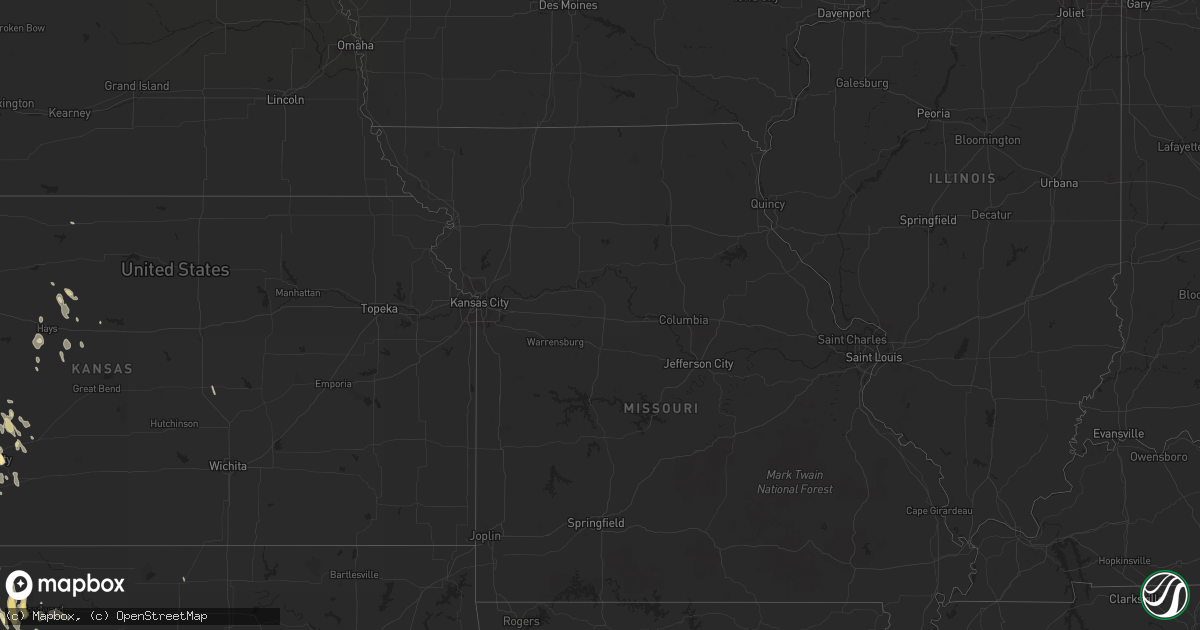
Hail Map in Texas on April 2, 2012
Get this storm
April 2 map
$229
one time, instant access
Download today. No call, no setup
Keep the $229
Bought the map and want the full workflow? Apply the entire $229 to a subscription within 7 days. None of it is wasted.
Every map, not just this one
This buys you this map. Subscription and you get every map we run, in the markets you choose from a few cities to whole states to nationwide. Plus real-time alerts the moment a storm fires.
Contact data
Name, contact info, occupancy, even credit band for addresses in the footprint. You go from where it hit to who to call.
Become the source they trust
Unlimited branding weather history reports on demand. You already have the documented answer ready for the property owner, and you are the one who showed up with it.
Property data and RoofTrace estimates
Pull up any address you have got, its value and the exact code rules for that jurisdiction, straight from One Click Code. Then RoofTrace estimates the squares, pitch, and roof value, priced the way you price.
Storm reports in Texas
Texas
| Date | Description |
|---|---|
| 04/02/20123:59 PM CDT | Hail report was at the intersection of fm 1488 and fm 2978. |
| 04/02/20123:59 PM CDT | Hail report was at the intersection of fm 1488 and fm 2978. |
| 04/02/20123:30 PM CDT | Windows blown out of businesses in clarksville...due to strong wind and debris. |
| 04/02/20123:20 PM CDT | A local report indicates 1.00 inch wind near BUSH-INTERCONTINENTAL A |
| 04/02/20123:20 PM CDT | Tree blown down at nash |
| 04/02/20123:15 PM CDT | Trees downed on houses in nash and wake village. Tree on a car in liberty-eylau. |
| 04/02/20122:55 PM CDT | 8 to 10 trees down across various parts of the city. |
| 04/02/20122:55 PM CDT | Tree down cr 4115 one mile north of 21 |
| 04/02/20122:50 PM CDT | Several large trees down in simms. |
| 04/02/20122:30 PM CDT | Trees down county wide |
| 04/02/20122:15 PM CDT | Numerous trees down on bird and houston streets |
| 04/02/20122:00 PM CDT | Trees blown down |
| 04/02/20121:50 PM CDT | Powelines were downed. |
| 04/02/20121:42 PM CDT | Liberty county sheriffs office reported dime and quarter sized hail falling for 7 ot 8 minutes at the office. |
| 04/02/20121:40 PM CDT | Tree downed on jim hogg road in lidale. |
| 04/02/20121:37 PM CDT | Large limbs down and some power out in marshall |
| 04/02/20121:35 PM CDT | The elderville lakeport vfd pavilion collapsed due to high winds. |
| 04/02/20121:26 PM CDT | A tree was downed on a house in the 400 block of south jean street. |
| 04/02/20121:20 PM CDT | Tree downed at george and locust streets. |
| 04/02/201212:50 PM CDT | Several road signs blown over along us hwy 59 |
| 04/02/201212:45 PM CDT | Four trees down in eastern side of county |
| 04/02/201212:45 PM CDT | Tree down north side of hwy 79 east side of loop near carthage. |
| 04/02/201212:15 PM CDT | Trees down on powerlines along hwy 84 |
| 04/02/201212:15 PM CDT | Numerous small limbs and leaf debris across the yard. Estimated winds in excess of 60 mph. |
| 04/02/201212:15 PM CDT | Trees blown down |
| 04/02/201211:25 AM CDT | Trees reported down in the pineland area |
| 04/02/201211:04 AM CDT | Newton sheriff report trees down in burkeville along farm to market 1415 |
| 04/02/201210:45 AM CDT | Newton sheriff report multiple trees down in downtown newton. There are trees down near melody lane and also shady acres. |
| 04/02/201210:31 AM CDT | Newton county sheriff report trees down in bleakwood west of hwy 190 |
| 04/02/201210:30 AM CDT | Trampolines blown over in kirbyville. |
| 04/02/20129:41 AM CDT | Orange emergency manager reports trees snaps with 3 or 4 houses with minor to moderate damage on 4th street. |
| 04/01/201210:02 PM CDT | A local report indicates 1.00 inch wind near 2 E VERA |
| 04/01/20129:52 PM CDT | Power lines down at the corner of cr 134 e and 183. Winds est 70 mph. |
| 04/01/20129:50 PM CDT | A local report indicates 1.00 inch wind near 1 S VERNON |
| 04/01/20129:23 PM CDT | A local report indicates 1.00 inch wind near CANADIAN |
| 04/01/20129:12 PM CDT | A local report indicates 1.75 inch wind near 6 S CANADIAN |
| 04/01/20128:53 PM CDT | A local report indicates 1.75 inch wind near 4 E LUTIE |
| 04/01/20128:45 PM CDT | A local report indicates 1.00 inch wind near 12 NE LEFORS |
| 04/01/20128:42 PM CDT | A local report indicates 1.00 inch wind near 2 ENE SHAMROCK |
| 04/01/20128:37 PM CDT | A local report indicates 1.75 inch wind near 1 E LUTIE |
| 04/01/20128:35 PM CDT | A local report indicates 1.00 inch wind near GOODLETT |
All States Impacted by Hail Map on April 2, 2012
Cities Impacted by Hail Map on April 2, 2012
- Sulphur Springs, TX
- Ragley, LA
- West Monroe, LA
- Eros, LA
- Columbia, LA
- Robeline, LA
- Marthaville, LA
- Henderson, TX
- Frederick, OK
- Baton Rouge, LA
- Bassfield, MS
- Sumrall, MS
- Plains, KS
- Texarkana, AR
- Lewisville, AR
- Fouke, AR
- Garland City, AR
- Harrold, TX
- Tipton, OK
- Zachary, LA
- Burkesville, KY
- Magnolia, AR
- Stephens, AR
- Jackson, AL
- Gainestown, AL
- Uriah, AL
- Plainville, KS
- Natoma, KS
- Pampa, TX
- Bee Spring, KY
- Sweeden, KY
- Schriever, LA
- Deridder, LA
- Reeves, LA
- Dry Creek, LA
- Haworth, OK
- Forgan, OK
- Meade, KS
- Haughton, LA
- Plain Dealing, LA
- Cotton Valley, LA
- Benton, LA
- Princeton, LA
- Woodworth, LA
- Oakdale, LA
- Forest Hill, LA
- Ville Platte, LA
- Elmer, LA
- Hineston, LA
- Glenmora, LA
- Richton, MS
- State Line, MS
- Batchelor, LA
- Lettsworth, LA
- Longview, TX
- Tatum, TX
- Lagrange, IN
- Spring Valley, WI
- Canadian, TX
- Higgins, TX
- Briscoe, TX
- Kinder, LA
- Atlanta, LA
- Wewoka, OK
- Sasakwa, OK
- Ruth, MS
- Bogue Chitto, MS
- McDavid, FL
- Atmore, AL
- Jamestown, ND
- Jud, ND
- Arnett, OK
- Pineville, LA
- Alexandria, LA
- Beldenville, WI
- River Falls, WI
- Cleveland, TX
- Camden, MS
- Wishek, ND
- Pearl River, LA
- Montezuma, KS
- Fowler, KS
- Shamrock, TX
- Wellington, TX
- Seymour, TX
- Munday, TX
- Benjamin, TX
- Oklaunion, TX
- Crowell, TX
- Electra, TX
- Vernon, TX
- Haynesville, LA
- Jackson, MS
- Ridgeland, MS
- Benton, MS
- Chickasha, OK
- Cement, OK
- Knoxville, TN
- Erath, LA
- Barataria, LA
- Quitman, LA
- Jonesboro, LA
- White Pigeon, MI
- Grandfield, OK
- Wills Point, TX
- Fruitvale, TX
- Edgewood, TX
- Beckville, TX
- Lawton, OK
- Temple, OK
- Randlett, OK
- Walters, OK
- Wichita Falls, TX
- Woodward, OK
- Saint Paul, MN
- Silver Creek, MS
- Deville, LA
- Jeanerette, LA
- Coushatta, LA
- Grand Saline, TX
- Osyka, MS
- Wheeler, TX
- Dodson, TX
- Roosevelt, OK
- Brandon, MS
- Flowood, MS
- Pearl, MS
- New Caney, TX
- Dayton, TX
- Splendora, TX
- Lecompte, LA
- San Angelo, TX
- Sarepta, LA
- Cordell, OK
- Gotebo, OK
- Hobart, OK
- Colony, OK
- Gage, OK
- Shattuck, OK
- Newellton, LA
- Center Point, LA
- Livingston, TX
- Gackle, ND
- Ingalls, KS
- Brookhaven, MS
- Crawford, OK
- Cheyenne, OK
- McCall Creek, MS
- Jefferson, TX
- New Iberia, LA
- Delcambre, LA
- Goodrich, TX
- Wannaska, MN
- Green Isle, MN
- Henderson, MN
- Belle Plaine, MN
- Liberty, TX
- Carthage, TX
- Hallsville, TX
- Linden, TX
- Harleton, TX
- Avinger, TX
- Marshall, TX
- Diana, TX
- Mountain View, OK
- Mount Pleasant, TX
- Talco, TX
- Cookville, TX
- Price, TX
- Quanah, TX
- Pitkin, LA
- Burnsville, MN
- Prior Lake, MN
- Savage, MN
- Saltillo, TX
- Headrick, OK
- Elmer, OK
- Snyder, OK
- Altus, OK
- Altus Afb, OK
- Carson, MS
- Annona, TX
- Zavalla, TX
- Rayne, LA
- Kaplan, LA
- Olustee, OK
- Mountain Park, OK
- Hooker, OK
- Hardesty, OK
- Guymon, OK
- Throckmorton, TX
- Fort Supply, OK
- Sontag, MS
- Natchez, MS
- Alto, TX
- Wells, TX
- Kennard, TX
- Abbeville, LA
- Ida, LA
- New Richmond, WI
- Roberts, WI
- Sublette, KS
- Madill, OK
- Gate, OK
- Rosston, OK
- Waurika, OK
- Ryan, OK
- Petrolia, TX
- Byers, TX
- Winfield, TX
- Pittsburg, TX
- Leesburg, TX
- Scroggins, TX
- Mount Vernon, TX
- Minneola, KS
- Arcadia, LA
- Ferriday, LA
- Buna, TX
- Commerce, TX
- Bivins, TX
- Atlanta, TX
- Bernice, LA
- Wellston, OK
- Ballinger, TX
- Rowena, TX
- Coleman, TX
- Miles, TX
- Norton, TX
- Talpa, TX
- Canton, KS
- Galva, KS
- Grayson, LA
- Jonesville, LA
- Canton, MS
- Madison, MS
- Russell, KS
- Silsbee, TX
- May, OK
- Sharon, OK
- Fargo, OK
- Newhebron, MS
- Prentiss, MS
- Mooreland, OK
- Kerens, TX
- Wright, KS
- Timpson, TX
- Edwards, MS
- Hudson, WI
- Converse, LA
- Conroe, TX
- Gloster, MS
- Junction City, AR
- Dodge City, KS
- Satanta, KS
- Wolfe City, TX
- Bayport, MN
- Stillwater, MN
- Houston, TX
- Humble, TX
- Porter, TX
- Kingwood, TX
- Napoleonville, LA
- Shakopee, MN
- Eden Prairie, MN
- Minneapolis, MN
- Overton, TX
- Tylertown, MS
- Montpelier, ND
- Petal, MS
- Tallulah, LA
- Ruston, LA
- Dubach, LA
- Homer, LA
- Pelahatchie, MS
- Channelview, TX
- Lehr, ND
- Mangum, OK
- Duke, OK
- Laverne, OK
- Newton, TX
- Cooper, TX
- Granite, OK
- Willow, OK
- Chatham, LA
- Choudrant, LA
- Ford, KS
- Crystal Springs, MS
- Florence, MS
- Harrisville, MS
- Hazlehurst, MS
- Terry, MS
- Georgetown, MS
- Leitchfield, KY
- Brownsville, KY
- Colfax, WI
- Buckatunna, MS
- Wesson, MS
- Beaumont, TX
- Hattiesburg, MS
- Jetmore, KS
- Spearville, KS
- Hanston, KS
- Kinsley, KS
- Chilton, WI
- Pfeifer, KS
- Victoria, KS
- Chireno, TX
- Hollis, OK
- Vinson, OK
- Davidson, OK
- Childress, TX
- Chillicothe, TX
- Gould, OK
- Eldorado, OK
- Bolton, MS
- Clinton, MS
- Haskell, TX
- Olla, LA
- Spring, TX
- Magnolia, TX
- Tenaha, TX
- Center, TX
- Sikes, LA
- Vaughan, MS
- Mobile, AL
- Broaddus, TX
- Galena Park, TX
- Pollock, LA
- Mccomb, MS
- Lakeville, MN
- Jayess, MS
- Hull, TX
- Fletcher, OK
- Jasper, TX
- Lumberton, MS
- Poplarville, MS
- Mendenhall, MS
- Pinola, MS
- Gulf Breeze, FL
- Shreveport, LA
- Mooringsport, LA
- El Dorado, AR
- Summit, MS
- Saint Amant, LA
- Perryton, TX
- Hastings, MN
- Farmington, MN
- Vermillion, MN
- Hampton, MN
- Rosemount, MN
- Menomonie, WI
- Pickens, MS
- Elko New Market, MN
- La Crosse, KS
- McCracken, KS
- Morton, MS
- Duncan, OK
- Kismet, KS
- Indiahoma, OK
- Chattanooga, OK
- Cache, OK
- Loveland, OK
- Jordan, MN
- Inver Grove Heights, MN
- Saint Paul Park, MN
- Glenwood City, WI
- Knapp, WI
- Downing, WI
- Wilson, WI
- Pickton, TX
- Copeland, KS
- Ensign, KS
- Cimarron, KS
- Crowley, LA
- Estherwood, LA
- Newhope, AR
- Langley, AR
- Dierks, AR
- Umpire, AR
- Hemphill, TX
- South Saint Paul, MN
- Silas, AL
- Waynesboro, MS
- Millry, AL
- Apple Springs, TX
- Franklin, LA
- Warren, TX
- Medford, OK
- Colmesneil, TX
- Delhi, LA
- Rayville, LA
- Kountze, TX
- Wilmot, AR
- Fredonia, ND
- Rusk, TX
- Jacksonville, TX
- Corunna, IN
- Wolcottville, IN
- Hudson, IN
- Kendallville, IN
- Hammon, OK
- Sayre, OK
- Collins, MS
- Vicksburg, MS
- Hockley, TX
- Newcastle, TX
- Long Branch, TX
- Gary, TX
- Nacogdoches, TX
- Garrison, TX
- Mount Enterprise, TX
- Smithdale, MS
- Liberty, MS
- Meadville, MS
- Clinton, LA
- Corrigan, TX
- Ethel, LA
- Jackson, LA
- Norwood, LA
- Groveton, TX
- Trinity, TX
- Baytown, TX
- Alba, TX
- Mineola, TX
- Shongaloo, LA
- Emerson, AR
- Braithwaite, LA
- Boyd, WI
- Stanley, WI
- Hays, KS
- Kokomo, MS
- Sweetwater, OK
- Liberal, KS
- Hugoton, KS
- Lake Charles, LA
- Mount Olive, MS
- Pine Grove, LA
- Ada, OK
- Lone Wolf, OK
- Waldo, AR
- Cyril, OK
- Ninnekah, OK
- Erick, OK
- Baldwin, WI
- Woodville, WI
- Saint Francisville, LA
- Fayette, MS
- Sandy Hook, MS
- Foxworth, MS
- Magnolia, MS
- Mansfield, LA
- Slidell, LA
- Milladore, WI
- Seminary, MS
- Mclean, TX
- Miami, TX
- Rodessa, LA
- Doddridge, AR
- Mena, AR
- Braxton, MS
- Elgin, OK
- Brookshire, TX
- Pleasant Hill, LA
- Pelican, LA
- Burkburnett, TX
- Devol, OK
- Geismar, LA
- Donaldsonville, LA
- Arlington, MN
- Foreman, AR
- Vinegar Bend, AL
- Leedey, OK
- New Augusta, MS
- Leroy, AL
- Henrietta, TX
- Ladonia, TX
- Jena, LA
- Beaumont, MS
- Fort Sill, OK
- Elk Mound, WI
- Tom Bean, TX
- Sherman, TX
- Whitewright, TX
- Joaquin, TX
- Keithville, LA
- Keatchie, LA
- Port Allen, LA
- Rush Springs, OK
- Faxon, OK
- Marksville, LA
- De Kalb, TX
- Goodman, MS
- Oak Vale, MS
- Simsboro, LA
- Bogalusa, LA
- Angie, LA
- Catharine, KS
- Gorham, KS
- Reydon, OK
- Lake Arthur, LA
- Jennings, LA
- Fairfield, TX
- Moselle, MS
- Blair, OK
- Magee, MS
- Gaylord, MN
- Plum City, WI
- Berwick, LA
- Morgan City, LA
- Theriot, LA
- Gibson, LA
- Butler, OK
- Spearman, TX
- Leakesville, MS
- South Haven, MI
- Palmetto, LA
- Melville, LA
- Newport, MN
- Marlow, OK
- Cadott, WI
- Monticello, MS
- Queen City, TX
- Biloxi, MS
- Kenner, LA
- Westwego, LA
- Ellsworth, WI
- Lena, MS
- Clinton, OK
- Foss, OK
- Shelbyville, TX
- Mize, MS
- Ball, LA
- Grand Cane, LA
- Topeka, IN
- Heavener, OK
- Utica, MS
- Purvis, MS
- Booker, TX
- Logansport, LA
- Eau Claire, WI
- Holliday, TX
- Apache, OK
- Crosby, TX
- Winnsboro, TX
- Como, TX
- Clarksville, TX
- Dodson, LA
- Offerle, KS
- Chippewa Falls, WI
- Kirbyville, TX
- Carver, MN
- Norwood Young America, MN
- Cologne, MN
- Bunker Hill, KS
- Waupaca, WI
- Prescott, WI
- Troup, TX
- Weinert, TX
- Grove Hill, AL
- Lillie, LA
- San Augustine, TX
- Tyler, TX
- Denham Springs, LA
- Greenwell Springs, LA
- Gueydan, LA
- Dermott, AR
- Talmoon, MN
- Deer River, MN
- Patterson, LA
- Hollister, OK
- Chaska, MN
- Iowa Park, TX
- Morgantown, KY
- Diberville, MS
- Blanchard, OK
- Amber, OK
- Corn, OK
- Vivian, LA
- Bay Minette, AL
- Summerfield, LA
- Bentonia, MS
- Amite, LA
- Gonzales, LA
- Prairieville, LA
- Oak Grove, LA
- De Queen, AR
- Livingston, LA
- Walker, LA
- Riverton, NE
- Lafitte, LA
- Winnfield, LA
- Emory, TX
- Afton, MN
- Merkel, TX
- Elton, LA
- Lockport, LA
- Milam, TX
- Bronson, TX
- Hawkins, TX
- Lake Elmo, MN
- Centreville, MS
- Bucklin, KS
- Naponee, NE
- Bison, KS
- Church Point, LA
- Brookeland, TX
- Bogata, TX
- Avery, TX
- Buckner, AR
- Kelly, LA
- Roseland, LA
- Lisbon, LA
- Columbia, MS
- Pennington, TX
- Montgomery, LA
- Stamps, AR
- Slaughter, LA
- Wilson, LA
- Dry Prong, LA
- Noble, LA
- Kensington, KS
- Brashear, TX
- Kilgore, TX
- Boyceville, WI
- Simmesport, LA
- Plaucheville, LA
- Holland, MI
- Gulfport, MS
- Downsville, LA
- Calhoun, LA
- Ypsilanti, ND
- Great Falls, SC
- Fort Lawn, SC
- Monterey, LA
- Des Allemands, LA
- Saint Gabriel, LA
- Sunshine, LA
- Winters, TX
- Balko, OK


