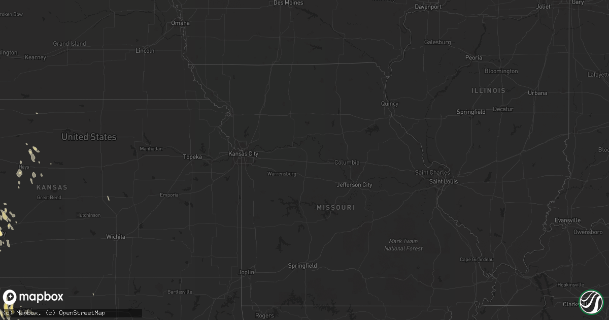
Hail Map in Louisiana on April 2, 2012
Get this storm
April 2 map
$229
one time, instant access
Download today. No call, no setup
Keep the $229
Bought the map and want the full workflow? Apply the entire $229 to a subscription within 7 days. None of it is wasted.
Every map, not just this one
This buys you this map. Subscription and you get every map we run, in the markets you choose from a few cities to whole states to nationwide. Plus real-time alerts the moment a storm fires.
Contact data
Name, contact info, occupancy, even credit band for addresses in the footprint. You go from where it hit to who to call.
Become the source they trust
Unlimited branding weather history reports on demand. You already have the documented answer ready for the property owner, and you are the one who showed up with it.
Property data and RoofTrace estimates
Pull up any address you have got, its value and the exact code rules for that jurisdiction, straight from One Click Code. Then RoofTrace estimates the squares, pitch, and roof value, priced the way you price.
Storm reports in Louisiana
Louisiana
| Date | Description |
|---|---|
| 04/02/20125:26 PM CDT | Quarter size hail fell at nws office. |
| 04/02/20125:00 PM CDT | Public report of quarter size hail. |
| 04/02/20124:51 PM CDT | Quarter size hail reported near roosevelt blvd and west metarie ave. |
| 04/02/20123:50 PM CDT | Tree downed blocking 4th street |
| 04/02/20123:47 PM CDT | Roof damage from wind to a house...structural damage to another bulding from tree down on it...numerous trees down on powerlines |
| 04/02/20123:38 PM CDT | Power lines down just outside of forest and two trees down in oak grove |
| 04/02/20123:10 PM CDT | Two trees down |
| 04/02/20123:10 PM CDT | Numerous trees down across the parish. |
| 04/02/20122:56 PM CDT | Trees and powerlines down. One tree fell on a house on old sterlington rd |
| 04/02/20122:45 PM CDT | Trees and power lines down in the southern portion of the parish around mangham |
| 04/02/20122:45 PM CDT | Along hwy 552...car struck a downed tree. |
| 04/02/20122:43 PM CDT | Structural damage and trees down at brownsville / bawcomville near hwy 34 |
| 04/02/20122:30 PM CDT | Number of large trees down from 2 miles east of winnsboro to the tensas parish line. Nickel sized hail also reported in the area. |
| 04/02/20122:25 PM CDT | Roof blown off a steel building at west ouachita high school |
| 04/02/20122:25 PM CDT | Trees and large limbs were downed in the southern portion of the parish...including along la highway 570 |
| 04/02/20122:20 PM CDT | Trees greater than 8 inches in diameter snapped in ruston. |
| 04/02/20122:10 PM CDT | Quarter size hail reported in zachary. |
| 04/02/20122:00 PM CDT | Tree down mt. Gilead road near hwy 170 |
| 04/02/20121:55 PM CDT | Trees down in the monterey and wildsville areas |
| 04/02/20121:50 PM CDT | Trees were downed in jonesville. Hail to dime size also reported...lasted around 5 minutes. |
| 04/02/20121:50 PM CDT | Large pine tree down on a house in haughton. There were no reports of injuries. |
| 04/02/20121:45 PM CDT | Quarter size hail in olla |
| 04/02/20121:39 PM CDT | Large limbs reported downed at and near barksdale afb. |
| 04/02/20121:35 PM CDT | Quarter size hail |
| 04/02/20121:35 PM CDT | Marble to quarter size hail reported in vicnity of tiger bend road and antioch road. Estimated wind gusts of 40 to 50 mph also reported. |
| 04/02/20121:35 PM CDT | Powerlines downed on allen street near ford street. |
| 04/02/20121:30 PM CDT | Numerous trees down across the county. |
| 04/02/20121:30 PM CDT | Large 50 lb trashcans blown over |
| 04/02/20121:30 PM CDT | Tree downed on a home in the 3800 block of ninock street. |
| 04/02/20121:25 PM CDT | Tree on home on stratmore drive |
| 04/02/20121:20 PM CDT | Numerous trees down across the parish. |
| 04/02/20121:00 PM CDT | Large limbs down along highway one and 371. |
| 04/02/201212:35 PM CDT | Trees down in the charles park area of alexandria and in ball. Report relayed through kalb-tv facebook page. |
| 04/02/201212:30 PM CDT | Roof blown off a house in the poland community. Report relayed through the kalb-tv facebook page. |
| 04/02/201210:55 AM CDT | Roof blown off the carc building near chennault airport. |
| 04/02/201210:45 AM CDT | Off duty nws employee reported semi blown off the road near i-210 and highway 14. Local reports and radar estimates wind gusts to 50 mph. |
All States Impacted by Hail Map on April 2, 2012
Cities Impacted by Hail Map on April 2, 2012
- Sulphur Springs, TX
- Ragley, LA
- West Monroe, LA
- Eros, LA
- Columbia, LA
- Robeline, LA
- Marthaville, LA
- Henderson, TX
- Frederick, OK
- Baton Rouge, LA
- Bassfield, MS
- Sumrall, MS
- Plains, KS
- Texarkana, AR
- Lewisville, AR
- Fouke, AR
- Garland City, AR
- Harrold, TX
- Tipton, OK
- Zachary, LA
- Burkesville, KY
- Magnolia, AR
- Stephens, AR
- Jackson, AL
- Gainestown, AL
- Uriah, AL
- Plainville, KS
- Natoma, KS
- Pampa, TX
- Bee Spring, KY
- Sweeden, KY
- Schriever, LA
- Deridder, LA
- Reeves, LA
- Dry Creek, LA
- Haworth, OK
- Forgan, OK
- Meade, KS
- Haughton, LA
- Plain Dealing, LA
- Cotton Valley, LA
- Benton, LA
- Princeton, LA
- Woodworth, LA
- Oakdale, LA
- Forest Hill, LA
- Ville Platte, LA
- Elmer, LA
- Hineston, LA
- Glenmora, LA
- Richton, MS
- State Line, MS
- Batchelor, LA
- Lettsworth, LA
- Longview, TX
- Tatum, TX
- Lagrange, IN
- Spring Valley, WI
- Canadian, TX
- Higgins, TX
- Briscoe, TX
- Kinder, LA
- Atlanta, LA
- Wewoka, OK
- Sasakwa, OK
- Ruth, MS
- Bogue Chitto, MS
- McDavid, FL
- Atmore, AL
- Jamestown, ND
- Jud, ND
- Arnett, OK
- Pineville, LA
- Alexandria, LA
- Beldenville, WI
- River Falls, WI
- Cleveland, TX
- Camden, MS
- Wishek, ND
- Pearl River, LA
- Montezuma, KS
- Fowler, KS
- Shamrock, TX
- Wellington, TX
- Seymour, TX
- Munday, TX
- Benjamin, TX
- Oklaunion, TX
- Crowell, TX
- Electra, TX
- Vernon, TX
- Haynesville, LA
- Jackson, MS
- Ridgeland, MS
- Benton, MS
- Chickasha, OK
- Cement, OK
- Knoxville, TN
- Erath, LA
- Barataria, LA
- Quitman, LA
- Jonesboro, LA
- White Pigeon, MI
- Grandfield, OK
- Wills Point, TX
- Fruitvale, TX
- Edgewood, TX
- Beckville, TX
- Lawton, OK
- Temple, OK
- Randlett, OK
- Walters, OK
- Wichita Falls, TX
- Woodward, OK
- Saint Paul, MN
- Silver Creek, MS
- Deville, LA
- Jeanerette, LA
- Coushatta, LA
- Grand Saline, TX
- Osyka, MS
- Wheeler, TX
- Dodson, TX
- Roosevelt, OK
- Brandon, MS
- Flowood, MS
- Pearl, MS
- New Caney, TX
- Dayton, TX
- Splendora, TX
- Lecompte, LA
- San Angelo, TX
- Sarepta, LA
- Cordell, OK
- Gotebo, OK
- Hobart, OK
- Colony, OK
- Gage, OK
- Shattuck, OK
- Newellton, LA
- Center Point, LA
- Livingston, TX
- Gackle, ND
- Ingalls, KS
- Brookhaven, MS
- Crawford, OK
- Cheyenne, OK
- McCall Creek, MS
- Jefferson, TX
- New Iberia, LA
- Delcambre, LA
- Goodrich, TX
- Wannaska, MN
- Green Isle, MN
- Henderson, MN
- Belle Plaine, MN
- Liberty, TX
- Carthage, TX
- Hallsville, TX
- Linden, TX
- Harleton, TX
- Avinger, TX
- Marshall, TX
- Diana, TX
- Mountain View, OK
- Mount Pleasant, TX
- Talco, TX
- Cookville, TX
- Price, TX
- Quanah, TX
- Pitkin, LA
- Burnsville, MN
- Prior Lake, MN
- Savage, MN
- Saltillo, TX
- Headrick, OK
- Elmer, OK
- Snyder, OK
- Altus, OK
- Altus Afb, OK
- Carson, MS
- Annona, TX
- Zavalla, TX
- Rayne, LA
- Kaplan, LA
- Olustee, OK
- Mountain Park, OK
- Hooker, OK
- Hardesty, OK
- Guymon, OK
- Throckmorton, TX
- Fort Supply, OK
- Sontag, MS
- Natchez, MS
- Alto, TX
- Wells, TX
- Kennard, TX
- Abbeville, LA
- Ida, LA
- New Richmond, WI
- Roberts, WI
- Sublette, KS
- Madill, OK
- Gate, OK
- Rosston, OK
- Waurika, OK
- Ryan, OK
- Petrolia, TX
- Byers, TX
- Winfield, TX
- Pittsburg, TX
- Leesburg, TX
- Scroggins, TX
- Mount Vernon, TX
- Minneola, KS
- Arcadia, LA
- Ferriday, LA
- Buna, TX
- Commerce, TX
- Bivins, TX
- Atlanta, TX
- Bernice, LA
- Wellston, OK
- Ballinger, TX
- Rowena, TX
- Coleman, TX
- Miles, TX
- Norton, TX
- Talpa, TX
- Canton, KS
- Galva, KS
- Grayson, LA
- Jonesville, LA
- Canton, MS
- Madison, MS
- Russell, KS
- Silsbee, TX
- May, OK
- Sharon, OK
- Fargo, OK
- Newhebron, MS
- Prentiss, MS
- Mooreland, OK
- Kerens, TX
- Wright, KS
- Timpson, TX
- Edwards, MS
- Hudson, WI
- Converse, LA
- Conroe, TX
- Gloster, MS
- Junction City, AR
- Dodge City, KS
- Satanta, KS
- Wolfe City, TX
- Bayport, MN
- Stillwater, MN
- Houston, TX
- Humble, TX
- Porter, TX
- Kingwood, TX
- Napoleonville, LA
- Shakopee, MN
- Eden Prairie, MN
- Minneapolis, MN
- Overton, TX
- Tylertown, MS
- Montpelier, ND
- Petal, MS
- Tallulah, LA
- Ruston, LA
- Dubach, LA
- Homer, LA
- Pelahatchie, MS
- Channelview, TX
- Lehr, ND
- Mangum, OK
- Duke, OK
- Laverne, OK
- Newton, TX
- Cooper, TX
- Granite, OK
- Willow, OK
- Chatham, LA
- Choudrant, LA
- Ford, KS
- Crystal Springs, MS
- Florence, MS
- Harrisville, MS
- Hazlehurst, MS
- Terry, MS
- Georgetown, MS
- Leitchfield, KY
- Brownsville, KY
- Colfax, WI
- Buckatunna, MS
- Wesson, MS
- Beaumont, TX
- Hattiesburg, MS
- Jetmore, KS
- Spearville, KS
- Hanston, KS
- Kinsley, KS
- Chilton, WI
- Pfeifer, KS
- Victoria, KS
- Chireno, TX
- Hollis, OK
- Vinson, OK
- Davidson, OK
- Childress, TX
- Chillicothe, TX
- Gould, OK
- Eldorado, OK
- Bolton, MS
- Clinton, MS
- Haskell, TX
- Olla, LA
- Spring, TX
- Magnolia, TX
- Tenaha, TX
- Center, TX
- Sikes, LA
- Vaughan, MS
- Mobile, AL
- Broaddus, TX
- Galena Park, TX
- Pollock, LA
- Mccomb, MS
- Lakeville, MN
- Jayess, MS
- Hull, TX
- Fletcher, OK
- Jasper, TX
- Lumberton, MS
- Poplarville, MS
- Mendenhall, MS
- Pinola, MS
- Gulf Breeze, FL
- Shreveport, LA
- Mooringsport, LA
- El Dorado, AR
- Summit, MS
- Saint Amant, LA
- Perryton, TX
- Hastings, MN
- Farmington, MN
- Vermillion, MN
- Hampton, MN
- Rosemount, MN
- Menomonie, WI
- Pickens, MS
- Elko New Market, MN
- La Crosse, KS
- McCracken, KS
- Morton, MS
- Duncan, OK
- Kismet, KS
- Indiahoma, OK
- Chattanooga, OK
- Cache, OK
- Loveland, OK
- Jordan, MN
- Inver Grove Heights, MN
- Saint Paul Park, MN
- Glenwood City, WI
- Knapp, WI
- Downing, WI
- Wilson, WI
- Pickton, TX
- Copeland, KS
- Ensign, KS
- Cimarron, KS
- Crowley, LA
- Estherwood, LA
- Newhope, AR
- Langley, AR
- Dierks, AR
- Umpire, AR
- Hemphill, TX
- South Saint Paul, MN
- Silas, AL
- Waynesboro, MS
- Millry, AL
- Apple Springs, TX
- Franklin, LA
- Warren, TX
- Medford, OK
- Colmesneil, TX
- Delhi, LA
- Rayville, LA
- Kountze, TX
- Wilmot, AR
- Fredonia, ND
- Rusk, TX
- Jacksonville, TX
- Corunna, IN
- Wolcottville, IN
- Hudson, IN
- Kendallville, IN
- Hammon, OK
- Sayre, OK
- Collins, MS
- Vicksburg, MS
- Hockley, TX
- Newcastle, TX
- Long Branch, TX
- Gary, TX
- Nacogdoches, TX
- Garrison, TX
- Mount Enterprise, TX
- Smithdale, MS
- Liberty, MS
- Meadville, MS
- Clinton, LA
- Corrigan, TX
- Ethel, LA
- Jackson, LA
- Norwood, LA
- Groveton, TX
- Trinity, TX
- Baytown, TX
- Alba, TX
- Mineola, TX
- Shongaloo, LA
- Emerson, AR
- Braithwaite, LA
- Boyd, WI
- Stanley, WI
- Hays, KS
- Kokomo, MS
- Sweetwater, OK
- Liberal, KS
- Hugoton, KS
- Lake Charles, LA
- Mount Olive, MS
- Pine Grove, LA
- Ada, OK
- Lone Wolf, OK
- Waldo, AR
- Cyril, OK
- Ninnekah, OK
- Erick, OK
- Baldwin, WI
- Woodville, WI
- Saint Francisville, LA
- Fayette, MS
- Sandy Hook, MS
- Foxworth, MS
- Magnolia, MS
- Mansfield, LA
- Slidell, LA
- Milladore, WI
- Seminary, MS
- Mclean, TX
- Miami, TX
- Rodessa, LA
- Doddridge, AR
- Mena, AR
- Braxton, MS
- Elgin, OK
- Brookshire, TX
- Pleasant Hill, LA
- Pelican, LA
- Burkburnett, TX
- Devol, OK
- Geismar, LA
- Donaldsonville, LA
- Arlington, MN
- Foreman, AR
- Vinegar Bend, AL
- Leedey, OK
- New Augusta, MS
- Leroy, AL
- Henrietta, TX
- Ladonia, TX
- Jena, LA
- Beaumont, MS
- Fort Sill, OK
- Elk Mound, WI
- Tom Bean, TX
- Sherman, TX
- Whitewright, TX
- Joaquin, TX
- Keithville, LA
- Keatchie, LA
- Port Allen, LA
- Rush Springs, OK
- Faxon, OK
- Marksville, LA
- De Kalb, TX
- Goodman, MS
- Oak Vale, MS
- Simsboro, LA
- Bogalusa, LA
- Angie, LA
- Catharine, KS
- Gorham, KS
- Reydon, OK
- Lake Arthur, LA
- Jennings, LA
- Fairfield, TX
- Moselle, MS
- Blair, OK
- Magee, MS
- Gaylord, MN
- Plum City, WI
- Berwick, LA
- Morgan City, LA
- Theriot, LA
- Gibson, LA
- Butler, OK
- Spearman, TX
- Leakesville, MS
- South Haven, MI
- Palmetto, LA
- Melville, LA
- Newport, MN
- Marlow, OK
- Cadott, WI
- Monticello, MS
- Queen City, TX
- Biloxi, MS
- Kenner, LA
- Westwego, LA
- Ellsworth, WI
- Lena, MS
- Clinton, OK
- Foss, OK
- Shelbyville, TX
- Mize, MS
- Ball, LA
- Grand Cane, LA
- Topeka, IN
- Heavener, OK
- Utica, MS
- Purvis, MS
- Booker, TX
- Logansport, LA
- Eau Claire, WI
- Holliday, TX
- Apache, OK
- Crosby, TX
- Winnsboro, TX
- Como, TX
- Clarksville, TX
- Dodson, LA
- Offerle, KS
- Chippewa Falls, WI
- Kirbyville, TX
- Carver, MN
- Norwood Young America, MN
- Cologne, MN
- Bunker Hill, KS
- Waupaca, WI
- Prescott, WI
- Troup, TX
- Weinert, TX
- Grove Hill, AL
- Lillie, LA
- San Augustine, TX
- Tyler, TX
- Denham Springs, LA
- Greenwell Springs, LA
- Gueydan, LA
- Dermott, AR
- Talmoon, MN
- Deer River, MN
- Patterson, LA
- Hollister, OK
- Chaska, MN
- Iowa Park, TX
- Morgantown, KY
- Diberville, MS
- Blanchard, OK
- Amber, OK
- Corn, OK
- Vivian, LA
- Bay Minette, AL
- Summerfield, LA
- Bentonia, MS
- Amite, LA
- Gonzales, LA
- Prairieville, LA
- Oak Grove, LA
- De Queen, AR
- Livingston, LA
- Walker, LA
- Riverton, NE
- Lafitte, LA
- Winnfield, LA
- Emory, TX
- Afton, MN
- Merkel, TX
- Elton, LA
- Lockport, LA
- Milam, TX
- Bronson, TX
- Hawkins, TX
- Lake Elmo, MN
- Centreville, MS
- Bucklin, KS
- Naponee, NE
- Bison, KS
- Church Point, LA
- Brookeland, TX
- Bogata, TX
- Avery, TX
- Buckner, AR
- Kelly, LA
- Roseland, LA
- Lisbon, LA
- Columbia, MS
- Pennington, TX
- Montgomery, LA
- Stamps, AR
- Slaughter, LA
- Wilson, LA
- Dry Prong, LA
- Noble, LA
- Kensington, KS
- Brashear, TX
- Kilgore, TX
- Boyceville, WI
- Simmesport, LA
- Plaucheville, LA
- Holland, MI
- Gulfport, MS
- Downsville, LA
- Calhoun, LA
- Ypsilanti, ND
- Great Falls, SC
- Fort Lawn, SC
- Monterey, LA
- Des Allemands, LA
- Saint Gabriel, LA
- Sunshine, LA
- Winters, TX
- Balko, OK


