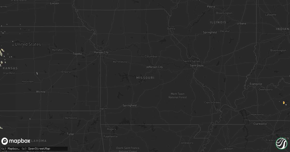
Hail Map on April 2, 2012
Get this storm
April 2 map
$229
one time, instant access
Download today. No call, no setup
Keep the $229
Bought the map and want the full workflow? Apply the entire $229 to a subscription within 7 days. None of it is wasted.
Every map, not just this one
This buys you this map. Subscription and you get every map we run, in the markets you choose from a few cities to whole states to nationwide. Plus real-time alerts the moment a storm fires.
Contact data
Name, contact info, occupancy, even credit band for addresses in the footprint. You go from where it hit to who to call.
Become the source they trust
Unlimited branding weather history reports on demand. You already have the documented answer ready for the property owner, and you are the one who showed up with it.
Property data and RoofTrace estimates
Pull up any address you have got, its value and the exact code rules for that jurisdiction, straight from One Click Code. Then RoofTrace estimates the squares, pitch, and roof value, priced the way you price.
States Impacted by Hail Map on April 2, 2012
Storm reports
Kansas
| Date | Description |
|---|---|
| 04/02/20126:55 PM CDT | A local report indicates 1.00 inch wind near 4 SW ANTONINO |
| 04/02/20126:46 PM CDT | A local report indicates 1.75 inch wind near 8 S MONTEZUMA |
| 04/02/20126:45 PM CDT | Hail estimated pea to quarter sized. |
| 04/02/20126:41 PM CDT | A local report indicates 1.75 inch wind near 9 S MONTEZUMA |
| 04/02/20126:41 PM CDT | A local report indicates 1.75 inch wind near 9 SSW MONTEZUMA |
| 04/02/20126:18 PM CDT | A local report indicates 1.75 inch wind near 4 W FOWLER |
| 04/02/20126:08 PM CDT | A local report indicates 1.75 inch wind near 6 NNE MEADE |
| 04/02/20125:55 PM CDT | Report was relayed by media. Ping pong size hail in ditch near garnett road and us highway 283. Time based on radar. |
| 04/02/20125:48 PM CDT | Hail ranged from pea sized to quarter sized. |
| 04/02/20125:47 PM CDT | A local report indicates 1.75 inch wind near 3 SW WRIGHT |
| 04/02/201212:15 AM CDT | The metal roof of the coldwater laundry building was torn off. |
| 04/01/20128:40 PM CDT | A local report indicates 1.00 inch wind near 5 WSW GRAY |
| 04/01/20128:30 PM CDT | A local report indicates 1.00 inch wind near 4 SW HANSTON |
Tennessee
| Date | Description |
|---|---|
| 04/02/20124:20 PM CDT | A few trees down near downtown. |
Mississippi
| Date | Description |
|---|---|
| 04/02/20126:11 PM CDT | Tree down blocking cr 74 at mccarley rd. |
| 04/02/20126:03 PM CDT | Some trees down along hwy 35 around vaiden. |
| 04/02/20125:52 PM CDT | Several trees down across northern neshoba county. County road 602 blocked by a tree across it. |
| 04/02/20125:50 PM CDT | Tree downed across ms highway 17 near blackhawk |
| 04/02/20125:35 PM CDT | Tree down across highway 12 just west of highway 429...road completely blocked...another tree down on williamsville road just south of kosciusko |
| 04/02/20125:30 PM CDT | Trees down across leake county particularly in the thomastown and standing pine areas...roof damaged on a church in the thomastown area |
| 04/02/20125:30 PM CDT | Numerous trees downed across leake county |
| 04/02/20125:20 PM CDT | Trees down blocking ms highway 35 north of walnut grove |
| 04/02/20125:00 PM CDT | Numerous trees down in the farmhaven area |
| 04/02/20124:57 PM CDT | A tree and a power line blown down. |
| 04/02/20124:50 PM CDT | Roof damage to a couple of buildings...minor roof damage to shell station at intersection of highway 25 and holly bush road |
| 04/02/20124:50 PM CDT | Roofs were blown off of baseball dugouts at pisgah high school |
| 04/02/20124:48 PM CDT | Trees down |
| 04/02/20124:45 PM CDT | Number of trees down on roads near and southeast of yazoo city |
| 04/02/20124:45 PM CDT | Tree down on a house on martin luther king in canton |
| 04/02/20124:40 PM CDT | A local report indicates 1.00 inch wind near 1 E BRANDON |
| 04/02/20124:40 PM CDT | Trees were downed along ebenezer blvd... And cotton hill rd. Tree fell on a car at main street and us highway 51. |
| 04/02/20124:38 PM CDT | A large tree was downed in the crossgates community |
| 04/02/20124:35 PM CDT | Siding was damaged on a couple houses in the sunchase subdivision. In addition a couple trees were downed along ms highway 468 near ms highway 18 |
| 04/02/20124:35 PM CDT | Measured at i-20 and crossgates blvd |
| 04/02/20124:35 PM CDT | Roof damage to a building at the jackson air national guard base |
| 04/02/20124:35 PM CDT | Dime to nickel sized hail with a few stones quarter sized. Also had wind gust to 44 mph. |
| 04/02/20124:32 PM CDT | Part of roof blown off edinburg school |
| 04/02/20124:30 PM CDT | Trees down in flora area |
| 04/02/20124:30 PM CDT | A utility pole was broken by high winds along w washington st |
| 04/02/20124:30 PM CDT | Trees were downed at steed rd and richardson rd...on old agency near highland colony parkway on the west and northwest side of ridgeland |
| 04/02/20124:20 PM CDT | Large tree limbs downed blocking the road at mississippi st and congress st in downtown jackson |
| 04/02/20124:20 PM CDT | Two trees down across old highway 49 and another down across power lines between florence and harrisville |
| 04/02/20124:15 PM CDT | Tree downed on a car on w northside dr |
| 04/02/20124:05 PM CDT | Shingles were blown off an outbuilding and limbs were downed. Delayed report. |
| 04/02/20124:00 PM CDT | Six reports of trees down across simpson county |
| 04/02/20124:00 PM CDT | Trees down across interstate 55 and us highway 51 |
| 04/02/20123:50 PM CDT | Power lines and a tree down along highway 28 near soso |
| 04/02/20123:50 PM CDT | Trees down across many parts of copiah county |
| 04/02/20123:45 PM CDT | Light poles blown down in brookhaven and tree down on a house just northeast of town |
| 04/02/20123:43 PM CDT | Occurred along hwy 84 on the east side of the county. |
| 04/02/20123:40 PM CDT | Multiple trees downed in the utica and learned area. Some blocking roadways. |
| 04/02/20123:30 PM CDT | Minor roof dmg also occurred from the hail |
| 04/02/20123:30 PM CDT | Trees down across interstate 20 and us highway 80 |
| 04/02/20123:25 PM CDT | Tree downed on a house along bowmar ave |
| 04/02/20123:25 PM CDT | Trees down on halls ferry rd and at indiana and porters chapel rd on the southeast side of vicksburg |
| 04/02/20123:25 PM CDT | Large tree downed across highway 27 at the big black river...along the warren/hinds county border |
| 04/02/20123:00 PM CDT | Three trees reported blown down between liberty and gloster. |
| 04/02/20123:00 PM CDT | Trees down across state highway 28 and us highway 61 in jefferson county |
| 04/02/20123:00 PM CDT | Tree downed blocking robertson rd |
| 04/02/20122:50 PM CDT | Numerous reports of hail in the area east and northeast of hattiesburg...including the city of petal and the sunrise community. Mostly pea to dime size...some quarter s |
| 04/02/20122:50 PM CDT | Trees and powerlines down county wide across claiborne county |
| 04/02/20122:35 PM CDT | Trees reported down on kingston rd...upper kingston rd...brooklyn dr...cranfield rd...and bryan rd. |
| 04/02/20122:33 PM CDT | A local report indicates 1.00 inch wind near 2 NNW PURVIS |
| 04/02/20122:30 PM CDT | Hail ranging from pea to quarter size |
Oklahoma
| Date | Description |
|---|---|
| 04/02/20126:12 PM CDT | A local report indicates 1.00 inch wind near BRYANS CORNER |
| 04/02/20125:43 PM CDT | A local report indicates 1.00 inch wind near CLINTON |
| 04/01/201211:25 PM CDT | Reported by lawton pd |
| 04/01/201210:48 PM CDT | A local report indicates 1.50 inch wind near 6 NNE FARGO |
| 04/01/201210:19 PM CDT | A local report indicates 62 MPH wind near 2 SE FREDERICK |
| 04/01/20129:35 PM CDT | A local report indicates 1.00 inch wind near MANGUM |
| 04/01/20129:06 PM CDT | A local report indicates 1.00 inch wind near 4 NW HOOKER |
| 04/01/20129:03 PM CDT | Reported by eldorado fd spotters |
| 04/01/20128:50 PM CDT | A local report indicates 1.00 inch wind near HOOKER |
| 04/01/20128:28 PM CDT | A local report indicates 1.00 inch wind near GAGE |
| 04/01/20127:27 PM CDT | A local report indicates 1.00 inch wind near 7 N ANGORA |
| 04/01/20127:06 PM CDT | Reported by koco-tv storm spotter |
Louisiana
| Date | Description |
|---|---|
| 04/02/20125:26 PM CDT | Quarter size hail fell at nws office. |
| 04/02/20125:00 PM CDT | Public report of quarter size hail. |
| 04/02/20124:51 PM CDT | Quarter size hail reported near roosevelt blvd and west metarie ave. |
| 04/02/20123:50 PM CDT | Tree downed blocking 4th street |
| 04/02/20123:47 PM CDT | Roof damage from wind to a house...structural damage to another bulding from tree down on it...numerous trees down on powerlines |
| 04/02/20123:38 PM CDT | Power lines down just outside of forest and two trees down in oak grove |
| 04/02/20123:10 PM CDT | Two trees down |
| 04/02/20123:10 PM CDT | Numerous trees down across the parish. |
| 04/02/20122:56 PM CDT | Trees and powerlines down. One tree fell on a house on old sterlington rd |
| 04/02/20122:45 PM CDT | Trees and power lines down in the southern portion of the parish around mangham |
| 04/02/20122:45 PM CDT | Along hwy 552...car struck a downed tree. |
| 04/02/20122:43 PM CDT | Structural damage and trees down at brownsville / bawcomville near hwy 34 |
| 04/02/20122:30 PM CDT | Number of large trees down from 2 miles east of winnsboro to the tensas parish line. Nickel sized hail also reported in the area. |
| 04/02/20122:25 PM CDT | Trees and large limbs were downed in the southern portion of the parish...including along la highway 570 |
| 04/02/20122:25 PM CDT | Roof blown off a steel building at west ouachita high school |
| 04/02/20122:20 PM CDT | Trees greater than 8 inches in diameter snapped in ruston. |
| 04/02/20122:10 PM CDT | Quarter size hail reported in zachary. |
| 04/02/20122:00 PM CDT | Tree down mt. Gilead road near hwy 170 |
| 04/02/20121:55 PM CDT | Trees down in the monterey and wildsville areas |
| 04/02/20121:50 PM CDT | Large pine tree down on a house in haughton. There were no reports of injuries. |
| 04/02/20121:50 PM CDT | Trees were downed in jonesville. Hail to dime size also reported...lasted around 5 minutes. |
| 04/02/20121:45 PM CDT | Quarter size hail in olla |
| 04/02/20121:39 PM CDT | Large limbs reported downed at and near barksdale afb. |
| 04/02/20121:35 PM CDT | Marble to quarter size hail reported in vicnity of tiger bend road and antioch road. Estimated wind gusts of 40 to 50 mph also reported. |
| 04/02/20121:35 PM CDT | Quarter size hail |
| 04/02/20121:35 PM CDT | Powerlines downed on allen street near ford street. |
| 04/02/20121:30 PM CDT | Large 50 lb trashcans blown over |
| 04/02/20121:30 PM CDT | Numerous trees down across the county. |
| 04/02/20121:30 PM CDT | Tree downed on a home in the 3800 block of ninock street. |
| 04/02/20121:25 PM CDT | Tree on home on stratmore drive |
| 04/02/20121:20 PM CDT | Numerous trees down across the parish. |
| 04/02/20121:00 PM CDT | Large limbs down along highway one and 371. |
| 04/02/201212:35 PM CDT | Trees down in the charles park area of alexandria and in ball. Report relayed through kalb-tv facebook page. |
| 04/02/201212:30 PM CDT | Roof blown off a house in the poland community. Report relayed through the kalb-tv facebook page. |
| 04/02/201210:55 AM CDT | Roof blown off the carc building near chennault airport. |
| 04/02/201210:45 AM CDT | Off duty nws employee reported semi blown off the road near i-210 and highway 14. Local reports and radar estimates wind gusts to 50 mph. |
Kentucky
| Date | Description |
|---|---|
| 04/02/20124:25 PM CDT | The state highway dept reported golf ball sized hail in the town of broadway. |
Arkansas
| Date | Description |
|---|---|
| 04/02/20125:02 PM CDT | A local report indicates 1.00 inch wind near INK |
| 04/02/20124:52 PM CDT | Several trees are down along drew 22 lane east of monticello. |
| 04/02/20124:20 PM CDT | Trees and signs down on west side of lake village due to outflow winds...also 90 percent of the shingles blown off a motel and a few trees down on sunnyside-lakeland ro |
| 04/02/20124:20 PM CDT | A tree was downed on nevada hwy. 7 near prescott. |
| 04/02/20124:05 PM CDT | Several trees are down along hwy 274 near east camden. |
| 04/02/20124:00 PM CDT | A couple of trees were downed across the road just west of horatio. |
| 04/02/20123:58 PM CDT | A local report indicates 60 MPH wind near DE QUEEN |
| 04/02/20123:40 PM CDT | Trees snapped and uprooted on old union road in the eastern portion of the county. |
| 04/02/20123:38 PM CDT | *** 1 inj *** numerous trees down in area around crossett...one down on a mobile home resulting in a person being transported to a hospital with unknown injuries...some |
| 04/02/20123:25 PM CDT | Trees snapped and uprooted in the parkers chapel area. |
Minnesota
| Date | Description |
|---|---|
| 04/01/201210:53 PM CDT | A local report indicates 1.00 inch wind near BURNSVILLE |
South Carolina
| Date | Description |
|---|---|
| 04/02/20123:30 PM CDT | A few trees blown down where catawba river road is adjacent to fishing creek lake. |
Texas
| Date | Description |
|---|---|
| 04/02/20123:59 PM CDT | Hail report was at the intersection of fm 1488 and fm 2978. |
| 04/02/20123:59 PM CDT | Hail report was at the intersection of fm 1488 and fm 2978. |
| 04/02/20123:30 PM CDT | Windows blown out of businesses in clarksville...due to strong wind and debris. |
| 04/02/20123:20 PM CDT | A local report indicates 1.00 inch wind near BUSH-INTERCONTINENTAL A |
| 04/02/20123:20 PM CDT | Tree blown down at nash |
| 04/02/20123:15 PM CDT | Trees downed on houses in nash and wake village. Tree on a car in liberty-eylau. |
| 04/02/20122:55 PM CDT | 8 to 10 trees down across various parts of the city. |
| 04/02/20122:55 PM CDT | Tree down cr 4115 one mile north of 21 |
| 04/02/20122:50 PM CDT | Several large trees down in simms. |
| 04/02/20122:30 PM CDT | Trees down county wide |
| 04/02/20122:15 PM CDT | Numerous trees down on bird and houston streets |
| 04/02/20122:00 PM CDT | Trees blown down |
| 04/02/20121:50 PM CDT | Powelines were downed. |
| 04/02/20121:42 PM CDT | Liberty county sheriffs office reported dime and quarter sized hail falling for 7 ot 8 minutes at the office. |
| 04/02/20121:40 PM CDT | Tree downed on jim hogg road in lidale. |
| 04/02/20121:37 PM CDT | Large limbs down and some power out in marshall |
| 04/02/20121:35 PM CDT | The elderville lakeport vfd pavilion collapsed due to high winds. |
| 04/02/20121:26 PM CDT | A tree was downed on a house in the 400 block of south jean street. |
| 04/02/20121:20 PM CDT | Tree downed at george and locust streets. |
| 04/02/201212:50 PM CDT | Several road signs blown over along us hwy 59 |
| 04/02/201212:45 PM CDT | Four trees down in eastern side of county |
| 04/02/201212:45 PM CDT | Tree down north side of hwy 79 east side of loop near carthage. |
| 04/02/201212:15 PM CDT | Trees down on powerlines along hwy 84 |
| 04/02/201212:15 PM CDT | Numerous small limbs and leaf debris across the yard. Estimated winds in excess of 60 mph. |
| 04/02/201212:15 PM CDT | Trees blown down |
| 04/02/201211:25 AM CDT | Trees reported down in the pineland area |
| 04/02/201211:04 AM CDT | Newton sheriff report trees down in burkeville along farm to market 1415 |
| 04/02/201210:45 AM CDT | Newton sheriff report multiple trees down in downtown newton. There are trees down near melody lane and also shady acres. |
| 04/02/201210:31 AM CDT | Newton county sheriff report trees down in bleakwood west of hwy 190 |
| 04/02/201210:30 AM CDT | Trampolines blown over in kirbyville. |
| 04/02/20129:41 AM CDT | Orange emergency manager reports trees snaps with 3 or 4 houses with minor to moderate damage on 4th street. |
| 04/01/201210:02 PM CDT | A local report indicates 1.00 inch wind near 2 E VERA |
| 04/01/20129:52 PM CDT | Power lines down at the corner of cr 134 e and 183. Winds est 70 mph. |
| 04/01/20129:50 PM CDT | A local report indicates 1.00 inch wind near 1 S VERNON |
| 04/01/20129:23 PM CDT | A local report indicates 1.00 inch wind near CANADIAN |
| 04/01/20129:12 PM CDT | A local report indicates 1.75 inch wind near 6 S CANADIAN |
| 04/01/20128:53 PM CDT | A local report indicates 1.75 inch wind near 4 E LUTIE |
| 04/01/20128:45 PM CDT | A local report indicates 1.00 inch wind near 12 NE LEFORS |
| 04/01/20128:42 PM CDT | A local report indicates 1.00 inch wind near 2 ENE SHAMROCK |
| 04/01/20128:37 PM CDT | A local report indicates 1.75 inch wind near 1 E LUTIE |
| 04/01/20128:35 PM CDT | A local report indicates 1.00 inch wind near GOODLETT |
Cities Impacted by Hail Map on April 2, 2012
- Sulphur Springs, TX
- Ragley, LA
- West Monroe, LA
- Eros, LA
- Columbia, LA
- Robeline, LA
- Marthaville, LA
- Henderson, TX
- Frederick, OK
- Baton Rouge, LA
- Bassfield, MS
- Sumrall, MS
- Plains, KS
- Texarkana, AR
- Lewisville, AR
- Fouke, AR
- Garland City, AR
- Harrold, TX
- Tipton, OK
- Zachary, LA
- Burkesville, KY
- Magnolia, AR
- Stephens, AR
- Jackson, AL
- Gainestown, AL
- Uriah, AL
- Plainville, KS
- Natoma, KS
- Pampa, TX
- Bee Spring, KY
- Sweeden, KY
- Schriever, LA
- Deridder, LA
- Reeves, LA
- Dry Creek, LA
- Haworth, OK
- Forgan, OK
- Meade, KS
- Haughton, LA
- Plain Dealing, LA
- Cotton Valley, LA
- Benton, LA
- Princeton, LA
- Woodworth, LA
- Oakdale, LA
- Forest Hill, LA
- Ville Platte, LA
- Elmer, LA
- Hineston, LA
- Glenmora, LA
- Richton, MS
- State Line, MS
- Batchelor, LA
- Lettsworth, LA
- Longview, TX
- Tatum, TX
- Lagrange, IN
- Spring Valley, WI
- Canadian, TX
- Higgins, TX
- Briscoe, TX
- Kinder, LA
- Atlanta, LA
- Wewoka, OK
- Sasakwa, OK
- Ruth, MS
- Bogue Chitto, MS
- McDavid, FL
- Atmore, AL
- Jamestown, ND
- Jud, ND
- Arnett, OK
- Pineville, LA
- Alexandria, LA
- Beldenville, WI
- River Falls, WI
- Cleveland, TX
- Camden, MS
- Wishek, ND
- Pearl River, LA
- Montezuma, KS
- Fowler, KS
- Shamrock, TX
- Wellington, TX
- Seymour, TX
- Munday, TX
- Benjamin, TX
- Oklaunion, TX
- Crowell, TX
- Electra, TX
- Vernon, TX
- Haynesville, LA
- Jackson, MS
- Ridgeland, MS
- Benton, MS
- Chickasha, OK
- Cement, OK
- Knoxville, TN
- Erath, LA
- Barataria, LA
- Quitman, LA
- Jonesboro, LA
- White Pigeon, MI
- Grandfield, OK
- Wills Point, TX
- Fruitvale, TX
- Edgewood, TX
- Beckville, TX
- Lawton, OK
- Temple, OK
- Randlett, OK
- Walters, OK
- Wichita Falls, TX
- Woodward, OK
- Saint Paul, MN
- Silver Creek, MS
- Deville, LA
- Jeanerette, LA
- Coushatta, LA
- Grand Saline, TX
- Osyka, MS
- Wheeler, TX
- Dodson, TX
- Roosevelt, OK
- Brandon, MS
- Flowood, MS
- Pearl, MS
- New Caney, TX
- Dayton, TX
- Splendora, TX
- Lecompte, LA
- San Angelo, TX
- Sarepta, LA
- Cordell, OK
- Gotebo, OK
- Hobart, OK
- Colony, OK
- Gage, OK
- Shattuck, OK
- Newellton, LA
- Center Point, LA
- Livingston, TX
- Gackle, ND
- Ingalls, KS
- Brookhaven, MS
- Crawford, OK
- Cheyenne, OK
- McCall Creek, MS
- Jefferson, TX
- New Iberia, LA
- Delcambre, LA
- Goodrich, TX
- Wannaska, MN
- Green Isle, MN
- Henderson, MN
- Belle Plaine, MN
- Liberty, TX
- Carthage, TX
- Hallsville, TX
- Linden, TX
- Harleton, TX
- Avinger, TX
- Marshall, TX
- Diana, TX
- Mountain View, OK
- Mount Pleasant, TX
- Talco, TX
- Cookville, TX
- Price, TX
- Quanah, TX
- Pitkin, LA
- Burnsville, MN
- Prior Lake, MN
- Savage, MN
- Saltillo, TX
- Headrick, OK
- Elmer, OK
- Snyder, OK
- Altus, OK
- Altus Afb, OK
- Carson, MS
- Annona, TX
- Zavalla, TX
- Rayne, LA
- Kaplan, LA
- Olustee, OK
- Mountain Park, OK
- Hooker, OK
- Hardesty, OK
- Guymon, OK
- Throckmorton, TX
- Fort Supply, OK
- Sontag, MS
- Natchez, MS
- Alto, TX
- Wells, TX
- Kennard, TX
- Abbeville, LA
- Ida, LA
- New Richmond, WI
- Roberts, WI
- Sublette, KS
- Madill, OK
- Gate, OK
- Rosston, OK
- Waurika, OK
- Ryan, OK
- Petrolia, TX
- Byers, TX
- Winfield, TX
- Pittsburg, TX
- Leesburg, TX
- Scroggins, TX
- Mount Vernon, TX
- Minneola, KS
- Arcadia, LA
- Ferriday, LA
- Buna, TX
- Commerce, TX
- Bivins, TX
- Atlanta, TX
- Bernice, LA
- Wellston, OK
- Ballinger, TX
- Rowena, TX
- Coleman, TX
- Miles, TX
- Norton, TX
- Talpa, TX
- Canton, KS
- Galva, KS
- Grayson, LA
- Jonesville, LA
- Canton, MS
- Madison, MS
- Russell, KS
- Silsbee, TX
- May, OK
- Sharon, OK
- Fargo, OK
- Newhebron, MS
- Prentiss, MS
- Mooreland, OK
- Kerens, TX
- Wright, KS
- Timpson, TX
- Edwards, MS
- Hudson, WI
- Converse, LA
- Conroe, TX
- Gloster, MS
- Junction City, AR
- Dodge City, KS
- Satanta, KS
- Wolfe City, TX
- Bayport, MN
- Stillwater, MN
- Houston, TX
- Humble, TX
- Porter, TX
- Kingwood, TX
- Napoleonville, LA
- Shakopee, MN
- Eden Prairie, MN
- Minneapolis, MN
- Overton, TX
- Tylertown, MS
- Montpelier, ND
- Petal, MS
- Tallulah, LA
- Ruston, LA
- Dubach, LA
- Homer, LA
- Pelahatchie, MS
- Channelview, TX
- Lehr, ND
- Mangum, OK
- Duke, OK
- Laverne, OK
- Newton, TX
- Cooper, TX
- Granite, OK
- Willow, OK
- Chatham, LA
- Choudrant, LA
- Ford, KS
- Crystal Springs, MS
- Florence, MS
- Harrisville, MS
- Hazlehurst, MS
- Terry, MS
- Georgetown, MS
- Leitchfield, KY
- Brownsville, KY
- Colfax, WI
- Buckatunna, MS
- Wesson, MS
- Beaumont, TX
- Hattiesburg, MS
- Jetmore, KS
- Spearville, KS
- Hanston, KS
- Kinsley, KS
- Chilton, WI
- Pfeifer, KS
- Victoria, KS
- Chireno, TX
- Hollis, OK
- Vinson, OK
- Davidson, OK
- Childress, TX
- Chillicothe, TX
- Gould, OK
- Eldorado, OK
- Bolton, MS
- Clinton, MS
- Haskell, TX
- Olla, LA
- Spring, TX
- Magnolia, TX
- Tenaha, TX
- Center, TX
- Sikes, LA
- Vaughan, MS
- Mobile, AL
- Broaddus, TX
- Galena Park, TX
- Pollock, LA
- Mccomb, MS
- Lakeville, MN
- Jayess, MS
- Hull, TX
- Fletcher, OK
- Jasper, TX
- Lumberton, MS
- Poplarville, MS
- Mendenhall, MS
- Pinola, MS
- Gulf Breeze, FL
- Shreveport, LA
- Mooringsport, LA
- El Dorado, AR
- Summit, MS
- Saint Amant, LA
- Perryton, TX
- Hastings, MN
- Farmington, MN
- Vermillion, MN
- Hampton, MN
- Rosemount, MN
- Menomonie, WI
- Pickens, MS
- Elko New Market, MN
- La Crosse, KS
- McCracken, KS
- Morton, MS
- Duncan, OK
- Kismet, KS
- Indiahoma, OK
- Chattanooga, OK
- Cache, OK
- Loveland, OK
- Jordan, MN
- Inver Grove Heights, MN
- Saint Paul Park, MN
- Glenwood City, WI
- Knapp, WI
- Downing, WI
- Wilson, WI
- Pickton, TX
- Copeland, KS
- Ensign, KS
- Cimarron, KS
- Crowley, LA
- Estherwood, LA
- Newhope, AR
- Langley, AR
- Dierks, AR
- Umpire, AR
- Hemphill, TX
- South Saint Paul, MN
- Silas, AL
- Waynesboro, MS
- Millry, AL
- Apple Springs, TX
- Franklin, LA
- Warren, TX
- Medford, OK
- Colmesneil, TX
- Delhi, LA
- Rayville, LA
- Kountze, TX
- Wilmot, AR
- Fredonia, ND
- Rusk, TX
- Jacksonville, TX
- Corunna, IN
- Wolcottville, IN
- Hudson, IN
- Kendallville, IN
- Hammon, OK
- Sayre, OK
- Collins, MS
- Vicksburg, MS
- Hockley, TX
- Newcastle, TX
- Long Branch, TX
- Gary, TX
- Nacogdoches, TX
- Garrison, TX
- Mount Enterprise, TX
- Smithdale, MS
- Liberty, MS
- Meadville, MS
- Clinton, LA
- Corrigan, TX
- Ethel, LA
- Jackson, LA
- Norwood, LA
- Groveton, TX
- Trinity, TX
- Baytown, TX
- Alba, TX
- Mineola, TX
- Shongaloo, LA
- Emerson, AR
- Braithwaite, LA
- Boyd, WI
- Stanley, WI
- Hays, KS
- Kokomo, MS
- Sweetwater, OK
- Liberal, KS
- Hugoton, KS
- Lake Charles, LA
- Mount Olive, MS
- Pine Grove, LA
- Ada, OK
- Lone Wolf, OK
- Waldo, AR
- Cyril, OK
- Ninnekah, OK
- Erick, OK
- Baldwin, WI
- Woodville, WI
- Saint Francisville, LA
- Fayette, MS
- Sandy Hook, MS
- Foxworth, MS
- Magnolia, MS
- Mansfield, LA
- Slidell, LA
- Milladore, WI
- Seminary, MS
- Mclean, TX
- Miami, TX
- Rodessa, LA
- Doddridge, AR
- Mena, AR
- Braxton, MS
- Elgin, OK
- Brookshire, TX
- Pleasant Hill, LA
- Pelican, LA
- Burkburnett, TX
- Devol, OK
- Geismar, LA
- Donaldsonville, LA
- Arlington, MN
- Foreman, AR
- Vinegar Bend, AL
- Leedey, OK
- New Augusta, MS
- Leroy, AL
- Henrietta, TX
- Ladonia, TX
- Jena, LA
- Beaumont, MS
- Fort Sill, OK
- Elk Mound, WI
- Tom Bean, TX
- Sherman, TX
- Whitewright, TX
- Joaquin, TX
- Keithville, LA
- Keatchie, LA
- Port Allen, LA
- Rush Springs, OK
- Faxon, OK
- Marksville, LA
- De Kalb, TX
- Goodman, MS
- Oak Vale, MS
- Simsboro, LA
- Bogalusa, LA
- Angie, LA
- Catharine, KS
- Gorham, KS
- Reydon, OK
- Lake Arthur, LA
- Jennings, LA
- Fairfield, TX
- Moselle, MS
- Blair, OK
- Magee, MS
- Gaylord, MN
- Plum City, WI
- Berwick, LA
- Morgan City, LA
- Theriot, LA
- Gibson, LA
- Butler, OK
- Spearman, TX
- Leakesville, MS
- South Haven, MI
- Palmetto, LA
- Melville, LA
- Newport, MN
- Marlow, OK
- Cadott, WI
- Monticello, MS
- Queen City, TX
- Biloxi, MS
- Kenner, LA
- Westwego, LA
- Ellsworth, WI
- Lena, MS
- Clinton, OK
- Foss, OK
- Shelbyville, TX
- Mize, MS
- Ball, LA
- Grand Cane, LA
- Topeka, IN
- Heavener, OK
- Utica, MS
- Purvis, MS
- Booker, TX
- Logansport, LA
- Eau Claire, WI
- Holliday, TX
- Apache, OK
- Crosby, TX
- Winnsboro, TX
- Como, TX
- Clarksville, TX
- Dodson, LA
- Offerle, KS
- Chippewa Falls, WI
- Kirbyville, TX
- Carver, MN
- Norwood Young America, MN
- Cologne, MN
- Bunker Hill, KS
- Waupaca, WI
- Prescott, WI
- Troup, TX
- Weinert, TX
- Grove Hill, AL
- Lillie, LA
- San Augustine, TX
- Tyler, TX
- Denham Springs, LA
- Greenwell Springs, LA
- Gueydan, LA
- Dermott, AR
- Talmoon, MN
- Deer River, MN
- Patterson, LA
- Hollister, OK
- Chaska, MN
- Iowa Park, TX
- Morgantown, KY
- Diberville, MS
- Blanchard, OK
- Amber, OK
- Corn, OK
- Vivian, LA
- Bay Minette, AL
- Summerfield, LA
- Bentonia, MS
- Amite, LA
- Gonzales, LA
- Prairieville, LA
- Oak Grove, LA
- De Queen, AR
- Livingston, LA
- Walker, LA
- Riverton, NE
- Lafitte, LA
- Winnfield, LA
- Emory, TX
- Afton, MN
- Merkel, TX
- Elton, LA
- Lockport, LA
- Milam, TX
- Bronson, TX
- Hawkins, TX
- Lake Elmo, MN
- Centreville, MS
- Bucklin, KS
- Naponee, NE
- Bison, KS
- Church Point, LA
- Brookeland, TX
- Bogata, TX
- Avery, TX
- Buckner, AR
- Kelly, LA
- Roseland, LA
- Lisbon, LA
- Columbia, MS
- Pennington, TX
- Montgomery, LA
- Stamps, AR
- Slaughter, LA
- Wilson, LA
- Dry Prong, LA
- Noble, LA
- Kensington, KS
- Brashear, TX
- Kilgore, TX
- Boyceville, WI
- Simmesport, LA
- Plaucheville, LA
- Holland, MI
- Gulfport, MS
- Downsville, LA
- Calhoun, LA
- Ypsilanti, ND
- Great Falls, SC
- Fort Lawn, SC
- Monterey, LA
- Des Allemands, LA
- Saint Gabriel, LA
- Sunshine, LA
- Winters, TX
- Balko, OK