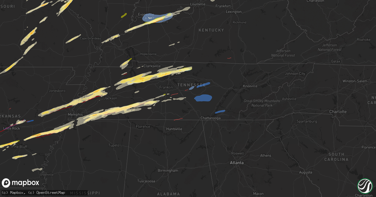
Hail Map in Tennessee on March 31, 2023
Get this storm
March 31 map
$229
one time, instant access
Download today. No call, no setup
Keep the $229
Bought the map and want the full workflow? Apply the entire $229 to a subscription within 7 days. None of it is wasted.
Every map, not just this one
This buys you this map. Subscription and you get every map we run, in the markets you choose from a few cities to whole states to nationwide. Plus real-time alerts the moment a storm fires.
Contact data
Name, contact info, occupancy, even credit band for addresses in the footprint. You go from where it hit to who to call.
Become the source they trust
Unlimited branding weather history reports on demand. You already have the documented answer ready for the property owner, and you are the one who showed up with it.
Property data and RoofTrace estimates
Pull up any address you have got, its value and the exact code rules for that jurisdiction, straight from One Click Code. Then RoofTrace estimates the squares, pitch, and roof value, priced the way you price.
Storm reports in Tennessee
Tennessee
| Date | Description |
|---|---|
| 03/31/20236:30 PM CDT | One church was destroyed and several homes were damaged near the intersection of fulton road and evins road west of brownsville. |
| 03/31/20236:28 PM CDT | A roof was blown off a trailer on pepper lane in brownsville. Some debris is on the road and in the trees. |
| 03/31/20236:28 PM CDT | Corrects previous tornado report from brownsville. A roof was blown off a trailer on pepper lane in brownsville. Some debris is on the road and in the trees. |
| 03/31/20236:19 PM CDT | Mesonet station tt531 covington. |
| 03/31/20236:19 PM CDT | Mesonet station tt531 covington. |
| 03/31/20236:15 PM CDT | Roof damage and windows blown out at chevrolet dealarship on highway 51 south of downtown covington. |
| 03/31/20236:15 PM CDT | The covington hospital has been damaged with patients being rerouted to lauderdale county. |
| 03/31/20236:12 PM CDT | Power lines and trees down on highway 51 south of covington blocking the road. |
| 03/31/20236:00 PM CDT | Large trees down near akins store road and highway 51. |
| 03/31/202311:59 AM CDT | Quarter size hail via mping. |
| 03/31/20235:24 AM CDT | Trees down county wide... Including several in etowah... Tn. |
| 03/31/20235:23 AM CDT | Trees down county wide. |
| 03/31/20235:00 AM CDT | Powerlines down and damaged utility pole near seymour. |
| 03/31/20234:50 AM CDT | Powerlines down on mint road... Trees reported down in the county. |
| 03/31/20234:50 AM CDT | One tree down near the talbott area. |
| 03/31/20234:40 AM CDT | Hamilton county reports trees and lines down throughout county... Time estimated from radar. |
| 03/31/20233:35 AM CDT | Multiple trees down near pine ridge road... Railroad crossing gate blown over at the railroad tracks. |
| 03/31/20233:30 AM CDT | Numerous trees were blown down around knox county. |
| 03/31/20233:11 AM CDT | 1 tree down on road near spring city. |
| 03/31/20233:10 AM CDT | Several trees down. |
| 03/31/20232:55 AM CDT | Over 20 uprooted trees along cumberland lakes drive near monterey. Time is estimated based on radar. |
| 03/31/20232:51 AM CDT | *** tornado possible *** multiple homes damaged |
| 03/31/20232:50 AM CDT | A tree fell onto the corner of a house on old spencer road. |
| 03/31/20232:35 AM CDT | Power lines... Utility poles... And trees down near milk plant road. Multiple other trees down across western and northern white county. |
| 03/31/20232:30 AM CDT | Two large oak trees uprooted along old state highway 111 about 6 miles away from fall creek falls state park southern entrance. |
| 03/31/20232:30 AM CDT | Multiple trees down along liberty road and john mccoin road near sparta. |
| 03/31/20232:20 AM CDT | Damage reported east of smithville off of highway 70 included downed and uprooted trees... Roof damage... Siding peeled off a barn... And busted windows. Time estimated |
| 03/31/20232:09 AM CDT | Mesonet station av589 short mountain. |
| 03/31/20231:52 AM CDT | Twitter report of house on old woodbury pike lost part of roof... Garages... Patio... And several trees. |
| 03/31/20231:42 AM CDT | Trees down on multiple locations: elam rd... Bivens hill rd and 9951 john bragg hwy. |
| 03/31/20231:39 AM CDT | Tree reportedly fell through house on troupe road. |
| 03/31/20231:31 AM CDT | *** tornado possible *** house damage...800f roof is gone |
| 03/31/20231:25 AM CDT | Several trees down near 10800 block of bunker hill road in rockvale... Tn. |
| 03/31/20231:20 AM CDT | Twitter reports of five train cars overturned one half mile south of nashville hwy and thick road intersection. Possible tornado. |
| 03/31/20231:19 AM CDT | *** tornado possible *** power lines down... Carport and fencing mangled... Building debris in road on beasley rd near tennessee central rd |
| 03/31/20231:19 AM CDT | *** tornado possible *** power lines down... Carport and fencing mangled... Building debris in road on beasley rd near tennessee central rd |
| 03/31/20231:08 AM CDT | Twitter report w/ photo. |
| 03/31/202312:57 AM CDT | Large maple tree down on browns road east of lafayette. Time estimated based on radar. |
| 03/31/202312:55 AM CDT | Roof of home collapsed and trees down on rose lane. Possible tornado. |
| 03/31/202312:51 AM CDT | . |
| 03/31/202312:51 AM CDT | A local report indicates 1.00 inch wind near 4 SE LAFAYETTE |
| 03/31/202312:47 AM CDT | A local report indicates 1.25 inch wind near 2 SSW MILLEDGEVILLE |
| 03/31/202312:45 AM CDT | Trees down in downtown hartsville at hayes st./rodgers st. |
| 03/31/202312:45 AM CDT | Hwy 10 and old lafayette rd. |
| 03/31/202312:33 AM CDT | Quarter size hail via mping. |
| 03/31/202312:29 AM CDT | *** tornado possible *** houses with heavy damage in the 2100 block of buffalo rd. |
| 03/31/202312:29 AM CDT | Ping pong ball sized hail via mping. |
| 03/31/202312:20 AM CDT | *** tornado possible *** trees and lines down... Road impassible and heavy residential structural damage along james whitehead rd. In grinders creek. |
| 03/31/202312:18 AM CDT | Twitter report w/ photo. |
| 03/31/202312:16 AM CDT | Trees uprooted or snapped; roof blown off. |
| 03/30/202311:59 PM CDT | Corrects previous hail report from 5 sw ridgetop. Quarter size hail via mping. |
| 03/30/202311:53 PM CDT | Trees and power lines down along hwy 128 just south of bryant ln. |
| 03/30/202311:35 PM CDT | One house near adamsville had its roof torn off. |
| 03/30/202311:25 PM CDT | A local report indicates a tornado near 2 WSW PICKWICK DAM |
| 03/30/202311:22 PM CDT | Corrects previous tornado report from 4 sw bethel springs. Power lines knocked down and guardrails thrown in the road. Numerous trees are down close to sky blue lane. |
| 03/30/202311:22 PM CDT | Power lines knocked down and guardrails thrown in the road. |
| 03/30/202311:18 PM CDT | Trees uprooted or snapped; roof blown off. |
| 03/30/202310:19 PM CDT | Trees and power poles down at green hills estate and hwy 218. Time estimated by radar. |
| 03/30/20239:56 PM CDT | Trees down near the intersection of dowty road and peach street on the north side of selmer. |
| 03/30/20239:55 PM CDT | Large oak tree uprooted and fell on house. |
| 03/30/20239:40 PM CDT | Reports of damage on buena vista road. |
| 03/30/20239:40 PM CDT | A wall collapsed on a house on flowers road near bethel springs. |
| 03/30/20238:47 PM CDT | Report from mping: 3-inch tree limbs broken; power poles broken. |
All States Impacted by Hail Map on March 31, 2023
Cities Impacted by Hail Map on March 31, 2023
- Iola, KS
- Colony, KS
- Welda, KS
- Concordia, MO
- Corder, MO
- Alma, MO
- Blackburn, MO
- Malta Bend, MO
- Miami, MO
- Marshall, MO
- Slater, MO
- Dalton, MO
- Brunswick, MO
- Salisbury, MO
- Clifton Hill, MO
- Mountain Home, AR
- Clarkridge, AR
- Gainesville, MO
- Udall, MO
- Tecumseh, MO
- Bakersfield, MO
- Caulfield, MO
- Worth, MO
- Grant City, MO
- Mount Ayr, IA
- Redding, IA
- Keytesville, MO
- Glasgow, MO
- Huntsville, MO
- Elk Creek, MO
- Yukon, MO
- Houston, MO
- Eunice, MO
- Summersville, MO
- Hartshorn, MO
- Raymondville, MO
- Salem, MO
- Butler, MO
- Jadwin, MO
- Kellerton, IA
- Lamoni, IA
- Grand River, IA
- Perry, MO
- Center, MO
- Monroe City, MO
- Hannibal, MO
- New London, MO
- Osceola, IA
- New Virginia, IA
- Hull, IL
- Plainville, IL
- Payson, IL
- Liberty, IL
- Cosby, MO
- Helena, MO
- Union Star, MO
- Clarksdale, MO
- Amity, MO
- Clayton, IL
- Camp Point, IL
- Pottersville, MO
- West Plains, MO
- Maysville, MO
- Pattonsburg, MO
- Weatherby, MO
- Kincaid, KS
- Everton, AR
- Hatfield, MO
- Parker, KS
- Centerville, KS
- Fontana, KS
- Kirby, AR
- Langley, AR
- Fayette, MO
- Windsor, MO
- Oregon, MO
- Holden, MO
- Centerview, MO
- Odessa, MO
- Stoutsville, MO
- Higbee, MO
- Fillmore, MO
- Excello, MO
- Jacksonville, MO
- Ravenwood, MO
- Sheridan, MO
- Conception Junction, MO
- Stanberry, MO
- Clyde, MO
- Caddo Gap, AR
- Glenwood, AR
- Midway, AR
- Stewartsville, MO
- Coffey, MO
- Moberly, MO
- Garnett, KS
- Piqua, KS
- Neosho Falls, KS
- Lakeview, AR
- Gilliam, MO
- Higginsville, MO
- Yellville, AR
- Flippin, AR
- Bull Shoals, AR
- Perryville, AR
- Blairstown, MO
- Clinton, MO
- Chilhowee, MO
- Leeton, MO
- Timewell, IL
- Pearcy, AR
- Hot Springs National Park, AR
- Royal, AR
- Osborn, MO
- Cameron, MO
- Winston, MO
- Altamont, MO
- Gallatin, MO
- Jameson, MO
- Woodburn, IA
- Knob Noster, MO
- Warrensburg, MO
- La Monte, MO
- Whiteman Air Force Base, MO
- Williamstown, MO
- Saint Patrick, MO
- Kahoka, MO
- Monticello, MO
- Montrose, MO
- Osceola, MO
- Alexandria, MO
- Deepwater, MO
- Rushville, IL
- Astoria, IL
- Vermont, IL
- Hughesville, MO
- Sedalia, MO
- Lorimor, IA
- Macksburg, IA
- Winterset, IA
- Afton, IA
- Thayer, IA
- Lonsdale, AR
- Murray, IA
- Benton, AR
- Lucas, IA
- Lacona, IA
- Milo, IA
- Pleasantville, IA
- Sumner, TX
- Paris, TX
- Houstonia, MO
- Powderly, TX
- Blossom, TX
- Truro, IA
- Ipava, IL
- Lewistown, IL
- Nelson, MO
- Van Wert, IA
- Cuba, IL
- Canton, IL
- Bryant, IL
- Blackwater, MO
- Weldon, IA
- Greenbrier, AR
- Quitman, AR
- Bosworth, MO
- Bogard, MO
- Hale, MO
- Saint David, IL
- Calhoun, MO
- Jamesport, MO
- Gilman City, MO
- Alexander, AR
- Lincoln, MO
- Little Rock, AR
- Spickard, MO
- Trenton, MO
- Princeton, MO
- Lucerne, MO
- Powersville, MO
- Kemp, TX
- Ennis, TX
- Monroe, IA
- Chatfield, TX
- Mabank, TX
- Detroit, TX
- North Little Rock, AR
- Franklin, MO
- New Franklin, MO
- Knoxville, IA
- Tremont, IL
- Swan, IA
- Otley, IA
- Reasnor, IA
- Newton, IA
- Sherwood, AR
- Chariton, IA
- Eustace, TX
- Granger, IA
- Polk City, IA
- Slater, IA
- Sheldahl, IA
- Madrid, IA
- Kelley, IA
- Ames, IA
- Sumner, MO
- Jacksonville, AR
- Trivoli, IL
- Hanna City, IL
- Glasford, IL
- Brookfield, MO
- Mapleton, IL
- Laclede, MO
- Kellogg, IA
- Peoria, IL
- Manito, IL
- Chillicothe, MO
- Kingston Mines, IL
- Unionville, MO
- Seymour, IA
- Centerville, IA
- Mystic, IA
- Morton, IL
- Mackinaw, IL
- Deer Creek, IL
- Broken Bow, OK
- Otterville, MO
- Bunceton, MO
- Bethel, OK
- Mercer, MO
- Corydon, IA
- Gilbert, IA
- Boone, IA
- Cole Camp, MO
- Story City, IA
- Stover, MO
- Florence, MO
- Gilman, IA
- Versailles, MO
- Fortuna, MO
- Syracuse, MO
- Tipton, MO
- Melcher Dallas, IA
- Harrisburg, MO
- Clark, MO
- East Peoria, IL
- Creve Coeur, IL
- Cabot, AR
- Washington, IL
- Peoria Heights, IL
- Edwards, IL
- Austin, AR
- Ward, AR
- Chillicothe, IL
- Mossville, IL
- Cincinnati, IA
- Metamora, IL
- Bucklin, MO
- Moravia, IA
- Roland, IA
- Ethel, MO
- Jewell, IA
- Randall, IA
- Boonville, MO
- Blakesburg, IA
- Unionville, IA
- Wooldridge, MO
- Rocheport, MO
- Albia, IA
- Centralia, MO
- Madison, MO
- Eureka, IL
- Roanoke, IL
- Paris, MO
- La Plata, MO
- Elmer, MO
- Kirksville, MO
- Benson, IL
- Columbia, MO
- Ellsworth, IA
- Radcliffe, IA
- Jamestown, MO
- Prairie Home, MO
- Alden, IA
- Williams, IA
- Ottumwa, IA
- Montour, IA
- Marshalltown, IA
- California, MO
- Toledo, IA
- Tama, IA
- Garwin, IA
- Pella, IA
- Sully, IA
- Lynnville, IA
- Mora, MO
- Minonk, IL
- Gibbs, MO
- Brashear, MO
- Mount Vernon, TX
- Mount Pleasant, TX
- Talco, TX
- Cookville, TX
- Udell, IA
- Mineral Springs, AR
- Saratoga, AR
- Columbus, AR
- Ozan, AR
- Nashville, AR
- Hedrick, IA
- Streator, IL
- Flanagan, IL
- Long Point, IL
- Dana, IL
- Kerens, TX
- Malakoff, TX
- Pontiac, IL
- Graymont, IL
- Cornell, IL
- Wortham, TX
- Richland, TX
- Streetman, TX
- Grinnell, IA
- Searsboro, IA
- Trinidad, TX
- Athens, TX
- Montezuma, IA
- Larue, TX
- Carlisle, AR
- Rio, IL
- Galesburg, IL
- Des Arc, AR
- Kamrar, IA
- Holliday, MO
- Hazen, AR
- Oneida, IL
- Lu Verne, IA
- Algona, IA
- Corwith, IA
- Wesley, IA
- Wyoming, IL
- Speer, IL
- Toulon, IL
- Bradford, IL
- Buda, IL
- Tiskilwa, IL
- Hallsville, MO
- Ollie, IA
- Sigourney, IA
- Auxvasse, MO
- Martinsburg, IA
- Princeton, IL
- Thompson, MO
- Mexico, MO
- McCaskill, AR
- Britt, IA
- Malcom, IA
- Frankston, TX
- Palmyra, MO
- Brooklyn, IA
- Wellsville, MO
- Montgomery City, MO
- Middletown, MO
- Coolidge, TX
- Vandalia, MO
- Mexia, TX
- Bowling Green, MO
- Curryville, MO
- Fairfield, TX
- Harper, IA
- Rush Hill, MO
- Ionia, IA
- New Hampton, IA
- Alta Vista, IA
- Laddonia, MO
- Elma, IA
- Teague, TX
- Benton City, MO
- Martinsburg, MO
- Blackstone, IL
- Charles City, IA
- Colwell, IA
- Wenona, IL
- Rutland, IL
- Orchard, IA
- Osage, IA
- Ancona, IL
- Ransom, IL
- Kinsman, IL
- Dwight, IL
- Garner, IA
- Verona, IL
- Gardner, IL
- Mazon, IL
- Braceville, IL
- Coal City, IL
- Odell, IL
- Louisiana, MO
- Frankford, MO
- Farber, MO
- Barry, IL
- Kinderhook, IL
- Malden, IL
- Milan, MO
- Altona, IL
- Woodhull, IL
- Cambridge, IL
- Bishop Hill, IL
- Galva, IL
- Kewanee, IL
- Annawan, IL
- Sheffield, IL
- Mineral, IL
- Chelsea, IA
- Neponset, IL
- Wyanet, IL
- Manlius, IL
- Walnut, IL
- Keota, IA
- Wellman, IA
- Parnell, IA
- Erie, IL
- Lyndon, IL
- Morrison, IL
- Fenton, IL
- Sterling, IL
- Tinley Park, IL
- Matteson, IL
- Frankfort, IL
- Richton Park, IL
- Bullard, TX
- Flint, TX
- Beecher, IL
- Cedar Lake, IN
- Wynne, AR
- Grant Park, IL
- Lowell, IN
- Crown Point, IN
- Merrillville, IN
- Dyer, IN
- Saint John, IN
- Crete, IL
- Colt, AR
- Arkadelphia, AR
- Kalona, IA
- Oxford, IA
- Donaldson, AR
- Malvern, AR
- Leola, AR
- Spring Valley, IL
- Arlington, IL
- La Moille, IL
- Harvey, IA
- Tracy, IA
- Bussey, IA
- Leighton, IA
- Mendota, IL
- Earlville, IL
- Triumph, IL
- New Sharon, IA
- Leland, IL
- Baylis, IL
- South English, IA
- North English, IA
- Versailles, IL
- Mount Sterling, IL
- Solo, MO
- Tennessee Colony, TX
- Rolla, MO
- Parkin, AR
- Saint James, MO
- Iowa City, IA
- Cuba, MO
- Licking, MO
- Coralville, IA
- Solon, IA
- North Liberty, IA
- Beardstown, IL
- Blairstown, IA
- Luzerne, IA
- Keystone, IA
- Van Horne, IA
- Hebron, IN
- Earle, AR
- Schererville, IN
- Valparaiso, IN
- Hobart, IN
- Wanatah, IN
- Union Mills, IN
- Hanna, IN
- Garrison, IA
- Dysart, IA
- Vinton, IA
- Boone Grove, IN
- Kouts, IN
- West Branch, IA
- Hamlet, IN
- Westville, IN
- Kingsford Heights, IN
- La Porte, IN
- Portage, IN
- Walkerton, IN
- Sheridan, AR
- Prattsville, AR
- Park Forest, IL
- Olympia Fields, IL
- Country Club Hills, IL
- Chicago Heights, IL
- Flossmoor, IL
- Hazel Crest, IL
- Glenwood, IL
- Homewood, IL
- Ohio, IL
- Sublette, IL
- Van Orin, IL
- West Brooklyn, IL
- Compton, IL
- Sullivan, MO
- Frederick, IL
- Virginia, IL
- Arenzville, IL
- Pittsfield, IL
- Griggsville, IL
- Winchester, IL
- Bluffs, IL
- Jacksonville, IL
- Chapin, IL
- Tipton, IA
- Genoa, WI
- Bennett, IA
- Viroqua, WI
- Chaseburg, WI
- Stoddard, WI
- Eureka, MO
- Nebo, IL
- House Springs, MO
- Chesterfield, MO
- Osceola, AR
- Augusta, IL
- La Prairie, IL
- Lomax, IL
- Fisk, MO
- High Ridge, MO
- Muscatine, IA
- Foley, MO
- Saint Charles, MO
- Letts, IA
- Wapello, IA
- Saint Peters, MO
- Hillsboro, MO
- Hamburg, IL
- Sperry, IA
- La Harpe, IL
- Dudley, MO
- Mediapolis, IA
- Marquand, MO
- Wappapello, MO
- West Liberty, IA
- Greenville, MO
- Blytheville, AR
- Valles Mines, MO
- Ballwin, MO
- Plymouth, IL
- Columbus Junction, IA
- Batchtown, IL
- Gladstone, IL
- McGee, MO
- De Soto, MO
- Drummonds, TN
- Kennett, MO
- Lowndes, MO
- New Salem, IL
- Barnhart, MO
- Campbell, MO
- Brussels, IL
- Bonne Terre, MO
- O'Fallon, MO
- Puxico, MO
- Farmington, MO
- Fredericktown, MO
- Piggott, AR
- Hornersville, MO
- Festus, MO
- Broseley, MO
- Golden, IL
- Carthage, IL
- Nichols, IA
- Golden Eagle, IL
- Dallas City, IL
- Burlington, IA
- Carman, IL
- White Hall, AR
- Jefferson, AR
- Sherrill, AR
- Lakeville, IN
- North Liberty, IN
- Plymouth, IN
- Bremen, IN
- South Bend, IN
- Potosi, MO
- Steelville, MO
- Wheatland, IA
- Bourbon, MO
- Clarence, IA
- Lowden, IA
- Wakarusa, IN
- Mishawaka, IN
- Richwoods, MO
- Elkhart, IN
- Texarkana, TX
- Texarkana, AR
- Elberon, IA
- San Pierre, IN
- North Judson, IN
- Calamus, IA
- Knox, IN
- Garland City, AR
- Grovertown, IN
- Munford, TN
- Brighton, TN
- Paw Paw, IL
- Steward, IL
- Ladora, IA
- Hartwick, IA
- Victor, IA
- Belle Plaine, IA
- Marengo, IA
- Covington, TN
- Goshen, IN
- Middle Amana, IA
- Walford, IA
- Norway, IA
- Amana, IA
- Swisher, IA
- Ely, IA
- Fairfax, IA
- Cedar Rapids, IA
- South Amana, IA
- Watkins, IA
- Mount Vernon, IA
- Atkins, IA
- Lisbon, IA
- Newhall, IA
- Marion, IA
- Monticello, IA
- Anamosa, IA
- Toddville, IA
- Hiawatha, IA
- Langworthy, IA
- Shellsburg, IA
- Springville, IA
- Central City, IA
- Palo, IA
- Robins, IA
- Alburnett, IA
- Martelle, IA
- Humphrey, AR
- Wabbaseka, AR
- De Witt, IA
- Delmar, IA
- Charlotte, IA
- Manchester, IA
- Winthrop, IA
- Vining, IA
- Urbana, IA
- Delhi, IA
- Ryan, IA
- Center Point, IA
- Masonville, IA
- Prairieburg, IA
- Hopkinton, IA
- Walker, IA
- Coggon, IA
- La Crosse, WI
- Coon Valley, WI
- Pleasant Plains, IL
- Stuttgart, AR
- Brownsville, TN
- Ripley, TN
- Preston, IA
- Bryant, IA
- Davenport, IA
- Bettendorf, IA
- Pleasant Valley, IA
- Mount Pleasant, IA
- Salem, IA
- West Point, IA
- West Burlington, IA
- Wever, IA
- Danville, IA
- New London, IA
- Middletown, IA
- Turrell, AR
- Stronghurst, IL
- Yarmouth, IA
- Biggsville, IL
- Oquawka, IL
- Gerlaw, IL
- Morning Sun, IA
- Monmouth, IL
- Keithsburg, IL
- Little York, IL
- Mount Union, IA
- Seaton, IL
- New Windsor, IL
- North Henderson, IL
- Aledo, IL
- Oakville, IA
- Alexis, IL
- Nappanee, IN
- New Boston, IL
- Joy, IL
- Lynn Center, IL
- Viola, IL
- Andover, IL
- Alpha, IL
- Ophiem, IL
- Moline, IL
- Winfield, IA
- Geneseo, IL
- Osco, IL
- Taylor Ridge, IL
- Matherville, IL
- Reynolds, IL
- East Moline, IL
- Sherrard, IL
- Colona, IL
- Silvis, IL
- Orion, IL
- Carbon Cliff, IL
- Milan, IL
- Coal Valley, IL
- Illinois City, IL
- Rock Island, IL
- Andalusia, IL
- Blue Grass, IA
- Fruitland, IA
- Buffalo, IA
- Grandview, IA
- Sherman, IL
- Casscoe, AR
- Roe, AR
- Clarendon, AR
- Holly Grove, AR
- Williamsville, IL
- Delaware, IA
- Worthington, IA
- Farley, IA
- Cascade, IA
- Earlville, IA
- Dubuque, IA
- Dyersville, IA
- Durango, IA
- Epworth, IA
- New Vienna, IA
- Sherrill, IA
- Holy Cross, IA
- Cassville, WI
- North Buena Vista, IA
- Luxemburg, IA
- Guttenberg, IA
- Potosi, WI
- Mauston, WI
- Wisconsin Dells, WI
- Adams, WI
- Friendship, WI
- Riverton, IL
- Arkdale, WI
- Saint Anthony, IA
- Clemons, IA
- New Providence, IA
- Union, IA
- Geneva, IA
- Thornton, IA
- Clear Lake, IA
- Meservey, IA
- State Center, IA
- Hamilton, IL
- Gilson, IL
- Columbia, IA
- Ackley, IA
- Iowa Falls, IA
- Nashua, IA
- Dows, IA
- Buckingham, IA
- Traer, IA
- Manhattan, IL
- Collins, IA
- Eddyville, IA
- Grimes, IA
- Dallas Center, IA
- King City, MO
- Albany, MO
- Darlington, MO
- La Belle, MO
- Lewistown, MO
- Clarence, MO
- Mark, IL
- Hennepin, IL
- Granville, IL
- Wells, MN
- New Richland, MN
- Tampico, IL
- Prophetstown, IL
- Wilmington, IL
- Woden, IA
- Titonka, IA
- Buffalo Center, IA
- Sheffield, IA
- Latimer, IA
- Alexander, IA
- Clubb, MO
- Marble Hill, MO
- Glenallen, MO
- Millersville, MO
- Greene, IA
- Indianola, IA
- Warsaw, MO
- Murfreesboro, AR
- Delight, AR
- Lockesburg, AR
- Hampton, IL
- Port Byron, IL
- Le Claire, IA
- Rapids City, IL
- Hillsdale, IL
- Naples, TX
- Rhodes, IA
- Hermann, MO
- Anabel, MO
- Eolia, MO
- Silex, MO
- Novinger, MO
- New Boston, MO
- Green Castle, MO
- Green City, MO
- Humphreys, MO
- Knox City, MO
- Newark, MO
- Steamboat Rock, IA
- Liberty, MO
- Lowpoint, IL
- Holt, MO
- Plattsburg, MO
- Lathrop, MO
- Cainsville, MO
- Lancaster, MO
- Bloomfield, IA
- Atlanta, MO
- Peotone, IL
- Monee, IL
- University Park, IL
- Janesville, IA
- Waverly, IA
- Garland, TX
- Rowlett, TX
- Melrose, IA
- Lovilia, IA
- Vallonia, IN
- Campbellsburg, IN
- Salem, IN
- Scottsburg, IN
- Washburn, IL
- Toluca, IL
- Baxter, IA
- Carrollton, MO
- Quincy, IL
- Royse City, TX
- Rockwall, TX
- Reddick, IL
- Essex, IL
- Gower, MO
- Bremond, TX
- Reagan, TX
- Kosse, TX
- Marlin, TX
- Pekin, IL
- Laredo, MO
- Shannon City, IA
- Harwood, MO
- Nevada, MO
- El Dorado Springs, MO
- Walker, MO
- Rich Hill, MO
- Tyler, TX
- Arp, TX
- Philadelphia, MO
- Emden, MO
- Eddy, TX
- Media, IL
- Kirkwood, IL
- Tatum, TX
- Henderson, TX
- Beckville, TX
- Hamilton, IA
- Gassville, AR
- Atkinson, IL
- Wataga, IL
- Beaufort, MO
- Saint Clair, MO
- Momence, IL
- Faucett, MO
- Dearborn, MO
- Steedman, MO
- Williamsburg, MO
- Portland, MO
- Fulton, MO
- Ackworth, IA
- Galt, MO
- Moulton, IA
- Plano, IA
- Bland, MO
- Belle, MO
- Edina, MO
- Easton, MO
- Appleton City, MO
- Rockville, MO
- Green Ridge, MO
- Johnsonville, IL
- Xenia, IL
- Johnston, IA
- Urbandale, IA
- Clive, IA
- Waukee, IA
- Smithville, OK
- Rattan, OK
- Hatfield, AR
- Watson, OK
- Cove, AR
- Chatsworth, IL
- Cullom, IL
- Novelty, MO
- Marshall, TX
- Murchison, TX
- Flora, IL
- Rinard, IL
- Iuka, IL
- Pickton, TX
- Derby, IA
- Troy, TX
- Moody, TX
- Knoxville, IL
- Exline, IA
- Bethel, MO
- Shelbyville, MO
- Leonard, MO
- Jessieville, AR
- Fouke, AR
- Queen City, TX
- New Blaine, AR
- Chebanse, IL
- Herscher, IL
- Dawson, TX
- Montalba, TX
- Purdon, TX
- Dahinda, IL
- Laura, IL
- Cherry, IL
- Williamsfield, IL
- Troy Grove, IL
- Corsicana, TX
- Powell, TX
- Pollock, MO
- De Kalb, TX
- Lonoke, AR
- Willow Springs, MO
- Cabool, MO
- Blevins, AR
- Prescott, AR
- Rockport, IL
- Durham, MO
- Canton, MO
- Taylor, MO
- Maywood, MO
- Ewing, MO
- La Grange, MO
- Mountain View, MO
- Pomona, MO
- Sweet Springs, MO
- Bellflower, MO
- Tyronza, AR
- Gilmore, AR
- McCrory, AR
- Augusta, AR
- Cherry Valley, AR
- Frenchmans Bayou, AR
- Burlison, TN
- Bassett, AR
- Joiner, AR
- Bonnerdale, AR
- Brookston, TX
- Hurdland, MO
- Baring, MO
- Troup, TX
- Reklaw, TX
- Jacksonville, TX
- Laneville, TX
- Tingley, IA
- Union, MO
- Eminence, MO
- Birch Tree, MO
- Ashdown, AR
- Bethany, MO
- Italy, TX
- Milford, TX
- Maxwell, IA
- Little Rock Air Force Base, AR
- Kankakee, IL
- Wilton, AR
- Okolona, AR
- Antoine, AR
- Friendship, AR
- Amity, AR
- Kingdom City, MO
- Pleasant Hill, IL
- Clarksburg, MO
- New Canton, IL
- Carthage, AR
- Davisville, MO
- Viburnum, MO
- Batavia, IA
- Packwood, IA
- Brashear, TX
- Emory, TX
- Point, TX
- El Paso, IL
- Clifton, IL
- Piper City, IL
- Kempton, IL
- Schell City, MO
- Hayesville, IA
- Richland, IA
- Ridgeway, MO
- Newtown, MO
- Harris, MO
- Promise City, IA
- Kearney, MO
- Louisville, IL
- Clutier, IA
- Leon, IA
- Decatur, IA
- Denver, MO
- Killduff, IA
- Ellston, IA
- Barry, TX
- Frost, TX
- Blooming Grove, TX
- Palestine, TX
- Diagonal, IA
- Saint Joseph, MO
- Tularosa, NM
- Morris, IL
- Sulphur Springs, TX
- Como, TX
- Braidwood, IL
- Smithfield, IL
- Camden, IL
- Urich, MO
- Littleton, IL
- Secor, IL
- Melbourne, IA
- Kilgore, TX
- Chandler, TX
- Brownsboro, TX
- Overton, TX
- Groveland, IL
- Pilot Grove, MO
- Sturgeon, MO
- Smithshire, IL
- Grapevine, AR
- Alamogordo, NM
- Dierks, AR
- Simms, TX
- Saltillo, TX
- New Boston, TX
- Omaha, TX
- Putnam, IL
- Chandlerville, IL
- Concord, IL
- Ashland, IL
- Middlebury, IN
- Bristol, IN
- Almyra, AR
- Marvell, AR
- Valmeyer, IL
- Marianna, AR
- Poplar Grove, AR
- Aubrey, AR
- Waterloo, IL
- Shipshewana, IN
- Howe, IN
- Columbia, IL
- Sturgis, MI
- Lexa, AR
- Belleville, IL
- Millstadt, IL
- O'Fallon, IL
- Fairview Heights, IL
- East Saint Louis, IL
- Gary, TX
- Tenaha, TX
- Joaquin, TX
- Burr Oak, MI
- Bronson, MI
- Hooppole, IL
- Deer Grove, IL
- Harmon, IL
- New Bedford, IL
- Amboy, IL
- Rock Falls, IL
- Milledgeville, IL
- Dixon, IL
- Woosung, IL
- Eldena, IL
- Mount Morris, IL
- Oregon, IL
- Polo, IL
- Watervliet, MI
- Benton Harbor, MI
- Hartford, MI
- Decatur, MI
- Lawrence, MI
- Paw Paw, MI
- Bangor, MI
- Gobles, MI
- Shannon, IL
- Baileyville, IL
- Angola, IN
- Fremont, IN
- Montgomery, MI
- Coldwater, MI
- Reading, MI
- Camden, MI
- Hillsdale, MI
- Pittsford, MI
- Hudson, MI
- Osseo, MI
- Tunica, MS
- Dundee, MS
- Montpelier, IA
- Cordova, IL
- Albany, IL
- Fulton, IL
- Timpson, TX
- Riverside, IA
- Hills, IA
- Bells, TN
- Franklin Grove, IL
- Ashton, IL
- Rochelle, IL
- Chana, IL
- Brickeys, AR
- Platteville, WI
- Lancaster, WI
- Rewey, WI
- Crockett, TX
- Clinton, IL
- Maroa, IL
- Weldon, IL
- Lane, IL
- Dewitt, IL
- Farmer City, IL
- De Land, IL
- Lee, IL
- Mansfield, IL
- Mahomet, IL
- Quincy, MI
- Bellflower, IL
- Fisher, IL
- Litchfield, MI
- Allen, MI
- Kennard, TX
- Dewey, IL
- Thomasboro, IL
- Champaign, IL
- Rantoul, IL
- Mattawan, MI
- Apple Springs, TX
- Robinsonville, MS
- Foosland, IL
- Paxton, IL
- Ludlow, IL
- Rockford, IL
- Byron, IL
- Davis Junction, IL
- Stillman Valley, IL
- Miles, IA
- Saint Louis, MO
- Venice, IL
- Granite City, IL
- Lovejoy, IL
- Madison, IL
- East Carondelet, IL
- Dupo, IL
- Caseyville, IL
- Glen Carbon, IL
- Maryville, IL
- Collinsville, IL
- Holcomb, IL
- Lindenwood, IL
- Cherry Valley, IL
- Roscoe, IL
- Machesney Park, IL
- Monroe Center, IL
- Loves Park, IL
- Caledonia, IL
- Morrisonville, IL
- Palmer, IL
- Taylorville, IL
- Durand, IL
- Leaf River, IL
- German Valley, IL
- Freeport, IL
- Pecatonica, IL
- Forreston, IL
- Winnebago, IL
- Rockton, IL
- Ridott, IL
- Lanark, IL
- Mount Carroll, IL
- Chadwick, IL
- Thomson, IL
- Assumption, IL
- Stonington, IL
- Moweaqua, IL
- Savanna, IL
- Princeton, IA
- Camanche, IA
- Clinton, IA
- Blue Mound, IL
- Macon, IL
- Walcott, IA
- Long Grove, IA
- Eldridge, IA
- Esmond, IL
- Moro, IL
- Bethalto, IL
- Cottage Hills, IL
- East Alton, IL
- Wood River, IL
- Shabbona, IL
- Malta, IL
- Ottawa, IL
- Sheridan, IL
- Waterman, IL
- Serena, IL
- Clare, IL
- Kirkland, IL
- Belvidere, IL
- Dekalb, IL
- Clayton, MI
- Edwardsville, IL
- Hanover, MI
- Jonesville, MI
- Alhambra, IL
- Worden, IL
- Troy, IL
- Hamel, IL
- Dorsey, IL
- New Douglas, IL
- Staunton, IL
- Horton, MI
- Jackson, MI
- Marine, IL
- Lebanon, IL
- Saint Jacob, IL
- Sharon, WI
- Capron, IL
- South Beloit, IL
- Harvard, IL
- Genoa, IL
- Sycamore, IL
- Somonauk, IL
- Garden Prairie, IL
- Poplar Grove, IL
- Kingston, IL
- Hinckley, IL
- Hampshire, IL
- Maple Park, IL
- Marengo, IL
- Sandwich, IL
- Cortland, IL
- Dalton City, IL
- Elburn, IL
- Big Rock, IL
- Sugar Grove, IL
- Plano, IL
- Elgin, IL
- Burlington, IL
- Saint Charles, IL
- Clinton, WI
- Union, IL
- Lake In The Hills, IL
- Woodstock, IL
- Huntley, IL
- Crystal Lake, IL
- Gilberts, IL
- Hernando, MS
- Hillsboro, IL
- Sorento, IL
- Pocahontas, IL
- Panama, IL
- Donnellson, IL
- Highland, IL
- Greenville, IL
- Lake Cormorant, MS
- Freeburg, IL
- Mascoutah, IL
- Scott Air Force Base, IL
- Nesbit, MS
- Horn Lake, MS
- Dundee, IL
- Wonder Lake, IL
- Walworth, WI
- Hebron, IL
- Fontana, WI
- Lake Geneva, WI
- Rankin, IL
- Gifford, IL
- Penfield, IL
- Stockton, IL
- Warren, IL
- Elizabeth, IL
- Cissna Park, IL
- Hoopeston, IL
- Lena, IL
- Nora, IL
- Monroe, WI
- Juda, WI
- McConnell, IL
- Orangeville, IL
- Dakota, IL
- Winslow, IL
- South Wayne, WI
- Browntown, WI
- Brodhead, WI
- Orfordville, WI
- Evansville, WI
- Janesville, WI
- Albany, WI
- Trenton, IL
- Summerfield, IL
- Fillmore, IL
- Coffeen, IL
- Mulberry Grove, IL
- Wellington, IL
- Smithboro, IL
- Kalamazoo, MI
- Delavan, WI
- Elkhorn, WI
- Olive Branch, MS
- Byhalia, MS
- Millington, IL
- Seneca, IL
- Newark, IL
- Yorkville, IL
- Millbrook, IL
- Peru, IL
- Seatonville, IL
- Dalzell, IL
- Ladd, IL
- Utica, IL
- Dover, IL
- La Salle, IL
- Collierville, TN
- Marseilles, IL
- Wedron, IL
- Rossville, TN
- Darien, WI
- Beloit, WI
- Channahon, IL
- Minooka, IL
- Montgomery, IL
- Joliet, IL
- Oswego, IL
- Crest Hill, IL
- Elwood, IL
- Shorewood, IL
- Plainfield, IL
- Lockport, IL
- New Lenox, IL
- Bristol, IL
- Aurora, IL
- Keyesport, IL
- Ramsey, IL
- Breese, IL
- Lemont, IL
- Bolingbrook, IL
- Woodridge, IL
- Naperville, IL
- North Aurora, IL
- Romeoville, IL
- Orland Park, IL
- Mokena, IL
- Batavia, IL
- Palos Park, IL
- Homer Glen, IL
- Hickory Hills, IL
- Cary, IL
- Des Plaines, IL
- Wasco, IL
- Algonquin, IL
- Willowbrook, IL
- Bensenville, IL
- Carpentersville, IL
- La Grange, IL
- Clarendon Hills, IL
- Whitewater, WI
- Mooseheart, IL
- Lyons, IL
- Broadview, IL
- Justice, IL
- Riverside, IL
- Hoffman Estates, IL
- Addison, IL
- La Grange Park, IL
- Warrenville, IL
- Wood Dale, IL
- Maywood, IL
- Wheaton, IL
- Western Springs, IL
- Hanover Park, IL
- Rolling Meadows, IL
- Glendale Heights, IL
- Darien, IL
- Lisle, IL
- Fox River Grove, IL
- Berkeley, IL
- Hillside, IL
- Geneva, IL
- Carol Stream, IL
- Mount Prospect, IL
- Oak Brook, IL
- Melrose Park, IL
- Palos Hills, IL
- River Grove, IL
- Downers Grove, IL
- Park Ridge, IL
- Bellwood, IL
- Avalon, WI
- Forest Park, IL
- Schiller Park, IL
- Medinah, IL
- Stone Park, IL
- Arlington Heights, IL
- Schaumburg, IL
- River Forest, IL
- Itasca, IL
- Elk Grove Village, IL
- Winfield, IL
- Prospect Heights, IL
- Hinsdale, IL
- Villa Park, IL
- Palatine, IL
- Bloomingdale, IL
- West Chicago, IL
- Roselle, IL
- Glenview, IL
- Williams Bay, WI
- Wayne, IL
- Summit Argo, IL
- Lombard, IL
- Westmont, IL
- Brookfield, IL
- Chicago, IL
- Hines, IL
- Bartlett, IL
- South Elgin, IL
- Willow Springs, IL
- Franklin Park, IL
- Glen Ellyn, IL
- Streamwood, IL
- Barrington, IL
- Elmhurst, IL
- Westchester, IL
- Wauconda, IL
- Vernon Hills, IL
- Wheeling, IL
- Lincolnshire, IL
- Grayslake, IL
- Round Lake, IL
- Buffalo Grove, IL
- Ringwood, IL
- Libertyville, IL
- Lake Forest, IL
- Island Lake, IL
- Mundelein, IL
- Lake Zurich, IL
- Fox Lake, IL
- Ingleside, IL
- Mchenry, IL
- Northbrook, IL
- Deerfield, IL
- Twin Lakes, WI
- Gurnee, IL
- Antioch, IL
- Genoa City, WI
- East Troy, WI
- Richmond, IL
- Zion, IL
- Waukegan, IL
- Palmyra, WI
- Bristol, WI
- Trevor, WI
- Spring Grove, IL
- Lake Villa, IL
- Eagle, WI
- Wadsworth, IL
- Springfield, WI
- Rochester, WI
- Salem, WI
- Big Bend, WI
- Burlington, WI
- Muskego, WI
- Silver Lake, WI
- Waukesha, WI
- Franksville, WI
- Mukwonago, WI
- Kansasville, WI
- Pleasant Prairie, WI
- Union Grove, WI
- Waterford, WI
- Wilmot, WI
- Kenosha, WI
- Aviston, IL
- Carlyle, IL
- Milford, IL
- Shobonier, IL
- Vandalia, IL
- Brownstown, IL
- Battle Creek, MI
- Bellevue, MI
- Red Banks, MS
- Bridgeview, IL
- Lake Bluff, IL
- Elmwood Park, IL
- Harwood Heights, IL
- Niles, IL
- North Chicago, IL
- Holly Springs, MS
- Lamar, MS
- Moscow, TN
- Great Lakes, IL
- Highland Park, IL
- Skokie, IL
- Golf, IL
- Winnetka, IL
- Wilmette, IL
- Morton Grove, IL
- Highwood, IL
- Glencoe, IL
- Calumet City, IL
- Hometown, IL
- Chicago Ridge, IL
- South Holland, IL
- Hammond, IN
- Whiting, IN
- Evanston, IL
- Berwyn, IL
- Alsip, IL
- Worth, IL
- Harvey, IL
- Midlothian, IL
- Dolton, IL
- Markham, IL
- Burbank, IL
- Blue Island, IL
- Robbins, IL
- Posen, IL
- Cicero, IL
- Oak Forest, IL
- Evergreen Park, IL
- Oak Lawn, IL
- Palos Heights, IL
- Riverdale, IL
- Kenilworth, IL
- Lincolnwood, IL
- Oak Park, IL
- Crestwood, IL
- Ambia, IN
- Earl Park, IN
- Fowler, IN
- Dieterich, IL
- Saint Elmo, IL
- Eldorado, IL
- Norris City, IL
- Broughton, IL
- Omaha, IL
- Boswell, IN
- Remington, IN
- Goodland, IN
- Oxford, IN
- Brookston, IN
- Carmi, IL
- Otterbein, IN
- Tolono, IL
- Ivesdale, IL
- Savoy, IL
- Philo, IL
- Sadorus, IL
- Urbana, IL
- Mt Zion, IL
- Decatur, IL
- Saint Joseph, IL
- Ogden, IL
- Michigan City, MS
- Winthrop Harbor, IL
- Sturtevant, WI
- Ingraham, IL
- Wheeler, IL
- Newton, IL
- Thornton, IL
- Steger, IL
- East Chicago, IN
- Lansing, IL
- Watson, IL
- Farina, IL
- Mason, IL
- Edgewood, IL
- Altamont, IL
- Saint Peter, IL
- Williamsburg, IA
- Cedar, IA
- Fremont, IA
- Oskaloosa, IA
- Willow Hill, IL
- Gary, IN
- Highland, IN
- Munster, IN
- Griffith, IN
- Lake Station, IN
- Wolcott, IN
- West Liberty, IL
- Oblong, IL
- Chesterton, IN
- Saulsbury, TN
- Chrisman, IL
- Ridge Farm, IL
- Dana, IN
- Cayuga, IN
- Middleton, TN
- Kingman, IN
- Perrysville, IN
- Bolivar, TN
- Southaven, MS
- Robinson, IL
- Stoy, IL
- Hutsonville, IL
- Sullivan, IN
- Palestine, IL
- Merom, IN
- Gates, TN
- Halls, TN
- Alamo, TN
- Friendship, TN
- Shelburn, IN
- Covington, IN
- Crawfordsville, IN
- Veedersburg, IN
- Waynetown, IN
- Hillsboro, IN
- Humboldt, TN
- Manteno, IL
- Bourbonnais, IL
- Michigan City, IN
- New Buffalo, MI
- La Crosse, IN
- Beverly Shores, IN
- Farmersburg, IN
- Lewis, IN
- Hymera, IN
- Jasonville, IN
- Coalmont, IN
- Culver, IN
- New Carlisle, IN
- Rolling Prairie, IN
- Three Oaks, MI
- Mill Creek, IN
- Chalmers, IN
- Reynolds, IN
- Monticello, IN
- Idaville, IN
- Burnettsville, IN
- Delphi, IN
- West Lafayette, IN
- Yeoman, IN
- Logansport, IN
- Walton, IN
- Royal Center, IN
- Monon, IN
- Camden, IN
- New Waverly, IN
- Peru, IN
- Wabash, IN
- Onward, IN
- Mexico, IN
- Twelve Mile, IN
- Corydon, KY
- Clay City, IN
- New Richmond, IN
- Clarks Hill, IN
- Colfax, IN
- Linden, IN
- Darlington, IN
- Lucerne, IN
- Denver, IN
- Perry, OH
- Madison, OH
- Geneva, OH
- Lagro, IN
- Urbana, IN
- Andrews, IN
- Frankfort, IN
- Poland, IN
- Spencer, IN
- Argos, IN
- Bourbon, IN
- Morganfield, KY
- Sturgis, KY
- Evansville, IN
- Henderson, KY
- Robards, KY
- Murray, KY
- Newburgh, IN
- Spottsville, KY
- Reed, KY
- Boonville, IN
- Richland, IN
- Rockport, IN
- Owensboro, KY
- Maceo, KY
- Lewisport, KY
- Grandview, IN
- Gosport, IN
- Ellettsville, IN
- Freedom, IN
- Coal City, IN
- Bowling Green, IN
- Patricksburg, IN
- Huntington, IN
- Paragon, IN
- Stinesville, IN
- Martinsville, IN
- Bloomington, IN
- Paris, TN
- New Paris, IN
- Etna Green, IN
- Milford, IN
- Tippecanoe, IN
- South Whitley, IN
- Warsaw, IN
- Columbia City, IN
- Larwill, IN
- Atwood, IN
- Avilla, IN
- Syracuse, IN
- Kimmell, IN
- Ligonier, IN
- Cromwell, IN
- Winona Lake, IN
- Claypool, IN
- Churubusco, IN
- Mentone, IN
- Kendallville, IN
- Laotto, IN
- North Webster, IN
- Pierceton, IN
- Leesburg, IN
- Wawaka, IN
- Millersburg, IN
- Albion, IN
- Arcola, IN
- Roanoke, IN
- Huntertown, IN
- Fort Wayne, IN
- Auburn, IN
- Garrett, IN
- Leo, IN
- Hawesville, KY
- Tell City, IN
- Cannelton, IN
- Somerville, TN
- Woodburn, IN
- Monroeville, IN
- Hoagland, IN
- New Haven, IN
- Payne, OH
- Spencerville, IN
- Grabill, IN
- Yoder, IN
- Michigantown, IN
- Forest, IN
- Williston, TN
- Thorntown, IN
- Russiaville, IN
- Kokomo, IN
- Sharpsville, IN
- Kempton, IN
- Greentown, IN
- Windfall, IN
- Swayzee, IN
- Converse, IN
- Fairmount, IN
- Jonesboro, IN
- Marion, IN
- Logansport, LA
- Hickory Valley, TN
- Sweetser, IN
- Gas City, IN
- Harlan, IN
- Bruceton, TN
- Camden, TN
- Cecil, OH
- Hicksville, OH
- Sherwood, OH
- Mark Center, OH
- Antwerp, OH
- Defiance, OH
- Paulding, OH
- Hornsby, TN
- New Johnsonville, TN
- Eva, TN
- Waverly, TN
- Philpot, KY
- Rome, IN
- Derby, IN
- Morgantown, IN
- Trafalgar, IN
- Bargersville, IN
- Franklin, IN
- Shelbyville, IN
- Greencastle, IN
- North Salem, IN
- Bainbridge, IN
- Coatesville, IN
- Fillmore, IN
- Ladoga, IN
- Danville, IN
- Roachdale, IN
- Lizton, IN
- Bienville, LA
- Quitman, LA
- Indianapolis, IN
- Pittsboro, IN
- Brownsburg, IN
- Zionsville, IN
- Avon, IN
- Plainfield, IN
- Clayton, IN
- Camby, IN
- Mooresville, IN
- Amo, IN
- West Newton, IN
- Beech Grove, IN
- Greenwood, IN
- Simsboro, LA
- Ruston, LA
- Corunna, IN
- Rome City, IN
- Markle, IN
- Zanesville, IN
- Latty, OH
- Ossian, IN
- McEwen, TN
- Liberty Center, IN
- Van Buren, IN
- Warren, IN
- Bluffton, IN
- Montpelier, IN
- Poneto, IN
- Keystone, IN
- Hartford City, IN
- Decatur, IN
- Craigville, IN
- Castor, LA
- Jamestown, LA
- Chatham, LA
- Choudrant, LA
- Oakwood, OH
- Berne, IN
- Geneva, IN
- Monroe, IN
- Muncie, IN
- Yorktown, IN
- Daleville, IN
- Albany, IN
- Dunkirk, IN
- Eaton, IN
- Bethel Springs, TN
- Henderson, TN
- Ridgeville, IN
- Redkey, IN
- Parker City, IN
- Selma, IN
- Farmland, IN
- Portland, IN
- Winchester, IN
- Needham, IN
- Boggstown, IN
- Eros, LA
- Fairland, IN
- Fountaintown, IN
- Morristown, IN
- Manilla, IN
- Calhoun, LA
- West Monroe, LA
- Erin, TN
- Continental, OH
- Convoy, OH
- Ohio City, OH
- Van Wert, OH
- Selmer, TN
- Wren, OH
- Willshire, OH
- Dickson, TN
- Vanleer, TN
- Salamonia, IN
- Union City, IN
- Fort Recovery, OH
- Adamsville, TN
- Morris Chapel, TN
- Charlotte, TN
- Cumberland Furnace, TN
- Goodell, IA
- Liscomb, IA
- Harmony, MN
- Saint Ansgar, IA
- Niles, MI
- Lime Springs, IA
- Cresco, IA
- Hickory Corners, MI
- Dowling, MI
- Delton, MI
- Topeka, IN
- Fort Atkinson, IA
- West Union, IA
- Springfield, IL
- Cantrall, IL
- Tripoli, IA
- Richland, MI
- Waldorf, MN
- Grand Mound, IA
- Floyd, IA
- Fairfield, IA
- Wayland, IA
- Lockridge, IA
- Saint Olaf, IA
- Elkader, IA
- Maquoketa, IA
- La Porte City, IA
- Albion, IA
- Owaneco, IL
- Pana, IL
- McIntire, IA
- Riceville, IA
- Jesup, IA
- Nashville, MI
- Ferryville, WI
- De Soto, WI
- Walls, MS
- Waterloo, IA
- Dunkerton, IA
- Gilbertville, IA
- Evansdale, IA
- Forest City, IL
- Havana, IL
- Topeka, IL
- Dixon, IA
- Washington, IA
- Saint Joseph, MI
- Revere, MO
- Farmington, IA
- Donnellson, IA
- Argyle, IA
- Rutledge, MO
- Montrose, IA
- Fort Madison, IA
- Wyaconda, MO
- Wayland, MO
- Gorin, MO
- White Pigeon, MI
- Constantine, MI
- Frierson, LA
- Shreveport, LA
- Elm Grove, LA
- Ringgold, LA
- Fairview, IL
- Whitehouse, TX
- Dundas, IL
- Pevely, MO
- Aredale, IA
- Hampton, IA
- Bristow, IA
- Dumont, IA
- Lerna, IL
- Mount Pulaski, IL
- Rosamond, IL
- Stacyville, IA
- Little Cedar, IA
- Cumberland City, TN
- Lagrange, IN
- Arnold, MO
- Carlinville, IL
- Litchfield, IL
- Troy, MO
- Huntingdon, TN
- Hollow Rock, TN
- McKenzie, TN
- Worthington, IN
- Groveton, TX
- Dittmer, MO
- Belknap, IL
- Grand Chain, IL
- Villa Ridge, IL
- Karnak, IL
- Golconda, IL
- Metropolis, IL
- La Center, KY
- Grantsburg, IL
- Olmsted, IL
- Kevil, KY
- Imperial, MO
- Lewisville, AR
- Bethany, IL
- Shelbyville, IL
- Sainte Marie, IL
- Sumner, IL
- Cotter, AR
- Madisonville, TX
- Normangee, TX
- Altheimer, AR
- West Helena, AR
- Chambersburg, IL
- Lone Tree, IA
- Franklin, IL
- Alexander, IL
- New Berlin, IL
- Lonedell, MO
- Fenton, MO
- Cadet, MO
- Lakota, IA
- Oxford Junction, IA
- Ashmore, IL
- Kansas, IL
- Gadsden, TN
- Orland, IN
- Hudson, IN
- Heflin, LA
- Gillespie, IL
- Leona, TX
- Mansfield, TN
- Bureau, IL
- Cherryville, MO
- England, AR
- Lentner, MO
- Charleston, IL
- Stephens, AR
- Camden, AR
- Lost Nation, IA
- Rosebud, TX
- Marquez, TX
- Franklin, TX
- Calvert, TX
- Burlington, TX
- Annapolis, IL
- West York, IL
- Cave In Rock, IL
- Elizabethtown, IL
- Waverly, KY
- Puryear, TN
- Almo, KY
- Hazel, KY
- Rossville, IL
- Potomac, IL
- Pine Village, IN
- Armstrong, IL
- Atalissa, IA
- Dubberly, LA
- Gibsland, LA
- Palmyra, IL
- Girard, IL
- Iola, TX
- Bedias, TX
- Center, TX
- Tiffin, IA
- Wilson, AR
- Henning, TN
- Cotton Plant, AR
- Jackson, TN
- Trenton, TN
- Henderson, IL
- Jewett, TX
- Centerville, TX
- Mount Olive, IL
- Benld, IL
- Elsberry, MO
- Winfield, MO
- Star City, AR
- Rison, AR
- Crystal City, MO
- Milan, TN
- Neoga, IL
- Trilla, IL
- Casey, IL
- Westfield, IL
- Toledo, IL
- Tallula, IL
- Blackwell, MO
- Cedar Hill, MO
- Mineral Point, MO
- Herculaneum, MO
- Buffalo, TX
- Hearne, TX
- Carthage, TX
- Long Branch, TX
- Brighton, IA
- West Chester, IA
- Delavan, IL
- Green Valley, IL
- Newman, IL
- Georgetown, IL
- Hindsboro, IL
- Metcalf, IL
- Bloomingdale, IN
- Hume, IL
- Oakland, IL
- Brocton, IL
- Lenox, MO
- Donahue, IA
- Douds, IA
- Floris, IA
- Mount Enterprise, TX
- Lufkin, TX
- Atwood, TN
- Trezevant, TN
- Big Sandy, TN
- Chidester, AR
- Selma, IA
- Birmingham, IA
- Bonfield, IL
- Kingsland, AR
- New Edinburg, AR
- Rusk, TX
- Fredericksburg, IA
- Sumner, IA
- Gould, AR
- Paris, IL
- Forsyth, IL
- Raymond, IL
- Waggoner, IL
- Pawnee, IL
- La Place, IL
- Harvel, IL
- Nilwood, IL
- Lovington, IL
- Hammond, IL
- Chesterfield, IL
- Farmersville, IL
- Mansfield, LA
- Keosauqua, IA
- Gibson City, IL
- Humboldt, IL
- Arcola, IL
- Mattoon, IL
- Trinity, TX
- Corrigan, TX
- Cushing, TX
- Garrison, TX
- Grand Junction, TN
- La Grange, TN
- Memphis, TN
- Mount Auburn, IA
- Farmington, IL
- Buffalo, IL
- Milton, IL
- Pearl, IL
- Petersburg, IL
- Luebbering, MO
- Grubville, MO
- Oakland, TN
- Seymour, IL
- Clarksville, MO
- Mokane, MO
- Athens, IL
- Bath, IL
- Maumelle, AR
- Preston, MN
- Warrenton, MO
- Kinmundy, IL
- Madison, IN
- Versailles, IN
- Holton, IN
- Dillsboro, IN
- Milan, IN
- Cross Plains, IN
- Canaan, IN
- Moores Hill, IN
- Saltillo, TN
- Bath Springs, TN
- Scotts Hill, TN
- Sardis, TN
- Savannah, TN
- Clifton, TN
- Enid, MS
- Charleston, MS
- Lambert, MS
- Tutwiler, MS
- Waynesboro, TN
- Ashland City, TN
- Chapmansboro, TN
- Joelton, TN
- Whites Creek, TN
- Goodlettsville, TN
- Pleasant Hill, OH
- Covington, OH
- Troy, OH
- Hohenwald, TN
- Nashville, TN
- Bethpage, TN
- Hartsville, TN
- Castalian Springs, TN
- Gallatin, TN
- Hampshire, TN
- Madison, TN
- Hendersonville, TN
- Lafayette, TN
- Dixon Springs, TN
- Smithton, IL
- Pleasant Shade, TN
- Guntown, MS
- Blue Springs, MS
- Baldwyn, MS
- Summertown, TN
- Mount Pleasant, TN
- Ottawa, OH
- Leipsic, OH
- Findlay, OH
- McComb, OH
- Mount Cory, OH
- Pontotoc, MS
- Uniopolis, OH
- Lima, OH
- Waynesfield, OH
- Wapakoneta, OH
- Harrod, OH
- Randolph, MS
- Houlka, MS
- Tupelo, MS
- Augusta, KY
- Brooksville, KY
- Germantown, KY
- Dover, KY
- Maysville, KY
- Spring Hill, TN
- Columbia, TN
- Chapel Hill, TN
- Stony Ridge, OH
- Fremont, OH
- Gibsonburg, OH
- Pemberville, OH
- Genoa, OH
- Woodville, OH
- Millbury, OH
- Oak Harbor, OH
- Walbridge, OH
- Luckey, OH
- Martin, OH
- Clay Center, OH
- Burgoon, OH
- Graytown, OH
- Bowling Green, OH
- Lindsey, OH
- Perrysburg, OH
- Elmore, OH
- Bradner, OH
- Rocky Ridge, OH
- Curtice, OH
- Helena, OH
- Port Clinton, OH
- Lacarne, OH
- Clyde, OH
- Bellevue, OH
- Castalia, OH
- Sandusky, OH
- Vickery, OH
- Huron, OH
- Green Springs, OH
- Lakeside Marblehead, OH
- Monroeville, OH
- Milan, OH
- Vermilion, OH
- Berlin Heights, OH
- Collins, OH
- Norwalk, OH
- Wakeman, OH
- College Grove, TN
- Eagleville, TN
- Rockvale, TN
- Plantersville, MS
- Christiana, TN
- Lorain, OH
- Elyria, OH
- Amherst, OH
- Oberlin, OH
- Fulton, MS
- Belmont, MS
- Golden, MS
- North Ridgeville, OH
- Brookpark, OH
- Avon, OH
- Sheffield Lake, OH
- Olmsted Falls, OH
- Berea, OH
- Cleveland, OH
- North Olmsted, OH
- Grafton, OH
- Westlake, OH
- Rocky River, OH
- Bay Village, OH
- Avon Lake, OH
- Beachwood, OH
- Lakewood, OH
- Independence, OH
- Euclid, OH
- Gates Mills, OH
- Willoughby, OH
- Eastlake, OH
- Wickliffe, OH
- Mentor, OH
- Grand River, OH
- Painesville, OH
- Murfreesboro, TN
- Readyville, TN
- Stearns, KY
- Monticello, KY
- Morrison, TN
- Mcminnville, TN
- Altamont, TN
- Rock Island, TN
- Woodbury, TN
- Liberty, TN
- Smithville, TN
- Dowelltown, TN
- Beersheba Springs, TN
- Spencer, TN
- Dunlap, TN
- Pikeville, TN
- Sparta, TN
- Hackleburg, AL
- Bear Creek, AL
- Haleyville, AL
- Hazel Green, AL
- Fayetteville, TN
- Flintville, TN
- Elora, TN
- Mason City, IA
- Huntsville, AL
- Madison, AL
- Brownsboro, AL
- Gurley, AL
- Owens Cross Roads, AL
- Trenton, AL
- Paint Rock, AL
- Hollytree, AL
- Woodville, AL
- New Hope, AL
- Scottsboro, AL
- Adams, MN
- Clinton, IN
- Hillsdale, IN
- Rockville, IN
- Montezuma, IN
- Marshall, IN
- Ashtabula, OH
- Dermott, AR
- Osceola, IN
- Mechanicsburg, IL
- Lawrenceburg, TN
- Ethridge, TN
- Minter City, MS
- Macon, MO
- Morgantown, KY
- Bowling Green, KY
- Arkansas City, AR
- Rohwer, AR
- McGehee, AR
- Unionville, TN
- Tallulah, LA
- Rayville, LA
- Monroe, LA
- Baskin, LA
- Winnsboro, LA
- Mangham, LA
- Delhi, LA
- Oak Ridge, LA
- Roundhill, KY
- Brownsville, KY
- Marietta, MS
- Lewisburg, TN
- Westmoreland, TN
- Drew, MS
- Lewisburg, KY
- Sardis, MS
- Crenshaw, MS
- Como, MS
- Sledge, MS
- Doddsville, MS
- Shaw, MS
- Bell Buckle, TN
- Shelbyville, TN
- Lobelville, TN
- Linden, TN
- Stewart, TN
- Tennessee Ridge, TN
- Belden, MS
- Columbia, LA
- Clarksdale, MS
- Schlater, MS
- Greenwood, MS
- Philipp, MS
- Marks, MS
- Lyon, MS
- Cedar Grove, TN
- Cross Plains, TN
- Lebanon, TN
- Mount Juliet, TN
- Lavinia, TN
- Buena Vista, TN
- White Bluff, TN
- White House, TN
- Pleasant View, TN
- Cunningham, TN
- Southside, TN
- Old Hickory, TN
- Springfield, TN
- Greenbrier, TN
- Portland, TN
- Cottontown, TN
- Olivehill, TN
- Nokomis, IL
- Smithfield, KY
- Shelbyville, KY
- Eminence, KY
- Wartrace, TN
- Beechgrove, TN
- Batesville, MS
- Courtland, MS
- Oxford, MS
- University, MS
- Taylor, MS
- Crump, TN
- Finger, TN
- Milledgeville, TN
- Dover, TN
- Indian Mound, TN
- Woodlawn, TN
- Martinsville, IL
- New Albany, MS
- Whiteville, TN
- Germantown, TN
- Toone, TN
- Pocahontas, TN
- Stantonville, TN
- Ruleville, MS
- Boyle, MS
- Battletown, KY
- Elizabeth, IN
- Central, IN
- Union Star, KY
- Payneville, KY
- Laconia, IN
- New Middletown, IN
- Corydon, IN
- Mauckport, IN
- Rhodelia, KY
- Myrtle, MS
- Sebree, KY
- Kincaid, IL
- What Cheer, IA
- Keswick, IA
- Barnes City, IA
- Gibson, IA
- Deep River, IA
- Webster, IA
- Stevenson, AL
- Bridgeport, AL
- Flat Rock, AL
- Trenton, GA
- Bryant, AL
- Harrison, TN
- Soddy Daisy, TN
- Hixson, TN
- Ooltewah, TN
- McDonald, TN
- Cleveland, TN
- Georgetown, TN
- Charleston, TN
- Boaz, AL
- Huntland, TN
- Thaxton, MS
- Etta, MS
- Culleoka, TN
- Elkmont, AL
- Toney, AL
- Vicksburg, MS
- Moulton, AL
- Danville, AL
- Hartselle, AL
- Houston, MS
- Vardaman, MS
- Shelbina, MO
- Bentonia, MS
- Saltillo, MS
- Westport, TN
- Manchester, TN
- Bremen, AL
- Pelahatchie, MS
- Brandon, MS
- Houston, AL
- Addison, AL
- Double Springs, AL
- Arley, AL
- Santa Fe, MO
- Caledonia, MS
- Hamilton, MS
- Mound Bayou, MS
- Casstown, OH
- Whiteland, IN
- Agency, IA
- Chillicothe, IA
- Drakesville, IA
- Woodstock, GA
- Mansfield, OH
- Hayesville, OH
- Ashland, OH
- Perrysville, OH
- Jeromesville, OH
- Jamestown, IN
- New Ross, IN
- Waveland, IN
- New Market, IN
- Russellville, IN
- Stilesville, IN
- Reelsville, IN
- Terre Haute, IN
- Mecca, IN
- Bridgeton, IN
- Carbon, IN
- Brazil, IN
- Rosedale, IN
- Lebanon, IN
- Gays, IL
- Windsor, IL
- Sullivan, IL
- Camargo, IL
- Arthur, IL
- Tuscola, IL
- Redmon, IL
- Greenup, IL
- Marshall, IL
- Vermilion, IL
- West Terre Haute, IN
- New Goshen, IN
- Dennison, IL
- Universal, IN
- Bradley, IL
- Fowler, IL
- Mendon, IL


