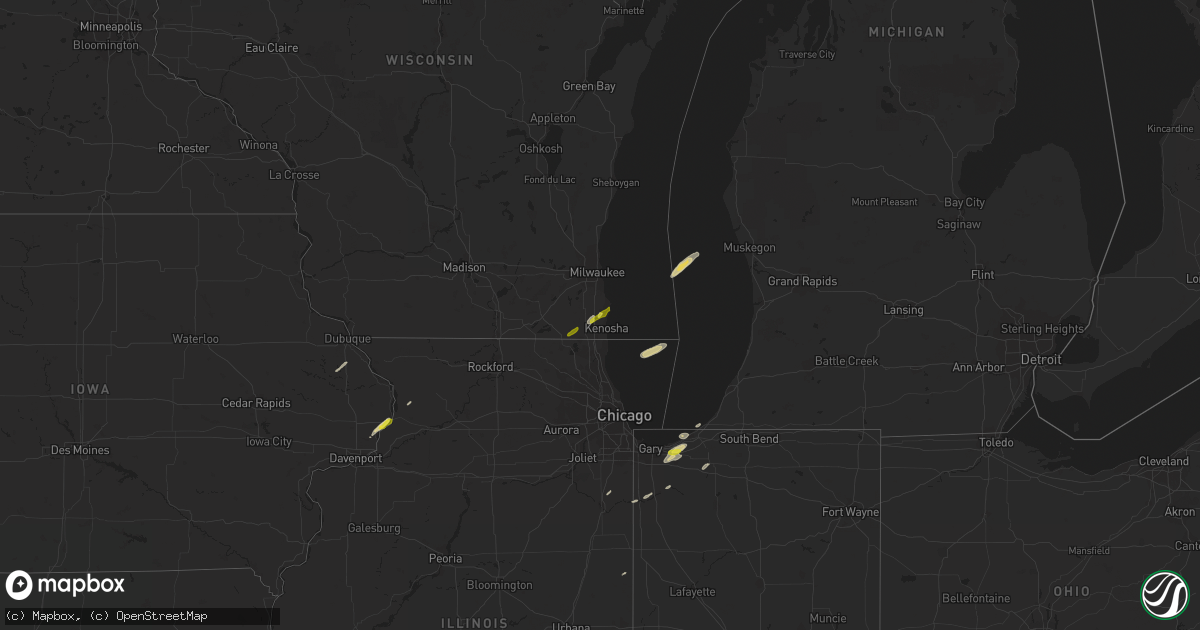
Hail Map on March 31, 2016
Get this storm
March 31 map
$229
one time, instant access
Download today. No call, no setup
Keep the $229
Bought the map and want the full workflow? Apply the entire $229 to a subscription within 7 days. None of it is wasted.
Every map, not just this one
This buys you this map. Subscription and you get every map we run, in the markets you choose from a few cities to whole states to nationwide. Plus real-time alerts the moment a storm fires.
Contact data
Name, contact info, occupancy, even credit band for addresses in the footprint. You go from where it hit to who to call.
Become the source they trust
Unlimited branding weather history reports on demand. You already have the documented answer ready for the property owner, and you are the one who showed up with it.
Property data and RoofTrace estimates
Pull up any address you have got, its value and the exact code rules for that jurisdiction, straight from One Click Code. Then RoofTrace estimates the squares, pitch, and roof value, priced the way you price.
States Impacted by Hail Map on March 31, 2016
Storm reports
Tennessee
| Date | Description |
|---|---|
| 03/31/20166:57 PM CDT | A local report indicates 1.00 inch wind near SMITHVILLE |
| 03/31/20166:30 PM CDT | Trees blocking blooming grove road and appleton road |
| 03/31/20166:30 PM CDT | Tree on home along north cove dr in murfreesboro |
| 03/31/20166:15 PM CDT | An nws storm survey team determined that 70mph straight line winds caused minor tree damage along shannon creek road in southwest giles county. |
| 03/31/20165:54 PM CDT | Trees down across southeastern portions of county |
| 03/31/20165:46 PM CDT | 50 to 60 mph windgust estimation |
| 03/31/20165:37 PM CDT | Golfball hail just west of columbia |
| 03/31/20165:34 PM CDT | Several trees down on hidden lake circle in columbia |
| 03/31/20165:33 PM CDT | 15 to 20 trees down |
| 03/31/20165:18 PM CDT | An nws storm survey team determined that straight line winds were the cause for damage in western maury county. An old barn was destroyed along cecil farm road along wi |
| 03/31/20165:12 PM CDT | 12 inch diameter tree down south of collinwood |
| 03/31/20164:58 PM CDT | Many trees down and one house destoryed near pickwick dam. This is possible tornado. |
| 03/31/20164:57 PM CDT | Fallen tree crushed a barn along betts road at smith road |
| 03/31/20164:50 PM CDT | Trees and powerlines down along hwy 48n and forrest ave |
| 03/31/20164:50 PM CDT | Trained spotter estimates 60 to 70 mph tstm wind gust in pleasant view |
| 03/31/20164:45 PM CDT | An nws storm survey team found ef0 anticyclonic tornado damage in northwest lewis county. A few trees were uprooted and snapped along darbytown road with several large |
| 03/31/20164:32 PM CDT | An nws storm survey team found damage in southeast perry county from an ef1 tornado. The tornado uprooted...snapped or downed hundreds of trees along its path before en |
| 03/31/20164:28 PM CDT | An ef-1 tornado caused damage to a house and rv just east of the tennessee river. |
| 03/31/20164:25 PM CDT | Quarter size hail in savannah. |
| 03/31/20164:24 PM CDT | Some trees down across central portions of the county |
| 03/31/20163:33 PM CDT | Sturctural damage and trees down in the roby community. Along with pea size hail. |
| 03/31/20163:29 PM CDT | Golf ball sized hail in reagan... Tennessee |
| 03/31/20163:20 PM CDT | 50 mph winds with quarter sized hail east of henderson. |
| 03/31/20162:54 PM CDT | Quarter sized hail in downtown jackson |
| 03/31/20162:48 PM CDT | An estimated wind gust of 60 mph in downtown jackson. |
| 03/31/20161:16 PM CDT | Trees down along mudville road. |
| 03/31/20161:16 PM CDT | Gas station tenant reports quarter sized hail. |
| 03/31/20161:15 PM CDT | Power poles blown over in atoka. |
| 03/31/20161:05 PM CDT | Power lines knocked down in drummonds. |
| 03/31/201612:53 PM CDT | Quarter size hail in halls. |
| 03/31/201612:00 PM CDT | Semi-truck blown over on i-55 south of burdette. |
| 03/30/20167:43 PM CDT | Quarter size hail was reported. |
| 03/30/20167:42 PM CDT | Trees down across sc/se portions of county |
Indiana
| Date | Description |
|---|---|
| 03/31/20166:20 PM CDT | Two trees down across highway in the 6100 bock of west 900 south and 8800 block of south 600 west. Time estimated from radar. |
| 03/31/20165:42 PM CDT | Report via twitter |
| 03/31/20165:15 PM CDT | Wind damgage to several mobile homes and barns in and around albion. |
| 03/31/20164:55 PM CDT | Around 7 trees down. |
| 03/31/20163:40 PM CDT | Captured on video a brief tornado touched down 3.5 miles southeast of lafayette at wabash national trailers. A guard shack was destroyed...a car rolled over and constru |
| 03/31/20163:30 PM CDT | A local report indicates 1.00 inch wind near CHESTERTON |
| 03/31/20163:30 PM CDT | Hollow tree blown down/apart on cedarview drive. |
| 03/31/20163:27 PM CDT | Tree on a house. |
| 03/31/20163:04 PM CDT | A local report indicates 61 MPH wind near 3 NW SOUTH BEND |
Louisiana
| Date | Description |
|---|---|
| 03/31/20165:40 PM CDT | Trees down on holman loop northwest of campti. |
| 03/31/20165:31 PM CDT | A tree fell and destroyed a house. |
| 03/31/20165:25 PM CDT | A tree fell and destroyed a house. |
| 03/31/20165:15 PM CDT | Between golf ball and tennis ball size hail is covering the ground in pollock. Report from the pollock town hall. |
| 03/31/20165:10 PM CDT | Golf ball size hail fell in the bentley community. |
| 03/31/20164:55 PM CDT | Reported by an off duty nws employee near grand bayou. |
| 03/31/20164:50 PM CDT | Grand bayou resevoir |
| 03/31/20164:37 PM CDT | Public posted photos of half dollar size hail in sharp. Time estimated from radar. |
| 03/31/20164:37 PM CDT | So reports trees and power lines downed on hwy 876 west of wisner |
| 03/31/20164:35 PM CDT | Quarter to half dollar size hail fell in the cartright community in northeast jackson parish. Report from a picture posted on the ktve facebook page. |
| 03/31/20164:25 PM CDT | Trees and power lines down on highway 146 near the intersection of mosswood drive just south of the lincoln parish line. |
| 03/31/20164:00 PM CDT | A second severe thunderstorm produced half dollar size hail north of the riverton community near the ouachita parish line. |
| 03/31/20164:00 PM CDT | Quarter size hail reported in the bosco community in southern ouachita parish near the caldwell parish line. Report from the general public on the ktve facebook page. |
| 03/31/20163:52 PM CDT | So reports trees down at hwy 859... Rodgers rd and hwy 17. |
| 03/31/20163:52 PM CDT | Large oak tree broken and blocking south bound lane of sr-17. |
| 03/31/20163:52 PM CDT | 2.25 inch size hail |
| 03/31/20163:36 PM CDT | So reports golfball size hail in baskin. |
| 03/31/20163:36 PM CDT | Utility pole broken along aj stephens rd |
| 03/31/20163:28 PM CDT | Quarter size hail reported. |
| 03/31/20163:17 PM CDT | Hail reported near the st. Maurice community. |
| 03/31/20163:10 PM CDT | Photo of large hail at oaklawn plantation from ktbs-tv facebook page. |
| 03/31/20162:57 PM CDT | Sheriff office reported half dollar sized hail near corey |
| 03/31/20162:50 PM CDT | Photo from knoe-tv facebook shows metal roof peeled back on home in vixen community. |
| 03/31/20162:50 PM CDT | Golf ball size hail reported in provencal |
Georgia
| Date | Description |
|---|---|
| 03/31/20166:38 PM CDT | Power lines down near godwin lane and county line road 262. Report of a brief tornado touchdown from two separate witnesses in the area. No other damage reported at thi |
| 03/31/20166:38 PM CDT | Power lines down near godwin lane and county line road 262. A caller also reported an unconfirmed tornado in that area |
| 03/31/20166:20 PM CDT | Tree down on butler ferry road |
| 03/31/20165:18 PM CDT | Estimated quarter size hail along highway 45 |
| 03/31/20166:49 AM CDT | Warner robins asos station reported peak gust of 72 kts out of sw just north of strong rotation signature. |
| 03/31/20166:42 AM CDT | A tornado touched down just northeast of centerville and initially took out trees along sentry oaks drive. As it moved east the tornado briefly reached ef-1 intensity w |
| 03/31/20166:34 AM CDT | Two pine trees down along kay rd south of byron. Estimated winds 60 mph. Damage location lines up with where possible tornado could have touched down. |
| 03/31/20166:10 AM CDT | Several trees down near zenith mill dr and lee pope rd. One power line on home. Possible tornado |
| 03/31/20166:04 AM CDT | Camper reported overturned with nobody inside along thomas road. Additional report of tree on a roof along thomas road. |
| 03/31/20166:03 AM CDT | An ef-0 tornado briefly touched down near the intersection of ga-hwy 128 and thomas road in east-central taylor county. The tornado was only on the ground for several m |
| 03/31/20166:02 AM CDT | Camper reported overturned with nobody inside along thomas road. Additional report of tree on a roof along thomas road. Possible tornado. |
| 03/31/20166:02 AM CDT | Reports of trees down about 1/2 mile north of hwy 128 and crowell church rd. Report from county ema. Possible tornado. |
Michigan
| Date | Description |
|---|---|
| 03/31/20164:39 PM CDT | Trees and wires downed |
Wisconsin
| Date | Description |
|---|---|
| 03/31/20161:29 PM CDT | Penny size with a few quarter size. |
| 03/31/20161:05 PM CDT | Nickel to quarter size. Lasted 3 to 5 minutes. |
| 03/31/20161:00 PM CDT | Relayed via broadcast media. Slightly larger than quarters. Time estimated from radar. |
| 03/31/201612:55 PM CDT | A local report indicates 1.00 inch wind near 2 W ELMWOOD PARK |
| 03/31/201612:45 PM CDT | Penny size with a few quarter size. Corrected for time of event. |
Mississippi
| Date | Description |
|---|---|
| 03/31/20166:57 PM CDT | Multiple trees and powerlines down in the area. |
| 03/31/20166:55 PM CDT | Several trees and powerlines down across the southern third of the county. Four trees down on homes. |
| 03/31/20166:53 PM CDT | A local report indicates 1.00 inch wind near ROME |
| 03/31/20166:43 PM CDT | Trees down. Shingles blown off of multiple homes. |
| 03/31/20166:41 PM CDT | Trees downed on us hwy 49 south of florence. Report via social media. |
| 03/31/20166:40 PM CDT | A local report indicates 1.00 inch wind near 3 S TUPELO |
| 03/31/20166:30 PM CDT | Golf ball sized hail and about 20 mph wind gust in amory |
| 03/31/20166:25 PM CDT | Half dollar sized hail. |
| 03/31/20166:22 PM CDT | Roof off a house on hughes road. Several trees snapped along lake lowndes road. |
| 03/31/20166:18 PM CDT | This tornado began southeast of columbus on frisco rd. It continued northeast... Snapping numerous trees. The tornado continued northeast crossing pritchard ln and then i (ja |
| 03/31/20166:18 PM CDT | Trees downed in the city of clinton |
| 03/31/20166:11 PM CDT | Dime to quarter size hail |
| 03/31/20166:01 PM CDT | Tree downed blocking ms hwy 27 at old port gibson rd |
| 03/31/20165:58 PM CDT | Several trees downed along ms hwy 27. |
| 03/31/20165:58 PM CDT | Tree downed on a house along cayuga rd |
| 03/31/20165:48 PM CDT | Near montpelier |
| 03/31/20165:42 PM CDT | A local report indicates 1.00 inch wind near LENA |
| 03/31/20165:34 PM CDT | Quarter sized hail. Most of the hail was dime to nickel sized hail. |
| 03/31/20165:34 PM CDT | Wind gust of 50-60 mph in hernando with penny to nickel size hail. |
| 03/31/20165:27 PM CDT | Reported south of maben |
| 03/31/20165:21 PM CDT | Reported in the blythe creek area |
| 03/31/20165:12 PM CDT | Tree downed at natchez trace parkway and ms hwy 43 |
| 03/31/20165:08 PM CDT | Several trees downed in the deerfield community |
| 03/31/20165:07 PM CDT | Quarter size hail reported at the germantown high school. |
| 03/31/20165:05 PM CDT | Several trees and powerlines down near hwy 51 and yandell rd area. |
| 03/31/20165:05 PM CDT | Large tree down across hwy 19. |
| 03/31/20165:05 PM CDT | Golf ball size hail reported off of hwy 491 near house. |
| 03/31/20165:05 PM CDT | Nickel to quarter size hail reported in hwy 51 and yandell rd area. |
| 03/31/20165:04 PM CDT | Tree down on a house near hwy 491 and cr 4300. |
| 03/31/20165:00 PM CDT | Trees down on myrleville road. |
| 03/31/20165:00 PM CDT | Several large trees down in deerfield subdivision. |
| 03/31/20164:59 PM CDT | Shingles were damaged and removed from a funeral home just north of town. |
| 03/31/20164:54 PM CDT | Dime to quarter size hail reported near deemer rd and hwy 492. |
| 03/31/20164:53 PM CDT | Golf ball size hail reported on union madden rd. |
| 03/31/20164:53 PM CDT | Golf ball sized hail fell in williams cove. |
| 03/31/20164:50 PM CDT | Trees and limbs down on old hwy 49 and banks lane. |
| 03/31/20164:50 PM CDT | Wall of a barn and a fence blown down. |
| 03/31/20164:50 PM CDT | A local report indicates 1.00 inch wind near UNION |
| 03/31/20164:46 PM CDT | Several trees down in this area. |
| 03/31/20164:45 PM CDT | A local report indicates 1.75 inch wind near 6 E SEBASTOPOL |
| 03/31/20164:44 PM CDT | A local report indicates 1.00 inch wind near SANDERSVILLE |
| 03/31/20164:42 PM CDT | Trees down on link rd. |
| 03/31/20164:28 PM CDT | A local report indicates 1.75 inch wind near BOLTON |
| 03/31/20164:24 PM CDT | Hail ranging from pea to golf ball size on i-20 |
| 03/31/20164:08 PM CDT | Tree downed on utility equipment along ms hwy 14 |
| 03/31/20164:06 PM CDT | A local report indicates 1.00 inch wind near 8 SW KOSCIUSKO |
| 03/31/20162:52 PM CDT | Tree down on hwy 27. |
| 03/31/20162:48 PM CDT | Tree down on hwy 184 blocking traffic. |
| 03/31/20168:32 AM CDT | Reports of numerous trees down/uprooted along the north side of us highway 98 in perry county. Time estimated from radar data. |
| 03/31/20167:56 AM CDT | Trees and power lines down near aldon road and stonfield drive. Possible tornado. |
| 03/31/20167:54 AM CDT | Several trees down at the upper elementary school. Possible tornado. |
| 03/31/20167:53 AM CDT | This tornado touched down near talowah rd where it uprooted a couple of trees and caused some minor roof damage to a home. The tornado continued east northeast uprootin |
| 03/31/20161:38 AM CDT | Picture and report relayed via social media. |
| 03/31/20161:25 AM CDT | A billboard was blown down.also several trees were blown down along highway 49. |
| 03/30/20167:39 PM CDT | Trees down |
| 03/30/20167:32 PM CDT | Several trees down around the shongelo community. |
| 03/30/20167:26 PM CDT | Numerous trees downed across the county... Including along ms hwy 37 and ms hwy 35 n. The skirting was blown off a mobile home. Small hail was also reported. |
| 03/30/20167:19 PM CDT | Quarter sized hail in the old union commmunity with cg lightning and very heavy rain. |
| 03/30/20167:18 PM CDT | Trees were blown down |
| 03/30/20167:10 PM CDT | Some trees and power lines down. |
| 03/30/20167:10 PM CDT | Numerous trees snapped and uprooted near the intersection of highway 13 and 43. Large tree fell on a home and damaged the roof. Estimated max winds of 80 mph. |
| 03/30/20167:10 PM CDT | Dime to golf ball size hail reported |
| 03/30/20167:07 PM CDT | Multiple trees down. Multiple roads closed due to debris. Some structure damage from trees. |
| 03/30/20167:05 PM CDT | Along ms hwy 18 south of brandon. Relayed via social media |
| 03/30/20167:00 PM CDT | Quarter sized hail reported in tutwiler |
Ohio
| Date | Description |
|---|---|
| 03/31/20166:40 PM CDT | Large tree down on chesnut hills rd. Near st. Rte. 661. Several other limbs down across county including near chatham rd. Time estimated by radar. |
| 03/31/20166:20 PM CDT | Tree that is approximately one foot in diameter was knocked down...time estimated from radar. |
| 03/31/20166:12 PM CDT | Large diameter limb knocked down...time estimated from radar. |
| 03/31/20166:04 PM CDT | Us-22 at state route 138. |
| 03/31/20165:51 PM CDT | Tree down across crownover mill rd. Time estimated by radar. |
| 03/31/20165:50 PM CDT | Several trees down |
| 03/31/20165:26 PM CDT | Roof off barn on miami trace road near us62 |
| 03/31/20164:52 PM CDT | Tree down on wolfangel and state roads in anderson township. |
| 03/31/20164:39 PM CDT | Tree that is approximately one foot in diameter was knocked down. |
| 03/31/20164:39 PM CDT | Numerous ash trees knocked down. |
Illinois
| Date | Description |
|---|---|
| 03/31/20163:36 PM CDT | A local report indicates 60 MPH wind near ODIN |
| 03/31/20163:29 PM CDT | A local report indicates 1.00 inch wind near NASHVILLE |
Arkansas
| Date | Description |
|---|---|
| 03/31/20163:33 PM CDT | Hail fell...ranging from the size of marbles to quarters. |
| 03/31/201612:51 PM CDT | Home weather station anemometer recorded a gust of 80 mph. |
| 03/31/201612:51 PM CDT | Shutter blown off of home from the estimated 80 mph gust. |
| 03/31/201612:05 PM CDT | Dozens of trees and power poles down...mostly on the north side of town. |
| 03/31/201612:00 PM CDT | 1 inch hail in lepanto. |
| 03/31/201612:00 PM CDT | Semi-truck blown over on i-55 south of burdette. |
| 03/31/201611:00 AM CDT | Ping pong ball size hail reported through social media. |
| 03/31/201610:40 AM CDT | High winds took large chunks of siding off a downtown jonesboro building. |
| 03/31/201610:32 AM CDT | 1 inch hail in west jonesboro. |
| 03/31/20169:38 AM CDT | Penny to quarter size hail in searcy. |
| 03/31/20168:42 AM CDT | Quarter size hail in perryville. |
Iowa
| Date | Description |
|---|---|
| 03/31/201610:39 AM CDT | Quarter size hail covering the ground. Hail lasted approximately 10 minutes. |
| 03/31/201610:35 AM CDT | Pea to quarter size hail |
| 03/31/201610:35 AM CDT | Occurring right now. |
| 03/31/201610:33 AM CDT | Pea to quarter size hail |
Kentucky
| Date | Description |
|---|---|
| 03/31/20166:35 PM CDT | A tree was blown down at intersection of east university drive and north main street |
| 03/31/20166:13 PM CDT | A tree was blown down along beasley road. |
| 03/31/20165:26 PM CDT | Trees and a few power lines down in adair county. |
| 03/31/20165:02 PM CDT | Power lines down. Time estimated from radar. |
| 03/31/20164:53 PM CDT | Tree down in northern barren county near the hart county line |
| 03/31/20164:37 PM CDT | Trees down. Time estimated from radar. |
| 03/31/20164:35 PM CDT | Trees down. Time estimated from radar. |
| 03/31/20164:17 PM CDT | Large tree down on new liberty pike |
| 03/31/20164:15 PM CDT | Several trees down. Time estimated from radar. |
| 03/31/20164:14 PM CDT | Estimated 10 to 15 large ash trees down in and around the new liberty area. Time estimated by radar. |
| 03/31/20164:09 PM CDT | Tree down on a vehicle on smallhouse road. |
| 03/31/20164:00 PM CDT | One tree down along southern part of painter rd. Time estimated by radar. |
| 03/31/20163:58 PM CDT | Flag pole down in far northeastern spencer county. |
| 03/31/20163:55 PM CDT | Power pole snapped and power lines down near interstate from strong winds. Also received report of tree damage along radcliffe rd sw of this location from state police. |
| 03/31/20163:47 PM CDT | Trees down throughout the county. |
| 03/31/20163:47 PM CDT | Trees down county wide. |
| 03/31/20163:46 PM CDT | Spotters report metal coming off barn roof in front of them at 1500 block of hwy 117 just north of fort campbell. |
| 03/31/20163:42 PM CDT | Trees down. |
| 03/31/20163:31 PM CDT | Large trees downed across beargrass creek. |
| 03/31/20163:31 PM CDT | Trees down on stony brook. |
| 03/31/20163:30 PM CDT | Tree uprooted on midland lane. |
| 03/31/20163:30 PM CDT | Pole barn blown apart on hwy 44... 1 mile from alpar lane. |
| 03/31/20163:29 PM CDT | Power lines down between shepherdsville and mt. Washington. |
| 03/31/20163:29 PM CDT | Outbuilding damaged near salt river electric on highway 44. |
| 03/31/20163:28 PM CDT | Tree on a mobile home on cane run road. |
| 03/31/20163:28 PM CDT | Large tree down on duncan street. |
| 03/31/20163:28 PM CDT | Power lines down on taylor blvd. |
| 03/31/20163:28 PM CDT | Power lines down on palatka road near manslick in the iroquois park area. |
| 03/31/20163:25 PM CDT | Bleachers and goal posts blown over at male high school. |
| 03/31/20163:22 PM CDT | Power lines down in shepherdsville. |
| 03/31/20163:20 PM CDT | Power lines down. Time estimated from radar. |
| 03/31/20163:18 PM CDT | Tree blown on to a house on dubourg avenue. |
| 03/31/20163:15 PM CDT | Large limb down aristides drive... Prp. |
| 03/31/20162:42 PM CDT | *** 2 inj *** trailers flipped over at nancy butler trailer park. Updated for injury report. |
| 03/31/20162:40 PM CDT | Roof off the gym at breckinridge county middle school. Damage to a nearby gas station. Damage to buildings on fairgrounds road. |
| 03/31/20162:30 PM CDT | Several trees down. Corrected time. |
| 03/31/20162:25 PM CDT | Tree down across highway 1700 near quisenberry road. |
| 03/31/20162:15 PM CDT | Power poles and wires down along hwy 54 near the 13 mile marker between whitesville and philpot |
| 03/31/20162:10 PM CDT | 2 power poles and a tree snapped at intersection of hwy 231 and old masonville road |
| 03/31/20162:05 PM CDT | Metal carport was torn off and destroyed. Carport was thrown into nearby house and did minimal damage to that homes roof. |
| 03/31/20162:05 PM CDT | Mobile home has been demolished on east marksberry road in utica. No injuries reported |
| 03/31/20162:03 PM CDT | Two trees uprooted on kennedy brashar road south of greenville ky |
| 03/31/20162:00 PM CDT | Several trees uprooted... All laying in same direction. Roof completely torn off metal building. Several trees are down across the county |
| 03/31/20161:42 PM CDT | Report of large tree limbs down on townsend drive |
| 03/31/20161:35 PM CDT | Damage to roof of rural farm home including numerous shingles blown off. Damage to property. 70 mph wind estimate. |
| 03/31/20161:30 PM CDT | Several trees down. Time estimated from radar. |
| 03/31/201612:55 PM CDT | 3 houses and some outbuildings that have damage along furches trail. Numerous large trees uprooted. Barn door blown off it. All damage faced to the northeast |
Alabama
| Date | Description |
|---|---|
| 03/31/20166:59 PM CDT | Report of one structure with roof...front porch...and back porch blown off |
| 03/31/20166:50 PM CDT | Trees down across alabama highway 96 near millport. |
| 03/31/20166:50 PM CDT | Tree down on home just off of alabama highway 96 west of millport. Location approximate. |
| 03/31/20166:48 PM CDT | Tornado end point. The tornado continued eastward along highway 34 and produced loss of shingles to a home and destroyed several outbuildings. The tornado crossed shock |
| 03/31/20166:48 PM CDT | Tornado end point. The tornado continued eastward along highway 34 and produced loss of shingles to a home and destroyed several outbuildings. The tornado crossed shock |
| 03/31/20166:45 PM CDT | A local report indicates 1.00 inch wind near 3 ESE PUTNAM |
| 03/31/20166:43 PM CDT | Tornado start point. The tornado touched down near county road 75 just south of highway 34. Numerous trees were snapped and uprooted along county road 75 and some minor |
| 03/31/20166:37 PM CDT | Tornado end point. Estimated peak wind 100 mph. Path length 2.08 miles. Maximum path width 500 yards. |
| 03/31/20166:32 PM CDT | Survey start point. The tornado started in mississippi and crossed the state line into pickens county alabama about 2.3 miles south of highway 82. The tornado tracked n |
| 03/31/20166:30 PM CDT | Trees and power lines down. Time estimated. |
| 03/31/20166:15 PM CDT | Trees down on mosley bridge road just east of gilbertown |
| 03/31/20162:45 PM CDT | Power lines down in the western portion of the county |
| 03/31/20162:13 PM CDT | Trees down reported near headquarter camp rd in southern covington county. Time estimated via radar. |
| 03/31/20162:12 PM CDT | Reports of trees down near kinston |
| 03/31/201612:08 PM CDT | Quarter size hail reported in appleton |
| 03/31/201611:24 AM CDT | Poarch creek ema reports downed powerlines at the intersection of jack springs and still farm rd. Time estimated from radar. |
| 03/31/201611:15 AM CDT | Trees and power lines down |
| 03/31/20165:00 AM CDT | A local report indicates 1.00 inch wind near 3 ESE PUTNAM |
| 03/31/201612:23 AM CDT | Tornado end point. Estimated peak wind 70 mph. Path length 2.09 miles. Maximum path width 50 yards. |
| 03/31/201612:22 AM CDT | Minor wind damage to the roof and to the porch of a home. Several trees snapped and uprooted. Time estimated by radar. |
| 03/31/201612:19 AM CDT | Tornado start point. The tornado began near the intersection of sr 51 and lee rd 47 where several pine trees were snapped and uprooted in a convergent pattern. One half |
| 03/30/201611:50 PM CDT | Large trees down on hickory drive... At the intersection of hunter and camelia and at hillside in the dalraida neighborhood. |
| 03/30/20169:48 PM CDT | Power lines down along lightwood road and power outages reported in the channa creek road area. Time estimated by radar. |
| 03/30/20169:44 PM CDT | Tornado end point. A single family home suffered the loss of some roofing materials and windows broken by debris. Another dozen softwoods were uprooted and/or snapped w |
| 03/30/20169:42 PM CDT | Tornado start point. Tornado briefly touched down near the intersection of spunky hollow road and sunrise lane. A metal storage barn with wood framing was heavily damag |
| 03/30/20169:42 PM CDT | Trees down blocking portion of spunky hollow road between fred terry road and tucker mountain road. Time estimated by radar. |
| 03/30/20169:40 PM CDT | Tree down near intersection of oporto madrid blvd and 5th avenue south in birmingham. Estimated 40 to 50 mile per hour winds. Time estimated by radar. |
| 03/30/20169:11 PM CDT | Debris near mm330 on i-65. Power flashes and tornado on the ground. |
| 03/30/20169:07 PM CDT | Gas station on upper river road in priceville damaged. Possible tornado damage. |
| 03/30/20169:04 PM CDT | Tree damage reported on bethel road. Possible tornado damage. |
| 03/30/20169:04 PM CDT | Damage was reported in the autumn woods subdivsion. Possible tornado daamge. |
| 03/30/20169:02 PM CDT | Power lines and trees reported down near the west shoal creek baptist church on shoal creek road. Possible tornado damage. |
| 03/30/20169:00 PM CDT | Several mobile homes were shifted off their foundations. Possible tornado damage. |
| 03/30/20169:00 PM CDT | Debris was reported along portions of interstate 65 near mile marker 330 between hartselle and priceville. |
| 03/30/20168:57 PM CDT | Ef-2 tornado with peak winds 115 mph...path length of 8.5 miles...and peak path width of 200 yds |
| 03/30/20168:39 PM CDT | Quarter sized hail reported in jasper. |
| 03/30/20168:35 PM CDT | Half dollar size hail picture send through social media. |
| 03/30/20168:23 PM CDT | Large tree was blown down romulus road. |
| 03/30/20168:11 PM CDT | Roof damage reported. Time estimated by radar. |
| 03/30/20168:10 PM CDT | Estimated 55-60 mph. |
| 03/30/20168:09 PM CDT | Tornado end point. Estimated peak wind 70 mph. Path length 1.88 miles. Maximum path width 400 yards. |
| 03/30/20168:06 PM CDT | Tornado end point. Estimated peak wind 70 mph. Path length 1.86 miles. Maximum path width 400 yards. |
| 03/30/20168:05 PM CDT | Tornado start point. The short-lived tornado touched down near cr 46 at the town of boley springs. The weak tornado tracked northeast and uprooted numerous trees along |
| 03/30/20168:04 PM CDT | Tornado start point. A short-lived tornado touched down near cr 46 at the town of boley springs. The weak tornado tracked northeast and dissipated near county road 83. |
| 03/30/20167:59 PM CDT | Up to quarter size hail reported between moulton and trinity. |
| 03/30/20167:51 PM CDT | Trees and power lines down near navoo. Time estimated by radar. |
| 03/30/20167:50 PM CDT | Up to quarter size hail was reported in the moulton. |
| 03/30/20167:45 PM CDT | Up to quarter size hail was reported. |
| 03/30/20167:39 PM CDT | Tree damage reported through online public storm report. |
| 03/30/20167:35 PM CDT | Tornado end point. Estimated peak wind 90 mph. Path length 3.7 miles. Maximum path width 500 yards. |
| 03/30/20167:28 PM CDT | Sheriff department reports large trees down on county road 53. Location approximate. |
| 03/30/20167:28 PM CDT | Tornado start point. A tornado touched down near the intersection of cr 52 and cr 18. It tracked northeast and uprooted and snapped numerous trees. It dissipated near c |
| 03/30/20167:27 PM CDT | Tornado start point. The tornado touched down near the intersection of county road 52 and county road 18. The tornado tracked northeast and uprooted and snapped numerou |
| 03/30/20167:13 PM CDT | Tornado end point. Estimated peak wind 105 mph. Path length 3.72 miles. Maximum path width 650 yards. |
| 03/30/20167:13 PM CDT | Tornado end point. Estimated peak wind 105 mph. Path length 3.75 miles. Maximum path width 630 yards. |
| 03/30/20167:08 PM CDT | Trees reported down along highway 96. Location approximate. |
| 03/30/20167:08 PM CDT | Damage to home reported along county road 51 with trees and power lines down. |
| 03/30/20167:08 PM CDT | Trees down along county road 52 in fayette county. Location approximate. |
| 03/30/20167:08 PM CDT | Trees down along county road 24 in fayette county. |
| 03/30/20167:05 PM CDT | Half dollar sized hail reported near kennedy. |
| 03/30/20167:05 PM CDT | A local report indicates 1.00 inch wind near 3 S BELK |
| 03/30/20167:03 PM CDT | Tornado start point. A tornado touched down near the intersection of cr 51 and turner road. The tornado traveled northward along county road 51 for about one mile uproo |
| 03/30/20167:02 PM CDT | Awning damage at the chevron in thomasville. Structural damage reported at the clarke county pole company on bashi road in thomasville |
| 03/30/20167:00 PM CDT | Tree down on a power line on bashi road west of thomasville |
| 03/30/20167:00 PM CDT | Report of roof blown off of a house on bashi road. Tree down on vehicles on old linden road. |
Texas
| Date | Description |
|---|---|
| 03/31/20165:58 AM CDT | Public reported golf ball sized hail in elmendorf. Time estimated from radar. |
| 03/31/20165:15 AM CDT | A local report indicates 1.00 inch wind near 1 N DEVINE |
| 03/31/20163:48 AM CDT | A local report indicates 1.00 inch wind near BRACKETTVILLE |
| 03/31/20163:45 AM CDT | Delayed report...several outbuildings were damaged by thunderstorm winds. Time estimated with radar. |
| 03/31/20163:40 AM CDT | Delayed report...several power poles blown down on hwy 83. Time estimated from radar. |
| 03/31/20162:30 AM CDT | Delayed report...dime and quarter sized hail at cooksey park |
Cities Impacted by Hail Map on March 31, 2016
- Wellington, IL
- Milford, IL
- Zwingle, IA
- Bernard, IA
- La Motte, IA
- Heber Springs, AR
- Natchitoches, LA
- Fredericksburg, TX
- Comfort, TX
- Brownsville, TN
- Brandon, MS
- Mendenhall, MS
- Morton, MS
- Florence, MS
- Raleigh, MS
- Braxton, MS
- Donalsonville, GA
- Columbia, TN
- Mount Pleasant, TN
- Patoka, IN
- Pulaski, MS
- Provencal, LA
- Elora, TN
- Flintville, TN
- Huntland, TN
- Union, MS
- Little Rock, MS
- Vernon, IL
- Alma, IL
- Patoka, IL
- Kinmundy, IL
- Leakey, TX
- McRae, AR
- Griffithville, AR
- Searcy, AR
- Sherwood, AR
- Little Rock Air Force Base, AR
- Beebe, AR
- Ward, AR
- Cabot, AR
- Jacksonville, AR
- North Little Rock, AR
- Austin, AR
- Hermanville, MS
- Vicksburg, MS
- Utica, MS
- Port Gibson, MS
- Drummonds, TN
- Millington, TN
- Samson, AL
- Coffee Springs, AL
- Geneva, AL
- Madison, MS
- Lamar, MS
- Bentley, LA
- Dry Prong, LA
- Pollock, LA
- Gordon, AL
- Scotts Hill, TN
- Huron, TN
- Reagan, TN
- Lexington, TN
- Magee, MS
- Hernando, MS
- Marianna, AR
- Moro, AR
- Brackettville, TX
- Northport, AL
- Buhl, AL
- Tuscaloosa, AL
- Coker, AL
- Crystal City, TX
- Butler, GA
- Reynolds, GA
- Montgomery, AL
- Forest, MS
- Lake, MS
- Coushatta, LA
- Cedarbluff, MS
- Osceola, AR
- Tutwiler, MS
- Mound Bayou, MS
- Drew, MS
- Ingraham, IL
- Clay City, IL
- Yazoo City, MS
- Benton, MS
- Olla, LA
- Amory, MS
- Robeline, LA
- Natchez, LA
- Sweeny, TX
- Van Vleck, TX
- Ruston, LA
- Choudrant, LA
- Michigan City, MS
- Ashland, MS
- Tallassee, AL
- Shorter, AL
- Millbrook, AL
- Prattville, AL
- Wetumpka, AL
- Coosada, AL
- Elmore, AL
- Tuskegee, AL
- Pike Road, AL
- Eclectic, AL
- Winnsboro, LA
- Delhi, LA
- Uvalde, TX
- Westpoint, TN
- Iron City, TN
- Bethel Springs, TN
- Adamsville, TN
- Selmer, TN
- Saline, LA
- Mansfield, LA
- Pelican, LA
- Prairie, MS
- Halls, TN
- Ripley, TN
- Minor Hill, TN
- Five Points, TN
- Marion, AR
- Dennis, MS
- Tishomingo, MS
- Iuka, MS
- Clarksdale, MS
- Monticello, MS
- Silver Creek, MS
- Batesville, TX
- La Pryor, TX
- Coffeeville, AL
- Toxey, AL
- Gilbertown, AL
- Sallis, MS
- Camden, MS
- Kosciusko, MS
- McIntosh, AL
- Deer Park, AL
- Citronelle, AL
- Middleton, TN
- Nettleton, MS
- Nashville, IL
- Ward, AL
- Pennington, AL
- Toone, TN
- Whiteville, TN
- Satartia, MS
- Moorhead, MS
- Somerville, TN
- Inverness, MS
- Itta Bena, MS
- Schlater, MS
- Lolita, TX
- Canton, MS
- Decatur, MS
- Conehatta, MS
- Louisville, MS
- Vinegar Bend, AL
- Moulton, AL
- Haleyville, AL
- Danville, AL
- Kennedy, AL
- Millport, AL
- Ethelsville, AL
- Edwards, MS
- De Witt, AR
- Elaine, AR
- Ethel, AR
- Saint Charles, AR
- Clinton, IA
- Camanche, IA
- Bentonia, MS
- Vance, MS
- Lambert, MS
- Merigold, MS
- Redwood, MS
- Vernon, AL
- Sulligent, AL
- Guin, AL
- Steens, MS
- Fayette, AL
- Winfield, AL
- Bloomington, IN
- Ellettsville, IN
- Munford, TN
- Aberdeen, MS
- Sikes, LA
- Dodson, LA
- Philadelphia, MS
- Collinsville, MS
- Burnsville, MS
- Goldonna, LA
- Jonesboro, LA
- Castor, LA
- Many, LA
- Montgomery, LA
- Stanton, TN
- Wisner, LA
- Tullos, LA
- Fort Necessity, LA
- Georgetown, LA
- Harrisonburg, LA
- Kelly, LA
- Columbia, LA
- Gilbert, LA
- Enterprise, LA
- Winnfield, LA
- Brewton, AL
- Castleberry, AL
- Ardmore, TN
- Fayetteville, TN
- Taft, TN
- Ringgold, LA
- Humnoke, AR
- Stuttgart, AR
- Sardis, AL
- Minter, AL
- Union Grove, WI
- Sturtevant, WI
- Kenosha, WI
- Jakin, GA
- Iron City, GA
- Colquitt, GA
- Brinson, GA
- Medina, TX
- Shiloh, TN
- Michie, TN
- Stantonville, TN
- Morris Chapel, TN
- Savannah, TN
- Wheatfield, IN
- Hebron, IN
- Linton, IN
- Jasonville, IN
- Lena, LA
- Colfax, LA
- Mora, LA
- Holly Grove, AR
- Floresville, TX
- Adkins, TX
- Elmendorf, TX
- La Vernia, TX
- San Antonio, TX
- Keiser, AR
- Mooreville, MS
- Verona, MS
- Tupelo, MS
- Newhebron, MS
- Prentiss, MS
- Glen, MS
- McCrory, AR
- Wynne, AR
- Marion, AL
- Plantersville, AL
- Campti, LA
- Pelahatchie, MS
- Smithville, MS
- Okolona, MS
- Houlka, MS
- Caraway, AR
- Luxora, AR
- Lepanto, AR
- Etowah, AR
- Harrisburg, AR
- Marked Tree, AR
- Trumann, AR
- Fort Valley, GA
- Roberta, GA
- Luray, TN
- Jacks Creek, TN
- Lexington, AL
- Loretto, TN
- Leoma, TN
- Prospect, TN
- Lester, AL
- Anderson, AL
- Goodspring, TN
- Hickory Ridge, AR
- Augusta, AR
- Brighton, TN
- Bastrop, LA
- Eros, LA
- Chatham, LA
- Calhoun, LA
- Quitman, LA
- Mason, TN
- Bolton, MS
- Memphis, TN
- Lake Cormorant, MS
- Forrest City, AR
- Hughes, AR
- Arlington, TN
- Cordova, TN
- Oakland, TN
- Eads, TN
- Red Bay, AL
- Tremont, MS
- Golden, MS
- Devine, TX
- Moore, TX
- Bigfoot, TX
- Lytle, TX
- Poteet, TX
- Somerset, TX
- Natalia, TX
- Valparaiso, IN
- McKenzie, AL
- Hickory, MS
- Hamburg, AR
- Portland, AR
- Parkdale, AR
- Princeton, IA
- Spencer, IN
- Gosport, IN
- Von Ormy, TX
- Andalusia, AL
- Lena, MS
- Hall Summit, LA
- Decaturville, TN
- Sardis, TN
- Henderson, TN
- Conway, AR
- Vilonia, AR
- Uniontown, AL
- Newbern, AL
- Faunsdale, AL
- Randolph, AL
- Lawley, AL
- De Kalb, MS
- Thomaston, AL
- Barksdale, TX
- Baskin, LA
- Rayville, LA
- Mangham, LA
- Grayson, LA
- Monroe, LA
- Louin, MS
- Clarendon, AR
- Roe, AR
- Marthaville, LA
- Sullivan, IN
- Worthington, IN
- Fulton, MS
- Chesterton, IN
- Cherry Valley, AR
- Chancellor, AL
- Blakely, GA
- Holly Springs, MS
- Walnut, MS
- Falkner, MS
- Clopton, AL
- Skipperville, AL
- Ariton, AL
- Clio, AL
- Newellton, LA
- Collins, MS
- Eupora, MS
- Saltillo, MS
- Shannon, MS
- Plantersville, MS
- Houston, MS
- Mantee, MS
- Mantachie, MS
- Calhoun City, MS
- Woodland, MS
- Center Point, TX
- Macon, MS
- West Monroe, LA
- Florala, AL
- Covington, TN
- Atoka, TN
- Turrell, AR
- Evergreen, AL
- Camp Wood, TX
- Dickinson, TX
- La Marque, TX
- Rosharon, TX
- Liverpool, TX
- Alvin, TX
- Santa Fe, TX
- Manteno, IL
- Edinburgh, IN
- Shelbyville, IN
- Franklin, IN
- Columbus, MS
- Oxford, MS
- Abbeville, MS
- Dugger, IN
- Lexa, AR
- Brickeys, AR
- Robinsonville, MS
- Tunica, MS
- Little River, AL
- Uriah, AL
- New Albany, MS
- Flora, MS
- Hampshire, TN
- Tallulah, LA
- Opp, AL
- Carlyle, IL
- Sandoval, IL
- Vandalia, IL
- Carlisle, AR
- Wabbaseka, AR
- Hohenwald, TN
- Hobart, IN
- Westville, IN
- Michigan City, IN
- Rocksprings, TX
- Gillett, AR
- Almyra, AR
- Pearsall, TX
- Ackerman, MS
- Flatwoods, LA
- Ingram, TX
- Lutts, TN
- Counce, TN
- Waterloo, AL
- Collinwood, TN
- Sicily Island, LA
- Aimwell, LA
- Atlanta, LA
- Jena, LA
- Cloutierville, LA
- Double Springs, AL
- Valley Park, MS
- Terry, MS
- Raymond, MS
- Yuma, TN
- Leesville, LA
- Myrtle, MS
- Rose Bud, AR
- Greensboro, AL
- Linden, AL
- Sweet Water, AL
- Dyersburg, TN
- Saint Joseph, LA
- Clinton, MS
- Daleville, AL
- Kinston, AL
- Black, AL
- Hartford, AL
- Tilden, TX
- Bainbridge, GA
- Linden, TN
- Pinson, TN
- Cottondale, AL
- Quitman, AR
- Mount Vernon, AR
- Kerrville, TX
- Tyronza, AR
- Bailey, MS
- Meridian, MS
- Daleville, MS
- Caledonia, MS
- Gattman, MS
- Hamilton, MS
- Mathiston, MS
- Maben, MS
- Sturgis, MS
- Mercer, TN
- Bassett, AR
- Joiner, AR
- Gilmore, AR
- Crawfordsville, AR
- Denmark, TN
- Frenchmans Bayou, AR
- Pleasant Hill, LA
- Thomasville, AL
- Campbell, AL
- Medon, TN
- Jackson, MS
- Ridgeland, MS
- Shobonier, IL
- Bald Knob, AR
- Florence, AL
- Elkmont, AL
- Saint Joseph, TN
- Killen, AL
- Pulaski, TN
- Flora, IL
- Olivehill, TN
- Waynesboro, TN
- Clifton, TN
- Bath Springs, TN
- Kingsford Heights, IN
- Union Mills, IN
- Pearl, MS
- Byram, MS
- Richland, MS
- Flowood, MS
- Crawford, MS
- Weir, MS
- Orrville, AL
- Spruce Pine, AL
- Marvell, AR
- Oak Ridge, LA
- Casscoe, AR
- Ramer, TN
- Guys, TN
- Racine, WI
- Rienzi, MS
- Starkville, MS
- Pheba, MS
- West Point, MS
- New Site, MS
- Cherokee, AL
- Grand Junction, TN
- Corinth, MS
- Concan, TX
- Texas City, TX
- Phil Campbell, AL
- Del Rio, TX
- Cordova, IL
- Newton, MS
- Tuscola, IL
- Enville, TN
- Carson, MS
- Cottonwood, AL
- Ashford, AL
- Dothan, AL
- Hodges, AL
- Friendship, TN
- Hickory Valley, TN
- Saulsbury, TN
- Bolivar, TN
- Hornsby, TN
- Gleason, TN
- Cleveland, MS
- Fisher, LA
- Converse, LA
- Georgiana, AL
- Greenville, AL
- Midfield, TX
- Blessing, TX
- Hitchcock, TX
- Judsonia, AR
- Lowell, IN
- Centreville, AL
- Beverly Shores, IN
- Cash, AR
- Jonesboro, AR
- Nineveh, IN
- Flat Rock, IN
- Trout, LA
- Taylorsville, MS
- Beech Bluff, TN
- Hunt, TX
- Crump, TN
- De Valls Bluff, AR
- Pontotoc, MS
- Gallion, AL
- Schneider, IN
- Marmaduke, AR
- Lawrence, MS
- Bay Springs, MS
- Walnut Grove, MS
- Crystal Springs, MS
- Stockton, AL
- Jackson, AL
- Atmore, AL
- Carthage, MS
- York, AL
- Dixons Mills, AL
- Kelso, TN
- Owensville, IN
- Griffin, IN
- Town Creek, AL
- Russell, AR
- Princeton, IN
- Magnolia, AL
- Pine Hill, AL
- Jackson, TN
- Perryville, AR
- Trinity, AL
- Decatur, AL
- Carlisle, IN
- Noxapater, MS
- Preston, MS
- Shuqualak, MS
- Aliceville, AL
- Thomson, IL
- Chadwick, IL
- Earle, AR
- Pansey, AL
- Brinkley, AR
- Needham, AL
- Mize, MS
- Sebastopol, MS
- Portage, IN
- Santa Fe, TN
- Salem, WI
- Silver Lake, WI
- Burlington, WI
- Twin Lakes, WI
- Fulton, IL
- Bigelow, AR
- Houston, AR
- Marion, LA
- Nesbit, MS
- Lawrenceburg, TN
- Heidelberg, MS
- Laurel, MS
- Jasper, AL
- Cordova, AL
- Unionville, IN