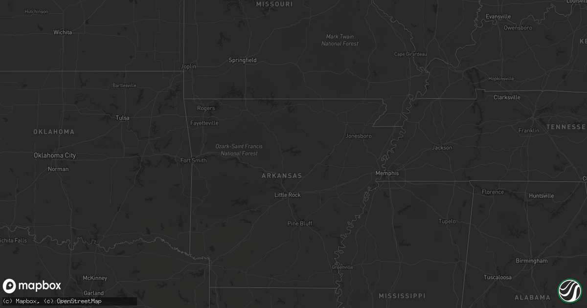
Hail Map in Texas on March 18, 2012
Get this storm
March 18 map
$229
one time, instant access
Download today. No call, no setup
Keep the $229
Bought the map and want the full workflow? Apply the entire $229 to a subscription within 7 days. None of it is wasted.
Every map, not just this one
This buys you this map. Subscription and you get every map we run, in the markets you choose from a few cities to whole states to nationwide. Plus real-time alerts the moment a storm fires.
Contact data
Name, contact info, occupancy, even credit band for addresses in the footprint. You go from where it hit to who to call.
Become the source they trust
Unlimited branding weather history reports on demand. You already have the documented answer ready for the property owner, and you are the one who showed up with it.
Property data and RoofTrace estimates
Pull up any address you have got, its value and the exact code rules for that jurisdiction, straight from One Click Code. Then RoofTrace estimates the squares, pitch, and roof value, priced the way you price.
Storm reports in Texas
Texas
| Date | Description |
|---|---|
| 03/18/20126:50 PM CDT | A local report indicates 73 MPH wind near GRAHAM |
| 03/18/20126:32 PM CDT | A local report indicates 1.00 inch wind near 3 W TRUSCOTT |
| 03/18/20125:48 PM CDT | Rptd via storm chaser web cam...measured with ruler live online. |
| 03/18/20125:37 PM CDT | Hail covering the ground |
| 03/18/20125:10 PM CDT | A local report indicates 1.25 inch wind near 15 SW CROWELL |
| 03/18/20125:09 PM CDT | Along hwy 83 |
| 03/18/20124:37 PM CDT | A local report indicates 1.00 inch wind near 7 N CHILDRESS |
| 03/18/20124:05 PM CDT | A local report indicates 1.00 inch wind near TELL |
| 03/18/20124:53 AM CDT | A local report indicates 1.00 inch wind near BIG SPRING |
| 03/18/20124:45 AM CDT | A local report indicates 1.00 inch wind near LEES |
| 03/18/20124:20 AM CDT | A local report indicates 1.75 inch wind near GREENWOOD |
| 03/18/20122:45 AM CDT | Pea to quarter sized hail. |
| 03/18/20122:37 AM CDT | Dime to quarter size hail. |
| 03/18/20122:25 AM CDT | A local report indicates 65 MPH wind near WELLINGTON |
| 03/18/20122:14 AM CDT | Power poles snapped along interstate 40. An empty semi truck traveling along interstate 40 was flipped over. |
| 03/18/20122:00 AM CDT | Wall collapsed at local health clinic. Heavy damage to high school football stadium press box. Numerous trees...fences...road signs downed. |
| 03/18/20121:57 AM CDT | Kvii tv schoolnet |
| 03/18/20121:50 AM CDT | Pea size to 2 inches covering the ground. |
| 03/18/20121:45 AM CDT | A local report indicates 75 MPH wind near 2 WSW CLARENDON |
| 03/18/20121:25 AM CDT | A local report indicates 60 MPH wind near 2 WSW TURKEY |
| 03/18/20121:15 AM CDT | One telephone pole partially broken...one light pole blown down...and the front end of a weak and old wood frame building blown out. This damage was very localized in p |
| 03/18/20121:10 AM CDT | A local report indicates 61 MPH wind near 2 ESE PAMPA |
| 03/18/20121:07 AM CDT | An aluminum shed was destroyed...the side wall of an abandoned wood frame building collapsed...the front wall of a business damaged...and there was damage to a power po |
| 03/18/201212:49 AM CDT | A local report indicates 66 MPH wind near MACKENZIE RESERVOIR |
| 03/18/201212:30 AM CDT | *** 2 inj *** trailer home flipped over |
| 03/17/201210:45 PM CDT | Several reports of dime to quarter sized hail. |
| 03/17/20129:39 PM CDT | A local report indicates 1.00 inch wind near 7 E CLARENDON |
| 03/17/20128:35 PM CDT | A local report indicates 66 MPH wind near 7 ESE SILVERTON |
| 03/17/20128:05 PM CDT | A local report indicates 1.75 inch wind near FLOYDADA |
| 03/17/20128:03 PM CDT | A local report indicates 1.00 inch wind near FLOYDADA |
| 03/17/20127:32 PM CDT | Estimated 65-75mph |
| 03/17/20127:20 PM CDT | Reported by kcbd |
| 03/17/20127:11 PM CDT | A local report indicates 60 MPH wind near SOUTHLAND |
All States Impacted by Hail Map on March 18, 2012
Cities Impacted by Hail Map on March 18, 2012
- North Platte, NE
- Dickens, NE
- Hershey, NE
- Lakeview, TX
- Erick, OK
- Plains, KS
- Meade, KS
- Hilliard, OH
- Mechanicsburg, OH
- Woodstock, OH
- Carter, OK
- Willow, OK
- Matador, TX
- Tarzan, TX
- Briscoe, TX
- Canadian, TX
- Lesage, WV
- Mankato, KS
- Esbon, KS
- Childress, TX
- Dodson, TX
- Hollis, OK
- Big Spring, TX
- Perryton, TX
- Mangum, OK
- Vinson, OK
- Gould, OK
- Cawker City, KS
- Stanton, TX
- South Solon, OH
- Jeffersonville, OH
- Fritch, TX
- Panhandle, TX
- Gardendale, TX
- Olton, TX
- Plainview, TX
- Hale Center, TX
- Lancaster, OH
- Amanda, OH
- Lamesa, TX
- Gail, TX
- Ackerly, TX
- Cedarville, OH
- Hayes Center, NE
- Logan, OH
- Glouster, OH
- Athens, OH
- Buchtel, OH
- Chauncey, OH
- The Plains, OH
- Nelsonville, OH
- Millfield, OH
- New Marshfield, OH
- Albany, OH
- Columbus, OH
- Ropesville, TX
- Meadow, TX
- Mission, SD
- Valentine, NE
- Alice, TX
- Seminole, TX
- Westerville, OH
- Quitaque, TX
- Clarendon, TX
- Lockney, TX
- Lorenzo, TX
- Floydada, TX
- Silverton, TX
- Oglesby, IL
- Leonore, IL
- Tonica, IL
- Garden City, TX
- Midland, TX
- Midkiff, TX
- Ralls, TX
- Slaton, TX
- Elsie, NE
- Paxton, NE
- Goldsmith, TX
- McCamey, TX
- Lenorah, TX
- Knott, TX
- Bremen, OH
- Odessa, TX
- Post, TX
- Stoutsville, OH
- Tahoka, TX
- Palestine, WV
- Sandyville, WV
- Stapleton, NE
- Tryon, NE
- Aspermont, TX
- Amarillo, TX
- Looneyville, WV
- Sutherland, NE
- Sugar Grove, OH
- Bloomingburg, OH
- Mount Sterling, OH
- Washington Court House, OH
- Ashville, OH
- Williamsport, OH
- Circleville, OH
- Rockbridge, OH
- Reydon, OK
- Fieldton, TX
- Wellington, TX
- Lubbock, TX
- Happy, TX
- Canyon, TX
- Littlefield, TX
- Snyder, TX
- Justiceburg, TX
- Seagraves, TX
- Canal Winchester, OH
- Groveport, OH
- Ottawa, IL
- Crowell, TX
- Brownfield, TX
- Odonnell, TX
- Orient, OH
- Commercial Point, OH
- Sayre, OK
- Turkey, TX
- Idalou, TX
- Lelia Lake, TX
- Hedley, TX
- Corning, OH
- Woodsfield, OH
- Andrews, TX
- Mclean, TX
- Amherst, TX
- Seymour, TX
- Chillicothe, TX
- Belleville, WV
- Wilson, TX
- Kermit, TX
- Wink, TX
- Carrizo Springs, TX
- Asherton, TX
- Galloway, OH
- Paducah, TX
- Crookston, NE
- Chandlersville, OH
- Stinnett, TX
- Roaring Springs, TX
- Hart, TX
- Crosbyton, TX
- Fluvanna, TX
- Foss, OK
- North Lewisburg, OH
- Mingo, OH
- Cable, OH
- Milford Center, OH
- Lockbourne, OH
- Carroll, OH
- Pickerington, OH
- Reynoldsburg, OH
- Dublin, OH
- Grove City, OH
- Amlin, OH
- Plain City, OH
- Old Glory, TX
- Levelland, TX
- Anton, TX
- Hamersville, OH
- Reedsville, OH
- Little Hocking, OH
- Cutler, OH
- Coolville, OH
- Washington, WV
- Abernathy, TX
- Shallowater, TX
- Xenia, OH
- Montezuma, KS
- Heath, OH
- Hebron, OH
- Wheeler, TX
- Turpin, OK
- Dickens, TX
- La Salle, IL
- Peru, IL
- West Jefferson, OH
- Mullen, NE
- Luray, KS
- Elk City, OK
- Ransom Canyon, TX
- Girard, TX
- Powell, OH
- Gandeeville, WV
- Walton, WV
- Chloe, WV
- Spencer, WV
- Marysville, OH
- Granite, OK
- Kress, TX
- Quanah, TX
- Monahans, TX
- Pyote, TX
- Springlake, TX
- Irwin, OH
- Urbana, OH
- Spur, TX
- Glen Elder, KS
- Jal, NM
- Denver City, TX
- Welch, TX
- Wallace, NE
- Streator, IL
- Grand Ridge, IL
- Lostant, IL
- Petersburg, TX
- Lewistown, OH
- London, OH
- Plains, TX
- Tokio, TX
- Elizabeth, WV
- Macfarlan, WV
- Spearman, TX
- Amesville, OH
- New Straitsville, OH
- Haydenville, OH
- Guysville, OH
- Stewart, OH
- Murray City, OH
- Mcadoo, TX
- Beloit, KS
- Elkview, WV
- Clendenin, WV
- New Albany, OH
- Pomeroy, OH
- Rutland, OH
- Dill City, OK
- Tulia, TX
- Loop, TX
- Long Bottom, OH
- Ravenswood, WV
- Portland, OH
- West Liberty, OH
- Alexandria, OH
- Pataskala, OH
- Lithopolis, OH
- Borger, TX
- McArthur, OH
- New Plymouth, OH
- Junction City, OH
- Baltimore, OH
- Left Hand, WV
- Amma, WV
- Bellefontaine, OH
- Cee Vee, TX
- Lebanon, OH
- Mason, OH
- Lower Salem, OH
- Clinton, OK


