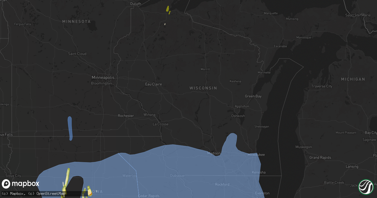
Hail Map in Wisconsin on March 14, 2025
Get this storm
March 14 map
$229
one time, instant access
Download today. No call, no setup
Keep the $229
Bought the map and want the full workflow? Apply the entire $229 to a subscription within 7 days. None of it is wasted.
Every map, not just this one
This buys you this map. Subscription and you get every map we run, in the markets you choose from a few cities to whole states to nationwide. Plus real-time alerts the moment a storm fires.
Contact data
Name, contact info, occupancy, even credit band for addresses in the footprint. You go from where it hit to who to call.
Become the source they trust
Unlimited branding weather history reports on demand. You already have the documented answer ready for the property owner, and you are the one who showed up with it.
Property data and RoofTrace estimates
Pull up any address you have got, its value and the exact code rules for that jurisdiction, straight from One Click Code. Then RoofTrace estimates the squares, pitch, and roof value, priced the way you price.
Storm reports in Wisconsin
Wisconsin
| Date | Description |
|---|---|
| 03/14/20259:14 AM CDT | Report from mping: quarter |
| 03/14/20258:44 AM CDT | Report from mping. |
| 03/14/20258:40 AM CDT | A local report indicates 1.00 inch wind near 4 WSW Washburn |
| 03/14/20258:33 AM CDT | A local report indicates 1.00 inch wind near 3 NE Moquah |
| 03/14/202512:57 AM CDT | Milwaukee asos measured 62 mph/54 knots. |
| 03/14/202512:40 AM CDT | Corrects previous tstm wnd gst report from dodge county airport. 50 kt gust measured at the dodge county airport in juneau. |
| 03/14/202512:40 AM CDT | 50 kt gust measured at the dodge county airport in juneau. |
| 03/14/202512:39 AM CDT | Mesonet station wi073 i-43 sb at sth 83. |
| 03/14/202512:35 AM CDT | Several fences blown down between beaver dam and horicon. |
| 03/14/202512:33 AM CDT | Large tree down. |
| 03/14/202512:29 AM CDT | Mesonet station wi090 waukesha co i-94 wb at sth 67. |
| 03/14/202512:25 AM CDT | A local report indicates 60 MPH wind near 2 NNE Oconomowoc |
| 03/14/202512:22 AM CDT | Mesonet station ew4463 sun prairie. |
| 03/14/202512:15 AM CDT | Numerous trees down between sullivan and oconomowoc. |
| 03/14/202512:10 AM CDT | Public report of 8 uprooted trees and roof damage to a garage 4 w of watertown. Time estimated from report info and radar data. |
| 03/14/202512:10 AM CDT | Public report of three uprooted trees and a toppled shed. Time estimated from report information and radar. |
| 03/14/202512:06 AM CDT | Several reports of tree and powerline damage. |
| 03/14/202512:00 AM CDT | Mesonet station wiwlh walworth. |
| 03/13/202511:50 PM CDT | Mesonet station wi087 i-39 90 at church rd. |
| 03/13/202511:50 PM CDT | Mesonet station wi089 i-39 90 at sth 26. |
| 03/13/202511:50 PM CDT | Mesonet station wi088 i-39 90 at sth 59 newville. |
| 03/13/202511:45 PM CDT | Tree came through a roof of a home. |
| 03/13/202511:45 PM CDT | Multiple trees on trailers. |
| 03/13/202511:45 PM CDT | Snapped trees. |
| 03/13/202511:42 PM CDT | Roof reported blown off. |
| 03/13/202511:39 PM CDT | Tree damage on the southwest side of janesville. |
| 03/13/202511:27 PM CDT | Trees down with power lines down. |
| 03/13/202511:25 PM CDT | Trees down in town of union. |
| 03/13/202511:20 PM CDT | Shingles off roof. Horse shed blown over and pushed into field. Fencing damage. Multiple trees down. |
| 03/13/202510:51 PM CDT | Mesonet station ap090 madison. |
| 03/13/202510:46 PM CDT | A local report indicates 64 MPH wind near 1 NE Dodgeville |
| 03/13/202510:41 PM CDT | Reports of uprooted trees and power issues from fennimore to boscobel to muscoda. |
| 03/13/202510:13 PM CDT | Wind gusts in the mid to upper 60s measured on home weather station. |
| 03/13/202510:10 PM CDT | A local report indicates 59 MPH wind near 5 NNW Platteville |
All States Impacted by Hail Map on March 14, 2025
Cities Impacted by Hail Map on March 14, 2025
- Burkesville, KY
- Cable, WI
- Grand View, WI
- Ashland, WI
- Washburn, WI
- Adair, OK
- Saint Paul, AR
- McLouth, KS
- Easton, KS
- Winchester, KS
- Atchison, KS
- Rushville, MO
- Grapevine, AR
- Pickford, MI
- Osawatomie, KS
- Paola, KS
- Edgerton, KS
- Wellsville, KS
- Spring Hill, KS
- Gardner, KS
- New Century, KS
- Olathe, KS
- Barbeau, MI
- Sault Sainte Marie, MI
- Columbus, KS
- Farlington, KS
- Fort Scott, KS
- Arcadia, KS
- Garland, KS
- Deerfield, MO
- Richards, MO
- Hume, MO
- Lenexa, KS
- De Soto, KS
- Scammon, KS
- Weir, KS
- Bonner Springs, KS
- Shawnee, KS
- Pleasanton, KS
- Prescott, KS
- Mound City, KS
- Chetopa, KS
- Baxter Springs, KS
- Miami, OK
- Rich Hill, MO
- Foster, MO
- Amoret, MO
- Fulton, KS
- Butler, MO
- Amsterdam, MO
- Adrian, MO
- Louisburg, KS
- Bucyrus, KS
- Stilwell, KS
- Overland Park, KS
- Leawood, KS
- Kansas City, MO
- Prairie Village, KS
- Kansas City, KS
- La Cygne, KS
- Archie, MO
- Harrisonville, MO
- Waldron, MO
- Platte City, MO
- Nevada, MO
- Bronaugh, MO
- Moundville, MO
- Galena, KS
- Sheldon, MO
- Quapaw, OK
- Garden City, MO
- Drexel, MO
- Joplin, MO
- Liberty, MO
- Carl Junction, MO
- Anderson, MO
- Goodman, MO
- Asbury, MO
- Pittsburg, KS
- Opolis, KS
- Mindenmines, MO
- Walker, MO
- Pleasant Hill, MO
- Neosho, MO
- Greenwood, MO
- Freeman, MO
- Cleveland, MO
- Peculiar, MO
- Camden Point, MO
- Smithville, MO
- Dearborn, MO
- Edgerton, MO
- Milo, MO
- El Dorado Springs, MO
- Webb City, MO
- Carterville, MO
- Carthage, MO
- Oronogo, MO
- Jasper, MO
- Alba, MO
- Purcell, MO
- Neck City, MO
- Raymore, MO
- Lone Jack, MO
- East Lynne, MO
- Lees Summit, MO
- Diamond, MO
- Granby, MO
- Gower, MO
- Agency, MO
- Faucett, MO
- Trimble, MO
- Treece, KS
- Harwood, MO
- Picher, OK
- Schell City, MO
- Rockville, MO
- Appleton City, MO
- Riverton, KS
- Sterling, NE
- Tecumseh, NE
- Liberal, MO
- Lamar, MO
- Saint Joseph, MO
- Wathena, KS
- Amazonia, MO
- Savannah, MO
- Easton, MO
- Independence, MO
- Stewartsville, MO
- Plattsburg, MO
- Blue Springs, MO
- Oak Grove, MO
- Grain Valley, MO
- Missouri City, MO
- Excelsior Springs, MO
- Buckner, MO
- Sibley, MO
- Orrick, MO
- Creighton, MO
- Holden, MO
- Kingsville, MO
- Urich, MO
- Montrose, MO
- Humboldt, NE
- Adams, NE
- Bennet, NE
- Clinton, MO
- Pickrell, NE
- Wyandotte, OK
- Grove, OK
- Tiff City, MO
- Seneca, MO
- Reeds, MO
- Sarcoxie, MO
- Avilla, MO
- Rosendale, MO
- Fillmore, MO
- Bolckow, MO
- La Russell, MO
- Amity, MO
- Clarksdale, MO
- Maysville, MO
- Osborn, MO
- Cosby, MO
- Helena, MO
- Union Star, MO
- Lawson, MO
- Lathrop, MO
- Cameron, MO
- Holt, MO
- Turney, MO
- Kearney, MO
- Table Rock, NE
- Burr, NE
- Golden City, MO
- Jay, OK
- Cortland, NE
- Syracuse, NE
- Cook, NE
- Miller, MO
- Wellington, MO
- Bates City, MO
- Odessa, MO
- Centerview, MO
- Chilhowee, MO
- Blairstown, MO
- Osceola, MO
- Warrensburg, MO
- Deepwater, MO
- Lowry City, MO
- Lockwood, MO
- Otoe, NE
- Unadilla, NE
- South Greenfield, MO
- Greenfield, MO
- Arcola, MO
- Adair, IA
- Dadeville, MO
- Stockton, MO
- Casey, IA
- Maryville, MO
- Barnard, MO
- Skidmore, MO
- Graham, MO
- Pickering, MO
- Burlington Junction, MO
- Avoca, NE
- King City, MO
- McFall, MO
- Albany, MO
- Darlington, MO
- Stanberry, MO
- Guilford, MO
- Rea, MO
- Clyde, MO
- Murray, IA
- Peru, IA
- Lorimor, IA
- Stark City, MO
- Weatherby, MO
- Pattonsburg, MO
- Kingston, MO
- Winston, MO
- Polo, MO
- Altamont, MO
- Mayview, MO
- Lexington, MO
- Norborne, MO
- Richmond, MO
- Henrietta, MO
- Hardin, MO
- Braymer, MO
- Camden, MO
- Leeton, MO
- Windsor, MO
- Calhoun, MO
- Corder, MO
- Knob Noster, MO
- Concordia, MO
- Higginsville, MO
- Dover, MO
- Collins, MO
- Manley, NE
- Murdock, NE
- Weeping Water, NE
- Louisville, NE
- Ashland, NE
- Humansville, MO
- Plattsmouth, NE
- Murray, NE
- Springfield, NE
- Nehawka, NE
- Pacific Junction, IA
- South Bend, NE
- Greenwood, NE
- Alvo, NE
- Elmwood, NE
- Gretna, NE
- Cedar Creek, NE
- Papillion, NE
- Offutt Afb, NE
- Bellevue, NE
- Council Bluffs, IA
- Memphis, NE
- Waterloo, NE
- Omaha, NE
- Ithaca, NE
- Yutan, NE
- Everton, MO
- Wentworth, MO
- Pierce City, MO
- Gentry, AR
- Bentonville, AR
- Decatur, AR
- Siloam Springs, AR
- Cave Springs, AR
- Anita, IA
- Massena, IA
- Bridgewater, IA
- Fontanelle, IA
- Springdale, AR
- Summers, AR
- Fayetteville, AR
- Winterset, IA
- Saint Charles, IA
- Lowell, AR
- Rogers, AR
- Pea Ridge, AR
- Centerton, AR
- Bella Vista, AR
- Seligman, MO
- Garfield, AR
- Bedford, IA
- Shambaugh, IA
- Braddyville, IA
- Clearmont, MO
- Hopkins, MO
- Clarinda, IA
- Elmo, MO
- New Market, IA
- Gravity, IA
- Van Meter, IA
- Stanton, IA
- Nodaway, IA
- Villisca, IA
- Corning, IA
- Redding, IA
- Worth, MO
- Blockton, IA
- Denver, MO
- Gentry, MO
- Sheridan, MO
- Clearfield, IA
- Grant City, MO
- Benton, IA
- La Vista, NE
- Treynor, IA
- Boys Town, NE
- Elkhorn, NE
- Mead, NE
- Valley, NE
- Tingley, IA
- Afton, IA
- Shannon City, IA
- Diagonal, IA
- Mount Ayr, IA
- Lenox, IA
- Sharpsburg, IA
- Creston, IA
- Prescott, IA
- Guthrie Center, IA
- New Hampton, MO
- Brayton, IA
- Hatfield, MO
- Bethany, MO
- Martinsville, MO
- Exira, IA
- Davis City, IA
- Grand River, IA
- Mercer, MO
- Lamoni, IA
- Ellston, IA
- Gilman City, MO
- Coffey, MO
- Cainsville, MO
- Eagleville, MO
- Kellerton, IA
- Blythedale, MO
- Leon, IA
- Ridgeway, MO
- Decatur, IA
- Princeton, MO
- Chillicothe, MO
- Ludlow, MO
- Whiteman Air Force Base, MO
- Waverly, MO
- Dawn, MO
- Carrollton, MO
- Mooresville, MO
- Breckenridge, MO
- Trenton, MO
- Chula, MO
- Alma, MO
- Laredo, MO
- Utica, MO
- Spickard, MO
- Jamesport, MO
- Bogard, MO
- Tina, MO
- Washburn, MO
- Coon Rapids, IA
- Green Ridge, MO
- Sweet Springs, MO
- Cole Camp, MO
- Mora, MO
- La Monte, MO
- Ionia, MO
- Sedalia, MO
- Houstonia, MO
- Lincoln, MO
- Malta Bend, MO
- Warsaw, MO
- Hughesville, MO
- Blackburn, MO
- Edwards, MO
- Cross Timbers, MO
- Wheatland, MO
- Urbana, MO
- Preston, MO
- Hermitage, MO
- Dunnegan, MO
- Weaubleau, MO
- Quincy, MO
- Bolivar, MO
- Flemington, MO
- Pittsburg, MO
- Cassville, MO
- Exeter, MO
- Fair Play, MO
- Walnut Grove, MO
- Aldrich, MO
- De Soto, IA
- Ash Grove, MO
- Mount Vernon, MO
- Verona, MO
- Purdy, MO
- Silver City, IA
- Glenwood, IA
- Fremont, NE
- Colon, NE
- Carter Lake, IA
- Bennington, NE
- Monett, MO
- West Des Moines, IA
- Clive, IA
- Windsor Heights, IA
- Des Moines, IA
- Urbandale, IA
- Johnston, IA
- Grimes, IA
- Crane, MO
- Aurora, MO
- Marionville, MO
- Granger, IA
- Adel, IA
- Waukee, IA
- Dallas Center, IA
- Billings, MO
- Glidden, IA
- Scranton, IA
- Ralston, IA
- Churdan, IA
- Woodward, IA
- McClelland, IA
- Underwood, IA
- Minden, IA
- Shelby, IA
- Fort Calhoun, NE
- Neola, IA
- Crescent, IA
- Persia, IA
- Honey Creek, IA
- Oakland, IA
- Logan, IA
- Missouri Valley, IA
- Blair, NE
- Arlington, NE
- Washington, NE
- Kennard, NE
- De Witt, MO
- Marshall, MO
- Blackwater, MO
- Sumner, MO
- Wheeling, MO
- Keytesville, MO
- Miami, MO
- Otterville, MO
- Browning, MO
- Gilliam, MO
- Pilot Grove, MO
- Mendon, MO
- Polk, MO
- Bosworth, MO
- Triplett, MO
- Laclede, MO
- Florence, MO
- Slater, MO
- Galt, MO
- Smithton, MO
- Salisbury, MO
- Linneus, MO
- Purdin, MO
- Dalton, MO
- Nelson, MO
- Meadville, MO
- Humphreys, MO
- Brunswick, MO
- Stover, MO
- Rothville, MO
- Glasgow, MO
- Hale, MO
- Brookfield, MO
- Harris, MO
- Milan, MO
- Marceline, MO
- Lake City, IA
- Lohrville, IA
- Madrid, IA
- Orient, IA
- Allerton, IA
- Saint Marys, IA
- Garden Grove, IA
- Grant, IA
- Lineville, IA
- Truro, IA
- Humeston, IA
- Liberty Center, IA
- Powersville, MO
- Thayer, IA
- Elliott, IA
- Patterson, IA
- Osceola, IA
- Greenfield, IA
- Williamson, IA
- Seymour, IA
- Menlo, IA
- Plano, IA
- Lucas, IA
- Redfield, IA
- Prole, IA
- Marne, IA
- Carlisle, IA
- Derby, IA
- Red Oak, IA
- Millerton, IA
- Columbia, IA
- Carbon, IA
- New Virginia, IA
- Griswold, IA
- Bevington, IA
- Martensdale, IA
- Elk Horn, IA
- Ackworth, IA
- Chariton, IA
- Macksburg, IA
- Corydon, IA
- Melcher Dallas, IA
- Norwalk, IA
- Newtown, MO
- Atlantic, IA
- Cumming, IA
- Russell, IA
- Weldon, IA
- Lacona, IA
- Woodburn, IA
- Indianola, IA
- Kimballton, IA
- Stuart, IA
- Lewis, IA
- Dexter, IA
- Audubon, IA
- Earlham, IA
- Wiota, IA
- Cromwell, IA
- Milo, IA
- Lucerne, MO
- Melrose, IA
- Van Wert, IA
- Promise City, IA
- Clio, IA
- Cumberland, IA
- Lovilia, IA
- Knoxville, IA
- Pleasantville, IA
- Unionville, MO
- Ogden, IA
- Bouton, IA
- Mineola, IA
- Woodbine, IA
- Panama, IA
- Portsmouth, IA
- Dunlap, IA
- Malvern, IA
- Farragut, IA
- Henderson, IA
- Union, NE
- Carson, IA
- Macedonia, IA
- Sidney, IA
- Imogene, IA
- Shenandoah, IA
- Emerson, IA
- Randolph, IA
- Thurman, IA
- Tabor, IA
- Hastings, IA
- Essex, IA
- Harlan, IA
- Irwin, IA
- Kirkman, IA
- Booneville, IA
- Hancock, IA
- Walnut, IA
- Hamlin, IA
- New Cambria, MO
- New Franklin, MO
- Fayette, MO
- Armstrong, MO
- Arrow Rock, MO
- Clifton Hill, MO
- Bucklin, MO
- Boonville, MO
- Bunceton, MO
- Winigan, MO
- Franklin, MO
- New Boston, MO
- Ames, IA
- Boone, IA
- Bois D Arc, MO
- Republic, MO
- Fairview, MO
- Clarksburg, MO
- Higbee, MO
- Macks Creek, MO
- Climax Springs, MO
- Latham, MO
- Louisburg, MO
- Sunrise Beach, MO
- Syracuse, MO
- Gravois Mills, MO
- Versailles, MO
- Half Way, MO
- Tunas, MO
- Buffalo, MO
- Barnett, MO
- Camdenton, MO
- Rocky Mount, MO
- Fortuna, MO
- Tipton, MO
- Roach, MO
- Rockwell City, IA
- Manson, IA
- Farnhamville, IA
- Somers, IA
- Story City, IA
- Stanhope, IA
- Freistatt, MO
- Schuyler, NE
- Columbus, NE
- Leigh, NE
- Clare, IA
- Knierim, IA
- Eureka Springs, AR
- Clever, MO
- Galena, MO
- Nixa, MO
- Cape Fair, MO
- Eagle Rock, MO
- Shell Knob, MO
- Prairie City, IA
- Highlandville, MO
- Colfax, IA
- Maitland, MO
- Altoona, IA
- Runnells, IA
- Mitchellville, IA
- Otley, IA
- Newton, IA
- Swan, IA
- Pleasant Hill, IA
- Reasnor, IA
- Hartford, IA
- Monroe, IA
- Perry, IA
- Brookline, MO
- Springfield, MO
- Kelley, IA
- Gravette, AR
- Avoca, IA
- Palmer, IA
- Gilmore City, IA
- Conception Junction, MO
- Berwick, IA
- Minburn, IA
- Linden, IA
- Bondurant, IA
- Panora, IA
- Ankeny, IA
- Westside, IA
- Manilla, IA
- Manning, IA
- Lidderdale, IA
- Arcadia, IA
- Aspinwall, IA
- Wall Lake, IA
- Carroll, IA
- Vail, IA
- Breda, IA
- Halbur, IA
- Gray, IA
- Templeton, IA
- Auburn, IA
- Dedham, IA
- Strafford, MO
- Lanesboro, IA
- Fair Grove, MO
- Mingo, IA
- Jamestown, MO
- Elkhart, IA
- Harrisburg, MO
- Sheldahl, IA
- Alleman, IA
- California, MO
- Ira, IA
- Prairie Home, MO
- Baxter, IA
- Rocheport, MO
- Slater, IA
- Maxwell, IA
- Columbia, MO
- Cambridge, IA
- Huxley, IA
- Polk City, IA
- Wooldridge, MO
- Luther, IA
- Collins, IA
- Ozark, MO
- Odebolt, IA
- Dow City, IA
- Schleswig, IA
- Lytton, IA
- Defiance, IA
- Deloit, IA
- Arthur, IA
- Ida Grove, IA
- Battle Creek, IA
- Sac City, IA
- Kiron, IA
- Denison, IA
- Lake View, IA
- Elkland, MO
- Linn Creek, MO
- Eldon, MO
- Osage Beach, MO
- Lake Ozark, MO
- Russellville, MO
- Rogersville, MO
- Sparta, MO
- State Center, IA
- Nevada, IA
- Colo, IA
- Kellogg, IA
- Laurel, IA
- Rhodes, IA
- Haverhill, IA
- Melbourne, IA
- Yorktown, IA
- Marshalltown, IA
- Zearing, IA
- Blairsburg, IA
- Gilbert, IA
- Radcliffe, IA
- Saint Anthony, IA
- Jewell, IA
- Garden City, IA
- Hubbard, IA
- McCallsburg, IA
- Kamrar, IA
- Roland, IA
- Clemons, IA
- Webster City, IA
- Ellsworth, IA
- Williams, IA
- Randall, IA
- Fordland, MO
- Stratford, IA
- Albion, IA
- New Providence, IA
- Iowa Falls, IA
- Alden, IA
- Conway, MO
- Golden, MO
- Marshfield, MO
- Reeds Spring, MO
- Ponce De Leon, MO
- Phillipsburg, MO
- Montreal, MO
- Eldora, IA
- Eugene, MO
- Brumley, MO
- Kaiser, MO
- Union, IA
- Tuscumbia, MO
- Centertown, MO
- Olean, MO
- Lohman, MO
- Seymour, MO
- Oldfield, MO
- Bruner, MO
- Spokane, MO
- Long Lane, MO
- Stanton, NE
- Hartville, MO
- Dows, IA
- Fort Dodge, IA
- Clarion, IA
- Moorland, IA
- Duncombe, IA
- Vincent, IA
- Popejoy, IA
- Eagle Grove, IA
- Rowan, IA
- Lehigh, IA
- Galt, IA
- Woolstock, IA
- Walnut Shade, MO
- Chestnutridge, MO
- Early, IA
- Huntsville, MO
- Forsyth, MO
- Grovespring, MO
- Niangua, MO
- Dayton, IA
- Pilot Mound, IA
- Chadwick, MO
- Garrison, MO
- Fulton, MO
- Marquez, TX
- Auxvasse, MO
- Winside, NE
- Kingdom City, MO
- Thompson, MO
- Mexico, MO
- Norfolk, NE
- Santa Fe, MO
- Nemaha, IA
- Moberly, MO
- Ashland, MO
- Latimer, IA
- Belmond, IA
- Clark, MO
- Havelock, IA
- Hallsville, MO
- Madison, MO
- Albert City, IA
- Dakota City, IA
- Schaller, IA
- Newell, IA
- Laurens, IA
- Pocahontas, IA
- Renwick, IA
- Jolley, IA
- Alta, IA
- Storm Lake, IA
- Thor, IA
- Livermore, IA
- Holstein, IA
- Ottosen, IA
- Paris, MO
- Galva, IA
- Goldfield, IA
- Varina, IA
- Pomeroy, IA
- Rolfe, IA
- Fonda, IA
- Barnum, IA
- Rutland, IA
- Hardy, IA
- Jefferson City, MO
- Sturgeon, MO
- Humboldt, IA
- Bradgate, IA
- Centralia, MO
- New Bloomfield, MO
- Bode, IA
- Hartsburg, MO
- Badger, IA
- Henley, MO
- Kanawha, IA
- Loose Creek, MO
- Argyle, MO
- Holts Summit, MO
- Koeltztown, MO
- Iberia, MO
- Dixon, MO
- Meta, MO
- Linn, MO
- Mokane, MO
- Saint Thomas, MO
- Westphalia, MO
- Freeburg, MO
- Ulman, MO
- Chamois, MO
- Saint Elizabeth, MO
- Tebbetts, MO
- Vienna, MO
- Bonnots Mill, MO
- Mansfield, MO
- Falcon, MO
- Lebanon, MO
- Stoutland, MO
- Lynchburg, MO
- Plato, MO
- Laddonia, MO
- Rush Hill, MO
- Laquey, MO
- Richland, MO
- Waynesville, MO
- Fort Leonard Wood, MO
- Newburg, MO
- Buffalo, TX
- Oakwood, TX
- Garrison, IA
- Le Grand, IA
- Hudson, IA
- Parkersburg, IA
- Grundy Center, IA
- Van Horne, IA
- Vinton, IA
- Chelsea, IA
- Ferguson, IA
- Conrad, IA
- Lincoln, IA
- Ackley, IA
- Steamboat Rock, IA
- Hampton, IA
- Malcom, IA
- Tama, IA
- Garwin, IA
- Whitten, IA
- Morrison, IA
- Traer, IA
- Dysart, IA
- Liscomb, IA
- Keystone, IA
- Gilman, IA
- Grinnell, IA
- Belle Plaine, IA
- Wellsburg, IA
- Bradford, IA
- Buckingham, IA
- Geneva, IA
- Coulter, IA
- Aplington, IA
- Austinville, IA
- Vining, IA
- Beaman, IA
- Holland, IA
- Sheffield, IA
- Montour, IA
- Clutier, IA
- Toledo, IA
- Reinbeck, IA
- Alexander, IA
- Elberon, IA
- Gladbrook, IA
- Dike, IA
- Jewett, TX
- Ava, MO
- Mountain Grove, MO
- Perry, MO
- Armstrong, IA
- Swea City, IA
- Granada, MN
- Fairmont, MN
- Duke, MO
- Paris, AR
- Licking, MO
- Edgar Springs, MO
- Deer, AR
- Montgomery City, MO
- Williamsburg, MO
- Steedman, MO
- Scranton, AR
- Martinsburg, MO
- Gause, TX
- Milano, TX
- Cameron, TX
- Lewisville, MN
- Amboy, MN
- Truman, MN
- Hartman, AR
- Norwood, MO
- Jonesburg, MO
- Rhineland, MO
- Warrenton, MO
- Marthasville, MO
- Mount Sterling, MO
- New Florence, MO
- Berger, MO
- Bland, MO
- High Hill, MO
- Owensville, MO
- Belle, MO
- Benton City, MO
- Hermann, MO
- Morrison, MO
- Wellsville, MO
- Portland, MO
- New Haven, MO
- Truxton, MO
- New London, MO
- Curryville, MO
- Palmyra, MO
- Farber, MO
- Quincy, IL
- Stoutsville, MO
- Taylor, MO
- Frankford, MO
- Center, MO
- Hannibal, MO
- Vandalia, MO
- Monroe City, MO
- Bellflower, MO
- Maywood, MO
- Middletown, MO
- Cedar Falls, IA
- West Chester, IA
- Montezuma, IA
- Wayland, IA
- Allison, IA
- Millersburg, IA
- Greene, IA
- Blairstown, IA
- New Hartford, IA
- Chapin, IA
- Shell Rock, IA
- Rockwell, IA
- Rockford, IA
- Luzerne, IA
- Waverly, IA
- North English, IA
- Marengo, IA
- South Amana, IA
- Clarksville, IA
- Brooklyn, IA
- Bristow, IA
- Guernsey, IA
- Webster, IA
- Stout, IA
- Keota, IA
- Victor, IA
- Conroy, IA
- Parnell, IA
- Aredale, IA
- Kesley, IA
- Williamsburg, IA
- Keswick, IA
- Waterloo, IA
- Dumont, IA
- Wellman, IA
- La Porte City, IA
- Marble Rock, IA
- Deep River, IA
- Washington, IA
- Nashua, IA
- Dougherty, IA
- Harper, IA
- Brighton, IA
- South English, IA
- Janesville, IA
- Charles City, IA
- Ladora, IA
- Hartwick, IA
- Alexandria, MO
- New Sharon, IA
- Barnes City, IA
- What Cheer, IA
- Canton, MO
- La Grange, MO
- Searsboro, IA
- Plainfield, IA
- Mount Auburn, IA
- Luray, MO
- Milton, IA
- Ewing, MO
- Arbela, MO
- Libertyville, IA
- Agency, IA
- Richland, IA
- Hedrick, IA
- Ollie, IA
- Eldon, IA
- Douds, IA
- Batavia, IA
- Gibson, IA
- Fairfield, IA
- Martinsburg, IA
- Hayesville, IA
- Packwood, IA
- Cantril, IA
- Keosauqua, IA
- Mount Sterling, IA
- Selma, IA
- Raymond, IA
- Delta, IA
- Sigourney, IA
- Gilbertville, IA
- Watkins, IA
- Birmingham, IA
- Tripoli, IA
- Evansdale, IA
- Rose Hill, IA
- Readlyn, IA
- Ottumwa, IA
- Floris, IA
- Fairbank, IA
- Dewar, IA
- Jesup, IA
- Monticello, MO
- Dunkerton, IA
- Denver, IA
- Brandon, IA
- Kahoka, MO
- Newhall, IA
- Williamstown, MO
- Hull, IL
- Saint Patrick, MO
- Stockport, IA
- Bowling Green, MO
- Farmington, IA
- Bonaparte, IA
- Silex, MO
- Lewistown, MO
- Payson, IL
- Ursa, IL
- Hillsboro, IA
- Homestead, IA
- Amana, IA
- Wayland, MO
- Lockridge, IA
- Rolla, MO
- Hearne, TX
- Durham, MO
- Franklin, TX
- Crocker, MO
- Vichy, MO
- Saint Robert, MO
- Devils Elbow, MO
- Brinktown, MO
- Jerome, MO
- Beulah, MO
- Huggins, MO
- Success, MO
- Bucyrus, MO
- Graff, MO
- Roby, MO
- Fowler, IL
- Mount Pleasant, IA
- Winfield, IA
- Rowley, IA
- Argyle, IA
- Mount Union, IA
- Salem, IA
- Olds, IA
- North Liberty, IA
- Tiffin, IA
- Mendon, IL
- Ainsworth, IA
- Revere, MO
- Swisher, IA
- Nauvoo, IL
- Kalona, IA
- Solon, IA
- Fairfax, IA
- Middle Amana, IA
- Donnellson, IA
- Walker, IA
- Norway, IA
- Walford, IA
- Liberty, IL
- West Point, IA
- Cedar Rapids, IA
- Riverside, IA
- Crawfordsville, IA
- Saint Paul, IA
- Palo, IA
- Iowa City, IA
- West Point, IL
- Keokuk, IA
- Hamilton, IL
- Atkins, IA
- New London, IA
- Coralville, IA
- Warsaw, IL
- Oxford, IA
- Shellsburg, IA
- Urbana, IA
- Fort Madison, IA
- Independence, IA
- Sutter, IL
- Center Point, IA
- Montrose, IA
- Danville, IA
- Pettigrew, AR
- Parthenon, AR
- Jasper, AR
- Ponca, AR
- Clarksville, AR
- Lamar, AR
- Coal Hill, AR
- Centerville, TX
- Oark, AR
- Ozone, AR
- Yellville, AR
- Subiaco, AR
- Western Grove, AR
- Everton, AR
- Valley Springs, AR
- Vernon Center, MN
- Madelia, MN
- Morning Sun, IA
- Columbus Junction, IA
- Yarmouth, IA
- Lone Tree, IA
- Conesville, IA
- Hiawatha, IA
- Hazleton, IA
- Oelwein, IA
- Toddville, IA
- Fredericksburg, IA
- Westgate, IA
- Ionia, IA
- Sumner, IA
- New Hampton, IA
- Oran, IA
- Frederika, IA
- Hagarville, AR
- Wesco, MO
- Cook Sta, MO
- Salem, MO
- Lenox, MO
- Cherryville, MO
- Steelville, MO
- Saint James, MO
- Cuba, MO
- Leasburg, MO
- Summit, AR
- Flippin, AR
- Cotter, AR
- Mount Judea, AR
- Pelsor, AR
- Lakeview, AR
- Hasty, AR
- Gassville, AR
- Harrison, AR
- Hills, IA
- Lisbon, IA
- Paloma, IL
- Columbus City, IA
- West Burlington, IA
- Elvaston, IL
- Letts, IA
- Wever, IA
- Burlington, IA
- Mediapolis, IA
- Coggon, IA
- Carthage, IL
- Loraine, IL
- Alburnett, IA
- Quasqueton, IA
- Winthrop, IA
- West Liberty, IA
- Central City, IA
- Ely, IA
- Dallas City, IL
- Niota, IL
- Robins, IA
- Marion, IA
- Basco, IL
- Sperry, IA
- Mount Vernon, IA
- West Branch, IA
- Wapello, IA
- Denmark, IA
- Nichols, IA
- Middletown, IA
- Rosebud, MO
- Ashburn, MO
- Lomax, IL
- Gerald, MO
- Kinderhook, IL
- Bourbon, MO
- Camp Point, IL
- Leslie, MO
- Coatsburg, IL
- Sullivan, MO
- Plainville, IL
- Louisiana, MO
- Hector, AR
- Dover, AR
- Vendor, AR
- Lake Village, AR
- Dermott, AR
- Arkansas City, AR
- Midway, AR
- Mountain Home, AR
- Grapeland, TX
- Clayton, IL
- London, AR
- Crockett, TX
- Clarkridge, AR
- Saint Joe, AR
- Gainesville, MO
- Bakersfield, MO
- Udall, MO
- Beaufort, MO
- Saint Clair, MO
- Union, MO
- Russellville, AR
- Rockport, IL
- Pleasant Hill, IL
- Witts Springs, AR
- Pittsfield, IL
- Pindall, AR
- Marshall, AR
- Tilly, AR
- Leslie, AR
- Jerusalem, AR
- Huntsville, IL
- Timewell, IL
- La Prairie, IL
- Golden, IL
- Caulfield, MO
- Gamaliel, AR
- West Plains, MO
- Villa Ridge, MO
- Gray Summit, MO
- Labadie, MO
- Gepp, AR
- Lyford, TX
- Tecumseh, MO
- Pottersville, MO
- Moody, MO
- Plainview, AR
- Griggsville, IL
- Edcouch, TX
- Washington, MO
- Pacific, MO
- Wildwood, MO
- Alton, MO
- Koshkonong, MO
- Dennard, AR
- Ballwin, MO
- Chesterfield, MO
- Onia, AR
- Timbo, AR
- Clarksville, MO
- Foristell, MO
- Truesdale, MO
- Luebbering, MO
- Fletcher, MO
- Lonedell, MO
- Augusta, IL
- Saint Albans, MO
- Foley, MO
- Nebo, IL
- Barry, IL
- Bowen, IL
- Eolia, MO
- Potosi, MO
- New Canton, IL
- Moscow Mills, MO
- Richwoods, MO
- Defiance, MO
- Wentzville, MO
- Plymouth, IL
- Grubville, MO
- Baylis, IL
- La Harpe, IL
- Lake Saint Louis, MO
- Elsberry, MO
- Hawk Point, MO
- Wright City, MO
- Dittmer, MO
- Augusta, MO
- Troy, MO
- Carman, IL
- Winfield, MO
- Catawissa, MO
- Robertsville, MO
- Cedar Hill, MO
- Gladstone, IL
- Eureka, MO
- O'Fallon, MO
- Saint Charles, MO
- Annada, MO
- Saint Peters, MO
- New Salem, IL
- Old Monroe, MO
- De Soto, MO
- Arenzville, IL
- Colchester, IL
- Rushville, IL
- Frederick, IL
- Meredosia, IL
- Versailles, IL
- Bardolph, IL
- Biggsville, IL
- Chambersburg, IL
- Table Grove, IL
- Vermont, IL
- Kirkwood, IL
- Bushnell, IL
- Roseville, IL
- Raritan, IL
- Littleton, IL
- Oquawka, IL
- Hardin, IL
- Grandview, IA
- Monmouth, IL
- Mount Sterling, IL
- Fieldon, IL
- Alexis, IL
- White Hall, IL
- Macomb, IL
- Prairie City, IL
- Hillview, IL
- Aledo, IL
- Saint Augustine, IL
- Berwick, IL
- Oakville, IA
- Bluffs, IL
- Perry, IL
- Camden, IL
- Media, IL
- Seaton, IL
- Golden Eagle, IL
- Sciota, IL
- Little York, IL
- Eldred, IL
- Good Hope, IL
- Milton, IL
- Abingdon, IL
- Blandinsville, IL
- Batchtown, IL
- Kampsville, IL
- Beardstown, IL
- Keithsburg, IL
- Stronghurst, IL
- Winchester, IL
- Brussels, IL
- Avon, IL
- Smithshire, IL
- Adair, IL
- Hamburg, IL
- Gerlaw, IL
- Pearl, IL
- Industry, IL
- Tennessee, IL
- Muscatine, IA
- Cameron, IL
- Marietta, IL
- Galesburg, IL
- Clinton, AR
- Perryville, AR
- Fifty Six, AR
- Henderson, AR
- Atkins, AR
- Mountain View, AR
- House Springs, MO
- Hillsboro, MO
- Arnold, MO
- Imperial, MO
- High Ridge, MO
- Barnhart, MO
- Valley Park, MO
- Fenton, MO
- Birch Tree, MO
- Adona, AR
- Casa, AR
- Perry, AR
- Hattieville, AR
- Hot Springs National Park, AR
- Melbourne, AR
- Brockwell, AR
- Scotland, AR
- Peace Valley, MO
- Big Flat, AR
- Calico Rock, AR
- Saint Louis, MO
- Columbia, IL
- Blackwell, MO
- Festus, MO
- Royal, AR
- Millstadt, IL
- Dupo, IL
- East Carondelet, IL
- East Saint Louis, IL
- Orion, IL
- Lynn Center, IL
- Browning, IL
- Matherville, IL
- Cambridge, IL
- Alpha, IL
- Osco, IL
- Joy, IL
- North Henderson, IL
- Wataga, IL
- East Galesburg, IL
- Henderson, IL
- Rio, IL
- New Boston, IL
- Geneseo, IL
- Reynolds, IL
- Andover, IL
- Ophiem, IL
- New Windsor, IL
- Sherrard, IL
- Woodhull, IL
- Gilson, IL
- Viola, IL
- Oneida, IL
- Astoria, IL
- Cabool, MO
- Delight, AR
- Brandsville, MO
- Winona, MO
- Amity, AR
- Houston, AR
- Morrilton, AR
- Hot Springs Village, AR
- Cleveland, AR
- Center Ridge, AR
- Franklin, AR
- Violet Hill, AR
- Dow, IL
- Murrayville, IL
- Concord, IL
- Florissant, MO
- Earth City, MO
- Elsah, IL
- Ellisville, IL
- Virginia, IL
- Jacksonville, IL
- Hazelwood, MO
- London Mills, IL
- Patterson, IL
- Roodhouse, IL
- Herculaneum, MO
- Ipava, IL
- Saint Ann, MO
- Jerseyville, IL
- Maquon, IL
- Rockbridge, IL
- Grafton, IL
- Knoxville, IL
- Crystal City, MO
- Greenfield, IL
- Smithfield, IL
- Bath, IL
- Maryland Heights, MO
- Pevely, MO
- Cuba, IL
- Kane, IL
- Portage Des Sioux, MO
- Carrollton, IL
- Bridgeton, MO
- Chapin, IL
- Chandlerville, IL
- West Alton, MO
- Horseshoe Bend, AR
- Valmeyer, IL
- Waterloo, IL
- O'Fallon, IL
- Caseyville, IL
- Belleville, IL
- Fairview Heights, IL
- Bee Branch, AR
- Choctaw, AR
- Venice, IL
- Madison, IL
- Maryville, IL
- Lovejoy, IL
- Glen Carbon, IL
- Collinsville, IL
- Edwardsville, IL
- Granite City, IL
- Bismarck, AR
- Okolona, AR
- Ash Flat, AR
- Troy, IL
- Fulton, AR
- Texarkana, AR
- Edgemont, AR
- Shirley, AR
- Bigelow, AR
- Fremont, MO
- Davisville, MO
- Hope, AR
- Lebanon, IL
- Saint Jacob, IL
- Salem, AR
- Marine, IL
- Highland, IL
- Alhambra, IL
- East Alton, IL
- Worden, IL
- Sage, AR
- Wiseman, AR
- Van Buren, MO
- Ellington, MO
- New Douglas, IL
- Bunker Hill, IL
- Havana, IL
- Fairview, IL
- Godfrey, IL
- Palmyra, IL
- Chesterfield, IL
- Moro, IL
- Fidelity, IL
- Medora, IL
- Modesto, IL
- Alton, IL
- Carlinville, IL
- Bethalto, IL
- Altona, IL
- Wood River, IL
- Brighton, IL
- Alexander, IL
- Roxana, IL
- Freeburg, IL
- Piasa, IL
- Cottage Hills, IL
- Canton, IL
- Franklin, IL
- Shipman, IL
- Wrights, IL
- Hettick, IL
- Waverly, IL
- Hartford, IL
- Ashland, IL
- Dorsey, IL
- Lewistown, IL
- South Roxana, IL
- Woodson, IL
- Arkadelphia, AR
- Higden, AR
- Fairfield Bay, AR
- Gurdon, AR
- Pocahontas, IL
- Cherokee Village, AR
- Williford, AR
- Hardy, AR
- Donaldson, AR
- Malvern, AR
- Scott Air Force Base, IL
- Mascoutah, IL
- Trenton, IL
- Summerfield, IL
- Thayer, MO
- Paron, AR
- Benton, AR
- Greenville, IL
- Sorento, IL
- New Baden, IL
- Romance, AR
- Mount Vernon, AR
- Rose Bud, AR
- Little Rock, AR
- Piedmont, MO
- Cadet, MO
- Roland, AR
- Leola, AR
- Gillespie, IL
- Donnellson, IL
- Drasco, AR
- Prim, AR
- Enola, AR
- Batesville, AR
- Hillsboro, IL
- Coffeen, IL
- Ravenden, AR
- Ravenden Springs, AR
- Fillmore, IL
- Breese, IL
- Aviston, IL
- Pocahontas, AR
- Warm Springs, AR
- Emmet, AR
- Carlyle, IL
- Bingham, IL
- Witt, IL
- Raymond, IL
- Nilwood, IL
- Waggoner, IL
- Sawyerville, IL
- Oakford, IL
- Auburn, IL
- Mount Olive, IL
- Liverpool, IL
- Victoria, IL
- Staunton, IL
- Girard, IL
- Benld, IL
- Wilsonville, IL
- Yates City, IL
- Saint David, IL
- Easton, IL
- Farmington, IL
- Topeka, IL
- Bryant, IL
- Petersburg, IL
- Pleasant Plains, IL
- Kilbourne, IL
- Hamel, IL
- Litchfield, IL
- Dahinda, IL
- Virden, IL
- Tallula, IL
- Loami, IL
- Chatham, IL
- New Berlin, IL
- Cave City, AR
- Hollandale, MS
- Anguilla, MS
- Heber Springs, AR
- Chillicothe, IL
- Divernon, IL
- Creve Coeur, IL
- Peoria Heights, IL
- Morton, IL
- Laura, IL
- Chestnut, IL
- Edelstein, IL
- Sherman, IL
- Lawndale, IL
- Glasford, IL
- Mossville, IL
- Washington, IL
- Middletown, IL
- Mechanicsburg, IL
- Athens, IL
- Illiopolis, IL
- Mapleton, IL
- Williamsfield, IL
- Danvers, IL
- McLean, IL
- Brimfield, IL
- Elkhart, IL
- Forest City, IL
- East Peoria, IL
- Emden, IL
- Norris, IL
- Galva, IL
- Buffalo, IL
- Riverton, IL
- Toulon, IL
- Speer, IL
- Green Valley, IL
- Elmwood, IL
- Hartsburg, IL
- Trivoli, IL
- Armington, IL
- Rochester, IL
- Bishop Hill, IL
- Glenarm, IL
- Hopedale, IL
- Delavan, IL
- Bloomington, IL
- Heyworth, IL
- Mount Pulaski, IL
- Clinton, IL
- Mackinaw, IL
- Thayer, IL
- Springfield, IL
- Cantrall, IL
- Deer Creek, IL
- Pekin, IL
- Williamsville, IL
- Pawnee, IL
- Hanna City, IL
- Tremont, IL
- Beason, IL
- Atlanta, IL
- Waynesville, IL
- Groveland, IL
- Kenney, IL
- South Pekin, IL
- Greenview, IL
- Metamora, IL
- Manito, IL
- Dawson, IL
- Princeville, IL
- Stanford, IL
- Dunlap, IL
- Shirley, IL
- Minier, IL
- Peoria, IL
- Kewanee, IL
- Farmersville, IL
- Kingston Mines, IL
- Lincoln, IL
- San Jose, IL
- Edwards, IL
- La Fayette, IL
- Mason City, IL
- Edinburg, IL
- New Holland, IL
- Isola, MS
- Belzoni, MS
- Poughkeepsie, AR
- Smithville, AR
- Locust Grove, AR
- Marcella, AR
- Vilonia, AR
- Austin, AR
- Smithboro, IL
- Keyesport, IL
- Annapolis, MO
- Patterson, MO
- Silva, MO
- Des Arc, MO
- Ramsey, IL
- Nokomis, IL
- Evening Shade, AR
- Conway, AR
- Sherwood, AR
- Secor, IL
- Roanoke, IL
- Putnam, IL
- Henry, IL
- Bureau, IL
- Wyanet, IL
- Magnolia, IL
- Toluca, IL
- Mineral, IL
- Malden, IL
- Buda, IL
- Princeton, IL
- Lacon, IL
- Hooppole, IL
- Eureka, IL
- Carlock, IL
- Harmon, IL
- Tampico, IL
- Atkinson, IL
- Amboy, IL
- Lowpoint, IL
- Benson, IL
- Goodfield, IL
- Deer Grove, IL
- Manlius, IL
- Prophetstown, IL
- Walnut, IL
- Annawan, IL
- Congerville, IL
- McNabb, IL
- Dover, IL
- Sparland, IL
- La Moille, IL
- Minonk, IL
- Sheffield, IL
- Varna, IL
- Wyoming, IL
- Ohio, IL
- Hennepin, IL
- Granville, IL
- Bradford, IL
- New Bedford, IL
- Depue, IL
- Neponset, IL
- La Rose, IL
- Tiskilwa, IL
- Washburn, IL
- Triumph, IL
- Troy Grove, IL
- Lee, IL
- Wenona, IL
- West Brooklyn, IL
- Peru, IL
- Cedar Point, IL
- Steward, IL
- Sublette, IL
- Arlington, IL
- Standard, IL
- Oglesby, IL
- Normal, IL
- La Salle, IL
- Cherry, IL
- Compton, IL
- Rutland, IL
- Earlville, IL
- Hudson, IL
- Van Orin, IL
- Dana, IL
- Ladd, IL
- Tonica, IL
- Utica, IL
- Mendota, IL
- El Paso, IL
- Paw Paw, IL
- Mark, IL
- Dalzell, IL
- Seatonville, IL
- Lostant, IL
- Spring Valley, IL
- Streator, IL
- Mulberry Grove, IL
- Black Rock, AR
- Searcy, AR
- Lewisville, AR
- Vulcan, MO
- Vandalia, IL
- Jacksonville, AR
- Prescott, AR
- Strawberry, AR
- Maynard, AR
- Doniphan, MO
- Cabot, AR
- Grandin, MO
- Mill Spring, MO
- Ellsinore, MO
- Powhatan, AR
- Rosston, AR
- Pangburn, AR
- Judsonia, AR
- Coal Valley, IL
- Aurora, IA
- Cherry Valley, IL
- Nora, IL
- Wheatland, IA
- Madison, WI
- Avoca, WI
- Cordova, IL
- Freeport, IL
- Blackstone, IL
- Zwingle, IA
- Juda, WI
- Saint Lucas, IA
- Hazel Green, WI
- Sherrill, IA
- Harvard, IL
- Kieler, WI
- Belmont, WI
- Potosi, WI
- Argyle, WI
- Lost Nation, IA
- Orfordville, WI
- Farmersburg, IA
- Cobb, WI
- Spring Green, WI
- Carbon Cliff, IL
- Lyndon, IL
- Dyersville, IA
- Greeley, IA
- Kingston, IL
- Cortland, IL
- Castalia, IA
- Tipton, IA
- Winnebago, IL
- Sheridan, IL
- Long Point, IL
- New Liberty, IA
- Dundee, IA
- Lexington, IL
- Bennett, IA
- Wilton, IA
- Grand Ridge, IL
- Genoa, IL
- Darien, WI
- Port Byron, IL
- Sterling, IL
- Baileyville, IL
- Garnavillo, IA
- Manchester, IA
- Davis Junction, IL
- Welton, IA
- Chadwick, IL
- Bellevue, IA
- Orangeville, IL
- Mount Carroll, IL
- Milledgeville, IL
- Marquette, IA
- Goose Lake, IA
- Monroe Center, IL
- Loves Park, IL
- Arena, WI
- Saint Charles, IL
- Calamus, IA
- Marseilles, IL
- Martelle, IA
- Delmar, IA
- Benton, WI
- Grand Mound, IA
- Spragueville, IA
- Shirland, IL
- Onslow, IA
- Gratiot, WI
- Prairieburg, IA
- Boscobel, WI
- Bryant, IA
- Fruitland, IA
- Blue Grass, IA
- Patch Grove, WI
- Center Junction, IA
- McConnell, IL
- Esmond, IL
- Delaware, IA
- Stitzer, WI
- Sycamore, IL
- Apple River, IL
- Belvidere, IL
- Waukon, IA
- Lancaster, WI
- Beloit, WI
- Monroe, WI
- Chana, IL
- Leonore, IL
- Ottawa, IL
- Woodford, WI
- Andrew, IA
- Elkport, IA
- Harpers Ferry, IA
- Fenton, IL
- Shabbona, IL
- Milan, IL
- Brooklyn, WI
- Waterville, IA
- Byron, IL
- McGregor, IA
- Colesburg, IA
- Rockton, IL
- Fort Atkinson, IA
- Malta, IL
- Newark, IL
- Kirkland, IL
- Clare, IL
- Atalissa, IA
- Rewey, WI
- Bloomington, WI
- Wauzeka, WI
- Muscoda, WI
- Miles, IA
- Serena, IL
- Millbrook, IL
- Rapids City, IL
- Ossian, IA
- Colona, IL
- Thomson, IL
- Dixon, IL
- Seneca, IL
- Worthington, IA
- Hampshire, IL
- Stoughton, WI
- Ryan, IA
- Graymont, IL
- Monticello, WI
- Elgin, IA
- Scales Mound, IL
- Bernard, IA
- Dubuque, IA
- Platteville, WI
- Rock Island, IL
- Brodhead, WI
- Arlington, IA
- Belleville, WI
- Prairie Du Chien, WI
- Dickeyville, WI
- Dakota, IL
- Pecatonica, IL
- Andalusia, IL
- Sandwich, IL
- West Union, IA
- Strawberry Point, IA
- German Valley, IL
- Silvis, IL
- Fulton, IL
- Earlville, IA
- Hillsdale, IL
- Illinois City, IL
- Cascade, IA
- Avalon, WI
- Morrison, IL
- Edgewood, IA
- Dodgeville, WI
- Springville, IA
- Teeds Grove, IA
- Somonauk, IL
- Elburn, IL
- Cedarville, IL
- Franklin Grove, IL
- Mount Hope, WI
- Woosung, IL
- Moscow, IA
- Fennimore, WI
- Eastman, WI
- Guttenberg, IA
- Blue River, WI
- Millington, IL
- Rock Falls, IL
- Stanley, IA
- Hampton, IL
- Morley, IA
- Oregon, WI
- Warren, IL
- Ridott, IL
- Verona, WI
- Bagley, WI
- Clinton, WI
- Elgin, IL
- Maynard, IA
- South Wayne, WI
- La Motte, IA
- Donahue, IA
- Mount Horeb, WI
- East Dubuque, IL
- Randalia, IA
- Afton, WI
- Pearl City, IL
- East Moline, IL
- Waucoma, IA
- Galena, IL
- Lanark, IL
- Machesney Park, IL
- Albany, IL
- Black Earth, WI
- South Beloit, IL
- Cassville, WI
- Mazomanie, WI
- Richland Center, WI
- Farley, IA
- Rock City, IL
- Lena, IL
- Dixon, IA
- Lowden, IA
- Gotham, WI
- Steuben, WI
- Woodman, WI
- Mount Morris, IL
- Moline, IL
- Lawler, IA
- Clermont, IA
- New Vienna, IA
- Montfort, WI
- Epworth, IA
- Masonville, IA
- Anamosa, IA
- Montpelier, IA
- Peosta, IA
- Wyoming, IA
- Lone Rock, WI
- Gays Mills, WI
- Le Claire, IA
- Sugar Grove, IL
- Davenport, IA
- Milton, WI
- Union, IL
- Evansville, WI
- Princeton, IA
- Wadena, IA
- Garber, IA
- Browntown, WI
- Durand, IL
- Albany, WI
- Sabula, IA
- Ashton, IL
- Savanna, IL
- Lamont, IA
- Mineral Point, WI
- Rockford, IL
- Towanda, IL
- Eldena, IL
- Leland, IL
- Luana, IA
- Shullsburg, WI
- Taylor Ridge, IL
- Ransom, IL
- Marengo, IL
- Long Grove, IA
- New Glarus, WI
- Olin, IA
- Eldridge, IA
- Elizabeth, IL
- Gridley, IL
- Leaf River, IL
- Hopkinton, IA
- Forreston, IL
- Durant, IA
- McCausland, IA
- Hanover, IL
- Pleasant Valley, IA
- Hollandale, WI
- Blanchardville, WI
- Burlington, IL
- Maquoketa, IA
- Fayette, IA
- Livingston, WI
- Poplar Grove, IL
- Lindenwood, IL
- Huntley, IL
- Kent, IL
- Stillman Valley, IL
- Blue Mounds, WI
- Postville, IA
- Hinckley, IL
- Bettendorf, IA
- Durango, IA
- Holy Cross, IA
- Dekalb, IL
- Wedron, IL
- Woodstock, IL
- Buffalo, IA
- Janesville, WI
- Stockton, IA
- Cornell, IL
- Charlotte, IA
- Highland, WI
- Maple Park, IL
- Ridgeway, WI
- Footville, WI
- Monmouth, IA
- Capron, IL
- Stockton, IL
- Plano, IL
- Garden Prairie, IL
- De Witt, IA
- Walcott, IA
- Edgerton, WI
- Luxemburg, IA
- Low Moor, IA
- Glen Haven, WI
- Cross Plains, WI
- Roscoe, IL
- Ancona, IL
- Rochelle, IL
- Preston, IA
- Clarence, IA
- Pontiac, IL
- Polo, IL
- Baldwin, IA
- Holcomb, IL
- Davis, IL
- Langworthy, IA
- Delhi, IA
- Monticello, IA
- Waterman, IL
- Caledonia, IL
- Stanwood, IA
- Linden, WI
- Elkader, IA
- Mechanicsville, IA
- Sharon, WI
- Winslow, IL
- Oregon, IL
- Flanagan, IL
- Barneveld, WI
- Big Rock, IL
- Cuba City, WI
- North Buena Vista, IA
- Saint Olaf, IA
- Camanche, IA
- Darlington, WI
- Oxford Junction, IA
- Erie, IL
- Clinton, IA
- Monona, IA
- Lansing, IA
- Shannon, IL
- Volga, IA
- Hawkeye, IA
- Yorkville, IL
- Chenoa, IL
- Morris, IL
- Bristol, IL
- Aurora, IL
- Harvel, IL
- Tovey, IL
- Morrisonville, IL
- Mount Auburn, IL
- Inverness, MS
- Itta Bena, MS
- Beebe, AR
- El Paso, AR
- Smithton, IL
- Bluff City, AR
- Greenville, MO
- Lynn, AR
- Sulphur Rock, AR
- Lodi, MO
- Brownstown, IL
- Fredericktown, MO
- Beecher City, IL
- Higginson, AR
- Clubb, MO
- McRae, AR
- Saint Elmo, IL
- Kensett, AR
- Marquand, MO
- Glenallen, MO
- Kinsman, IL
- Dwight, IL
- Verona, IL
- Odell, IL
- Patton, MO
- Bald Knob, AR
- Latham, IL
- Warrensburg, IL
- Decatur, IL
- Niantic, IL
- Maroa, IL
- Sheridan, AR
- Pleasant Plains, AR
- Bradford, AR
- Oconee, IL
- Bethany, IL
- Mason, IL
- Harristown, IL
- Taylorville, IL
- Livingston, IL
- Boody, IL
- Butler, IL
- Pana, IL
- Shobonier, IL
- Taylor Springs, IL
- Owaneco, IL
- Panama, IL
- Mt Zion, IL
- Palmer, IL
- Shelbyville, IL
- Stonington, IL
- Findlay, IL
- Kincaid, IL
- Altamont, IL
- Tower Hill, IL
- Blue Mound, IL
- Ohlman, IL
- Bulpitt, IL
- Herrick, IL
- Macon, IL
- Assumption, IL
- Lakewood, IL
- Rosamond, IL
- Dalton City, IL
- Moweaqua, IL
- Forsyth, IL
- Walshville, IL
- Irving, IL
- Cowden, IL
- Newport, AR
- Sedgewickville, MO
- Tuckerman, AR
- Oil Trough, AR
- Prattsville, AR
- Sidon, MS
- Cruger, MS
- Mcfarland, WI
- Middleton, WI
- Garner, AR
- Imboden, AR
- Portia, AR
- Walnut Ridge, AR
- Redfield, AR
- Hensley, AR
- Poplar Bluff, MO
- Marble Hill, MO
- Hoxie, AR
- Chidester, AR
- Thida, AR
- Perryville, MO
- Greenwood, MS
- Harviell, MO
- Williamsville, MO
- Coila, MS
- Puxico, MO
- Wappapello, MO
- North Little Rock, AR
- Swifton, AR
- Oxly, MO
- Broseley, MO
- Fairdealing, MO
- Naylor, MO
- Dudley, MO
- Fisk, MO
- Camden, AR
- Cash, AR
- England, AR
- Friedheim, MO
- Daisy, MO
- Peach Orchard, AR
- Delaplaine, AR
- Biggers, AR
- Germantown, IL
- Stewardson, IL
- Effingham, IL
- Shumway, IL
- Augusta, AR
- Scott, AR
- Keo, AR
- Whitewater, WI
- Walworth, WI
- Carrollton, MS
- Sigel, IL
- McCrory, AR
- Hickory Ridge, AR
- Fisher, AR
- Amagon, AR
- Chester, IL
- Saint Mary, MO
- Patoka, IL
- Mode, IL
- Vernon, IL
- Sparkman, AR
- Carthage, AR
- Bono, AR
- Alicia, AR
- Fontana, WI
- Crystal Lake, IL
- Lake In The Hills, IL
- Hebron, IL
- West Chicago, IL
- Algonquin, IL
- Lake Geneva, WI
- Carpentersville, IL
- Streamwood, IL
- Cary, IL
- Plainfield, IL
- Hoffman Estates, IL
- Montgomery, IL
- Mchenry, IL
- Geneva, IL
- Dundee, IL
- Warrenville, IL
- Wayne, IL
- North Aurora, IL
- Batavia, IL
- Wasco, IL
- Bartlett, IL
- Wonder Lake, IL
- Minooka, IL
- South Elgin, IL
- Gilberts, IL
- Naperville, IL
- Williams Bay, WI
- Mooseheart, IL
- Barrington, IL
- Oswego, IL
- Delavan, WI
- Mazon, IL
- Bloomfield, MO
- Coulterville, IL
- Jacob, IL
- Rockwood, IL
- Ava, IL
- Percy, IL
- Farrar, MO
- Cutler, IL
- Walsh, IL
- Steeleville, IL
- Frohna, MO
- Sparta, IL
- Campbell Hill, IL
- Knobel, AR
- Murphysboro, IL
- Elkville, IL
- Pinckneyville, IL
- Vergennes, IL
- Du Quoin, IL
- Uniontown, MO
- Bell City, MO
- Oran, MO
- Dowell, IL
- Fordyce, AR
- Carlisle, AR
- Oak Ridge, MO
- Millersville, MO
- McCarley, MS
- Grenada, MS
- Holcomb, MS
- North Carrollton, MS
- Winona, MS
- Cambridge, WI
- Marshall, WI
- Lake Mills, WI
- Fort Atkinson, WI
- Deerfield, WI
- Cottage Grove, WI
- Waterloo, WI
- Columbus, WI
- Jefferson, WI
- Ivan, AR
- Jonesboro, AR
- Saint Peter, IL
- Bearden, AR
- Elkhorn, WI
- Eagle, WI
- Palmyra, WI
- Watertown, WI
- East Troy, WI
- Johnson Creek, WI
- Sullivan, WI
- Dousman, WI
- Mukwonago, WI
- Reeseville, WI
- Helenville, WI
- Lonoke, AR
- Pollard, AR
- Corning, AR
- Neoga, IL
- Willowbrook, IL
- Western Springs, IL
- Rolling Meadows, IL
- Broadview, IL
- Brookfield, IL
- Westchester, IL
- Trevor, WI
- Union Grove, WI
- Winnetka, IL
- Buffalo Grove, IL
- Palatine, IL
- La Grange Park, IL
- Romeoville, IL
- Maywood, IL
- Hines, IL
- Riverside, IL
- Island Lake, IL
- Wheaton, IL
- Ingleside, IL
- Berkeley, IL
- Melrose Park, IL
- Springfield, WI
- Waukegan, IL
- Richmond, IL
- Itasca, IL
- Skokie, IL
- Summit Argo, IL
- Wheeling, IL
- Round Lake, IL
- Hanover Park, IL
- Burlington, WI
- Hinsdale, IL
- Lake Forest, IL
- Mundelein, IL
- Libertyville, IL
- Northbrook, IL
- Morton Grove, IL
- Twin Lakes, WI
- Clarendon Hills, IL
- Willow Springs, IL
- Roselle, IL
- Gurnee, IL
- Franklin Park, IL
- Joliet, IL
- Salem, WI
- River Grove, IL
- Oak Park, IL
- Elk Grove Village, IL
- Winfield, IL
- Deerfield, IL
- Glen Ellyn, IL
- Chicago, IL
- Medinah, IL
- Bolingbrook, IL
- Highland Park, IL
- Spring Grove, IL
- Lake Zurich, IL
- Grayslake, IL
- Stone Park, IL
- Fox Lake, IL
- Niles, IL
- Bristol, WI
- Kansasville, WI
- Lisle, IL
- Justice, IL
- Bensenville, IL
- Lockport, IL
- Wood Dale, IL
- Berwyn, IL
- Fox River Grove, IL
- Elmwood Park, IL
- Downers Grove, IL
- Ringwood, IL
- Carol Stream, IL
- La Grange, IL
- Bridgeview, IL
- Darien, IL
- Bellwood, IL
- Hillside, IL
- Lemont, IL
- Great Lakes, IL
- Wauconda, IL
- Wilmot, WI
- Crest Hill, IL
- Hickory Hills, IL
- Lincolnshire, IL
- Schiller Park, IL
- Park Ridge, IL
- Arlington Heights, IL
- Glendale Heights, IL
- Prospect Heights, IL
- Des Plaines, IL
- Homer Glen, IL
- Palos Hills, IL
- Wadsworth, IL
- River Forest, IL
- Forest Park, IL
- Vernon Hills, IL
- Lake Villa, IL
- Glenview, IL
- Golf, IL
- Shorewood, IL
- Genoa City, WI
- Harwood Heights, IL
- Westmont, IL
- Schaumburg, IL
- Silver Lake, WI
- Elmhurst, IL
- Kenosha, WI
- Mount Prospect, IL
- Lombard, IL
- Addison, IL
- Antioch, IL
- Woodridge, IL
- North Chicago, IL
- Lake Bluff, IL
- Oak Brook, IL
- Lyons, IL
- Bloomingdale, IL
- Villa Park, IL
- Kingsland, AR
- Rison, AR
- Montrose, IL
- Toledo, IL
- Weiner, AR
- Altenburg, MO
- Old Appleton, MO
- Vanduser, MO
- Gorham, IL
- Hazen, AR
- Braidwood, IL
- New Lenox, IL
- Frankfort, IL
- Tinley Park, IL
- Wilmington, IL
- Gardner, IL
- Manhattan, IL
- Braceville, IL
- Channahon, IL
- Orland Park, IL
- Elwood, IL
- Coal City, IL
- Mokena, IL
- Palos Park, IL
- De Valls Bluff, AR
- Watson, IL
- Teutopolis, IL
- Neelyville, MO
- Sturdivant, MO
- Dexter, MO
- Bernie, MO
- Zalma, MO
- Advance, MO
- Paragould, AR
- Duck Hill, MS
- Marmaduke, AR
- Qulin, MO
- Chaffee, MO
- Scott City, MO
- Cape Girardeau, MO
- Mendenhall, MS
- Biscoe, AR
- Brownwood, MO
- Benton, MO
- Letona, AR
- Beech Grove, AR
- Stuttgart, AR
- Campbell, MO
- Wheeler, IL
- Dieterich, IL
- Jewett, IL
- Carterville, IL
- Herrin, IL
- Brinkley, AR
- Clarendon, AR
- Wheatley, AR
- Moro, AR
- Goodwin, AR
- Palestine, AR
- Lafe, AR
- Charleston, IL
- Westfield, IL
- Casey, IL
- Greenup, IL
- Lerna, IL
- Bay, AR
- Pelahatchie, MS
- Morton, MS
- De Soto, IL
- Malden, MO
- Brandon, MS
- Mattoon, IL
- Royalton, IL
- Rector, AR
- Beaver Dam, WI
- Fox Lake, WI
- Burnett, WI
- Clyman, WI
- Neosho, WI
- Iron Ridge, WI
- Waupun, WI
- Juneau, WI
- Oconomowoc, WI
- Horicon, WI
- Hustisford, WI
- Lebanon, WI
- Ixonia, WI
- Mayville, WI
- Lowell, WI
- Zion, IL
- North Prairie, WI
- Waterford, WI
- Rochester, WI
- Pleasant Prairie, WI
- Ashippun, WI
- Gore Springs, MS
- Waukesha, WI
- Hartland, WI
- Big Bend, WI
- Nashotah, WI
- Muskego, WI
- Okauchee, WI
- Delafield, WI
- Brookfield, WI
- New Berlin, WI
- Wales, WI
- Pewaukee, WI
- South Milwaukee, WI
- Elm Grove, WI
- Evanston, IL
- Winthrop Harbor, IL
- Highwood, IL
- Wilmette, IL
- Franklin, WI
- Hales Corners, WI
- Milwaukee, WI
- Evergreen Park, IL
- Burbank, IL
- Hometown, IL
- Glencoe, IL
- Midlothian, IL
- Cicero, IL
- Greendale, WI
- Saint Francis, WI
- Franksville, WI
- Oak Lawn, IL
- Alsip, IL
- Racine, WI
- Palos Heights, IL
- Oak Creek, WI
- Chicago Ridge, IL
- Lincolnwood, IL
- Worth, IL
- Crestwood, IL
- Sturtevant, WI
- Cudahy, WI
- Caledonia, WI
- Kenilworth, IL
- Edgewood, IL
- Harvey, IL
- Farina, IL
- Country Club Hills, IL
- Flossmoor, IL
- Robbins, IL
- Whiting, IN
- Hazel Crest, IL
- Homewood, IL
- Calumet City, IL
- Matteson, IL
- Blue Island, IL
- Riverdale, IL
- Posen, IL
- Alma, IL
- Markham, IL
- Hammond, IN
- South Holland, IL
- Oak Forest, IL
- Dolton, IL
- Monee, IL
- Kansas, IL
- Trilla, IL
- Humboldt, IL
- Marshall, IL
- Ashmore, IL
- Arthur, IL
- Strasburg, IL
- Lovington, IL
- Martinsville, IL
- Sullivan, IL
- Windsor, IL
- Paris, IL
- Gays, IL
- Arcola, IL
- Hammond, IL
- Dennison, IL
- Brocton, IL
- Argenta, IL
- Camargo, IL
- La Place, IL
- Tuscola, IL
- Cerro Gordo, IL
- Oakland, IL
- Hindsboro, IL
- Hidalgo, IL
- Jonesboro, IL
- Anna, IL
- Newman, IL
- Coffeeville, MS
- Big Creek, MS
- Mulkeytown, IL
- Benton, IL
- Christopher, IL
- Buckner, IL
- Hurst, IL
- Zeigler, IL
- West Frankfort, IL
- Sikeston, MO
- Essex, MO
- State University, AR
- Brookland, AR
- Lake City, AR
- Kennett, MO
- Monette, AR
- Cardwell, MO
- Arbyrd, MO
- Holcomb, MO
- Greenway, AR
- Calhoun City, MS
- Black Oak, AR
- Belle Rive, IL
- Orient, IL
- Dahlgren, IL
- Macedonia, IL
- Whittington, IL
- Ewing, IL
- Oreana, IL
- Atwood, IL
- McClure, IL
- Ullin, IL
- Thebes, IL
- Dongola, IL
- Cypress, IL
- Buncombe, IL
- Olive Branch, IL
- Vienna, IL
- Tamms, IL
- Leachville, AR
- Senath, MO
- Hornersville, MO
- Vardaman, MS
- Pittsboro, MS
- Gobler, MO
- Wardell, MO
- Portageville, MO
- Bragg City, MO
- Hayti, MO
- Steele, MO
- Bement, IL
- Union, MS
- Decatur, MS
- Gibson, MO
- Clarkton, MO
- Crown Point, IN
- Derma, MS
- Gary, IN
- Crete, IL
- Thornton, IL
- Beecher, IL
- Lansing, IL
- University Park, IL
- Munster, IN
- Dyer, IN
- Griffith, IN
- Olympia Fields, IL
- Saint John, IN
- Steger, IL
- Peotone, IL
- Richton Park, IL
- Schererville, IN
- Lowell, IN
- Chicago Heights, IL
- Cedar Lake, IN
- Glenwood, IL
- Grant Park, IL
- Manteno, IL
- Park Forest, IL
- East Chicago, IN
- Merrillville, IN
- Highland, IN
- Woodland, MS
- Houston, MS
- Gideon, MO
- Ivesdale, IL
- Sidell, IL
- Monticello, IL
- Seymour, IL
- Villa Grove, IL
- Fairmount, IL
- Potomac, IL
- Murdock, IL
- Lake Station, IN
- Redmon, IL
- Tolono, IL
- Bondville, IL
- Pesotum, IL
- Allerton, IL
- Broadlands, IL
- Fithian, IL
- Sidney, IL
- Milmine, IL
- Sadorus, IL
- Muncie, IL
- Rankin, IL
- Rantoul, IL
- Penfield, IL
- Savoy, IL
- Chrisman, IL
- White Heath, IL
- Champaign, IL
- Metcalf, IL
- Philo, IL
- Indianola, IL
- Hume, IL
- Hobart, IN
- Thomasboro, IL
- Royal, IL
- Gifford, IL
- Portage, IN
- Urbana, IL
- Homer, IL
- Armstrong, IL
- Ogden, IL
- Saint Joseph, IL
- Longview, IL
- Bertrand, MO
- Perrysville, IN
- Covington, IN
- Ridge Farm, IL
- Bismarck, IL
- Dana, IN
- Cayuga, IN
- Rossville, IL
- Catlin, IL
- Collison, IL
- Henning, IL
- Georgetown, IL
- Tilton, IL
- Westville, IL
- Oakwood, IL
- Danville, IL
- Hoopeston, IL
- Alvin, IL
- Oakland, MS
- Water Valley, MS
- Wayne City, IL
- Barnhill, IL
- Goreville, IL
- Creal Springs, IL
- Ozark, IL
- Philadelphia, MS
- McLeansboro, IL
- Tiptonville, TN
- Yorktown, AR
- Marston, MO
- Lilbourn, MO
- New Madrid, MO
- Fairfield, IL
- Mounds, IL
- Hickman, KY
- Star City, AR
- Geff, IL
- Hornbeak, TN
- Ridgely, TN
- Mount Erie, IL
- Olney, IL
- Ingraham, IL
- Clay City, IL
- Louisville, IL
- Newton, IL
- Sailor Springs, IL
- Carrier Mills, IL
- Stonefort, IL
- Harrisburg, IL
- Karnak, IL
- Villa Ridge, IL
- Olmsted, IL
- Grand Chain, IL
- Pulaski, IL
- Cairo, IL
- Belknap, IL
- Parma, MO
- Lincoln, TX
- Paige, TX
- Lexington, TX
- Dime Box, TX
- Caldwell, TX
- New Burnside, IL
- Equality, IL
- Eldorado, IL
- Somerville, TX
- Elgin, TX
- Del Valle, TX
- Bastrop, TX
- Cedar Creek, TX
- Shannon, MS
- Nettleton, MS
- Plantersville, MS
- Okolona, MS
- Randolph, MS
- Houlka, MS
- Omaha, IL
- Ridgway, IL
- Grady, AR
- Bloomingdale, IN
- Royal Center, IN
- Williamsport, IN
- Camden, IN
- Darlington, IN
- Burlington, IN
- Clinton, IN
- Templeton, IN
- Buck Creek, IN
- Russiaville, IN
- Mellott, IN
- Waynetown, IN
- Otterbein, IN
- Veedersburg, IN
- Monticello, IN
- Bringhurst, IN
- Newtown, IN
- Lafayette, IN
- Battle Ground, IN
- State Line, IN
- Ambia, IN
- Fowler, IN
- Mulberry, IN
- Flora, IN
- Kingman, IN
- Idaville, IN
- Young America, IN
- Clarks Hill, IN
- Boswell, IN
- Hillsboro, IN
- Logansport, IN
- Yeoman, IN
- Wingate, IN
- Galveston, IN
- Rossville, IN
- Brookston, IN
- Frankfort, IN
- Delphi, IN
- Forest, IN
- Attica, IN
- Westpoint, IN
- Oxford, IN
- Montezuma, IN
- Michigantown, IN
- West Lafayette, IN
- Hillsdale, IN
- Pine Village, IN
- Linden, IN
- Dayton, IN
- Burnettsville, IN
- Chalmers, IN
- Marshall, IN
- West Lebanon, IN
- Romney, IN
- New Richmond, IN
- Walton, IN
- Kokomo, IN
- Crawfordsville, IN
- Bunker Hill, IN
- Colfax, IN
- Cutler, IN
- Paducah, KY
- West Paducah, KY
- Columbus, KY
- East Prairie, MO
- Union City, TN
- Clinton, KY
- Arlington, KY
- Golden Gate, IL
- Ledbetter, KY
- Brookport, IL
- Boaz, KY
- McDade, TX
- Matthews, MO
- Catron, MO
- Kevil, KY
- Charleston, MO
- Miller City, IL
- Greentown, IN
- Simpson, IL
- Milford, IL
- Reynolds, IN
- Wellington, IL
- Remington, IN
- Wolcott, IN
- Cisne, IL
- Sumner, IL
- Parkersburg, IL
- Bone Gap, IL
- Albion, IL
- Calhoun, IL
- West Salem, IL
- Onward, IN
- Miami, IN
- Wabash, IN
- Swayzee, IN
- La Fontaine, IN
- Denver, IN
- Grissom Arb, IN
- Macy, IN
- Converse, IN
- New Waverly, IN
- North Manchester, IN
- Twelve Mile, IN
- Marion, IN
- Roann, IN
- Sweetser, IN
- Peru, IN
- Amboy, IN
- Mexico, IN
- Bryan, TX
- Fort Branch, IN
- Princeton, IN
- Columbus, MS
- Salem, KY
- Hampton, KY
- Ethelsville, AL
- Oaktown, IN
- Carlisle, IN
- Lawrenceville, IL
- Sullivan, IN
- Banner, MS
- Bruce, MS
- Golden, MS
- Fulton, MS
- Tupelo, MS
- Tremont, MS
- Giddings, TX
- College Station, TX
- Owensville, IN
- Cynthiana, IN
- Poseyville, IN
- Hazleton, IN
- Petersburg, IN
- Francisco, IN
- Patoka, IN
- Oakland City, IN
- Thompsonville, IL
- Galatia, IL
- Marion, IL
- Raleigh, IL
- Dugger, IN
- Haubstadt, IN
- Mount Carmel, IL
- Bardwell, KY
- Piggott, AR
- Ledbetter, TX
- Burna, KY
- Smithland, KY
- Tiline, KY
- Golconda, IL
- Lyons, TX
- Snook, TX
- Fancy Farm, KY
- Cunningham, KY
- Melber, KY
- Marion, KY
- Elizabethtown, IL
- Cave In Rock, IL
- Morganfield, KY
- Sturgis, KY
- Iola, TX
- Otwell, IN
- La Center, KY
- Wickliffe, KY
- Grantsburg, IL
- Vina, AL
- Montgomery, IN
- Washington, IN
- Monroe City, IN
- Winslow, IN
- Spottsville, KY
- Sebree, KY
- Chandler, IN
- Owensboro, KY
- Robards, KY
- Boonville, IN
- Calhoun, KY
- Newburgh, IN
- Corydon, KY
- Henderson, KY
- Dixon, KY
- Waverly, KY
- Reed, KY
- Tennyson, IN
- Evansville, IN
- Clay, KY
- Herod, IL
- New Haven, IL
- Junction, IL
- Mount Vernon, IN
- Shawneetown, IL
- Rosiclare, IL
- Spurgeon, IN
- Lynnville, IN
- Uniontown, KY
- Holland, IN
- Huntingburg, IN
- Velpen, IN
- Dale, IN
- New Harmony, IN
- Jasper, IN
- Elberfeld, IN
- Wadesville, IN
- Stendal, IN
- Loogootee, IN
- Cannelburg, IN
- Carrollton, AL
- Gordo, AL
- North Zulch, TX
- Madisonville, TX
- Bedias, TX
- Eddyville, IL
- Flat Rock, IL
- Hamilton, AL
- Hodges, AL
- Amory, MS
- Providence, KY
- Anderson, TX
- Crawford, MS
- Ramer, TN
- Phil Campbell, AL
- Red Bay, AL
- Russellville, AL
- Spruce Pine, AL
- Princeton, KY
- Corinth, MS
- Townley, AL
- Carbon Hill, AL
- Hickory, KY
- Grand Rivers, KY
- Calvert City, KY
- Benton, KY
- Barlow, KY
- Symsonia, KY
- Midway, TX
- Shoals, IN
- Bedford, IN
- Oolitic, IN
- Orleans, IN
- Springville, IN
- Nashville, IN
- Dubois, IN
- French Lick, IN
- Williams, IN
- Gentryville, IN
- Ferdinand, IN
- Chrisney, IN
- Celestine, IN
- Heltonville, IN
- Richland, IN
- Mitchell, IN
- Norman, IN
- Saint Anthony, IN
- West Baden Springs, IN
- Avoca, IN
- Rockport, IN
- Slaughters, KY
- Fayette, AL
- Reform, AL
- Berry, AL
- Elrod, AL
- Northport, AL
- Dundas, IL
- Carmi, IL
- Norris City, IL
- Oakman, AL
- Parrish, AL
- Jasper, AL
- English, IN
- Saint Croix, IN
- Saint Francisville, IL
- Dale, TX
- Macon, MS
- Shuqualak, MS
- Falkner, MS
- Ashland, MS
- Aliceville, AL
- Walnut, MS
- Michie, TN
- Pontotoc, MS
- Metropolis, IL
- Holly Springs, MS
- Paoli, IN
- Santa Claus, IN
- Freetown, IN
- Campbellsburg, IN
- Tell City, IN
- Edinburgh, IN
- Nineveh, IN
- Bristow, IN
- Fredericksburg, IN
- Birdseye, IN
- Franklin, IN
- Evanston, IN
- Vallonia, IN
- Ramsey, IN
- Leopold, IN
- Hardinsburg, IN
- Grandview, IN
- Lincoln City, IN
- Seymour, IN
- Tunnelton, IN
- Branchville, IN
- Schnellville, IN
- Salem, IN
- Leavenworth, IN
- Lamar, IN
- Grantsburg, IN
- Saint Meinrad, IN
- Milltown, IN
- Depauw, IN
- Marengo, IN
- Columbus, IN
- Eckerty, IN
- Taswell, IN
- Medora, IN
- Sulphur, IN
- Brownstown, IN
- Fredonia, KY
- Haleyville, AL
- Bear Creek, AL
- Hackleburg, AL
- Utica, KY
- Jacksonville, TX
- Rusk, TX
- Troy, IN
- Maceo, KY
- Philpot, KY
- Lewisport, KY
- Adamsville, TN
- Shiloh, TN
- Selmer, TN
- Stantonville, TN
- Savannah, TN
- Hanson, KY
- Rumsey, KY
- Westport, IN
- Greensburg, IN
- Saint Paul, IN
- Madison, IN
- Palmyra, IN
- Hartsville, IN
- Sunman, IN
- Butlerville, IN
- Manilla, IN
- Shelbyville, IN
- Crothersville, IN
- Jonesville, IN
- Paris Crossing, IN
- Milroy, IN
- Taylorsville, IN
- Batesville, IN
- Grammer, IN
- New Salisbury, IN
- Elizabethtown, IN
- Vernon, IN
- Commiskey, IN
- Waldron, IN
- Clifford, IN
- Scipio, IN
- Osgood, IN
- North Vernon, IN
- Austin, IN
- Milan, IN
- Cross Plains, IN
- Napoleon, IN
- Dillsboro, IN
- Flat Rock, IN
- Versailles, IN
- Holton, IN
- Hope, IN
- Pekin, IN
- Scottsburg, IN
- Kennard, TX
- Alto, TX
- Wells, TX
- Douglass, TX
- Hawesville, KY
- Shreveport, LA
- Greenwood, LA
- Mooringsport, LA
- Blanchard, LA
- Cushing, TX
- Nacogdoches, TX
- Garrison, TX
- Long Branch, TX
- Carthage, TX
- Reynolds Station, KY
- Cloverport, KY
- Whitesville, KY
- Payneville, KY
- Rome, IN
- Hardinsburg, KY
- Cannelton, IN
- Union Star, KY
- Stephensport, KY
- Derby, IN
- Underwood, IN
- Borden, IN
- Henryville, IN
- Battletown, KY
- Corydon, IN
- Mauckport, IN
- Rhodelia, KY
- Central, IN
- Belcher, LA
- Benton, LA
- Georgetown, IN
- Lanesville, IN
- Floyds Knobs, IN
- New Albany, IN
- Laconia, IN
- Guston, KY
- Webster, KY
- Brandenburg, KY
- Nebo, KY
- Harned, KY
- Irvington, KY
- Dupont, IN
- Sacramento, KY
- Madisonville, KY
- Manitou, KY
- Crandall, IN
- Greenville, IN
- Deputy, IN
- De Berry, TX
- Elizabeth, IN
- Sellersburg, IN
- Louisville, KY
- Clarksville, IN
- Jeffersonville, IN
- Crestwood, KY
- La Grange, KY
- Goshen, KY
- Prospect, KY
- Westport, KY
- Charlestown, IN
- Warren, IN
- Servia, IN
- Huntington, IN
- Urbana, IN
- Andrews, IN
- Lagro, IN
- Lexington, IN
- Hanover, IN
- Otisco, IN
- Memphis, IN
- Nabb, IN
- Marysville, IN
- Pendleton, KY
- Smithfield, KY
- Bedford, KY
- Sulphur, KY
- New Middletown, IN
- Ekron, KY
- Milton, KY
- Glenview, KY
- Masonic Home, KY
- New Washington, IN
- Bethlehem, IN
- Fairdale, KY
- Shelbyville, KY
- Buckner, KY
- Pewee Valley, KY
- Simpsonville, KY
- Shongaloo, LA
- Sarepta, LA
- Emerson, AR
- Cotton Valley, LA
- Boston, IN
- Homer, IN
- New Paris, OH
- Richmond, IN
- West Manchester, OH
- Arlington, IN
- Christiansburg, OH
- New Carlisle, OH
- Piqua, OH
- Webster, IN
- Clayton, OH
- Saint Paris, OH
- Falmouth, IN
- Laura, OH
- Eldorado, OH
- Connersville, IN
- Brookville, OH
- Englewood, OH
- Pitsburg, OH
- Conover, OH
- Centerville, IN
- Troy, OH
- Verona, OH
- Dayton, OH
- Phillipsburg, OH
- Brownsville, IN
- Rushville, IN
- Pleasant Hill, OH
- Tipp City, OH
- Arcanum, OH
- Bradford, OH
- Turners Station, KY
- New Madison, OH
- Glenwood, IN
- Milton, IN
- New Castle, KY
- Greenville, OH
- Campbellsburg, KY
- Hollansburg, OH
- Covington, OH
- Eaton, OH
- West Alexandria, OH
- Brookville, IN
- Metamora, IN
- Cambridge City, IN
- Greens Fork, IN
- Lewisburg, OH
- Liberty, IN
- Fletcher, OH
- Ludlow Falls, OH
- Casstown, OH
- Laurel, IN
- Oldenburg, IN
- Vandalia, OH
- Eminence, KY
- West Milton, OH
- Karnack, TX
- Jefferson, TX
- Bivins, TX
- Magnolia, AR
- Tucker, AR
- Des Arc, AR
- Cotton Plant, AR
- Batesville, MS
- Courtland, MS
- Leland, MS
- Shaw, MS
- Boyle, MS
- Cleveland, MS
- Montrose, AR
- Hamburg, AR
- Vernon, AL
- Winfield, AL
- Cullman, AL
- Hanceville, AL
- Bossier City, LA
- Jones, LA
- Wilmot, AR
- Courtland, AL
- Hillsboro, AL
- Moulton, AL
- Warrior, AL
- Kennedy, AL
- Natchitoches, LA
- Cordova, AL
- Potts Camp, MS
- Senatobia, MS
- Como, MS
- Crossett, AR
- Huttig, AR
- Marion, LA
- Bremen, AL
- Crane Hill, AL
- Marshall, TX
- Waskom, TX
- Rohwer, AR
- McGehee, AR
- Greenville, MS
- Rockville, IN
- Thorntown, IN
- Waveland, IN
- New Ross, IN
- New Market, IN
- Alamo, IN
- Oxford, OH
- Camden, OH
- West College Corner, IN
- College Corner, OH
- Cedar Grove, IN
- New Lebanon, OH
- Germantown, OH
- Bath, IN
- West Harrison, IN
- Hamilton, OH
- Farmersville, OH
- Somerville, OH
- Coldwater, MS
- Brooksville, MS
- Byhalia, MS
- Millport, AL
- Lovelady, TX
- Bankston, AL
- Goldonna, LA
- Locust Fork, AL
- Kimberly, AL
- Cleveland, AL
- Gardendale, AL
- Hayden, AL
- Trafford, AL
- Holly Pond, AL
- Willard, OH
- Springhill, LA
- Plain Dealing, LA
- Guys, TN
- Bethany, LA
- Watson, AR
- Portland, AR
- Counce, TN
- Chatham, LA
- Sterlington, LA
- Farmerville, LA
- Bastrop, LA
- Henderson, TX
- Berlin Heights, OH
- Milan, OH
- Dora, AL
- Quitman, LA
- Downsville, LA
- Arab, AL
- Baileyton, AL
- Joppa, AL
- Eros, LA
- West Monroe, LA
- Union Grove, AL
- Blountsville, AL
- Eva, AL
- Somerville, AL
- Eldridge, AL
- Albertville, AL
- Horton, AL
- Blanchester, OH
- Tillar, AR
- West Point, KY
- Quinton, AL
- Bessemer, AL
- Enville, TN
- Laneville, TX
- Mount Enterprise, TX
- Coshocton, OH
- Birch Run, MI
- Nauvoo, AL
- Moscow, TN
- Ellery, IL
- Williamsburg, OH
- Fayetteville, OH
- Colt, AR
- Monticello, AR
- Natchez, LA
- Robeline, LA
- Jonesboro, LA
- Provencal, LA
- Marks, MS
- Pocahontas, TN
- Echola, AL
- Huron, OH
- Vermilion, OH
- Choudrant, LA
- Fisherville, KY
- Mayfield, KY
- Winnfield, LA
- Parkdale, AR
- Taylor, AR
- Ellettsville, IN
- Gosport, IN
- Fairfield, TX
- Somerville, TN
- Grand Junction, TN
- New Vienna, OH
- Martinsville, OH
- Edison, OH
- Cardington, OH
- Marion, OH
- Caledonia, OH
- Leona, TX
- Benoit, MS
- Calhoun, LA
- Adger, AL
- Tuscaloosa, AL
- Buhl, AL
- Coker, AL
- Universal, IN
- New Goshen, IN
- Rosedale, IN
- Mecca, IN
- Vermilion, IL
- West Terre Haute, IN
- Creston, NE
- Bloomington, IN
- Odon, IN
- Crane, IN
- Bloomfield, IN
- Plainville, IN
- Owensburg, IN
- Scotland, IN
- Newberry, IN
- Solsberry, IN
- Wheatland, IN
- Elnora, IN
- Trafalgar, IN
- Morgantown, IN
- Bargersville, IN
- Unionville, IN
- Martinsville, IN
- Greenfield, IN
- Gwynneville, IN
- Fairland, IN
- Needham, IN
- Carthage, IN
- Morristown, IN
- Whiteland, IN
- Fountaintown, IN
- Boggstown, IN
- Straughn, IN
- Williamsburg, IN
- Knightstown, IN
- Mays, IN
- Lewisville, IN
- Fountain City, IN
- Earling, IA
- College Springs, IA
- Charter Oak, IA
- Arion, IA
- Mount Hope, AL


