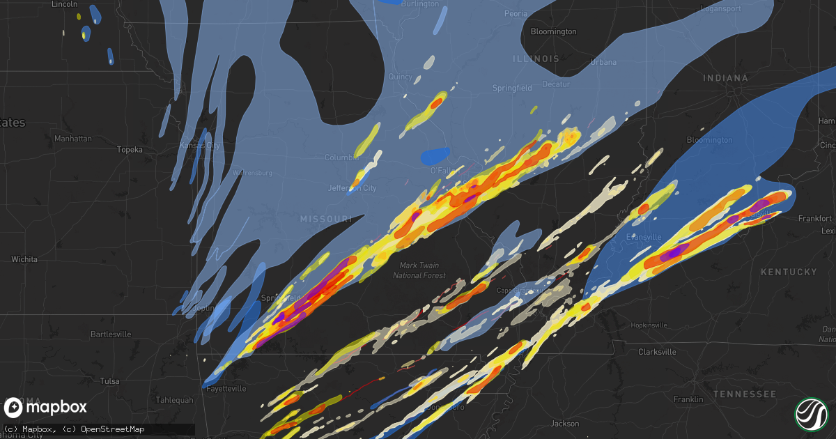
Hail Map on March 14, 2025
Get this storm
March 14 map
$229
one time, instant access
Download today. No call, no setup
Keep the $229
Bought the map and want the full workflow? Apply the entire $229 to a subscription within 7 days. None of it is wasted.
Every map, not just this one
This buys you this map. Subscription and you get every map we run, in the markets you choose from a few cities to whole states to nationwide. Plus real-time alerts the moment a storm fires.
Contact data
Name, contact info, occupancy, even credit band for addresses in the footprint. You go from where it hit to who to call.
Become the source they trust
Unlimited branding weather history reports on demand. You already have the documented answer ready for the property owner, and you are the one who showed up with it.
Property data and RoofTrace estimates
Pull up any address you have got, its value and the exact code rules for that jurisdiction, straight from One Click Code. Then RoofTrace estimates the squares, pitch, and roof value, priced the way you price.
States Impacted by Hail Map on March 14, 2025
Storm reports
Illinois
| Date | Description |
|---|---|
| 03/14/20253:54 PM CDT | Possible tornado. Damage to trees and powerlines and outbuildings. |
| 03/14/202511:58 AM CDT | A local report indicates 58 MPH wind near 1 SW West Chicago |
| 03/14/202511:55 AM CDT | Structural damage near cutler... Il. Roof off trailer on lincoln street and 2 barns destroyed. |
| 03/14/202511:40 AM CDT | A local report indicates 63 MPH wind near 1 SE Timberlane |
| 03/14/20252:31 AM CDT | Tree down on house in brookport. Line damage. |
| 03/14/20251:49 AM CDT | A local report indicates 1.75 inch wind near Harrisburg |
| 03/14/20251:46 AM CDT | Report from mping of half dollar |
| 03/14/20251:31 AM CDT | Severe damage to a home on gilead church road. No injuries. |
| 03/14/20251:23 AM CDT | Drone footage of multiple destroyed buildings including mobile homes along us highway 45 north of vienna near interstate 64. |
| 03/14/20251:08 AM CDT | Report from mping: half dollar |
| 03/14/202512:58 AM CDT | A few trailers flipped. |
| 03/14/202512:51 AM CDT | Delayed report. Relayed from social media. Time estimated by radar. Multiple power poles down east side of paris along us 150. |
| 03/14/202512:50 AM CDT | Trees uprooted... Structural damage to a trailer home... And a roof uplifted from a single residence home. |
| 03/14/202512:40 AM CDT | Tornado reported north of carterville. |
| 03/14/202512:36 AM CDT | Multiple trees uprooted at glen flora county club. Time estimated from radar. |
| 03/14/202512:32 AM CDT | Reported at cmi. |
| 03/14/202512:31 AM CDT | Power poles broken and powerlines down. |
| 03/14/202512:25 AM CDT | Gravestones toppled and windows blown out of the paradise baptist church and cemetery. Probably tornado damage. |
| 03/14/202512:24 AM CDT | A local report indicates 59 MPH wind near 1 NNW Antioch |
| 03/14/202512:23 AM CDT | Photo shared on social media showing multiple softwood trees damaged with some snapped in vernon hills. Time estimated from radar. |
| 03/14/202512:20 AM CDT | Large 40 foot tall 10 inch diameter pine tree snapped about 10 feet up and landed onto house. |
| 03/14/202512:20 AM CDT | Power poles and lines down. Time estimated from radar. |
| 03/14/202512:17 AM CDT | Multiple reports of trees and power poles down in du quoin. |
| 03/14/202512:15 AM CDT | Fire department responding to blown transformers... Some on fire across town. |
| 03/14/202512:15 AM CDT | Power lines down. Time estimated from radar. |
| 03/14/202512:12 AM CDT | Peak measured wind gust. Tree also downed. |
| 03/14/202512:12 AM CDT | Power poles reported down on highway 154. Time estimated from radar. |
| 03/14/202512:09 AM CDT | Report of house destroyed. |
| 03/14/202512:08 AM CDT | Photo shared of tree uprooted in johnsburg. Time estimated from radar. |
| 03/14/202512:08 AM CDT | Outbuilding destroyed. Time estimated from radar with a radar confirmed tornado. |
| 03/14/202512:04 AM CDT | Trained spotter reports part of a roof was blown off of a pole barn along button rd northeast of hebron. Time estimated by radar. |
| 03/14/202512:03 AM CDT | Six inch tree over little kinkaid rd... East of mcclure rd . |
| 03/14/202512:02 AM CDT | Semis blown over on i-57. |
| 03/14/202512:00 AM CDT | Trained spotter reports 6 power poles down at sr 173 and price rd in hebron. Time estimated by radar. |
| 03/14/202512:00 AM CDT | Report from social media. Porch and portion of roof torn off of home. |
| 03/14/202512:00 AM CDT | Multiple reports of uprooted or damaged trees in naperville. Time estimated from radar. |
| 03/13/202511:59 PM CDT | Measured on personal weather station at west chicago esda. |
| 03/13/202511:59 PM CDT | Gutters and roofing material ripped off of house... Small outbuilding demolished... Large limbs and cell tower blown down. Time estimated from radar. |
| 03/13/202511:57 PM CDT | Part of a tree snapped off on the northeast side of plainfield. Time estimated from radar. |
| 03/13/202511:57 PM CDT | Multiple reports of tree and fence damage in woodstock. Time estimated from radar. |
| 03/13/202511:56 PM CDT | Asos station kdpa west chicago - dupage arpt. |
| 03/13/202511:55 PM CDT | Measured on personal weather station. |
| 03/13/202511:53 PM CDT | Delayed report. Relayed from broadcast media. Time estimated by radar. Large 12 in tree limbs down on a house. Shingles peeled upward on roofing. |
| 03/13/202511:51 PM CDT | Fayette county ema reporting multiple lines down in vandalia. |
| 03/13/202511:49 PM CDT | Multiple areas with power lines downed across west side of aurora. |
| 03/13/202511:49 PM CDT | Tree down blocking road. |
| 03/13/202511:49 PM CDT | Large sections of siding peeled off of a large outbuilding near union. Time estimated from radar. |
| 03/13/202511:48 PM CDT | Photo shared of tree uprooted in marengo. Time estimated from radar. |
| 03/13/202511:45 PM CDT | Measured on personal weather station. |
| 03/13/202511:45 PM CDT | Hail lasted for approximately 5 minutes and partially covered the road. |
| 03/13/202511:44 PM CDT | Awos station karr 2 wnw sugar grove. |
| 03/13/202511:44 PM CDT | Tree debris on roadway. |
| 03/13/202511:44 PM CDT | Centralia esda reporting multiple power lines down. |
| 03/13/202511:42 PM CDT | Power line and tree limbs down. |
| 03/13/202511:41 PM CDT | Building damage... Wires down. |
| 03/13/202511:40 PM CDT | Tree in road... 20-30 feet long... 3-4 feet diameter. |
| 03/13/202511:40 PM CDT | Barn with 2nd level torn off... Near findlay along rt 128. Delayed report. Time estimated by radar. |
| 03/13/202511:38 PM CDT | Corrects previous tstm wnd dmg report from 4 ssw maple park. Pritchard road between perry and harter roads closed due to downed power lines. |
| 03/13/202511:37 PM CDT | Report of trees downed and building damage. |
| 03/13/202511:37 PM CDT | Tree downed onto wires in genoa. Time estimated from radar. |
| 03/13/202511:37 PM CDT | Tree down across road on power lines. |
| 03/13/202511:37 PM CDT | Trees reported down on road in many locations along beith road. |
| 03/13/202511:35 PM CDT | Report shared via social media of power lines downed on i-90 near south beloit. Time estimated by radar. |
| 03/13/202511:35 PM CDT | Tree down on power lines with a minor fire. |
| 03/13/202511:33 PM CDT | Sign damage and downed power poles near the blains farm and fleet on riverside blvd. Time estimated from radar. |
| 03/13/202511:32 PM CDT | A local report indicates 65 MPH wind near 4 NNW Hinckley |
| 03/13/202511:31 PM CDT | A local report indicates 65 MPH wind near 3 NNE Leland |
| 03/13/202511:28 PM CDT | A local report indicates 62 MPH wind near 4 NNW Winnebago |
| 03/13/202511:25 PM CDT | A local report indicates 67 MPH wind near 3 W Hinckley |
| 03/13/202511:25 PM CDT | A local report indicates 1.25 inch wind near Altamont |
| 03/13/202511:23 PM CDT | Asos station krfd rockford airport. |
| 03/13/202511:22 PM CDT | A local report indicates 1.75 inch wind near 1 S Vandalia |
| 03/13/202511:20 PM CDT | Wtvo/wqrf. |
| 03/13/202511:20 PM CDT | Delayed report. School bus barn roof was peeled off. Time estimated by radar. |
| 03/13/202511:18 PM CDT | Irvington grade school has a light pole broken at ground level. |
| 03/13/202511:13 PM CDT | Multiple power poles downed or snapped east of rochelle. Report of tree damage in the general area as well. Time estimated from radar. |
| 03/13/202511:10 PM CDT | 4 foot diameter pine tree uprooted. |
| 03/13/202511:10 PM CDT | A local report indicates 64 MPH wind near Dayton |
| 03/13/202511:10 PM CDT | A local report indicates 59 MPH wind near 1 NE Byron |
| 03/13/202511:09 PM CDT | Large tree blocking wolf road near westview road. |
| 03/13/202511:08 PM CDT | Power poles leaning at a 30 degree angle as a result of the strong thunderstorm winds. Time estimated from radar. |
| 03/13/202511:08 PM CDT | Report from mping: hen egg+ |
| 03/13/202511:07 PM CDT | House collapsed with 2 elderly occupants trapped. |
| 03/13/202511:07 PM CDT | A local report indicates 60 MPH wind near 4 NE Oregon |
| 03/13/202511:05 PM CDT | A local report indicates 1.50 inch wind near 3 SE Taylorville |
| 03/13/202511:05 PM CDT | A local report indicates 65 MPH wind near 2 SE Compton |
| 03/13/202511:04 PM CDT | A local report indicates 72 MPH wind near Ancona |
| 03/13/202511:03 PM CDT | Tree on a house with residents trapped. Residents have been freed. |
| 03/13/202511:00 PM CDT | Report from mping: quarter |
| 03/13/202511:00 PM CDT | St. Clair county em reported mobile home overturned with residents trapped inside. |
| 03/13/202510:57 PM CDT | Damage to a shed and fence. |
| 03/13/202510:55 PM CDT | Awos station kvys peru airport. |
| 03/13/202510:52 PM CDT | Possible tornado. Damage to trees and outbuildings. |
| 03/13/202510:52 PM CDT | Large tree limbs and branches downed in polo. Time estimated from radar. |
| 03/13/202510:50 PM CDT | A local report indicates 58 MPH wind near 4 WSW Troy Grove |
| 03/13/202510:50 PM CDT | Barn... Silos and outbuildings damaged. |
| 03/13/202510:47 PM CDT | St. Clair county em reported more than 20 places of power lines down in ofallon... Mascoutah... And lebanon. |
| 03/13/202510:45 PM CDT | A local report indicates 1.00 inch wind near Shiloh |
| 03/13/202510:45 PM CDT | Report from mping: golf ball |
| 03/13/202510:44 PM CDT | Ham operator reporting quarter size hail. |
| 03/13/202510:41 PM CDT | Report of mobile home destroyed. |
| 03/13/202510:40 PM CDT | A local report indicates 1.00 inch wind near 1 ESE Highland |
| 03/13/202510:39 PM CDT | Dime to quarter size hail. |
| 03/13/202510:39 PM CDT | Several power poles sheared off between hennepin and mark. 1400 customers without power. |
| 03/13/202510:38 PM CDT | Pritchard road between perry and harter roads closed due to downed power lines. |
| 03/13/202510:38 PM CDT | Multiple buildings and silos damaged or destroyed on farm near new baden... Il. |
| 03/13/202510:35 PM CDT | Numerous trees down blocking roads south of hennepin. |
| 03/13/202510:33 PM CDT | From madison county il em. |
| 03/13/202510:32 PM CDT | Siding and windows destroyed by wind driven hail. |
| 03/13/202510:31 PM CDT | Also reported quarter size hail with 1.1 inches of rain. |
| 03/13/202510:30 PM CDT | A local report indicates 1.00 inch wind near O'Fallon |
| 03/13/202510:28 PM CDT | Report from mping: quarter |
| 03/13/202510:28 PM CDT | Report from mping: quarter |
| 03/13/202510:28 PM CDT | Measured from personal weather station. Time estimated. |
| 03/13/202510:27 PM CDT | Report from mping: quarter |
| 03/13/202510:27 PM CDT | Report from mping: quarter |
| 03/13/202510:25 PM CDT | Wind driven hail resulted in extensive damage to west facing homes and buildings. |
| 03/13/202510:25 PM CDT | A local report indicates 1.00 inch wind near O'Fallon |
| 03/13/202510:25 PM CDT | Large trees blown down on the south side of washington. |
| 03/13/202510:25 PM CDT | Large tree snapped onto house/deck. |
| 03/13/202510:22 PM CDT | A local report indicates 61 MPH wind near Chillicothe |
| 03/13/202510:15 PM CDT | A grain bin was destroyed and part of a barn roof was damaged. |
| 03/13/202510:12 PM CDT | Columbia pd reported hail between quarter and golf ball size. |
| 03/13/202510:10 PM CDT | Report from mping: ping pong ball |
| 03/13/202510:10 PM CDT | 60 to 70 mph winds estimated from new berlin to loami. |
| 03/13/202510:10 PM CDT | A local report indicates 1.50 inch wind near Marine |
| 03/13/202510:10 PM CDT | Damage to trees and outbuildings. |
| 03/13/202510:08 PM CDT | A local report indicates 1.00 inch wind near Troy |
| 03/13/202510:08 PM CDT | Tree down. Time estimated from radar. |
| 03/13/202510:08 PM CDT | Report from mping: half dollar |
| 03/13/202510:07 PM CDT | Trees down. |
| 03/13/202510:07 PM CDT | Corrects previous hail report from 2 ese columbia. Columbia pd reported hail between quarter and golf ball size. |
| 03/13/202510:06 PM CDT | A local report indicates 1.00 inch wind near 1 SE Glen Carbon |
| 03/13/202510:06 PM CDT | A local report indicates 1.00 inch wind near O'Fallon |
| 03/13/202510:06 PM CDT | Damage to trees and sheds. |
| 03/13/202510:05 PM CDT | Two power poles down. |
| 03/13/202510:05 PM CDT | A local report indicates 1.00 inch wind near 2 E Glen Carbon |
| 03/13/202510:05 PM CDT | Report from mping: quarter |
| 03/13/202510:05 PM CDT | A local report indicates 1.00 inch wind near 1 ESE Troy |
| 03/13/202510:05 PM CDT | A local report indicates 1.25 inch wind near 3 ESE Columbia |
| 03/13/202510:05 PM CDT | Possible tornado. Two mobile homes damage... One was completely rolled over. Time estimated. |
| 03/13/202510:03 PM CDT | A local report indicates 1.50 inch wind near Collinsville |
| 03/13/202510:03 PM CDT | A local report indicates 1.50 inch wind near Collinsville |
| 03/13/202510:00 PM CDT | A local report indicates 1.00 inch wind near 1 ENE Glen Carbon |
| 03/13/202510:00 PM CDT | A couple trees downed by thunderstorm winds. Time estimated from radar. |
| 03/13/202510:00 PM CDT | Restaurant sign blown over. Time estimated from radar. |
| 03/13/20259:59 PM CDT | Roofing material ripped off of a large building. Time estimated from radar. |
| 03/13/20259:58 PM CDT | A large section of sturdy fencing was knocked down across from the kroger on rt 40. |
| 03/13/20259:58 PM CDT | Rotted tree snapped at its base at the peoria country club golf course. Time estimated from radar. |
| 03/13/20259:57 PM CDT | Large but decayed tree snapped near the base. Time estimated by radar. |
| 03/13/20259:57 PM CDT | Fence and a few ill-looking trees downed by thunderstorm winds. Time estimated from radar. |
| 03/13/20259:55 PM CDT | Structural damage to a home porch. |
| 03/13/20259:52 PM CDT | St. Clair county em reported a tree fell on a house on melvin drive... Injuring a 9-year old in cahokia heights. Time estimated from radar. |
| 03/13/20259:47 PM CDT | Trees down. |
| 03/13/20259:46 PM CDT | Overturned semi on the illinois side of the jb bridge. |
| 03/13/20259:41 PM CDT | A local report indicates 70 MPH wind near Cambridge |
| 03/13/20259:40 PM CDT | Metal carport blown down. Time estimated from radar. |
| 03/13/20259:39 PM CDT | Decayed tree split... Powerlines down... And pieces of roofing material blown off a couple buildings. Timing estimated from radar. |
| 03/13/20259:15 PM CDT | Reported at gbg. |
| 03/13/20259:10 PM CDT | Several tree branches were blown down and power was out for about 6 hours. |
| 03/13/20259:05 PM CDT | Sheriff department reported multiple powerlines down throughout the county. |
| 03/13/20259:04 PM CDT | Delayed report and time estimated from radar. Steeple blown off a church. |
| 03/13/20258:56 PM CDT | Estimated storm outflow gust. |
| 03/13/20258:55 PM CDT | Public report of 60 to 70 mph wind gusts. Some small branches reported down. |
| 03/13/20258:47 PM CDT | Report from mping: quarter |
| 03/13/20258:45 PM CDT | Report from mping: golf ball |
| 03/13/20258:40 PM CDT | Corrects time of occurrence for previous tstm wnd gst report from 2 e bald bluff. Estimated storm outflow gust. |
| 03/13/20258:31 PM CDT | A local report indicates 81 MPH wind near 4 SE Blandinsville |
| 03/13/20257:47 PM CDT | Large limbs down in quincy. |
Texas
| Date | Description |
|---|---|
| 03/14/20256:04 AM CDT | Report via email. |
| 03/14/20255:30 AM CDT | Public report of quarter size hail in the caro community. |
| 03/14/20254:24 AM CDT | Report from mping: half dollar |
| 03/14/20254:01 AM CDT | Report from mping: half dollar |
| 03/14/20253:48 AM CDT | Report from mping: quarter |
| 03/14/20253:48 AM CDT | Accumulating hail. |
| 03/14/20253:31 AM CDT | Corrects previous hail report from 4 wsw gallatin. Public report of hail estimated to be quarter size near the cherokee county airport. |
| 03/14/20253:28 AM CDT | Public report of hail estimated to be quarter size near the cherokee county airport. |
| 03/14/20253:21 AM CDT | A local report indicates 1.75 inch wind near 1 E College Station |
| 03/14/20253:20 AM CDT | Report from mping: ping pong ball |
| 03/14/20253:19 AM CDT | Report from mping: ping pong ball |
| 03/14/20253:18 AM CDT | Report from mping: ping pong ball |
| 03/14/20253:18 AM CDT | Report from mping: quarter |
| 03/14/20253:18 AM CDT | Report from mping: hen egg |
| 03/14/20253:18 AM CDT | A local report indicates 1.50 inch wind near 6.5 S Caldwell |
| 03/14/20253:18 AM CDT | A local report indicates 1.50 inch wind near 4 E Bryan |
| 03/14/20253:16 AM CDT | Report from mping: ping pong ball |
| 03/14/20253:16 AM CDT | Report from mping: ping pong ball |
| 03/14/20253:16 AM CDT | Report from mping: golf ball |
| 03/14/20253:16 AM CDT | Report from mping: ping pong ball |
| 03/14/20253:16 AM CDT | Report from mping: quarter |
| 03/14/20253:14 AM CDT | Report from mping: golf ball |
| 03/14/20253:13 AM CDT | Report from mping: quarter |
| 03/14/20253:13 AM CDT | Report from mping: ping pong ball |
| 03/14/20253:13 AM CDT | A local report indicates 1.75 inch wind near 1 E College Station |
| 03/14/20253:12 AM CDT | A local report indicates 1.75 inch wind near College Station |
| 03/14/20253:12 AM CDT | Report from mping: quarter |
| 03/14/20253:12 AM CDT | Report from mping: quarter |
| 03/14/20253:10 AM CDT | Report from mping: quarter |
| 03/14/20253:10 AM CDT | Report from mping: ping pong ball |
| 03/14/20253:09 AM CDT | Report from mping: quarter |
| 03/14/20253:08 AM CDT | Report from mping: ping pong ball |
| 03/14/20253:06 AM CDT | Report from mping: ping pong ball |
| 03/14/20253:06 AM CDT | At kbtx studio. |
| 03/14/20253:06 AM CDT | Report from mping: ping pong ball |
| 03/14/20253:06 AM CDT | Report from mping: ping pong ball |
| 03/14/20253:06 AM CDT | Pea to quarter size in the sherwood campgrounds. |
| 03/14/20253:06 AM CDT | Report from mping: ping pong ball |
| 03/14/20253:06 AM CDT | Report from mping: quarter |
| 03/14/20253:00 AM CDT | Report from mping: quarter |
| 03/14/20253:00 AM CDT | Report from mping: quarter |
| 03/14/20252:58 AM CDT | Public report from loebau relayed from media. Time estimated by radar. |
| 03/14/20252:36 AM CDT | A local report indicates 1.50 inch wind near 6 S Caldwell |
| 03/14/20252:36 AM CDT | Report from mping: quarter |
| 03/13/20258:50 PM CDT | The houston county emergency manager... Local fire marshall and broadcast media confirmed hail in kennard. |
| 03/13/20258:30 PM CDT | Houston county emergency manager reported quarter size hail west of grapeland. |
Arkansas
| Date | Description |
|---|---|
| 03/14/20255:47 PM CDT | A local report indicates 1.00 inch wind near Gateway |
| 03/14/20255:35 PM CDT | A local report indicates 1.00 inch wind near 3 N Rogers |
| 03/14/20255:34 PM CDT | A local report indicates 1.00 inch wind near 2 E Cave Springs |
| 03/14/20255:31 PM CDT | A local report indicates 1.25 inch wind near 1 N Rogers |
| 03/14/20255:18 PM CDT | Thunderstorm wind gusts damaged tree limbs... Up to 2 inches in diameter. |
| 03/14/20254:59 PM CDT | A local report indicates 60 MPH wind near Northwest Arkansas Regi |
| 03/14/20256:20 AM CDT | Report of multiple trees downed along hwy-52... Hwy-133... And camp rd. |
| 03/14/202512:34 AM CDT | A local report indicates 1.00 inch wind near 4 SW Jonesboro |
| 03/14/202512:27 AM CDT | Emergency management report of damage to homes in the pruett chapel area. Possible tornado. |
| 03/14/202512:21 AM CDT | Several trees were uprooted or snapped near the finch community at the intersection of county road 737 and county road 721. Possible tornado. |
| 03/14/202512:21 AM CDT | A local report indicates 1.00 inch wind near 4 WNW Weiner |
| 03/13/202511:34 PM CDT | A local report indicates 1.25 inch wind near 1 NE Bald Knob |
| 03/13/202511:30 PM CDT | Fire station damaged in campbell station. |
| 03/13/202511:29 PM CDT | Ardot camera caught tornado looking north from the exit 83 camera on i-57/us-67. Radar shows debris signature around campbell station. |
| 03/13/202511:17 PM CDT | Ping pong ball sized hail was falling in black rock per emergency manager. |
| 03/13/202511:10 PM CDT | Roof blown off home just west of black rock near the intersection of us 63 and ar hwy 117. |
| 03/13/202511:07 PM CDT | Multiple trees down across roads... Including hwy 24 east of prescott... Ar. |
| 03/13/202511:05 PM CDT | Corrects previous tornado report from 2 w black rock. Roof blown off home just west of black rock near the intersection of us 63 and ar hwy 117. |
| 03/13/202510:54 PM CDT | Homes damaged in the jesup area from possible tornado. |
| 03/13/202510:52 PM CDT | A local report indicates 1.00 inch wind near 3 SW El Paso |
| 03/13/202510:37 PM CDT | Reports of damage in cave city. Possible tornado. |
| 03/13/202510:35 PM CDT | Corrects time/date of previous tornado report from cave city. Initial findings from tornado damage survey leads to a rating of ef-3 with peak winds of 165 mph. Addition |
| 03/13/202510:25 PM CDT | Damage to a roof and 4-wheelers... Destroyed and flipped storage buildings... All near a home on hempstead 57 rd. |
| 03/13/202510:20 PM CDT | Trees down on ar hwy 7 and hwy 51. |
| 03/13/202510:12 PM CDT | *** 1 inj *** trailer house blown over south of hope... Ar. One person taken to the hospital. |
| 03/13/202510:12 PM CDT | Tree reported down on hwy 29 south of hope... Ar. |
| 03/13/20259:53 PM CDT | Report of severe damage to home. |
| 03/13/20258:56 PM CDT | Tree down on us 65. |
| 03/13/20258:05 PM CDT | A local report indicates 1.75 inch wind near 1 SW Gum Springs |
| 03/13/20257:58 PM CDT | A local report indicates 1.00 inch wind near 2 NW Lamar |
| 03/13/20257:52 PM CDT | A local report indicates 1.00 inch wind near Summit |
| 03/13/20257:42 PM CDT | Report via slack. |
Minnesota
| Date | Description |
|---|---|
| 03/13/20257:32 PM CDT | Awos station kfrm fairmont ap. |
Missouri
| Date | Description |
|---|---|
| 03/14/20256:57 PM CDT | About halfway between auxvasse and mexico. |
| 03/14/20256:54 PM CDT | Ping pong sized hail seymour. 1.5 inch. |
| 03/14/20256:50 PM CDT | Largest hail was quarter sized. |
| 03/14/20256:50 PM CDT | Report from mping... Quarter 1.00 inch hail. |
| 03/14/20256:50 PM CDT | Quarter sized hail at 176 and 65 hwy. Taney-christian line. |
| 03/14/20256:48 PM CDT | Large hail... Trees down... Holes in siding reported 7 miles east of niangua. Possible tor. |
| 03/14/20256:45 PM CDT | Mesonet station fw9032 seymour. |
| 03/14/20256:45 PM CDT | Picture of golf ball size hail. 1.75 inch hail. |
| 03/14/20256:40 PM CDT | Estimated maximum winds 90 to 100 mph. Damage included a roof torn off of home... Numerous barns destroyed... A collapsed cell phone tower... And snapped trees laying i |
| 03/14/20256:34 PM CDT | Report from mping... Ping pong ball 1.50 inch. |
| 03/14/20256:32 PM CDT | Quarter size hail emerald beach... Mo. |
| 03/14/20256:32 PM CDT | Quarter sized hail. 5 mile east of rogersville on 60 at the new rv park. |
| 03/14/20256:26 PM CDT | Multiple reports of downed tree limbs and property damage between clark and sturgeon. Time based on social media reports. |
| 03/14/20256:24 PM CDT | Corrects previous hail report from 4 nnw golden. Half dollar size hail emerald beach. |
| 03/14/20256:19 PM CDT | Outflow winds from weakening precipitation were likely to blame for these gusts based on radar. |
| 03/14/20256:19 PM CDT | Fire dept reports multiple building damaged near sumner. Timing estimated via radar. |
| 03/14/20256:18 PM CDT | Half dollar size hail... 1.3 miles south of 76 hwy on y hwy. |
| 03/14/20256:17 PM CDT | Half dollar size hail... 1.25 inch. Via contact. |
| 03/14/20256:16 PM CDT | Report from mping... Quarter... 1.00 in. |
| 03/14/20256:14 PM CDT | Nickle to quarter sized hail reported strafford. |
| 03/14/20256:13 PM CDT | Report from mping... Quarter... 1.00 in. |
| 03/14/20256:13 PM CDT | In nixa high winds... Heavy rain... And quarter sized hail. On east side of nixa in forrest heights subdivision. |
| 03/14/20256:12 PM CDT | Huge hail backed by strong winds destroyed window. |
| 03/14/20256:12 PM CDT | Golf ball sized hail at 15th st and daniels in ozark. |
| 03/14/20256:12 PM CDT | Dime to golf ball sized. Ended at 625 pm. |
| 03/14/20256:12 PM CDT | Downed tree and wires near mckinsey street. Time estimated from radar. |
| 03/14/20256:12 PM CDT | Report from mping... Quarter... 1.00 in. |
| 03/14/20256:11 PM CDT | Ozark 65 and hwy 14... Half dollar sized hail... And extremely heavy rain. |
| 03/14/20256:10 PM CDT | Nickel to quarter sized hail at 15th st and daniels in ozark. |
| 03/14/20256:08 PM CDT | Quarter and dime hail in ozark at godfathers pizza. |
| 03/14/20256:06 PM CDT | Half dollar size hail emerald beach. |
| 03/14/20256:06 PM CDT | Baseball sized hail went through the highlandville area. |
| 03/14/20256:01 PM CDT | Report from mping... Quarter 1.00 in. |
| 03/14/20256:00 PM CDT | A local report indicates 1.25 inch wind near Ozark |
| 03/14/20255:58 PM CDT | Em reports multiple trees down around cooper county. Timing estimated via radar. |
| 03/14/20255:58 PM CDT | Em reports power outages and trees downed in cooper county. Timing estimated via radar. Il 3960 8769 trees uprooted... Structural damage to a trail |
| 03/14/20255:58 PM CDT | Em reports power outages and trees downed in cooper county. Timing estimated via radar. |
| 03/14/20255:54 PM CDT | Report from mping... Half dollar... 1.25 in. |
| 03/14/20255:54 PM CDT | Reporting heavy rainfall and quarter-size hail around highway 39 and highway 76 east intersection north of shell knob. |
| 03/14/20255:51 PM CDT | Social media report of damage to a chicken coop and several trees and limbs down at a property near coatsville. Time estimated from radar. |
| 03/14/20255:39 PM CDT | Roof damage to a home in salisbury. Time estimated from radar. |
| 03/14/20255:38 PM CDT | Several reports of downed wires near boonville with numerous power outages. Time based on dispatch reports and confirmed from radar. |
| 03/14/20255:35 PM CDT | Several reports of downed power lines in the green city and greencastle area with numerous power outages. Time estimated from radar. |
| 03/14/20255:26 PM CDT | Picture of a garage with roof removed sent in by em. Timing estimated via radar. |
| 03/14/20255:24 PM CDT | Time confirmed from radar. |
| 03/14/20255:22 PM CDT | I have a report of 2 large tree limbs down near high and roberson in springfield. One limb is blocking high... The other is on roberson. |
| 03/14/20255:19 PM CDT | Downed wires and numerous power outages south of slater and gilliam. Time estimated from radar. |
| 03/14/20255:16 PM CDT | Civilian submitted report of thunderstorm wind damage near brookfield with multiple downed trees and power lines. Roof damage also reported to a house. Time confirmed f |
| 03/14/20255:15 PM CDT | Social media report of a downed tree at a residence in brookfield. Time confirmed from radar. |
| 03/14/20255:15 PM CDT | Reports of shingles torn off roofs. |
| 03/14/20255:12 PM CDT | Social media photos of a damaged outbuilding and tree limbs down in browning. Time estimated from radar. |
| 03/14/20255:09 PM CDT | Missouri ag mesonet southwest of linneus measured 59 mph wind gust. |
| 03/14/20255:07 PM CDT | Multiple power poles down in chariton county... With outages centered near keytesville and salisbury. Time estimated from radar. |
| 03/14/20255:06 PM CDT | A local report indicates 61 MPH wind near Sedalia Memorial Arpt |
| 03/14/20255:05 PM CDT | Corrects previous non-tstm wnd dmg report from 4 nw rothville. Tree uprooted near route tt. Time estimated from radar. |
| 03/14/20254:51 PM CDT | Power line down across from oak park on elliott. |
| 03/14/20254:47 PM CDT | Several outbuildings and multiple grain bins damaged. Also reported a near-continuous damage swath from 6 wsw laredo to this location. Time based on radar. |
| 03/14/20254:45 PM CDT | Metal building blown into trees and several limbs down at a property near princeton. Time estimated from radar. |
| 03/14/20254:39 PM CDT | Time confirmed from radar. |
| 03/14/20254:37 PM CDT | Radio station in trenton reports 70 mph winds. Relayed by em. |
| 03/14/20254:37 PM CDT | Roof blown off old ag building. Timing estimated from radar. |
| 03/14/20254:37 PM CDT | Em reports partial building collapse at east gate shopping center. |
| 03/14/20254:30 PM CDT | Time confirmed from radar. |
| 03/14/20254:30 PM CDT | Damage to garage/out building; roof blown across us-65. Timing estimated via radar. |
| 03/14/20254:29 PM CDT | Mu barton farm campus recorded 69 mph gust. Relayed by em. |
| 03/14/20254:20 PM CDT | Downed wires and power outages near maysville. Time estimated from radar. |
| 03/14/20254:16 PM CDT | Reports of semis overturned on us-50 west of warrensburg. Timing estimated from radar. Tree limbs down. |
| 03/14/20254:16 PM CDT | Reports of semis overturned on us-50 west of warrensburg. Timing estimated from radar. |
| 03/14/20254:13 PM CDT | Downed tree and an outbuilding destroyed at a residence in winston. Time estimated from radar. |
| 03/14/20254:13 PM CDT | Two power poles downed near stanberry. Time estimated from radar. |
| 03/14/20254:13 PM CDT | Awning blown over and other property damage just west of warrensburg. Time estimated from radar. |
| 03/14/20254:11 PM CDT | Damaged out buildings and roof blown off machine shed. |
| 03/14/20254:11 PM CDT | Power lines down by i-35 racetrack. Timing estimated via radar. |
| 03/14/20254:08 PM CDT | Several downed power lines near and east of sheridan... With multiple power outages reported. Time estimated from radar. |
| 03/14/20254:06 PM CDT | Downed tree and wires near route tt. Time estimated from radar. |
| 03/14/20254:06 PM CDT | Downed tree and wires near holstein road. Time estimated from radar. |
| 03/14/20254:03 PM CDT | Estimated; relayed from social media. |
| 03/14/20254:00 PM CDT | Picture of light pole fallen on car in a parking lot. Time estimated from radar. |
| 03/14/20254:00 PM CDT | Social media report of downed tree limbs and minor property damage at a residence in holt from severe thunderstorm wind gusts. Time estimated from radar. |
| 03/14/20253:58 PM CDT | A local report indicates 60 MPH wind near Oak Grove |
| 03/14/20253:58 PM CDT | Social media report of minor tree damage from estimated 70 mph wind gusts from thunderstorms. Time estimated from radar. |
| 03/14/20253:58 PM CDT | Downed tree and wires near pennsylvania avenue. Time estimated from radar. |
| 03/14/20253:55 PM CDT | Social media report of damage to a barn roof and to a chicken coop near helena. Time estimated from radar. |
| 03/14/20253:53 PM CDT | Measured 58 mph wind gust at kstj. |
| 03/14/20253:53 PM CDT | Several downed power poles in the stewartsville area. Time estimated from radar. |
| 03/14/20253:53 PM CDT | Tree fallen on house in excelsior springs. Timing estimated via radar. |
| 03/14/20253:50 PM CDT | Downed tree at a residence in richmond. Time estimated from radar. |
| 03/14/20253:50 PM CDT | Report of a semi blown over along mo-210 via social media relayed by law enforcement. Timing estimated via radar. |
| 03/14/20253:50 PM CDT | Several large trees and limbs down damaging a property near excelsior springs. Time estimated from radar. |
| 03/14/20253:50 PM CDT | Downed wires and power outages near county line road. Time estimated from radar. |
| 03/14/20253:49 PM CDT | Emergency management reported a downed power line in rural pleasant hill. Location estimated. |
| 03/14/20253:48 PM CDT | Minor property damage from strong thunderstorm winds at a residence north of oak grove. Time estimated from radar. |
| 03/14/20253:48 PM CDT | Windows blown out at a residence in independence. Time estimated from radar. |
| 03/14/20253:48 PM CDT | Downed wires near old santa fe trail. Time estimated from radar. |
| 03/14/20253:45 PM CDT | Social media video of a fence blown over and minor damage to ballpark property at blue springs high school. Time estimated from radar. |
| 03/14/20253:45 PM CDT | Social media report of roof damage to a house from outflow wind gusts. Time based on video footage. |
| 03/14/20253:45 PM CDT | Roof damage to a residence in grain valley. Time estimated from radar. |
| 03/14/20253:45 PM CDT | Measured by stj asos. |
| 03/14/20253:42 PM CDT | Social media video of a light pole snapped. Time estimated from radar. |
| 03/14/20253:42 PM CDT | Downed wires near rosine street. Time estimated from radar. |
| 03/14/20253:40 PM CDT | Roof damage to a business from severe thunderstorm winds. Time estimated from radar. |
| 03/14/20253:40 PM CDT | Roof damage to a business from severe thunderstorm winds. Time estimated from radar. |
| 03/14/20253:39 PM CDT | Downed tree at a residence in lees summit. Time estimated from radar. |
| 03/14/20253:39 PM CDT | Downed tree at a residence in lees summit. Time estimated from radar. |
| 03/14/20253:39 PM CDT | Several reports of wires down and power outages in the mosby area. Time confirmed from radar based on dispatch reports. |
| 03/14/20253:37 PM CDT | A local report indicates 60 MPH wind near 2 NNE Lees Summit |
| 03/14/20253:37 PM CDT | A local report indicates 60 MPH wind near 2 NNE Lee's Summit |
| 03/14/20253:37 PM CDT | Multiple trees down around harrisonville. Timing estimated via radar. |
| 03/14/20253:35 PM CDT | Public reported siding torn from a business and estimated winds of 60 mph. |
| 03/14/20253:35 PM CDT | Local law enforcement reporting trees down in blue springs... Including at least 1 reported on vehicle. |
| 03/14/20253:35 PM CDT | Public relayed... Via social media video... Estimated wind gusts 65 to 70 mph. |
| 03/14/20253:34 PM CDT | Fence blown over and minor property damage at a residence in agency. Time estimated from radar. |
| 03/14/20253:34 PM CDT | Large tree downed at a residence in raymore. Time estimated from radar. |
| 03/14/20253:29 PM CDT | Social media report of downed tree limbs at a property in dearborn. Time estimated from radar. |
| 03/14/20253:29 PM CDT | Downed wires and numerous power outages between rushville and de kalb. Time estimated from radar. |
| 03/14/20253:26 PM CDT | Tree fell onto a house. Time estimated from radar. |
| 03/14/20253:21 PM CDT | Downed wires near route 273. Time estimated from radar. |
| 03/14/20253:21 PM CDT | Social media report of an uprooted tree near 64th street. Time estimated from radar. |
| 03/14/20253:20 PM CDT | Downed tree at a residence in grandview. Time estimated from radar. |
| 03/14/20253:20 PM CDT | A local report indicates 60 MPH wind near Joplin |
| 03/14/20253:17 PM CDT | Mping report of tree limbs down at this location. Time confirmed from radar. |
| 03/14/20253:17 PM CDT | Downed wires and power outages in platte city. Time estimated from radar. |
| 03/14/20253:13 PM CDT | Propane station canopy blown down. Relayed via social media. Timing estimated from radar. |
| 03/14/20253:12 PM CDT | A local report indicates 67 MPH wind near 5 NW Anderson |
| 03/14/20253:11 PM CDT | Sporadic instances of wires down with attendant power outages between harrisonville and butler. Time based on dispatch reports and social media posts and confirmed by r |
| 03/14/20253:11 PM CDT | Large tree down near bales avenue. Time estimated from radar. |
| 03/14/20253:09 PM CDT | Downed tree near ward parkway. Time estimated from radar. |
| 03/14/20251:51 AM CDT | A local report indicates 1.75 inch wind near 2 N Pascola |
| 03/14/20251:42 AM CDT | Reported numerous large trees uprooted and on peoples homes. Worst damage is around jones park in kennett... Mo. Some trees snapped and debarking of trees also occurred |
| 03/14/20251:41 AM CDT | Report from mping: ping pong ball |
| 03/14/20251:40 AM CDT | Report from mping of half dollar |
| 03/14/20251:23 AM CDT | Tree down in wardell... Mo. Possible tornado damage. |
| 03/14/20251:06 AM CDT | Damage reported at a nursing home in sikeston near george e day parkway area. Possible tornado. |
| 03/14/20251:04 AM CDT | Power lines down in kennett... Mo. Possible tornado damage. |
| 03/14/20251:03 AM CDT | Multiple homes damaged... Damage to lowes... Significant damage to nursing home. Possible tornado. |
| 03/14/202512:36 AM CDT | Trained spotter reported a tornado just north of benton with power poles down. |
| 03/14/202512:28 AM CDT | Asos station kcgi cape girardeau mo. |
| 03/14/202512:16 AM CDT | *** 2 inj *** multiple structures damaged. 2 injuries. |
| 03/14/202512:00 AM CDT | Reported near pp highway and cr 254. |
| 03/13/202511:40 PM CDT | Multiple structures with major damage on the south side of perryville. |
| 03/13/202511:40 PM CDT | Damage reported on the south side of perryville. Possible tornado. |
| 03/13/202511:38 PM CDT | Report from mping of half dollar |
| 03/13/202511:35 PM CDT | Major damage reported to new covenant fellowship church and a neighboring trailer park on pp highway. |
| 03/13/202511:33 PM CDT | Many reports of damage in poplar bluff. Houses and buildings destroyed. Power outages and gas leaks reported. Possible tornado. |
| 03/13/202511:25 PM CDT | Near dd and bcr 810. |
| 03/13/202510:56 PM CDT | Report from mping: quarter |
| 03/13/202510:45 PM CDT | Report from mping: quarter |
| 03/13/202510:36 PM CDT | Report from mping: quarter |
| 03/13/202510:34 PM CDT | Multiple trees down. Time estimated by radar. |
| 03/13/202510:19 PM CDT | Report from mping: half dollar |
| 03/13/202510:18 PM CDT | Report from mping: half dollar |
| 03/13/202510:16 PM CDT | Windows blown out of a house near fremont. Possible tornado. Time estatimed. |
| 03/13/202510:14 PM CDT | Multiple limbs off trees. Some damage to roofs in area. |
| 03/13/202510:13 PM CDT | A local report indicates 1.00 inch wind near 1 SW Brentwood |
| 03/13/202510:11 PM CDT | Home reported destroyed on d highway near the carter/reynolds county line. Time estimated. |
| 03/13/202510:09 PM CDT | Report from mping: ping pong ball |
| 03/13/202510:08 PM CDT | A local report indicates 1.00 inch wind near Oakville |
| 03/13/202510:08 PM CDT | Report from mping: quarter |
| 03/13/202510:07 PM CDT | Report from mping: quarter |
| 03/13/202510:06 PM CDT | Report from mping: quarter |
| 03/13/202510:05 PM CDT | Report from mping: quarter |
| 03/13/202510:05 PM CDT | Broken windows and hail damaged cars. |
| 03/13/202510:05 PM CDT | A local report indicates 1.25 inch wind near Oakville |
| 03/13/202510:03 PM CDT | A local report indicates 2.00 inch wind near 2 SW Oakville |
| 03/13/202510:01 PM CDT | A local report indicates 2.00 inch wind near Oakville |
| 03/13/202510:01 PM CDT | Report from mping: half dollar |
| 03/13/20259:58 PM CDT | Report from mping: quarter |
| 03/13/20259:57 PM CDT | Tree on house intersection of harris and lindberg. |
| 03/13/20259:56 PM CDT | Report from mping: quarter |
| 03/13/20259:56 PM CDT | Report from mping: half dollar |
| 03/13/20259:55 PM CDT | A local report indicates 2.00 inch wind near 3 S Saint Louis |
| 03/13/20259:51 PM CDT | A local report indicates 1.00 inch wind near 1 NW Lemay |
| 03/13/20259:51 PM CDT | Report from mping: quarter |
| 03/13/20259:50 PM CDT | He had 1-1.5 inch hail... Emailing a photo. |
| 03/13/20259:50 PM CDT | A local report indicates 1.00 inch wind near 1 NW Saint Louis |
| 03/13/20259:50 PM CDT | A local report indicates 1.00 inch wind near 1 SE Mehlville |
| 03/13/20259:50 PM CDT | A local report indicates 1.25 inch wind near 2 SE Saint Louis |
| 03/13/20259:49 PM CDT | Report from mping: quarter |
| 03/13/20259:47 PM CDT | A local report indicates 1.00 inch wind near 3 NNE Lemay |
| 03/13/20259:47 PM CDT | Trees down and roof damage near liguori lane. |
| 03/13/20259:46 PM CDT | Report from mping: quarter |
| 03/13/20259:46 PM CDT | A local report indicates 1.00 inch wind near 3 NE Lemay |
| 03/13/20259:46 PM CDT | Report from mping: quarter |
| 03/13/20259:45 PM CDT | A local report indicates 1.00 inch wind near 3 E Shrewsbury |
| 03/13/20259:45 PM CDT | Report from mping: quarter |
| 03/13/20259:45 PM CDT | A local report indicates 1.50 inch wind near 3 SSE Saint Louis |
| 03/13/20259:45 PM CDT | Report from mping: quarter |
| 03/13/20259:45 PM CDT | Large transmission tower blown over. |
| 03/13/20259:44 PM CDT | A local report indicates 1.00 inch wind near Brentwood |
| 03/13/20259:43 PM CDT | Report from mping: quarter |
| 03/13/20259:43 PM CDT | A local report indicates 1.25 inch wind near 1 SE Crestwood |
| 03/13/20259:42 PM CDT | A local report indicates 1.00 inch wind near 3 N Arnold |
| 03/13/20259:42 PM CDT | Report from mping: quarter |
| 03/13/20259:42 PM CDT | A local report indicates 1.00 inch wind near 1 S Lemay |
| 03/13/20259:41 PM CDT | A local report indicates 1.00 inch wind near 2 SE Sunset Hills |
| 03/13/20259:41 PM CDT | Report from mping: quarter |
| 03/13/20259:41 PM CDT | Report from mping: quarter |
| 03/13/20259:40 PM CDT | Multiple houses with roof damage. Multiple trees down. |
| 03/13/20259:40 PM CDT | Multiple roofs damaged in neighborhood. Garage collapse. |
| 03/13/20259:40 PM CDT | Report from mping: hen egg |
| 03/13/20259:40 PM CDT | Multiple homes with roof damage. Snapped trees. |
| 03/13/20259:39 PM CDT | Report from mping: half dollar |
| 03/13/20259:39 PM CDT | Report from mping: quarter |
| 03/13/20259:38 PM CDT | Report from mping: quarter |
| 03/13/20259:38 PM CDT | A local report indicates 1.00 inch wind near Fenton |
| 03/13/20259:38 PM CDT | Also wind damage and uprooted trees. |
| 03/13/20259:37 PM CDT | A local report indicates 1.00 inch wind near 1 SW Crestwood |
| 03/13/20259:37 PM CDT | Report from mping: quarter |
| 03/13/20259:37 PM CDT | Trees on multiple house near washington and n st. Charles st. |
| 03/13/20259:37 PM CDT | Report from mping: quarter |
| 03/13/20259:37 PM CDT | Multiple large trees down over new halls ferry road in florrisant. Time estimated by radar. |
| 03/13/20259:36 PM CDT | St. Louis county em relayed report of a house damaged on brunswick drive with occupants trapped inside. |
| 03/13/20259:36 PM CDT | A local report indicates 1.00 inch wind near 1 E Murphy |
| 03/13/20259:36 PM CDT | Report from mping: quarter |
| 03/13/20259:35 PM CDT | A local report indicates 1.75 inch wind near 2 S Fenton |
| 03/13/20259:35 PM CDT | A local report indicates 1.00 inch wind near 3 W Arnold |
| 03/13/20259:35 PM CDT | Report of a tree down over a vehicle and block the street south of industrial lane. Time estimated from radar. |
| 03/13/20259:34 PM CDT | A local report indicates 1.00 inch wind near 1 WSW Fenton |
| 03/13/20259:34 PM CDT | Trees on garage and homes at intersection of benedetta dr and domenico ct. Bridgeton. |
| 03/13/20259:33 PM CDT | A local report indicates 1.00 inch wind near 2 NE Richwoods |
| 03/13/20259:33 PM CDT | Report from mping: quarter |
| 03/13/20259:31 PM CDT | Relayed report of a house destroyed on scotch drive in bridgeton. Time estimated from radar. |
| 03/13/20259:30 PM CDT | A local report indicates 1.00 inch wind near 2 S Murphy |
| 03/13/20259:30 PM CDT | Carport collapse. Multiple trees and power lines down... Roofs blown off. Neighborhood at vogel and miller in arnold... Mo. |
| 03/13/20259:30 PM CDT | Multiple trees on houses. |
| 03/13/20259:29 PM CDT | Report from mping: quarter |
| 03/13/20259:28 PM CDT | A local report indicates 1.75 inch wind near 1 WSW House Springs |
| 03/13/20259:27 PM CDT | Report from mping: quarter |
| 03/13/20259:27 PM CDT | A local report indicates 1.25 inch wind near 1 W Harvester |
| 03/13/20259:25 PM CDT | Report from mping: ping pong ball |
| 03/13/20259:25 PM CDT | Report from mping: half dollar |
| 03/13/20259:25 PM CDT | A local report indicates 1.75 inch wind near 1 WSW House Springs |
| 03/13/20259:24 PM CDT | Corrects previous tornado report from 3 ene morse mill. Multiple structures damaged at clayton huskey road and state route bb. One structure is collapsed. Time estimate |
| 03/13/20259:21 PM CDT | A local report indicates 1.00 inch wind near Cedar Hill |
| 03/13/20259:19 PM CDT | A local report indicates 1.75 inch wind near Catawissa |
| 03/13/20259:16 PM CDT | House damage. Possible tor. |
| 03/13/20259:14 PM CDT | Several homes reported with significant damage and multiple trees and powerlines down. |
| 03/13/20259:13 PM CDT | Nws storm survey concluded that an ef1 tornado with peak winds of 90 to 100 mph touched down just south of rover. The tornado travelled northeast for 6.25 miles before |
| 03/13/20259:10 PM CDT | A large tree down across the road on pp highway coming off 63... A quarter of a mile. Howell county. |
| 03/13/20259:09 PM CDT | A local report indicates 1.00 inch wind near Pacific |
| 03/13/20259:06 PM CDT | Tree limb sticking through roof. Le dubois in 3838 8687 garage roof fell off and into the roadway on g |
| 03/13/20259:06 PM CDT | Tree limb sticking through roof. |
| 03/13/20259:06 PM CDT | Public report of debris damage in the area... Howell county. |
| 03/13/20259:05 PM CDT | A local report indicates 78 MPH wind near Troy |
| 03/13/20259:02 PM CDT | A local report indicates 2.00 inch wind near 1 ESE Sullivan |
| 03/13/20259:00 PM CDT | Report from mping... Quarter hail... 1.00 inch. Time based on radar. |
| 03/13/20259:00 PM CDT | A local report indicates 1.75 inch wind near Cherryville |
| 03/13/20259:00 PM CDT | Report of extensive damage from spotter confirmed tornado. Multiple buildings damaged and vehicles damaged on interstate 44. |
| 03/13/20259:00 PM CDT | Multiple buildings suffered damage near hwy at and hwy 100 near villa ridge. |
| 03/13/20258:56 PM CDT | Multiple building with significant damage. Roofs blown off. |
| 03/13/20258:54 PM CDT | House damaged and power lines down. Possible tor. |
| 03/13/20258:54 PM CDT | Tractor trailer impacted on i-44 near mile marker 247 near union. No further information available. Time estimated by radar. |
| 03/13/20258:53 PM CDT | Building with significant roof damage. Intersection of mo 100 and st marys rd. Viia ridge. |
| 03/13/20258:52 PM CDT | A trailer home was reported to have sustained significant damage on county road oo. |
| 03/13/20258:51 PM CDT | Relayed information from a resident off massey ford road near the bourbouse river. Tornado took down several trees and power lines down. Power is out. |
| 03/13/20258:50 PM CDT | Power lines down and out buildings destroyed. Possible tornado. |
| 03/13/20258:50 PM CDT | Tree branches broken. |
| 03/13/20258:50 PM CDT | A local report indicates 1.50 inch wind near Steelville |
| 03/13/20258:49 PM CDT | Quarter size hail... High wind... And street flooding. |
| 03/13/20258:47 PM CDT | Report from mping: golf ball |
| 03/13/20258:45 PM CDT | Report from mping: quarter |
| 03/13/20258:45 PM CDT | Corrects previous time of tstm wnd dmg report from 4 wnw moody. House damage. Possible tor. |
| 03/13/20258:44 PM CDT | Report from mping: ping pong ball |
| 03/13/20258:41 PM CDT | Picture submitted via social media. Time estimated by radar. |
| 03/13/20258:40 PM CDT | A local report indicates 1.25 inch wind near Bourbon |
| 03/13/20258:37 PM CDT | Report from mping: quarter |
| 03/13/20258:36 PM CDT | Report from mping... Ping pong ball hail... 1.50 inch. Time based on radar. |
| 03/13/20258:34 PM CDT | A local report indicates 1.25 inch wind near 1 N Steelville |
| 03/13/20258:30 PM CDT | 1.00 inch hail. |
| 03/13/20258:30 PM CDT | A local report indicates 1.00 inch wind near 1 W Cuba |
| 03/13/20258:30 PM CDT | Delayed report. Two inch hail along dickinson rd. |
| 03/13/20258:30 PM CDT | Delayed report. Time estimated from radar. |
| 03/13/20258:23 PM CDT | A local report indicates 1.00 inch wind near 3 NE Rosati |
| 03/13/20258:06 PM CDT | Report from mping... Half dollar hail... 1.25 inches. |
| 03/13/20258:00 PM CDT | Quarter size hail... 1.00 inch. |
| 03/13/20257:53 PM CDT | Ems relayed report to 911 center. Dime size hail fell at the location. |
| 03/13/20257:50 PM CDT | Roof off house. Time based on radar. Possible tor. |
| 03/13/20257:42 PM CDT | Wind estimate courtesy of ktvi-tv. |
| 03/13/20257:40 PM CDT | Wind estimated. Stop sign blew off post and past the vehicle while driving. Courtesy of kmiz-tv. |
| 03/13/20257:36 PM CDT | Quarter size hail evening shade. 1.0 inch. |
| 03/13/20257:36 PM CDT | Report from mping... Quarter... 1.00 inch hail. |
| 03/13/20257:36 PM CDT | Report from mping quarter... 1.00 inch hail. |
| 03/13/20257:34 PM CDT | Medical transport indicated permanent modot signs were down. |
| 03/13/20257:30 PM CDT | Reports of tree damage. Possible tornado on the ground. |
| 03/13/20257:30 PM CDT | Structural damage and trees down and power lines down hartville proper. |
| 03/13/20257:28 PM CDT | Ambulance driver estimated wind speed. |
| 03/13/20257:15 PM CDT | On hwy 14 at douglas and christian county line. Just started with pea to ping pong sized hail. 1.5 inch hail. |
| 03/13/20257:10 PM CDT | Relay of a 55 to 60 mph thunderstorm wind gust. |
| 03/13/20257:10 PM CDT | Tree down and power lines down in holts summit. |
| 03/13/20257:07 PM CDT | Hail damage to trees and cars. |
| 03/13/20257:03 PM CDT | Also... Nickel size hail falling with the 60 mph wind at mexico... Mo. |
| 03/13/20257:01 PM CDT | Jefferson city memorial airport. |
| 03/13/20257:00 PM CDT | Report from mping... Ping pong ball ... 1.50 inches. |
Louisiana
| Date | Description |
|---|---|
| 03/14/20256:57 AM CDT | Corrects previous non-tstm wnd dmg report from 3 n natchez. Outbuilding destroyed by strong winds on fish hatchery road. Time estimated by radar. |
| 03/14/20256:45 AM CDT | Mping report. |
| 03/14/20256:40 AM CDT | Reports of trees and powerlines down near highway 15 n and highway 145. |
| 03/14/20256:38 AM CDT | Mping report. |
| 03/14/20255:46 AM CDT | Report from mping: ping pong ball |
| 03/14/20255:46 AM CDT | Public report of quarter size hail in the blanchard area. |
Kentucky
| Date | Description |
|---|---|
| 03/14/20256:50 AM CDT | In woodpark ct area. |
| 03/14/20256:46 AM CDT | Mping report of quarter hail. Time estimated from radar. |
| 03/14/20256:46 AM CDT | A local report indicates 1.00 inch wind near 2 W Middletown |
| 03/14/20256:41 AM CDT | Report from mping: quarter |
| 03/14/20256:41 AM CDT | A local report indicates 1.50 inch wind near Skylight |
| 03/14/20256:38 AM CDT | Twitter post with picture of hail in hikes point. |
| 03/14/20256:35 AM CDT | Tree down on house on halstead ave. |
| 03/14/20256:35 AM CDT | Picture of 1.75 to 2 inch hail in goshen. |
| 03/14/20256:34 AM CDT | A local report indicates 69 MPH wind near 1 NNE Louisville Int'l |
| 03/14/20256:32 AM CDT | Tree down on 600 block of blankenbaker ave. Time estimated from radar. |
| 03/14/20256:31 AM CDT | Report from mping: ping pong ball |
| 03/14/20256:28 AM CDT | Trees down on park rd. Time estimated from radar. |
| 03/14/20256:25 AM CDT | Report from mping: quarter |
| 03/14/20256:24 AM CDT | Mping report. Covered the ground. |
| 03/14/20256:08 AM CDT | Reported at the dispatch center. Time estimated from radar. |
| 03/14/20256:06 AM CDT | Business sign fell down. Time estimated from radar. |
| 03/14/20256:05 AM CDT | Measured at kentucky mesonet station for brandenburg. |
| 03/14/20256:02 AM CDT | At least quarter hail along with high winds on sandy hill rd. Location approximated by time of report... With ongoing hail. |
| 03/14/20256:01 AM CDT | 2 buildings damaged on property in the 300 block of crosier bottom rd. Time estimated from radar. |
| 03/14/20255:45 AM CDT | Mping report. Time adjusted from radar. |
| 03/14/20255:39 AM CDT | A local report indicates 1.25 inch wind near Masonville |
| 03/14/20255:15 AM CDT | Dispatcher had hail at their house near the eoc. Time estimated from radar. |
| 03/14/20255:13 AM CDT | Report from mping of ping pong ball |
| 03/14/20255:10 AM CDT | Tree down across the road just south of 1403 on 1389. Time estimated from radar. |
| 03/14/20255:01 AM CDT | Picture shared on social media of baseball sized hail. |
| 03/14/20254:58 AM CDT | Measured in poverty... Kentucky. |
| 03/14/20254:58 AM CDT | Report from mping of tennis ball |
| 03/14/20254:58 AM CDT | Report from mping of hen egg |
| 03/14/20254:56 AM CDT | Damage to vehicles and windshields from large hail. |
| 03/14/20254:56 AM CDT | Report from mping of golf ball |
| 03/14/20254:50 AM CDT | Golf ball sized hail 1 mile east of panther creek park. |
| 03/14/20254:43 AM CDT | A local report indicates 1.50 inch wind near 5 S Stanley |
| 03/14/20253:57 AM CDT | Report from mping of golf ball |
| 03/14/20253:40 AM CDT | Thirty to fourty-five seconds of quarter size hail in clay. |
| 03/14/20253:30 AM CDT | Sporadic reports of power lines down in the robards area. |
| 03/14/20253:20 AM CDT | 72 mph wind gust measurement by mesonet site at 3:20 am. |
| 03/14/20253:19 AM CDT | A local report indicates 1.00 inch wind near Lone Oak |
| 03/14/20253:07 AM CDT | A local report indicates 60 MPH wind near 2 ESE Sturgis |
| 03/14/20253:00 AM CDT | Double wide knocked off its foundation... Front porch ripped off... Roof ripped off. |
| 03/14/20252:28 AM CDT | Tree down blocking the road on north friendship and guyline road. |
| 03/14/20252:25 AM CDT | Trees down at n gum springs road and lovelaceville road. |
| 03/14/20252:25 AM CDT | Several large tree limbs down and one tree uprooted just north of highway 60 on maxon road. |
| 03/14/20252:15 AM CDT | A local report indicates 1.00 inch wind near Columbus |
| 03/14/20251:30 AM CDT | Public photo of hail 1.75 inches near ledbetter. |
Indiana
| Date | Description |
|---|---|
| 03/14/20256:30 AM CDT | *** 4 inj *** multiple temporary buildings knocked over at construction site on river ridge. |
| 03/14/20256:28 AM CDT | Wind driven hail broke windows had drifts of 6 inch depth. |
| 03/14/20256:28 AM CDT | A local report indicates 1.25 inch wind near Jeffersonville |
| 03/14/20256:28 AM CDT | Report from mping: hen egg |
| 03/14/20256:27 AM CDT | Report from mping: quarter |
| 03/14/20256:26 AM CDT | Mellwood dr area... Quarter and golf ball hail. |
| 03/14/20256:23 AM CDT | Report from mping: half dollar |
| 03/14/20256:16 AM CDT | Report from mping: ping pong ball |
| 03/14/20256:15 AM CDT | Tree down spring farms dr and old vincennes rd. |
| 03/14/20256:10 AM CDT | Mping report. Time estimated from radar. |
| 03/14/20256:10 AM CDT | Spotter also reports lots of wind. |
| 03/14/20256:08 AM CDT | 1.5 to 2 inch hail report. Time estimated from radar. |
| 03/14/20256:05 AM CDT | Report from mping: ping pong ball |
| 03/14/20256:04 AM CDT | Twitter post with picture on chestnut street. |
| 03/14/20256:03 AM CDT | Report from mping: half dollar |
| 03/14/20256:01 AM CDT | Bad hail storm with some small trees damaged and big tree limbs down. Estimated quarter hail. Time estimated from radar. |
| 03/14/20255:35 AM CDT | A local report indicates 58 MPH wind near Richmond |
| 03/14/20255:28 AM CDT | Report from mping: ping pong ball |
| 03/14/20255:27 AM CDT | Picture of various size hail. |
| 03/14/20255:23 AM CDT | Quarter hail and lots of wind. |
| 03/14/20255:17 AM CDT | Tree down. Time estimated from radar data. |
| 03/14/20255:16 AM CDT | Multiple trees down throughout hagerstown. Time estimated from radar data. |
| 03/14/20255:16 AM CDT | Multiple trees down throughout cambridge city. Time estimated from radar data. |
| 03/14/20255:16 AM CDT | Tree down. Time estimated from radar data. |
| 03/14/20255:16 AM CDT | Tree down. Time estimated from radar data. |
| 03/14/20255:15 AM CDT | Large tree downed across rte 350 near 400 block of indian trail. |
| 03/14/20255:14 AM CDT | Tree down. Time estimated from radar data. |
| 03/14/20255:11 AM CDT | Heavily damaged barn with a section of missing roof panels and one collapsed wall. |
| 03/14/20255:06 AM CDT | Fallen tree near s. Benham rd. And east county road 800 s. Time estimated by radar. |
| 03/14/20255:05 AM CDT | *** 3 inj *** late report of over 50 locations spread across rush county with tress or powerlines down with at least two dozen structures damaged. Three people were inj |
| 03/14/20254:58 AM CDT | Reports of trees down in rushville and entire town without power due to wind damage. |
| 03/14/20254:54 AM CDT | Late report of thunderstorm winds downed a tree at st. Vincent catholic church. Time estimated from radar. |
| 03/14/20254:35 AM CDT | Late report of thunderstorm winds snapped two wooden power poles and a center-pivot sprinkler was overturned in the field north of county road 800 north near baseline r |
| 03/14/20254:30 AM CDT | Reports of trees and wires down along the western portion of bartholomew co. |
| 03/14/20254:30 AM CDT | Hail just over quarter sized. |
| 03/14/20254:20 AM CDT | Damage to home... Tree damage around. |
| 03/14/20254:16 AM CDT | A local report indicates 60 MPH wind near 1 W Spurgeons Corner |
| 03/14/20254:14 AM CDT | Multiple power poles broken... Trees down. Possible home damage. |
| 03/14/20254:13 AM CDT | Tree down on rooster hill rd and shady hollow rd. Time estimated based on radar. |
| 03/14/20254:09 AM CDT | Tree down across walnut ridge rd just west of sr135. Time estimated from radar. |
| 03/14/20254:02 AM CDT | Live power line down across roadway in the 6400 block of marshall rd north of saltillo. Time estimated from radar. |
| 03/14/20254:02 AM CDT | Tree down on a house on suder ln. Time estimated from radar. |
| 03/14/20254:02 AM CDT | Transformers on fire and power out in the city. Time estimated from radar. |
| 03/14/20254:00 AM CDT | Asos station kbmg bloomington. |
| 03/14/20254:00 AM CDT | Tree down blocking south kyana rd. Time estimated from radar. |
| 03/14/20253:58 AM CDT | Spotter estimated 60 mph winds. |
| 03/14/20253:57 AM CDT | Tree blocking one lane near state road 264 and 500e. Time estimated from radar. |
| 03/14/20253:53 AM CDT | Roof damage corner of 2nd st and w vincennes. Also report of damage on s 4th st... Pole barn damaged. |
| 03/14/20253:51 AM CDT | Trees down cr 100 w near 600 n. Time estimated from radar. |
| 03/14/20253:50 AM CDT | Power poles down cr 500 n near 200 w. Time estimated from radar. |
| 03/14/20253:45 AM CDT | Tree down blocking hwy 150 near 725w. Time estimated from radar. |
| 03/14/20253:45 AM CDT | Trees snapped in half and blocking bedford st. Time estimated from radar. |
| 03/14/20253:37 AM CDT | Late report of thunderstorm winds downed trees along old indiana state route 37 at brehop lane. Time estimated from radar. |
| 03/14/20253:37 AM CDT | Power was out in the celestine area. |
| 03/14/20253:36 AM CDT | Large tree reported down somewhere on dubois cuzco rd... Blocking roadway. Estimated location and time. |
| 03/14/20253:35 AM CDT | Tree down. Time estimated from radar. |
| 03/14/20253:35 AM CDT | Trees and power lines downed. Old masonry building leaning towards us231. Possible tornado damage near and west of town. |
| 03/14/20253:33 AM CDT | Trees and power lines down south of st rd 164 on 500e. Time estimated from radar. |
| 03/14/20253:33 AM CDT | Power line down on schnellville rd. Time estimated from radar. |
| 03/14/20253:30 AM CDT | Garage roof fell off and into the roadway on greener rd. Time estimated off radar. |
| 03/14/20253:30 AM CDT | Broken power line post and lines partially in one lane of traffic. Time estimated from radar. |
| 03/14/20253:29 AM CDT | Two trees blocking both lanes. Time estimated from radar. |
| 03/14/20253:28 AM CDT | Trained spotter reports 60 mph wind gust in portersville. |
| 03/14/20253:27 AM CDT | Tree blocking one lane of traffic 400 south by north cherry. Time estimated from radar. |
| 03/14/20253:27 AM CDT | Several trees and power lines down between jasper and ireland. |
| 03/14/20253:26 AM CDT | Tree down blocking schuetter rd area in jasper. Time estimated from radar. |
| 03/14/20253:25 AM CDT | Viewer photo of woodshed thrown onto a car. Somewhere between holland and huntingburg. Time estimated from radar. |
| 03/14/20253:22 AM CDT | Several trees blocking the roadway. Time estimated from radar. |
| 03/14/20253:20 AM CDT | A local report indicates 67 MPH wind near Newburgh |
| 03/14/20253:15 AM CDT | Tree snapped. |
| 03/14/20253:14 AM CDT | Metal outbuilding lost a number of roof panels. Photos show one wall may have lost panels as well. |
| 03/14/20253:10 AM CDT | Late report of thunderstorm winds downed several trees in and to the south of fillmore. Time estimated from radar. |
| 03/14/20253:05 AM CDT | Security camera footage showed a tornado in oakland city. Damage reported around the city. |
| 03/14/20253:05 AM CDT | Screen shot of security camera footage of a tornado in oakland city. |
| 03/14/20252:58 AM CDT | 11 power poles snapped between elm and fir rd on 11th rd. 700 customers impacted. |
| 03/14/20252:56 AM CDT | A local report indicates 1.75 inch wind near Princeton |
| 03/14/20252:49 AM CDT | Tree of unknown size downed over road. Time estimated from radar. |
| 03/14/20252:45 AM CDT | Roof blown off of a building along owensville road. |
| 03/14/20252:45 AM CDT | Roof blown off building along owensville road. |
| 03/14/20252:41 AM CDT | Report from mping of quarter |
| 03/14/20252:39 AM CDT | Late report of thunderstorm winds downed an old communication tower onto a cable line to a utility pole at 108 north cleveland street. These winds also downed a communi |
| 03/14/20252:30 AM CDT | Multiple tree limbs snapped. Relayed via social media. |
| 03/14/20252:19 AM CDT | Large tree limb down over in-246. |
| 03/14/20252:15 AM CDT | Awos station kfkr frankfort. |
| 03/14/20251:54 AM CDT | Asos station klaf w. Lafayette - purdue univ. Arpt. |
| 03/14/20251:40 AM CDT | Late report of thunderstorm winds downed dozens of trees across warren county. Time estimated from radar. |
| 03/14/20251:35 AM CDT | Tree limbs downed on state road 25. |
| 03/14/20251:20 AM CDT | Late report of thunderstorm winds downed dozens of trees and poles across fountain county. Time estimated from radar. |
| 03/14/20251:17 AM CDT | Reports of tree damage. |
| 03/14/20251:16 AM CDT | Extensive tree damage... Barn damage... Road shutdown from being impassable. |
| 03/14/20251:16 AM CDT | Tree snapped near ground. |
| 03/14/20251:14 AM CDT | A local report indicates 59 MPH wind near 1 NW Cedar Lake |
| 03/14/20251:14 AM CDT | Ef-1 tornado with peak wind of 110 mph... Path length of 2.66 miles... And a max width of 75 yards. Destroyed a small garage. Severely damaged a 150 year old barn. |
Tennessee
| Date | Description |
|---|---|
| 03/14/20254:24 AM CDT | A local report indicates 1.00 inch wind near 2 S Savannah |
Iowa
| Date | Description |
|---|---|
| 03/14/20256:46 PM CDT | Mesonet station rsli4 storm lake. |
| 03/14/20256:45 PM CDT | 2 semis blown over. |
| 03/14/20256:44 PM CDT | A local report indicates 71 MPH wind near 4 SE Kirkville |
| 03/14/20256:42 PM CDT | Via personal weather station. |
| 03/14/20256:40 PM CDT | Damage to a store sign. Time estimated. |
| 03/14/20256:39 PM CDT | Via personal weather station. |
| 03/14/20256:35 PM CDT | Lean-to shed uprooted from ground... Carried and destroyed taking out power lines and slammed into garage. Large healthy pine tree snapped off a couple feet from its ba |
| 03/14/20256:28 PM CDT | A local report indicates 67 MPH wind near 3 WNW Fremont |
| 03/14/20256:26 PM CDT | Via personal weather station. |
| 03/14/20256:25 PM CDT | Empty cattle semi blown over - time estimated. |
| 03/14/20256:25 PM CDT | Trained spotter reports estimated tstm wind gusts 60-70 mph and large branch down. |
| 03/14/20256:24 PM CDT | Via personal weather station. |
| 03/14/20256:18 PM CDT | Tree fell on a power line in stratford - time estimated. |
| 03/14/20256:18 PM CDT | Estimated 60-70 mph winds that lasted nearly 10 minutes. |
| 03/14/20256:12 PM CDT | A local report indicates 64 MPH wind near 2 SE Newton |
| 03/14/20256:12 PM CDT | A local report indicates 64 MPH wind near 3 SW Webster City |
| 03/14/20256:03 PM CDT | Report from mping: quarter |
| 03/14/20256:03 PM CDT | Overturned semi. |
| 03/14/20256:02 PM CDT | A local report indicates 58 MPH wind near 2 SE Newton |
| 03/14/20256:00 PM CDT | Trained spotter report measured wind gust using hand-held anemometer. |
| 03/14/20256:00 PM CDT | Time estimated from radar. From neal smith raws station. |
| 03/14/20256:00 PM CDT | A local report indicates 59 MPH wind near 3 SW Denison |
| 03/14/20256:00 PM CDT | Barn missing roof - delayed report... Time estimated by radar. |
| 03/14/20255:58 PM CDT | 1/2 mile of power poles snapped off 3 m west and 1 mi north of carroll near the town of maple river. Time estimated. |
| 03/14/20255:57 PM CDT | A local report indicates 64 MPH wind near 3 WSW Glidden |
| 03/14/20255:56 PM CDT | A local report indicates 72 MPH wind near 2 WNW Pleasant Hill |
| 03/14/20255:52 PM CDT | A local report indicates 63 MPH wind near Des Moines Int Airport |
| 03/14/20255:52 PM CDT | Large tree blown over onto a house causing damage to the house. Time estimated. |
| 03/14/20255:51 PM CDT | A local report indicates 65 MPH wind near 2 SW Pleasant Hill |
| 03/14/20255:50 PM CDT | Damage to wooden privacy fence. Time estimated. |
| 03/14/20255:50 PM CDT | 40 ft tall pine tree blown over in the 6600 block of ne 8th ct. Estimated winds of 65-75 mph. |
| 03/14/20255:50 PM CDT | Trained spotter estimated wind gust 60 mph. |
| 03/14/20255:47 PM CDT | Branches 1 to 1.5 inch diameter torn from trees by wind gusts. |
| 03/14/20255:45 PM CDT | Report from mping: quarter |
| 03/14/20255:44 PM CDT | Report from mping: quarter |
| 03/14/20255:41 PM CDT | Apartment buildings lost their roofs in guthrie center - time estimated by radar. |
| 03/14/20255:41 PM CDT | Roof blown off of a storage building. Time estimated. |
| 03/14/20255:40 PM CDT | 60 mph wind gusts reported by 4 spotters from ackworth to martinsdale. |
| 03/14/20255:38 PM CDT | A local report indicates 1.00 inch wind near Perry |
| 03/14/20255:37 PM CDT | Power poles snapped off in knoxville - time estimated. |
| 03/14/20255:36 PM CDT | Report from mping: quarter |
| 03/14/20255:34 PM CDT | A local report indicates 1.50 inch wind near 3 WNW Ames |
| 03/14/20255:34 PM CDT | A local report indicates 1.00 inch wind near 3 WNW Ames |
| 03/14/20255:34 PM CDT | A local report indicates 1.00 inch wind near 2 W Ames |
| 03/14/20255:29 PM CDT | Measured by personal weather station. |
| 03/14/20255:28 PM CDT | A local report indicates 70 MPH wind near 2 S Menlo |
| 03/14/20255:27 PM CDT | Semi that was blown over on i80 at the 86 mile marker near menlo. |
| 03/14/20255:24 PM CDT | Measured on personal weather station. |
| 03/14/20255:22 PM CDT | Tree down blocking the road. |
| 03/14/20255:21 PM CDT | A local report indicates 63 MPH wind near Des Moines Int Airport |
| 03/14/20255:14 PM CDT | Measured on two separate personal weather stations. |
| 03/14/20255:05 PM CDT | A local report indicates 1.00 inch wind near 1 ENE Urbandale |
| 03/14/20255:00 PM CDT | A local report indicates 1.00 inch wind near Windsor Heights |
| 03/14/20254:59 PM CDT | Delayed report. |
| 03/14/20254:54 PM CDT | A local report indicates 71 MPH wind near 2 ENE Lamoni |
| 03/14/20254:53 PM CDT | A local report indicates 62 MPH wind near 2 ENE Lamoni |
| 03/14/20254:52 PM CDT | A local report indicates 60 MPH wind near 2 SSE Silver City |
| 03/14/20254:52 PM CDT | A local report indicates 66 MPH wind near 4 WSW Mcclelland |
| 03/14/20254:23 PM CDT | A local report indicates 58 MPH wind near 3 NNW Pacific Junction |
| 03/14/20254:20 PM CDT | Relayed via broadcast media. |
| 03/14/20254:17 PM CDT | Relayed by whotv. |
| 03/14/20254:15 PM CDT | Dime-quarter sized hail. |
| 03/14/20254:09 PM CDT | A local report indicates 1.00 inch wind near 1 N Bridgewater |
| 03/13/20259:51 PM CDT | Delayed report and time estimated from radar. Large business sign down just south of the pennsylvania ave and jfk road intersection. |
| 03/13/20259:47 PM CDT | A local report indicates 75 MPH wind near 3 ENE Clinton |
| 03/13/20259:37 PM CDT | Time estimated by radar. Report that part of a barn roof was ripped off by the thunderstorm winds. |
| 03/13/20259:20 PM CDT | Windows broken out of a home along with a patio table blown off the porch. |
| 03/13/20259:05 PM CDT | A 12 foot tree uprooted. |
| 03/13/20259:05 PM CDT | A local report indicates 60 MPH wind near Lowden |
| 03/13/20258:53 PM CDT | A local report indicates 65 MPH wind near 1 W Manchester |
| 03/13/20258:21 PM CDT | Branches down. |
| 03/13/20258:15 PM CDT | A local report indicates 62 MPH wind near Columbus City |
| 03/13/20258:15 PM CDT | A local report indicates 70 MPH wind near 4 WSW Mount Union |
| 03/13/20258:12 PM CDT | Corrects previous tstm wnd gst report from cedar rapids municipal airport. Report from the control tower. |
| 03/13/20258:12 PM CDT | Report from the control tower. |
| 03/13/20258:06 PM CDT | Asos equipment. |
| 03/13/20258:05 PM CDT | A local report indicates 62 MPH wind near 2 NNE Ainsworth |
| 03/13/20258:01 PM CDT | Measured on the riverfront and main street. |
| 03/13/20258:00 PM CDT | Measured at the washington county eoc. |
| 03/13/20257:55 PM CDT | Awos station kawg washington arpt. |
| 03/13/20257:53 PM CDT | Turkey house lost roof and blown onto the road and pulling on power lines/poles. Multiple poles down in the area of the turkey farm and along a line towards brighton. T |
| 03/13/20257:53 PM CDT | Spotter reporting power poles down in brighton iowa. |
| 03/13/20257:50 PM CDT | A local report indicates 65 MPH wind near 2 E Marengo |
| 03/13/20257:48 PM CDT | Wind equipment measurement. |
| 03/13/20257:45 PM CDT | Spotter reported a measured 74 mph wind gust north of washington on g36. |
| 03/13/20257:44 PM CDT | Multiple personal weather stations in the area reporting 60+ mph wind gusts. |
| 03/13/20257:44 PM CDT | Multiple per |
| 03/13/20257:37 PM CDT | A local report indicates 63 MPH wind near 2 W Nauvoo |
| 03/13/20257:37 PM CDT | Time estimated from radar. Shingles off roof with outdoor furniture blown over. |
| 03/13/20257:35 PM CDT | Mesonet station rvhi4 us-30 at us-218. |
| 03/13/20257:34 PM CDT | Em reported a 61 mph wind gust just south of stockport. |
| 03/13/20257:34 PM CDT | Personal weather station reported a peak gust of 74 mph. |
| 03/13/20257:21 PM CDT | A local report indicates 71 MPH wind near Grundy Center |
| 03/13/20257:15 PM CDT | Awos station kffl fairfield arpt. |
| 03/13/20257:08 PM CDT | A local report indicates 58 MPH wind near 2 SW Hampton |
| 03/13/20257:05 PM CDT | Via personal weather station. |
Mississippi
| Date | Description |
|---|---|
| 03/14/20251:35 AM CDT | Numerous trees and power lines down. Possible tornado. |
| 03/14/202512:40 AM CDT | Report of extensive damage to elliott community; downed power lines and multiple residences destroyed. |
| 03/14/202512:40 AM CDT | Report of extensive damage to elliott community; downed power lines and multiple residences destroyed. |
| 03/14/202512:36 AM CDT | Houses heavily damaged in the elliott area. |
| 03/14/202512:31 AM CDT | Multiple reports of a tornado crossing i-55 northwest of duck hill. Several large trees downed... And a tractor trailer truck was overturned. |
| 03/14/202512:07 AM CDT | Roof removed from a house and steel framed shop damaged north of a solar farm along us 82 near valley hill. |
| 03/13/202511:42 PM CDT | Trees snapped... Powerlines downed... And sheet metal debris in a field along phillipston rd. |
| 03/13/202511:20 PM CDT | Multiple reports of a tornado ongoing north of belzoni. |
| 03/13/202510:40 PM CDT | Report of multiple trees and powerlines downed... As well as damage to a residence on malcolm drive. |
Ohio
| Date | Description |
|---|---|
| 03/14/20256:22 AM CDT | Asos station kday dayton international airport. |
| 03/14/20256:05 AM CDT | Trees down throughout the county. The time at this location is estimated from radar data. |
| 03/14/20255:58 AM CDT | Snapped pole and tree down. Time estimated from radar data. |
| 03/14/20255:55 AM CDT | Tree down. Time estimated from radar data. |
| 03/14/20255:53 AM CDT | Large tree down. Time estimated from radar data. |
| 03/14/20255:44 AM CDT | A few trees down on oh-571 between union city and greenville. |
| 03/14/20255:37 AM CDT | A few trees down in the area. Time estimated from radar data. |
| 03/14/20255:37 AM CDT | Tree down. Time estimated from radar data. |
| 03/14/20255:12 AM CDT | Corrects previous tstm wnd dmg report from 2 sw scott. Updated time. Two locations where power poles were snapped and lines were down. |
| 03/14/20254:12 AM CDT | Two locations where power poles were snapped and lines were down. Time estimated from radar. |
Kansas
| Date | Description |
|---|---|
| 03/14/20254:35 PM CDT | Awos station koin oberlin. |
| 03/14/20253:53 PM CDT | Mesonet station up841 1.9 w monument |
| 03/14/20253:16 PM CDT | Measured by personal weather station. |
| 03/14/20253:15 PM CDT | A local report indicates 69 MPH wind near Crestline |
| 03/14/20253:06 PM CDT | Tree snapped at a residence. Time is estimated based on social media post and confirmed from radar. |
| 03/14/20253:04 PM CDT | Trained spotter relayed measured 67 mph wind gust. |
| 03/14/20252:53 PM CDT | Large tree uprooted at a residence near stilwell. Time estimated from radar. |
| 03/14/20252:53 PM CDT | Tree limbs snapped at a residence in bonner springs. Time estimated from radar. |
| 03/14/20252:51 PM CDT | Asos station kixd olathe new century aircenter. |
| 03/14/20252:47 PM CDT | Em relayed trained spotter report of 60 mph measured wind gusts. |
| 03/14/20252:46 PM CDT | Tree branches broken near 4 inch in diameter. |
| 03/14/20252:44 PM CDT | Downed wires near 391st street. Time estimated from radar. |
| 03/14/20252:43 PM CDT | Considerable damage to a building... Including a roof blown into another building... Near route 52 in mound city. Time estimated from radar. |
| 03/14/20252:35 PM CDT | Public submitted report of multiple trees and limbs down near paola from thunderstorm outflow. Additional damage occurred after the storms moved through... With non-thu |
| 03/14/20252:24 PM CDT | Private weather sensor. Precipitation recorded at time of measurement. |
| 03/14/202512:02 PM CDT | 65 mph winds near 251st and springdale rd. Also had dime size hail. |
Nebraska
| Date | Description |
|---|---|
| 03/14/20256:29 PM CDT | Report relayed by em. Spotter had nickel to quarter size hail. |
| 03/14/20256:19 PM CDT | Measured on weather station. |
| 03/14/20256:07 PM CDT | Measured on personal weather station. |
| 03/14/20256:07 PM CDT | Measured on personal weather station. |
| 03/14/20256:07 PM CDT | 2 inch diameter tree lambs falling. Estimated 50-60 mph. |
| 03/14/20256:05 PM CDT | Hooper police reported 50-60 mph wind gusts. |
| 03/14/20255:53 PM CDT | Dime to quarter size hail falling for 5 minutes with 40 to 50 mph wind gusts. |
| 03/14/20255:49 PM CDT | A local report indicates 78 MPH wind near 2 ESE Tekamah |
| 03/14/20255:40 PM CDT | A local report indicates 63 MPH wind near 2 ESE Tekamah |
| 03/14/20255:37 PM CDT | A local report indicates 70 MPH wind near 7 W Herman |
| 03/14/20255:20 PM CDT | A local report indicates 59 MPH wind near 2 SE Heartwell |
| 03/14/20254:54 PM CDT | A local report indicates 63 MPH wind near 1 S Washington |
| 03/14/20254:48 PM CDT | A local report indicates 62 MPH wind near 7 ENE Omaha |
| 03/14/20254:36 PM CDT | A local report indicates 59 MPH wind near 4 S Grafton |
| 03/14/20254:31 PM CDT | A local report indicates 63 MPH wind near Martell |
| 03/14/20254:30 PM CDT | A local report indicates 58 MPH wind near 1 NNW Strang |
| 03/14/20254:23 PM CDT | A local report indicates 61 MPH wind near 5 WNW Plattsmouth |
| 03/14/20254:20 PM CDT | Delayed report. Farm shop severely damaged... Time estimated from radar... Report relayed by em. |
| 03/14/20254:13 PM CDT | Tree down blocking the southbound lanes at the intersection of highway 66 and 42nd street. Reports of blown signage along highway 66. |
| 03/14/20254:11 PM CDT | Report from social media. |
| 03/14/20254:05 PM CDT | Report of tree and power line down at 5th street and market. Time estimated by radar. |
| 03/14/20253:59 PM CDT | A local report indicates 60 MPH wind near 5 NE Table Rock |
| 03/14/20253:56 PM CDT | A local report indicates 58 MPH wind near 2 N Blue Springs |
| 03/14/20253:55 PM CDT | Tree down south of highway 2 and 67 reported by ema. Time estimated by radar. |
| 03/14/20253:52 PM CDT | A local report indicates 70 MPH wind near 1 S Fairbury |
| 03/14/20253:49 PM CDT | A local report indicates 58 MPH wind near 1 W Humboldt |
| 03/14/20253:36 PM CDT | A local report indicates 1.00 inch wind near 3 SE Sterling |
| 03/14/20253:17 PM CDT | Mostly smaller hail... But a couple of soft hail stones up to the size of a quarter. |
| 03/14/20253:17 PM CDT | Tree limbs less than 1 inch in diameter on ground. |
Alabama
| Date | Description |
|---|---|
| 03/14/20254:20 AM CDT | Social media photo of quarter-size hail in oakman. |
| 03/14/20253:47 AM CDT | Social media photos of half dollar to ping pong ball size hail in gordo. |
| 03/14/20253:15 AM CDT | A local report indicates 1.00 inch wind near Hodges |
Wisconsin
| Date | Description |
|---|---|
| 03/14/20259:14 AM CDT | Report from mping: quarter |
| 03/14/20258:44 AM CDT | Report from mping. |
| 03/14/20258:40 AM CDT | A local report indicates 1.00 inch wind near 4 WSW Washburn |
| 03/14/20258:33 AM CDT | A local report indicates 1.00 inch wind near 3 NE Moquah |
| 03/14/202512:57 AM CDT | Milwaukee asos measured 62 mph/54 knots. |
| 03/14/202512:40 AM CDT | Corrects previous tstm wnd gst report from dodge county airport. 50 kt gust measured at the dodge county airport in juneau. |
| 03/14/202512:40 AM CDT | 50 kt gust measured at the dodge county airport in juneau. |
| 03/14/202512:39 AM CDT | Mesonet station wi073 i-43 sb at sth 83. |
| 03/14/202512:35 AM CDT | Several fences blown down between beaver dam and horicon. |
| 03/14/202512:33 AM CDT | Large tree down. |
| 03/14/202512:29 AM CDT | Mesonet station wi090 waukesha co i-94 wb at sth 67. |
| 03/14/202512:25 AM CDT | A local report indicates 60 MPH wind near 2 NNE Oconomowoc |
| 03/14/202512:22 AM CDT | Mesonet station ew4463 sun prairie. |
| 03/14/202512:15 AM CDT | Numerous trees down between sullivan and oconomowoc. |
| 03/14/202512:10 AM CDT | Public report of three uprooted trees and a toppled shed. Time estimated from report information and radar. |
| 03/14/202512:10 AM CDT | Public report of 8 uprooted trees and roof damage to a garage 4 w of watertown. Time estimated from report info and radar data. |
| 03/14/202512:06 AM CDT | Several reports of tree and powerline damage. |
| 03/14/202512:00 AM CDT | Mesonet station wiwlh walworth. |
| 03/13/202511:50 PM CDT | Mesonet station wi087 i-39 90 at church rd. |
| 03/13/202511:50 PM CDT | Mesonet station wi089 i-39 90 at sth 26. |
| 03/13/202511:50 PM CDT | Mesonet station wi088 i-39 90 at sth 59 newville. |
| 03/13/202511:45 PM CDT | Tree came through a roof of a home. |
| 03/13/202511:45 PM CDT | Snapped trees. |
| 03/13/202511:45 PM CDT | Multiple trees on trailers. |
| 03/13/202511:42 PM CDT | Roof reported blown off. |
| 03/13/202511:39 PM CDT | Tree damage on the southwest side of janesville. |
| 03/13/202511:27 PM CDT | Trees down with power lines down. |
| 03/13/202511:25 PM CDT | Trees down in town of union. |
| 03/13/202511:20 PM CDT | Shingles off roof. Horse shed blown over and pushed into field. Fencing damage. Multiple trees down. |
| 03/13/202510:51 PM CDT | Mesonet station ap090 madison. |
| 03/13/202510:46 PM CDT | A local report indicates 64 MPH wind near 1 NE Dodgeville |
| 03/13/202510:41 PM CDT | Reports of uprooted trees and power issues from fennimore to boscobel to muscoda. |
| 03/13/202510:13 PM CDT | Wind gusts in the mid to upper 60s measured on home weather station. |
| 03/13/202510:10 PM CDT | A local report indicates 59 MPH wind near 5 NNW Platteville |
South Dakota
| Date | Description |
|---|---|
| 03/13/20257:40 PM CDT | Mesonet station 197 sd rwis gayville. |
Cities Impacted by Hail Map on March 14, 2025
- Burkesville, KY
- Cable, WI
- Grand View, WI
- Ashland, WI
- Washburn, WI
- Adair, OK
- Saint Paul, AR
- McLouth, KS
- Easton, KS
- Winchester, KS
- Atchison, KS
- Rushville, MO
- Grapevine, AR
- Pickford, MI
- Osawatomie, KS
- Paola, KS
- Edgerton, KS
- Wellsville, KS
- Spring Hill, KS
- Gardner, KS
- New Century, KS
- Olathe, KS
- Barbeau, MI
- Sault Sainte Marie, MI
- Columbus, KS
- Farlington, KS
- Fort Scott, KS
- Arcadia, KS
- Garland, KS
- Deerfield, MO
- Richards, MO
- Hume, MO
- Lenexa, KS
- De Soto, KS
- Scammon, KS
- Weir, KS
- Bonner Springs, KS
- Shawnee, KS
- Pleasanton, KS
- Prescott, KS
- Mound City, KS
- Chetopa, KS
- Baxter Springs, KS
- Miami, OK
- Rich Hill, MO
- Foster, MO
- Amoret, MO
- Fulton, KS
- Butler, MO
- Amsterdam, MO
- Adrian, MO
- Louisburg, KS
- Bucyrus, KS
- Stilwell, KS
- Overland Park, KS
- Leawood, KS
- Kansas City, MO
- Prairie Village, KS
- Kansas City, KS
- La Cygne, KS
- Archie, MO
- Harrisonville, MO
- Waldron, MO
- Platte City, MO
- Nevada, MO
- Bronaugh, MO
- Moundville, MO
- Galena, KS
- Sheldon, MO
- Quapaw, OK
- Garden City, MO
- Drexel, MO
- Joplin, MO
- Liberty, MO
- Carl Junction, MO
- Anderson, MO
- Goodman, MO
- Asbury, MO
- Pittsburg, KS
- Opolis, KS
- Mindenmines, MO
- Walker, MO
- Pleasant Hill, MO
- Neosho, MO
- Greenwood, MO
- Freeman, MO
- Cleveland, MO
- Peculiar, MO
- Camden Point, MO
- Smithville, MO
- Dearborn, MO
- Edgerton, MO
- Milo, MO
- El Dorado Springs, MO
- Webb City, MO
- Carterville, MO
- Carthage, MO
- Oronogo, MO
- Jasper, MO
- Alba, MO
- Purcell, MO
- Neck City, MO
- Raymore, MO
- Lone Jack, MO
- East Lynne, MO
- Lees Summit, MO
- Diamond, MO
- Granby, MO
- Gower, MO
- Agency, MO
- Faucett, MO
- Trimble, MO
- Treece, KS
- Harwood, MO
- Picher, OK
- Schell City, MO
- Rockville, MO
- Appleton City, MO
- Riverton, KS
- Sterling, NE
- Tecumseh, NE
- Liberal, MO
- Lamar, MO
- Saint Joseph, MO
- Wathena, KS
- Amazonia, MO
- Savannah, MO
- Easton, MO
- Independence, MO
- Stewartsville, MO
- Plattsburg, MO
- Blue Springs, MO
- Oak Grove, MO
- Grain Valley, MO
- Missouri City, MO
- Excelsior Springs, MO
- Buckner, MO
- Sibley, MO
- Orrick, MO
- Creighton, MO
- Holden, MO
- Kingsville, MO
- Urich, MO
- Montrose, MO
- Humboldt, NE
- Adams, NE
- Bennet, NE
- Clinton, MO
- Pickrell, NE
- Wyandotte, OK
- Grove, OK
- Tiff City, MO
- Seneca, MO
- Reeds, MO
- Sarcoxie, MO
- Avilla, MO
- Rosendale, MO
- Fillmore, MO
- Bolckow, MO
- La Russell, MO
- Amity, MO
- Clarksdale, MO
- Maysville, MO
- Osborn, MO
- Cosby, MO
- Helena, MO
- Union Star, MO
- Lawson, MO
- Lathrop, MO
- Cameron, MO
- Holt, MO
- Turney, MO
- Kearney, MO
- Table Rock, NE
- Burr, NE
- Golden City, MO
- Jay, OK
- Cortland, NE
- Syracuse, NE
- Cook, NE
- Miller, MO
- Wellington, MO
- Bates City, MO
- Odessa, MO
- Centerview, MO
- Chilhowee, MO
- Blairstown, MO
- Osceola, MO
- Warrensburg, MO
- Deepwater, MO
- Lowry City, MO
- Lockwood, MO
- Otoe, NE
- Unadilla, NE
- South Greenfield, MO
- Greenfield, MO
- Arcola, MO
- Adair, IA
- Dadeville, MO
- Stockton, MO
- Casey, IA
- Maryville, MO
- Barnard, MO
- Skidmore, MO
- Graham, MO
- Pickering, MO
- Burlington Junction, MO
- Avoca, NE
- King City, MO
- McFall, MO
- Albany, MO
- Darlington, MO
- Stanberry, MO
- Guilford, MO
- Rea, MO
- Clyde, MO
- Murray, IA
- Peru, IA
- Lorimor, IA
- Stark City, MO
- Weatherby, MO
- Pattonsburg, MO
- Kingston, MO
- Winston, MO
- Polo, MO
- Altamont, MO
- Mayview, MO
- Lexington, MO
- Norborne, MO
- Richmond, MO
- Henrietta, MO
- Hardin, MO
- Braymer, MO
- Camden, MO
- Leeton, MO
- Windsor, MO
- Calhoun, MO
- Corder, MO
- Knob Noster, MO
- Concordia, MO
- Higginsville, MO
- Dover, MO
- Collins, MO
- Manley, NE
- Murdock, NE
- Weeping Water, NE
- Louisville, NE
- Ashland, NE
- Humansville, MO
- Plattsmouth, NE
- Murray, NE
- Springfield, NE
- Nehawka, NE
- Pacific Junction, IA
- South Bend, NE
- Greenwood, NE
- Alvo, NE
- Elmwood, NE
- Gretna, NE
- Cedar Creek, NE
- Papillion, NE
- Offutt Afb, NE
- Bellevue, NE
- Council Bluffs, IA
- Memphis, NE
- Waterloo, NE
- Omaha, NE
- Ithaca, NE
- Yutan, NE
- Everton, MO
- Wentworth, MO
- Pierce City, MO
- Gentry, AR
- Bentonville, AR
- Decatur, AR
- Siloam Springs, AR
- Cave Springs, AR
- Anita, IA
- Massena, IA
- Bridgewater, IA
- Fontanelle, IA
- Springdale, AR
- Summers, AR
- Fayetteville, AR
- Winterset, IA
- Saint Charles, IA
- Lowell, AR
- Rogers, AR
- Pea Ridge, AR
- Centerton, AR
- Bella Vista, AR
- Seligman, MO
- Garfield, AR
- Bedford, IA
- Shambaugh, IA
- Braddyville, IA
- Clearmont, MO
- Hopkins, MO
- Clarinda, IA
- Elmo, MO
- New Market, IA
- Gravity, IA
- Van Meter, IA
- Stanton, IA
- Nodaway, IA
- Villisca, IA
- Corning, IA
- Redding, IA
- Worth, MO
- Blockton, IA
- Denver, MO
- Gentry, MO
- Sheridan, MO
- Clearfield, IA
- Grant City, MO
- Benton, IA
- La Vista, NE
- Treynor, IA
- Boys Town, NE
- Elkhorn, NE
- Mead, NE
- Valley, NE
- Tingley, IA
- Afton, IA
- Shannon City, IA
- Diagonal, IA
- Mount Ayr, IA
- Lenox, IA
- Sharpsburg, IA
- Creston, IA
- Prescott, IA
- Guthrie Center, IA
- New Hampton, MO
- Brayton, IA
- Hatfield, MO
- Bethany, MO
- Martinsville, MO
- Exira, IA
- Davis City, IA
- Grand River, IA
- Mercer, MO
- Lamoni, IA
- Ellston, IA
- Gilman City, MO
- Coffey, MO
- Cainsville, MO
- Eagleville, MO
- Kellerton, IA
- Blythedale, MO
- Leon, IA
- Ridgeway, MO
- Decatur, IA
- Princeton, MO
- Chillicothe, MO
- Ludlow, MO
- Whiteman Air Force Base, MO
- Waverly, MO
- Dawn, MO
- Carrollton, MO
- Mooresville, MO
- Breckenridge, MO
- Trenton, MO
- Chula, MO
- Alma, MO
- Laredo, MO
- Utica, MO
- Spickard, MO
- Jamesport, MO
- Bogard, MO
- Tina, MO
- Washburn, MO
- Coon Rapids, IA
- Green Ridge, MO
- Sweet Springs, MO
- Cole Camp, MO
- Mora, MO
- La Monte, MO
- Ionia, MO
- Sedalia, MO
- Houstonia, MO
- Lincoln, MO
- Malta Bend, MO
- Warsaw, MO
- Hughesville, MO
- Blackburn, MO
- Edwards, MO
- Cross Timbers, MO
- Wheatland, MO
- Urbana, MO
- Preston, MO
- Hermitage, MO
- Dunnegan, MO
- Weaubleau, MO
- Quincy, MO
- Bolivar, MO
- Flemington, MO
- Pittsburg, MO
- Cassville, MO
- Exeter, MO
- Fair Play, MO
- Walnut Grove, MO
- Aldrich, MO
- De Soto, IA
- Ash Grove, MO
- Mount Vernon, MO
- Verona, MO
- Purdy, MO
- Silver City, IA
- Glenwood, IA
- Fremont, NE
- Colon, NE
- Carter Lake, IA
- Bennington, NE
- Monett, MO
- West Des Moines, IA
- Clive, IA
- Windsor Heights, IA
- Des Moines, IA
- Urbandale, IA
- Johnston, IA
- Grimes, IA
- Crane, MO
- Aurora, MO
- Marionville, MO
- Granger, IA
- Adel, IA
- Waukee, IA
- Dallas Center, IA
- Billings, MO
- Glidden, IA
- Scranton, IA
- Ralston, IA
- Churdan, IA
- Woodward, IA
- McClelland, IA
- Underwood, IA
- Minden, IA
- Shelby, IA
- Fort Calhoun, NE
- Neola, IA
- Crescent, IA
- Persia, IA
- Honey Creek, IA
- Oakland, IA
- Logan, IA
- Missouri Valley, IA
- Blair, NE
- Arlington, NE
- Washington, NE
- Kennard, NE
- De Witt, MO
- Marshall, MO
- Blackwater, MO
- Sumner, MO
- Wheeling, MO
- Keytesville, MO
- Miami, MO
- Otterville, MO
- Browning, MO
- Gilliam, MO
- Pilot Grove, MO
- Mendon, MO
- Polk, MO
- Bosworth, MO
- Triplett, MO
- Laclede, MO
- Florence, MO
- Slater, MO
- Galt, MO
- Smithton, MO
- Salisbury, MO
- Linneus, MO
- Purdin, MO
- Dalton, MO
- Nelson, MO
- Meadville, MO
- Humphreys, MO
- Brunswick, MO
- Stover, MO
- Rothville, MO
- Glasgow, MO
- Hale, MO
- Brookfield, MO
- Harris, MO
- Milan, MO
- Marceline, MO
- Lake City, IA
- Lohrville, IA
- Madrid, IA
- Orient, IA
- Allerton, IA
- Saint Marys, IA
- Garden Grove, IA
- Grant, IA
- Lineville, IA
- Truro, IA
- Humeston, IA
- Liberty Center, IA
- Powersville, MO
- Thayer, IA
- Elliott, IA
- Patterson, IA
- Osceola, IA
- Greenfield, IA
- Williamson, IA
- Seymour, IA
- Menlo, IA
- Plano, IA
- Lucas, IA
- Redfield, IA
- Prole, IA
- Marne, IA
- Carlisle, IA
- Derby, IA
- Red Oak, IA
- Millerton, IA
- Columbia, IA
- Carbon, IA
- New Virginia, IA
- Griswold, IA
- Bevington, IA
- Martensdale, IA
- Elk Horn, IA
- Ackworth, IA
- Chariton, IA
- Macksburg, IA
- Corydon, IA
- Melcher Dallas, IA
- Norwalk, IA
- Newtown, MO
- Atlantic, IA
- Cumming, IA
- Russell, IA
- Weldon, IA
- Lacona, IA
- Woodburn, IA
- Indianola, IA
- Kimballton, IA
- Stuart, IA
- Lewis, IA
- Dexter, IA
- Audubon, IA
- Earlham, IA
- Wiota, IA
- Cromwell, IA
- Milo, IA
- Lucerne, MO
- Melrose, IA
- Van Wert, IA
- Promise City, IA
- Clio, IA
- Cumberland, IA
- Lovilia, IA
- Knoxville, IA
- Pleasantville, IA
- Unionville, MO
- Ogden, IA
- Bouton, IA
- Mineola, IA
- Woodbine, IA
- Panama, IA
- Portsmouth, IA
- Dunlap, IA
- Malvern, IA
- Farragut, IA
- Henderson, IA
- Union, NE
- Carson, IA
- Macedonia, IA
- Sidney, IA
- Imogene, IA
- Shenandoah, IA
- Emerson, IA
- Randolph, IA
- Thurman, IA
- Tabor, IA
- Hastings, IA
- Essex, IA
- Harlan, IA
- Irwin, IA
- Kirkman, IA
- Booneville, IA
- Hancock, IA
- Walnut, IA
- Hamlin, IA
- New Cambria, MO
- New Franklin, MO
- Fayette, MO
- Armstrong, MO
- Arrow Rock, MO
- Clifton Hill, MO
- Bucklin, MO
- Boonville, MO
- Bunceton, MO
- Winigan, MO
- Franklin, MO
- New Boston, MO
- Ames, IA
- Boone, IA
- Bois D Arc, MO
- Republic, MO
- Fairview, MO
- Clarksburg, MO
- Higbee, MO
- Macks Creek, MO
- Climax Springs, MO
- Latham, MO
- Louisburg, MO
- Sunrise Beach, MO
- Syracuse, MO
- Gravois Mills, MO
- Versailles, MO
- Half Way, MO
- Tunas, MO
- Buffalo, MO
- Barnett, MO
- Camdenton, MO
- Rocky Mount, MO
- Fortuna, MO
- Tipton, MO
- Roach, MO
- Rockwell City, IA
- Manson, IA
- Farnhamville, IA
- Somers, IA
- Story City, IA
- Stanhope, IA
- Freistatt, MO
- Schuyler, NE
- Columbus, NE
- Leigh, NE
- Clare, IA
- Knierim, IA
- Eureka Springs, AR
- Clever, MO
- Galena, MO
- Nixa, MO
- Cape Fair, MO
- Eagle Rock, MO
- Shell Knob, MO
- Prairie City, IA
- Highlandville, MO
- Colfax, IA
- Maitland, MO
- Altoona, IA
- Runnells, IA
- Mitchellville, IA
- Otley, IA
- Newton, IA
- Swan, IA
- Pleasant Hill, IA
- Reasnor, IA
- Hartford, IA
- Monroe, IA
- Perry, IA
- Brookline, MO
- Springfield, MO
- Kelley, IA
- Gravette, AR
- Avoca, IA
- Palmer, IA
- Gilmore City, IA
- Conception Junction, MO
- Berwick, IA
- Minburn, IA
- Linden, IA
- Bondurant, IA
- Panora, IA
- Ankeny, IA
- Westside, IA
- Manilla, IA
- Manning, IA
- Lidderdale, IA
- Arcadia, IA
- Aspinwall, IA
- Wall Lake, IA
- Carroll, IA
- Vail, IA
- Breda, IA
- Halbur, IA
- Gray, IA
- Templeton, IA
- Auburn, IA
- Dedham, IA
- Strafford, MO
- Lanesboro, IA
- Fair Grove, MO
- Mingo, IA
- Jamestown, MO
- Elkhart, IA
- Harrisburg, MO
- Sheldahl, IA
- Alleman, IA
- California, MO
- Ira, IA
- Prairie Home, MO
- Baxter, IA
- Rocheport, MO
- Slater, IA
- Maxwell, IA
- Columbia, MO
- Cambridge, IA
- Huxley, IA
- Polk City, IA
- Wooldridge, MO
- Luther, IA
- Collins, IA
- Ozark, MO
- Odebolt, IA
- Dow City, IA
- Schleswig, IA
- Lytton, IA
- Defiance, IA
- Deloit, IA
- Arthur, IA
- Ida Grove, IA
- Battle Creek, IA
- Sac City, IA
- Kiron, IA
- Denison, IA
- Lake View, IA
- Elkland, MO
- Linn Creek, MO
- Eldon, MO
- Osage Beach, MO
- Lake Ozark, MO
- Russellville, MO
- Rogersville, MO
- Sparta, MO
- State Center, IA
- Nevada, IA
- Colo, IA
- Kellogg, IA
- Laurel, IA
- Rhodes, IA
- Haverhill, IA
- Melbourne, IA
- Yorktown, IA
- Marshalltown, IA
- Zearing, IA
- Blairsburg, IA
- Gilbert, IA
- Radcliffe, IA
- Saint Anthony, IA
- Jewell, IA
- Garden City, IA
- Hubbard, IA
- McCallsburg, IA
- Kamrar, IA
- Roland, IA
- Clemons, IA
- Webster City, IA
- Ellsworth, IA
- Williams, IA
- Randall, IA
- Fordland, MO
- Stratford, IA
- Albion, IA
- New Providence, IA
- Iowa Falls, IA
- Alden, IA
- Conway, MO
- Golden, MO
- Marshfield, MO
- Reeds Spring, MO
- Ponce De Leon, MO
- Phillipsburg, MO
- Montreal, MO
- Eldora, IA
- Eugene, MO
- Brumley, MO
- Kaiser, MO
- Union, IA
- Tuscumbia, MO
- Centertown, MO
- Olean, MO
- Lohman, MO
- Seymour, MO
- Oldfield, MO
- Bruner, MO
- Spokane, MO
- Long Lane, MO
- Stanton, NE
- Hartville, MO
- Dows, IA
- Fort Dodge, IA
- Clarion, IA
- Moorland, IA
- Duncombe, IA
- Vincent, IA
- Popejoy, IA
- Eagle Grove, IA
- Rowan, IA
- Lehigh, IA
- Galt, IA
- Woolstock, IA
- Walnut Shade, MO
- Chestnutridge, MO
- Early, IA
- Huntsville, MO
- Forsyth, MO
- Grovespring, MO
- Niangua, MO
- Dayton, IA
- Pilot Mound, IA
- Chadwick, MO
- Garrison, MO
- Fulton, MO
- Marquez, TX
- Auxvasse, MO
- Winside, NE
- Kingdom City, MO
- Thompson, MO
- Mexico, MO
- Norfolk, NE
- Santa Fe, MO
- Nemaha, IA
- Moberly, MO
- Ashland, MO
- Latimer, IA
- Belmond, IA
- Clark, MO
- Havelock, IA
- Hallsville, MO
- Madison, MO
- Albert City, IA
- Dakota City, IA
- Schaller, IA
- Newell, IA
- Laurens, IA
- Pocahontas, IA
- Renwick, IA
- Jolley, IA
- Alta, IA
- Storm Lake, IA
- Thor, IA
- Livermore, IA
- Holstein, IA
- Ottosen, IA
- Paris, MO
- Galva, IA
- Goldfield, IA
- Varina, IA
- Pomeroy, IA
- Rolfe, IA
- Fonda, IA
- Barnum, IA
- Rutland, IA
- Hardy, IA
- Jefferson City, MO
- Sturgeon, MO
- Humboldt, IA
- Bradgate, IA
- Centralia, MO
- New Bloomfield, MO
- Bode, IA
- Hartsburg, MO
- Badger, IA
- Henley, MO
- Kanawha, IA
- Loose Creek, MO
- Argyle, MO
- Holts Summit, MO
- Koeltztown, MO
- Iberia, MO
- Dixon, MO
- Meta, MO
- Linn, MO
- Mokane, MO
- Saint Thomas, MO
- Westphalia, MO
- Freeburg, MO
- Ulman, MO
- Chamois, MO
- Saint Elizabeth, MO
- Tebbetts, MO
- Vienna, MO
- Bonnots Mill, MO
- Mansfield, MO
- Falcon, MO
- Lebanon, MO
- Stoutland, MO
- Lynchburg, MO
- Plato, MO
- Laddonia, MO
- Rush Hill, MO
- Laquey, MO
- Richland, MO
- Waynesville, MO
- Fort Leonard Wood, MO
- Newburg, MO
- Buffalo, TX
- Oakwood, TX
- Garrison, IA
- Le Grand, IA
- Hudson, IA
- Parkersburg, IA
- Grundy Center, IA
- Van Horne, IA
- Vinton, IA
- Chelsea, IA
- Ferguson, IA
- Conrad, IA
- Lincoln, IA
- Ackley, IA
- Steamboat Rock, IA
- Hampton, IA
- Malcom, IA
- Tama, IA
- Garwin, IA
- Whitten, IA
- Morrison, IA
- Traer, IA
- Dysart, IA
- Liscomb, IA
- Keystone, IA
- Gilman, IA
- Grinnell, IA
- Belle Plaine, IA
- Wellsburg, IA
- Bradford, IA
- Buckingham, IA
- Geneva, IA
- Coulter, IA
- Aplington, IA
- Austinville, IA
- Vining, IA
- Beaman, IA
- Holland, IA
- Sheffield, IA
- Montour, IA
- Clutier, IA
- Toledo, IA
- Reinbeck, IA
- Alexander, IA
- Elberon, IA
- Gladbrook, IA
- Dike, IA
- Jewett, TX
- Ava, MO
- Mountain Grove, MO
- Perry, MO
- Armstrong, IA
- Swea City, IA
- Granada, MN
- Fairmont, MN
- Duke, MO
- Paris, AR
- Licking, MO
- Edgar Springs, MO
- Deer, AR
- Montgomery City, MO
- Williamsburg, MO
- Steedman, MO
- Scranton, AR
- Martinsburg, MO
- Gause, TX
- Milano, TX
- Cameron, TX
- Lewisville, MN
- Amboy, MN
- Truman, MN
- Hartman, AR
- Norwood, MO
- Jonesburg, MO
- Rhineland, MO
- Warrenton, MO
- Marthasville, MO
- Mount Sterling, MO
- New Florence, MO
- Berger, MO
- Bland, MO
- High Hill, MO
- Owensville, MO
- Belle, MO
- Benton City, MO
- Hermann, MO
- Morrison, MO
- Wellsville, MO
- Portland, MO
- New Haven, MO
- Truxton, MO
- New London, MO
- Curryville, MO
- Palmyra, MO
- Farber, MO
- Quincy, IL
- Stoutsville, MO
- Taylor, MO
- Frankford, MO
- Center, MO
- Hannibal, MO
- Vandalia, MO
- Monroe City, MO
- Bellflower, MO
- Maywood, MO
- Middletown, MO
- Cedar Falls, IA
- West Chester, IA
- Montezuma, IA
- Wayland, IA
- Allison, IA
- Millersburg, IA
- Greene, IA
- Blairstown, IA
- New Hartford, IA
- Chapin, IA
- Shell Rock, IA
- Rockwell, IA
- Rockford, IA
- Luzerne, IA
- Waverly, IA
- North English, IA
- Marengo, IA
- South Amana, IA
- Clarksville, IA
- Brooklyn, IA
- Bristow, IA
- Guernsey, IA
- Webster, IA
- Stout, IA
- Keota, IA
- Victor, IA
- Conroy, IA
- Parnell, IA
- Aredale, IA
- Kesley, IA
- Williamsburg, IA
- Keswick, IA
- Waterloo, IA
- Dumont, IA
- Wellman, IA
- La Porte City, IA
- Marble Rock, IA
- Deep River, IA
- Washington, IA
- Nashua, IA
- Dougherty, IA
- Harper, IA
- Brighton, IA
- South English, IA
- Janesville, IA
- Charles City, IA
- Ladora, IA
- Hartwick, IA
- Alexandria, MO
- New Sharon, IA
- Barnes City, IA
- What Cheer, IA
- Canton, MO
- La Grange, MO
- Searsboro, IA
- Plainfield, IA
- Mount Auburn, IA
- Luray, MO
- Milton, IA
- Ewing, MO
- Arbela, MO
- Libertyville, IA
- Agency, IA
- Richland, IA
- Hedrick, IA
- Ollie, IA
- Eldon, IA
- Douds, IA
- Batavia, IA
- Gibson, IA
- Fairfield, IA
- Martinsburg, IA
- Hayesville, IA
- Packwood, IA
- Cantril, IA
- Keosauqua, IA
- Mount Sterling, IA
- Selma, IA
- Raymond, IA
- Delta, IA
- Sigourney, IA
- Gilbertville, IA
- Watkins, IA
- Birmingham, IA
- Tripoli, IA
- Evansdale, IA
- Rose Hill, IA
- Readlyn, IA
- Ottumwa, IA
- Floris, IA
- Fairbank, IA
- Dewar, IA
- Jesup, IA
- Monticello, MO
- Dunkerton, IA
- Denver, IA
- Brandon, IA
- Kahoka, MO
- Newhall, IA
- Williamstown, MO
- Hull, IL
- Saint Patrick, MO
- Stockport, IA
- Bowling Green, MO
- Farmington, IA
- Bonaparte, IA
- Silex, MO
- Lewistown, MO
- Payson, IL
- Ursa, IL
- Hillsboro, IA
- Homestead, IA
- Amana, IA
- Wayland, MO
- Lockridge, IA
- Rolla, MO
- Hearne, TX
- Durham, MO
- Franklin, TX
- Crocker, MO
- Vichy, MO
- Saint Robert, MO
- Devils Elbow, MO
- Brinktown, MO
- Jerome, MO
- Beulah, MO
- Huggins, MO
- Success, MO
- Bucyrus, MO
- Graff, MO
- Roby, MO
- Fowler, IL
- Mount Pleasant, IA
- Winfield, IA
- Rowley, IA
- Argyle, IA
- Mount Union, IA
- Salem, IA
- Olds, IA
- North Liberty, IA
- Tiffin, IA
- Mendon, IL
- Ainsworth, IA
- Revere, MO
- Swisher, IA
- Nauvoo, IL
- Kalona, IA
- Solon, IA
- Fairfax, IA
- Middle Amana, IA
- Donnellson, IA
- Walker, IA
- Norway, IA
- Walford, IA
- Liberty, IL
- West Point, IA
- Cedar Rapids, IA
- Riverside, IA
- Crawfordsville, IA
- Saint Paul, IA
- Palo, IA
- Iowa City, IA
- West Point, IL
- Keokuk, IA
- Hamilton, IL
- Atkins, IA
- New London, IA
- Coralville, IA
- Warsaw, IL
- Oxford, IA
- Shellsburg, IA
- Urbana, IA
- Fort Madison, IA
- Independence, IA
- Sutter, IL
- Center Point, IA
- Montrose, IA
- Danville, IA
- Pettigrew, AR
- Parthenon, AR
- Jasper, AR
- Ponca, AR
- Clarksville, AR
- Lamar, AR
- Coal Hill, AR
- Centerville, TX
- Oark, AR
- Ozone, AR
- Yellville, AR
- Subiaco, AR
- Western Grove, AR
- Everton, AR
- Valley Springs, AR
- Vernon Center, MN
- Madelia, MN
- Morning Sun, IA
- Columbus Junction, IA
- Yarmouth, IA
- Lone Tree, IA
- Conesville, IA
- Hiawatha, IA
- Hazleton, IA
- Oelwein, IA
- Toddville, IA
- Fredericksburg, IA
- Westgate, IA
- Ionia, IA
- Sumner, IA
- New Hampton, IA
- Oran, IA
- Frederika, IA
- Hagarville, AR
- Wesco, MO
- Cook Sta, MO
- Salem, MO
- Lenox, MO
- Cherryville, MO
- Steelville, MO
- Saint James, MO
- Cuba, MO
- Leasburg, MO
- Summit, AR
- Flippin, AR
- Cotter, AR
- Mount Judea, AR
- Pelsor, AR
- Lakeview, AR
- Hasty, AR
- Gassville, AR
- Harrison, AR
- Hills, IA
- Lisbon, IA
- Paloma, IL
- Columbus City, IA
- West Burlington, IA
- Elvaston, IL
- Letts, IA
- Wever, IA
- Burlington, IA
- Mediapolis, IA
- Coggon, IA
- Carthage, IL
- Loraine, IL
- Alburnett, IA
- Quasqueton, IA
- Winthrop, IA
- West Liberty, IA
- Central City, IA
- Ely, IA
- Dallas City, IL
- Niota, IL
- Robins, IA
- Marion, IA
- Basco, IL
- Sperry, IA
- Mount Vernon, IA
- West Branch, IA
- Wapello, IA
- Denmark, IA
- Nichols, IA
- Middletown, IA
- Rosebud, MO
- Ashburn, MO
- Lomax, IL
- Gerald, MO
- Kinderhook, IL
- Bourbon, MO
- Camp Point, IL
- Leslie, MO
- Coatsburg, IL
- Sullivan, MO
- Plainville, IL
- Louisiana, MO
- Hector, AR
- Dover, AR
- Vendor, AR
- Lake Village, AR
- Dermott, AR
- Arkansas City, AR
- Midway, AR
- Mountain Home, AR
- Grapeland, TX
- Clayton, IL
- London, AR
- Crockett, TX
- Clarkridge, AR
- Saint Joe, AR
- Gainesville, MO
- Bakersfield, MO
- Udall, MO
- Beaufort, MO
- Saint Clair, MO
- Union, MO
- Russellville, AR
- Rockport, IL
- Pleasant Hill, IL
- Witts Springs, AR
- Pittsfield, IL
- Pindall, AR
- Marshall, AR
- Tilly, AR
- Leslie, AR
- Jerusalem, AR
- Huntsville, IL
- Timewell, IL
- La Prairie, IL
- Golden, IL
- Caulfield, MO
- Gamaliel, AR
- West Plains, MO
- Villa Ridge, MO
- Gray Summit, MO
- Labadie, MO
- Gepp, AR
- Lyford, TX
- Tecumseh, MO
- Pottersville, MO
- Moody, MO
- Plainview, AR
- Griggsville, IL
- Edcouch, TX
- Washington, MO
- Pacific, MO
- Wildwood, MO
- Alton, MO
- Koshkonong, MO
- Dennard, AR
- Ballwin, MO
- Chesterfield, MO
- Onia, AR
- Timbo, AR
- Clarksville, MO
- Foristell, MO
- Truesdale, MO
- Luebbering, MO
- Fletcher, MO
- Lonedell, MO
- Augusta, IL
- Saint Albans, MO
- Foley, MO
- Nebo, IL
- Barry, IL
- Bowen, IL
- Eolia, MO
- Potosi, MO
- New Canton, IL
- Moscow Mills, MO
- Richwoods, MO
- Defiance, MO
- Wentzville, MO
- Plymouth, IL
- Grubville, MO
- Baylis, IL
- La Harpe, IL
- Lake Saint Louis, MO
- Elsberry, MO
- Hawk Point, MO
- Wright City, MO
- Dittmer, MO
- Augusta, MO
- Troy, MO
- Carman, IL
- Winfield, MO
- Catawissa, MO
- Robertsville, MO
- Cedar Hill, MO
- Gladstone, IL
- Eureka, MO
- O'Fallon, MO
- Saint Charles, MO
- Annada, MO
- Saint Peters, MO
- New Salem, IL
- Old Monroe, MO
- De Soto, MO
- Arenzville, IL
- Colchester, IL
- Rushville, IL
- Frederick, IL
- Meredosia, IL
- Versailles, IL
- Bardolph, IL
- Biggsville, IL
- Chambersburg, IL
- Table Grove, IL
- Vermont, IL
- Kirkwood, IL
- Bushnell, IL
- Roseville, IL
- Raritan, IL
- Littleton, IL
- Oquawka, IL
- Hardin, IL
- Grandview, IA
- Monmouth, IL
- Mount Sterling, IL
- Fieldon, IL
- Alexis, IL
- White Hall, IL
- Macomb, IL
- Prairie City, IL
- Hillview, IL
- Aledo, IL
- Saint Augustine, IL
- Berwick, IL
- Oakville, IA
- Bluffs, IL
- Perry, IL
- Camden, IL
- Media, IL
- Seaton, IL
- Golden Eagle, IL
- Sciota, IL
- Little York, IL
- Eldred, IL
- Good Hope, IL
- Milton, IL
- Abingdon, IL
- Blandinsville, IL
- Batchtown, IL
- Kampsville, IL
- Beardstown, IL
- Keithsburg, IL
- Stronghurst, IL
- Winchester, IL
- Brussels, IL
- Avon, IL
- Smithshire, IL
- Adair, IL
- Hamburg, IL
- Gerlaw, IL
- Pearl, IL
- Industry, IL
- Tennessee, IL
- Muscatine, IA
- Cameron, IL
- Marietta, IL
- Galesburg, IL
- Clinton, AR
- Perryville, AR
- Fifty Six, AR
- Henderson, AR
- Atkins, AR
- Mountain View, AR
- House Springs, MO
- Hillsboro, MO
- Arnold, MO
- Imperial, MO
- High Ridge, MO
- Barnhart, MO
- Valley Park, MO
- Fenton, MO
- Birch Tree, MO
- Adona, AR
- Casa, AR
- Perry, AR
- Hattieville, AR
- Hot Springs National Park, AR
- Melbourne, AR
- Brockwell, AR
- Scotland, AR
- Peace Valley, MO
- Big Flat, AR
- Calico Rock, AR
- Saint Louis, MO
- Columbia, IL
- Blackwell, MO
- Festus, MO
- Royal, AR
- Millstadt, IL
- Dupo, IL
- East Carondelet, IL
- East Saint Louis, IL
- Orion, IL
- Lynn Center, IL
- Browning, IL
- Matherville, IL
- Cambridge, IL
- Alpha, IL
- Osco, IL
- Joy, IL
- North Henderson, IL
- Wataga, IL
- East Galesburg, IL
- Henderson, IL
- Rio, IL
- New Boston, IL
- Geneseo, IL
- Reynolds, IL
- Andover, IL
- Ophiem, IL
- New Windsor, IL
- Sherrard, IL
- Woodhull, IL
- Gilson, IL
- Viola, IL
- Oneida, IL
- Astoria, IL
- Cabool, MO
- Delight, AR
- Brandsville, MO
- Winona, MO
- Amity, AR
- Houston, AR
- Morrilton, AR
- Hot Springs Village, AR
- Cleveland, AR
- Center Ridge, AR
- Franklin, AR
- Violet Hill, AR
- Dow, IL
- Murrayville, IL
- Concord, IL
- Florissant, MO
- Earth City, MO
- Elsah, IL
- Ellisville, IL
- Virginia, IL
- Jacksonville, IL
- Hazelwood, MO
- London Mills, IL
- Patterson, IL
- Roodhouse, IL
- Herculaneum, MO
- Ipava, IL
- Saint Ann, MO
- Jerseyville, IL
- Maquon, IL
- Rockbridge, IL
- Grafton, IL
- Knoxville, IL
- Crystal City, MO
- Greenfield, IL
- Smithfield, IL
- Bath, IL
- Maryland Heights, MO
- Pevely, MO
- Cuba, IL
- Kane, IL
- Portage Des Sioux, MO
- Carrollton, IL
- Bridgeton, MO
- Chapin, IL
- Chandlerville, IL
- West Alton, MO
- Horseshoe Bend, AR
- Valmeyer, IL
- Waterloo, IL
- O'Fallon, IL
- Caseyville, IL
- Belleville, IL
- Fairview Heights, IL
- Bee Branch, AR
- Choctaw, AR
- Venice, IL
- Madison, IL
- Maryville, IL
- Lovejoy, IL
- Glen Carbon, IL
- Collinsville, IL
- Edwardsville, IL
- Granite City, IL
- Bismarck, AR
- Okolona, AR
- Ash Flat, AR
- Troy, IL
- Fulton, AR
- Texarkana, AR
- Edgemont, AR
- Shirley, AR
- Bigelow, AR
- Fremont, MO
- Davisville, MO
- Hope, AR
- Lebanon, IL
- Saint Jacob, IL
- Salem, AR
- Marine, IL
- Highland, IL
- Alhambra, IL
- East Alton, IL
- Worden, IL
- Sage, AR
- Wiseman, AR
- Van Buren, MO
- Ellington, MO
- New Douglas, IL
- Bunker Hill, IL
- Havana, IL
- Fairview, IL
- Godfrey, IL
- Palmyra, IL
- Chesterfield, IL
- Moro, IL
- Fidelity, IL
- Medora, IL
- Modesto, IL
- Alton, IL
- Carlinville, IL
- Bethalto, IL
- Altona, IL
- Wood River, IL
- Brighton, IL
- Alexander, IL
- Roxana, IL
- Freeburg, IL
- Piasa, IL
- Cottage Hills, IL
- Canton, IL
- Franklin, IL
- Shipman, IL
- Wrights, IL
- Hettick, IL
- Waverly, IL
- Hartford, IL
- Ashland, IL
- Dorsey, IL
- Lewistown, IL
- South Roxana, IL
- Woodson, IL
- Arkadelphia, AR
- Higden, AR
- Fairfield Bay, AR
- Gurdon, AR
- Pocahontas, IL
- Cherokee Village, AR
- Williford, AR
- Hardy, AR
- Donaldson, AR
- Malvern, AR
- Scott Air Force Base, IL
- Mascoutah, IL
- Trenton, IL
- Summerfield, IL
- Thayer, MO
- Paron, AR
- Benton, AR
- Greenville, IL
- Sorento, IL
- New Baden, IL
- Romance, AR
- Mount Vernon, AR
- Rose Bud, AR
- Little Rock, AR
- Piedmont, MO
- Cadet, MO
- Roland, AR
- Leola, AR
- Gillespie, IL
- Donnellson, IL
- Drasco, AR
- Prim, AR
- Enola, AR
- Batesville, AR
- Hillsboro, IL
- Coffeen, IL
- Ravenden, AR
- Ravenden Springs, AR
- Fillmore, IL
- Breese, IL
- Aviston, IL
- Pocahontas, AR
- Warm Springs, AR
- Emmet, AR
- Carlyle, IL
- Bingham, IL
- Witt, IL
- Raymond, IL
- Nilwood, IL
- Waggoner, IL
- Sawyerville, IL
- Oakford, IL
- Auburn, IL
- Mount Olive, IL
- Liverpool, IL
- Victoria, IL
- Staunton, IL
- Girard, IL
- Benld, IL
- Wilsonville, IL
- Yates City, IL
- Saint David, IL
- Easton, IL
- Farmington, IL
- Topeka, IL
- Bryant, IL
- Petersburg, IL
- Pleasant Plains, IL
- Kilbourne, IL
- Hamel, IL
- Litchfield, IL
- Dahinda, IL
- Virden, IL
- Tallula, IL
- Loami, IL
- Chatham, IL
- New Berlin, IL
- Cave City, AR
- Hollandale, MS
- Anguilla, MS
- Heber Springs, AR
- Chillicothe, IL
- Divernon, IL
- Creve Coeur, IL
- Peoria Heights, IL
- Morton, IL
- Laura, IL
- Chestnut, IL
- Edelstein, IL
- Sherman, IL
- Lawndale, IL
- Glasford, IL
- Mossville, IL
- Washington, IL
- Middletown, IL
- Mechanicsburg, IL
- Athens, IL
- Illiopolis, IL
- Mapleton, IL
- Williamsfield, IL
- Danvers, IL
- McLean, IL
- Brimfield, IL
- Elkhart, IL
- Forest City, IL
- East Peoria, IL
- Emden, IL
- Norris, IL
- Galva, IL
- Buffalo, IL
- Riverton, IL
- Toulon, IL
- Speer, IL
- Green Valley, IL
- Elmwood, IL
- Hartsburg, IL
- Trivoli, IL
- Armington, IL
- Rochester, IL
- Bishop Hill, IL
- Glenarm, IL
- Hopedale, IL
- Delavan, IL
- Bloomington, IL
- Heyworth, IL
- Mount Pulaski, IL
- Clinton, IL
- Mackinaw, IL
- Thayer, IL
- Springfield, IL
- Cantrall, IL
- Deer Creek, IL
- Pekin, IL
- Williamsville, IL
- Pawnee, IL
- Hanna City, IL
- Tremont, IL
- Beason, IL
- Atlanta, IL
- Waynesville, IL
- Groveland, IL
- Kenney, IL
- South Pekin, IL
- Greenview, IL
- Metamora, IL
- Manito, IL
- Dawson, IL
- Princeville, IL
- Stanford, IL
- Dunlap, IL
- Shirley, IL
- Minier, IL
- Peoria, IL
- Kewanee, IL
- Farmersville, IL
- Kingston Mines, IL
- Lincoln, IL
- San Jose, IL
- Edwards, IL
- La Fayette, IL
- Mason City, IL
- Edinburg, IL
- New Holland, IL
- Isola, MS
- Belzoni, MS
- Poughkeepsie, AR
- Smithville, AR
- Locust Grove, AR
- Marcella, AR
- Vilonia, AR
- Austin, AR
- Smithboro, IL
- Keyesport, IL
- Annapolis, MO
- Patterson, MO
- Silva, MO
- Des Arc, MO
- Ramsey, IL
- Nokomis, IL
- Evening Shade, AR
- Conway, AR
- Sherwood, AR
- Secor, IL
- Roanoke, IL
- Putnam, IL
- Henry, IL
- Bureau, IL
- Wyanet, IL
- Magnolia, IL
- Toluca, IL
- Mineral, IL
- Malden, IL
- Buda, IL
- Princeton, IL
- Lacon, IL
- Hooppole, IL
- Eureka, IL
- Carlock, IL
- Harmon, IL
- Tampico, IL
- Atkinson, IL
- Amboy, IL
- Lowpoint, IL
- Benson, IL
- Goodfield, IL
- Deer Grove, IL
- Manlius, IL
- Prophetstown, IL
- Walnut, IL
- Annawan, IL
- Congerville, IL
- McNabb, IL
- Dover, IL
- Sparland, IL
- La Moille, IL
- Minonk, IL
- Sheffield, IL
- Varna, IL
- Wyoming, IL
- Ohio, IL
- Hennepin, IL
- Granville, IL
- Bradford, IL
- New Bedford, IL
- Depue, IL
- Neponset, IL
- La Rose, IL
- Tiskilwa, IL
- Washburn, IL
- Triumph, IL
- Troy Grove, IL
- Lee, IL
- Wenona, IL
- West Brooklyn, IL
- Peru, IL
- Cedar Point, IL
- Steward, IL
- Sublette, IL
- Arlington, IL
- Standard, IL
- Oglesby, IL
- Normal, IL
- La Salle, IL
- Cherry, IL
- Compton, IL
- Rutland, IL
- Earlville, IL
- Hudson, IL
- Van Orin, IL
- Dana, IL
- Ladd, IL
- Tonica, IL
- Utica, IL
- Mendota, IL
- El Paso, IL
- Paw Paw, IL
- Mark, IL
- Dalzell, IL
- Seatonville, IL
- Lostant, IL
- Spring Valley, IL
- Streator, IL
- Mulberry Grove, IL
- Black Rock, AR
- Searcy, AR
- Lewisville, AR
- Vulcan, MO
- Vandalia, IL
- Jacksonville, AR
- Prescott, AR
- Strawberry, AR
- Maynard, AR
- Doniphan, MO
- Cabot, AR
- Grandin, MO
- Mill Spring, MO
- Ellsinore, MO
- Powhatan, AR
- Rosston, AR
- Pangburn, AR
- Judsonia, AR
- Coal Valley, IL
- Aurora, IA
- Cherry Valley, IL
- Nora, IL
- Wheatland, IA
- Madison, WI
- Avoca, WI
- Cordova, IL
- Freeport, IL
- Blackstone, IL
- Zwingle, IA
- Juda, WI
- Saint Lucas, IA
- Hazel Green, WI
- Sherrill, IA
- Harvard, IL
- Kieler, WI
- Belmont, WI
- Potosi, WI
- Argyle, WI
- Lost Nation, IA
- Orfordville, WI
- Farmersburg, IA
- Cobb, WI
- Spring Green, WI
- Carbon Cliff, IL
- Lyndon, IL
- Dyersville, IA
- Greeley, IA
- Kingston, IL
- Cortland, IL
- Castalia, IA
- Tipton, IA
- Winnebago, IL
- Sheridan, IL
- Long Point, IL
- New Liberty, IA
- Dundee, IA
- Lexington, IL
- Bennett, IA
- Wilton, IA
- Grand Ridge, IL
- Genoa, IL
- Darien, WI
- Port Byron, IL
- Sterling, IL
- Baileyville, IL
- Garnavillo, IA
- Manchester, IA
- Davis Junction, IL
- Welton, IA
- Chadwick, IL
- Bellevue, IA
- Orangeville, IL
- Mount Carroll, IL
- Milledgeville, IL
- Marquette, IA
- Goose Lake, IA
- Monroe Center, IL
- Loves Park, IL
- Arena, WI
- Saint Charles, IL
- Calamus, IA
- Marseilles, IL
- Martelle, IA
- Delmar, IA
- Benton, WI
- Grand Mound, IA
- Spragueville, IA
- Shirland, IL
- Onslow, IA
- Gratiot, WI
- Prairieburg, IA
- Boscobel, WI
- Bryant, IA
- Fruitland, IA
- Blue Grass, IA
- Patch Grove, WI
- Center Junction, IA
- McConnell, IL
- Esmond, IL
- Delaware, IA
- Stitzer, WI
- Sycamore, IL
- Apple River, IL
- Belvidere, IL
- Waukon, IA
- Lancaster, WI
- Beloit, WI
- Monroe, WI
- Chana, IL
- Leonore, IL
- Ottawa, IL
- Woodford, WI
- Andrew, IA
- Elkport, IA
- Harpers Ferry, IA
- Fenton, IL
- Shabbona, IL
- Milan, IL
- Brooklyn, WI
- Waterville, IA
- Byron, IL
- McGregor, IA
- Colesburg, IA
- Rockton, IL
- Fort Atkinson, IA
- Malta, IL
- Newark, IL
- Kirkland, IL
- Clare, IL
- Atalissa, IA
- Rewey, WI
- Bloomington, WI
- Wauzeka, WI
- Muscoda, WI
- Miles, IA
- Serena, IL
- Millbrook, IL
- Rapids City, IL
- Ossian, IA
- Colona, IL
- Thomson, IL
- Dixon, IL
- Seneca, IL
- Worthington, IA
- Hampshire, IL
- Stoughton, WI
- Ryan, IA
- Graymont, IL
- Monticello, WI
- Elgin, IA
- Scales Mound, IL
- Bernard, IA
- Dubuque, IA
- Platteville, WI
- Rock Island, IL
- Brodhead, WI
- Arlington, IA
- Belleville, WI
- Prairie Du Chien, WI
- Dickeyville, WI
- Dakota, IL
- Pecatonica, IL
- Andalusia, IL
- Sandwich, IL
- West Union, IA
- Strawberry Point, IA
- German Valley, IL
- Silvis, IL
- Fulton, IL
- Earlville, IA
- Hillsdale, IL
- Illinois City, IL
- Cascade, IA
- Avalon, WI
- Morrison, IL
- Edgewood, IA
- Dodgeville, WI
- Springville, IA
- Teeds Grove, IA
- Somonauk, IL
- Elburn, IL
- Cedarville, IL
- Franklin Grove, IL
- Mount Hope, WI
- Woosung, IL
- Moscow, IA
- Fennimore, WI
- Eastman, WI
- Guttenberg, IA
- Blue River, WI
- Millington, IL
- Rock Falls, IL
- Stanley, IA
- Hampton, IL
- Morley, IA
- Oregon, WI
- Warren, IL
- Ridott, IL
- Verona, WI
- Bagley, WI
- Clinton, WI
- Elgin, IL
- Maynard, IA
- South Wayne, WI
- La Motte, IA
- Donahue, IA
- Mount Horeb, WI
- East Dubuque, IL
- Randalia, IA
- Afton, WI
- Pearl City, IL
- East Moline, IL
- Waucoma, IA
- Galena, IL
- Lanark, IL
- Machesney Park, IL
- Albany, IL
- Black Earth, WI
- South Beloit, IL
- Cassville, WI
- Mazomanie, WI
- Richland Center, WI
- Farley, IA
- Rock City, IL
- Lena, IL
- Dixon, IA
- Lowden, IA
- Gotham, WI
- Steuben, WI
- Woodman, WI
- Mount Morris, IL
- Moline, IL
- Lawler, IA
- Clermont, IA
- New Vienna, IA
- Montfort, WI
- Epworth, IA
- Masonville, IA
- Anamosa, IA
- Montpelier, IA
- Peosta, IA
- Wyoming, IA
- Lone Rock, WI
- Gays Mills, WI
- Le Claire, IA
- Sugar Grove, IL
- Davenport, IA
- Milton, WI
- Union, IL
- Evansville, WI
- Princeton, IA
- Wadena, IA
- Garber, IA
- Browntown, WI
- Durand, IL
- Albany, WI
- Sabula, IA
- Ashton, IL
- Savanna, IL
- Lamont, IA
- Mineral Point, WI
- Rockford, IL
- Towanda, IL
- Eldena, IL
- Leland, IL
- Luana, IA
- Shullsburg, WI
- Taylor Ridge, IL
- Ransom, IL
- Marengo, IL
- Long Grove, IA
- New Glarus, WI
- Olin, IA
- Eldridge, IA
- Elizabeth, IL
- Gridley, IL
- Leaf River, IL
- Hopkinton, IA
- Forreston, IL
- Durant, IA
- McCausland, IA
- Hanover, IL
- Pleasant Valley, IA
- Hollandale, WI
- Blanchardville, WI
- Burlington, IL
- Maquoketa, IA
- Fayette, IA
- Livingston, WI
- Poplar Grove, IL
- Lindenwood, IL
- Huntley, IL
- Kent, IL
- Stillman Valley, IL
- Blue Mounds, WI
- Postville, IA
- Hinckley, IL
- Bettendorf, IA
- Durango, IA
- Holy Cross, IA
- Dekalb, IL
- Wedron, IL
- Woodstock, IL
- Buffalo, IA
- Janesville, WI
- Stockton, IA
- Cornell, IL
- Charlotte, IA
- Highland, WI
- Maple Park, IL
- Ridgeway, WI
- Footville, WI
- Monmouth, IA
- Capron, IL
- Stockton, IL
- Plano, IL
- Garden Prairie, IL
- De Witt, IA
- Walcott, IA
- Edgerton, WI
- Luxemburg, IA
- Low Moor, IA
- Glen Haven, WI
- Cross Plains, WI
- Roscoe, IL
- Ancona, IL
- Rochelle, IL
- Preston, IA
- Clarence, IA
- Pontiac, IL
- Polo, IL
- Baldwin, IA
- Holcomb, IL
- Davis, IL
- Langworthy, IA
- Delhi, IA
- Monticello, IA
- Waterman, IL
- Caledonia, IL
- Stanwood, IA
- Linden, WI
- Elkader, IA
- Mechanicsville, IA
- Sharon, WI
- Winslow, IL
- Oregon, IL
- Flanagan, IL
- Barneveld, WI
- Big Rock, IL
- Cuba City, WI
- North Buena Vista, IA
- Saint Olaf, IA
- Camanche, IA
- Darlington, WI
- Oxford Junction, IA
- Erie, IL
- Clinton, IA
- Monona, IA
- Lansing, IA
- Shannon, IL
- Volga, IA
- Hawkeye, IA
- Yorkville, IL
- Chenoa, IL
- Morris, IL
- Bristol, IL
- Aurora, IL
- Harvel, IL
- Tovey, IL
- Morrisonville, IL
- Mount Auburn, IL
- Inverness, MS
- Itta Bena, MS
- Beebe, AR
- El Paso, AR
- Smithton, IL
- Bluff City, AR
- Greenville, MO
- Lynn, AR
- Sulphur Rock, AR
- Lodi, MO
- Brownstown, IL
- Fredericktown, MO
- Beecher City, IL
- Higginson, AR
- Clubb, MO
- McRae, AR
- Saint Elmo, IL
- Kensett, AR
- Marquand, MO
- Glenallen, MO
- Kinsman, IL
- Dwight, IL
- Verona, IL
- Odell, IL
- Patton, MO
- Bald Knob, AR
- Latham, IL
- Warrensburg, IL
- Decatur, IL
- Niantic, IL
- Maroa, IL
- Sheridan, AR
- Pleasant Plains, AR
- Bradford, AR
- Oconee, IL
- Bethany, IL
- Mason, IL
- Harristown, IL
- Taylorville, IL
- Livingston, IL
- Boody, IL
- Butler, IL
- Pana, IL
- Shobonier, IL
- Taylor Springs, IL
- Owaneco, IL
- Panama, IL
- Mt Zion, IL
- Palmer, IL
- Shelbyville, IL
- Stonington, IL
- Findlay, IL
- Kincaid, IL
- Altamont, IL
- Tower Hill, IL
- Blue Mound, IL
- Ohlman, IL
- Bulpitt, IL
- Herrick, IL
- Macon, IL
- Assumption, IL
- Lakewood, IL
- Rosamond, IL
- Dalton City, IL
- Moweaqua, IL
- Forsyth, IL
- Walshville, IL
- Irving, IL
- Cowden, IL
- Newport, AR
- Sedgewickville, MO
- Tuckerman, AR
- Oil Trough, AR
- Prattsville, AR
- Sidon, MS
- Cruger, MS
- Mcfarland, WI
- Middleton, WI
- Garner, AR
- Imboden, AR
- Portia, AR
- Walnut Ridge, AR
- Redfield, AR
- Hensley, AR
- Poplar Bluff, MO
- Marble Hill, MO
- Hoxie, AR
- Chidester, AR
- Thida, AR
- Perryville, MO
- Greenwood, MS
- Harviell, MO
- Williamsville, MO
- Coila, MS
- Puxico, MO
- Wappapello, MO
- North Little Rock, AR
- Swifton, AR
- Oxly, MO
- Broseley, MO
- Fairdealing, MO
- Naylor, MO
- Dudley, MO
- Fisk, MO
- Camden, AR
- Cash, AR
- England, AR
- Friedheim, MO
- Daisy, MO
- Peach Orchard, AR
- Delaplaine, AR
- Biggers, AR
- Germantown, IL
- Stewardson, IL
- Effingham, IL
- Shumway, IL
- Augusta, AR
- Scott, AR
- Keo, AR
- Whitewater, WI
- Walworth, WI
- Carrollton, MS
- Sigel, IL
- McCrory, AR
- Hickory Ridge, AR
- Fisher, AR
- Amagon, AR
- Chester, IL
- Saint Mary, MO
- Patoka, IL
- Mode, IL
- Vernon, IL
- Sparkman, AR
- Carthage, AR
- Bono, AR
- Alicia, AR
- Fontana, WI
- Crystal Lake, IL
- Lake In The Hills, IL
- Hebron, IL
- West Chicago, IL
- Algonquin, IL
- Lake Geneva, WI
- Carpentersville, IL
- Streamwood, IL
- Cary, IL
- Plainfield, IL
- Hoffman Estates, IL
- Montgomery, IL
- Mchenry, IL
- Geneva, IL
- Dundee, IL
- Warrenville, IL
- Wayne, IL
- North Aurora, IL
- Batavia, IL
- Wasco, IL
- Bartlett, IL
- Wonder Lake, IL
- Minooka, IL
- South Elgin, IL
- Gilberts, IL
- Naperville, IL
- Williams Bay, WI
- Mooseheart, IL
- Barrington, IL
- Oswego, IL
- Delavan, WI
- Mazon, IL
- Bloomfield, MO
- Coulterville, IL
- Jacob, IL
- Rockwood, IL
- Ava, IL
- Percy, IL
- Farrar, MO
- Cutler, IL
- Walsh, IL
- Steeleville, IL
- Frohna, MO
- Sparta, IL
- Campbell Hill, IL
- Knobel, AR
- Murphysboro, IL
- Elkville, IL
- Pinckneyville, IL
- Vergennes, IL
- Du Quoin, IL
- Uniontown, MO
- Bell City, MO
- Oran, MO
- Dowell, IL
- Fordyce, AR
- Carlisle, AR
- Oak Ridge, MO
- Millersville, MO
- McCarley, MS
- Grenada, MS
- Holcomb, MS
- North Carrollton, MS
- Winona, MS
- Cambridge, WI
- Marshall, WI
- Lake Mills, WI
- Fort Atkinson, WI
- Deerfield, WI
- Cottage Grove, WI
- Waterloo, WI
- Columbus, WI
- Jefferson, WI
- Ivan, AR
- Jonesboro, AR
- Saint Peter, IL
- Bearden, AR
- Elkhorn, WI
- Eagle, WI
- Palmyra, WI
- Watertown, WI
- East Troy, WI
- Johnson Creek, WI
- Sullivan, WI
- Dousman, WI
- Mukwonago, WI
- Reeseville, WI
- Helenville, WI
- Lonoke, AR
- Pollard, AR
- Corning, AR
- Neoga, IL
- Willowbrook, IL
- Western Springs, IL
- Rolling Meadows, IL
- Broadview, IL
- Brookfield, IL
- Westchester, IL
- Trevor, WI
- Union Grove, WI
- Winnetka, IL
- Buffalo Grove, IL
- Palatine, IL
- La Grange Park, IL
- Romeoville, IL
- Maywood, IL
- Hines, IL
- Riverside, IL
- Island Lake, IL
- Wheaton, IL
- Ingleside, IL
- Berkeley, IL
- Melrose Park, IL
- Springfield, WI
- Waukegan, IL
- Richmond, IL
- Itasca, IL
- Skokie, IL
- Summit Argo, IL
- Wheeling, IL
- Round Lake, IL
- Hanover Park, IL
- Burlington, WI
- Hinsdale, IL
- Lake Forest, IL
- Mundelein, IL
- Libertyville, IL
- Northbrook, IL
- Morton Grove, IL
- Twin Lakes, WI
- Clarendon Hills, IL
- Willow Springs, IL
- Roselle, IL
- Gurnee, IL
- Franklin Park, IL
- Joliet, IL
- Salem, WI
- River Grove, IL
- Oak Park, IL
- Elk Grove Village, IL
- Winfield, IL
- Deerfield, IL
- Glen Ellyn, IL
- Chicago, IL
- Medinah, IL
- Bolingbrook, IL
- Highland Park, IL
- Spring Grove, IL
- Lake Zurich, IL
- Grayslake, IL
- Stone Park, IL
- Fox Lake, IL
- Niles, IL
- Bristol, WI
- Kansasville, WI
- Lisle, IL
- Justice, IL
- Bensenville, IL
- Lockport, IL
- Wood Dale, IL
- Berwyn, IL
- Fox River Grove, IL
- Elmwood Park, IL
- Downers Grove, IL
- Ringwood, IL
- Carol Stream, IL
- La Grange, IL
- Bridgeview, IL
- Darien, IL
- Bellwood, IL
- Hillside, IL
- Lemont, IL
- Great Lakes, IL
- Wauconda, IL
- Wilmot, WI
- Crest Hill, IL
- Hickory Hills, IL
- Lincolnshire, IL
- Schiller Park, IL
- Park Ridge, IL
- Arlington Heights, IL
- Glendale Heights, IL
- Prospect Heights, IL
- Des Plaines, IL
- Homer Glen, IL
- Palos Hills, IL
- Wadsworth, IL
- River Forest, IL
- Forest Park, IL
- Vernon Hills, IL
- Lake Villa, IL
- Glenview, IL
- Golf, IL
- Shorewood, IL
- Genoa City, WI
- Harwood Heights, IL
- Westmont, IL
- Schaumburg, IL
- Silver Lake, WI
- Elmhurst, IL
- Kenosha, WI
- Mount Prospect, IL
- Lombard, IL
- Addison, IL
- Antioch, IL
- Woodridge, IL
- North Chicago, IL
- Lake Bluff, IL
- Oak Brook, IL
- Lyons, IL
- Bloomingdale, IL
- Villa Park, IL
- Kingsland, AR
- Rison, AR
- Montrose, IL
- Toledo, IL
- Weiner, AR
- Altenburg, MO
- Old Appleton, MO
- Vanduser, MO
- Gorham, IL
- Hazen, AR
- Braidwood, IL
- New Lenox, IL
- Frankfort, IL
- Tinley Park, IL
- Wilmington, IL
- Gardner, IL
- Manhattan, IL
- Braceville, IL
- Channahon, IL
- Orland Park, IL
- Elwood, IL
- Coal City, IL
- Mokena, IL
- Palos Park, IL
- De Valls Bluff, AR
- Watson, IL
- Teutopolis, IL
- Neelyville, MO
- Sturdivant, MO
- Dexter, MO
- Bernie, MO
- Zalma, MO
- Advance, MO
- Paragould, AR
- Duck Hill, MS
- Marmaduke, AR
- Qulin, MO
- Chaffee, MO
- Scott City, MO
- Cape Girardeau, MO
- Mendenhall, MS
- Biscoe, AR
- Brownwood, MO
- Benton, MO
- Letona, AR
- Beech Grove, AR
- Stuttgart, AR
- Campbell, MO
- Wheeler, IL
- Dieterich, IL
- Jewett, IL
- Carterville, IL
- Herrin, IL
- Brinkley, AR
- Clarendon, AR
- Wheatley, AR
- Moro, AR
- Goodwin, AR
- Palestine, AR
- Lafe, AR
- Charleston, IL
- Westfield, IL
- Casey, IL
- Greenup, IL
- Lerna, IL
- Bay, AR
- Pelahatchie, MS
- Morton, MS
- De Soto, IL
- Malden, MO
- Brandon, MS
- Mattoon, IL
- Royalton, IL
- Rector, AR
- Beaver Dam, WI
- Fox Lake, WI
- Burnett, WI
- Clyman, WI
- Neosho, WI
- Iron Ridge, WI
- Waupun, WI
- Juneau, WI
- Oconomowoc, WI
- Horicon, WI
- Hustisford, WI
- Lebanon, WI
- Ixonia, WI
- Mayville, WI
- Lowell, WI
- Zion, IL
- North Prairie, WI
- Waterford, WI
- Rochester, WI
- Pleasant Prairie, WI
- Ashippun, WI
- Gore Springs, MS
- Waukesha, WI
- Hartland, WI
- Big Bend, WI
- Nashotah, WI
- Muskego, WI
- Okauchee, WI
- Delafield, WI
- Brookfield, WI
- New Berlin, WI
- Wales, WI
- Pewaukee, WI
- South Milwaukee, WI
- Elm Grove, WI
- Evanston, IL
- Winthrop Harbor, IL
- Highwood, IL
- Wilmette, IL
- Franklin, WI
- Hales Corners, WI
- Milwaukee, WI
- Evergreen Park, IL
- Burbank, IL
- Hometown, IL
- Glencoe, IL
- Midlothian, IL
- Cicero, IL
- Greendale, WI
- Saint Francis, WI
- Franksville, WI
- Oak Lawn, IL
- Alsip, IL
- Racine, WI
- Palos Heights, IL
- Oak Creek, WI
- Chicago Ridge, IL
- Lincolnwood, IL
- Worth, IL
- Crestwood, IL
- Sturtevant, WI
- Cudahy, WI
- Caledonia, WI
- Kenilworth, IL
- Edgewood, IL
- Harvey, IL
- Farina, IL
- Country Club Hills, IL
- Flossmoor, IL
- Robbins, IL
- Whiting, IN
- Hazel Crest, IL
- Homewood, IL
- Calumet City, IL
- Matteson, IL
- Blue Island, IL
- Riverdale, IL
- Posen, IL
- Alma, IL
- Markham, IL
- Hammond, IN
- South Holland, IL
- Oak Forest, IL
- Dolton, IL
- Monee, IL
- Kansas, IL
- Trilla, IL
- Humboldt, IL
- Marshall, IL
- Ashmore, IL
- Arthur, IL
- Strasburg, IL
- Lovington, IL
- Martinsville, IL
- Sullivan, IL
- Windsor, IL
- Paris, IL
- Gays, IL
- Arcola, IL
- Hammond, IL
- Dennison, IL
- Brocton, IL
- Argenta, IL
- Camargo, IL
- La Place, IL
- Tuscola, IL
- Cerro Gordo, IL
- Oakland, IL
- Hindsboro, IL
- Hidalgo, IL
- Jonesboro, IL
- Anna, IL
- Newman, IL
- Coffeeville, MS
- Big Creek, MS
- Mulkeytown, IL
- Benton, IL
- Christopher, IL
- Buckner, IL
- Hurst, IL
- Zeigler, IL
- West Frankfort, IL
- Sikeston, MO
- Essex, MO
- State University, AR
- Brookland, AR
- Lake City, AR
- Kennett, MO
- Monette, AR
- Cardwell, MO
- Arbyrd, MO
- Holcomb, MO
- Greenway, AR
- Calhoun City, MS
- Black Oak, AR
- Belle Rive, IL
- Orient, IL
- Dahlgren, IL
- Macedonia, IL
- Whittington, IL
- Ewing, IL
- Oreana, IL
- Atwood, IL
- McClure, IL
- Ullin, IL
- Thebes, IL
- Dongola, IL
- Cypress, IL
- Buncombe, IL
- Olive Branch, IL
- Vienna, IL
- Tamms, IL
- Leachville, AR
- Senath, MO
- Hornersville, MO
- Vardaman, MS
- Pittsboro, MS
- Gobler, MO
- Wardell, MO
- Portageville, MO
- Bragg City, MO
- Hayti, MO
- Steele, MO
- Bement, IL
- Union, MS
- Decatur, MS
- Gibson, MO
- Clarkton, MO
- Crown Point, IN
- Derma, MS
- Gary, IN
- Crete, IL
- Thornton, IL
- Beecher, IL
- Lansing, IL
- University Park, IL
- Munster, IN
- Dyer, IN
- Griffith, IN
- Olympia Fields, IL
- Saint John, IN
- Steger, IL
- Peotone, IL
- Richton Park, IL
- Schererville, IN
- Lowell, IN
- Chicago Heights, IL
- Cedar Lake, IN
- Glenwood, IL
- Grant Park, IL
- Manteno, IL
- Park Forest, IL
- East Chicago, IN
- Merrillville, IN
- Highland, IN
- Woodland, MS
- Houston, MS
- Gideon, MO
- Ivesdale, IL
- Sidell, IL
- Monticello, IL
- Seymour, IL
- Villa Grove, IL
- Fairmount, IL
- Potomac, IL
- Murdock, IL
- Lake Station, IN
- Redmon, IL
- Tolono, IL
- Bondville, IL
- Pesotum, IL
- Allerton, IL
- Broadlands, IL
- Fithian, IL
- Sidney, IL
- Milmine, IL
- Sadorus, IL
- Muncie, IL
- Rankin, IL
- Rantoul, IL
- Penfield, IL
- Savoy, IL
- Chrisman, IL
- White Heath, IL
- Champaign, IL
- Metcalf, IL
- Philo, IL
- Indianola, IL
- Hume, IL
- Hobart, IN
- Thomasboro, IL
- Royal, IL
- Gifford, IL
- Portage, IN
- Urbana, IL
- Homer, IL
- Armstrong, IL
- Ogden, IL
- Saint Joseph, IL
- Longview, IL
- Bertrand, MO
- Perrysville, IN
- Covington, IN
- Ridge Farm, IL
- Bismarck, IL
- Dana, IN
- Cayuga, IN
- Rossville, IL
- Catlin, IL
- Collison, IL
- Henning, IL
- Georgetown, IL
- Tilton, IL
- Westville, IL
- Oakwood, IL
- Danville, IL
- Hoopeston, IL
- Alvin, IL
- Oakland, MS
- Water Valley, MS
- Wayne City, IL
- Barnhill, IL
- Goreville, IL
- Creal Springs, IL
- Ozark, IL
- Philadelphia, MS
- McLeansboro, IL
- Tiptonville, TN
- Yorktown, AR
- Marston, MO
- Lilbourn, MO
- New Madrid, MO
- Fairfield, IL
- Mounds, IL
- Hickman, KY
- Star City, AR
- Geff, IL
- Hornbeak, TN
- Ridgely, TN
- Mount Erie, IL
- Olney, IL
- Ingraham, IL
- Clay City, IL
- Louisville, IL
- Newton, IL
- Sailor Springs, IL
- Carrier Mills, IL
- Stonefort, IL
- Harrisburg, IL
- Karnak, IL
- Villa Ridge, IL
- Olmsted, IL
- Grand Chain, IL
- Pulaski, IL
- Cairo, IL
- Belknap, IL
- Parma, MO
- Lincoln, TX
- Paige, TX
- Lexington, TX
- Dime Box, TX
- Caldwell, TX
- New Burnside, IL
- Equality, IL
- Eldorado, IL
- Somerville, TX
- Elgin, TX
- Del Valle, TX
- Bastrop, TX
- Cedar Creek, TX
- Shannon, MS
- Nettleton, MS
- Plantersville, MS
- Okolona, MS
- Randolph, MS
- Houlka, MS
- Omaha, IL
- Ridgway, IL
- Grady, AR
- Bloomingdale, IN
- Royal Center, IN
- Williamsport, IN
- Camden, IN
- Darlington, IN
- Burlington, IN
- Clinton, IN
- Templeton, IN
- Buck Creek, IN
- Russiaville, IN
- Mellott, IN
- Waynetown, IN
- Otterbein, IN
- Veedersburg, IN
- Monticello, IN
- Bringhurst, IN
- Newtown, IN
- Lafayette, IN
- Battle Ground, IN
- State Line, IN
- Ambia, IN
- Fowler, IN
- Mulberry, IN
- Flora, IN
- Kingman, IN
- Idaville, IN
- Young America, IN
- Clarks Hill, IN
- Boswell, IN
- Hillsboro, IN
- Logansport, IN
- Yeoman, IN
- Wingate, IN
- Galveston, IN
- Rossville, IN
- Brookston, IN
- Frankfort, IN
- Delphi, IN
- Forest, IN
- Attica, IN
- Westpoint, IN
- Oxford, IN
- Montezuma, IN
- Michigantown, IN
- West Lafayette, IN
- Hillsdale, IN
- Pine Village, IN
- Linden, IN
- Dayton, IN
- Burnettsville, IN
- Chalmers, IN
- Marshall, IN
- West Lebanon, IN
- Romney, IN
- New Richmond, IN
- Walton, IN
- Kokomo, IN
- Crawfordsville, IN
- Bunker Hill, IN
- Colfax, IN
- Cutler, IN
- Paducah, KY
- West Paducah, KY
- Columbus, KY
- East Prairie, MO
- Union City, TN
- Clinton, KY
- Arlington, KY
- Golden Gate, IL
- Ledbetter, KY
- Brookport, IL
- Boaz, KY
- McDade, TX
- Matthews, MO
- Catron, MO
- Kevil, KY
- Charleston, MO
- Miller City, IL
- Greentown, IN
- Simpson, IL
- Milford, IL
- Reynolds, IN
- Wellington, IL
- Remington, IN
- Wolcott, IN
- Cisne, IL
- Sumner, IL
- Parkersburg, IL
- Bone Gap, IL
- Albion, IL
- Calhoun, IL
- West Salem, IL
- Onward, IN
- Miami, IN
- Wabash, IN
- Swayzee, IN
- La Fontaine, IN
- Denver, IN
- Grissom Arb, IN
- Macy, IN
- Converse, IN
- New Waverly, IN
- North Manchester, IN
- Twelve Mile, IN
- Marion, IN
- Roann, IN
- Sweetser, IN
- Peru, IN
- Amboy, IN
- Mexico, IN
- Bryan, TX
- Fort Branch, IN
- Princeton, IN
- Columbus, MS
- Salem, KY
- Hampton, KY
- Ethelsville, AL
- Oaktown, IN
- Carlisle, IN
- Lawrenceville, IL
- Sullivan, IN
- Banner, MS
- Bruce, MS
- Golden, MS
- Fulton, MS
- Tupelo, MS
- Tremont, MS
- Giddings, TX
- College Station, TX
- Owensville, IN
- Cynthiana, IN
- Poseyville, IN
- Hazleton, IN
- Petersburg, IN
- Francisco, IN
- Patoka, IN
- Oakland City, IN
- Thompsonville, IL
- Galatia, IL
- Marion, IL
- Raleigh, IL
- Dugger, IN
- Haubstadt, IN
- Mount Carmel, IL
- Bardwell, KY
- Piggott, AR
- Ledbetter, TX
- Burna, KY
- Smithland, KY
- Tiline, KY
- Golconda, IL
- Lyons, TX
- Snook, TX
- Fancy Farm, KY
- Cunningham, KY
- Melber, KY
- Marion, KY
- Elizabethtown, IL
- Cave In Rock, IL
- Morganfield, KY
- Sturgis, KY
- Iola, TX
- Otwell, IN
- La Center, KY
- Wickliffe, KY
- Grantsburg, IL
- Vina, AL
- Montgomery, IN
- Washington, IN
- Monroe City, IN
- Winslow, IN
- Spottsville, KY
- Sebree, KY
- Chandler, IN
- Owensboro, KY
- Robards, KY
- Boonville, IN
- Calhoun, KY
- Newburgh, IN
- Corydon, KY
- Henderson, KY
- Dixon, KY
- Waverly, KY
- Reed, KY
- Tennyson, IN
- Evansville, IN
- Clay, KY
- Herod, IL
- New Haven, IL
- Junction, IL
- Mount Vernon, IN
- Shawneetown, IL
- Rosiclare, IL
- Spurgeon, IN
- Lynnville, IN
- Uniontown, KY
- Holland, IN
- Huntingburg, IN
- Velpen, IN
- Dale, IN
- New Harmony, IN
- Jasper, IN
- Elberfeld, IN
- Wadesville, IN
- Stendal, IN
- Loogootee, IN
- Cannelburg, IN
- Carrollton, AL
- Gordo, AL
- North Zulch, TX
- Madisonville, TX
- Bedias, TX
- Eddyville, IL
- Flat Rock, IL
- Hamilton, AL
- Hodges, AL
- Amory, MS
- Providence, KY
- Anderson, TX
- Crawford, MS
- Ramer, TN
- Phil Campbell, AL
- Red Bay, AL
- Russellville, AL
- Spruce Pine, AL
- Princeton, KY
- Corinth, MS
- Townley, AL
- Carbon Hill, AL
- Hickory, KY
- Grand Rivers, KY
- Calvert City, KY
- Benton, KY
- Barlow, KY
- Symsonia, KY
- Midway, TX
- Shoals, IN
- Bedford, IN
- Oolitic, IN
- Orleans, IN
- Springville, IN
- Nashville, IN
- Dubois, IN
- French Lick, IN
- Williams, IN
- Gentryville, IN
- Ferdinand, IN
- Chrisney, IN
- Celestine, IN
- Heltonville, IN
- Richland, IN
- Mitchell, IN
- Norman, IN
- Saint Anthony, IN
- West Baden Springs, IN
- Avoca, IN
- Rockport, IN
- Slaughters, KY
- Fayette, AL
- Reform, AL
- Berry, AL
- Elrod, AL
- Northport, AL
- Dundas, IL
- Carmi, IL
- Norris City, IL
- Oakman, AL
- Parrish, AL
- Jasper, AL
- English, IN
- Saint Croix, IN
- Saint Francisville, IL
- Dale, TX
- Macon, MS
- Shuqualak, MS
- Falkner, MS
- Ashland, MS
- Aliceville, AL
- Walnut, MS
- Michie, TN
- Pontotoc, MS
- Metropolis, IL
- Holly Springs, MS
- Paoli, IN
- Santa Claus, IN
- Freetown, IN
- Campbellsburg, IN
- Tell City, IN
- Edinburgh, IN
- Nineveh, IN
- Bristow, IN
- Fredericksburg, IN
- Birdseye, IN
- Franklin, IN
- Evanston, IN
- Vallonia, IN
- Ramsey, IN
- Leopold, IN
- Hardinsburg, IN
- Grandview, IN
- Lincoln City, IN
- Seymour, IN
- Tunnelton, IN
- Branchville, IN
- Schnellville, IN
- Salem, IN
- Leavenworth, IN
- Lamar, IN
- Grantsburg, IN
- Saint Meinrad, IN
- Milltown, IN
- Depauw, IN
- Marengo, IN
- Columbus, IN
- Eckerty, IN
- Taswell, IN
- Medora, IN
- Sulphur, IN
- Brownstown, IN
- Fredonia, KY
- Haleyville, AL
- Bear Creek, AL
- Hackleburg, AL
- Utica, KY
- Jacksonville, TX
- Rusk, TX
- Troy, IN
- Maceo, KY
- Philpot, KY
- Lewisport, KY
- Adamsville, TN
- Shiloh, TN
- Selmer, TN
- Stantonville, TN
- Savannah, TN
- Hanson, KY
- Rumsey, KY
- Westport, IN
- Greensburg, IN
- Saint Paul, IN
- Madison, IN
- Palmyra, IN
- Hartsville, IN
- Sunman, IN
- Butlerville, IN
- Manilla, IN
- Shelbyville, IN
- Crothersville, IN
- Jonesville, IN
- Paris Crossing, IN
- Milroy, IN
- Taylorsville, IN
- Batesville, IN
- Grammer, IN
- New Salisbury, IN
- Elizabethtown, IN
- Vernon, IN
- Commiskey, IN
- Waldron, IN
- Clifford, IN
- Scipio, IN
- Osgood, IN
- North Vernon, IN
- Austin, IN
- Milan, IN
- Cross Plains, IN
- Napoleon, IN
- Dillsboro, IN
- Flat Rock, IN
- Versailles, IN
- Holton, IN
- Hope, IN
- Pekin, IN
- Scottsburg, IN
- Kennard, TX
- Alto, TX
- Wells, TX
- Douglass, TX
- Hawesville, KY
- Shreveport, LA
- Greenwood, LA
- Mooringsport, LA
- Blanchard, LA
- Cushing, TX
- Nacogdoches, TX
- Garrison, TX
- Long Branch, TX
- Carthage, TX
- Reynolds Station, KY
- Cloverport, KY
- Whitesville, KY
- Payneville, KY
- Rome, IN
- Hardinsburg, KY
- Cannelton, IN
- Union Star, KY
- Stephensport, KY
- Derby, IN
- Underwood, IN
- Borden, IN
- Henryville, IN
- Battletown, KY
- Corydon, IN
- Mauckport, IN
- Rhodelia, KY
- Central, IN
- Belcher, LA
- Benton, LA
- Georgetown, IN
- Lanesville, IN
- Floyds Knobs, IN
- New Albany, IN
- Laconia, IN
- Guston, KY
- Webster, KY
- Brandenburg, KY
- Nebo, KY
- Harned, KY
- Irvington, KY
- Dupont, IN
- Sacramento, KY
- Madisonville, KY
- Manitou, KY
- Crandall, IN
- Greenville, IN
- Deputy, IN
- De Berry, TX
- Elizabeth, IN
- Sellersburg, IN
- Louisville, KY
- Clarksville, IN
- Jeffersonville, IN
- Crestwood, KY
- La Grange, KY
- Goshen, KY
- Prospect, KY
- Westport, KY
- Charlestown, IN
- Warren, IN
- Servia, IN
- Huntington, IN
- Urbana, IN
- Andrews, IN
- Lagro, IN
- Lexington, IN
- Hanover, IN
- Otisco, IN
- Memphis, IN
- Nabb, IN
- Marysville, IN
- Pendleton, KY
- Smithfield, KY
- Bedford, KY
- Sulphur, KY
- New Middletown, IN
- Ekron, KY
- Milton, KY
- Glenview, KY
- Masonic Home, KY
- New Washington, IN
- Bethlehem, IN
- Fairdale, KY
- Shelbyville, KY
- Buckner, KY
- Pewee Valley, KY
- Simpsonville, KY
- Shongaloo, LA
- Sarepta, LA
- Emerson, AR
- Cotton Valley, LA
- Boston, IN
- Homer, IN
- New Paris, OH
- Richmond, IN
- West Manchester, OH
- Arlington, IN
- Christiansburg, OH
- New Carlisle, OH
- Piqua, OH
- Webster, IN
- Clayton, OH
- Saint Paris, OH
- Falmouth, IN
- Laura, OH
- Eldorado, OH
- Connersville, IN
- Brookville, OH
- Englewood, OH
- Pitsburg, OH
- Conover, OH
- Centerville, IN
- Troy, OH
- Verona, OH
- Dayton, OH
- Phillipsburg, OH
- Brownsville, IN
- Rushville, IN
- Pleasant Hill, OH
- Tipp City, OH
- Arcanum, OH
- Bradford, OH
- Turners Station, KY
- New Madison, OH
- Glenwood, IN
- Milton, IN
- New Castle, KY
- Greenville, OH
- Campbellsburg, KY
- Hollansburg, OH
- Covington, OH
- Eaton, OH
- West Alexandria, OH
- Brookville, IN
- Metamora, IN
- Cambridge City, IN
- Greens Fork, IN
- Lewisburg, OH
- Liberty, IN
- Fletcher, OH
- Ludlow Falls, OH
- Casstown, OH
- Laurel, IN
- Oldenburg, IN
- Vandalia, OH
- Eminence, KY
- West Milton, OH
- Karnack, TX
- Jefferson, TX
- Bivins, TX
- Magnolia, AR
- Tucker, AR
- Des Arc, AR
- Cotton Plant, AR
- Batesville, MS
- Courtland, MS
- Leland, MS
- Shaw, MS
- Boyle, MS
- Cleveland, MS
- Montrose, AR
- Hamburg, AR
- Vernon, AL
- Winfield, AL
- Cullman, AL
- Hanceville, AL
- Bossier City, LA
- Jones, LA
- Wilmot, AR
- Courtland, AL
- Hillsboro, AL
- Moulton, AL
- Warrior, AL
- Kennedy, AL
- Natchitoches, LA
- Cordova, AL
- Potts Camp, MS
- Senatobia, MS
- Como, MS
- Crossett, AR
- Huttig, AR
- Marion, LA
- Bremen, AL
- Crane Hill, AL
- Marshall, TX
- Waskom, TX
- Rohwer, AR
- McGehee, AR
- Greenville, MS
- Rockville, IN
- Thorntown, IN
- Waveland, IN
- New Ross, IN
- New Market, IN
- Alamo, IN
- Oxford, OH
- Camden, OH
- West College Corner, IN
- College Corner, OH
- Cedar Grove, IN
- New Lebanon, OH
- Germantown, OH
- Bath, IN
- West Harrison, IN
- Hamilton, OH
- Farmersville, OH
- Somerville, OH
- Coldwater, MS
- Brooksville, MS
- Byhalia, MS
- Millport, AL
- Lovelady, TX
- Bankston, AL
- Goldonna, LA
- Locust Fork, AL
- Kimberly, AL
- Cleveland, AL
- Gardendale, AL
- Hayden, AL
- Trafford, AL
- Holly Pond, AL
- Willard, OH
- Springhill, LA
- Plain Dealing, LA
- Guys, TN
- Bethany, LA
- Watson, AR
- Portland, AR
- Counce, TN
- Chatham, LA
- Sterlington, LA
- Farmerville, LA
- Bastrop, LA
- Henderson, TX
- Berlin Heights, OH
- Milan, OH
- Dora, AL
- Quitman, LA
- Downsville, LA
- Arab, AL
- Baileyton, AL
- Joppa, AL
- Eros, LA
- West Monroe, LA
- Union Grove, AL
- Blountsville, AL
- Eva, AL
- Somerville, AL
- Eldridge, AL
- Albertville, AL
- Horton, AL
- Blanchester, OH
- Tillar, AR
- West Point, KY
- Quinton, AL
- Bessemer, AL
- Enville, TN
- Laneville, TX
- Mount Enterprise, TX
- Coshocton, OH
- Birch Run, MI
- Nauvoo, AL
- Moscow, TN
- Ellery, IL
- Williamsburg, OH
- Fayetteville, OH
- Colt, AR
- Monticello, AR
- Natchez, LA
- Robeline, LA
- Jonesboro, LA
- Provencal, LA
- Marks, MS
- Pocahontas, TN
- Echola, AL
- Huron, OH
- Vermilion, OH
- Choudrant, LA
- Fisherville, KY
- Mayfield, KY
- Winnfield, LA
- Parkdale, AR
- Taylor, AR
- Ellettsville, IN
- Gosport, IN
- Fairfield, TX
- Somerville, TN
- Grand Junction, TN
- New Vienna, OH
- Martinsville, OH
- Edison, OH
- Cardington, OH
- Marion, OH
- Caledonia, OH
- Leona, TX
- Benoit, MS
- Calhoun, LA
- Adger, AL
- Tuscaloosa, AL
- Buhl, AL
- Coker, AL
- Universal, IN
- New Goshen, IN
- Rosedale, IN
- Mecca, IN
- Vermilion, IL
- West Terre Haute, IN
- Creston, NE
- Bloomington, IN
- Odon, IN
- Crane, IN
- Bloomfield, IN
- Plainville, IN
- Owensburg, IN
- Scotland, IN
- Newberry, IN
- Solsberry, IN
- Wheatland, IN
- Elnora, IN
- Trafalgar, IN
- Morgantown, IN
- Bargersville, IN
- Unionville, IN
- Martinsville, IN
- Greenfield, IN
- Gwynneville, IN
- Fairland, IN
- Needham, IN
- Carthage, IN
- Morristown, IN
- Whiteland, IN
- Fountaintown, IN
- Boggstown, IN
- Straughn, IN
- Williamsburg, IN
- Knightstown, IN
- Mays, IN
- Lewisville, IN
- Fountain City, IN
- Earling, IA
- College Springs, IA
- Charter Oak, IA
- Arion, IA
- Mount Hope, AL