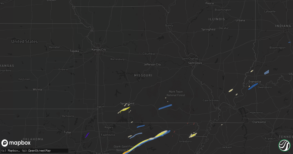
Hail Map in Missouri on March 6, 2022
Get this storm
March 6 map
$229
one time, instant access
Download today. No call, no setup
Keep the $229
Bought the map and want the full workflow? Apply the entire $229 to a subscription within 7 days. None of it is wasted.
Every map, not just this one
This buys you this map. Subscription and you get every map we run, in the markets you choose from a few cities to whole states to nationwide. Plus real-time alerts the moment a storm fires.
Contact data
Name, contact info, occupancy, even credit band for addresses in the footprint. You go from where it hit to who to call.
Become the source they trust
Unlimited branding weather history reports on demand. You already have the documented answer ready for the property owner, and you are the one who showed up with it.
Property data and RoofTrace estimates
Pull up any address you have got, its value and the exact code rules for that jurisdiction, straight from One Click Code. Then RoofTrace estimates the squares, pitch, and roof value, priced the way you price.
Storm reports in Missouri
Missouri
| Date | Description |
|---|---|
| 03/06/20225:35 PM CST | Video relayed to the national weather service from emergency management of an apparent tornado over an open field east of neelyville. No known damage at this time. Time |
| 03/06/20226:57 AM CST | Media relayed photo of barn damage from the lenox mo area. Damage estimated between 655 pm and 700 pm. |
| 03/06/20224:57 AM CST | At 1057 PM CST, severe thunderstorms were located along a line extending from 10 miles east of Eminence to near Winona to near Birch Tree to 9 miles west of Alton to 9 miles west of Thayer, moving east at 50 mph. HAZARD...60 mph wind gusts and penny size hail. SOURCE...Radar indicated. IMPACT...Expect damage to roofs, siding, and trees. Locations impacted include... Grand Gulf State Park... Ozark National Scenic Riverways... Thayer... Winona... Alton... Birch Tree... Eminence... Koshkonong... Thomasville... Myrtle... Wilderness... Couch... Rover... West Eminence... Greer... |
| 03/06/20224:55 AM CST | At 1055 PM CST, severe thunderstorms were located along a line extending from 10 miles east of Eminence to 6 miles southeast of Birch Tree to 11 miles west of Thayer, moving east at 50 mph. HAZARD...60 mph wind gusts. SOURCE...Radar indicated. IMPACT...Expect damage to roofs, siding, and trees. Severe thunderstorms will be near... Fremont around 1115 PM CST.Other locations in the path of these severe thunderstorms include VanBuren and Handy. |
| 03/06/20224:05 AM CST | At 1005 PM CST, severe thunderstorms were located along a line extending from 9 miles northeast of Willow Springs to 6 miles west of Mountain View to 9 miles north of West Plains to near Bakersfield, moving northeast at 140 mph. HAZARD...60 mph wind gusts. SOURCE...Radar indicated. IMPACT...Expect damage to roofs, siding, and trees. Locations impacted include... West Plains... Current River State Park... Ozark National Scenic Riverways... Echo Bluff State Park... Mountain View... Willow Springs... Winona... Alton... Birch Tree... Eminence... Pomona... Summersville... South Fork... Koshkonong... Brandsville... Montier... Thomasville... Teresita... Midridge... Pottersville... |
| 03/06/20223:33 AM CST | At 933 PM CST, severe thunderstorms were located along a line extending from 11 miles west of Willow Springs to 17 miles northeast of Gainesville to near Price Place, moving east at 60 mph. HAZARD...60 mph wind gusts and penny size hail. SOURCE...Radar indicated. IMPACT...Expect damage to roofs, siding, and trees. Locations impacted include... West Plains... Norfork Lake... Mountain View... Willow Springs... Pomona... Summersville... Bakersfield... South Fork... Brandsville... Peace Valley... Lanton... Tecumseh... Arroll... Pottersville... Caulfield... Udall... Siloam Springs... White Church... Moody... Clear Springs... |
| 03/06/20223:04 AM CST | At 903 PM CST, severe thunderstorms were located along a line extending from 14 miles south of Ava to 11 miles northwest of Price Place to 8 miles northeast of Diamond City, moving east at 45 mph. HAZARD...60 mph wind gusts and penny size hail. SOURCE...Radar indicated. IMPACT...Expect damage to roofs, siding, and trees. Locations impacted include... Bull Shoals Lake... Norfork Lake... Gainesville... Bakersfield... Theodosia... Pontiac... Wasola... Sundown... Brixey... Willhoit... Tecumseh... Udall... Hardenville... Thornfield... Vanzant... Squires... Zanoni... Noble... Gentryville... Sycamore... |
| 03/06/20222:41 AM CST | At 841 PM CST, severe thunderstorms were located along a line extending from 8 miles southeast of Taneyville to 8 miles northwest of Diamond City, moving northeast at 55 mph. HAZARD...60 mph wind gusts and quarter size hail. SOURCE...Radar indicated. IMPACT...Hail damage to vehicles is expected. Expect wind damage to roofs, siding, and trees. Locations impacted include... Bull Shoals Lake... Protem... Rueter... |
| 03/06/20221:56 AM CST | A local report indicates 1.25 inch wind near ARBYRD |
| 03/06/20221:54 AM CST | A local report indicates 1.00 inch wind near CARDWELL |
| 03/05/202211:13 PM CST | At 512 PM CST, a severe thunderstorm was located near Corning, moving northeast at 35 mph. HAZARD...60 mph wind gusts and penny size hail. SOURCE...Radar indicated. IMPACT...Expect damage to roofs, siding, and trees. This severe thunderstorm will be near... Naylor around 520 PM CST. Neelyville around 525 PM CST. |
| 03/05/202210:15 PM CST | Report of knocked down tree along highway jj just north of summersville. |
| 03/05/20228:24 PM CST | Report from mping: half dollar |
| 03/05/20228:15 PM CST | A local report indicates 1.00 inch wind near 4 SSE BOAZ |
All States Impacted by Hail Map on March 6, 2022
Cities Impacted by Hail Map on March 6, 2022
- Hector, AR
- Lamar, AR
- Scranton, AR
- Dover, AR
- Mountain View, AR
- Fifty Six, AR
- Timbo, AR
- Cardwell, MO
- Arbyrd, MO
- Paragould, AR
- Carrier Mills, IL
- Stonefort, IL
- Billings, MO
- Nixa, MO
- Clever, MO
- Marshall, AR
- Leslie, AR
- Jerusalem, AR
- Tilly, AR
- Pelsor, AR
- Patoka, IN
- Princeton, IN
- Owensville, IN
- Marionville, MO
- Aurora, MO
- Ozark, MO
- Crane, MO
- Pampa, TX
- Melbourne, AR
- Sage, AR
- Franklin, AR
- Jasper, AR
- Hasty, AR
- Parthenon, AR
- Harrison, AR
- Harrisburg, IL
- Cedarcreek, MO
- Kirbyville, MO
- Hardy, AR
- Ash Flat, AR
- Evening Shade, AR
- Horseshoe Bend, AR
- Vichy, MO
- Henderson, KY
- Waverly, KY
- Raywick, KY
- Campbellsville, KY
- Lebanon, KY
- Willisburg, KY
- Harrodsburg, KY
- Rector, AR
- Elizabethtown, IL
- Rosiclare, IL
- Springfield, MO
- Brookline, MO
- Republic, MO
- Vancleve, KY
- Senath, MO
- Subiaco, AR
- New Blaine, AR
- Dennard, AR
- Knoxville, AR
- London, AR
- Salem, MO
- Onia, AR
- Rogersville, MO
- Monette, AR
- Shamrock, TX
- Witts Springs, AR
- Herod, IL
- Eminence, MO
- Quail, TX
- Hedley, TX
- Union City, TN
- Sidney, AR
- Violet Hill, AR
- Columbus, IN
- Edinburgh, IN
- Stendal, IN
- Paoli, IN
- Dale, IN
- Dubois, IN
- French Lick, IN
- English, IN
- Jasper, IN
- Celestine, IN
- Holland, IN
- Saint Anthony, IN
- Huntingburg, IN
- Schnellville, IN
- Eckerty, IN
- Birdseye, IN
- Galena, MO
- Highlandville, MO
- Winona, MO
- Mountain View, MO
- Summersville, MO
- Birch Tree, MO
- Willow Springs, MO
- Evansville, IN
- Morganfield, KY
- Spottsville, KY
- Corydon, KY
- Paris, AR
- Peggs, OK
- Hulbert, OK
- Rose, OK
- Mount Pleasant, AR
- Guion, AR
- Williford, AR
- Poughkeepsie, AR
- Clinton, AR
- Fox, AR
- Pollard, AR
- Corning, AR
- Strawberry, AR
- Lynn, AR
- Imboden, AR
- Everton, AR
- Valley Springs, AR
- Yellville, AR
- Saint Joe, AR
- Vendor, AR
- Western Grove, AR
- Mountain Home, AR
- Lakeview, AR
- Midway, AR
- Bull Shoals, AR
- Peel, AR
- Dardanelle, AR
- Ola, AR
- Danville, AR
- Rison, AR
- Pine Bluff, AR
- Bearden, AR
- Yorktown, AR
- Grady, AR
- Fordyce, AR
- Hampton, AR
- Kingsland, AR
- Thornton, AR
- Star City, AR
- New Edinburg, AR
- Harrell, AR
- Warren, AR
- Banks, AR
- Wilmar, AR
- Mountainburg, AR
- Chester, AR


