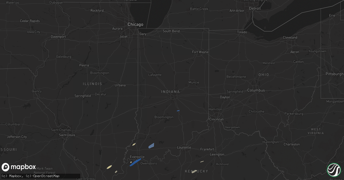
Hail Map in Indiana on March 6, 2022
Get this storm
March 6 map
$229
one time, instant access
Download today. No call, no setup
Keep the $229
Bought the map and want the full workflow? Apply the entire $229 to a subscription within 7 days. None of it is wasted.
Every map, not just this one
This buys you this map. Subscription and you get every map we run, in the markets you choose from a few cities to whole states to nationwide. Plus real-time alerts the moment a storm fires.
Contact data
Name, contact info, occupancy, even credit band for addresses in the footprint. You go from where it hit to who to call.
Become the source they trust
Unlimited branding weather history reports on demand. You already have the documented answer ready for the property owner, and you are the one who showed up with it.
Property data and RoofTrace estimates
Pull up any address you have got, its value and the exact code rules for that jurisdiction, straight from One Click Code. Then RoofTrace estimates the squares, pitch, and roof value, priced the way you price.
Storm reports in Indiana
Indiana
| Date | Description |
|---|---|
| 03/06/20226:26 AM CST | At 1226 AM CST, severe thunderstorms were located along a line extending from near Earl Park to near Boswell to 8 miles east of Hoopeston, moving northeast at 70 mph. HAZARD...60 mph wind gusts. SOURCE...Radar indicated. IMPACT...Expect damage to roofs, siding, and trees. Severe thunderstorms will be near... Fowler around 130 AM EST. Remington around 1240 AM CST. Oxford around 140 AM EST. Otterbein around 145 AM EST.Other locations impacted by these severe thunderstorms includeTempleton, Swanington and Wadena.Including the following interstate... Indiana I-65 between mile markers 200 and 203. |
| 03/06/20223:10 AM CST | Trees down at 5156 n county road 100 e. |
| 03/06/20223:09 AM CST | Elementary school roof damaged... Trees and power poles knocked down. Time estimated from radar. |
| 03/06/20223:07 AM CST | Trees down at 550 s old michigan road |
| 03/06/20222:35 AM CST | Late report. Damage to a metal storage barn. Trees down. Time estimated by radar. |
| 03/06/20222:20 AM CST | Reports of a large tree blocking a roadway on sr 64 just west of bretzville. |
| 03/06/20222:10 AM CST | Trees down williams rd and 50n... Williams rd and 200w. Time estimated |
| 03/06/20222:05 AM CST | Report of a tree in roadway at sr 56 and 500 w. |
| 03/06/20221:40 AM CST | Late report. Large tree down. Time estimated by radar. |
| 03/06/20221:15 AM CST | Heavy wooden swing set blown over and thrown through a fence into a field. |
| 03/06/20221:15 AM CST | Wind gust broke 1 inch tree limbs and blew off shingles. Time estimated from radar. |
| 03/06/20221:05 AM CST | Late report. Tree damage on ford ridge rd. Time estimated by radar. |
| 03/06/20221:00 AM CST | Late report. A van was moved and a trailer was moved several hundred yards. Time estimated by radar. |
| 03/05/202211:15 PM CST | Late report. Debris in the road at sr 58 and cr 450s. Also... Social media pictures showing destroyed travel trailer and a vehicle flipped over. Possible tornado. Will |
| 03/05/20229:25 PM CST | At 325 AM EST, severe thunderstorms were located along a line extending from 6 miles west of Decatur to near Muncie, moving east at 55 mph. HAZARD...60 mph wind gusts. SOURCE...Radar indicated. IMPACT...Expect damage to trees and power lines. Locations impacted include... Troy, Sidney, Piqua, Greenville, Celina, Wapakoneta, St. Marys, Coldwater, New Bremen, Minster, Versailles, Covington, St. Henry, Newport, Cridersville, Bradford, Union City, Anna, Fort Loramie and Jackson Center.This includes I-75 in Ohio between mile markers 76 and 117. |
| 03/05/20229:16 PM CST | At 316 AM EST, a severe thunderstorm was located near Lawrence, or 12 miles northeast of Indianapolis, moving east at 55 mph. HAZARD...60 mph wind gusts. SOURCE...Radar indicated. IMPACT...Expect damage to roofs, siding, and trees. This severe thunderstorm will be near... McCordsville around 320 AM EST. Fortville around 325 AM EST. Ingalls around 330 AM EST. Pendleton around 335 AM EST.Other locations in the path of this severe thunderstorm includeShirley, Markleville, Wilkinson and Kennard.This includes the following highways... Interstate 69 between mile markers 200 and 205, near mile marker207, and between mile markers 215 and 218. Interstate 70 between mile markers 114 and 118. |
| 03/05/20229:05 PM CST | At 304 AM EST, a severe thunderstorm was located 9 miles northeast of Noblesville, or 9 miles west of Anderson, moving east at 70 mph. HAZARD...60 mph wind gusts. SOURCE...Radar indicated. IMPACT...Expect damage to roofs, siding, and trees. This severe thunderstorm will be near... Edgewood, Frankton and River Forest around 310 AM EST. Anderson, Alexandria, Country Club Heights and Woodlawn Heights around 315 AM EST. Chesterfield and Daleville around 320 AM EST.Other locations in the path of this severe thunderstorm includeYorktown, Ball State University, Muncie, Parker City, Selma andPrairie Creek Reservoir.This includes Interstate 69 between mile markers 205 and 252. |
| 03/05/20228:53 PM CST | At 253 AM EST, severe thunderstorms were located along a line extending from near Sweetser to 6 miles northwest of Noblesville, moving east at 60 mph. HAZARD...60 mph wind gusts. SOURCE...Radar indicated. IMPACT...Expect damage to roofs, siding, and trees. Locations impacted include... Marion, Hartford City, Gas City, Upland, Fairmount, Dunkirk, Montpelier, Jonesboro, Redkey, Sweetser, Swayzee, Pennville, Matthews, Sims, Nottingham, Fowlerton, Shamrock Lakes, Mill Grove, Herbst and Keystone.This includes Interstate 69 in Indiana between mile markers 252 and267. |
| 03/05/20228:43 PM CST | At 243 AM EST, severe thunderstorms were located along a line extending from near Winona Lake to 6 miles northwest of Wabash to 6 miles northeast of Kokomo, moving east at 65 mph. HAZARD...60 mph wind gusts. SOURCE...Radar indicated. IMPACT...Expect damage to roofs, siding, and trees. Locations impacted include... Fort Wayne, Marion, Huntington, New Haven, Warsaw, Peru, Wabash, Bluffton, Columbia City, North Manchester, Winona Lake, Ossian, Tri-lakes, Huntertown, Avilla, Churubusco, South Whitley, Sweetser, Andrews and North Webster.This includes the following highways... Interstate 469 between mile markers 0 and 15, and between milemarkers 25 and 30. Interstate 69 in Indiana between mile markers 266 and 322. |
| 03/05/20228:42 PM CST | At 241 AM EST, a severe thunderstorm was located 11 miles northwest of Danville, or 17 miles southeast of Crawfordsville, moving northeast at 75 mph. HAZARD...70 mph wind gusts. SOURCE...Radar indicated. IMPACT...Expect considerable tree damage. Damage is likely to mobile homes, roofs, and outbuildings. This severe thunderstorm will be near... Jamestown around 245 AM EST. Pittsboro and Lizton around 250 AM EST. Brownsburg around 255 AM EST. Zionsville and Whitestown around 300 AM EST.Other locations in the path of this severe thunderstorm includeMeridian Hills, Williams Creek, Carmel, Westfield, Fishers,Noblesville, Cicero, Arcadia and Morse Reservoir.This includes the following highways... Interstate 65 between mile markers 123 and 152. Interstate 69 between mile markers 205 and 210. Interstate 74 between mile markers 44 and 68. |
| 03/05/20228:27 PM CST | At 226 AM EST, a severe thunderstorm was located 11 miles north of Frankfort, moving northeast at 75 mph. HAZARD...60 mph wind gusts. SOURCE...Radar indicated. IMPACT...Expect damage to roofs, siding, and trees. This severe thunderstorm will be near... Russiaville around 235 AM EST. Kokomo and Indian Heights around 240 AM EST.This includes Interstate 65 between mile markers 154 and 170. |
| 03/05/20228:14 PM CST | At 214 AM EST, severe thunderstorms were located along a line extending from near Royal Center to 8 miles northeast of Delphi to 6 miles east of Lafayette, moving east at 50 mph. HAZARD...60 mph wind gusts. SOURCE...Radar indicated. IMPACT...Expect damage to roofs, siding, and trees. Locations impacted include... Logansport, Peru, Grissom Afb, Akron, Walton, Bunker Hill, Royal Center, Mexico, Lincoln, Wells, Galveston, Miami, Erie, Denver, Fulton, Macy, Onward, Clymers, Bennetts Switch and Nyena Lake. |
| 03/05/20228:11 PM CST | At 210 AM EST, a severe thunderstorm was located 10 miles southwest of Crawfordsville, moving east at 80 mph. HAZARD...70 mph wind gusts. SOURCE...Radar indicated. IMPACT...Expect considerable tree damage. Damage is likely to mobile homes, roofs, and outbuildings. This severe thunderstorm will be near... Ladoga and New Ross around 220 AM EST. Jamestown and Advance around 225 AM EST. Thorntown around 230 AM EST.Other locations in the path of this severe thunderstorm includeLebanon and Ulen.This includes the following highways... Interstate 65 between mile markers 134 and 153. Interstate 70 between mile markers 1 and 5. Interstate 74 between mile markers 23 and 66. |
| 03/05/20227:41 PM CST | At 139 AM EST, a severe thunderstorm was located over Chrisman, or 13 miles north of Paris, moving east at 75 mph. HAZARD...70 mph wind gusts. SOURCE...Radar indicated. IMPACT...Expect considerable tree damage. Damage is likely to mobile homes, roofs, and outbuildings. This severe thunderstorm will be near... Newport, Cayuga, Montezuma and Lodi around 150 AM EST. Kingman, Bloomingdale and Turkey Run State Park around 155 AM EST.Other locations in the path of this severe thunderstorm includeMarshall, Wallace, Judson, Waveland, Russellville, Alamo, ShadesState Park, New Market and Crawfordsville.This includes Interstate 74 between mile markers 23 and 35. |
| 03/05/20227:31 PM CST | At 131 AM EST, severe thunderstorms were located along a line extending from near Perkins to near Boswell to 10 miles northwest of Covington, moving east at 60 mph. HAZARD...60 mph wind gusts. SOURCE...Radar indicated. IMPACT...Expect damage to roofs, siding, and trees. Locations impacted include... Monticello, Brookston, Wolcott, Royal Center, Reynolds, Chalmers, Burnettsville, Clymers, Badger Grove, Smithson, Golden Hill, Indiana Beach, Norway, Idaville, Sitka, Cedar Point, Bell Center and Lake Cicott.This includes Interstate 65 between mile markers 185 and 198. |
| 03/05/20227:23 PM CST | At 122 AM EST, a severe thunderstorm was located 10 miles east of Rossville, or 17 miles northeast of Danville, moving east at 75 mph. HAZARD...60 mph wind gusts. SOURCE...Radar indicated. IMPACT...Expect damage to roofs, siding, and trees. This severe thunderstorm will be near... Pine Village and Rainsville around 130 AM EST. Lafayette, West Lafayette and Purdue University around 140 AM EST.Other locations in the path of this severe thunderstorm includeBattle Ground.This includes the following highways... Interstate 65 between mile markers 161 and 183. Interstate 74 between mile markers 1 and 22. |
| 03/05/20227:04 PM CST | At 104 AM EST, severe thunderstorms were located along a line extending from 21 miles west of Stevensville to Porter, moving east at 65 mph. HAZARD...60 mph wind gusts. SOURCE...Radar indicated. IMPACT...Expect damage to roofs, siding, and trees. Locations impacted include... Niles, Benton Harbor, St. Joseph, Dowagiac, Buchanan, Fair Plain, Benton Heights, Bridgman, New Buffalo, Berrien Springs, Watervliet, Three Oaks, Coloma, Stevensville, Shorewood-Tower Hill, Paw Paw Lake, Shorewood-Tower Hills-Harbert, Lake Michigan Beach, Bertrand and Pokagon.This includes the following highways... Interstate 196 between mile markers 0 and 7. Interstate 94 in Michigan between mile markers 0 and 42. |
| 03/05/20227:00 PM CST | At 100 AM CST, a severe thunderstorm was located near Charleston, moving east at 55 mph. HAZARD...60 mph wind gusts and penny size hail. SOURCE...Radar indicated. IMPACT...Expect damage to roofs, siding, and trees. This severe thunderstorm will be near... Westfield around 110 AM CST. Martinsville around 115 AM CST. Clarksville around 120 AM CST.Other locations in the path of this severe thunderstorm includeMarshall, Oliver, Dennison and Vermilion.This includes Interstate 70 between mile markers 137 and 154. |
All States Impacted by Hail Map on March 6, 2022
Cities Impacted by Hail Map on March 6, 2022
- Hector, AR
- Lamar, AR
- Scranton, AR
- Dover, AR
- Mountain View, AR
- Fifty Six, AR
- Timbo, AR
- Cardwell, MO
- Arbyrd, MO
- Paragould, AR
- Carrier Mills, IL
- Stonefort, IL
- Billings, MO
- Nixa, MO
- Clever, MO
- Marshall, AR
- Leslie, AR
- Jerusalem, AR
- Tilly, AR
- Pelsor, AR
- Patoka, IN
- Princeton, IN
- Owensville, IN
- Marionville, MO
- Aurora, MO
- Ozark, MO
- Crane, MO
- Pampa, TX
- Melbourne, AR
- Sage, AR
- Franklin, AR
- Jasper, AR
- Hasty, AR
- Parthenon, AR
- Harrison, AR
- Harrisburg, IL
- Cedarcreek, MO
- Kirbyville, MO
- Hardy, AR
- Ash Flat, AR
- Evening Shade, AR
- Horseshoe Bend, AR
- Vichy, MO
- Henderson, KY
- Waverly, KY
- Raywick, KY
- Campbellsville, KY
- Lebanon, KY
- Willisburg, KY
- Harrodsburg, KY
- Rector, AR
- Elizabethtown, IL
- Rosiclare, IL
- Springfield, MO
- Brookline, MO
- Republic, MO
- Vancleve, KY
- Senath, MO
- Subiaco, AR
- New Blaine, AR
- Dennard, AR
- Knoxville, AR
- London, AR
- Salem, MO
- Onia, AR
- Rogersville, MO
- Monette, AR
- Shamrock, TX
- Witts Springs, AR
- Herod, IL
- Eminence, MO
- Quail, TX
- Hedley, TX
- Union City, TN
- Sidney, AR
- Violet Hill, AR
- Columbus, IN
- Edinburgh, IN
- Stendal, IN
- Paoli, IN
- Dale, IN
- Dubois, IN
- French Lick, IN
- English, IN
- Jasper, IN
- Celestine, IN
- Holland, IN
- Saint Anthony, IN
- Huntingburg, IN
- Schnellville, IN
- Eckerty, IN
- Birdseye, IN
- Galena, MO
- Highlandville, MO
- Winona, MO
- Mountain View, MO
- Summersville, MO
- Birch Tree, MO
- Willow Springs, MO
- Evansville, IN
- Morganfield, KY
- Spottsville, KY
- Corydon, KY
- Paris, AR
- Peggs, OK
- Hulbert, OK
- Rose, OK
- Mount Pleasant, AR
- Guion, AR
- Williford, AR
- Poughkeepsie, AR
- Clinton, AR
- Fox, AR
- Pollard, AR
- Corning, AR
- Strawberry, AR
- Lynn, AR
- Imboden, AR
- Everton, AR
- Valley Springs, AR
- Yellville, AR
- Saint Joe, AR
- Vendor, AR
- Western Grove, AR
- Mountain Home, AR
- Lakeview, AR
- Midway, AR
- Bull Shoals, AR
- Peel, AR
- Dardanelle, AR
- Ola, AR
- Danville, AR
- Rison, AR
- Pine Bluff, AR
- Bearden, AR
- Yorktown, AR
- Grady, AR
- Fordyce, AR
- Hampton, AR
- Kingsland, AR
- Thornton, AR
- Star City, AR
- New Edinburg, AR
- Harrell, AR
- Warren, AR
- Banks, AR
- Wilmar, AR
- Mountainburg, AR
- Chester, AR


