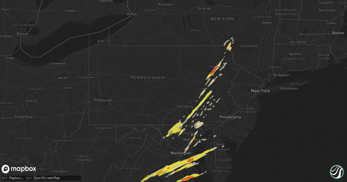
Hail Map in Pennsylvania on February 25, 2017
Get this storm
February 25 map
$229
one time, instant access
Download today. No call, no setup
Keep the $229
Bought the map and want the full workflow? Apply the entire $229 to a subscription within 7 days. None of it is wasted.
Every map, not just this one
This buys you this map. Subscription and you get every map we run, in the markets you choose from a few cities to whole states to nationwide. Plus real-time alerts the moment a storm fires.
Contact data
Name, contact info, occupancy, even credit band for addresses in the footprint. You go from where it hit to who to call.
Become the source they trust
Unlimited branding weather history reports on demand. You already have the documented answer ready for the property owner, and you are the one who showed up with it.
Property data and RoofTrace estimates
Pull up any address you have got, its value and the exact code rules for that jurisdiction, straight from One Click Code. Then RoofTrace estimates the squares, pitch, and roof value, priced the way you price.
Storm reports in Pennsylvania
Pennsylvania
| Date | Description |
|---|---|
| 02/25/20173:50 PM CST | Tractor trailor blown over and tossed 30 feet on bushkill center road. |
| 02/25/20173:48 PM CST | A local report indicates 60 MPH wind near CONCORD TWP |
| 02/25/20173:40 PM CST | Traffic lights blown down at the tatamy interchange on route 33. Time estimated from radar. |
| 02/25/20173:38 PM CST | Trees down onto wires on sullivan trail road between belfast road and church road. All lanes closed. Time estimated from radar. |
| 02/25/20173:35 PM CST | Trees down with one on a house along a portion of sullivan trail. Time estimated from radar. |
| 02/25/20173:35 PM CST | Several trees and wires down |
| 02/25/20173:31 PM CST | Several trees and wires down |
| 02/25/20173:30 PM CST | Along a 1.5 mile stretch from bushkill center road to highway 33...there were numerous trees... Power lines... And telephone poles down. Trees were blown down on to 4 h |
| 02/25/20173:25 PM CST | Several trees down in west allentown. Time estimated from radar. |
| 02/25/20173:23 PM CST | Multiple power poles down. Time estimated from radar. |
| 02/25/20173:23 PM CST | Roof blown off an apartment building. All occupants of the 20 apartments were evacuated and sought housing with family members. No injuries were reported. Time estimate |
| 02/25/20173:21 PM CST | Numerous trees down. |
| 02/25/20173:15 PM CST | Multiple reports of roof damage...power lines and trees down. |
| 02/25/20173:11 PM CST | Multiple reports of roof damage...power lines...poles...and trees down |
| 02/25/20173:09 PM CST | Yard fencing blown down. |
| 02/25/20173:07 PM CST | Roof of a medivac hanger blown off hitting a house at a nearby mobile home park. Power out in the area. Time estimated from radar. |
| 02/25/20173:06 PM CST | Some trees down in portions of carbon county...especially from near parryville northeastward. Time estimated from radar. |
| 02/25/20173:05 PM CST | Several power poles and trees blown down. Barn roof blown off. Time estimated from radar. |
| 02/25/20173:00 PM CST | A local report indicates 65 MPH wind near 1 NE READING |
| 02/25/20172:56 PM CST | A local report indicates 61 MPH wind near READING REGIONAL AIRPOR |
| 02/25/20172:55 PM CST | A local report indicates 60 MPH wind near HAMBURG |
| 02/25/20172:54 PM CST | A local report indicates 1.00 inch wind near BERNVILLE |
| 02/25/20172:50 PM CST | 5 trees down. Small part of of barn roof blown off. Pea sized hail. |
| 02/25/20172:50 PM CST | Several trees snapped and uprooted. Time estimated from radar. |
| 02/25/20172:45 PM CST | A local report indicates 1.00 inch wind near STOUCHSBURG |
| 02/25/20172:41 PM CST | Several treees down |
| 02/25/20172:37 PM CST | Trees and wires down along forest hill road in stevens. |
| 02/25/20172:36 PM CST | Trees and wires down on mountain spring road in stevens. |
| 02/25/20172:35 PM CST | A local report indicates 1.00 inch wind near BEAR CREEK |
| 02/25/20172:35 PM CST | A microburst produced straight line winds of 70 to 90 mph... Producing a 9 miles swath of wind damage that was approximately half a mile wide. Numerous trees were toppl |
| 02/25/20172:32 PM CST | Quarter-sized hail near lititz. |
| 02/25/20172:28 PM CST | Quarter-sized hail near manheim. |
| 02/25/20172:20 PM CST | 60mph wind at least 2 trees down |
| 02/25/20172:20 PM CST | A local report indicates 1.00 inch wind near BERNVILLE |
| 02/25/20172:15 PM CST | An ef1 tornado was confirmed between hallam and wrightsville by a nws storm survey. Maximum wind speeds are estimated at 90 mph... With a path length of approximately t |
| 02/25/20172:12 PM CST | A microburst produced straight line winds of 70 to 80 mph... Producing a 9 mile swath of wind damage that was approximately one mile in width. Numerous trees were toppl |
| 02/25/20172:05 PM CST | Quarter-sized hail in myerstown. |
| 02/25/20172:05 PM CST | Quarter-sized hail in richland. |
| 02/25/20172:00 PM CST | Spotter reports 3 trees down on property. Large tree blocking road a mile away. |
| 02/25/20171:50 PM CST | Quarter-sized hail near mcsherrystown. |
| 02/25/20171:50 PM CST | Multiple trees down |
| 02/25/20171:45 PM CST | Roof blown off a residence |
| 02/25/20171:44 PM CST | Quarter-sized hail in mastersonville. |
| 02/25/20171:43 PM CST | I-81 southbound mile marker 180 |
| 02/25/20171:42 PM CST | Roof blown off lake scranton water plant. |
| 02/25/20171:42 PM CST | Quarter-sized hail near mount joy. |
| 02/25/20171:40 PM CST | Possible tornado. Approximately 30 homes damaged... 2 with major damage. Roofs off some homes. Lots of trees down. Some people still trapped. No injuries or deaths repo |
| 02/25/20171:38 PM CST | Quarter-sized hail near maytown. |
| 02/25/20171:36 PM CST | Quarter-sized hail in springettsbury twp. |
| 02/25/20171:35 PM CST | A local report indicates 1.00 inch wind near DURYEA |
| 02/25/20171:35 PM CST | A tornado touched down close to bald mountain road in plains township luzerne county... Pa around 235 pm est saturday february 25th... 2017. The tornado did extensive d |
| 02/25/20171:35 PM CST | Ef2 tornado confirmed from plains to pittston. Maximum winds estimated at 100 to 120 mph. Damage to 30 homes. Over 1000 trees knocked down. |
| 02/25/20171:30 PM CST | . |
| 02/25/20171:29 PM CST | . |
| 02/25/20171:27 PM CST | Barn roof blown off |
| 02/25/20171:25 PM CST | . |
| 02/25/20171:22 PM CST | Quarter-sized hail in springettsbury twp. |
| 02/25/20171:15 PM CST | A local report indicates 1.00 inch wind near MOUNTAIN TOP |
All States Impacted by Hail Map on February 25, 2017
Cities Impacted by Hail Map on February 25, 2017
- Onancock, VA
- Greenbush, VA
- Onley, VA
- Accomac, VA
- Parksley, VA
- Hopewell, VA
- Baltimore, MD
- Rosedale, MD
- Linthicum Heights, MD
- Brooklyn, MD
- Glen Burnie, MD
- Curtis Bay, MD
- Halethorpe, MD
- White Haven, PA
- Lake Harmony, PA
- Blakeslee, PA
- Tappahannock, VA
- Milford, VA
- Valley Lee, MD
- Drayden, MD
- Hague, VA
- Callaway, MD
- Tall Timbers, MD
- Warsaw, VA
- Bowling Green, VA
- Ruther Glen, VA
- Hustle, VA
- Champlain, VA
- Bumpass, VA
- Colonial Beach, VA
- Loretto, VA
- Montpelier, VA
- Coltons Point, MD
- Leonardtown, MD
- Beaverdam, VA
- Montross, VA
- Great Mills, MD
- Doswell, VA
- Maidens, VA
- Park Hall, MD
- Caret, VA
- California, MD
- Patuxent River, MD
- Lexington Park, MD
- Fishing Creek, MD
- Fredericksburg, VA
- Petersburg, VA
- Disputanta, VA
- Charles City, VA
- King William, VA
- Walkerton, VA
- Frederick, MD
- Middletown, DE
- Townsend, DE
- Shartlesville, PA
- Bernville, PA
- Richland, PA
- Myerstown, PA
- Hamburg, PA
- Newmanstown, PA
- Womelsdorf, PA
- Lebanon, PA
- Chesterfield, VA
- Colonial Heights, VA
- Richmond, VA
- Henrico, VA
- Chester, VA
- Amelia Court House, VA
- Church Road, VA
- Blackstone, VA
- Barhamsville, VA
- West Point, VA
- Keysville, VA
- Meherrin, VA
- Poquoson, VA
- Smithfield, VA
- Elberon, VA
- Hampton, VA
- Ivor, VA
- Yorktown, VA
- Wakefield, VA
- Newport News, VA
- Cape Charles, VA
- Westminster, MD
- New Windsor, MD
- Brandywine, MD
- Walton, NY
- Downsville, NY
- Glen Arm, MD
- Fork, MD
- Hydes, MD
- Fallston, MD
- Kingsville, MD
- Baldwin, MD
- Big Island, VA
- Goode, VA
- Goldsboro, MD
- Felton, DE
- Camden Wyoming, DE
- East Berlin, PA
- Dover, PA
- Thomasville, PA
- Jarratt, VA
- King George, VA
- Rhoadesville, VA
- Shady Side, MD
- Mcdaniel, MD
- North Beach, MD
- Owings, MD
- Woodbridge, VA
- Saint Michaels, MD
- Stafford, VA
- Churchton, MD
- Richardsville, VA
- Midland, VA
- Culpeper, VA
- Waldorf, MD
- Charlottesville, VA
- Queenstown, MD
- Cordova, MD
- Burr Hill, VA
- Barboursville, VA
- Quantico, VA
- Claiborne, MD
- Spotsylvania, VA
- Nanjemoy, MD
- North Garden, VA
- Rapidan, VA
- Deale, MD
- Goldvein, VA
- White Plains, MD
- Keswick, VA
- Easton, MD
- Wittman, MD
- La Plata, MD
- Wye Mills, MD
- Accokeek, MD
- Bryans Road, MD
- Triangle, VA
- Welcome, MD
- Huntingtown, MD
- Chesapeake Beach, MD
- Gordonsville, VA
- Stevensville, MD
- Centreville, MD
- Tracys Landing, MD
- Sherwood, MD
- Pomfret, MD
- Henderson, MD
- Lorton, VA
- Port Tobacco, MD
- Marbury, MD
- Locust Grove, VA
- Sumerduck, VA
- Orange, VA
- Upper Marlboro, MD
- Sunderland, MD
- Queen Anne, MD
- Bozman, MD
- Dumfries, VA
- Ridgely, MD
- Indian Head, MD
- Aquasco, MD
- Lignum, VA
- Friendship, MD
- Greensboro, MD
- Dunkirk, MD
- Unionville, VA
- Somerset, VA
- Ijamsville, MD
- La Crosse, VA
- Port Clinton, PA
- Orwigsburg, PA
- Williamsburg, VA
- Charles Town, WV
- Kenbridge, VA
- Dundas, VA
- Farnham, VA
- Center Cross, VA
- Dunnsville, VA
- Starlight, PA
- Hancock, NY
- Fishs Eddy, NY
- Equinunk, PA
- East Branch, NY
- Long Eddy, NY
- Weatherly, PA
- Beaver Meadows, PA
- Nesquehoning, PA
- Freeland, PA
- Tamaqua, PA
- Yale, VA
- Stony Creek, VA
- McKenney, VA
- Charlotte Hall, MD
- Prince Frederick, MD
- Benedict, MD
- Mechanicsville, MD
- Hughesville, MD
- Ford, VA
- Topping, VA
- Melfa, VA
- Shacklefords, VA
- Saluda, VA
- New Kent, VA
- Burkeville, VA
- Locust Hill, VA
- Toano, VA
- Drakes Branch, VA
- North, VA
- Mattaponi, VA
- Wilsons, VA
- Gloucester, VA
- Saxe, VA
- White Stone, VA
- Deltaville, VA
- Hartfield, VA
- Crewe, VA
- Lanexa, VA
- Victoria, VA
- Prince George, VA
- Cobbs Creek, VA
- Bloxom, VA
- Wake, VA
- Hardyville, VA
- Dutton, VA
- Green Bay, VA
- Sutherland, VA
- Providence Forge, VA
- Painter, VA
- Keymar, MD
- Woodsboro, MD
- Union Bridge, MD
- Odenton, MD
- Conowingo, MD
- Darlington, MD
- Whiteford, MD
- Pylesville, MD
- Fawn Grove, PA
- Peach Bottom, PA
- Airville, PA
- Street, MD
- Drumore, PA
- Jarrettsville, MD
- Delta, PA
- Frederica, DE
- Magnolia, DE
- Dover, DE
- Littlestown, PA
- Lakewood, PA
- Pleasant Mount, PA
- Laurel, MD
- Bowie, MD
- Middletown, MD
- Braddock Heights, MD
- Jefferson, MD
- Hazleton, PA
- Drums, PA
- Red Oak, VA
- Skipwith, VA
- Dewitt, VA
- Dinwiddie, VA
- Lancaster, PA
- Washington Boro, PA
- Millersville, PA
- Bryantown, MD
- Newburg, MD
- Port Republic, MD
- Bel Alton, MD
- Faulkner, MD
- Rice, VA
- Moseley, VA
- Jetersville, VA
- Macungie, PA
- Boyertown, PA
- Bechtelsville, PA
- Emmaus, PA
- Barto, PA
- Zionsville, PA
- Auburn, PA
- Kempton, PA
- Manheim, PA
- Lititz, PA
- New Ringgold, PA
- Mohrsville, PA
- Schaefferstown, PA
- Robesonia, PA
- Aberdeen Proving Ground, MD
- Gunpowder, MD
- Edgewood, MD
- Leasburg, NC
- Roxboro, NC
- Midlothian, VA
- Pasadena, MD
- Felton, PA
- Stewartstown, PA
- Sandston, VA
- Emmitsburg, MD
- Taneytown, MD
- Crapo, MD
- Marietta, PA
- Maytown, PA
- Mount Joy, PA
- Knoxville, MD
- Bird In Hand, PA
- Willow Street, PA
- Leola, PA
- Worton, MD
- Chestertown, MD
- Pittston, PA
- Wilkes Barre, PA
- Mechanicsville, VA
- Surry, VA
- Spring Grove, VA
- Bruington, VA
- Wylliesburg, VA
- Chase City, VA
- Saint Stephens Church, VA
- Aylett, VA
- Thurmont, MD
- Hanover, PA
- Rocky Ridge, MD
- Gettysburg, PA
- Walkersville, MD
- Upperville, VA
- Mountain Top, PA
- Hampstead, MD
- Manchester, MD
- Duryea, PA
- Moosic, PA
- Scranton, PA
- Moscow, PA
- Taylor, PA
- Peckville, PA
- Old Forge, PA
- Olyphant, PA
- Jermyn, PA
- Jessup, PA
- Wapwallopen, PA
- Archbald, PA
- Elizabethtown, PA
- York New Salem, PA
- Wrightsville, PA
- Seven Valleys, PA
- York, PA
- Columbia, PA
- Severna Park, MD
- Purcellville, VA
- Round Hill, VA
- Waverly, VA
- Ronks, PA
- Strasburg, PA
- Quarryville, PA
- Paradise, PA
- King And Queen Court House, VA
- Fort George G Meade, MD
- Lanham, MD
- Glenn Dale, MD
- Ephrata, PA
- Fleetwood, PA
- Mertztown, PA
- Sykesville, MD
- Newtown, VA
- Windsor, PA
- Landisville, PA
- Mountville, PA
- Red Lion, PA
- Freeman, VA
- Lawrenceville, VA
- Clarksville, VA
- Cumbola, PA
- Pine Grove, PA
- Pottsville, PA
- New Philadelphia, PA
- Cressona, PA
- Schuylkill Haven, PA
- Port Carbon, PA
- Emporia, VA
- Boydton, VA
- South Hill, VA
- Bullock, NC
- White Plains, VA
- Brodnax, VA
- Bracey, VA
- Oxford, NC
- Nelson, VA
- Buffalo Junction, VA
- Baskerville, VA
- Douglassville, PA
- Birdsboro, PA
- Kutztown, PA
- Lenhartsville, PA
- Ashland, VA
- Bethel, PA
- Barnesville, PA
- Middleport, PA
- Brockton, PA
- Hayes, VA
- Farmville, VA
- Finksburg, MD
- Hanover, MD
- Hyattsville, MD
- Bel Air, MD
- Harmans, MD
- Capitol Heights, MD
- Parkville, MD
- Perry Hall, MD
- Nottingham, MD
- Beltsville, MD
- Forest Hill, MD
- Greenbelt, MD
- Severn, MD
- Spring Grove, PA
- Myersville, MD
- Reading, PA
- Prompton, PA
- Denver, PA
- Reinholds, PA
- Mohnton, PA
- East Earl, PA
- New Holland, PA
- Terre Hill, PA
- Stevens, PA
- Kinzers, PA
- Andreas, PA
- McSherrystown, PA
- Glenville, PA
- New Oxford, PA
- Leesport, PA
- Powhatan, VA
- Brogue, PA
- Waymart, PA
- Lake Ariel, PA
- Forest City, PA
- Carbondale, PA
- Lovettsville, VA
- Manquin, VA
- Stevensville, VA
- Hanover, VA
- Lutherville Timonium, MD
- Towson, MD
- Mount Airy, MD
- Woodbine, MD
- Freeland, MD
- Gloucester Point, VA
- Randolph, VA
- Clover, VA
- Scottsburg, VA
- Alberta, VA
- Shoemakersville, PA
- Warfield, VA
- Dolphin, VA
- Windsor, VA
- Henderson, NC
- Courtland, VA
- Burlington, NC
- Yanceyville, NC
- Mebane, NC
- White Hall, MD
- Deposit, NY
- Gouldsboro, PA
- Honesdale, PA
- Sterling, PA
- Hawley, PA
- Virgilina, VA
- Narvon, PA
- Morgantown, PA
- Harleigh, PA
- Sheppton, PA
- Rodman, NY
- Churchville, MD
- New Park, PA
- Holtwood, PA
- Pocono Lake, PA
- Tobyhanna, PA
- Belle Haven, VA
- Hudgins, VA
- Hacksneck, VA
- Carson, VA
- Carrollton, VA
- Earlysville, VA
- Bedford, VA


