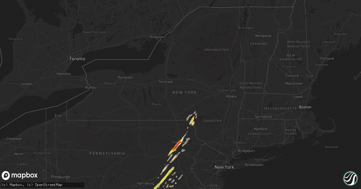
Hail Map in New York on February 25, 2017
Get this storm
February 25 map
$229
one time, instant access
Download today. No call, no setup
Keep the $229
Bought the map and want the full workflow? Apply the entire $229 to a subscription within 7 days. None of it is wasted.
Every map, not just this one
This buys you this map. Subscription and you get every map we run, in the markets you choose from a few cities to whole states to nationwide. Plus real-time alerts the moment a storm fires.
Contact data
Name, contact info, occupancy, even credit band for addresses in the footprint. You go from where it hit to who to call.
Become the source they trust
Unlimited branding weather history reports on demand. You already have the documented answer ready for the property owner, and you are the one who showed up with it.
Property data and RoofTrace estimates
Pull up any address you have got, its value and the exact code rules for that jurisdiction, straight from One Click Code. Then RoofTrace estimates the squares, pitch, and roof value, priced the way you price.
Storm reports in New York
New York
| Date | Description |
|---|---|
| 02/25/20175:15 PM CST | 6hr road closure - downed poles and power lines |
| 02/25/20175:15 PM CST | Trees down blocking road |
| 02/25/20175:11 PM CST | Over 50 trees down. |
| 02/25/20175:10 PM CST | Tree went through a house. |
| 02/25/20175:05 PM CST | Trees... Wires and poles down ny- 32 |
| 02/25/20175:05 PM CST | Power lines down. |
| 02/25/20175:05 PM CST | Trees and wires down with partial road blocked on channingville rd |
| 02/25/20175:04 PM CST | Downed tree on new salem road between callahans and tooley drive blocked one lane. |
| 02/25/20175:04 PM CST | Tree down on southern portion of river road closed one lane. |
| 02/25/20175:04 PM CST | Connelly road closed betwen route 9w and millbrook drive due to downed tree. |
| 02/25/20175:04 PM CST | Downed tree. |
| 02/25/20175:02 PM CST | Tree down on old post road at swarterkill road |
| 02/25/20174:58 PM CST | 8hr road closure - downed tree with poles and wires |
| 02/25/20174:57 PM CST | Tree down on pine bush road between buck road and county route 2. |
| 02/25/20174:57 PM CST | Tree down 26 fairview avenue between lucas avenue and the dead end. |
| 02/25/20174:57 PM CST | Tree down on legget road 500 feet from intersection with state route 209 |
| 02/25/20174:53 PM CST | Tops of trees torn off and trees down at route 17k and bailey road. |
| 02/25/20174:52 PM CST | Downed tree in front of crossgates mall. |
| 02/25/20174:52 PM CST | Trees uprooted in wallkill. |
| 02/25/20174:51 PM CST | Tree down on plains road at new hurley road. |
| 02/25/20174:48 PM CST | Recorded 76mph wind gust from a private weather station |
| 02/25/20174:45 PM CST | Tree down on bone hollow road between whitefield road and smith lane. |
| 02/25/20174:45 PM CST | Tree down buck road between cherryhill road and mill road |
| 02/25/20174:44 PM CST | A local report indicates 69 MPH wind near MONTGOMERY AIRPORT |
| 02/25/20174:44 PM CST | 2 planes blown onto 3rd plane. Hangar corrugated roof ripped off |
| 02/25/20174:40 PM CST | Downed tree at intersection of western ave and manning blvd. |
| 02/25/20174:40 PM CST | Downed tree |
| 02/25/20174:35 PM CST | Downed tree. |
| 02/25/20174:35 PM CST | Wires down on middletown medical at crescent avenue and maltese drive. |
| 02/25/20174:35 PM CST | Wires down closing route 211 just west of route 17. |
| 02/25/20174:32 PM CST | Trees uprooted in wallkill. |
| 02/25/20174:21 PM CST | Downed tree reported. |
| 02/25/20174:20 PM CST | Trees down along pine hill road in minisink. |
| 02/25/20174:15 PM CST | Downed tree. |
| 02/25/20174:04 PM CST | 4 trees down on house... Heavily damaging it. |
| 02/25/20174:04 PM CST | At least 200 trees down around mohican lake road. Radar estimated time. |
| 02/25/20173:28 PM CST | Reported to nws with photo via facebook. Radar estimated time. |
| 02/25/20172:56 PM CST | Trees down on wires. |
| 02/25/20172:48 PM CST | Tree down on wires. |
| 02/25/20172:47 PM CST | Trees down on wires. |
| 02/25/20172:47 PM CST | 15 trees uprooted. |
| 02/25/20172:25 PM CST | Downed power lines |
| 02/25/20171:00 PM CST | Power outage |
| 02/25/201712:16 PM CST | Roof blown off building |
| 02/25/201711:48 AM CST | Trees and power lines down from the county line north to potsdam |
| 02/25/201711:27 AM CST | Trees down on red lake rd. |
| 02/25/201711:27 AM CST | Trees and wires down near intersection of rt 37 and rt 411 |
| 02/25/201711:18 AM CST | Roof and wall damage to business |
All States Impacted by Hail Map on February 25, 2017
Cities Impacted by Hail Map on February 25, 2017
- Onancock, VA
- Greenbush, VA
- Onley, VA
- Accomac, VA
- Parksley, VA
- Hopewell, VA
- Baltimore, MD
- Rosedale, MD
- Linthicum Heights, MD
- Brooklyn, MD
- Glen Burnie, MD
- Curtis Bay, MD
- Halethorpe, MD
- White Haven, PA
- Lake Harmony, PA
- Blakeslee, PA
- Tappahannock, VA
- Milford, VA
- Valley Lee, MD
- Drayden, MD
- Hague, VA
- Callaway, MD
- Tall Timbers, MD
- Warsaw, VA
- Bowling Green, VA
- Ruther Glen, VA
- Hustle, VA
- Champlain, VA
- Bumpass, VA
- Colonial Beach, VA
- Loretto, VA
- Montpelier, VA
- Coltons Point, MD
- Leonardtown, MD
- Beaverdam, VA
- Montross, VA
- Great Mills, MD
- Doswell, VA
- Maidens, VA
- Park Hall, MD
- Caret, VA
- California, MD
- Patuxent River, MD
- Lexington Park, MD
- Fishing Creek, MD
- Fredericksburg, VA
- Petersburg, VA
- Disputanta, VA
- Charles City, VA
- King William, VA
- Walkerton, VA
- Frederick, MD
- Middletown, DE
- Townsend, DE
- Shartlesville, PA
- Bernville, PA
- Richland, PA
- Myerstown, PA
- Hamburg, PA
- Newmanstown, PA
- Womelsdorf, PA
- Lebanon, PA
- Chesterfield, VA
- Colonial Heights, VA
- Richmond, VA
- Henrico, VA
- Chester, VA
- Amelia Court House, VA
- Church Road, VA
- Blackstone, VA
- Barhamsville, VA
- West Point, VA
- Keysville, VA
- Meherrin, VA
- Poquoson, VA
- Smithfield, VA
- Elberon, VA
- Hampton, VA
- Ivor, VA
- Yorktown, VA
- Wakefield, VA
- Newport News, VA
- Cape Charles, VA
- Westminster, MD
- New Windsor, MD
- Brandywine, MD
- Walton, NY
- Downsville, NY
- Glen Arm, MD
- Fork, MD
- Hydes, MD
- Fallston, MD
- Kingsville, MD
- Baldwin, MD
- Big Island, VA
- Goode, VA
- Goldsboro, MD
- Felton, DE
- Camden Wyoming, DE
- East Berlin, PA
- Dover, PA
- Thomasville, PA
- Jarratt, VA
- King George, VA
- Rhoadesville, VA
- Shady Side, MD
- Mcdaniel, MD
- North Beach, MD
- Owings, MD
- Woodbridge, VA
- Saint Michaels, MD
- Stafford, VA
- Churchton, MD
- Richardsville, VA
- Midland, VA
- Culpeper, VA
- Waldorf, MD
- Charlottesville, VA
- Queenstown, MD
- Cordova, MD
- Burr Hill, VA
- Barboursville, VA
- Quantico, VA
- Claiborne, MD
- Spotsylvania, VA
- Nanjemoy, MD
- North Garden, VA
- Rapidan, VA
- Deale, MD
- Goldvein, VA
- White Plains, MD
- Keswick, VA
- Easton, MD
- Wittman, MD
- La Plata, MD
- Wye Mills, MD
- Accokeek, MD
- Bryans Road, MD
- Triangle, VA
- Welcome, MD
- Huntingtown, MD
- Chesapeake Beach, MD
- Gordonsville, VA
- Stevensville, MD
- Centreville, MD
- Tracys Landing, MD
- Sherwood, MD
- Pomfret, MD
- Henderson, MD
- Lorton, VA
- Port Tobacco, MD
- Marbury, MD
- Locust Grove, VA
- Sumerduck, VA
- Orange, VA
- Upper Marlboro, MD
- Sunderland, MD
- Queen Anne, MD
- Bozman, MD
- Dumfries, VA
- Ridgely, MD
- Indian Head, MD
- Aquasco, MD
- Lignum, VA
- Friendship, MD
- Greensboro, MD
- Dunkirk, MD
- Unionville, VA
- Somerset, VA
- Ijamsville, MD
- La Crosse, VA
- Port Clinton, PA
- Orwigsburg, PA
- Williamsburg, VA
- Charles Town, WV
- Kenbridge, VA
- Dundas, VA
- Farnham, VA
- Center Cross, VA
- Dunnsville, VA
- Starlight, PA
- Hancock, NY
- Fishs Eddy, NY
- Equinunk, PA
- East Branch, NY
- Long Eddy, NY
- Weatherly, PA
- Beaver Meadows, PA
- Nesquehoning, PA
- Freeland, PA
- Tamaqua, PA
- Yale, VA
- Stony Creek, VA
- McKenney, VA
- Charlotte Hall, MD
- Prince Frederick, MD
- Benedict, MD
- Mechanicsville, MD
- Hughesville, MD
- Ford, VA
- Topping, VA
- Melfa, VA
- Shacklefords, VA
- Saluda, VA
- New Kent, VA
- Burkeville, VA
- Locust Hill, VA
- Toano, VA
- Drakes Branch, VA
- North, VA
- Mattaponi, VA
- Wilsons, VA
- Gloucester, VA
- Saxe, VA
- White Stone, VA
- Deltaville, VA
- Hartfield, VA
- Crewe, VA
- Lanexa, VA
- Victoria, VA
- Prince George, VA
- Cobbs Creek, VA
- Bloxom, VA
- Wake, VA
- Hardyville, VA
- Dutton, VA
- Green Bay, VA
- Sutherland, VA
- Providence Forge, VA
- Painter, VA
- Keymar, MD
- Woodsboro, MD
- Union Bridge, MD
- Odenton, MD
- Conowingo, MD
- Darlington, MD
- Whiteford, MD
- Pylesville, MD
- Fawn Grove, PA
- Peach Bottom, PA
- Airville, PA
- Street, MD
- Drumore, PA
- Jarrettsville, MD
- Delta, PA
- Frederica, DE
- Magnolia, DE
- Dover, DE
- Littlestown, PA
- Lakewood, PA
- Pleasant Mount, PA
- Laurel, MD
- Bowie, MD
- Middletown, MD
- Braddock Heights, MD
- Jefferson, MD
- Hazleton, PA
- Drums, PA
- Red Oak, VA
- Skipwith, VA
- Dewitt, VA
- Dinwiddie, VA
- Lancaster, PA
- Washington Boro, PA
- Millersville, PA
- Bryantown, MD
- Newburg, MD
- Port Republic, MD
- Bel Alton, MD
- Faulkner, MD
- Rice, VA
- Moseley, VA
- Jetersville, VA
- Macungie, PA
- Boyertown, PA
- Bechtelsville, PA
- Emmaus, PA
- Barto, PA
- Zionsville, PA
- Auburn, PA
- Kempton, PA
- Manheim, PA
- Lititz, PA
- New Ringgold, PA
- Mohrsville, PA
- Schaefferstown, PA
- Robesonia, PA
- Aberdeen Proving Ground, MD
- Gunpowder, MD
- Edgewood, MD
- Leasburg, NC
- Roxboro, NC
- Midlothian, VA
- Pasadena, MD
- Felton, PA
- Stewartstown, PA
- Sandston, VA
- Emmitsburg, MD
- Taneytown, MD
- Crapo, MD
- Marietta, PA
- Maytown, PA
- Mount Joy, PA
- Knoxville, MD
- Bird In Hand, PA
- Willow Street, PA
- Leola, PA
- Worton, MD
- Chestertown, MD
- Pittston, PA
- Wilkes Barre, PA
- Mechanicsville, VA
- Surry, VA
- Spring Grove, VA
- Bruington, VA
- Wylliesburg, VA
- Chase City, VA
- Saint Stephens Church, VA
- Aylett, VA
- Thurmont, MD
- Hanover, PA
- Rocky Ridge, MD
- Gettysburg, PA
- Walkersville, MD
- Upperville, VA
- Mountain Top, PA
- Hampstead, MD
- Manchester, MD
- Duryea, PA
- Moosic, PA
- Scranton, PA
- Moscow, PA
- Taylor, PA
- Peckville, PA
- Old Forge, PA
- Olyphant, PA
- Jermyn, PA
- Jessup, PA
- Wapwallopen, PA
- Archbald, PA
- Elizabethtown, PA
- York New Salem, PA
- Wrightsville, PA
- Seven Valleys, PA
- York, PA
- Columbia, PA
- Severna Park, MD
- Purcellville, VA
- Round Hill, VA
- Waverly, VA
- Ronks, PA
- Strasburg, PA
- Quarryville, PA
- Paradise, PA
- King And Queen Court House, VA
- Fort George G Meade, MD
- Lanham, MD
- Glenn Dale, MD
- Ephrata, PA
- Fleetwood, PA
- Mertztown, PA
- Sykesville, MD
- Newtown, VA
- Windsor, PA
- Landisville, PA
- Mountville, PA
- Red Lion, PA
- Freeman, VA
- Lawrenceville, VA
- Clarksville, VA
- Cumbola, PA
- Pine Grove, PA
- Pottsville, PA
- New Philadelphia, PA
- Cressona, PA
- Schuylkill Haven, PA
- Port Carbon, PA
- Emporia, VA
- Boydton, VA
- South Hill, VA
- Bullock, NC
- White Plains, VA
- Brodnax, VA
- Bracey, VA
- Oxford, NC
- Nelson, VA
- Buffalo Junction, VA
- Baskerville, VA
- Douglassville, PA
- Birdsboro, PA
- Kutztown, PA
- Lenhartsville, PA
- Ashland, VA
- Bethel, PA
- Barnesville, PA
- Middleport, PA
- Brockton, PA
- Hayes, VA
- Farmville, VA
- Finksburg, MD
- Hanover, MD
- Hyattsville, MD
- Bel Air, MD
- Harmans, MD
- Capitol Heights, MD
- Parkville, MD
- Perry Hall, MD
- Nottingham, MD
- Beltsville, MD
- Forest Hill, MD
- Greenbelt, MD
- Severn, MD
- Spring Grove, PA
- Myersville, MD
- Reading, PA
- Prompton, PA
- Denver, PA
- Reinholds, PA
- Mohnton, PA
- East Earl, PA
- New Holland, PA
- Terre Hill, PA
- Stevens, PA
- Kinzers, PA
- Andreas, PA
- McSherrystown, PA
- Glenville, PA
- New Oxford, PA
- Leesport, PA
- Powhatan, VA
- Brogue, PA
- Waymart, PA
- Lake Ariel, PA
- Forest City, PA
- Carbondale, PA
- Lovettsville, VA
- Manquin, VA
- Stevensville, VA
- Hanover, VA
- Lutherville Timonium, MD
- Towson, MD
- Mount Airy, MD
- Woodbine, MD
- Freeland, MD
- Gloucester Point, VA
- Randolph, VA
- Clover, VA
- Scottsburg, VA
- Alberta, VA
- Shoemakersville, PA
- Warfield, VA
- Dolphin, VA
- Windsor, VA
- Henderson, NC
- Courtland, VA
- Burlington, NC
- Yanceyville, NC
- Mebane, NC
- White Hall, MD
- Deposit, NY
- Gouldsboro, PA
- Honesdale, PA
- Sterling, PA
- Hawley, PA
- Virgilina, VA
- Narvon, PA
- Morgantown, PA
- Harleigh, PA
- Sheppton, PA
- Rodman, NY
- Churchville, MD
- New Park, PA
- Holtwood, PA
- Pocono Lake, PA
- Tobyhanna, PA
- Belle Haven, VA
- Hudgins, VA
- Hacksneck, VA
- Carson, VA
- Carrollton, VA
- Earlysville, VA
- Bedford, VA


