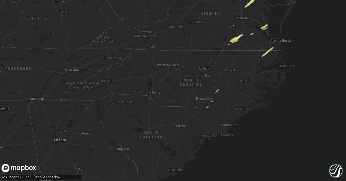
Hail Map in North Carolina on February 21, 2014
Get this storm
February 21 map
$229
one time, instant access
Download today. No call, no setup
Keep the $229
Bought the map and want the full workflow? Apply the entire $229 to a subscription within 7 days. None of it is wasted.
Every map, not just this one
This buys you this map. Subscription and you get every map we run, in the markets you choose from a few cities to whole states to nationwide. Plus real-time alerts the moment a storm fires.
Contact data
Name, contact info, occupancy, even credit band for addresses in the footprint. You go from where it hit to who to call.
Become the source they trust
Unlimited branding weather history reports on demand. You already have the documented answer ready for the property owner, and you are the one who showed up with it.
Property data and RoofTrace estimates
Pull up any address you have got, its value and the exact code rules for that jurisdiction, straight from One Click Code. Then RoofTrace estimates the squares, pitch, and roof value, priced the way you price.
Storm reports in North Carolina
North Carolina
| Date | Description |
|---|---|
| 02/21/20141:35 PM CST | Tree down on burney town rd |
| 02/21/20141:27 PM CST | 911 center reported trees down throughout the county. |
| 02/21/20141:18 PM CST | 1 block s of intersection of hwy 41 and 24. Gazeboo full of plants blown over. Radar estimated. |
| 02/21/20141:15 PM CST | Portable car port blown across the road. |
| 02/21/20141:15 PM CST | Large tree down across hwy 13 |
| 02/21/20141:10 PM CST | Tree on house |
| 02/21/20141:05 PM CST | Trees down on strickland road. Radar estimated. |
| 02/21/20141:01 PM CST | Tree down across sand pit road. Radar estimated |
| 02/21/20141:00 PM CST | Four to five trees down near penderlea hwy and basden rd - time estimated based on radar |
| 02/21/201412:55 PM CST | Spotter measured a 69 mph wind gust off of a vortex brand car mounted anemometer |
| 02/21/201412:50 PM CST | Open air canopy roof ripped off a building at blueberry rd and hwy 210 - time estimated based on radar |
| 02/21/201412:49 PM CST | Measured from a home weather station |
| 02/21/201412:47 PM CST | One tree down on a house on combs rd. |
| 02/21/201412:46 PM CST | One tree down on nahunta rd...near hwy 581. |
| 02/21/201412:45 PM CST | Couple of trees down in the princeton area |
| 02/21/201412:44 PM CST | One tree down on salem church rd. |
| 02/21/201412:25 PM CST | Nws damage survey revealed ef-1 damage to an office trailer and surrounding trees that were uplifted and tossed on to nearby tree canopy. |
| 02/21/201412:25 PM CST | Tree down on suttontown road |
| 02/21/201412:25 PM CST | Abandoned mobile home damaged by wind at 5400 block of us hwy 13. |
| 02/21/201412:23 PM CST | Tree down on bells church road at hwy 701 |
| 02/21/201412:20 PM CST | Tree down on highway 701 north - time estimated based on radar |
| 02/21/201412:18 PM CST | Tree down on bells branch road |
| 02/21/201412:17 PM CST | 2 trees down near church and keener roads |
| 02/21/201412:16 PM CST | Tree down on jones road in newton grove |
| 02/21/201412:09 PM CST | Two to three foot diameter tree uprooted and damaged a fence on alta street - time estimated based on radar |
| 02/21/201412:07 PM CST | Tree down on williams lake road |
| 02/21/201411:59 AM CST | Tree down on bethel church road - time estimated based on radar |
| 02/21/201411:50 AM CST | Canopy collapse at smithfield packing facility damaged several vehicles - time estimated based on radar |
| 02/21/201411:50 AM CST | Tree on vehicle |
| 02/21/201411:40 AM CST | Roof off shed. Metal carport beginning to lift up. |
| 02/21/201411:40 AM CST | One tree down near gillespie st and snow hill rd |
| 02/21/201411:40 AM CST | Tree on vehicle |
| 02/21/201411:25 AM CST | Multiple trees were reported down. Possible tornado. |
| 02/21/201411:15 AM CST | A home was reportedly damaged near elrod road. Possible tornado. |
| 02/21/201411:08 AM CST | Tree blown down on power line starting fire |
| 02/21/201411:08 AM CST | Tree blown down on power line starting fire |
| 02/21/201410:52 AM CST | One tree down across vass road |
| 02/21/201410:43 AM CST | Tree blown down along walter grissom road. |
| 02/21/201410:35 AM CST | Tree blown down along highway 96. |
| 02/21/201410:25 AM CST | Large tree blown down along caistor lane. |
| 02/21/201410:20 AM CST | Large branches blown down along six forks road. |
| 02/21/201410:10 AM CST | Tree down on oakwood ave. |
| 02/21/201410:10 AM CST | Tree blown down near highway 85. |
| 02/21/201410:10 AM CST | Gas station canopy blown over. |
| 02/21/201410:05 AM CST | Tree blown down near kelly road and lee lane. |
| 02/21/20149:52 AM CST | Two trees blown down along joe peed road. |
| 02/21/20149:51 AM CST | Large pine tree blown down and large limbs also down along ellis road near highway 147. |
| 02/21/20149:30 AM CST | Tree blown down along ike brooks road. |
| 02/21/20149:25 AM CST | Trees down across the road 24 27 area...near the county line. |
| 02/21/20149:24 AM CST | Tree blown down |
| 02/21/20149:23 AM CST | Tree blown down along guess road. |
| 02/21/20149:20 AM CST | One tree blown down along highway 24 27 |
| 02/21/20149:11 AM CST | Dot reports 5 trees down near the mangum area near hwy 109 and jack currie rd |
| 02/21/20149:11 AM CST | Tree and power lines blown down along highway 109 south. |
| 02/21/20149:02 AM CST | Tree blown down near the intersection of highway 87 and boywood road. |
| 02/21/20148:40 AM CST | Numerous trees and power lines down in the church street area of greensboro |
| 02/21/20148:25 AM CST | Wall blown over onto a vehicle on third street. Unattended vehicle. No injuries. |
| 02/21/20147:30 AM CST | Trees down in and around king...one possibly on a mobile home. |
| 02/21/20147:20 AM CST | Trees down southwest part of king. Pictures via facebook. |
All States Impacted by Hail Map on February 21, 2014
Cities Impacted by Hail Map on February 21, 2014
- Dinwiddie, VA
- Stony Creek, VA
- Dewitt, VA
- Dolphin, VA
- Lawrenceville, VA
- Emporia, VA
- Warfield, VA
- Jarratt, VA
- Alberta, VA
- Freeman, VA
- Carson, VA
- McKenney, VA
- Yorktown, VA
- Williamsburg, VA
- Gloucester, VA
- Hayes, VA
- Sanford, FL
- Hustle, VA
- Colonial Beach, VA
- Loretto, VA
- Champlain, VA
- Newtown, VA
- Ruther Glen, VA
- Caret, VA
- Montross, VA
- Aylett, VA
- Tappahannock, VA
- Bowling Green, VA
- Newburg, MD
- Milford, VA
- Midlothian, VA
- Newport News, VA
- Saint Augustine, FL
- Waverly, VA
- Chesapeake, VA
- Sunbury, NC
- Corapeake, NC
- South Mills, NC
- Gatesville, NC
- Hobbsville, NC
- Mims, FL
- Bunnell, FL
- Geneva, FL
- Four Oaks, NC
- Chesterfield, VA
- Brodnax, VA
- White Oak, NC
- Newton Grove, NC
- Dunn, NC
- Benson, NC
- Amelia Court House, VA
- Red Springs, NC
- Fellsmere, FL
- Newberry, FL
- Sebastian, FL
- Roseboro, NC
- Autryville, NC
- Palm City, FL
- Green Cove Springs, FL
- Palatka, FL


