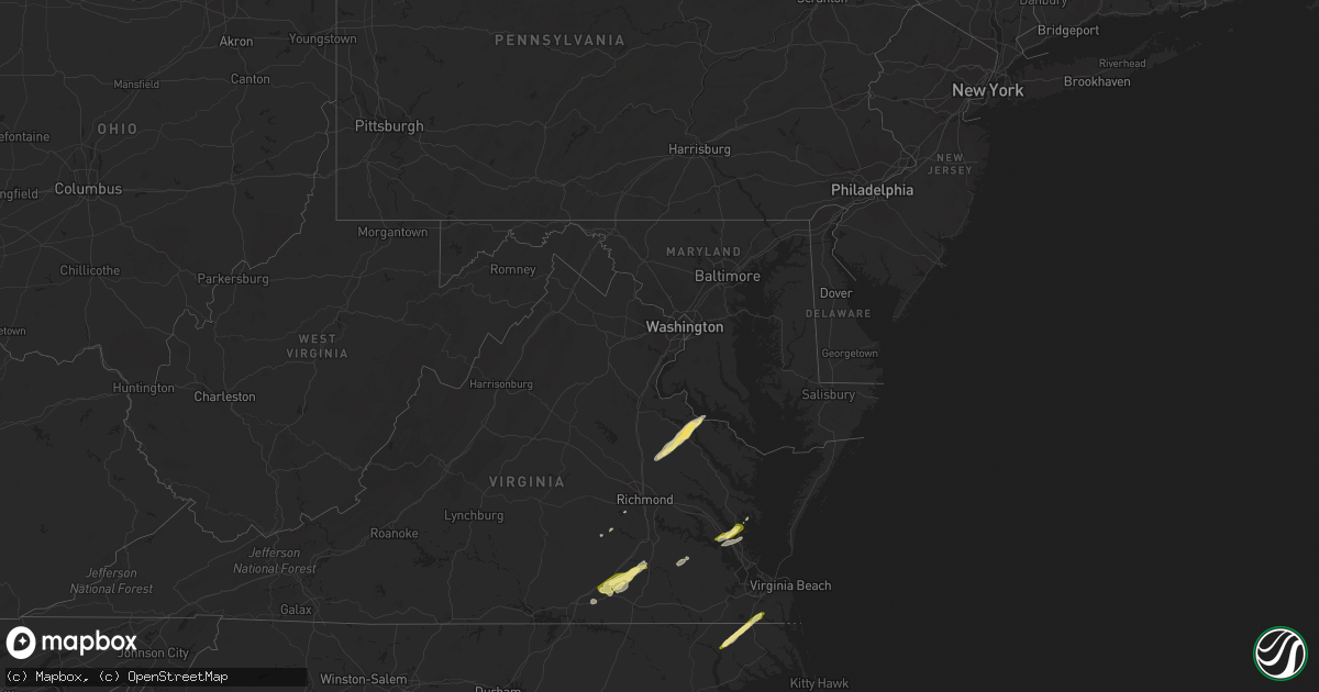
Hail Map in Maryland on February 21, 2014
Get this storm
February 21 map
$229
one time, instant access
Download today. No call, no setup
Keep the $229
Bought the map and want the full workflow? Apply the entire $229 to a subscription within 7 days. None of it is wasted.
Every map, not just this one
This buys you this map. Subscription and you get every map we run, in the markets you choose from a few cities to whole states to nationwide. Plus real-time alerts the moment a storm fires.
Contact data
Name, contact info, occupancy, even credit band for addresses in the footprint. You go from where it hit to who to call.
Become the source they trust
Unlimited branding weather history reports on demand. You already have the documented answer ready for the property owner, and you are the one who showed up with it.
Property data and RoofTrace estimates
Pull up any address you have got, its value and the exact code rules for that jurisdiction, straight from One Click Code. Then RoofTrace estimates the squares, pitch, and roof value, priced the way you price.
Storm reports in Maryland
Maryland
| Date | Description |
|---|---|
| 02/21/20141:23 PM CST | Tree down at catalina drive and clubhouse drive. |
| 02/21/201412:51 PM CST | A farm building was damaged in preston. |
| 02/21/201412:20 PM CST | Trees down on dark road |
| 02/21/201412:10 PM CST | A farm building was damaged in preston. |
| 02/21/201411:55 AM CST | Trees down on dark road |
| 02/21/201411:54 AM CST | Tree down on trapp road |
| 02/21/201411:39 AM CST | Tree down on cove point road northwest of cove point. |
| 02/21/201411:39 AM CST | Tree down at cove lake road and cove point drive. |
| 02/21/201411:38 AM CST | Power lines reported down at two locations on three notch road. |
| 02/21/201411:37 AM CST | Tree down at catalina drive and clubhouse drive. |
| 02/21/201411:37 AM CST | Tree down on soundings road. |
| 02/21/201411:37 AM CST | Tree down at park chesapeake dr and manoe ct |
| 02/21/201411:37 AM CST | Tree down in the 11000 block of rawhide road. |
| 02/21/201411:37 AM CST | Tree down at little cove point road and haltrace drive. |
| 02/21/201411:35 AM CST | Tree down on soundings road. |
| 02/21/201411:34 AM CST | Tree down at mccready road and coster road. |
| 02/21/201411:34 AM CST | Power lines reported down at two locations on three notch road. |
| 02/21/201411:33 AM CST | Trees down on wildewood parkway west of california md. |
| 02/21/201411:33 AM CST | Trees down in wildewood area west of california md. |
| 02/21/201411:32 AM CST | Power lines reported down at two locations on three notch road. |
| 02/21/201411:32 AM CST | Power lines and power pole down |
| 02/21/201411:31 AM CST | Trees down on wildewood parkway west of california md. |
| 02/21/201411:30 AM CST | Three 1.5 foot diameter trees down |
| 02/21/201411:30 AM CST | Power lines down on saint andrews church road. |
| 02/21/201411:29 AM CST | Multiple large trees down closed fairgrounds rd |
| 02/21/201411:27 AM CST | Two trees down on point lookout road near leonardstown high school. |
| 02/21/201411:26 AM CST | Multiple large trees down closed fairgrounds rd |
| 02/21/201411:23 AM CST | Ef0 tornado from 1223 pm est to 1239 pm est. Tornado damage first reported in compton in st. Marys county md and last damage reported was near cove point in calvert cou |
| 02/21/201411:23 AM CST | Tree reported down on breton beach road. |
| 02/21/201411:20 AM CST | Tree reported down on breton beach road. |
| 02/21/201411:15 AM CST | Tree reported down on maddox road in bushwood. |
All States Impacted by Hail Map on February 21, 2014
Cities Impacted by Hail Map on February 21, 2014
- Dinwiddie, VA
- Stony Creek, VA
- Dewitt, VA
- Dolphin, VA
- Lawrenceville, VA
- Emporia, VA
- Warfield, VA
- Jarratt, VA
- Alberta, VA
- Freeman, VA
- Carson, VA
- McKenney, VA
- Yorktown, VA
- Williamsburg, VA
- Gloucester, VA
- Hayes, VA
- Sanford, FL
- Hustle, VA
- Colonial Beach, VA
- Loretto, VA
- Champlain, VA
- Newtown, VA
- Ruther Glen, VA
- Caret, VA
- Montross, VA
- Aylett, VA
- Tappahannock, VA
- Bowling Green, VA
- Newburg, MD
- Milford, VA
- Midlothian, VA
- Newport News, VA
- Saint Augustine, FL
- Waverly, VA
- Chesapeake, VA
- Sunbury, NC
- Corapeake, NC
- South Mills, NC
- Gatesville, NC
- Hobbsville, NC
- Mims, FL
- Bunnell, FL
- Geneva, FL
- Four Oaks, NC
- Chesterfield, VA
- Brodnax, VA
- White Oak, NC
- Newton Grove, NC
- Dunn, NC
- Benson, NC
- Amelia Court House, VA
- Red Springs, NC
- Fellsmere, FL
- Newberry, FL
- Sebastian, FL
- Roseboro, NC
- Autryville, NC
- Palm City, FL
- Green Cove Springs, FL
- Palatka, FL


